Postcard from Mesoamerica


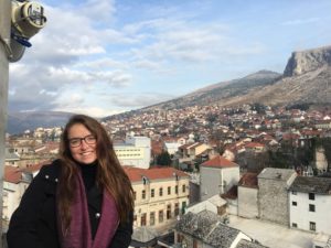
As Geography research begins in the field and ends in the field, so does my Presidential Column. I had the good fortune to be able to compose most of my first column (July 2018) during my fieldwork in Belize and Guatemala in Central America. Now I am filing my final column as your AAG President from field camp in northwestern Belize, working with an international team of colleagues, students, and volunteers to study the resilience of ancient Maya society. While “Op-Ed” stands for Opinion/Editorial, it also represents both Opportunity and Education. I thank you, my readers and fellow AAG members, for the Opportunity to freely explore challenging and timely issues and to share thoughts and opinions on current events and research over the last year. I am also grateful for the platform of the AAG Newsletter on which to perform one of my primary duties as a Professional Geographer: to Educate, to enable understanding and discussing important issues from local to global scales, and, to inspire actions to solve the planet’s most critical human and environmental problems. It is a tall order, but we should set expectations for ourselves at the very highest level to ensure a better future for people, the environment, and the planet.

Pocket transit given to Tim Beach, Sheryl’s husband, by his father. (Photo courtesy Sheryl Luzzadder-Beach)

This is my 26th field year exploring the palimpsests of millennia of urban and agricultural landscapes of parts of modern Mexico, Belize, and Guatemala. Each year we discover more about how extensive and influential ancient humans have been in the Americas. We have increased our understanding of human influences on the earth, from William Denevan exploding the Pristine Myth in the 1992 Annals Special issue (82(3):369-85), to the 2013 dawning of the journal The Anthropocene, (Anne Chin, Editor-in-Chief), to the May 2019 binding vote of the Anthropocene Working Group approving that the Anthropocene shall be “treated as a formal chrono-stratigraphic unit” and its primary marker will be “one of the stratigraphic signals around the mid-twentieth century of the Common Era” (AWG, 5/21/19). It is still a complicated matter of agreeing when that marker occurs in time globally. While the swirling smog of the 19th C. Industrial Revolution was a leading, if not charismatic, candidate, not to mention the globally detectable nuclear testing fallout signal of the mid-20th C., evidence still builds for an Early Anthropocene. Denevan’s idea (1992) that 18th century human visibility on the landscape was less substantial than that which was visible before 1492 still stands the test of time, further supported by W. F. Ruddiman et al.’s 2016 work (Rev. Geophys. 54: 93-118) on early, increased releases of CO2 and Methane to the atmosphere associated with increased burning and farming like rice paddy (wetland) agriculture in Asia. Now with advanced geospatial technology such as Lidar guiding our field exploration and validation, we are fast on the trail of finding significant extents of ancient landesque capital, including cultivated landscapes, ranging far across the Western Hemisphere, including Mesoamerica. Much else has changed in field research infrastructure since the early 1990s: Quad maps in Belize were produced for us in 1993 as Ozalid blueprints in the Government Mapping Office in Belmopan. Now there is a Land Information Center providing geospatial data. In 1994, a colleague mounted a brick-shaped GPS unit on an extension pole in the jungle, trying to reach a satellite signal at just the right hour. For communications, there was a payphone and one fax machine in the general store in the village near our field camp, a lifeline for college students with final papers due who were here in the field to collect data before the rainy season hit. Now we despair that the local internet is not working today in camp. Yet, there are some regions here in Belize and beyond still too remote to access cell service, allowing us a moment to also rejoice that there are places untouched by clouds of 4G data smog to walk through and be interrogated by.

My last official duty as AAG President will take place at the end of June, when I travel on behalf of the AAG to Beijing and Harbin, China, where I will be hosted by the Geographical Society of China to present in a session on “Scientific Organization Governance” at the China Association of Science and Technology Meeting, and will present academic talks on my team’s Ancient Water Management research, at Chinese universities. It is a privilege to be able to collaborate internationally, and to thereby conduct science and science diplomacy. Getting back to my yearlong theme of Science, Geography, and Human Rights, we must strive to fulfil the ideals of making science accessible to the benefit of all people; of guaranteeing scientists their rights to practice and to preserve science; and to protect scientists’ rights to collaborate freely and internationally.

Although my title will change to Past President on 1 July, my service to AAG as a member of the leadership team will continue for one more year: on the AAG Executive Committee, the AAG Council, and the Disciplinary Matters Committee. My writing assignment will shift from a monthly column, to composing the content and form of the Past Presidential Address for the Denver meetings and for the Annals, as per tradition. I look forward to my new role, and continuing to serve our association. I congratulate the incoming President, David Kaplan, and thank him for his service this past year as Vice President, and ask that you all lend your support to his efforts and themes. I also thank Derek Alderman for his service as Past President, and congratulate him on completing his term on the AAG Council, concluding on 30 June. I also extend a warm welcome and best wishes to Vice-President elect Amy Lobben. Speaking of service, please do not forget to nominate deserving AAG members for awards! See the AAG website for complete details.

The AAG Council and AAG Committees and Task Forces deserve much of our thanks for keeping our association vibrant and dynamic through their volunteer efforts. I am most grateful for the lasting friendships and professional relationships that have been formed with the Officers, Council, Committees, and the AAG Staff, and thank them all for their support during my presidency and beyond. My final words of praise are for the AAG Staff, the Legal team, and retiring Executive Director Dr. Douglas Richardson, for their day in and day out dedication to this non-profit organization’s mission and members. I will not be able to name all of the AAG staff in this column but please know you are a terrific team! I will note that AAG’s Rebecca Pendergast and Emily Fekete are especially thanked for their good-natured patience with my stretching the concept of “column publication deadline.”

AAG Members, I thank all 12,000 of you for making the AAG a community. I look forward to seeing you at future meetings, especially in Denver for the 2020 AAG Annual Meetings. Make a Difference with Geography. Have a great summer, wherever your Geography takes you!

— Sheryl Luzzadder-Beach
President, American Association of Geographers
Professor, Geography and the Environment and C.B. Smith Fellow in US-Mexico Relations, University of Texas at Austin
slbeach (at) austin (dot) utexas (dot) edu

DOI: 10.14433/2017.0055

    Share

Taking Steps to Create a Welcoming Discipline for ALL Geographers: A New Resource for Indigenous Students

The AAG is pleased to announce the release of a new interactive web map of colleges and universities that offer both Geography Programs and Indigenous Studies Programs. Developed in consultation with members of the AAG’s Indigenous Peoples Specialty Group (IPSG), the map serves to help Indigenous students find safe places to pursue a Geography degree. In this case safe places refer to colleges and universities that have an active Indigenous Studies program, cultural center, or other active organization that can act as a support system for Indigenous students to keep them connected to their traditional communities and provide mentorship to help them achieve their academic goals. In many cases, this also includes colleges and universities that are geographically accessible to students, meaning the school is a commutable distance from their homes or within their home state for the purposes of in-state tuition.

There is a strong record of the application of geography, and specifically GIS, to address the needs of Tribal Governments and associated communities. Tracking land ownership records for resource management and land claims,[1],[2] assisting Tribal Governments with improving medical services, transportation, and economic development, and the preservation of cultural and natural resources[3],[4] represent a few of the ways spatial techniques and GIS have assisted indigenous communities. Coupled with the expectation that the GIS industry will grow by 10% each year through 2023[5], encouraging Indigenous students to pursue Geography could not only present opportunities in a growing field but provide tools and skills to better serve the needs of their own communities.

AAG Membership Data

Since 1981, the AAG has seen a gradual increase in the number of minorities within its membership. In the early 2000s there was a dramatic increase in the number of members who identify as Asian, African American, and Hispanic, however, the number of members who identify as Native Alaskan, Native American, or Pacific Islander has not followed that trend (Graph 1).[6] This suggests that Indigenous people have not been welcomed and included in Geography to the same extent as other underrepresented groups, a concern of the AAG as the Association is dedicated to “promoting inclusion, equity, and social justice across the entire discipline.”[7]

Graph 1: AAG Minority Membership since 1981.[6]

The Interactive WebMap

To address the need for greater Native American, Native Alaskan, and Pacific Islander representation in the AAG, the AAG has developed a database and interactive webmap to help students find schools suited to their needs. The database and interactive webmap was built by cross-referencing the American Indian Higher Education Consortium’s (AIHEC) list of Tribal Colleges,[8] the Guide to Native American Studies Programs in the U.S. and Canada,[9] and the AAG’s Guide to Geography Programs in the Americas[10] to identify schools in the US and Canada that qualify as a safe place. The academic catalog for each school was reviewed to determine if they offered both Geography Programs and Indigenous Studies Programs. Those that did were then added to the database along with information about the level of degrees offered in both fields as well as any cultural centers, administrative departments, or student organizations that would also be beneficial, as well as direct links to those websites.

Some of the identified colleges and universities do not offer degrees in both fields but were still included in the database because they have another structure in place that would also fulfill that need. For example few Tribal Colleges offer degrees in geography but do offer geography courses and, as institutions run by and for their communities, support structures for students are already available. Likewise, a couple of the schools included in this database do not offer an Indigenous Studies degree, but support research centers, cultural centers, or other partnerships with community organizations that would also fulfill that need. The result is a database of 185 colleges and universities across the United States and Canada.

Once the database was completed, a corresponding webmap was made as a method of searching the database spatially and includes filters to help students narrow down potential schools. The map includes two query tools that allow the user to select schools based on the degree they are interested in pursuing. One of these filters selects  programs by the level of Geography degrees and the other sorts by the level of Indigenous Studies degrees. The application also includes a filter tool that allows the user to select schools by country (United States or Canada), State or Province, or highlight only Tribal Colleges.

For more information please contact:

Jolene Keen, Research Associate, American Association of Geographers

[1] Barcus, Holly R., and Laura J. Smith. “Facilitating Native Land Reacquisition in the Rural USA through Collaborative Research and Geographic Information Systems.” Geographical Research 54, no. 2 (12, 2015): 118-28. doi:10.1111/1745-5871.12167.

[2] Chapin, Mac, Zachary Lamb, and Bill Threlkeld. “Mapping Indigenous Lands.” Annual Review of Anthropology 34, no. 1 (10 2005): 619-38. doi:10.1146/annurev.anthro.34.081804.120429.

[3] Horn, Brady P., Gary N. Barragan, Chis Fore, and Caroline A. Bonham. “A Cost Comparison of Travel Models and Behavioural Telemedicine for Rural, Native American Populations in New Mexico.” Journal of Telemedicine and Telecare 22, no. 1 (05, 2015): 47-55. doi:10.1177/1357633×15587171.

[4] Deogawanka, Sangeeta. “How GIS Is Being Used to Help Native Americans ~ GIS Lounge.” GIS Lounge. November 10, 2014. https://www.gislounge.com/gis-used-help-native-americans/

[5] Dempsey, C. (2017, June 23). Global GIS Industry Continues to Grow ~ GIS Lounge. Retrieved from https://www.gislounge.com/global-gis-industry-continues-grow/

[6] Race and Ethnicity in Geography | AAG. (n.d.). Retrieved from https://www.aag.org/cs/disciplinarydata/raceandethnicity

[7] AAG Membership Data | AAG. (2017). Retrieved from https://www.aag.org/cs/disciplinarydata/aagmembershipdata

[8] AIHEC: Who We Serve. American Indian Higher Education Consortium.

[9] Nelson, Robert M., Guide to Native Studies Programs in the U.S. and Canada. (2011)

[10] AAG Guide to Geography Programs in the Americas 2017-2018. American Association of Geographers.

    Share

Daniel McGlone

Education: Masters in Urban Spatial Analytics (University of Pennsylvania), Bachelors in Geography and Geospatial Imaging (Harrisburg University of Science and Technology)

Could you give us a description of your job and some of the primary tasks and duties for which you’re responsible?
Azavea is a geospatial software company. We’re a mixture of professional services and products. I am the Senior GIS Analyst the Data Analytics team. I’m the only person at the company with a degree in GIS, so I’m the lead on any task that involves spatial analysis. We have projects that we work on for clients that involve spatial analysis or data analysis that produce maps or reports. We also service other teams in the company, so there might be a team that’s building a geospatial software application, and they might need some data analysis or data prep.

As the Senior GIS Analyst, I am often working any of the ends on projects as well as the analysis. When we’re scoping out a proposal, I’ll work on that and outline the different tasks that we’re going to be doing, the different steps in the geospatial analysis, as well as the outline of which tools and software we’re going to use to complete the analysis. I work hand in hand with the project manager, and we deliver a scope to the client. They’ll approve it or we’ll have negotiations around it, and then we’ll begin working on the project. When a project begins, I’ll work with the project manager to assign tasks and roles. The project manager will be the primary point of contact with the client, and I’ll be working internally with the team, often doing a lot of the analysis work, and finishing off the deliverables and end products and handing them over to the client.

Who are your clients?
Azavea is a B Corporation – that stands for “Benefits”. We’re a for-profit company, but we’ve operated with the mission of a nonprofit, so we work on projects that we think benefit the world and the community we live in. Primarily our clients are nonprofits, foundations, or governments. We also pride ourselves as a civic technology firm. We work on a lot of projects that we think help connect people with decision makers, and help improve the civic sphere that we all live in.

My other job title is Cicero Data Manager. Cicero is a database of elected officials, their contact information, and legislative districts for 9 countries, all 50 states, and about 300 cities throughout the United States. I’m in charge of maintaining all of our data on elected officials. We provide Cicero as a database so our clients, which are normally nonprofits or advocacy organizations who are trying to connect their members with elected officials, can advocate for their cause. We offer our database to them to use internally.

How do you perceive the value and importance of geographic knowledge in performing your work? Could you give us a breakdown of the substantive, conceptual, and procedural geographic knowledge you’ve acquired through your training in geography and how this relates to your job? 

Being the only person with a GIS Analyst job title in my company means that I am the one that people go to when they have questions about how to complete a project with spatial analysis or geographic data.

I would say the substantive and conceptual knowledge are important usually for scoping out projects and thinking about how to complete projects. We often have clients that come to us with limited budgets, or they have a lot of data and they just don’t know what to do with it. Having a conceptual knowledge of the type of tools that you would need to run, or the type of analysis that you would need to do is really important because that helps scope out a project and figure out the solution to their problem. They might have a bunch of data about their clients, and where their clients live, but they might not know that census data exists. We can predict where other clients might be that they haven’t tapped into. Having that kind of conceptual knowledge about the relationship between people and place is really, really important.

Procedural knowledge comes in when we actually win a project. We have to figure out how we are going to go about doing it. It’s also helpful in terms of scoping out projects. We tend to respond to a lot of RFPs for work, and we apply for a lot of small business innovation research (SPIR) grants. We have a technical writer, so she responds to all of these and writes up proposals. Sometimes, she’ll come to me if there is an opportunity through a government agency, so we can figure out if we can complete that project and how exactly we would do it.

To give an example, we recently had an opportunity to do some work in Madagascar. Our client wanted to work with folks on the ground in mapping Madagascar to better connect people with elected officials to promote environmental policy. Our solution was to leverage our Cicero product to get the legislative district boundaries for Madagascar and the elected official data, and then build a mobile app that allows people in Madagascar to connect with their assembly members in the legislature. Also, we could take environmental data for Madagascar to collect land cover change, climate, and other geographic/spatial data and aggregate that into legislative districts. This would actually give people information about land cover change, deforestation, and habitat change in their district so they could inform their elected official or assembly member about what was happening. We had to find the unique solution to that problem, and it was conceptual geographic knowledge that really helped figure that out.

Substantive knowledge definitely comes into play as well. We use census data all the time in our projects. We have to figure out what is the best census data to use, and what’s the best administration level (tracts, block groups, blocks, metropolitan areas). That comes into play with a lot of our projects, including some of our software projects where we have to scope out what is the best way to display this data on a web map (MSA level, block level, tract level, state level).

What have you observed in your work in terms of impacts in your applications and uses of geography and through your organization?
At Azavea, our bottom line is that we want our projects to have a positive impact on the community. A few years ago, we worked with the Delaware Valley Association for the Education of Young Children. They are an organization that advocates for higher quality child care across the Philadelphia region. We took data on childcare institutions in the city of Philadelphia and ranked the quality of childcare at these institutions. We looked at the quality of childcare and also the risk factors or negative impacts on children in Philadelphia, and then we ranked and scored city council districts using that information. We created these targeted reports that showed the city council how they were ranked against other city council districts. It enabled the Delaware Valley Association for the Education of Young Children to advocate for increased funding for childcare. That was really powerful, as the city council ended up awarding the Delaware Valley Association for the Education of Young Children $500,000. They also got a matching grant from the William Penn Foundation. They ended up getting a million dollars to improve the quality of childcare and education for young people in Philadelphia.

That kind of model of creating, aggregating, scoring and ranking data by legislative or council district has been effective for us for a lot of different causes. Last year, I was an expert witness for a federal court case on gerrymandering here in Pennsylvania. We had an organization that was filing a lawsuit to get the congressional districts in Pennsylvania overturned as a gerrymander. They needed some mapping done to prove that some districts were gerrymandered. In terms of this court case, I was brought on and mapped out all of the congressional districts. I also used data on a partisan voting index at the voting precinct level to show that the districts were gerrymandered. The evidence and the data that was used in our case were used in the subsequent court case at the state level, which actually won and overturned the congressional districts. I can’t say that our case was successful as we were turned down in federal court in a 2-1 decision, but the subsequent state case in the state court did end up winning.

What is it about geography that inspires you and helps you pursue your life aspirations?
I have been interested in geography and maps for my entire life. I love to travel and see new places in the world, and knowing about geography and having that understanding has helped me become a better world traveler. I feel that my deep interest and understanding of geography has also helped me become a better, more engaged citizen politically. Geography gives me a better understanding of different places and different people. In terms of my professional life, I had a lot of different options. Underlying all of these options was a strong interest in geography, and I felt that GIS was the way to go.

If you could think back to that undergraduate experience you had at Harrisburg, when did you have that ‘a-ha’ moment with geography?
One of these moments occurred when I was in an undergraduate course. I have always been pretty interested in urban planning and considered it as a potential career opportunity. When I first discovered the extent to which GIS could be used in planning and transportation analysis, I became even more interested in it. I worked on a project where I mapped out a potential commuter rail line between Harrisburg and Lancaster, and I used GIS to figure out how many people lived within certain distances of different branches of railroads for potential community rail lines. It was all very conceptual, and it was all very basic, but it was then that I realized “wow, this is really powerful.”

As someone who has been interested in politics all my life, another moment was when I first realized that I can connect the dots with GIS data in terms of redistricting and drawing legislative district lines. There’s not enough discussion about how, as a GIS Analyst, I can help make redistricting and drawing of lines more accessible to everyday people. At Azavea, I had the opportunity to work on one of our projects called District Builder, which is an online, web-based tool for drawing legislative districts. It was kind of a moment when I realized “wow, GIS is so important and fundamental to how we vote,” and that was definitely an ‘a-ha’ moment for me in realizing what I wanted to do as a GIS analyst and as a geographer.

    Share

Beyond Compactness: A New Measure to Evaluate Congressional Districts

Redrawing congressional district boundaries, an activity that happens every ten years following the decennial census, may be the most consequential application of geography in the United States. As congressional elections have become less competitive, many are raising questions about the current boundaries of congressional districts, often citing lack of geographical compactness as their rationale. Geographical compactness generally ranges from 0 to 1, with 1 being a perfect circle. Wyoming’s only district is currently the most geographically compact district with a score of .77.

The U.S. Supreme Court has ruled multiple times that the assertion a district is oddly-shaped is insufficient to claim that the boundaries have been manipulated. In fact, some districts that score low in compactness can also be the most competitive. Odd shapes are sometimes needed to connect communities, to comply with the Voting Rights Act, or result from oddly-shaped states or coastal areas. Furthermore, communities rarely form in circles or squares naturally. Rather, communities rely more on existing administrative boundaries (counties, municipalities), infrastructure, and physical features to form.

A “Natural Communities” Score for District Boundaries

Esri’s Policy Maps team formed the research question: How much are current congressional boundaries defined by physical features (mountains and rivers), infrastructure (highways and railroads), or other existing administrative boundaries (county and place boundaries)? We calculated the percent of perimeter of each district that was a county boundary, a place (city, township, or other municipality) boundary, an interstate highway, a railroad track, a river, or within proximity to a mountain peak, as well as geographical compactness for comparison.

Also available as an interactive web map with detailed information in pop-ups.

Using a statistical technique called factor analysis, we were able to create an index that incorporates all these measures and to determine the optimal weights for capturing as much information possible based on the correlations between variables. We call this the Natural Communities index. Not surprisingly, the results of the factor analysis suggested giving the most weight to sharing a boundary with an existing administrative boundary. The least weight was given to proximity to a mountain peak. Geographical compactness helps the score, but not by much since that measure was given such a low weight. The infrastructure measures both had sizeable negative weights, meaning that having infrastructure as a boundary is somehow negatively associated with our construct of natural communities and thus hurts a district’s score, perhaps because infrastructure is used to bring people together rather than separate them. Using these weights, we can come up with a “natural communities” score for each district. The scores were then standardized to have a mean of zero and a standard deviation of 1, for easy comparison. Districts that score high on our Natural Communities index are shown in green on the map below, whereas districts that score low are shown in brown.

States with only one district (Alaska, Delaware, Montana, North Dakota, South Dakota, Vermont, and Wyoming) generally scored highly, but these districts having different values does not make sense since there were no other options these districts could have used. We gave all these districts a “perfect” score of 2.0, shown in dark green in the map.

A Look at Specific Districts

New Mexico’s 1st

New Mexico’s 1st District has a compactness score of .26 (national average was .18).

New Mexico’s 1st District scored average (0). This district has 60.4 percent of its perimeter defined by administrative boundaries (national average was 65.4 percent), and 2.4 percent defined by a major highway (national average was 2.3 percent).

Ohio’s 3rd

Ohio’s 3rd District has a compactness score of .06 (national average was .18).

Ohio’s 3rd District scored very low (-3.5). This district has only 16.3 percent of its perimeter defined by administrative boundaries (national average was 65.4 percent), and high percentages defined by the two infrastructure categories – railroad tracks and major highways – which has a negative impact on the score.

Arkansas’ 2nd

Arkansas’ 2nd District scored very high (+1.4). This district has 100 percent of its perimeter defined by administrative boundaries (national average was 65.4 percent), zero percent defined by infrastructure, and 37.5 percent defined by a river or stream (national average was 18.1%).

Arkansas’ 2nd District has a compactness score of .24 (national average was .18).

Our index adds information by accounting for the existing administrative boundaries as well as considering infrastructure and physical geographic features. This new score provides much more context when evaluating congressional district boundaries than simply geographical compactness. For example, Arkansas’ 2nd District is slightly less compact than New Mexico’s 1st District but scores much higher when taking into account the existing administrative boundaries (counties and places) and physical geographic boundaries (rivers and mountain peaks).

Join the Discussion

Our natural communities score can be used going into the upcoming redistricting exercises when evaluating multiple proposed districts. This score can add to the conversation when communicating proposed plans to the public during briefings and comment periods.

For maps, data, and other resources for creating your own policy maps, visit Esri Maps for Public Policy or watch the video Top 10 Tips for Policy Story Maps.

About the Author

Diana C. Lavery is a product engineer on Esri’s Living Atlas and Policy Maps teams.

    Share

Harassment-Free AAG: Moving Forward

“Our lives begin to end the day we become silent about things that matter.” 

Attributed to Dr. Martin Luther King Jr.

In civil society, we measure our words and deeds, and listen to others’ ideas and opinions. We set our expectations for civil discourse not necessarily based on a minimum expectation of the law, but based on our humanity, because we set high standards for ourselves and feel empathy for others.

We, too, can be thoughtful in word and deed. We, too, can have each other’s best interests at heart. Sometimes, however, we can be too stunned by words or deeds to move, frozen in shock. We can be frozen by the fear of the powerful, or the shock of the unexpected. And, we can become frustrated when the wheels of justice turn too slowly or silently. We applaud those who do speak up for justice.

I am writing to assure our community that Harassment-Free AAG does not end at the boarding gate for the flight home from the Annual Meeting. In fact, avoiding workplace discrimination and harassment all weeks of the year is the first concern in AAG’s current Statement of Professional Ethics (see section II and II.A.).

The AAG launched Harassment-Free AAG at the 2019 Annual Meeting, which members did use. I am again grateful to all the individuals, AAG Staff Members, and committee members who worked hard on the policy and on the logistics, enactment, launch, and post-meeting follow through of this new program. This program builds upon the 2017 Council Resolution creating the Standing Committee on AAG Annual Meeting Attendee Disciplinary Matters. Meanwhile, AAG members will be receiving a post-Annual Meeting survey created by the Harassment-Free AAG task force, due out in early May, to assess their experiences as a benchmark for the beginning of this program, so please watch for it and respond.

And, justice moves at a judicial pace. Several incidents did occur and were reported, and the AAG is processing them. Please do not misinterpret silence as inaction or not caring. In order for AAG sanctions to be enforceable, there must be due process. This is in fairness to those seeking justice, to complainants, witnesses, and to respondents, until all evidence is presented and considered, and decisions are rendered in the formal process. If there is no due process, it undermines AAG’s ability to enforce sanctions when warranted. So rest assured that the meeting Advocate, Ombudsperson, and AAG Staff, AAG legal counsel, and officers have been working hard behind the scenes both during and after the meeting to process and respond to reports.

That said, some incidents have been discussed in the wider social media, which of course cannot be un-seen. One recent incident is made more troubling because of the lack of response of bystanders in real time. It is certainly our collective duty to call out bullying: peer pressure is another check on misbehavior in civil society, in addition to formal proceedings. Again, we turn to Dr. King for introspection:

In the end, we will remember not the words of our enemies, but the silence of our friends.

Every one of us has a responsibility to speak out against mistreatment and misbehavior. While it is up to the justice system to investigate their severity and pervasiveness, and to determine consequences, this is also about our humanity and doing the right thing. AAG has released the following statement with the hopes that it will ease members’ concerns about the status of pending cases:

Statement by AAG regarding Harassment Free Meetings and Recent Incidents

“ The AAG is fully committed to having harassment free meetings. We have recently implemented a new wide-ranging Harassment Free AAG meetings policy (see AAG Event Conduct Policy http://annualmeeting.aag.org/conduct) that was rolled out at the Washington, DC meeting, and it has already made a positive contribution. The AAG is now compiling all the information currently available on each of the five harassment incidents which have been reported at the recent Annual Meeting. We have presented this information to our attorney, and will be undertaking formal investigations of each of the incidents as promptly as legally possible. The AAG also has a legally-reviewed policy in place on how to proceed regarding such incidents, and a special AAG Committee to handle these cases. That process is moving forward now on each of these incidents as rapidly as possible, and each will be thoroughly investigated, and enforceable sanctions will be forthcoming as warranted.”

Waiting for findings is painful, especially because we are sometimes at the mercy of University processes and timelines. So, again, I am grateful that AAG has a clear and enhanced anti-harassment policy and a process to address misbehavior by our members. I am grateful for our AAG Members’ concern and attention to this topic, and for the AAG Staff’s prompt and thorough actions to respond. AAG Council has asked the Harassment-Free Task Force to work on more specific topics that have arisen, including suggestions from our members, as we move into year 2 of this program. We will continue to review and update the new policy as unanticipated circumstances arise, and as the post-meeting survey provides input. Our work is far from done.

Thank you for allowing me into your mailboxes each month to discuss important issues that affect us all and thank you all for moving AAG into the 21st century in our expectations for courteous, thoughtful, and professional discourse, for healthy debates among ourselves, and for respect for one another.

Please share your ideas with me at: slbeach (at) austin (dot) utexas (dot) edu

— Sheryl Luzzadder-Beach, President, AAG
Professor, Geography and the Environment, The University of Texas at Austin

DOI: 10.14433/2017.0053

    Share

New Books: March 2019

Every month the AAG compiles a list of newly-published books in geography and related areas. Some are selected for review in the AAG Review of Books.

Publishers are welcome to send new volumes to the Editor-in-Chief (Kent Mathewson, Editor-in-Chief, AAG Review of BooksDepartment of Geography and Anthropology, Louisiana State University, Baton Rouge, LA 70803).

Anyone interested in reviewing these or other titles should also contact the Editor-in-Chief.

PLEASE NOTE: Due to current public health policies which have prompted the closing of most offices, we are unable to access incoming books at this time. We are working on a solution during this transition and will continue our new books processing as soon as we can. In the meantime, please feel free to peruse previous books from our archived lists.

March 2019

Adventures in Modernism: Thinking with Marshall Berman by Jennifer Corby (ed.) (Urban Research 2019)

The Alps: An Environmental History by Jon Mathieu (Polity 2019)

The Caribbean: A Brief History (3rd Edition) by Gad Heuman (Bloomsbury 2018)

Circulation and Urbanization by Ross Exo Adams (Sage Publishing 2019)

Civilization Critical: Energy, Food, Nature, and the Future by Darrin Qualman (Fernwood Publishing 2019)

The Codex Mexicanus: A Guide to Life in Late Sixteenth-Century New Spain by Lori Boornazian Diel (University of Texas Press 2018)

Detain and Deport: The Chaotic U.S. Immigration Enforcement Regime by Nancy Hiemstra (University of Georgia Press 2019)

Digital Geographies by James Ash, Rob Kitchin, and Agnieszka Leszczynski (eds.) (Sage Publishing 2018)

Dream City: Creation, Destruction, and Reinvention in Downtown Detroit by Conrad Kickert (The MIT Press 2019)

Governing Gifts: Faith, Charity, and the Security State by Erica Caple James (ed.) (University of New Mexico Press 2019)

At Home on the Waves: Human Habitation of the Sea from the Mesolithic to Today by Tanya J. King and Gary Robinson (eds.) (Berghahn Books 2019)

Inventing Exoticism: Geography, Globalism, and Europe’s Early Modern World by Benjamin Schmidt (University of Pennsylvania Press 2019)

Latin American Migrations to the U.S. Heartland: Changing Social Landscapes in Middle America by Linda Allegro and Andrew Grant Wood (eds.) (University of Illinois Press 2018)

Law as Refuge of Anarchy: Societies without Hegemony or State by Hermann Amborn (The MIT Press 2019)

Lisbon, City of the Sea: A History by Malcolm Jack (I.B. Tauris 2019)

Making Climate Change History: Documents from Global Warming’s Past by Joshua P. Howe (University of Washington Press 2017)

Making History – Creating a Landscape: The Portuguese American Community of Southeastern New England by James W. Fonseca (CreateSpace 2018)

Postwar Emigration to South America from Japan and the Ryukyu Islands by Pedro Iacobelli (Bloomsbury Academic 2019)

São Paulo: A Graphic Biography by Felipe Correa (University of Texas Press 2018)

The Second Coming by Franco Berardi (Polity Books 2019)

Subaltern Geographies by Tariq Jazeel and Stephen Legg (eds.) (University of Georgia Press 2019)

Water Resources Planning: Fundamentals for an Integrated Framework (Fourth Edition) by Andrew A. Dzurik, Tara Shenoy Kulkarni, and Bonnie Kranzer Boland (Rowman and Littlefield 2018)

    Share

Harassment-Free AAG: What to expect at the Washington D.C. Meeting

I am excited to write that there are four weeks to go in our countdown to the AAG Annual Meetings in Washington DC (April 3-7, 2019). I welcome guest columnist Dr. Lorraine Dowler, who has been a prior contributor to this space, and this month we highlight Climate Change to which we can all contribute positively for the AAG Meetings.

Harassing behavior by powerful individuals towards those more vulnerable has given rise to recent social movements including #MeToo, #UsToo and, Idle No More to name a few. These social movements are also influencing the academy as countless numbers of academic associations are currently examining how safe and inclusive their academic meetings are for those members who do not represent the majority of meeting attendees. These associations are gathering data about harassment through surveys, updating professional codes of conduct and hiring consultants to develop programs that directly address harassment and the creation of safe and inclusive spaces at academic meetings. Relatedly, the AAG charged a task force in Spring 2018 to gather information and recommend programmatic changes in order to envision a safer and more inclusive national meeting. The Council approved the task’s force proposal for the 2019 meeting, and this column will furnish a preliminary overview of resources that will be available to attendees at the Washington meeting.

    Share

Newsletter – February 2019

PRESIDENT’S COLUMN

AAG Election Underway and Looking Forward to Annual Meeting in Washington DC in April!


By Sheryl Luzzadder-Beach

AAG president Sheryl Luzzadder-Beach provides the inside scoop on upcoming activities at the AAG Annual Meeting as well as a reminder to vote in the ongoing AAG election in her monthly column. As she remarked in her first presidential column, as AAG members prepare to visit Washington, D.C., “imagine what 12,000-plus geographers can do together to make a better world.”

Continue Reading.

ANNUAL MEETING

2019 AAG Annual Meeting Presidential Plenary and Opening Session Announced

The AAG Opening Session will take place on Wednesday, April 3 at 6:20 p.m. Following welcoming remarks from Executive Director Doug Richardson, the Presidential Plenary will address “The Intersection of Geography, Environmental Science, Human Health, and Human Rights” and feature distinguished panelists joining AAG President Sheryl Luzzadder-Beach to discuss how their research fields intersect with geography and the three AAG 2019 DC themes.

Learn more

Eric Holder to Deliver Keynote on Gerrymandering

Holder_Eric-2009-w

In anticipation of the 2020 Census, the AAG announces the participation of Eric H. Holder, Jr. as a keynote speaker at this year’s Annual Meeting in Washington, D.C. Currently serving as chairman of the National Democratic Redistricting Committee, he will present his expertise on gerrymandering in a special address. Holder will deliver his remarks on Thursday, April 4th 2019 at 12:00 pm.

Learn more about the keynote.

“Focus on Washington, DC and the Mid Atlantic” is an ongoing series curated by the Local Arrangements Committee to provide insight on and understanding of the geographies of Washington, DC and the greater Mid Atlantic region in preparation for the 2019 AAG Annual Meeting.


A Local’s Guide to D.C. Neighborhoods

Curious to know more about the area immediately surrounding the 2019 AAG Annual Meeting hotels? While the hotels themselves are situated in the Woodley Park Neighborhood (home to the Smithsonian National Zoo), several bordering neighborhoods are easily accessible by foot, bike, or transit. Learn more about the hyperlocal sites found in each of these communities while you prepare to visit Northwest D.C. in April.

Read more about DC Neighborhoods.

Don’t delay – book your room for #aagDC today!

AAG has negotiated a discounted block of hotel rooms at the 2019 AAG Annual Meeting headquarters, the Marriott Wardman Park. This rate is available on a first come, first served basis. Spring is a busy season in DC, be sure to reserve your room before they are filled and rates increase.

PUBLICATIONS

NEW Issue of The AAG Review of Books:
Discussions on Ethnicity, Economic Geography, Global Health, and Arid Lands

AAG-RoB-winter-7-1-cvr-baby

The latest issue of The AAG Review of Books is now available (Volume 7, Issue 1, Winter 2019) with 11 book reviews on recent books related to geography, public policy and international affairs. The Winter 2019 issue also includes one book review essay and four book review discussions.

All AAG members have full online access to all issues of The AAG Review of Books through the Members Only page. Each issue, the Editor chooses two items to feature, made available free of charge. In this issue you can read the following for free: Book Review Forum of The Arid Lands: History, Power, Knowledge, by Diana K. Davis and The Politics of Scale: A History of Rangeland Science, by Nathan F. Sayre; Review by Rebecca Lave, Thomas Bassett, Geoff Mann, Paul Robbins, Simon Batterbury, Nathan F. Sayre, and Diana K. Davis; as well as Sabina Lawreniuk’s Book Review Essay of From Rice Fields to Killing Fields: Nature, Life, and Labor under the Khmer Rouge, by James A. Tyner and Landscape, Memory and Post-Violence in Cambodia, by James A. Tyner. As a reminder, anyone can search the full list of books reviewed in all issues of The AAG Review of Books by title, author, reviewer, theme and other categories using our new database.

Questions about The AAG Review of Books? Contact aagreview [at] aag [dot] org.

In addition to the most recently published journal, read the latest issue of the other AAG journals online:

• Annals of the American Association of Geographers
• The Professional Geographer
• GeoHumanities
• The AAG Review of Books

New Books in Geography – January Available! 

AAGRoB-winter-7-1-cvr-babyFrom art in China to water security, almost the whole alphabet is covered with the latest titles in geography that were received by the AAG during the month of January. The New Books list contains recently published titles in geography and related fields.

Browse the whole list of new books.

ASSOCIATION NEWS


AAG Seeks Feedback In Search Process for New Executive Director

The AAG Council has assembled a search committee composed of current council members and other experienced geographers to work on the important task of recruiting a new executive director. In addition to specialty, affinity and other groups within AAG, the general membership is encouraged to provide their views, and suggested candidates, through an online survey available until Feb. 13 or via email to AAGExecDir [at] StorbeckSearch [dot] com.

More information on the survey

Vote today in the 2019 AAG Election

Election-buttonThe AAG election will be conducted online again, and will take place January 30 – February 21. Each member who has an email address on record with the AAG will receive a special email with a code that will allow them to sign in to our AAG SimplyVoting website and vote. The 2019 election slate is available on our website to prepare you for casting your vote.

Learn more about the candidates.


Meet the 2019 Class of AAG Fellows!

The AAG Fellows program recognizes geographers who have made significant contributions to advancing geography. AAG Fellows, conferred for life, serve the AAG as an august body to address key AAG initiatives including creating and contributing to AAG initiatives; advising on AAG strategic directions and grand challenges; and mentoring early and mid-career faculty.

See the Fellows.

AAG Welcomes Spring 2019 Interns

The AAG is excited to welcome three new interns coming aboard our staff for the Spring 2019 semester! Joining us this semester are Matilda Kreider, a junior at George Washington University majoring in Political Communication with a minor in Geography, Crystal King, a senior at Michigan State University majoring in Economic Geography with a cognate in Business, and Jessica Gillette, a sophomore at George Washington University double majoring in Geography and International Affairs.

MEMBER NEWS

Profiles of Professional Geographers

Many geographers are employed in all levels of government – local, state, and federal. This month, meet Hope Morgan, a GIS Manager at North Carolina Geospatial & Technology Management Office, an office within NC Emergency Management. Hope explains the connections between technology, emergency management, and government employment and how this helps her to make a difference in her home state of North Carolina!

Learn more about Geography Careers.

February Member Updates

HWISE-logo-300x146-1

The latest news about AAG Members.

The Household Water Insecurity Experiences (HWISE) – Research Coordination Network (RCN), led in part by AAG National Councilor Wendy Jepson, is hosting special sessions at the 2019 AAG Annual Meeting. HWISE is excited to announce five panels on April 4 with the following themes: HWISE Data, Methodological Advances, Thematic Engagements, Research in Economically Advanced Countries, and Quantitative Approaches. They will conclude with an open reception for networking. Watch a video of their recent work or follow them on Twitter @HWISE_RCN.

RESOURCES AND OPPORTUNITIES

Call For Papers – Special Annals Issue on the Anthropocene

In 2017 the Working Group on the Anthropocene recommended formalization of the Anthropocene with an Epoch rank based on a mid-twentieth century boundary associated with radionuclide fallout as a stratigraphic Golden Spike, but this recommendation has yet to be acted upon and is far from universally accepted. This Special Issue of the Annals of the American Association of Geographers calls for papers examining all geographic aspects of the concept of the Anthropocene. Abstracts of no more than 250 words should be submitted by email to Jennifer Cassidento (jcassidento [at] aag [dot] org) by March 31, 2019. The Editor will consider all abstracts and then invite a selection to submit full papers for peer review by May 15, 2019.

Learn how to contribute to the special issue.

FEATURED ARTICLES

Mapping chimps: Drones and the future of conservation

Professor Serge Wich, Dr. Alex Piel, Dr. Fiona Stewart and a team of PhD researchers from Liverpool John Moores University are working to save Tanzania’s chimpanzees. Their tools: homemade drones and Pix4Dmapper.

Since the project launched in 2012, Serge and the team have been working on a number of initiatives to support and protect the chimpanzees.

Learn how Pix4D is giving chimps a chance.

GEOGRAPHERS IN THE NEWS
EVENTS CALENDAR
    Share

Mapping chimps: Drones and the future of conservation

Chimpanzees are one of our closest cousins – and are at risk of extinction. Drone mapping is giving them another chance.


Image courtesy of Allison Rogers.

Professor Serge Wich, Dr. Alex Piel, Dr. Fiona Stewart and a team of PhD researchers from Liverpool John Moores University are working to save Tanzania’s chimpanzees. Their tools: homemade drones and Pix4Dmapper.

Since the project launched in 2012, Serge and the team have been working on a number of initiatives to support and protect the chimpanzees.

“Chimpanzees are so closely related to us,” explained Serge. “So if we are to unravel our own human ancestry we need to be able to study the species – if they go extinct then we definitely don’t have that opportunity anymore.”

As most conservation interventions come from government, the team is focusing on gathering high quality data on the number of animals, and feeding the information back to the government.

Up until the project launched, data was collected on foot, a time-consuming process – despite the fact that the forests and savannas of Tanzania are well known for having low densities of chimpanzees. Chimpanzees are always on the move to find food and “Over a year, they might cover fifty, sixty or even seventy square kilometers. That’s quite large particularly in this very undulating terrain. It’s a real challenge to study them in those areas,” says Serge.

“The main aim of the project is to create more efficient methods of obtaining the distribution and density of chimpanzees in these kind of habitats. These areas are very hilly and are very difficult to negotiate,” says Serge. “Plus some areas are not reachable by car, especially given that we do survey work over large areas. So if we can make a more efficient by using drones that would be really helpful.”

Continue reading about the project.

    Share

AAG Welcomes Spring 2019 Interns

Three new interns have joined the AAG staff this spring semester! The AAG would like to welcome Matilda, Crystal, and Jessica to the organization.

Matilda Kreider is a junior at George Washington University pursuing a B.A. in political communication with a minor in geography. Matilda is interested in communicating science to the public through museums and/or science journalism and is considering M.A. programs in geography, museum studies, or science writing. Matilda previously interned at The Wilderness Society, where she advocated for the protection of public lands and did research on race and representation in environmentalism; at the Connecticut River Museum, a small regional historical and geographical museum; and at Stewart B. McKinney National Wildlife Refuge under the U.S. Fish and Wildlife Service. Matilda attributes her love of nature to growing up on the beach in Connecticut and her concern for the environment to viewing the effects of sea level rise up close and personal. Her favorite places in DC are Eastern Market, Second Story Books, the Phillips Collection, the World War II Memorial, and Tasty Kabob food truck.

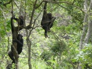
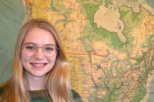
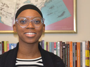
Crystal King is a senior at Michigan State University, pursuing a B.S. in Economic Geography and a Cognate in Business. Crystal previously interned at a venture capital fund in New York City and hopes to combine her interests in business and geography by studying international business in the future. In her spare time, Crystal enjoys live music, a good book, and spending time with animals. She is originally from Detroit, but her favorite place to travel is London.

Jessica Gillette is a Sophomore at the George Washington University pursuing a B.A. in Geography with a minor in G.I.S., and a B.A. in International Affairs with a focus on Security Policy. Currently she’s planning on furthering her Geographic skills in graduate school. While at the AAG she will be working on projects related to the Guide to Geography Programs, the Annual Meeting, and the archive of AAG publications in the Library of Congress. While not at work or school she can be found watching the Houston Texans or exploring D.C.

If you or someone you know is interested in applying for an internship at the AAG, the AAG seeks interns on a year-round basis for the spring, summer, and fall semesters. More information on internships at the AAG is also available on the Jobs & Careers section of the AAG website at: https://www.aag.org/internships.

    Share