Straits: Social Connection Despite Separation
 Geography in the News is an educational series offered by the American Association of Geographers for teachers and students in all subjects. We include vocabulary, discussion, and assignment ideas at the end of each article.
By Daniel Nirenblatt
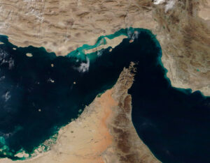
If you’ve heard about it once, you’ve heard about it dozens of times: The Strait of Hormuz, a thin body of water in the Person Gulf. Twenty percent of the world’s oil goes through this narrow channel. It is the focus of fierce competition now, and the focal point of a war.
The Strait of Hormuz is a reminder that not all of the world’s impressive places are at huge scales, such as the Himalayas, the Pacific Ocean, the Sahara, or the Amazon rainforest. More modest places also command attention. Take straits, the narrow waterways between the lands that hold them.
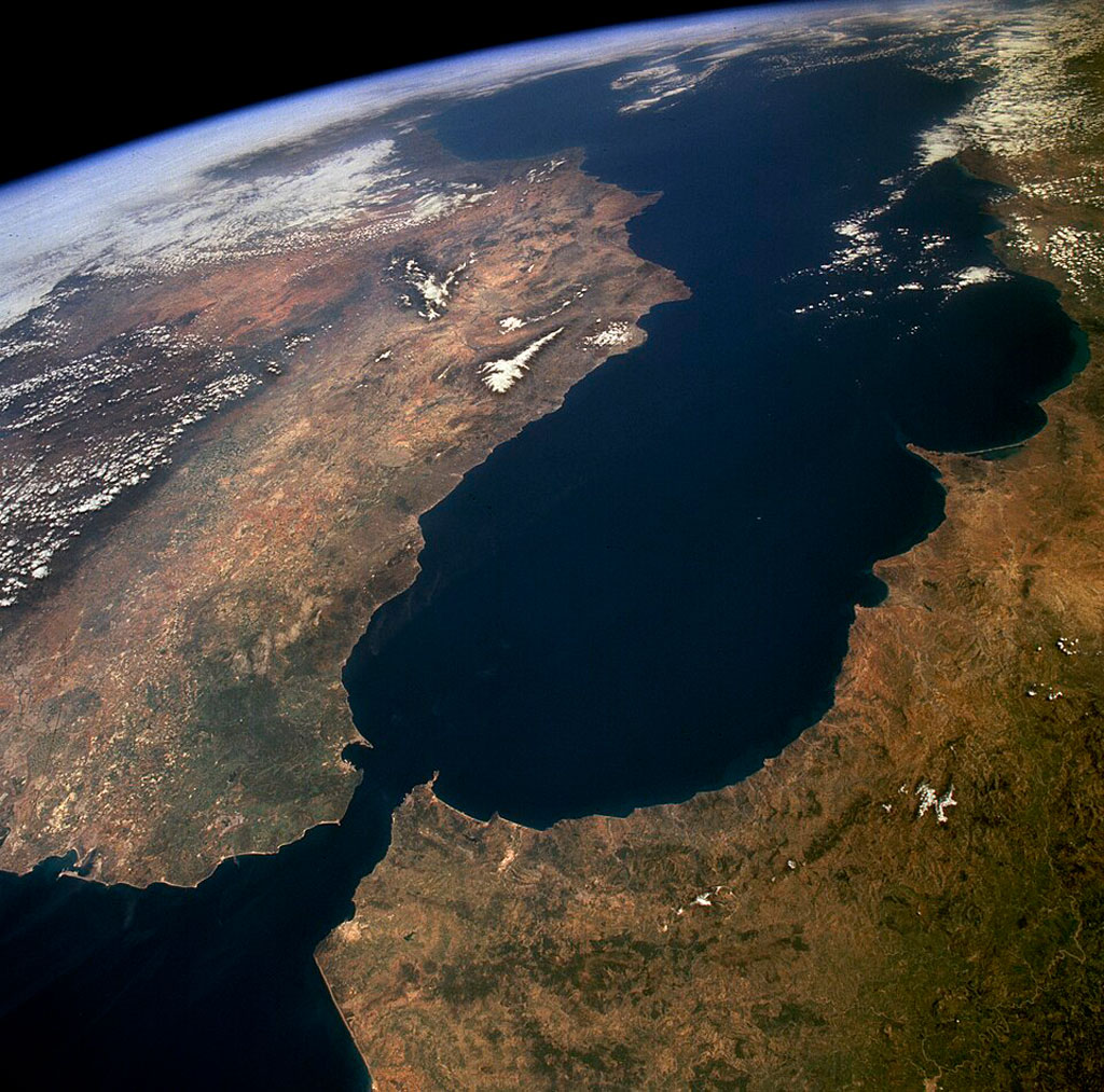
Straits connect two larger bodies of water. They often form because of plate tectonics, or when water floods low-lying land. For example, the Strait of Gibraltar, which connects the Mediterranean Sea to the Atlantic Ocean—was formed by plate tectonics. The Bering Strait between Alaska and the far east of Russia formed between 11,000 and 13,000 years ago, when glaciers melted and raised sea levels to where they are today.
Ships often have to pass through narrow “chokepoints” to get from one port to another. Many of these chokepoints are straits. Cities have benefited economically by settling along these trade routes. Businesses that are close to frequent shipping in straits can import and export goods more easily because they are also close to other shipping-related businesses.
When a city controls a strait—or when its economy becomes tied to shipping near a strait—it can become a major trade hub for its region. Two such cities are in opposite parts of the world: Detroit and Singapore.
The strait of the Detroit River grew into a defining feature of American and Canadian waterways. In fact, the name Detroit comes from the French, “le détroit,” meaning “the strait.” Singapore, originally colonized by the British, came to oversee over one-third of global sea traffic tonnage.
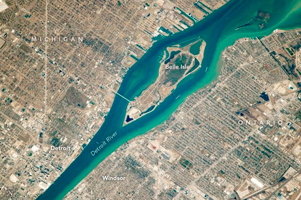
Before European settlement, the Detroit River was a shared place for the many Indigenous groups in the Great Lakes region. The river strait was used for connection rather than division. It supported regional trade, fishing, and diplomacy even though early French colonial efforts tried to organize the shoreline into “ribbon farms.” These are long, narrow plots of farmland with waterfront access that date back to the 1760s.
Into the 19th century, Detroit and the Detroit River were known under the codename “Midnight” during the Underground Railroad. This is because the city was the last hurdle to cross before refuge in Windsor, Ontario. The Detroit River became something to cross rather than something to travel through, but it kept its identity as a meeting place for those fleeing slavery to cross into a better place. The river has always held its identity as a hub of social connection, whether for the economy or in times of crisis.
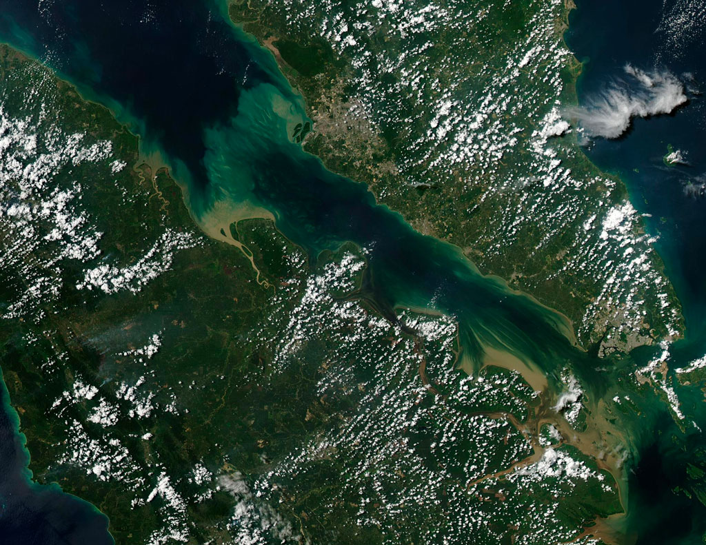
Just as Detroit sits at an important chokepoint in the Great Lakes, so does Singapore in the Straits of Malacca. These two bodies—the Strait of Malacca and the Singapore Strait—offer the shortest connection possible between the Indian Ocean and South China Sea. The straits enable earby ports to benefit from frequent shipping. Smaller ports handle local trade, which frees larger ports to focus on regional and global shipping. The local trading community created by this network is ethnically diverse and rich in connections.
The east-west sea route connects the Indian and Pacific Oceans economically. The north-south social networks connect people and businesses on land. These connections are maintained through business and social ties. Over one-third of global shipping tonnage passes through the Straits of Malacca. Singapore’s location on the Straits makes it a capital of major international trade as well as social connection. To maintain these ties and economic growth, the Straits of Malacca must rely on peace. However, piracy is still a major problem.
Cities that are founded on straits have an important responsibility. They naturally become centers of social and economic growth, which support regional trade. What began as simple “natural shortcuts” between two bodies of water became home to cities that led their regions both economically and culturally. Because straits are so important, they often become targets in war. Countries that are in wars over straits usually wish to control the flow of resources and trade, which disrupts global shipping.
AAG’s Geography in the News is inspired by the series of the same name founded by Neal Lineback, professor and the chair of Appalachian State University’s Department of Geography and Planning. For nearly 30 years from 1986 to 2013, GITN delivered timely explainer articles to educators and students, relevant to topics in the news. Many of these were published on Maps.com’s educational platforms and in National Geographic’s blogs. AAG is pleased to carry on the series.
Sources Consulted for this Article
Bahgat, Gawdat, Crisis in the Strait of Hormuz: What Lies Ahead? May 2026.
Cowley, Sarah, The Detroit River: A Fluid Highway of Connection a Historical Boat Tour of the Lower Archipelago. June 2026.
Evers, Hans-Dieter and Gerke, Solvay, The strategic importance of the Straits of Malacca for world trade and regional development. 2006.
National Geographic Society, Strait. No date.
Vocabulary and Terms
- Chokepoint
- Diplomacy
- Ethnically diverse
- European settlement
- Indigenous
- Le détroit
- Physical geography
- Piracy
- Plate tectonics
- Refuge
- Revenue
- Ribbon farms
- Strait
- Tonnage
- Underground Railroad
Questions for Discussion and Further Study
- Straits are not only locations for economic activity, but they also promote other human activities and behaviors. Name and discuss the types of human activities and conditions that a strait can encourage.
- The Detroit River is actually a strait. How do we know that French settlers recognized this, too?
- For outside study: Why were ribbon farms in the shape they were in? What was the benefit of that shape? Are there/were there ribbon farms near where you live?
- For further study: What are some of the ethnicities who have gathered in Singapore?