It’s Up to Us: #AAG2023’s Low-Carbon Travel Campaign

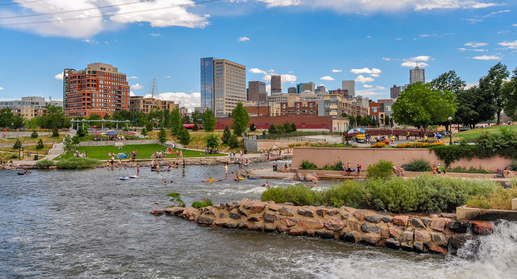
A view of Confluence Park beach and Denver skyline by Kent Kanouse, CC BY 3.0

AAG has set an ambitious goal of reducing our carbon emissions from each annual meeting by 45% by 2030 and 100% by 2050. As we return to our first in-person meeting in years, the travel choices we make really matter.

To encourage AAG 2023 participants to consider their travel options and lean away from carbon emissions whenever they can, AAG’s Climate Action Task Force prompted us to create the #AAG4Earth campaign. We encourage you to join in, explore your choices, and create a low-carbon adventure to arrive in Denver.

Getting there

Try Rail: Travel Amtrak to arrive at elegant Denver Union Station, a more than century-old Beaux Arts train station. Connect via the California Zephyr, a train route from Chicago to San Francisco. Visit Amtrak to explore your travel options. For groups of 8 or more, Amtrak Share Fares provide a discount of up to 60% off tickets. Groups of 15 or more can earn discounts or a free escort ticket for each 20 travelers. Visit Amtrak’s website or call 1-800-USA-1GRP for more information if your group is 15 or more passengers.

Arrive by Bus: Travel to Denver from virtually anywhere in the U.S. on Greyhound or Express Arrow. Use a service like Busbud or WanderU to find your best route and price.

Have to travel by plane? Denver International Airport (DEN) has taken steps to reduce its global carbon footprint.

On the ground

Even if you are traveling too long a distance to reduce your carbon footprint much, you still have lots of options for curtailing emissions from your activity once you’re in Denver:

Transit in Denver

Denver’s Regional Transit District offers schedules, trip planning, and real-time predictions of arrival from its website or app. Within the downtown area, you can hop on the Free MallRide and MetroRide buses departing from Union Station and continue down 16th Street and 18th/19th Streets, respectively.

Biking, Scooting, Rolling, and Walking

Check out Denver’s Wheelchair Accessibility Guide. And see Denver’s Shared Micromobility Program which offers information on scooters and bikes to rent. From the Visit Denver website, you can download a city bike map or use the Denver Regional COG’s interactive map to explore the many routes in bikeable Denver. There are 20 miles of bike lanes in downtown, convenient to the Cherry Creek and Platte River trails. Cycleton rents bikes from its location about 15 minutes’ drive and 30-40 minutes from Union Station by transit.

Denver’s walkable downtown begins with the 16th Street Mall, a car-free pedestrian space that is the fastest way to the AAG meeting hotels from Union Station, with a drop-off point next to the Sheraton Denver Downtown. The 16th Street Mall also features dining options from fast casual to upscale as well as shopping and breweries. Pedestrian bridges link 16th Street with nearby Commons Park and nearby LoHi neighborhood. Overall, downtown Denver is rated as one of the city’s most walkable places.

When choosing restaurants, shopping, and amusement parks, check for their commitment to shrinking their carbon footprints. For example, the Denver Beer Company spells out its commitment to reducing emissions and ethical product sourcing on its website.

We’re in this together. The decision to travel in a low-carbon way is a community-oriented decision and should be shared and celebrated communally. As you make your travel plans, show your pride in your decisions with the #AAG4Earth hashtag.

    Share

Ashok Dutt

Dr. Ashok K. Dutt, Professor Emeritus at the University of Akron, Ohio and a long time AAG member passed away on November 4, 2022. He was 91 years old.

He studied geography at the master and doctoral levels at Patna University (India, 1955, 1961). Subsequently, he was a Post-Doctoral Fellow at the Institute of Social Studies at Hague (Netherlands, 1964)  and studied physical planning under the supervision of  Professor J.P. Thijsee. He then emigrated to the United States and began his academic career at St. Anselm’s College (New Hampshire, 1966-68), Asian Institute, East Carolina University (Summer, 1967) and spent the remainder of his career teaching and conducting research at the Department of Geography and Urban Studies, University of Akron (1968-2004).

He had a distinguished career in teaching and research in the areas of urban, social, medical, and development planning with regional interests in Europe, Asia and US. He published over a dozen co-edited books and more than 200 research papers, book chapters, and encyclopedic entries. A notable contribution of his research was the conceptualization of the models of urban city forms called the Colonial-based South Asian City and Bazaar-based South Asian City. His most recent co-edited book is titled Urban and Regional Planning and Development: 20th Century Forms and 21st Century Transformations (Springer, 2020). He was a Fulbright scholar in India (1988-89) and was recognized as the recipient of distinguished scholar award by the Asian Geography and Regional Development Planning Specialty groups at the Association of American Geographers (1991 and 1992).

He is survived by his wife Professor Emeritus Hiran Dutta, daughters Jhumku Kohtz and Rinku Dutt and grandchildren.

By Sudhir Thakur, Professor, California State University Sacramento

    Share

AAG Action on Climate Change

Geography and Geographers in a Changing World

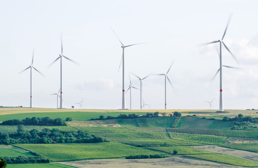
Photo of wind turbines on a farm by Karsten Wurth for Unsplash
Credit: Karsten Wurth for Unsplash

Photo of Marilyn Raphael by Ashley Kruythoff, UCLA

October and November are AAG Regional Meetings months, and I was preparing to go to my first as AAG President. As is customary, I asked what members would like to hear about, and was offered a number of different but related topics including “anything related to the future of geography and the role of the AAG.” The latter was especially important because a large proportion of the members attending the regional meetings are students — graduate and undergraduate. Instead of choosing a single topic, I integrated the two, and before I knew it, I had committed myself to speaking on Geography and Geographers in a Changing World.

Now, anyone looking at that title would instantly realize that this is not a 40-minute oral presentation; rather, it is the topic of a multi-authored manuscript (for example, this one) suitable for publication in a medium much like the Annals, or an edited book suitable for use in a “History of Modern Geography” class. In fact, a day or so after the presentation I casually googled the topic and found several related titles, including Gilbert White’s Geographers in a Perilously Changing World.

Graduate and undergraduate students in our discipline are trying to put their geographical education and their hopes for jobs into context as they prepare to leave university. They are entering a world that is more interconnected than ever — the speed with which information and misinformation are spread via social media is one example of that connectedness. Another is the reliance on mapping technologies for nearly everything, from finding the fastest route home through traffic to understanding public health trends. Our students face a world in which the economy is unstable, the global political state is tenuous, the climate is changing, and environmental degradation is a perennial problem. And, if that wasn’t bad enough, we have just experienced three years of a pandemic that has fundamentally changed the way we live and work.

Our students are so concerned about these issues that they are wondering how their geographic education is going to help them find jobs as well as answers to these pressing problems. Indeed, they are demanding a truly synthetic geography education that gives them a broad toolkit to tackle the world into which they will graduate. To meet their questions, it is worth reminding ourselves of who we are as geographers, from where we’ve come and to think about where we might be going. And how we fit into today’s world. It helps to take stock of what has happened in context, as we move to the next phase.

Changes in Geography and the AAG

“Change is a constant” is an overused phrase, but it is good to be reminded. Geography has been changing along with the world, very recently as well as over the last few decades. The discipline was once the static study of place concerned with how things are arranged on earth’s surface, with the map being the geographer’s tool. Geography’s quantitative revolution and the technological development of computers in the mid-20th century facilitated the development of geographic information systems (GIS), initially the tool of geographers but now used almost universally where spatial data analysis is needed. GIS, as well as new ways of thinking about things geographical, for example critical (human) geography and critical physical geography, means that geographers can ask different, arguably better, questions, potentially increasing the richness of their answers.

There has also been significant change in the leadership of the AAG, from one where men were far overrepresented, to one where women are more visible and active as leaders. The Association was founded in 1904. Seventeen years later, it elected its first female President. It took another 63 years before the second female president was elected (1984). Now, in the 21st century, a female president has become commonplace, so much so that I am the third female president in the last three years and next year there will be a fourth.

Other evidence of change within the AAG is apparent in the 2023 Annual Meeting theme: Toward More Just Geographies. This theme was chosen “in recognition of the urgency, centrality, and interdependence of equity, inclusion, diversity, and justice within our discipline and in the world” and reflects a core shift within the institution, matching changes that are occurring worldwide. This is not a singular action, but part of a fundamental change in the ways in which we operate. The AAG is now implementing a Council-approved 3-Year JEDI (justice, equity, inclusion and diversity) strategic framework.

The Outlook for Geography (as the Landscape Changes)

The point that I am making is that even with all of the changes that are occurring around us and within our organization, the core geographic ideas will not change. Geography, as in what we do, will change. A perfect example is how GIS has allowed us to ask new questions and to frame pre-existing questions differently, while still focusing on the richness of space moving from the static study of places on maps to the more revealing and arguably more interesting concepts such as the processes underlying the formation and interconnectedness of these places. A present-day working definition of geography is now closer to something like this: Geography examines human (e.g., social, cultural, economic, political) and physical (eg climatological, geomorphological, biogeographical) phenomena within the context of space, that is to say, how their location and their connections to others over space contribute to their characteristics and impacts and to the definition of the others.

The tools of geography are being used by other disciplines, and not just GIS. What I mean is that the interdisciplinary approach to understanding is becoming (or has become) commonplace. The contemporary movement in the social sciences, where I note many geography departments are housed, is towards addressing questions of global interconnection; migration, urbanization; environmental sustainability; climate change and its impacts, among others. There is a movement toward the use of more synthetic approaches to answer these questions. The synthetic approach is embedded in geography as is evident in the working definition that I outlined above and practiced in approaches like critical physical geography (and including critical remote sensing, qualitative GIS).

Finally, the demographic makeup of geographers is changing (or becoming more evident)

I am especially delighted that we see more geographers, representing many more identities: cultural, gender, ability/disability, and ethnic identities bringing with them a greater diversity of experience and knowledge. This expanding diversity means that different points of view are being introduced and incorporated into the body of geography. This can only make for a healthier discipline. There has never been a better time to be a geographer.

DOI: 10.14433/2017.0119


Please note: The ideas expressed in the AAG President’s column are not necessarily the views of the AAG as a whole. This column is traditionally a space in which the president may talk about their views or focus during their tenure as president of AAG, or spotlight their areas of professional work. Please feel free to email the president directly at raphael [at] geog [dot] ucla [dot] edu to enable a constructive discussion.

    Share

David M. Mark

David M. Mark, The University at Buffalo, The State University of New York (UB) Distinguished Professor Emeritus in the Department of Geography and an internationally recognized leader in the field of GIScience, died Sept. 24 after a brief illness. He was 74.

Jeri Jaeger, UB professor emeritus of linguistics and Mark’s partner of 15 years, was by his side.

Mark joined the UB faculty in 1981 and had a major impact on the Department of Geography and the university more broadly, and his influence on the disciplines of geography, GIScience and human spatial cognition/languages was seen on an international scale. Among his many achievements, he worked with Andrew Frank, Andrew Turk, David Stea and others to establish the field of ethnophysiography — the perception and description of landforms by different cultures.

Mark served as director of the UB site of the National Center for Geographic Information and Analysis (NCGIA), funded by NSF to UB, UC Santa Barbara, and University of Maine from 1995-2013. NCGIA helped establish a national and international presence for the burgeoning field of GIScience.

Mark’s own research began with geometric descriptions of the land surface and evolved toward ethnophysiography. Along the way, he pioneered methods for representing these landforms using digital computers, which helped usher in the field of GIScience. He and other NCGIA colleagues simultaneously developed a formal theory for spatial thinking, grounded in cognition and linguistics. His ethnophysiographic and ontological research has been a major component of the theoretical foundation of GIScience. Collectively, his work has profoundly influenced the knowledge body of GIScience and the research directions pursued in the field today.

A prolific scholar, Mark published well over 200 manuscripts that have been cited over 18,000 times. He was lead investigator on numerous large grants, including from the National Institutes of Health and two National Science Foundation (NSF) Integrated Graduate Education, Research and Training (IGERT) projects, which funded and launched the careers of about 50 doctoral students.

He was the recipient of numerous awards and honors, including the University Consortium for Geographic Information Science Researcher of the year (2004), Educator of the Year (2009) and Elected Fellow (2010); the American Association of Geographers’ Robert T. Aangeenbrug Distinguished Career Award (2013); Simon Fraser University’s Outstanding Alumni Award for Academic Achievement (2016); and the Waldo-Tobler GIScience Prize from the Austrian Academy of Sciences (2016).

A native of British Columbia, Canada, he earned a B.A. in geography from Simon Fraser in 1970, an M.A. in geography from the University of British Columbia in 1974 and a Ph.D. in geography from Simon Fraser in 1977. He was an assistant professor at the University of Western Ontario before joining the UB faculty.

Aside from his academic achievements, Mark was an enthusiastic “birder” for many decades. He and Jaeger traveled extensively, including to the Amazon River, the coast of Alaska, game parks in Africa, Egypt and the Nile River, and India. He added to his lifetime list of birds wherever he traveled.

In years past, David was a member of the geography department’s soccer team and goalie for the floor hockey team. Many of his teammates were his graduate students. He was a dedicated fan of the Buffalo Sabres and Bills, and went to many games with friends. Having bonded with the Bills during the Super Bowl years of 1991-94, he had been looking forward to this year with great anticipation.


Contributed by members of the University at Buffalo Geography Department.

    Share

The International Encyclopedia of Geography

The International Encyclopedia of Geography: People, the Earth, Environment, and Technology

Image showing complete set of The International Encyclopedia of Geography: People, the Earth, Environment, and TechnologyRepresenting the definitive reference work for this broad and dynamic field, The International Encyclopedia of Geography: People, the Earth, Environment, and Technology arises from an unprecedented collaboration between Wiley and the American Association of Geographers (AAG) to review and define the concepts, research, and techniques in geography and interrelated fields. Available as an online resource and as a 15-volume full-color print set, the Encyclopedia assembles a truly global group of scholars for a comprehensive, authoritative overview of geography around the world.

  • Contains more than 1,000 entries ranging from 1,000 to 10,000 words offering accessible introductions to basic concepts, sophisticated explanations of complex topics, and information on geographical societies around the world
  • Assembles a truly global group of more than 900 scholars hailing from over 40 countries, for a comprehensive, authoritative overview of geography around the world
  • Provides definitive coverage of the field, encompassing human geography, physical geography, geographic information science and systems, earth studies, and environmental science
  • Brings together interdisciplinary perspectives on geographical topics and techniques of interest across the social sciences, humanities, science, and medicine
  • Features full color throughout the print version and more than 1,000 illustrations and photographs
  • Annual updates to the online edition

Online advantages

Online access provides many benefits for scholars, researchers, professors, students and librarians:

  • publishes annually for the most comprehensive reference available in the field
  • 24/7 use
  • enhanced search and discoverability
  • search by keyword or phrase across the full text
  • browse by table of contents and topic to explore the breadth of coverage
  • export citations
  • click through reference links
  • bookmark content to share with social networks
  • unlimited concurrent user access
  • perpetual access rights with one-time purchase
  • COUNTER-compliant usage data
  • no DRM restrictions
  • enhanced MARC records at no extra charge
Learn more about topics and recent articles


For more information, contact Jennifer Cassidento.

    Share

William Laatsch

The geographer who loved nothing more than exploring unfamiliar territory has embarked on his next journey, to a destination not found in any atlas. William Ganfield Laatsch, 84, passed away September 14, 2022.

William Laatsch was born June 20, 1938, in Waukesha, WI, to Wayland and Elizabeth (Ganfield) Laatsch. His lifelong love of learning and exploring began in childhood, nurtured by family trips to Northern Wisconsin and the east coast. An only child, he often joked about how, instead of being chaotic and crowded affairs, holidays were often spent reading, surrounded by aunts and uncles who would do the same until cocktail hour.

I don’t expect them all to become geographers. I just expect them to be better stewards of the Earth and its people.

Photo of William Laatsch pointing to a desk map with students looking on

While Bill’s immediate family was small, his youth in Waukesha was surrounded by a close knit group of families that included Richard and Elizabeth Hunter and their daughter Frances. Growing up on the same block, Fran and Bill would accompany each other to school which was the start of a loving relationship that would see them marry on August 18, 1962 and go on to spend the next 60 years together. Fran was Bill’s partner as he pursued his academic career, and together they traveled widely, across North America, Europe, and Asia. They had a special affinity for the American West. Together Bill and Fran would raise two children, Ann (Shorewood, WI) and David (Wauwatosa, WI).

Photo of William Laatsch pointing to a large wall map with student looking on

In 1956 Bill enrolled at Carroll College, now Carroll University, where his family ties to the institution ran deep. His grandfather, William Arthur Ganfield, served as the College’s sixth president and Bill’s parents, aunts, and uncle also attended Carroll. He continued his studies at the University of Oklahoma where he earned a Master of Science in physical geography, and the University of Alberta in Edmonton. There, he studied high latitude geography, mining development, and town site development. (Decades later, he would be honored with a Yukon ecological reserve named after him in recognition of his 1970’s doctoral dissertation recommendation that the region emphasize ecotourism as a hedge against the decline of mining). After earning his Ph.D. in cultural geography, he accepted a position in the Department of Regional Analysis at the University of Wisconsin-Green Bay.

Photo of William Laatsch wearing a mouse costume for the annual fall Bill Laatsch Wine and Cheese Classic, courtesy University of Wisconsin library digital archivesBill spent 43 years at UWGB as a Professor of Geography and Department Chair, and postponed retirement to fill the position of Interim Provost and Vice Chancellor for Academic Affairs. For decades, he hosted the Bill Laatsch Wine and Cheese Classic each fall, where he—dressed as a 6’4” gray mouse (shown at right)—would welcome students back to campus with his signature warmth and good humor. Bill retired in 2009, and became the first faculty member to have a classroom named in their honor. During the course of his career he earned numerous prestigious awards for teaching excellence, both locally and nationally. Bill inspired generations of students to pursue careers in teaching, urban planning, cartography, GIS, remote sensing, and other professions related to cultural geography’s focus on the Earth and how humans interact with it. About his students, he remarked “I don’t expect them all to become geographers. I just expect them to be better stewards of the Earth and its people.”

He also served as a consultant for the U.S. Department of Defense, Wisconsin Department of Transportation and the Wisconsin Department of Development. He was a member of the Editorial Board of the “Voyageur” Historical Review, former chairman of the State of Wisconsin Historic Preservation Review Board, Chairman of the Midwest division of the Association of American Geographers and Fellow of the American Geographical Society. He is a former President of the Heritage Hill Corporation, which operates the Heritage Hill State Historical Park for the Department of Natural Resources.

Photo of William Laatsch taking notes near an alter with religious artifactsA professional interest in Belgian settlement in northeastern Wisconsin culminated in helping to establish the Belgian Heritage Center in Namur, Wisconsin, which is dedicated to telling the story of Belgian settlement in Wisconsin and works to preserve unique elements of Belgian culture. Bill loved leading bus tours of the Southern Door County Belgian architectural and historical sites for students, tourists, and anyone who would seek out his expertise and, to his children’s horror, terrible jokes.

A deep allegiance to his alma mater, Carroll, is evident in Bill’s years of service to the institution. He served on the Board of Trustees for 19 years (1991-2010) chairing numerous committees and ultimately as Chairman of the Board.

Bill revered the Earth’s beauty, and was moved to tears when he saw Mount Everest in person in 1996. He loved Jake’s corned beef, deep belly laughs, early morning fresh cheese curd runs, Door County, and striking up conversations with strangers across the world (whether they spoke his language or not). A champion trapshooter, he loved shooting and found joy in teaching his children to enjoy the sport as well. Above all else, he loved being Papa to his grandchildren. He treated everyone he met with respect and kindness, and gave generously of his time and energy to environmental, educational, historical, and artistic causes.

Bill was preceded in death by his parents and his beloved in-laws Richard and Elizabeth Hunter. He is survived by his wife Frances Hunter, daughter Ann Laatsch, son David (Tara) Laatsch, and his two amazing grandchildren, Elizabeth and Andrew, as well as countless friends, colleagues, and students who he inspired, encouraged, and mentored.


Reprinted with permission from the Feerick Funeral Home.

    Share

Tell Your Member of Congress to Support the Climate Provisions in the Inflation Reduction Act

    Share

On the Map: The Spot Where Modern Denver Began

Confluence Park rapids and beach with a backdrop of the Denver Skyline by Kent Kanouse, Creative Commons

The confluence of two rivers in downtown Denver — Niinéniiniicíihéhe (the South Platte River) and Cherry Creek — marks the 1858 gold strike that launched a major city.

This spot also marks the prospectors’ encounter with the Arapaho, whose winter camping grounds and sovereign land this was, as affirmed in the 1851 Treaty of Fort Laramie. In addition to white settlers, Cherokee Nation citizens made up a significant number of the early prospectors, pushed off their own land after the 1828 Georgia Gold Rush and subsequent Trail of Tears.

At the site of Confluence Park, it was William Greenberry “Green” Russell who led the group that began a search for gold there in May 1858. When they found indications four miles south, their temporary settlement became what is now known as Denver.

In the intervening century, the 10.5-mile stretch of the South Platte River where Confluence Park rests fell on hard times, like many urban rivers. By the 1970s, it was a polluted, not only neglected but a frequent dumping site, “Denver’s receptacle for anything they wanted out of sight, out of mind.” according to Colorado State Senator Joe Shoemaker, who led the campaign to restore the riverfront. In 1974, Shoemaker co-founded the Platte River Development Committee with then-Denver Mayor Bill McNichols, eventually transforming it into the Greenway Foundation. The park underwent a long renovation and reopened with more amenities in 2018.

Confluence Park rapids and beach by Kent Kanouse, Creative Commons by Wally Gobetz, Creative Commons
Confluence Park rapids and beach by Wally Gobetz, Creative Commons

Today’s Confluence Park is a public gathering place that offers recreation, paved paths and nature trails, river views and natural landscapes; tubing, and a kayak run. Fishing is permitted, as are wading and shallow swimming at a small beach. Shopping and dining are close by.


Find out more about the Cherokee Nation’s participation in the Colorado Gold Rush

DOI: 10.14433/2017.0118


Sources: Colorado Encyclopedia; “Confluence Park,The Cultural Landscape Foundation; RIVER TOWNS: Denver | The South Platte’s dirty past promises a pristine future,” September 18, 2021 Colorado Politics; OsiyoTV; Uncover Colorado; “The Birth of Denver, from Boom to Bust to Boom,” Indian Country Today, Oct. 29, 2013. 

    Share