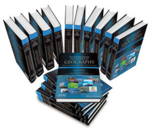
Representing the definitive reference work for this broad and dynamic field, The International Encyclopedia of Geography: People, the Earth, Environment, and Technology arises from an unprecedented collaboration between Wiley and the American Association of Geographers (AAG) to review and define the concepts, research, and techniques in geography and interrelated fields. Available as an online resource and as a 15-volume full-color print set, the Encyclopedia assembles a truly global group of scholars for a comprehensive, authoritative overview of geography around the world.
Contains more than 1,000 entries ranging from 1,000 to 10,000 words offering accessible introductions to basic concepts, sophisticated explanations of complex topics, and information on geographical societies around the world
Assembles a truly global group of more than 900 scholars hailing from over 40 countries, for a comprehensive, authoritative overview of geography around the world
Provides definitive coverage of the field, encompassing human geography, physical geography, geographic information science and systems, earth studies, and environmental science
Brings together interdisciplinary perspectives on geographical topics and techniques of interest across the social sciences, humanities, science, and medicine
Features full color throughout the print version and more than 1,000 illustrations and photographs
Annual updates to the online edition
Online advantages
Online access provides many benefits for scholars, researchers, professors, students and librarians:
publishes annually for the most comprehensive reference available in the field
24/7 use
enhanced search and discoverability
search by keyword or phrase across the full text
browse by table of contents and topic to explore the breadth of coverage
The geographer who loved nothing more than exploring unfamiliar territory has embarked on his next journey, to a destination not found in any atlas. William Ganfield Laatsch, 84, passed away September 14, 2022.
William Laatsch was born June 20, 1938, in Waukesha, WI, to Wayland and Elizabeth (Ganfield) Laatsch. His lifelong love of learning and exploring began in childhood, nurtured by family trips to Northern Wisconsin and the east coast. An only child, he often joked about how, instead of being chaotic and crowded affairs, holidays were often spent reading, surrounded by aunts and uncles who would do the same until cocktail hour.
I don’t expect them all to become geographers. I just expect them to be better stewards of the Earth and its people.
While Bill’s immediate family was small, his youth in Waukesha was surrounded by a close knit group of families that included Richard and Elizabeth Hunter and their daughter Frances. Growing up on the same block, Fran and Bill would accompany each other to school which was the start of a loving relationship that would see them marry on August 18, 1962 and go on to spend the next 60 years together. Fran was Bill’s partner as he pursued his academic career, and together they traveled widely, across North America, Europe, and Asia. They had a special affinity for the American West. Together Bill and Fran would raise two children, Ann (Shorewood, WI) and David (Wauwatosa, WI).
In 1956 Bill enrolled at Carroll College, now Carroll University, where his family ties to the institution ran deep. His grandfather, William Arthur Ganfield, served as the College’s sixth president and Bill’s parents, aunts, and uncle also attended Carroll. He continued his studies at the University of Oklahoma where he earned a Master of Science in physical geography, and the University of Alberta in Edmonton. There, he studied high latitude geography, mining development, and town site development. (Decades later, he would be honored with a Yukon ecological reserve named after him in recognition of his 1970’s doctoral dissertation recommendation that the region emphasize ecotourism as a hedge against the decline of mining). After earning his Ph.D. in cultural geography, he accepted a position in the Department of Regional Analysis at the University of Wisconsin-Green Bay.
Bill spent 43 years at UWGB as a Professor of Geography and Department Chair, and postponed retirement to fill the position of Interim Provost and Vice Chancellor for Academic Affairs. For decades, he hosted the Bill Laatsch Wine and Cheese Classic each fall, where he—dressed as a 6’4” gray mouse (shown at right)—would welcome students back to campus with his signature warmth and good humor. Bill retired in 2009, and became the first faculty member to have a classroom named in their honor. During the course of his career he earned numerous prestigious awards for teaching excellence, both locally and nationally. Bill inspired generations of students to pursue careers in teaching, urban planning, cartography, GIS, remote sensing, and other professions related to cultural geography’s focus on the Earth and how humans interact with it. About his students, he remarked “I don’t expect them all to become geographers. I just expect them to be better stewards of the Earth and its people.”
He also served as a consultant for the U.S. Department of Defense, Wisconsin Department of Transportation and the Wisconsin Department of Development. He was a member of the Editorial Board of the “Voyageur” Historical Review, former chairman of the State of Wisconsin Historic Preservation Review Board, Chairman of the Midwest division of the Association of American Geographers and Fellow of the American Geographical Society. He is a former President of the Heritage Hill Corporation, which operates the Heritage Hill State Historical Park for the Department of Natural Resources.
A professional interest in Belgian settlement in northeastern Wisconsin culminated in helping to establish the Belgian Heritage Center in Namur, Wisconsin, which is dedicated to telling the story of Belgian settlement in Wisconsin and works to preserve unique elements of Belgian culture. Bill loved leading bus tours of the Southern Door County Belgian architectural and historical sites for students, tourists, and anyone who would seek out his expertise and, to his children’s horror, terrible jokes.
A deep allegiance to his alma mater, Carroll, is evident in Bill’s years of service to the institution. He served on the Board of Trustees for 19 years (1991-2010) chairing numerous committees and ultimately as Chairman of the Board.
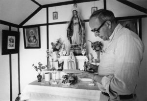
Bill revered the Earth’s beauty, and was moved to tears when he saw Mount Everest in person in 1996. He loved Jake’s corned beef, deep belly laughs, early morning fresh cheese curd runs, Door County, and striking up conversations with strangers across the world (whether they spoke his language or not). A champion trapshooter, he loved shooting and found joy in teaching his children to enjoy the sport as well. Above all else, he loved being Papa to his grandchildren. He treated everyone he met with respect and kindness, and gave generously of his time and energy to environmental, educational, historical, and artistic causes.
Bill was preceded in death by his parents and his beloved in-laws Richard and Elizabeth Hunter. He is survived by his wife Frances Hunter, daughter Ann Laatsch, son David (Tara) Laatsch, and his two amazing grandchildren, Elizabeth and Andrew, as well as countless friends, colleagues, and students who he inspired, encouraged, and mentored.
Tell Your Member of Congress to Support the Climate Provisions in the Inflation Reduction Act
Share
Stories
On the Map: The Spot Where Modern Denver Began
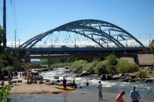
The confluence of two rivers in downtown Denver — Niinéniiniicíihéhe (the South Platte River) and Cherry Creek — marks the 1858 gold strike that launched a major city.
This spot also marks the prospectors’ encounter with the Arapaho, whose winter camping grounds and sovereign land this was, as affirmed in the 1851 Treaty of Fort Laramie. In addition to white settlers, Cherokee Nation citizens made up a significant number of the early prospectors, pushed off their own land after the 1828 Georgia Gold Rush and subsequent Trail of Tears.
At the site of Confluence Park, it was William Greenberry “Green” Russell who led the group that began a search for gold there in May 1858. When they found indications four miles south, their temporary settlement became what is now known as Denver.
In the intervening century, the 10.5-mile stretch of the South Platte River where Confluence Park rests fell on hard times, like many urban rivers. By the 1970s, it was a polluted, not only neglected but a frequent dumping site, “Denver’s receptacle for anything they wanted out of sight, out of mind.” according to Colorado State Senator Joe Shoemaker, who led the campaign to restore the riverfront. In 1974, Shoemaker co-founded the Platte River Development Committee with then-Denver Mayor Bill McNichols, eventually transforming it into the Greenway Foundation. The park underwent a long renovation and reopened with more amenities in 2018.
Confluence Park rapids and beach by Wally Gobetz, Creative Commons
Today’s Confluence Park is a public gathering place that offers recreation, paved paths and nature trails, river views and natural landscapes; tubing, and a kayak run. Fishing is permitted, as are wading and shallow swimming at a small beach. Shopping and dining are close by.
Find out more about the Cherokee Nation’s participation in the Colorado Gold Rush
Yi-Fu Tuan, a towering intellectual figure and University of Wisconsin–Madison professor emeritus of geography died Aug. 10 at UW Hospital in Madison at age 91, with a dear friend and former student, Charles Chang, by his side.
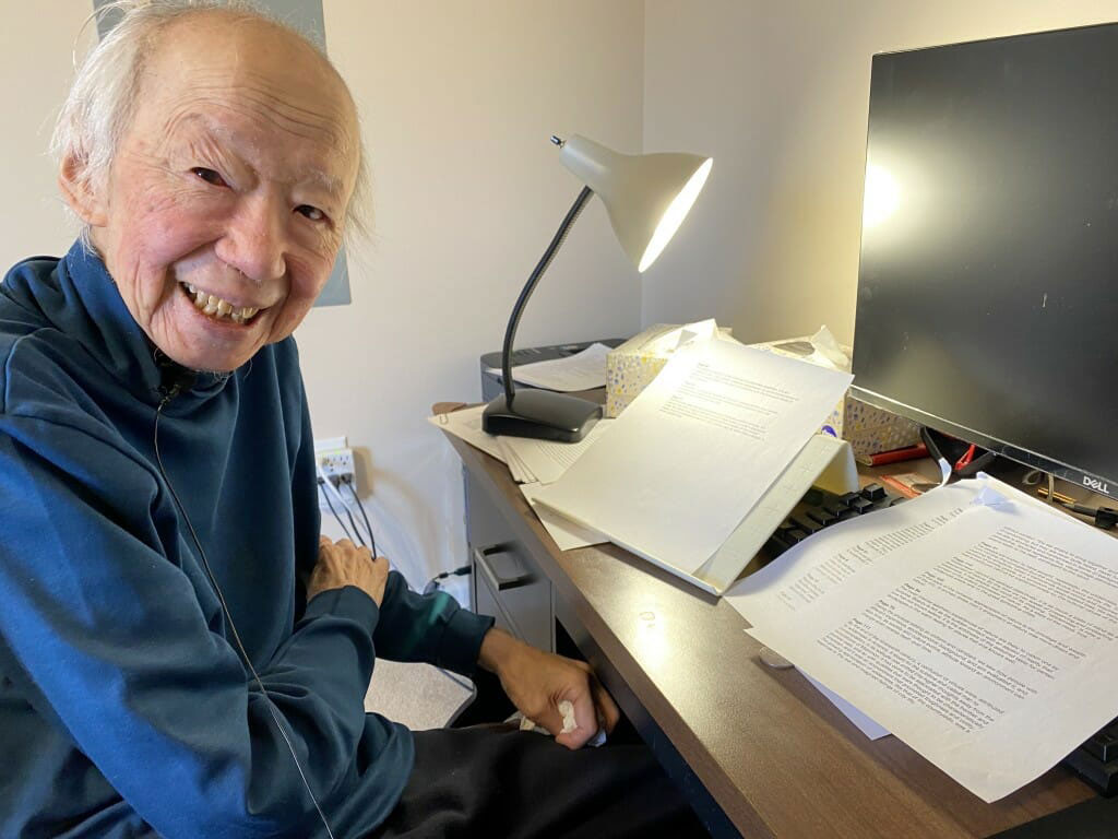
Yi-Fu Tuan in March 2022 during a break in filming with a Dutch film crew. His work introducing and expanding the field of humanistic geography is influential across the arts, humanities and social sciences, as well outside academia. Photo by Kris Olds
People think that geography is about capitals, landforms and so on. But it is also about place — its emotional tone, social meaning, and generative potential.”
—Yi-Fu Tuan
Tuan was a prolific writer and deep thinker who was known as the father of humanistic geography. A movement within the field of human geography, humanistic geography arose in the 1970s as a way to counter what humanists saw as a tendency to treat places as mere sites or locations. Instead, a humanistic geographer would argue, the places we inhabit have as many personalities as those whose lives have intersected with them. And the stories we tell about places often say as much about who we are, as about where our feet are planted.
It was Tuan who gave rise to the recognition among geographers that the intimacies of personal encounters with space produce a “sense of place.”
“People think that geography is about capitals, landforms and so on,” Tuan said. “But it is also about place — its emotional tone, social meaning, and generative potential.”
Time, age, sadness, loss, goodness, happiness, and the concept of home are all themes Tuan explored at length in his more than 20 books, including his best-known work, “Space & Place,” as well as “Humanist Geography: An Individual’s Search for Meaning.” In his later years, Tuan turned to introspection with his most recent books: “Who Am I? An Autobiography of Emotion, Mind and Spirit” and an addendum, “Who Am I? A Sequel.” Both works look back on the author’s early life in China and his rise to become one of America’s most innovative intellectuals.
Born in 1930 in Tianjin, China, Yi-Fu Tuan was educated in China, Australia, the Philippines and the United Kingdom. He received his bachelor’s and master’s degrees from the University of Oxford and his doctorate from the University of California, Berkeley.
Yi-Fu Tuan joined the faculty of the Department of Geography at UW–Madison in 1983, was named John Kirtland Wright Professor of Geography in 1985 and was named a Vilas Research Professor that same year, before attaining emeritus status in 1998.
His influence on the field of geography was enormous.
“For decades, Yi-Fu Tuan’s work shaped the thinking of generations of geography students and academics,” says Lily Kong, human geographer and president, Singapore Management University. “His place in the geographical canon is undoubted. His shaping of humanistic geography contributed to important philosophical shifts in the discipline.”
By emphasizing humans as thinking, dreaming, imagining beings who experience the world — capable of goodness, beauty and truth as well as greed, cruelty and domination — he showed us how all of these traits are reflected in our spaces, places and landscapes.”
—Tim Cresswell
Tuan was beloved by his students, both graduate and undergraduate alike. He often shared meals with undergraduates and enjoyed visiting the State Street Starbucks to listen in on, and sometimes join, students’ conversations about their studies.
“Yi-Fu Tuan insisted on the importance of the “human” in “human geography,” says Tim Cresswell, a graduate student of Tuan’s at UW–Madison who is now Ogilvie Professor of Geography at the University of Edinburgh. “By emphasizing humans as thinking, dreaming, imagining beings who experience the world — capable of goodness, beauty and truth as well as greed, cruelty and domination — he showed us how all of these traits are reflected in our spaces, places and landscapes.”
Tuan opened geography to scholars in other disciplines, according to Cresswell, and invited thinking on what geography had to offer our understanding of the human condition. Tuan’s work was cited and celebrated by scholars across the arts, humanities and social sciences, as well as by writers and professionals outside academia.
After his retirement, Tuan remained an emphatic presence on campus. Through his books, essays, and letters, as well as through innumerable conversations with students, Tuan continued to profoundly influence scholarship and thinking. An article about Yi-Fu Tuan in The Chronicle of Higher Education, 13 years after his retirement from UW–Madison, claimed that the geographer “may be the most influential scholar you’ve never heard of.” His world-renowned stature was complemented by a kind and generous demeanor, an intense curiosity about the world, and a keen interest in how his beloved department was evolving over the years. He was a model university scholar and citizen, says Kris Olds, a professor in the Department of Geography.
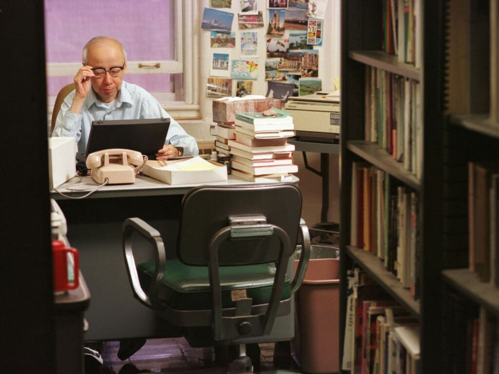
Yi-Fu Tuan at work in his Science Hall office in 1998. Tuan was a prolific writer. Photo by Jeff Miller
In Oct. 2012, Tuan was awarded the Vautrin-Lud International Geography Prize, the highest honor a geographer can receive. In 2013, he received the inaugural American Association of Geographers Stanley Brunn Award for Creativity in Geography, created to recognize “originality, creativity, and significant intellectual breakthroughs in geography.”
One of Tuan’s most unique contributions may be his “Dear Colleague” letters, composed over decades and sent to colleagues and friends, relating observations and changes in his daily life against a backdrop of larger political, educational, and social change.
“I do not know what Yi-Fu would like to say to everyone at the department in his last ‘Dear Colleague’ letter on Earth,” says Charles Chang. “But I do know that in his first ‘Dear Colleague’ letter from (hopefully) Heaven, he would like to thank them for their support over all these years.”
Chang also pointed to a story Tuan shared in an unpublished manuscript entitled “Summing Up,” in 2019.
“One day, as I walked down State Street, I heard the voice of a child behind me saying repeatedly, ‘Are you a student?’ Tuan wrote. “I ignored the question, for it could hardly be addressed to me. But I got curious, turned around, and asked the child, ‘Now, look here, do I look like a student?’ His reply, ‘Yes, you have a backpack.’ Well, that made my day! I have a backpack, which means that I am a student still open to life.”
“In a broad sense,” Chang says, “he was always open to life. He remained an active learner of the cosmos, of human goodness, to the end.”
Education: Bachelor’s degree in Geography: Geographic Information Science (San Diego State University)
The following profile was compiled by Jessica Embury (San Diego State University) for the Encoding Geography initiative. To learn more, visit: https://www.ncrge.org/encoding-geography/
Please describe your job, employer, and the primary tasks you perform in your position.
I am a GIS Specialist at the City of Oceanside Water Utilities Department. I am directly responsible for coordinating the collection of data among various departments and teams and managing the data collected. I often automate tedious tasks in order to build efficient workflows and processes for the collection of data and presentation of information.
What is your educational background? How did you initially discover geocomputation and why did you ultimately choose a career that uses geography and computer science?
I chose to pursue an education in GIS because I was interested in making a positive change in our natural environment. I had aimed to leverage GIS to strengthen my environmental studies and I had come to realize that it was extremely important to have a technical skill set. It was not enough to know how to make maps and I began to learn python coding. This is when I realized the importance of data design and I expanded my toolset by learning SQL. These skills could be applied to many different fields of study, and I utilize them daily in local government.
When thinking about geography, what specific background knowledge and conceptual ideas are important and useful to know?
Knowing the fundamentals of Geographic and Projected coordinate systems can be useful when handling data. This is a foundational GIS concept but can be more complex than some GIS professionals would like to admit.
When thinking about computer science, what specific background knowledge and conceptual ideas are important and useful to know?
Data design is key. The correct data types must be considered when attempting to integrate computer science with GIS programs like Esri software.
What procedural knowledge is important and useful to know, from either geography or computer science?
Data cleanliness is important and having standard operating procedures for the collection of that data can make the difference between having reliable or unreliable data.
What is an example of a social, economic, environmental, or other issue that you have recently investigated in a project at work?
I assisted the Homeless Outreach Team in developing a survey application to better identify homeless individuals who are qualified for assistance programs. The surveys are submitted to a database and have auto-calculated fields using SQL triggers to help create more usable and robust datasets so that decision makers are more informed.
What types of questions did you ask and think about in your project?
I was interested in identifying hot spots of homelessness within the city and why those areas are as such. Temporal scales were considered when designing the dataset in order to have a better snapshot of the current situation. Surveys older than six months are archived using scheduled scripts. Analysis of regional interconnectedness is ongoing, and many questions are beginning to arise, both geographically and programmatically.
What types of data did you acquire to support your project? If possible, please identify up to three datasets you utilize most.
We utilized zoning datasets to identify responsible agencies that are required to respond to homeless activity. Districting datasets were also utilized to assign volunteers to regions of the city with more homelessness during the homeless point-in-time count.
What types of content knowledge and skills did you use to evaluate, process, and analyze the data you gathered for your project?
While analyzing the survey data, it was imperative that null and ‘declined’ values were accounted for to not skew the statistics. The data, or lack thereof, had to be presented succinctly.
How did you apply geography and computer science to communicate the results of your project?
I created an Esri Dashboard for the Homeless Outreach Team to view the live data collected in the field, which allows supervisors to observe homeless statistics and track their team’s progress.
Reflecting on your work, how does it align with your personal values and your community or civic interests?
I want to do everything I can to make my community better. I believe I have the power to influence change when leveraging my GIS skills and can apply my geographic and computational expertise to a multitude of different issues.
This material is based upon work supported by the National Science Foundation under Grants No. 2031418, 2031407, and 2031380 (Collaborative Research: Encoding Geography – Scaling up an RPP to achieve inclusive geocomputational education). Any opinions, findings, and conclusions or recommendations expressed in this material are those of the author(s) and do not necessarily reflect the views of the National Science Foundation
Meghan Dilworth and Samantha Hinton Intern at AAG for Summer 2022 Semester
Two new interns have joined the AAG staff this summer! The AAG would like to welcome Meghan and Samantha to the organization.
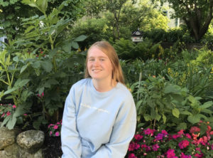
Meghan Dilworth is a senior at Arizona State University (ASU), pursuing a B.A. in Geography and Urban Planning. Meghan has been a Teaching Assistant/Mentor in the ASU Geography department for three years. Additionally, she has worked as a Geography Content Curator at SolarSPELL, a company that collects geography and educational information for people in areas that don’t have access to the internet or traditional libraries, such as East Africa or the Pacific Islands. In her spare time Meghan’s interests include travel, snow skiing, horseback riding and gymnastics.
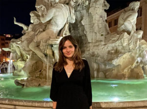
Samantha Hinton was born and raised in New York City where she graduated from The Spence School. She currently attends Trinity College Dublin, pursuing a B.A. major in Geography. At Trinity, she is the geography library undergraduate representative, a Student 2 Student Mentor, part of the women’s soccer team, and the treasurer of the Geographical Society. She has spent the last six months doing her Erasmus at Utrecht University in The Netherlands. Samantha chose to apply for geography because she is passionate about appreciating the outdoors. With geography, she strives to learn more about the intersection and impact between humans, space, and the environment. While not working, she enjoys traveling, making art, and playing sports.
If you or someone you know is interested in applying for an internship at the AAG, the AAG seeks interns on a year-round basis for the spring, summer, and fall semesters. Currently, due to COVID-19 safety regulations AAG interns are home-based employees.
I begin this year of my presidency feeling thankful. Thankful that I survived the pandemic (so far!) and thankful for the opportunity to serve my discipline at this level. So, before I write another word, I want to say thank you for giving me this opportunity. I did not imagine, indeed, could never have imagined becoming president of this Association when as a child my interest in geography began to develop. I am looking forward to working with the Council on matters of importance to geography and to the members of the AAG. I am looking forward to going to the regional meetings this fall and doing my part to support and encourage the work that the regions are doing. I firmly believe that as its regional divisions thrive, so will the whole Association.
In this column, I’ll focus on the effect of the pandemic on us. I want to acknowledge here our three previous presidents who served their terms under the shadow of COVID-19, as well as our Executive Director Gary Langham who has only known the AAG during the pandemic. David Kaplan was there in March 2020, just as these changes had begun, writing a compassionate column warning of the threat, pointing out how well positioned geography is to help us understand the threat, and asking us to be careful ourselves and to look out for others. Amy Lobben served her term completely virtually, and Emily Yeh’s term was almost completely virtual. Their stewardship has meant that the AAG has not only survived the pandemic, but seized opportunities to re-envision its service to members.
I’m beginning my presidency at a peculiar time in the AAG’s history. For the past two and a half years we’ve been living with a pandemic, forced by the extremely contagious novel coronavirus – COVID-19. This virus and our response to it have changed the way we live and work, the economy, and society, in fundamental ways, some of which we will only recognize in coming years. And these changes are not limited to the US. They are worldwide.
Emergence from the pandemic has not been a smooth transition back to normal, probably because that pre-2020 normal does not exist anymore. We are now in what some call a new normal, and others the post-pandemic world. I wonder, is it true that we are post—pandemic, and if it is, what exactly does that mean? How has this experience changed what and how we think, as well as how we live our lives? How much of that change is good? How much of it do we need to undo? What has not changed and needs to change? What has changed but not enough, so that we still need to work on it? What has changed that we need to keep in its new form? I have a lot of questions.
Emergence from the pandemic has not been a smooth transition back to normal, probably because that pre-2020 normal does not exist anymore.
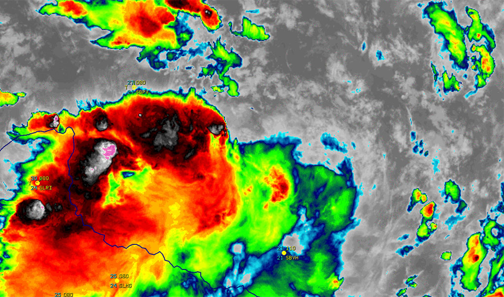
Over the course of the last two and a half years I have been actively looking at these changes with the express aim of seeing what good I could extract. One might say, actively trying to find the silver lining in the mesoscale convective complex that is COVID-19. It is not an easy task, but I did not want to emerge from the pandemic with nothing positive to show for all of the chaos that it caused. Here is some of what I found.
COVID-19 separated us from each other. Our first response to the virus was to isolate ourselves, either due to official lockdowns or by choice and concern. In that justifiable fear for our lives before vaccines became freely available, we withdrew, stayed home, worked from home, attended classes from home, and tried to play at home. For many of us this was fine. We took the opportunity to focus on family life, DIY projects abounded, selfcare ascended as a vital approach to our days. For many of us, though, the lockdown phase of the pandemic was hugely problematic. Many people could not stay home or lost their jobs because employers depended on us to show up, but we withdrew. Trying to work/teach/host/attend meetings online from an active home was difficult, sometimes embarrassing. And yes, sometimes, that home to which we withdrew was not a safe space. My silver lining (and I realized later, that of many others) is the weekly family Zoom meetings that my brother instituted. We are a large family living in several countries, thousands of miles apart from each other and we had the real fear that isolation forced by Covid would destroy our connectedness. The weekly Zoom meetings have helped to keep us connected even more tightly than we were before the pandemic began.
What has changed that we need to keep in its new form? What has changed but not enough so that we still need to work on it?
We changed how we travelled and communicated. We greatly limited airplane travel and drove fewer miles, especially those who stopped commuting to work. Texts and phone calls and social media were no longer backed up by in-person social events or the daily meetings and conversations at work. Our annual meetings, where we met our colleagues, renewed friendships and collaborations, and shared our research, went virtual. And, despite the heroic attempts of our tech people, virtual spaces cannot compare to in-person for maintaining those vital connections. One—alas temporary—silver lining here was an immediate and significant effect on the levels of atmospheric pollution in major cities around the globe. In Los Angeles, where I “isolated” I have never seen such brilliantly blue skies except perhaps the day after a storm passed over. The pandemic showed us that we could substantially cut emissions of greenhouse gases if we were forced to. Another, more enduring, silver lining here is that as we are emerging from the crisis and able to again meet in person, we have also learned the value—especially for cost, and access—of maintaining a virtual option.
COVID-19 negatively affected our academic units. One of my tasks as Vice President was to organize and host the Departmental Chairs’ Luncheon. As a part of preparing for the discussion, the group was polled for topics of interest. Advice on how to deal with the negative impacts of COVID-19 on their departments was the topic most often mentioned. Their concerns ranged from work overload and burnout to low faculty morale and the fear that the pandemic had forced structural changes, often bringing student and faculty and staff expectations into conflict. These underscored for me how negatively affected we have been by the pandemic and the urgent need to take steps to support our faculty and students in the wake of the pandemic.But the discussion around these issues also revealed to me how strong the desire is to come through this safely and to use what we have learnt to make stronger, more caring departments and indeed a stronger and more caring AAG. It is an opportunity for the AAG to become more relevant to its membership and to the broader community as we emerge from the pandemic.
Changing For Good
This year as President I want to focus on bringing AAG to a sustainable post-pandemic state. I want us to take advantage of the new opportunities that have developed over the past two and a half years. I begin in this column by addressing a couple of the questions that I raised earlier.
What has changed that we need to keep in its new form?
My answer here would be our approach to communicating. For example, there are ways we can improve the experience of virtual meetings at AAG. We do not have to completely sacrifice our annual in-person meeting; however, we should continue to expand and improve our virtual (and hybrid) capacity to provide thoughtful and well-executed options for participation. AAG is already providing new yearlong opportunities for us to engage with each other through Professional Development webinars for leaders and early-career geographers, as well as the Summer Series specifically for students. I can foresee membership growth with simultaneous reduced carbon footprint from this win-win approach.
What has changed but not enough so that we still need to work on it?
There are other answers here, but I will say that our awareness of inequality has heightened, supporting actions that were already started within the AAG. It is no coincidence that some of AAG’s most valuable programming under the Rapid Response to COVID-19–for example, Bridging the Digital Divide and the equity and mental health aspects of the Graduate Summer Series–were also meant to address longstanding inequities within the geography discipline, itself a mirror of inequities in society. As I said in my nomination statement for this presidency, COVID-19 brought these inequities into more prominence: “The legitimate fear of infection has led to an abrupt change in the way in which society operates and communicates, exposing the realities of our inequality.” While the trio of diversity, inclusion, and representation has been a focus in the AAG, it remains a critical issue, and AAG still has work to do to ensure that geography as a discipline becomes inclusive and equitable. We need to continue to work on reducing inequality and to address racial, social and environmental injustice, in our discipline. And the way to do this is through increased diversity, inclusion and representation of under-represented groups. I was excited to read the JEDI framework document and look forward to the implementation of its recommendations.
The way ahead. The pandemic was/is a disruption of immense proportions. However, we geographers are a resilient bunch and because of this we will extract from this experience the pieces that will help us shape ourselves into a bigger/better/stronger organization. We will emerge and thrive, becoming really post-pandemic. I look forward to helping us get there.
Please note: The ideas expressed in the AAG President’s column are not necessarily the views of the AAG as a whole. This column is traditionally a space in which the president may talk about their views or focus during their tenure as president of AAG, or spotlight their areas of professional work. Please feel free to email the president directly at raphael [at] geog [dot] ucla [dot] edu to enable a constructive discussion.
Share
Stories
Member Profile: Phoebe Lind
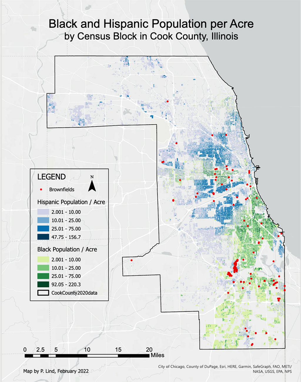
As a dancer and a geographer, Phoebe Lind’s career has been shaped by space and place. Most recently, her work as an enumerator for the U.S. Census Bureau, as a redistricting consultant for the Cook County Board, and as a recent graduate with a Masters degree in Geography and Environmental Sciences from Northeastern Illinois University, Lind has investigated the spatial relationship between environmental hazards and minority communities, and how they collectively inform the redistricting process.
I‘ve always really enjoyed the science behind maps: how they’re made, how projections work, the way that they can be incredibly insightful to spatial trends of where problems exist in the world.
“I think I changed career paths because the world really needs people studying environmental issues, learning how to sufficiently use this amazing GIS technology that we have today, to start to fix all kinds of complicated problems that we are dealing with.” Lind earned her bachelor’s degree in Dance before deciding to pursue a Masters at NEIU.
Lind’s academic research was inspired by a nationwide study that correlates the locations and traits of congressional districts relative to minority populations and Superfund sites. She decided to try to replicate the study herself, “or maybe develop a modified set of methods that could allow for this same study to be done on a county wide or similar scale, like a state or a city,” Lind explains, emphasizing the importance of scale. Lind’s own connection to the space she was studying—Cook County, where she lives—became clear as she moved through her research. “The reality for me is that I just have so much information on Cook County. And so much expertise on this redistricting process, because I did it. I did the redistricting process for this round of redistricting. I was an enumerator. I got to collect the data.”
Working on the ground as an enumerator in Cook County during the beleaguered 2020 census did a great deal to inform how she carried out her research. “I had no idea what that job would be like, and it felt like a historic opportunity to kind of jump in and see how the process went. I feel really lucky to have been the one helping. This is important demographic and population data for the country…and then being able to see the other side of that and having input on the redistricting process…it felt like a very important job.”
Are enough geographers in the room during the redistricting process? Lind thinks not. While processes differ from state to state, more geographers are needed everywhere to discuss the factors at play and help drive insights. “I think the redistricting process would benefit from more GIS data analysts, and geographers. Politicians may be great at what they do, but they could be missing a lot of things that matter in the redistricting process. GIS is great at pointing those things that seem invisible until you put the table of data on a map and point it out to them saying, ‘this is the data and this is what it looks like spatially.’”
When asked what she’ll do now that she has received her masters degree, she smiles. “I have a very nice problem where I’m interested in lots of different ways that I can use GIS…but since working with Cook County data, election data and election mapping have also been super interesting…I’m thinking I might want to go a little further with the study [I initiated], to see what I can change, what methods I can tweak. Maybe I can add onto it…because I think it has potential to grow a lot. But that’ll probably serve as kind of a side project to whatever job I end up doing, so the future is a little bit unknown. I’m pretty much just excited about GIS.”
AAG Members get exclusive access to publications, prominent journals, unique advocacy, grant, scholarship and professional opportunities with access to industry focus communities, and event discounts, including our annual meeting.
Some content may only be accessible if you belong to specific Specialty or Affinity Groups. You can still update your membership below. You will need to go through the Join flow, but you do not need to repurchase your membership unless it is expired or about to expire.
To provide the best experiences, we use technologies like cookies to store and/or access device information. Consenting to these technologies will allow us to process data such as browsing behavior or unique IDs on this site. Not consenting or withdrawing consent, may adversely affect certain features and functions.
Functional
Always active
The technical storage or access is strictly necessary for the legitimate purpose of enabling the use of a specific service explicitly requested by the subscriber or user, or for the sole purpose of carrying out the transmission of a communication over an electronic communications network.
Preferences
The technical storage or access is necessary for the legitimate purpose of storing preferences that are not requested by the subscriber or user.
Statistics
The technical storage or access that is used exclusively for statistical purposes.The technical storage or access that is used exclusively for anonymous statistical purposes. Without a subpoena, voluntary compliance on the part of your Internet Service Provider, or additional records from a third party, information stored or retrieved for this purpose alone cannot usually be used to identify you.
Marketing
The technical storage or access is required to create user profiles to send advertising, or to track the user on a website or across several websites for similar marketing purposes.
To provide the best experiences, we use technologies like cookies to store and/or access device information. Consenting to these technologies will allow us to process data such as browsing behavior or unique IDs on this site. Not consenting or withdrawing consent, may adversely affect certain features and functions.
Functional
Always active
The technical storage or access is strictly necessary for the legitimate purpose of enabling the use of a specific service explicitly requested by the subscriber or user, or for the sole purpose of carrying out the transmission of a communication over an electronic communications network.
Preferences
The technical storage or access is necessary for the legitimate purpose of storing preferences that are not requested by the subscriber or user.
Statistics
The technical storage or access that is used exclusively for statistical purposes.The technical storage or access that is used exclusively for anonymous statistical purposes. Without a subpoena, voluntary compliance on the part of your Internet Service Provider, or additional records from a third party, information stored or retrieved for this purpose alone cannot usually be used to identify you.
Marketing
The technical storage or access is required to create user profiles to send advertising, or to track the user on a website or across several websites for similar marketing purposes.


 Representing the definitive reference work for this broad and dynamic field, The International Encyclopedia of Geography: People, the Earth, Environment, and Technology arises from an unprecedented collaboration between Wiley and the American Association of Geographers (AAG) to review and define the concepts, research, and techniques in geography and interrelated fields. Available as an online resource and as a 15-volume full-color print set, the Encyclopedia assembles a truly global group of scholars for a comprehensive, authoritative overview of geography around the world.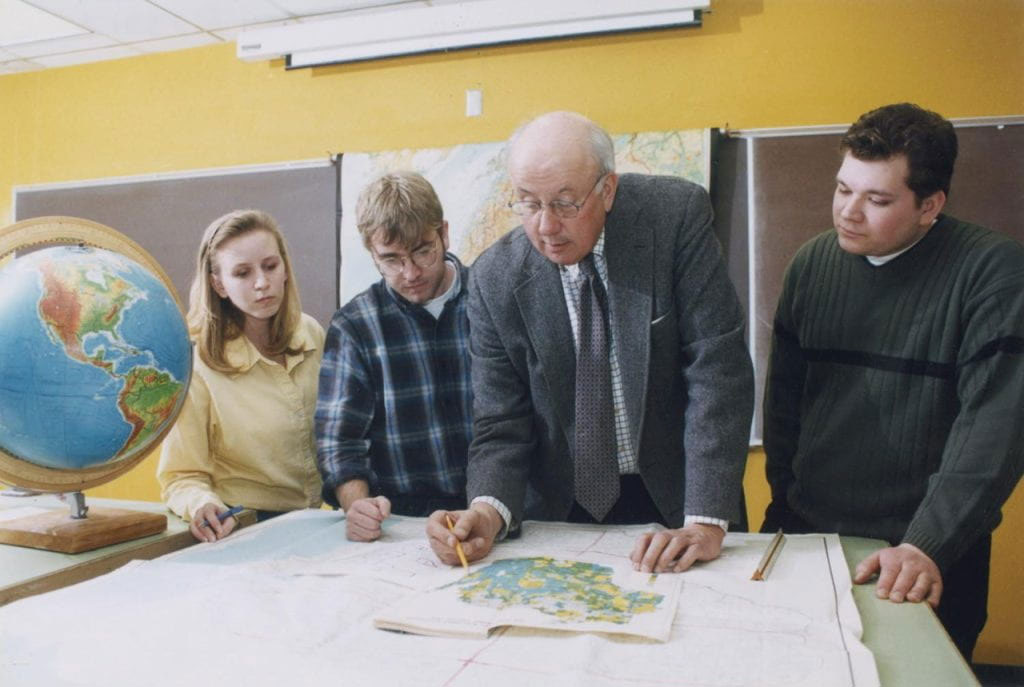
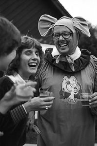 Bill spent 43 years at UWGB as a Professor of Geography and Department Chair, and postponed retirement to fill the position of Interim Provost and Vice Chancellor for Academic Affairs. For decades, he hosted the Bill Laatsch Wine and Cheese Classic each fall, where he—dressed as a 6’4” gray mouse (shown at right)—would welcome students back to campus with his signature warmth and good humor. Bill retired in 2009, and became the first faculty member to have a classroom named in their honor. During the course of his career he earned numerous prestigious awards for teaching excellence, both locally and nationally. Bill inspired generations of students to pursue careers in teaching, urban planning, cartography, GIS, remote sensing, and other professions related to cultural geography’s focus on the Earth and how humans interact with it. About his students, he remarked “I don’t expect them all to become geographers. I just expect them to be better stewards of the Earth and its people.”
 A
A 
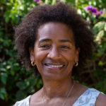
 Meghan Dilworth is a senior at Arizona State University (ASU), pursuing a B.A. in Geography and Urban Planning. Meghan has been a Teaching Assistant/Mentor in the ASU Geography department for three years. Additionally, she has worked as a Geography Content Curator at SolarSPELL, a company that collects geography and educational information for people in areas that don’t have access to the internet or traditional libraries, such as East Africa or the Pacific Islands. In her spare time Meghan’s interests include travel, snow skiing, horseback riding and gymnastics.
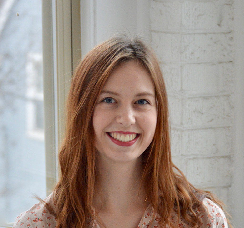
 Samantha Hinton was born and raised in New York City where she graduated from The Spence School. She currently attends Trinity College Dublin, pursuing a B.A. major in Geography. At Trinity, she is the geography library undergraduate representative, a Student 2 Student Mentor, part of the women’s soccer team, and the treasurer of the Geographical Society. She has spent the last six months doing her Erasmus at Utrecht University in The Netherlands. Samantha chose to apply for geography because she is passionate about appreciating the outdoors. With geography, she strives to learn more about the intersection and impact between humans, space, and the environment. While not working, she enjoys traveling, making art, and playing sports.