Newsletter – January 2019
PRESIDENT’S COLUMN
Share Your Science, and Make a Difference with Geography at the AAG Annual Meeting in April 2019
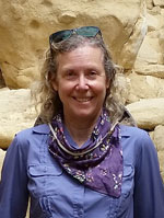
By Sheryl Luzzadder-Beach
 Happy New Year, Geographers and Friends of Geography! There is still much for us, as fellow AAG Members, to do and to accomplish, and what better month than January to re-commit ourselves to serving people and the planet, when we celebrate Civil Rights Leader Martin Luther King Jr.’s Birthday. It is hard to believe we are already halfway through the fiscal year, whether you are still enjoying the academic winter break, or are just returning from the holidays with family and friends. I do ask that we stop to recognize our fellow Geographers in the federal workforce who, at the time of this writing, are experiencing one of the two longest Government shutdowns in U.S. history, and we hope it is resolved soon for their sake and for the greater good of our country.
ANNUAL MEETING
Online Program Now Available!
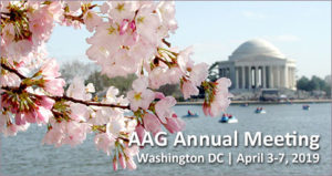 The #aagDC online program is ready to view online. Search the schedule by author name, session type, key words, author affiliation, specialty group sponsorship, and more. For those presenting posters, the poster presentations will take place April 4, 5, and 6, 2019.
Past President’s Address Announced
 At the 2019 Annual Meeting, AAG Past President Derek Alderman will deliver his Past President’s Address entitled “Keeping it REAL in a Post-Truth World: Geography as Reparative Storytelling.” In his presentation, he will speak on enhancing the place of storytelling within geography as part of his initiative, Geography is REAL (Responsive, Engaged, Advocating, and Life-Improving). Asking attendees to view storytelling as more than entertainment, Alderman encourages storytelling to be considered for its value as a tool of education, disciplinary promotion, public outreach, community-building, and scholar-activism. The Past President’s Address will be held on Saturday, April 6 from 11:50 a.m. – 1:00 p.m.
![]()
“Focus on Washington, DC and the Mid Atlantic” is an ongoing series curated by the Local Arrangements Committee to provide insight on and understanding of the geographies of Washington, DC and the greater Mid Atlantic region in preparation for the 2019 AAG Annual Meeting.
Throwback to the 2010 AAG Annual Meeting!
 Though the new year is here, start it out with a trip to 2010, the last year that the AAG Annual Meeting was held in Washington, DC. Focus on DC articles from 2009 and 2010 are available to read online with topics spanning the historical development of the district to the waterways of the Anacostia River and Chesapeake Bay. Take a walk down memory lane and see how much has changed in the previous nine years.
Poster abstracts for #aagDC due January 31! All abstracts editable until February 23
Present a poster at the 2019 AAG Annual Meeting. As soon as your poster is ready, upload the electronic file to our Poster Portal so it can be viewed online well before and beyond your presentation session. In addition, the AAG has set up printing partnerships for discounts on both paper and fabric poster printing to help you save.
- Register to attend the 2019 AAG Annual Meeting in Washington, DC
- Submit an abstract for a poster presentation
- Book your hotel room in one of two hotels with an AAG attendee discounted rate
- Find out how to travel from the airport or Amtrak station using DC public transit
- Suggest potential workshops or field trips by submitting a proposal
PUBLICATIONS
NEW Issue of GeoHumanities:
Articles featuring Southeast Asia to the UK; qualitative methods to poetry
The latest issue of GeoHumanities is now available (Volume 4, Issue 2, December 2018) with 15 new research articles and creative pieces on subjects within geography. Topics include plantation museums, the Mexican diaspora, Bollywood films, language commodification, critical visual methods, rewilding, medical health humanities, and children’s geographies. Regional areas include Cambodia, New England, and Indochina. With authors from a variety of institutions including Curtin University, Penn State University, Washington University in St. Louis, University of Wisconsin – Madison, and the University of British Columbia and the University of Manitoba.
All AAG members have full online access to all issues of GeoHumanities through the Members Only page. In every issue, the editors choose one article to make freely available for two months. In this issue you can read Geographies of Medical and Health Humanities: A Cross-Disciplinary Conversation, by Sarah de Leeuw, Courtney Donovan, Nicole Schafenacker, Robin Kearns, Pat Neuwelt, Susan Merill Squier, Cheryl McGeachan, Hester Parr, Arthur W. Frank, Lindsay-Ann Coyle, Sarah Atkinson, Nehal El-Hadi, Karen Shklanka, Caroline Shooner, Diana Beljaars & Jon Anderson for free.
Questions about GeoHumanities? Contact geohumanities [at] aag [dot] org.
 In addition to the most recently published journal, read the latest issue of the other AAG journals online:
• Annals of the American Association of Geographers
• The Professional Geographer
• GeoHumanities
• The AAG Review of Books
New Books in Geography – December Available!
 New Year, New Books! Celebrate the new year by browsing the latest books in geography and related disciplines. Learn about geographers such as Doreen Massey and Alfred Wegener. Travel to locations ranging from Denver to the Caribbean. Gain insight on topics from coffee to corruption.
Browse the whole list of new books.
ASSOCIATION NEWS
Get ready for the 2019 AAG Election
 The AAG election will be conducted online again, and will take place starting the end of January. Each member who has an email address on record with the AAG will receive a special email with a code that will allow them to sign in to our AAG SimplyVoting website and vote. It’s important to update your email address in your AAG account to ensure you receive the email ballot. The 2019 election slate will be published soon.
AAG is Proud to Announce the First Round of 2019 AAG Awards

The American Association of Geographers congratulates the individuals and entities named to receive an AAG Award. The awardees represent outstanding contributions to and accomplishments in the geographic field. Formal recognition of the awardees will occur at the 2019 AAG Annual Meeting in Washington, DC during the AAG Awards Luncheon on Sunday, April 7, 2019.
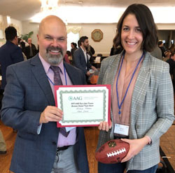
Congratulations to Outstanding Graduate Student Papers from Regional Meetings
The AAG is proud to announce the Fall 2018 student winners of the AAG Council Award for Outstanding Graduate Student Paper at a Regional Meeting. The annual award, designed to both encourage regional meeting participation and support AAG Annual Meeting travel, is granted to one student from each division as decided by regional division board members. The winners from each region will present their work in two dedicated sessions at the 2019 AAG Annual Meeting. Congratulations to all of the students who participated!
POLICY UPDATE
Dr. Kelvin Droegemeier Confirmed as New Director of OSTP

In one of their final acts before the new Congress convened last week, the Senate on Wednesday confirmed Dr. Kelvin Droegemeier as the new Director of the Office of Science and Technology Policy (OSTP). Before his nomination, Dr. Droegemeier’s career included research in meteorology and severe storms at the University of Oklahoma. He also served on the National Science Board under the administrations of President George W. Bush and President Barack Obama. He later went on to become vice chair of the board, which governs the National Science Foundation.
Dr. Droegemeier’s confirmation enjoyed bipartisan support and was included in a round of other non-controversial nominations that passed before the start of the new Congress. Until last week, the post had been vacant since the start of the Trump administration.
MEMBER NEWS
January Member Updates
The latest news about AAG Members.
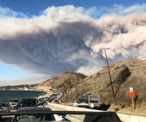
Nathan Gill, a postdoctoral researcher at University of Wisconsin – Madison, recently had his work on forest regrowth following wildfire in Yellowstone National Park featured in Discover magazine. Gill was a recipient of an AAG Research Grant for his project, “Mechanisms of forest resilience in the Northern Rockies: Novel fire regimes and the role of postfire seed dispersal.”
A study conducted by Emil Malizia, of the University of North Carolina at Chapel Hill, and Yasuyuki Motoyama, of the University of Kansas, and published in The Professional Geographer is the subject of a recent article by Richard Florida in City Lab. The study assesses the conditions found where firms tend to cluster in both urban and suburban areas, concluding that diversity, density, public transit, and walkability are key factors influencing business location.
RESOURCES AND OPPORTUNITIES
Call For Papers – Special Annals Issue on the Anthropocene
In 2017 the Working Group on the Anthropocene recommended formalization of the Anthropocene with an Epoch rank based on a mid-twentieth century boundary associated with radionuclide fallout as a stratigraphic Golden Spike, but this recommendation has yet to be acted upon and is far from universally accepted. This Special Issue of the Annals of the American Association of Geographers calls for papers examining all geographic aspects of the concept of the Anthropocene. Abstracts of no more than 250 words should be submitted by email to Jennifer Cassidento (jcassidento [at] aag [dot] org) by March 31, 2019. The Editor will consider all abstracts and then invite a selection to submit full papers for peer review by May 15, 2019.
Learn how to contribute to the special issue.
Visiting Geographical Scientist Program Accepting Applications from Departments
 The Visiting Geographical Scientist Program (VGSP) sponsors visits by prominent geographers to small departments or institutions that do not have the resources to bring in well-known speakers. The purpose of this program is to stimulate interest in geography, targeted for students, faculty members, and administrative officers. Participating institutions select and make arrangements with the visiting geographer. A list of pre-approved speakers is available on the website. VGSP is funded by Gamma Theta Upsilon (GTU), the international honors society for geographers.
Learn more about the program and how to apply.
Grant for Research Using World’s Largest Geography and Map Collection
 The John W. Kluge Center and the Philip Lee Phillips Map Society at the Library of Congress invite qualified scholars to apply for a grant to conduct research for two months at the Kluge Center using the Geography and Map Division’s collections and resources. The Philip Lee Phillips Society Fellowship will award $11,500 to selected scholars with the possibility of an additional $2,000 as an honorarium for a later lecture and publication.
Applications due February 15, 2019.
Fellowship Opportunities with the National Academies’ Gulf Research Program
 The Gulf Research Program of the National Academies of Sciences, Engineering, and Medicine is now accepting applications for two fellowship opportunities:
· The Early-Career Research Fellowship supports emerging scientific leaders as they take risks on untested research and pursue unique, interdisciplinary collaborations. Fellows receive two years of relatively unrestricted funding that helps them navigate this period with independence, flexibility, and a built-in support network. Applications are due by February 20, 2019.
· The Science Policy Fellows gain first-hand experience at the interface of science and policy as they spend one year alongside decision-makers at agencies across Alabama, Louisiana, Mississippi, Texas, and Florida. Under the guidance of a mentor, fellows learn what it takes to make scientific information not just useful, but usable. Applications are due by March 6, 2019.
IN MEMORIAM
Lawrence Estaville
 On December 20, 2018, Lawrence Estaville, who helped to found the Ethnic Geography and Business Geography specialty groups as well as the Gilbert M. Grosvenor Center for Geographic Education at Texas State University, passed away. Dr. Estaville was a university professor, scholar, and administrator for over 40 years. A passionate educator, he was the recipient of several awards including the AAG Enhancing Diversity Award in 2016.
Dorothy Drummond
 It is with sadness that we note the passing of geography professor, author, and advocate Dorothy Drummond on November 30, 2018. An avid traveler, Drummond authored multiple world cultures textbooks and founded the Geography Educators’ Network of Indiana. She taught courses at both Indiana State University and Saint Mary-of-the-Woods College. She passed away while conducting research in China at the age of 89.
GEOGRAPHERS IN THE NEWS
- Geography Professor Matt Huber on Climate Change economies in VICE
- John Williams, University of Wisconsin at Madison geography professor, discusses climate change study in Newsweek
- Alderman quoted in NPR article about NYC street names honoring The Notorious B.I.G. and Wu-Tang Clan
EVENTS CALENDAR


 “It is encouraging to be receiving AAG Members’ thoughtful geography abstracts for the AAG Annual Meeting major themes: Geospatial Health Research; Geography and Human Rights; and Physical Geography in Environmental Science. Thank you. There is still time to participate… While you are in Washington, visit your legislators, share your science, speak up and be a part of the change: make a difference with Geography. And on Tuesday 6 November, make a difference with your citizenship: VOTE.”
 The AAG Council and Executive Director have announced a third theme for the 2019 AAG Annual Meeting: Physical Geography in Environmental Science. This theme joins two others, Geography, GIScience, and Health: Building an International Geospatial Health Research Network (IGHRN) and Geographies of Human Rights: The Right to Benefit from Scientific Progress, as a way to focus the meeting.
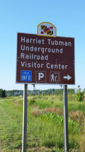
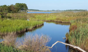
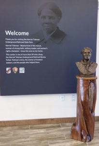
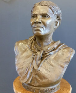 Amidst the Blackwater National Wildlife Refuge in Dorchester County, Maryland lies the Harriet Tubman Underground Railroad Visitor Center. The Center celebrates the legacy of Harriet Tubman, who spent her childhood enslaved in the area before assisting over 100 African American slaves to freedom in the mid 1800s.
 The AAG is pleased to welcome Dwayne Parks to fill the role of Accounting Specialist. Dwayne brings more than 17 years of experience working with organizational data to the association headquarters in D.C. Previously, he has worked in a variety of fields including science, legal, and healthcare.
 The UK Academy of Social Sciences conferred the award of Fellow on Mei-Po Kwan in their 2018 class of social scientists. Kwan, the only US geographer to receive the award this year, was chosen for her “significant contributions to theory, methods and practice in urban, GIScience, mobility and health research.”
 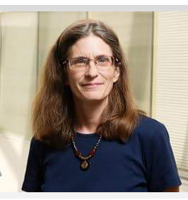 The AAG is saddened to hear of the sudden passing of Marilyn Sue O’Hara, also known as Marilyn Ruiz on September 30, 2018. O’Hara was a Clinical Professor of Pathobiology at the University of Illinois. She obtained a PhD in geography in 1995 from the University of Florida. Her work largely centered around the spatial diffusion of disease and epidemiology.