AAG Names Rita Colwell as the 2019 Honorary Geographer

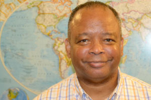
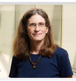
Rita Colwell (Photo by Sam Kittner)

The American Association of Geographers has named Rita Colwell, the first woman to be director of the National Science Foundation (NSF), as its 2019 AAG Honorary Geographer. Rita Colwell currently is a distinguished university professor at the University of Maryland at College Park and at Johns Hopkins University Bloomberg School of Public Health, a senior advisor and chairman emeritus at Canon U.S. Life Sciences, Inc., and the president and CEO of CosmosID, Inc.

Colwell’s internationally recognized research primarily focuses on water and health with particular focus on cholera and infectious disease. A pioneer for women in science, she has published more than 750 articles and has authored or co-authored 17 books. During her time at the NSF she not only increased the size of individual grants awarded by expanding the budget of the NSF by 68 percent, but also advocated for greater support for women scientists and science and technology education. Dr. Colwell has taken on many significant advisory positions in the U.S. Government, nonprofit science policy organizations, and private foundations throughout her career, including her role as a former president of the American Association for the Advancement of Science (AAAS). Prior to joining NSF, Colwell served as president of the University of Maryland’s Biotechnology Institute and as Vice President for Academic Affairs at the University. She has been awarded 55 honorary degrees, as well as the recipient of the Order of the Rising Sun, Gold and Silver Star, bestowed by the Emperor of Japan, the 2006 National Medal of Science awarded by the President of the United States, and the 2010 Stockholm Water Prize awarded by the King of Sweden. The Colwell Massif geological site in Antarctica was named in recognition of her work in the polar regions.

Colwell may be familiar to some members of the AAG, as she provided the opening keynote lecture at the Centennial Meeting of the AAG in 2004 in Philadelphia, PA. Her talk, entitled “The New Landscape of Science: A Geographic Portal,” still resonates within the discipline today. AAG will confer the 2019 AAG Honorary Geographer Award upon Rita Colwell at the 2019 AAG Annual Meeting in Washington, D.C. Details of this session will be forthcoming.

Every year the Association bestows its Honorary Geographer Award on an exceptional leader, to recognize excellence in the arts, research, teaching, and writing on geographic topics by non-geographers. Previous AAG Honorary Geographer awardees have included biologist Stephen J. Gould, architect Maya Lin, Nobel Laureate in economics Paul Krugman, sociologist Saskia Sassen, economist Jeffrey Sachs, and authors Calvin Trillin, Barbara Kingsolver, John McPhee and Barry Lopez, among others.

    Share

Newsletter – November 2018

PRESIDENT’S COLUMN

Watershed Moments

By Sheryl Luzzadder-Beach

vote sticker i voted 3002776434_643d076694_z-150x150“It is encouraging to be receiving AAG Members’ thoughtful geography abstracts for the AAG Annual Meeting major themes: Geospatial Health Research; Geography and Human Rights; and Physical Geography in Environmental Science. Thank you. There is still time to participate… While you are in Washington, visit your legislators, share your science, speak up and be a part of the change: make a difference with Geography. And on Tuesday 6 November, make a difference with your citizenship: VOTE.”

Continue Reading.


ANNUAL MEETING

Additional Theme Announced for #aagDC

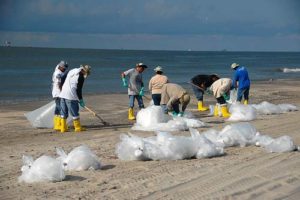
Deepwater_horizon_beach_cleanup500-300x200The AAG Council and Executive Director have announced a third theme for the 2019 AAG Annual Meeting: Physical Geography in Environmental Science. This theme joins two others, Geography, GIScience, and Health: Building an International Geospatial Health Research Network (IGHRN) and Geographies of Human Rights: The Right to Benefit from Scientific Progress, as a way to focus the meeting.

Learn more about the meeting themes.

FocusOnNewOrleansLogo


“Focus on Washington, DC and the Mid Atlantic” is an ongoing series curated by the Local Arrangements Committee to provide insight on and understanding of the geographies of Washington, DC and the greater Mid Atlantic region in preparation for the 2019 AAG Annual Meeting.

Harriet Tubman Underground Railroad Visitor Center

Amidst the Blackwater National Wildlife Refuge in Dorchester County, Maryland lies the Harriet Tubman Underground Railroad Visitor Center. The Center celebrates the legacy of Harriet Tubman, who spent her childhood enslaved in the area before assisting over 100 African American slaves to freedom in the mid 1800s. Catherine W. Cooper provides an overview of Tubman’s life and the landscape she impacted.

Read more.

Registration rates increase for #aagDC November 8!

Abstracts for paper presentations are due November 8, while abstracts for poster presentations are due January 31. All abstracts can be edited until February 23.


ASSOCIATION NEWS

Geography Awareness Week is Almost here!

Geography Awareness Week, held the third week of November each year, will run from November 11-17, 2018. This year’s theme is Migration. Get involved in Geography Awareness Week with some of our suggested activities. Don’t forget to share your involvement with us on social media with the hashtags #GeoWeek or #GeographyAwarenessWeek.

Find activities and resources.

AAG Announces Launch of Geography.com

AAG and Esri have teamed up to create geography.com, a website designed for educational purposes and the promotion of the discipline. It is intended as an outreach tool for site visitors to learn more about what geography is, what geography offers, and career opportunities available in the field. The intended audience includes the general public and students (high school and undergraduates), as well as educators, parents, and federal agencies or other organizations seeking information about geography.

Dwayne Parks Joins AAG Staff as Accounting Specialist

The AAG is pleased to welcome Dwayne Parks to fill the role of Accounting Specialist. Dwayne brings more than 17 years of experience working with organizational data to the association headquarters in D.C. Previously, he has worked in a variety of fields including science, legal, and healthcare.

Read more about Dwayne.


MEMBER NEWS

Profiles of Professional Geographers

Douglas Gress

Douglas Gress, Professor of Economic Geography, Seoul National University, has spent the majority of his professional career outside of his home country of the United States. In this month’s Profile he offers some advice not just about geography careers, but also about living abroad and being prepared to move while working to obtain a dream job.

Learn more about geography careers.

November Member Updates

The latest news about AAG Members.

Mei-Po KwanThe UK Academy of Social Sciences conferred the award of Fellow on Mei-Po Kwan in their 2018 class of social scientists. Kwan, the only US geographer to receive the award this year, was chosen for her “significant contributions to theory, methods and practice in urban, GIScience, mobility and health research.” More about the award.

In early October, Minnesota Governor Mark Dayton issued a certificate of commendation to the John R. Borchert Map Library at University of Minnesota for its work in preserving and providing access to historical aerial photography of the state. The library provides online access to 270 different sets of 1923-1991 historic photos covering Minnesota’s 87 counties. The Map Library is named for John R. Borchert, AAG president in 1968-69. Borchert was professor of geography at the University of Minnesota (1949-1989) and member of the National Academy of Sciences. Explore the library.


RESOURCES AND OPPORTUNITIES

Upcoming Awards Deadlines – Nominate Deserving Geographers!

honors and awardsDecember 31st marks the deadline for multiple awards to honor and support geographers in all stages of their careers. Members may nominate their colleagues for the Wilbanks Award for transformational research in geography or the Glenda Laws Award for social justice as well as the AAG E. Willard and Ruby S. Miller Award for contributions to geography in teaching or research. Students can apply for AAG Dissertation Research Grants and the Hess Community College Geography Scholarship. Those with a geography career are invited to apply for an AAG Research Grant. Nominations are also being solicited for a variety of books in geography awards including the Globe Book Award, the Jackson Prize, and the Meridian Book Award.

Follow the AAG Awards Calendar for Deadlines.

Take Time Out This Summer for Professional Development

The AAG’s Geography Faculty Development Alliance (GFDA) will once again offer a valuable in-depth opportunity for early career professionals and department leaders in Geography to learn and engage during its annual workshops June 23-29, 2019, at George Washington University in Washington, D.C. The shorter four-day workshop for department leaders (June 26-29) will overlap with the week-long conference for early career attendees providing a full career spectrum of exercises and activities. These workshops are part of AAG’s membership resources, which also include its Jobs and Careers Center and many other programs.

Learn more.


IN MEMORIAM

Marilyn Sue O’Hara

Marilyn Sue O’HaraThe AAG is saddened to hear of the sudden passing of Marilyn Sue O’Hara, also known as Marilyn Ruiz on September 30, 2018. O’Hara was a Clinical Professor of Pathobiology at the University of Illinois. She obtained a PhD in geography in 1995 from the University of Florida. Her work largely centered around the spatial diffusion of disease and epidemiology.

Read more.


PUBLICATIONS

Read the November 2018 Issue of the ‘Annals of the AAG’

Annals-cvr-2017

The AAG is pleased to announce that Volume 108, Issue 6 (November 2018) of the Annals of the American Association of Geographers is now available online. The November issue contains a special forum: Context and Uncertainty in Geography and GIScience.

Full article listing available.

New Books in Geography — September and October 2018 Available

New Books in Geography illustration of stack of books

From places like the Arctic and Africa to people like Lévi-Strauss and Doreen Massey, the topics are varied on the latest list of new books in geography! Recently released books are compiled from various publishers each month. The October list features topics such as citizenship, drugs, plants, and fire safety. Some of these titles are later reviewed in the AAG Review of Books.

Browse the list of September new books.

Browse the list of October new books.

Fall 2018 Issue of ‘The AAG Review of Books’ Now Available

Volume 6, Issue 4 of The AAG Review of Books has now been published online. This quarterly online journal publishes scholarly reviews of recent books related to geography, public policy and international affairs. A review essay this quarter by Gerry Kearns reflects on Ireland’s Brexit Problem.

Read the reviews.


GEOGRAPHERS IN THE NEWS

EVENTS CALENDAR

Submit News to the AAG Newsletter. To share your news, email us!

    Share

Harriet Tubman Underground Railroad Visitor Center

“I never ran my train off track and I never lost a passenger.” Harriet Tubman was fond of saying this in her later years, but during the 1850s when she was actively escorting enslaved people north to freedom using the Underground Railroad (UGRR) network, she was taking grave risks with her own life and liberty as well as that of the people she led. The Harriet Tubman Underground Railroad Visitor Center (HTVC) tells the story of this renowned “conductor” with her words and with exhibits providing insights into her early years and the historic events of her times. Sites and artifacts of the UGRR are limited. After all, its success depended on secrecy.

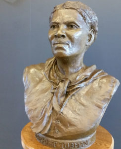
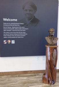
Sculpture by Brendan O’Neill, Sr. The sculptor depicts Tubman at about age 30, approximately when she achieved her freedom. The bust and its pedestal are five feet tall, just Tubman’s height. The scars from whippings stand out on the back of her neck in O’Neill’s sculpture. (Photo by C.W. Cooper)

The history of slavery and of the UGRR is known. This HTVC puts a person, Harriet Tubman, at the center of the historic story. We know where she grew up and the work she did. After she escaped to free territory we know of a number of her trips back to her home region, and we know about many of the family members and friends she helped to escape. Some of the places and people that harbored her and the people with her are known. Most are not. But a drive through this rural landscape of “Chesapeake Bay country” can provide a sense of the woman and the times. Sensitivity to this landscape can help the visitor imagine and understand the events and the people who risked so much to gain so much.

The Site Is the Setting

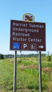
Highway sign at approach to Harriet Tubman Underground Railroad Visitor Center (Photo by C.W. Cooper)

The HTVC in Dorchester County is approximately a two-hour drive from Washington D.C. to the Eastern Shore of Maryland – that is, east of the Chesapeake Bay. The county seat of Dorchester County is Cambridge on the Choptank River. The Cambridge courthouse was the scene of slave auctions and almost the scene of auctions of some of Tubman’s family members.

The HTVC is not at Harriet Tubman’s birthplace, like many national park sites, nor at another notable place in her life. But the landscape around the HTVC and across the broader region is an integral part of her story. The HTVC property is carved from Blackwater National Wildlife Refuge (BNWR), so the setting is protected. The farm fields, woodlands, impoundments and open waters of the refuge provide cover and habitat for the migratory waterfowl and other creatures and give a sense of the mid-nineteenth century landscape.

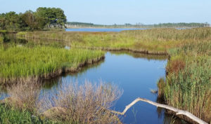
The land of Tubman’s youth is the coastal plain of Delmarva, a region of farming, timbering, marshes, and rivers. Dorchester County is overwhelmingly low lying and flat. The waterways and the land peninsulas (“necks” in this region) intertwine like the fingers of clasped hands. Places that are nearby as the crow flies may be miles apart as the road winds. Woodland trees are not especially tall, but the woods are thick, and the ground cover can be dense. In marshy areas, “wetlands,” there may by little hillocks of dry land. The roads are now paved and the field crops may differ, but imagination may help the visitor form an impression of former times.

The Historic Setting

Students studying the period leading to the Civil War typically concentrate on the national political scene of presidential elections and federal legislation. The story of a single person leading small groups of individuals through the hazards of escape can give a different perspective to illuminate the political story.

The historic setting of the 1840s and 1850s is one of Northerners’ growing antislavery sentiment and of Southerners’ steadfast commitment to slaveholding in a primarily agrarian economy. Political parties shifted and realigned. Opinions became increasingly entrenched with successive administrations: John Tyler (following death of William Henry Harrison 1840, Whig); James K. Polk (elected 1844, Democrat); Zachary Taylor (elected 1848, Whig); Millard Fillmore (following Taylor’s death in 1850, Whig); Franklin Pierce (elected 1852, Democrat); James Buchanan (elected 1856, Democrat); and finally Abraham Lincoln, elected in 1860, Republican. Other important events: The Missouri Compromise, 1820, set the precedent that new states would be admitted to the Union in pairs, one free state and one slave state together. The Fugitive Slave Act, 1850, provided that escaped slaves found in the North must be returned. The Dred Scott decision in 1857 ruled that Dred Scott, a slave, was not a citizen and had not obtained his freedom because he had been taken from a slave state to a free state; it also essentially ruled the Missouri Compromise unconstitutional. The Lincoln-Douglas debates (1858) made Lincoln well known when he ran for the presidency. Then in April 1861 the South fired on the Union troops at Ft. Sumter in the harbor of Charleston, South Carolina touching off the Civil War.

The history is the big story. But it played out in the lives of individuals on local landscapes. One such individual whose local actions illustrated the larger context is Harriet Tubman in Dorchester County on Maryland’s Eastern Shore.

Harriet Tubman, the Person and Her Actions

Water, marsh grasses and woodlands in Dorchester County, Maryland (Photo by C.W. Cooper)

Harriet Tubman was born, it is thought, in 1822 near the village of Madison. She was born Araminta Ross, and was called Minty. Her parents, Ben and Harriet (Rit) were slaves owned by different, though related, people. In 1844 Harriet married John Tubman, a free African American, and about that time took her mother’s first name, Harriet (Larson, p. xvi). Tubman’s father was freed in 1840 by act of his deceased owner’s will (Larson p. 27). Tubman’s brothers remained enslaved until she conducted them to Canada in late 1854. In 1855 Ben bought Rit, then 70 years old, for $20. In pre-Civil War Dorchester County, approximately one-half of the African Americans were free.

One incident in Tubman’s childhood had lifetime repercussions. When she was about seven years old, she accompanied a slave woman of her owner’s household to make a purchase at the Bucktown store. Also at the store were another slave and his overseer. As the two men argued and the slave turned to leave, the overseer threw a two-pound counter weight at him mistakenly hitting Tubman in the head. She dropped to the floor unconscious. It was several days before she recovered, and she carried the scar, a dent in her forehead, the rest of her life. Until her death Tubman was prone to suddenly falling asleep, awakening in a few moments, and she had visions and recurring dreams.

As a youngster, aged about six, Tubman was assigned to collect the catch in muskrat traps. Muskrat is a rodent that lives in marshland, about a foot long when fully grown. The hides are most valuable when the muskrat is caught in the winter when the fur is thick. That’s when the water is cold, sometimes frozen over. Checking muskrat traps is a cold, unpleasant assignment.

Harriet’s father, Ben, worked in timbering, cutting trees and hauling the lumber to wharfs to be sent to shipbuilders in Baltimore. In her teens, Tubman worked with him. Tubman was a strong, effective worker. It was not unusual for a slave owner to hire out a slave for wages which would be paid to the owner. When she was about 25 Harriet paid her owner a fee, estimated at $50 – $60, and then for the next year she kept her wages. With her income she bought two oxen which would have boosted her wage rate.

Tubman would have known a number of people in the broader community. In the lumber camps and river docks she would have met people from beyond the immediate region. Water transport was widespread with boats docking at the wharfs of large homes as well as at the town docks. African Americans working on the boats would have brought news of a wider world. Perhaps the most valuable aspect of her varied work and locations was learning to live on the land.

The horrors of slavery were real. “Every time I saw a white man I was afraid of being carried away. I had two sisters carried away in a chain gang ― one of them left two children. We were always uneasy” (HTVC). The sculptured bust of Tubman displayed in the HTVC includes the raised scars on the back of her neck ― marks of whipping.

Harriet Tubman was determined to be free. As she said looking back in 1886, “I had reasoned this out in my mind; there was one of two things I had a right to, liberty or death; if I could not have one, I would have the other, for no man should take me alive” (HTVC).

After an aborted attempt to escape with her brothers, she went alone. She left after dark one Saturday night in 1849 (Adler p.23). With no work done on Sunday, she would not be missed for two days. Looking back on that 1849 flight to freedom and thinking about her feelings as she crossed into a free state, she said, “When I found I had crossed that line, I looked at my hands to see if I was the same person. There was such a glory over everything the sun came like gold through the trees, and over the fields, and I felt like I was in heaven” (HTVC). What was unexpected in the following weeks, was how much she missed her family. She determined that they too should be free and that she would see to it. Yet every time she returned to Dorchester County to lead others north, she was traveling from a safe place to a place of danger – a place where detection and capture meant the probability of a whipping, or worse, and the possibility of being “sold south.”

In late 1850 through friends, John Bowley, a free African American, contacted Tubman for help. This took some coordination. He was a ship carpenter in Baltimore, but his enslaved family still lived on their owner’s farm on the Eastern Shore. Bowley’s wife, Kessiah, a niece of Tubman, together with the couple’s two young children, was to be sold in an auction on the courthouse steps in Cambridge. Tubman got to Baltimore and met with Bowley to plan his wife’s escape. At the auction, Bowley made the highest bid for the woman and the two children. The officials managing the auction broke for lunch and returned to collect payment but found that the high bidder was no longer around. As they started to re-auction Kessiah, they realized she too was gone. The four members of the Bowley family hid in a nearby cellar and slipped away at night in a small boat on the Choptank River and then sailed to Baltimore where they met Tubman who guided them north to Philadelphia and freedom (Adler p. 48). December weather added to the hazard of the 75-mile journey up the Chesapeake Bay to Baltimore.

In preparing for another journey, Tubman sent a coded letter message to a friend. When the suspicious postal inspectors could not find anything wrong, they handed the letter to the intended recipient who read it, understood the message and tossed the letter back saying it made no sense to him. He then went and alerted Tubman’s brothers to be ready to leave at a moment’s notice.

After gaining his freedom, Tubman’s father had established a home for himself and Rit in Poplar Neck in Caroline County, 40 miles from the Brodess Plantation, where Harriet’s brothers lived near Bucktown. On Christmas Eve, 1854, the brothers went to their parents’ home. Eight people waited in a corncrib, unwilling to let Rit Ross know her children were so close for fear her emotions would alert other people. Ben Ross brought food to them. Knowing he’d be questioned by slave catchers and wanting to answer truthfully that he “hadn’t seen them,” Ben covered his eyes with a handkerchief as he helped his grown children.

Tubman had an unshakable faith that God would protect her and would show her the way to safety in the years she led people north to freedom. One time she was escorting a number of escaping slaves. She had a premonition of danger and immediately left the road leading her “passengers” to wade through chest deep water to cross a river. The danger was real since slave catchers were waiting ahead on the road. Describing her safe escape, she said “It wasn’t me. It was the Lord” (Adler p. 59).

In all, Tubman made, it is believed, 13 trips between the Eastern Shore and free lands, escorting 70 enslaved persons to freedom, and her advice helped at least 50 others escape. No wonder she was called “Moses.” In later years she was fond of saying, “I never ran my train off track and I never lost a passenger” (Adler p.4).

After the Civil War broke out, Tubman went south and aided efforts of the Union Army. She went on one raid up the Combahee River in South Carolina to disrupt Confederate supply lines. As slaves in plantations along the river realized the boats were Union boats, they swam to get aboard. Tubman also helped in the field hospitals for the black troops and distributed food and clothes to escaping slaves who flocked to the Union camps. In later years, Tubman made her home in Auburn, New York, where her parents and some siblings had settled after the war and after returning to the United States from Canada. Tubman actively supported women’s suffrage. She died in 1913.

The Harriet Tubman Underground Railroad Visitor Center

Harriet Tubman Underground Railroad Visitor Center exhibit with sculptural bust and welcome signage (Photo by C.W. Cooper)

The Harriet Tubman Underground Railroad Visitor Center tells the story of Harriet Tubman’s life in the context of her times. The design concept of the visitor center is “The View North,” referencing the direction the slaves took towards freedom setting their course by the North Star. The layout of the building and the exhibits within it follow a progression northward.

Although not particularly “high tech,” the exhibits, the artifacts of model cabins, the two-pound weight, the video of the region with a narrative commentary of her escape trips all contribute to an immersion in Tubman’s world. The context includes acknowledgment of the dangers risked by other people, both enslaved and free, in helping the passengers along on the “railroad.”

Born into slavery, Tubman was small and unable to read and write. She freed herself and others and continued to be a voice for individual rights all her life. The HTVC presents her story. The setting, the Dorchester County landscape, is an integral part of the story.

DOI: 10.14433/2017.0046

_________________________________

Bibliography:

Adler, David A. 2013. Harriet Tubman and the Underground Railroad. New York: Holiday House. This biography is often classified in the children’s or youth portion of a library.

HTVC, Harriet Tubman Underground Railroad Visitor Center exhibits.

Larson, Kate Clifford. 2004. Bound for the Promised Land. New York: Ballantine Books. This is a full-length biography of Harriet Tubman.

Lockhart, Barbara M. 2012. Elizabeth’s Field. North Charleston, South Carolina: c. Barbara M. Lockhart. This book of fiction is based on extensive research and the personal oral history with the author’s elderly African American neighbor who heard the stories first hand. The author’s land had been owned briefly in the 1850s by a freed African American woman. This unusual event gave rise to extensive research and this fictional account weaving the lives of slaves and free, owner and slave, and the life of the times. Today’s high school and college students find it to be the basis of discussion and enhanced appreciation for people and place. Copies of Elizabeth’s Field are available at the HTVC and through Amazon.

_________________________________

Sites of Visitor Interest

Harriet Tubman Underground Railroad Visitor Center

Harriet Tubman Underground Railroad Byway (Tubman Byway)  The Byway maps a route of over 130 miles in Maryland, Delaware and Pennsylvania showing over 30 sites linked with Tubman’s life and work.

Blackwater National Wildlife Refuge

Statue of Frederick Douglass, Easton, Maryland — On the grounds of the Talbot County Courthouse at 11 North Washington Street, in downtown Easton.

Adkins Arboretum, Ridgeley Maryland

Academy Art Museum, Easton, Maryland

Chesapeake Bay Maritime Museum, St. Michael’s, Maryland — The 18-acre campus on the Miles River is an active center with historic watercraft and interpretive displays of life in the region, watermen, farmers, tourists, people who have made their living from the Chesapeake Bay and the region.

    Share

The Resilient Streams in the Urban Landscape of Washington, D.C.

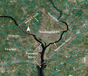
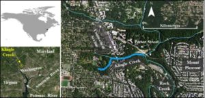
The process of urbanization often leads to the alteration of local streams. Such alterations range from complete disappearance of streams by making them flow underground, converting them into canals, loss of their aquatic habitat, and changes in their morphology (Kang and Marston 2006; Kang 2007) . In Washington, D.C. many streams and springs have disappeared during the last 200 years of urban development and federal growth (Williams 1977) . The two rivers bordering the city, the Potomac and Anacostia rivers, and the National Mall within the city, look very different as compared to their respective landscape characteristics in the 1700s due to changing sediment and runoff volumes. In Figure 1 you can see that the current stream density within the city and the surrounding areas reveals a significant difference (Figure 1). However, some times the local conditions of streams are resilient enough to counter the effects of the urban runoff (Kang 2007; Kang and Marston 2006).

Figure 1: A Visual Depiction of the Current Variable Density of the Stream Network within and outside Washington DC (Source: USGS)

While many local streams have disappeared, the resilient Rock Creek continues to drain the western portion of the national city into the Potomac River. The prominent names among the streams that disappeared include Smith Spring, Frankling Park Springs, Gibson’s Spring, Caffrey’s Spring, City Spring, and Tiber Spring (Williams 1977) . While some of them are underground, others were converted into canals or significantly reduced in their coverage for the development of the city. However, Rock Creek has successfully survived through the impervious development of the city.

Despite ambitious urban growth, the federal government protected the Rock Creek Park so that Rock Creek could meander through its flood plain. It is also a vibrant ecosystem supporting aquatic life as well as wildlife in its flood plain. One of the cherished experiences of many Washingtonians is to witness a rich variety of wild life as they conclude their late evening commute from work through the Rock Creek Parkway that partially runs through the flood plains of Rock Creek.

Figure 2: Location of Klingle Creek in Washington, D.C. (Source: USGS)

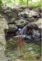
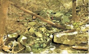
The successful survival of Rock Creek during the last century of urban growth is also because of its equally resilient tributaries that kept it alive and strong. Tributaries such as Klingle Creek (Figure 2), offer a microcosm to understand the resilient structure and ecology of this national creek. Klingle Creek is a small urban branch of Rock Creek and flows through the neighborhoods of Woodley Park, Cleveland Park, and Mount Pleasant in the city of Washington. It is unique to Rock Creek because of its geomorphic survival during the changing land cover politics around it. Surrounded by highly urbanized landscape, Klingle Creek presents a healthy ecosystem with a variety of fluvial processes. The stream has adjusted to the surrounding highly impervious landscape in a synergistic fashion. Starting as a narrow channel at the headwater, its capacity gradually increases in the downstream direction to accommodate the urban run-off. Various sections in the upstream portion of Klingle Creek experience bank erosion allowing for a sediment supply for the lower portion. The lower portion of the creek includes large rocks creating beautiful waterfalls (Figure 3) while reducing the velocity of the urban flow. It also provides sediment traps for various types of aquatic habitat (Figure 4). Many portions of the creek present lush moss covered rocks and woody debris offering a soothing experience to nature lovers.

Figure 3: Large rocks creating a waterfall in the lower portion of Klingle Creek (Source: Ranbir Kang, 2015)
Figure 4: A medium resolution point cloud (draped with colors from orthoimages) showing the sorting of large rocks in the lower portion of Klingle Creek to trap sediment (Source: Ranbir Kang, 2015)

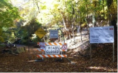
Despite a highly urban landscape comprising its watershed, Klingle Creek is lined by a riparian corridor with a thick tree canopy. While the occasional tree fall offers woody debris to regulate the eco-geomorphology of the stream, a thick tree canopy helps promote the interception of rainwater. Therefore, it has played an important role in the survival of Rock Creek against the urban sprawl in the heart of our capital. For a long time, Klingle road (which ran parallel to Klingle Creek) was used by locals as a quick access between Cortland Place and Porter Street. However, the frequent flooding and maintenance costs of the road made the city think about alternatives to the road which led to the calls for saving Klingle Valley. While various groups of the community gathered support to remove the road, other groups gathered in favor of keeping the road. The battle grew until the dispute reached the City Council and in 1991, the road was barricaded (Figure 5).

Figure 5: The barricaded entrance to Klingle Road in 2015. The Creek is located on the left of the barricade while facing it. (Source: Ranbir Kang)

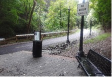
Figure 6: The entrance to the new multi-use Klingle Trail in 2015. The Creek is located on the left while facing the trash can. (Source: Ranbir Kang)

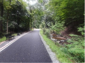
After more than two decades of dispute, in 2015 the barricaded portion of Klingle Road was replaced by a multi-use trail (Figure 6). The trail offers a variety of recreational opportunities for users of all age groups. One side of the new trail is bordered by Klingle Creek and the other side includes the historical woodland garden of the Tregaron Conservancy. While benches along the trail offer a view of the creek (Figure 7), the trail also connects the recreational communities of two neighborhoods in the city.

Figure 7: Benches along the new Klingle Trail to enjoy the view of the Klingle Creek. (Source: Ranbir Kang)

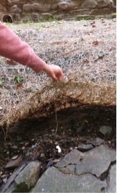
Figure 8: Post restoration use of a matting to protect the stream banks of the restored portion of Klingle Creek. (Source: Ranbir Kang)
 

The process of replacing the road with a trail included restoring various sections of Klingle Creek through alterations of the stream banks and creating a sequence of steps and pools along the stream. It also included efforts to modify the banks by planting native vegetation and covering various portions of the bank with protective matting (Figure 8)..

The replacement of the road with a trail along Klingle Creek is an example of geodesign. There are numerous cases of urban areas across the globe where communities and city officials worked together in geodesigning their cities with a sustainable futuristic approach (Beatley 2016). The high line project in New York City and the urban parks in the city of Singapore are just two more examples where cities introduced green zones within the highly urbanized landscapes to connect their communities with nature using softer sustainable architectural designs. Economics is often one of the major driving forces behind such conservation and restoration initiatives so that the long term future demands are met with minimal cost. The ecological challenges and experiences of residents in Klingle Valley during the next decade will determine the effects of the restored creek on the larger Rock Creek, the role and functions of the new trail, and the appropriateness of restoration design and expenditures in the Klingle Valley restoration project. Klingle Valley, an urban creek along with its sister tributaries of Rock Creek offer us a soothing experience and a quick get away from the urban stress. With Washington moving forward as a sustainable city, Klingle Creek complements that ambition as a resilient hydrology of Anthropocene.

Ranbir Kang is an associate professor at Western Illinois University. With a long term research interest in the Washington metropolitan area, he specializes in urban hydrology, human impact on fluvial systems, and high resolution river surveys.

DOI: 10.14433/2017.0044

References:

Beatley, Tim. 2016. Geodesigning nature into cities. ArcNews Winter 2016:20-21.

Kang, R. S. 2007. Effects of urbanization on channel morphology of three streams in the central redbed plains of Oklahoma, Graduate College of Oklahoma State University, Oklahoma State University, Stillwater, OK.

Kang, R. S., and R. A. Marston. 2006. Geomorphic effects of rural-to-urban land use conversion on three streams in the Central Redbed Plains of Oklahoma. Geomorphology 79:488-506.

Williams, Garnett. P. 1977. Washington D.C.’s Vanishing Springs and Waterways. Arlington, VA 22202: U. S. Geological Survey.

    Share

Joe Schwartzberg

I am now in my ninety-first year and am writing this from my home in White Bear Lake, Minnesota. Presently I am in a home hospice care program in which I expect to spend whatever time remains to me. I am writing this in lieu of a much more extensive memoir in which I had hoped to present, as a major part of my legacy, a detailed account of my richly spent lifetime. But, even in this greatly abbreviated narrative my life story will, I believe, be of interest to numerous potential readers. Many of them knew/know me in respect to one or another aspect of my diverse career, but have little or no knowledge of the others. I also hope that this account will impart useful lessons to groups with whom I identify and, perhaps, induce them to work harder in support of causes – workable world government, human rights, global education (especially in geography), and others — that we jointly support.
 
To enhance its readability, this account is written in the third person to make it less open to the criticism that I, the writer, am guilty of undue self-promotion. It goes without saying that, like all other human beings, I have my share of shortcomings, but I have chosen here to focus on the positive.
 
Joseph E. Schwartzberg
Born in Brooklyn, New York on February 5, 1928, Joseph Schwartzberg was the second of four children of Philip and Frances Schwartzberg. He and his siblings were born within a span of less than six years. All six members of the family participated in the operation of their small clothing store. They lived in two rooms behind the store during the bad years of the depression and in an apartment immediately above it when times were good. Joe graduated from Erasmus Hall High School in 1945 and in 1949 from Brooklyn College (cum laude), where he majored in geology.
During World War II Joe spent parts of three summers working on farms to support the war effort: a poultry farm on a then defunct New Deal cooperative homestead project in New Jersey; a poultry and tobacco family farm in the Connecticut River Valley; and a large cattle ranch near Houston, Texas. When it became apparent that the war in the Pacific would shortly end, Joe quit his job and hitchhiked to various cities in Mexico, all the way to Acapulco on the Pacific coast. This was, arguably, the most noteworthy of his numerous hitchhiking trips – in North America, Europe and Asia — that Joe made during the course of a life marked by extensive travel.
During his years in college Joe was active in a number of student organizations. He was president of Beta Delta Mu, an interracial fraternity (quite rare in those days); and was the manager and a (not particularly good) member of the collegiate wrestling team.
Shortly after earning his B.A, Joe accepted a position as a geographer with the Map Intelligence Branch of the U.S. Army Map Service near Washington, D.C. Simultaneously he worked for his M.A. at the University of Maryland. His master’s thesis (1951), “Old Order Amish and Stauffer Mennonite Communities in Southern Maryland,” was based on field research among the communities named. This work instilled in him a love of fieldwork and an abiding interest in “plain people” and, more generally, in communities with life styles deviating from established norms. During this period, Joe frequently attended Washington’s First Unitarian Church. There, he became familiar with the then burgeoning World Federalist movement. He has maintained his allegiance to the “one world” ideal ever since.
Shortly after the outbreak of war in Korea, Joe was drafted into the U.S. Army. Although he anticipated that he would be sent to Korea immediately on conclusion of his infantry basic training, he was assigned instead to a topographic engineering battalion headquartered in the Presidio of San Francisco. After nine months in that unit he accepted a commission as a 2nd lieutenant and was transferred to Fort Belvoir, Virginia. There he trained for work in a newly created terrain intelligence unit, which was dispatched to Heidelberg, Germany in December 1952. His duties entailed extensive travel in Germany; and his leave time provided additional opportunities for international travel.
After almost three years of military service, Joe, then a 1st lieutenant, took his discharge in Germany. Thus began an extensive period of foreign travel and residence, including four months in Seville, Spain (then still under the rule of Franco) in early 1953; eight months in Paris in 1953-54, studying French language and civilization at the Sorbonne (courtesy of the G.I. Bill of Rights); a month in Israel; brief sojourns in many Islamic nations in North Africa and the Middle East; a half-year touring India and other countries of South Asia; several months in Southeast Asia; and a month in Japan.
During his stay in Paris, Joe drew up a rough draft of a World Constitution, many of whose ideas were incorporated in articles and books published later in his career. Joe’s federalist thinking was later reinforced by his experience in India, the world’s most populous federal polity. Considering that, despite its many serious problems, meager resources and incredibly diverse population, India was able to maintain a viable democracy, convinced Joe that a federalized world, with vastly greater resources, could do so as well.
Joe’s sojourn in India was marked by visits to a number of Gandhian ashrams and government-managed community development projects (some guided by the Ford Foundation); and by the formulation of numerous friendships: with government officials, holy men [sadhus], artists and writers, other travelers, etc. Several of these friendships endured for decades.
In September 1956 Joe embarked on study for a doctoral degree at the University of Wisconsin. He had by then decided to specialize in either South or Southeast Asia, and chose as his advisor the renowned geographer, Richard Hartshorne, notwithstanding the fact that Hartshorne had no Asian experience. That somehow didn’t matter. In 1958 Joe was awarded the first of two year-long fellowships from the Social Science Research Council, the first for field work in India, the second for support while writing his dissertation His field work entailed thousands of miles of travel by bicycle (accompanied by Indian interpreters) to more than 200 villages throughout India. His dissertation, Occupational Structure and Level of Economic Development in India: A Regional Analysis, completed in 1960, was later published as monograph no. 4 of the 1961 Census of India. Working with the Census Commissioner, Joe provided detailed recommendations for the schedule of questions for the 1961 census, as well as a template for decadal census atlases at both the national and state levels.
In 1960, Joe accepted a dual appointment at the University of Pennsylvania, joining the Wharton School’s Department of Geography and Industry and the Department of South Asia Regional Studies, the first such regionally specialized program in the United States. His contacts in the latter department greatly expanded his multi-disciplinary understanding, not only of South Asia, but also of regional studies in general. Several relevant papers on regionalism ensued, as did two seminal papers on the geography of the Indian caste system.
In 1962 Joe was in charge of training, at the University of Pennsylvania, of the first group of Peace Corps volunteers to be sent to Ceylon (now Sri Lanka). He accompanied the PC volunteers to Ceylon for a final month of training, following which he spent almost a year in India as a Fellow of the American Institute of Indian Studies. For most of this period he expanded his previous research.
During this year he met Monique Ribaux, a Swiss medical lab technician working for the malaria eradication program of the World Health Organization. The two were wed in Geneva in December 1963, and subsequently had two sons, Philip (b. 1964) and Paul (b. 1966). They were divorced in 1998.
In the spring of 1964, Joe learned from a colleague at Pennsylvania of a proposal to create a Historical Atlas of South Asia at the University of Minnesota, following the bequest to that institution of the magnificent Ames Library of South Asia. Excited by that challenging initiative, Joe wrote a lengthy memorandum to its two principal faculty supporters specifying what he thought such an atlas should contain. This resulted in an unanticipated invitation for him to come to Minnesota to join the Geography Department and edit the work. He accepted the offer, and moved to Minneapolis with his family that December.
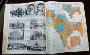
The atlas project took much longer than anticipated. It entailed procurement of numerous research grants, and required roughly 85 person-years of work from a multi-disciplinary team of specialists at Minnesota and the American Geographical Society. First published by the University of Chicago Press in 1978, the work was reissued in an updated edition by the Oxford University Press in 1992, and in a digitized edition by the University of Chicago in 2006. It won the Watumull Prize of the American Historical Association, as the best work on Indian history of the 1978-79 biennium, and an outstanding achievement award from the Association of American Geographers. In 1981 David Watumull observed: “Over the years, since 1946 when this Prize was instituted, I can … say, without a doubt, that this is the finest and most worthwhile book to be selected.” What makes the work unique is its presentation, not only of the findings of modern historians of South Asia, but also its recreations of the ways in which aspects of that region were made known by numerous actors – both South Asian and outsiders –over more than three millennia.
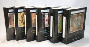
Publication of the atlas led to Joe’s being recruited into what was to become an even larger (and still on-going) project, the preparation of a multi-volume History of Cartography. Apart from offering advice in planning the work (headquartered at the University of Wisconsin), Joe was asked to write an article on the indigenous cartography of South Asia, a subject on which there was then virtually no extant literature. However, years of research in South Asia and neighboring regions – in libraries, museums and private art collections, as well as in the field – uncovered a vastly larger corpus of cartographic and cosmographic artifacts than one might have anticipated. Joe was the associate editor and principal author, by far, of two volumes of the history, one on South Asia and the Islamic World, the other on East Asia, Southeast Asia and Greater Tibet (University of Chicago Press, 1992 and 1994 respectively). In all, he contributed more than 550 pages of text and illustrations for the work. (Particularly remarkable were his 76 pages dealing with the cosmography and cartography of “Greater Tibet,” a subject on which there had been virtually no prior cartographic scholarship.)
Joe’s additional writing in his years at Minnesota (1964-2000) took numerous forms: scores of book reviews, essays in political geography, editorials on contemporary issues and events, numerous articles on the Kashmir dispute, work on folk regions in South Asia, a short monograph relating to the history of exploration, various spin-offs from his work on the history of cartography, and major contributions to several encyclopedias, including the lengthy article on the “Physical and Human Geography [of India]” for the 15th edition of the Encyclopaedia Britannica on whose advisory board he subsequently served.
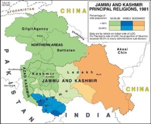
Joe’s writings on Kashmir were focused on promoting a peaceful resolution of the multi-partite disputes over that region. They were based largely on his visits – in 1993, 1994 and 1997 – to all parts of that contested, ethnically diverse state. He conducted interviews, on both sides of the Indo-Pakistani line of control, with a wide range of political actors (UN personnel, civil administrators, military officers, party leaders, dissidents [some in hiding],businessmen, journalists, victims of violence, and others). While his tours in 1993 and 1994 were largely self-financed, that of 1997 was as part of a fact-finding team sponsored by and drawn from the Kashmir Study Group (KSG). This think tank, of which Joe was a founding member, was established in 1996 by Farooq Kathwari (a wealthy Kashmir-American businessman), and was made up mainly of scholars and retired diplomats. Though the published findings and recommendations of the KSG (to which Joe was a principal – but anonymous – contributor), were widely discussed in diplomatic circles in South Asia, North America and Europe, hawkish nationalistic spoilers ultimately prevented their adoption. The KSG still exists; but it is less active than in its early years.
Along with writing, Joe taught thousands of students in a variety of courses and seminars. His most popular courses were introductory human geography (a sweeping overview of how the world is constituted) and political geography (wherein one is challenged – as in the real world – by the necessity of striking a credible balance between idealism and realpolitik). More specialized were his offerings on South and Southeast Asia and on historical cartography. Of particular relevance for his work on global governance were his seminars on “The Geography of Federalism,” “The Law of the Sea” and “A Charter for the New Millennium.” In 1979-80, Joe held a visiting Fulbright professorship at the Center for the Study of Regional Development at Jawaharlal Nehru University in New Delhi, during which he offered a course in population geography and a seminar on field methods.
Attendance at conferences provided Joe with abundant opportunities for travel, either en route to or returning from the conference venue. His participation at the 1992 Rio Summit Conference on the Environment and Development, for example, was followed by extensive travel in South America; and his atlas presentation at the Canberra meeting of the International Congress of Orientalists in 1971 was combined with visits to a number of Pacific Island nations. In all, Joe has traveled to approximately a hundred countries.
Intermittently, Joe served as a consultant to numerous governmental and scholarly agencies in the United States, Canada and India, and as a member of selection committees for various academic awards. For three years (1985-88) Joe was the elected Secretary of the US National Commission of the International Geographic Union. His previously noted work for the Indian census was instrumental in his consulting with the Mandal Commission, tasked with devising a quota system (arguably unwise) for allocating jobs and educational seats for members of so-called “other backward castes.” On October 23, 1959 Asok Mitra, the then Registrar General and Ex-Officio Census Commissioner of India, wrote to Joe as follows: “I am indeed very grateful to you for your letter of 25th September and your very well thought out recommendations for the improvement of the 1961 Census of India. I feel very grateful to you indeed, as these recommendations are by far the most detailed, practicable and important that I have ever received. All of them bear the imprint of a sense of reality.”
In recognition of his scholarly achievements the Department of Geography nominated Joe in 1995 and in 1996 for a highly competitive Regents Professorship, the highest academic honor that the University of Minnesota can bestow. However, neither nomination resulted in success.
Apart from scholarship, Joe was also heavily engaged in service activities on and off campus. On campus, he served (albeit briefly) as Chair of the Department of South Asian and Middle Eastern Studies, as an elected representative in the University Senate and in the Assembly of the College of Liberal Arts, and as a member of numerous committees. For three years (1984-87) he directed the Minnesota Studies in International Development program (MSID), providing unpaid student internships in a number of countries of the global South. He established several MSID programs in India and headed a delegation to Colombia, which led to a program with that nation’s Fundación Social, a business conglomerate guided by the Jesuit teachings of “liberation theology”. For several years following the Colombia visit, Joe was among a group of activists that tried (unsuccessfully) to establish an inner-city cooperative bank based on the Fundación model. In 2009 the University bestowed on Joe its annual “Award for Global Engagement” and the title “Distinguished International Professor Emeritus.”
In the public arena, Joe was also quite active. He served in various capacities in the Minnesota Chapter of the World Federalist Association (later Citizens for Global Solutions), including 14 years as its President. He was also active in several roles in the governance of WFA/CGS at the national level.  He chaired WFA’s Policy and Recommendations Committee for several years prior to the establishment of CGS in 2004, and for the following decade was especially active in the World Federalist Institute, a CGS-affiliated think tank. For several decades he served as a member either of the Board, or of the Advisory Council, of the Minnesota Chapter of the United Nations Association.
In 1996 Joe was one of the handful of activists who founded the Minnesota Alliance of Peacemakers, which subsequently grew into an umbrella institution with roughly eighty peace and justice organizational members. In the following year he was a co-founder of the aforementioned Kashmir Study Group. In 1999, Joe was the annual honoree of the Vincent J. Hawkinson Foundation, an entity promoting peace and justice activism in five states of the Upper Midwest of the United States.
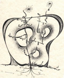
In a non-academic vein, Joe gained a touch of notoriety for his remarkable doodles, hundreds of which were created during tedious staff meetings and conferences in Minnesota and elsewhere. One of these appears to the left.
Additionally, Joe derived much pleasure from writing and illustrating whimsical stories for his children and grandchildren. Among these were Emanuel and Elvis, the story of a forgetful old man’s dependency on his pet elephant. Another favorite was There’s a Frog up Your Nose, a path-breaking four-part trilogy, the contents of which are less disgusting than the title.
Following his formal retirement from the University of Minnesota in 2000, Joe focused more heavily on issues of global governance, working largely with several organizations already named – writing scores of op-ed essays for their respective journals – and with the Academic Council on the United Nations System in whose journal, Global Governance, he published papers on UN peacekeeping and weighted voting. He expanded his advocacy of the latter idea in a monograph published in 2004 by the World Federalist Movement – Institute for Global Policy, Revitalizing the United Nations System: Reform through Weighted Voting. A related monograph, Creating a World Parliamentary Assembly: An Evolutionary Journey, was published by the Berlin-based Committee for a Democratic United Nations in 2012.
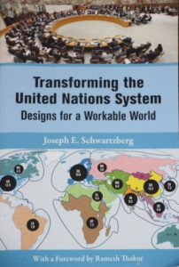
The ideas in these two monographs and in many previous articles – along with many others – were compiled in a book, Transforming the United Nations System: Designs for a Workable World (TUNS), published by the United Nations University Press in 2013. That work provides a comprehensive set of proposals for moving away from the Westphalian paradigm of unfettered state sovereignty on which the present system of global governance is predicated. Despite – or perhaps because of – its radical nature, Joe’s most recent book has been warmly endorsed by leading global thinkers, including Boutros Boutros-Ghali, Thomas Pickering, Brian Urquhart, Thomas Weiss, Johan Galtung, Alfred de Zayas, Stephen Schlesinger and many others. Joe’s editor at the United Nations University Press wrote to him shortly before publication: “I don’t think we’ve ever had a book with so much praise and backing from such a prestigious group of endorsers.” The Press then made Joe its first nominee ever for the prestigious Grawemeyer Award for Ideas Improving World Order. (He did not win, however.)
Of all that Joe has written, the most important, potentially, is the following credo, which he composed in 1976:
An Affirmation of Human Oneness
I am a member of the human family, a citizen of the world.
The achievements of men and women throughout the ages are my heritage.
My destiny is bound to that of all my fellow human beings.
What we jointly create forms our bequest to future generations.
May my life serve the good of my family.
May our use of the earth preserve it for those yet to come.
Joe hopes that this statement will be routinely recited at the outset of civic events, school ceremonies and other noteworthy occasions throughout the world, either along with the respective national anthems or independently. Toward that end Joe had the Affirmation translated into 12 major world languages for distribution at the summit Conference on the Environment and Development, which he attended in Rio de Janeiro in 1992. The total number of translations now stands at 43.
In 2001, Joe and his fellow peace and justice activist, Louise Pardee, entered into a domestic partnership and Joe moved from his cramped apartment in Minneapolis to Louise’s spacious lakeside home in suburban White Bear Lake. Since then, Louise has contributed to Joe’s work, editorially and in other ways.
In December 2014, Joe legally established The Workable World Trust, the principal purpose of which is to disseminate and promote the many global governance proposals in his most recent book. The work of the Trust has been carried out with the remarkably efficient and competent support of Ms. Nancy Dunlavy, who legally succeeded Joe as Director of the Trust in 2017. Joe then formally assumed the title of Director Emeritus. In practice, however, the two continue to cooperate on a wide variety of projects; and Joe intends to remain active as long as his health permits.
The Trust has negotiated translations of TUNS into Arabic, Chinese, French, German, Japanese, Russian and Spanish, thereby facilitating virtually worldwide discussion of its reform recommendations. Additionally, a much shorter, less academic Study and Discussion Guide has been prepared for each translation.
The Trust has supported (or is supporting) many projects in addition to those noted above, with beneficiaries in every continent. It has sponsored major conferences, such as the “Creating a Workable World” conference (University of Minnesota, 2015), the “Seminar on Security Council Reform” (UN Church Center, New York, 2016), and the “Commonwealth of Nations as a Vehicle for Sustainable Peace & Development” conference (Brisbane, Australia, 2018). It has also contributed substantial funds in support of conferences and reform advocacy by like-minded groups (e.g. The World Federalist Movement, the Berlin-based Democracy Without Borders, the Brussels-based Center for United Nations Constitutional Research), and provided travel support for youth participation at the Ventotene International Seminar in Italy and a Model UN program in Mexico City. It is also the principal financial backer of the “UN2020” initiative for a General Assembly-backed effort to institute a major reform process to mark the 75th anniversary of the UN’s founding. The Trust has also endowed a Workable World lecture series through the year 2025 in conjunction with the prestigious Nobel Peace Prize Forum, held each year at Augsburg University in Minneapolis. Further, Joe has bequeathed to Augsburg his personal global governance book collection, along with a fund for the enlargement of his bequest. Since its creation, the Trust distributed over $2 million (estimate as of March 2018) in support of numerous undertakings.
In summary, Joe has enjoyed a remarkably rich and rewarding life. He has sought to conduct himself as a World Citizen, in both word and deed. He has demonstrated his willingness to tackle big projects and his ability to bring many of them to successful conclusions, at times independently and at times as part of a team. He has been recognized for the rigor, originality, and social value of his scholarship. He has put forward detailed and practicable proposals for improving global governance through peaceful evolutionary processes. He recognizes the fallibility of human beings and the institutions that they create, and knows that utopia is not attainable. But a workable world is. Joe hopes that his work and that of the Workable Word Trust – which will outlive him – will contribute significantly toward the achievement of that goal and encourage others to join in the struggle to bring it to fruition.
   White Bear Lake, Minnesota, August 2018
    Share

Terrence W. Haverluk

Terrence W. Haverluk died September 18, 2018, in Colorado Springs, CO. He was a Professor in the Geospatial Science Program at the United States Air Force Academy. Terry was born September 12, 1958, in Gillette, Wyoming. He was an athlete throughout high school, excelling in both wrestling and baseball. He attended the University of Northern Colorado for his undergraduate degree in geography. He worked as a roughneck on the oil rigs in Weld County, CO, to pay for school. After travelling throughout Europe and Mexico, he enrolled in the Geography Department at the University of Minnesota, where he earned his MA in 1987 and PhD in 1993. Terry was a cultural geographer who published numerous influential research articles and books. He first became recognized for his work on Hispanic migration patterns in the United States and the cultural changes that resulted in receiving communities. He also published on Mexican food diffusion, regional food types, and cultural adaptations of cuisine and cooking. During the most recent years he turned to geopolitics, publishing the textbook Geopolitics From the Ground Up, journal articles, and teaching the topic in the Scholars Program at the Air Force Academy and occasionally at the University of Colorado, Colorado Springs and Pikes Peak Community College. A consummate geographer, he easily transcended subdisciplines, making connections between the physical and human world and teaching classes in both. Anybody who knew Terry can attest that he was a jovial, fun-loving, and enthusiastic person. He loved to cook and travel, and was proficient in both Spanish and French. He was also a brilliant scholar. His research contributions helped many others, and he was the best lecturer anybody could ever have the pleasure to listen to. At the Air Force Academy, he was well-known among faculty and cadets for his “Chile Pepper” lecture, and recently was known to receive standing ovations from cadets as he walked into the classroom. However, he had been in poor health for nearly a decade, suffering from various ailments, but all related to his underlying struggle with alcohol. Terry had just turned 60 the weekend before his death, and hosted a pig roast at his property. Many of his friends and family came from around the country, which gave him great joy. The geography community has lost a great mind and great spirit. He is survived by his wife Julie and daughters Elena and Claire.

    Share

Caitlin Kontgis

Education: Ph.D. in Geography (University of Wisconsin-Madison), M.S. in Environmental Health Sciences (University of California-Berkeley), B.A. in Geography (University of California-Santa Barbara)

Describe your career path following your Ph.D. up to your current position. What are the range of tasks / responsibilities for whicyou’ve been responsible in the positions you’ve held?
I submitted my dissertation in December 2015, but I had already begun at a company called Descartes Labs, a startup that analyzes petabytes of satellite imagery. We have a team of software engineers that deals with ingesting the data, correcting it, and building a Python-based platform to access it. I’m on the Applied Science team, and we’re using the data to generate models or maps of various land cover types. Some of this is client driven; for example, a client might come to us and want to know where all of the corn in the United States is and what the yields will be at the end of the year.

We have a pretty wide variety of clients. We work with the U.S. government, and we have a particularly cool project with DARPA assessing food security in the Middle East and North Africa. We have also worked with Cargill – they’re interested in agriculture, obviously, and we also have other sorts of commodities clients. We’ve also done work with non-profits and have contacts at World Resources Institute and National Geographic.

The project that I’m currently working on involves using radar data to map rice across Asia, so it’s sort of a return to what I was doing in my Ph.D. I started at Descartes while I was still finishing my dissertation. I was looking at a lot of jobs as I was finishing, but I wasn’t really finding jobs that seemed like the right fit or where I wanted to be geographically. I Googled “private sector jobs with remote sensing” and this small company came up – the company was only 10 people at the time. I interviewed and really liked New Mexico, the people, and the team, so I decided I’d give it a shot and have really enjoyed it.

The job has evolved since I began working here. When I started it was only about a dozen people, and there wasn’t much structure on the team. Now we’ve grown to about 75 people, so we’ve had to get quite a bit of structure in place. I lead our solutions efforts; on the Applied Science team, we’ll have customers come to the Sales team and pitch an idea, and I help the Sales team assess whether or not the idea is technically feasible. We now have a proposal process in place, where we’ll do a more in-depth review of the project to see how we would approach it, roughly how much time it would take, how many people it would require, and then go from there. I lead the team that is doing all of the solutions work and then work with the Sales team to make sure we’re not committing to something we can’t do.

Can you talk a little more about the analysis you perform – you mentioned that it’s not just limited to the U.S., correct?
Yes, we have the entire historical Landsat archive, as well as global MODIS data and European Space Agency Sentinel data across the globe. When the company was just getting off the ground our initial project was trying to predict corn yields in the United States earlier in the season and with higher accuracy than the USDA, which we did, and that’s how we got our first couple of customers. From there, we’ve looked at a variety of applications including forestry, construction, and different types of agriculture across the entire globe.

The backbone of the company is the computing systems that we have. The team that started the company came from Los Alamos National Labs, and they were experts in high performance computing. They picked up on remote sensing quite easily, then built a system that can process data very efficiently so we can scale analyses really, really rapidly. I think I processed all of the data for Asia and ran that model in less than six hours for the entire continent. That’s really the powerhouse of the company.

How has your education/background in geography prepared you for this position?
I think the thing that jumps out most obviously is having a good grasp of procedural geographic knowledge. We work with spatial data and massive amounts of satellite imagery on a regular basis, so having a thorough understanding of these kinds of data is critical to what we’re doing on the job. For example, we have a project monitoring food security in the Middle East and North Africa. Ideally, we would just choose a random assortment of points and label all of them across the region to train and test our models. However, that’s not feasible given constraints on how you can move across the area. For instance, there may not be road networks, or you might be trespassing onto private land. Thinking about how to best use the data given, that it might be quite linear and not indicative of the entire region that you may want to be sampling, is very important.

I think understanding that these issues exist and being able to creatively brainstorm how to overcome them is pretty critical for what we do, as a lot of clients that we work with may not necessarily understand those concepts as thoroughly. They’ll often come to you with a vector dataset of points, and not understand why you can’t use those points right off the bat. In order to communicate that information to clients in a way that makes sense and is easy for them to understand, you need to have a pretty deep understanding of the datasets and what’s possible or isn’t possible given the constraints of the imagery that’s being collected.

How does your knowledge of the region under analysis – for example, the landscape characteristics or the cultural/economic geography of the area – inform your overall approach in how you use these technologies and how you analyze the environments?
It’s a huge component of what we do. The most obvious example I can think of is just the climate of a region. When I was working in Vietnam during my Ph.D., I was relying on Landsat data, but for six months out of the year, you don’t get a single scene where you can actually see the landscape because of the monsoons. At Descartes, it’s been much easier because we have all of the radar data from the European Space Agency on their Sentinel-1 satellite. Radar data can be difficult to work with, but in regions like the monsoonal tropics, it’s the only way you’re going to get data throughout the whole year.  Having that knowledge of where you’re actually studying and understanding those climatic impacts is crucial.

Also, there are geo-political considerations. Looking at the tariffs that are now being imposed by the United States – is China going to start sourcing all of its soybeans from Brazil now? Keeping track of that and understanding how that might affect some of the models that we’re running is critical in having a deeper understanding of the dynamics that we’re trying to study and better understand. Because some of it you can’t just explain with the satellite imagery, you have to have a broader view of what’s going on globally with politics and trade.

What have you observed in your career in terms of positive impacts in the community or for your clients? How has geography enhanced the work of your organization?
In terms of the organization, I mentioned that the company was very small when I came on and most folks on the team had a background in astrophysics or computer engineering. It was amazing and pretty humbling what they were able to do without formal training in remote sensing or geography. However, being armed with some of the knowledge that I got during my Ph.D. has been important.

Understanding the terms that people are using in more detail has also been critical. For example, if we want to map urban areas, what exactly is an urban area? We think about urban areas being San Francisco or Washington, DC or New York, but globally those are quite different and varied. In Vietnam, for example, many parts of the cities are made of vegetation, so we aren’t necessarily picking up that signal in remote sensing data the same way we would looking at San Francisco. So, bringing those ideas of geography and what constitutes a certain land cover type, or this broader picture of what the data are saying has been useful for the team. I have since recruited some of my friends out of Madison so we now have more geographers on the team, which is great, as we’re able to convey geographic concepts to the broader group. I think it just arms us better to go out and talk to other experts in the field, and better communicate with our clients as well. For the organization, I think it has been very useful to have that knowledge on the team.

In terms of our community, Santa Fe is a small town and our company is a big fish in a small pond, so we’ve been able to give back in a variety of ways. We are out and involved in the community, and everybody thinks that what we are doing is mind-blowing, so it’s fun to present our work locally. We’ve done a few presentations around town and at schools, and it’s pretty neat to watch people who have no experience or exposure to satellite imagery see what sort of things can be done with it.

When you look back at your education trajectory, how did you discover geography? How did you realize that it connects with your aspirations and your goals in life, as a private citizen, but also as a professional?
I had a really, really amazing teacher for my intro to geography course at UC Santa Barbara. I didn’t know geography was something that I could major in when I went into undergrad; I took the course to fulfill a math requirement. The course was amazing. Carl Sundbeck, the lecturer for the course, showed different images of a road trip he took in the 1970s across the entire United States. He was describing the landscape and how different mountain ranges formed, or how a city such as Los Angeles grew up where it did because of the geography of the region and why that was beneficial. Drawing these connections just sort of blew me away, and suddenly the world made sense in a way I had never thought about. And it made me want to learn about geography, obviously, so then I ended up majoring in it.

I traveled for a bit between my Bachelor’s and Master’s programs, and it was amazing making those same connections that I was making during my initial intro to geography classes. It was really exciting and made me want to continue down that path. During my Master’s degree, I was doing a lot of data processing and epidemiology work, which is very statistical and very important, but it’s just not for me. I felt stuck at my desk and not really doing the work that I wanted to be doing. I went to Vietnam the summer between the two years of my Master’s program with a friend of mine from undergrad who was from there and we stayed with her family. I felt the same way as an undergrad when I was traveling. I wanted to get back to geography and do research that was in the field, which was a lot more dynamic than what I was working on for my Master’s thesis.

I then ended up going to Madison for my Ph.D. because the woman who taught my remote sensing classes at Santa Barbara had moved there. So I went to work with her and basically went with the excuse that I wanted to continue exploring, traveling, and getting to know other cultures. I proposed to do the work in Vietnam and got it funded by NASA. I was really lucky in that regard, as I got to sort of drive my own ship. And then coming to Descartes, it just sort of continued. I’m not necessarily out in the field collecting data and interviewing farmers, but it’s still every single day looking at satellite imagery and trying to better understand the world, so it’s exploration in a different form. It’s doing a lot of exploration via satellite imagery, not necessarily boots on the ground, but it’s still fulfilling that interest.

Do you remember having an “a-ha!” moment, that perhaps changed the way you think about issues and topics? Is there another example you might have?
It definitely occurred when I was at Santa Barbara. I realized that “Wow, you can earn a living doing something that you really love!” I don’t know what I envisioned I’d be doing after college when I was 18, or what I’d be doing as a career. There was some moment at Santa Barbara when it all clicked. I remember realizing there are jobs where you can continue on a path of scientific discovery and exploration, that you don’t just have to be crunching numbers and data or doing something that’s just a job. You can do something that you really feel passionately about. You know, it probably was that first geography class, and then the same lecturer taught the follow-up class the next semester. I think at that point I was pretty hooked. At that stage, I hadn’t even taken a remote sensing class and didn’t realize what career opportunities were out there. It was just sort of like: I love this; this guy can make a living doing this, so there must be room for other people. Those first couple of classes in college were pretty crucial to where I am now.

    Share

Newsletter – September 2018

PRESIDENT’S COLUMN

A New Academic Year

By Sheryl Luzzadder-Beach

Beach_Sheryl-500This Labor Day weekend marks the return to University instruction for many geography faculty and students, and as an educator, I welcome you all back to our academic community and wish you a successful new academic year. Many of us are returning from field and lab research, writing, and conferences, wondering where the summer went and why we are considered nine-month-employees! … For our non-academic professional Geography community, I pause to thank you for your research partnerships, your innovation and entrepreneurship, and for the internship opportunities and inspiration you offer to our students.
Continue Reading.

Read past columns from the current AAG President on our President’s Column page.


ANNUAL MEETING

Carla Hayden, 2019 AAG Atlas Awardee, to Speak in D.C.

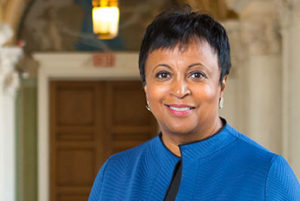
Carla HaydenThe AAG will be awarding Carla Hayden, 14th Librarian of Congress, the Atlas Award during the 2019 AAG Annual Meeting, on Friday, April 5, 2019. Hayden will deliver a keynote address after presentation of the Atlas Award, the association’s highest honor.

Learn more about Hayden.

Focus on new

“Focus on Washington, DC and the Mid Atlantic” is an ongoing series curated by the Local Arrangements Committee to provide insight on and understanding of the geographies of Washington, DC and the greater Mid Atlantic region in preparation for the 2019 AAG Annual Meeting.

Stories of Change Hidden in Washington, D.C.’s Alley

Tucked into residential areas of Washington, DC exists a maze of alley homes and retail establishments dating back to the Reconstruction era of the mid-1800s. Today, urban hikers may find a mixture of homes, art, and food scattered in various masked locales. Rebecca Summer elaborates on the disappearing feature of the gentrifying city in this latest Focus article.

Read more.

Get Involved with the AAG Jobs and Careers Center!

The AAG seeks panelists, mentors, and workshop leaders for careers and professional development events for its annual meeting, April 3–7, 2019, in Washington, DC. Individuals representing a broad range of employment sectors, organizations, academic and professional backgrounds, and racial/ethnic/gender perspectives are encouraged to apply. If interested, email careers [at] aag [dot] org, specifying topic(s) and activity(s) of interest, and attach a current C.V. or resume. For best consideration, please submit your information by October 25, 2018.

Learn about the AAG Jobs & Careers Center.

Registration for #aagDC Now Open! Start Planning your Trip!

The new early bird registration rate for the 2019 AAG Annual Meeting expires on September 27, 2018. Register early to ensure the best rates!


ASSOCIATION NEWS

Meet the Editors of AAG Journals: Tim Cresswell, Deborah Dixon, and Philip J. Nicholson

This month, get to know the editorial team of AAG’s newest journal, GeoHumanities. Two editors, Tim Cresswell and Deborah Dixon, and one assistant editor, Philip J. Nicholson, work on the journal, which includes scholarly articles at the intersection of geography and the humanities, shorter creative pieces, and an accompanying online art exhibition of author’s works.
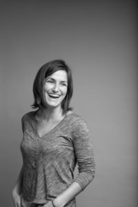
Find out more about the AAG Journals editors.

Visiting Geographical Scientist Program Accepting Applications for 2018-19

The Visiting Geographical Scientist program (VGSP) sponsors visits by prominent geographers to small departments or institutions that do not have the resources to bring in well-known speakers. The purpose of this program is to stimulate interest in geography, targeted for students, faculty members, and administrative officers. Participating institutions select and make arrangements with the visiting geographer. A list of pre-approved speakers is available online. VGSP is funded by Gamma Theta Upsilon (GTU), the international honors society for geographers.

Apply to and learn more about the VGSP.


MEMBER NEWS

Profiles of Professional Geographers

Caitlin KontgisThis month, learn about the career path of Caitlin Kontgis who works as an Applied Scientist Lead (Solutions) at Descartes Labs in New Mexico. Kontgis discusses her passion for geography, how it has led to her giving back to her local community, and the undergraduate courses that inspired her eventual professional goals.
Learn more about geography careers.

Summer Member Updates

Many AAG members were active throughout the summer with research and other geography related activities and honors.

50 year AAG Member Martin J. Pasqualetti was named the University of California, Riverside Alumni Association’s 2018 Distinguished Alumnus. His work has largely focused on energy, including his UC, Riverside dissertation, Energy in an OasisLearn more.

Marla R. Emery, a Research Geographer with the United States Department of Agriculture, Forest Service Research and Development, has been appointed co-Chair of the Intergovernmental Science-Policy Platform on Biodiversity and Ecosystem Services for the assessment of the sustainable use of wild species. Read more.

AAG Councilmember Wendy Jepson was awarded an NSF grant to lead a new water security research network. She was also selected as one of eight Texas A&M Faculty for their inaugural X-Grant program in which she will lead a team examining desalination and water reuse.

Julie Loisel, an assistant professor of geography at Texas A&M, was awarded one of eight inaugural grants in the Texas A&M X-Grant program that awards research funding for interdisciplinary projects. Her team will be assessing CO2 levels in arctic permafrost. Learn more.

The keynote speaker for the 4th Annual International Geography Youth Summit in Bengaluru, India was Sue Roberts of the University of Kentucky. The summit, founded by Chandra Shekhar Balachandran, attracted 170 young adults aged 11 to 17. Read more.

Jacqueline M. Vadjunec has been appointed to serve as a Program Director for Geography and Spatial Sciences at the National Science Foundation. Jacqueline will work with two other GSS program directors, Antoinette WinklerPrins and Thomas Baerwald. She replaces Sunil Narumalani, who has returned to the University of Nebraska-Lincoln. Learn more.

Victoria Trucksess took part in graduate studies in Belize this past summer through Miami University’s Project Dragonfly. Trucksess of Hackettstown, N.J., studied approaches to environmental stewardship. Inspired by her work in Belize, Trucksess is now conducting a semester-long research project.


OP-ED

Researchers with disabilities in the academic system

By Aleksandra (Sasha) Kosanic, Nancy Hansen, Susanne Zimmermann-Janschitz, and Vera Chouinard

Op-ed-logo-300x77

“Although researchers with disabilities are an exceptional category, they are a still very much underrepresented group in Academia worldwide. With 1.5 billion people with disabilities worldwide, the percentage of academic positions filled in by academics with disabilities is surprisingly low… The low number/percentage of Academics with disabilities in top class universities and other research institutions is alarming, and we have to ask why this is the case and what are possible solutions to change this situation for the better.”

Continue reading.


IN MEMORIAM

Robert H. Stoddard

Robert StoddardRobert Stoddard passed away on May 21, 2018 at the age of 89. Stoddard, one of the first geographers to focus on pilgrimage, was also an Asia specialist who combined his interests throughout his distinguished teaching career in the U.S. at University of Nebraska-Lincoln and abroad in India, Nepal, and Sri Lanka.
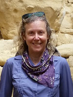
Read more.


PUBLICATIONS

New Books in Geography — July 2018 Available

New Books in Geography illustration of stack of books

Recent books published in geography and related topics span the discipline from Bolivia and Chile to Asia and Manila to Russia and the Arctic. Some of these new titles will be selected to be reviewed for the AAG Review of Books. Individuals interested in reviewing these or other titles should contact the Editor-in-Chief, Kent Mathewson.

Browse the list of new books.

Read the September 2018 Issue of the ‘Annals of the AAG’

Annals-cvr-2017

Volume 108, Issue 5 of the Annals of the American Association of Geographers is now available! Articles spanning the breadth of geography from the four major areas of Methods, Models, and Geographic Information Science; Nature and Society; People, Place, and Region; and Physical Geography and Environmental Sciences are featured in each issue. Access to the journal is included in your AAG membership.

Full article listing available.

Summer 2018 Issue of ‘The AAG Review of Books’ Now Available

Volume 6, Issue 3 of The AAG Review of Books has now been published online. In addition to featuring individual book reviews and discussions, the quarterly publication also includes longer essays on several books dealing with a particular theme. This quarter, the essay by Joseph S. Wood looks at the white, rural poor in the US.

Read the reviews.


GEOGRAPHERS IN THE NEWS

EVENTS CALENDAR

Submit News to the AAG Newsletter. To share your news, email us!

    Share

A New Academic Year

This Labor Day weekend marks the return to University instruction for many geography faculty and students, and as an educator, I welcome you all back to our academic community and wish you a successful new academic year. Many of us are returning from field and lab research, writing, and conferences, wondering where the summer went and why we are considered nine-month-employees! The answer is we are year-round members of our academic communities. Last week I wrote the final Department Chair’s welcome of my term to the UT Austin Geography community. As my term closes, I am passing the administrative baton to a wonderful colleague, to whom I give my thanks and wish all the best. I am excited for the new beginning of rejoining my fellow professors and to have more time to devote to scholarship, to my students, and to the AAG. I thank those faculty, students, and staff who helped along the journey, and thank the department chairs who will carry our missions forward.

Every September, my family also celebrated the ritual known as back-to-school. Like my current household, we lived on the academic calendar: My Father is a retired junior high school teacher, and my Mother retired after a career that included elementary, junior high, and school district librarianships. The excitement of a new school year was signaled by the faint odor of dry grasses, star thistle, and oak leaves rehydrating in the cool, dewy September mornings of northern California. My educator parents encouraged me to follow any profession I desired, and gave me the confidence as a young girl to embrace science. My mother bought me my first microscope for my birthday while I was an elementary school student. In my windowsill, I grew protozoa from the science kit and studied them, along with rocks and minerals collected with my parents, under that microscope. Parents and teachers comprise an important partnership to inspire young students to succeed, and I encourage all of us to actively engage our students in Geography in the classroom and in research, to do outreach, and to practice inclusion.

For our non-academic professional Geography community, I pause to thank you for your research partnerships, your innovation and entrepreneurship, and for the internship opportunities and inspiration you offer to our students. I owe my career in water resources to an internship with the California Department of Water Resources. Geography professionals are also our university alumni, and as such are members of our extended academic communities; we thank you for your support and salute your successes. Looking ahead to Fall 2018, we have many AAG regional division meetings to attend. I encourage professional and academic geographers and students to take full advantage of these opportunities to exchange ideas and renew connections with friends, colleagues, alumni, and alma maters. We members of the AAG Executive Committee will be fanning out to attend the regional meetings, stretching from Keene, NH, to Reno, NV, and we look forward to connecting with all of you there. Please also remember that registration for the AAG Annual Meeting in Washington DC is now open.

Professional Meetings and Inclusiveness

An extremely important matter of AAG concern is creating and maintaining an inclusive, professional environment for meeting attendees. At our Spring meeting in New Orleans, the AAG Council created a task force to address harassment at AAG Meetings. They will have their first meeting in Washington, DC, in mid-September to consider data gathering, best practices, and policies that other professional societies employ for their meetings, to make the AAG Annual Meeting a safe space for all participants. The Task Force will report back to the AAG Council later this Fall. Derek Alderman’s January 2018 Presidential Column, co-authored with Lorraine Dowler, provides an excellent summary of the issues and resource links. This new Task Force is empowered by the AAG Professional Conduct Policy and AAG Statement on Professional Ethics. We also have a Standing Committee on AAG Annual Meeting Disciplinary Matters, and it has acted when called upon. We need to make our policies more visible, create safe spaces at our meetings, and provide a clear path of due process, to proactively reduce the number of incidents of inappropriate behavior, and to deal with those that do happen with firm consequences. In a future column I will report back on the progress of this Task Force.

Reflections on Rio: Geographers as Global Ambassadors

Speaking of conferences, this August I attended the World Congress of Soil Science in Rio de Janeiro, Brazil. Four Thousand soil scientists assembled under the theme of “Beyond Food and Fuel.” This conference called to attention the importance of soil as both a natural and cultural resource, and its multiple functions ranging from ecosystem support to biogeochemical cycling, to archiving environmental change and cultural history. Exhibits and activities included geographically curated Brazilian soil profiles, soil art, and a student “soil judging” competition with teams from around the world. We are reminded by this gathering of scientists that much of Geography studies the Critical Zone we humans inhabit. Rio is a city of contrasts, from wealthy to impoverished communities all perched side by side in a stunning geological and biogeographical setting, including the coastal Atlantic shore. More drama is added by granitic domes looming around the city and offshore as islands. Lush greenery clings to the steep slopes, as do houses, highways, and bike paths. The living natural heritage is preserved in The Botanical Garden of Rio de Janeiro. Not a week and a half after our return from Rio, however, it is shocking to see that Rio, Brazil, and in fact the world has just suffered a huge loss of cultural and scientific heritage with a fire destroying the National Museum of Brazil over the September 1 weekend. Sources have compared this fire to that which destroyed the ancient library of Alexandria in 48 BC. Helping Brazil to rebuild cultural and scientific heritage lost from this tragedy will take time and a global effort. I urge Geographers to assist in this recovery, and I offer my deepest condolences to our Brazilian hosts.

Geo-existential Legislation: S.2128 The Geospatial Data Act

Alerted by the AAG, one of my last official acts as Geography Chair at UT Austin, and an early action as AAG President, involved writing a letter to a Texas Senator, requesting support and sponsorship of S.2128, the Geospatial Data Act (GDA) of 2017. This legislation will be voted on in a Senate sub-committee soon. The AAG, led by our Executive Director, has worked tirelessly for many years to support Geographers’ professional access to participate in federal research and contracts involving mapping and geospatial data analysis. This important current legislation has the potential to save U.S. taxpayers millions of dollars by reducing duplication in geospatial data activities across all federal agencies, and has been endorsed by numerous prominent geospatial and geography organizations, including the AAG; the National States Geographic Information Council (NSGIC); and the United States Geospatial Intelligence Foundation (USGIF). It has also been supported by private-sector leaders, including Google, Esri, Boundless, and many others. If enacted, the GDA will improve coordination between the numerous agencies that use geospatial data as a critical asset in many endeavors, including responding to disaster situations such as Hurricanes Harvey and Maria, which impacted Gulf and Caribbean coastal communities a year ago. You can follow this and other policy issues affecting Geography on the AAG Policy Page. As always, feel free to write to your legislators and share your opinion on this and other matters. Thank you!

Please share your own ideas with me via email: slbeach [at] austin [dot] utexas [dot] edu

— Sheryl Luzzadder-Beach
President, American Association of Geographers
Professor, and Fellow of the C.B. Smith Sr. Centennial Chair in U.S.-Mexico Relations
Geography and the Environment, The University of Texas at Austin

DOI: 10.14433/2017.0043

    Share

Stories of Change Hidden in Washington, D.C.’s Alleys

Washington, D.C. is known for its monuments, museums, and grand government buildings. It is associated with policy wonks, foreign dignitaries, and political controversy. But it is also a home town for thousands of people who live in its lively neighborhoods. How best to get a glimpse of everyday life for D.C.’s residents, those people living in places hidden from view on the National Mall? A tour of the city’s most hidden places of all: its urban alleys.
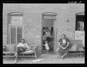
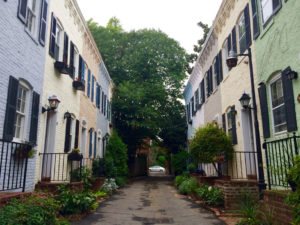
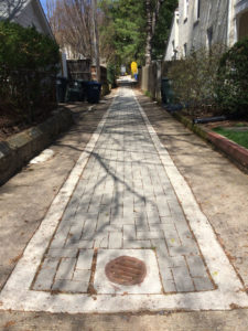
Like many American cities, D.C. has a system of alleys. Most of these narrow thoroughfares are used for municipal functions such as garbage collection, deliveries, and parking. You might also find more informal, but not unexpected, signs of use, like basketball hoops or folding chairs used by those who live, work, or spend time nearby. Yet a turn down the right alley in D.C. might surprise you. In D.C. alleys you’ll find clues about the city’s history of substandard housing for African American migrants following the Civil War, you’ll see evidence of the early roots of gentrification in the 1950s, you’ll glimpse a burgeoning public art scene, you’ll tread across new wastewater management projects, you’ll stumble upon a community garden, or you’ll even find yourself in a hip and expensive commercial enclave. D.C.’s alleys offer insight into how this city has dealt with its long history of strained race relations, how it is creatively managing urban space to sustainably support urban growth and density, and how it is attempting to stay true to its longtime African American and Latinx residents while attracting whiter, younger, and wealthier residents who have flooded the city in recent years.

Even prior to the Civil War, D.C.’s alleys told a unique story. As the city’s population increased in the 1850s, alleys were cut from the city’s large blocks to provide access to residential space in block interiors. These new alleys often formed I or H shapes, with only narrow outlets to main streets, and they were called “hidden” or “blind” alleys because the activities inside could not be seen from front streets. As sites of makeshift wood-framed housing, these alleys were where black and white residents found inexpensive places to live downtown. As opposed to other Southern cities that had alley housing, in which a servant or slave house along the alley would share a lot with the main house, to which it would be oriented, the residents of D.C.’s blind alleys were disconnected from the residents of the front streets; their homes were on separate lots and they were oriented to the back alley. In fact, alley-facing lots and front street-facing lots were often separated by other narrow alleys or by fences. D.C.’s alley residents were legally and socially removed from life on front streets.

During and immediately following the Civil War, the city faced a severe housing shortage as the population nearly doubled. Growth of the African American population was particularly profound as freed people flooded the city. Between 1860 and 1870, the black population more than tripled from 14,000 to 43,000. In a pedestrian city without mass transportation, these migrants were forced to live close to employment downtown. As historian James Borchert has detailed, many individuals and families found shelter in the makeshift housing, and later brick row houses, constructed in the blind alleys, which became increasingly overcrowded. The lack of adequate sewerage systems, clean water, and waste disposal also caused high rates of disease and death. Crucially, the overcrowding was not just due to an increase in population. Absentee owners of alley properties recognized the high demand for shelter and increased rents. This in turn led to more density as families were forced to double up in order to pay rent.

An African American family sits outside of their alley dwelling, 1941. Photograph by Edwin Rosskam, 1941. Library of Congress, Prints & Photographs Division, FSA/OWI Collection, LC-USF34-012828-D. Public domain. https://www.loc.gov/pictures/item/2017764780/

D.C.’s alleys were racially segregated, and whereas the majority were all-white before the Civil War, by 1897, 93% of alley dwellers were African American. Borchert argues extensively that through the first decades of the twentieth century, despite the real dangers of disease, death, and poverty, African American alley residents in D.C. valued their communities. Many were newly adjusting to urban life from being enslaved on Southern plantations, and they created incredibly close-knit, alley-based communities rooted in extended kinship networks and communal help. They treated the alley itself as communal property where children could play, adults could socialize and exchange goods, and neighbors could warn one another about outsiders—particularly white outsiders like police or social reformers—who might enter the alley. Alleys also had exceptionally high retention rates given high population turnover in other cities at the time, and especially because alley dwellers did not own their own homes. In alleys, African Americans made claims to the city. 

For those living in alleys, they were places of African American identity and belonging, where necessity reinforced strong communities based on kinship and mutual aid. White Progressive-Era reformers and elites also understood alleys as African American urban space, but for them this had only negative connotations. They published studies reporting on the high rates of disease, death, poverty, and crime in alley dwelling communities, and they generally concluded that the isolated built environment of blind alleys fostered immorality. Findings like these ignored or were oblivious to the positive associations of community or mutual aid that were so central to life for alley residents. Instead, they popularized perceptions of alleys as African American slums.

Restored alley dwellings line Pomander Walk in D.C.’s Georgetown neighborhood. Photograph by Rebecca Summer, 2016.

By the 1950s, young professionals, nearly all whom were white, were moving to Washington, D.C. to work for the growing federal government, and these new Washingtonians wanted to live near their workplaces. It was in the 1950s that developers set out to transform downtown Washington, D.C. neighborhoods—those with alley dwellings—into elite white enclaves. In the Southwest neighborhood, this process occurred with federal urban renewal funds, and Southwest’s many alley dwellings were the first to be demolished in the now-notorious clearance of Southwest, which resulted in the displacement of 23,000 of its residents. In neighborhoods like Capitol Hill, Georgetown, and Foggy Bottom, small-scale developers bought alley dwellings, evicted African American tenants, rehabilitated the homes, and sold them to young white professionals, facilitating the transition of these D.C. neighborhoods from mixed-race and mixed-income to nearly entirely upper-middle-class and white. Not called gentrification at the time, the process of displacement, rehabilitation, and resale foreshadowed demographic change that would sweep entire neighborhoods in the 1970s and again in the present day. By the end of the 1950s, alley dwellings were no longer classified as slums, and these low-rent African American communities disappeared from D.C.’s landscape. Yet the built environment persists; turn down alleys such as Snow’s Court in Foggy Bottom, Pomander Walk in Georgetown, or Brown’s Court in Capitol Hill (to name just a few) and you’ll find the narrow nearly-million-dollar rehabilitated rowhouses that once housed the city’s poorest African American residents.

As Washington D.C.’s alley dwellings disappeared due to demolition and rehabilitation in the 1950s, so did the public perception of inner-city alleys as African American community and residential space. By the 1960s, as in the rest of the country, D.C.’s alleys were primarily known as service corridors whose formal functions included vehicle storage and waste collection. In this period of postwar white flight and urban disinvestment, however, alleys also filled with garbage and teemed with rats. By the 1980s, alleys were too often associated with the drug trade and horrific gun and sexual violence. Alleys became symbols of decline in America’s cities, which, compared to growing suburbs, were disproportionately African American, underfunded, and underserviced.

One of D.C.’s “green alleys,” located in a residential neighborhood in the upper northwest part of the city. The alleys are designed by the D.C. government’s Department of Transportation to mitigate storm water runoff. Photograph by Rebecca Summer, 2016.

Today, as many U.S. cities have seen the reversal of white flight as investment and young professionals have flooded downtown neighborhoods, some cities, including D.C., are turning again to their alleys. These overlooked and long-neglected public spaces seem to be the solution for the myriad puzzles facing growing cities. D.C.’s Department of Transportation, for example, has instituted a Green Alleys program to combat wastewater runoff; walk down an alley in the residential neighborhoods on the outskirts of the city and you’ll find new permeable paving. The city’s 2016 zoning rewrite now allows for dwelling units to be built along alleys in certain residential zones in an attempt to add density and more affordable housing to the city’s downtown; walk through some back alleys in Capitol Hill and you’ll see new construction of alley-facing houses (this move to put residences back in alleys would have Progressive-Era reformers stunned).

The entrance to The Dabney, a high-end restaurant located in D.C.’s Blagden Alley. The restaurant is accessible only through the alley. Photograph by Rebecca Summer, 2018.

Alleys even provide an antidote for D.C. residents now frustrated by the effects of recent investment. Those disillusioned by the ubiquity of glass-paneled luxury apartment buildings and mixed-use developments can turn down alleys for a seemingly more authentic city scale. Alleys promise a labyrinth space where one can wander and discover. They remain in people’s imaginations the edgy, dirty, and potentially dangerous parts of a newly glitzy city. And of course, this edginess and “frontier” quality can be capitalized upon as well. Enter Blagden Alley in the Shaw neighborhood, and you’ll find high-end restaurants, a boutique coffee shop, and design firms, accessible only through the alley. Even if you confirm the locations on Google Maps before you go, you’ll still have to trust your sense of direction as you pass a surface parking lot, dumpsters, delivery trucks, and strewn garbage on your way to the center of one of the city’s last remaining nineteenth-century “blind alleys.” In Blagden Alley you’ll also find the “D.C. Alley Museum,” an officially christened collection of alley murals (alley murals, not part of the “museum,” abound in the Shaw/U Street area). While these murals don’t have the defiance of graffiti tags—they are in fact funded by the D.C. Commission on the Arts and Humanities—they still give the illusion of artists appropriating the surfaces of private property. Blagden Alley offers a partially curated aesthetic that serves as an antithesis to the large-scale development that now swaths the downtown core.

“Let Go,” a mural by Rose Jaffe, is part of the “DC Alley Museum” located in Blagden Alley. The murals are funded in part by the D.C. Commission on the Arts and Humanities. Photograph by Rebecca Summer, 2017.

D.C.’s alleys have, at the moment, found a tenuous balance between longtime uses and new investment: in Blagden Alley and nearby Naylor Court, garbage trucks trundle past professionals eating at high-end restaurants; rats scurry beneath Instagram-ready murals; and prostitution and drug use take over the alleys by night, while families living in restored alley dwellings set up block parties by day. You might lament the late gentrification of these alleys, the last holdouts in a larger area that’s already thoroughly gentrified. Or, you might enjoy an urban space that manages to attract racially and economically diverse groups of people. At least for now, you would be right to think so either way. Alleys offer a glimpse of life in this city in transition.

Rebecca Summer is a Ph.D. candidate in the University of Wisconsin-Madison’s department of geography. Learn more at www.rebeccasummer.net. She can be reached at rsummer [at] wisc [dot] edu.

The research reported in this article was supported by an award from the National Science Foundation, BCS-1656997.


DOI: 10.14433/2017.0041

Recommended reading:

Ammon, Francesca Russello, “Commemoration Amid Criticism: The Mixed Legacy of Urban Renewal in Southwest Washington, D.C.” Journal of Planning History 8 no. 3 (2009): 175–220.

Chris Myers Asch and George Derek Musgrove, Chocolate City: A History of Race and Democracy in the Nation’s Capital (Chapel Hill: University of North Carolina Press, 2017).

James Borchert, Alley Life in Washington: Family, Community, Religion, and Folklife in the City, 1850-1970 (Chicago: University of Illinois Press, 1980).

District Department of Transportation, “Green Alley Projects,” https://ddot.dc.gov/GreenAlleys

Mark Jenkins, “Murals and mosaics enliven an already bustling Blagden Alley,” The Washington Post, December 29, 2015, https://www.washingtonpost.com/goingoutguide/museums/murals-and-mosaics-enliven-an-already-bustling-blagden-alley/2015/12/29/6a9917f4-a991-11e5-9b92-dea7cd4b1a4d_story.html?utm_term=.70994c52ee3f

Kathleen M. Lesko, Valerie Babb and Carroll R. Gibbs, Black Georgetown Remembered: A History of its Black Community from the Founding of “The Town of George” in 1751 to the Present Day (Washington, D.C.: Georgetown University Press, 2016).

Dan Reed, “Even D.C.’s Alleys Are Thriving,” The Washingtonian, March 9, 2017, https://www.washingtonian.com/2017/03/09/even-dcs-alleys-thriving/

    Share