New Books: January 2019

Every month the AAG compiles a list of newly-published books in geography and related areas. Some are selected for review in the AAG Review of Books.

Publishers are welcome to send new volumes to the Editor-in-Chief (Kent Mathewson, Editor-in-Chief, AAG Review of BooksDepartment of Geography and Anthropology, Louisiana State University, Baton Rouge, LA 70803).

Anyone interested in reviewing these or other titles should also contact the Editor-in-Chief.

PLEASE NOTE: Due to current public health policies which have prompted the closing of most offices, we are unable to access incoming books at this time. We are working on a solution during this transition and will continue our new books processing as soon as we can. In the meantime, please feel free to peruse previous books from our archived lists.

January 2019

The American Politics of French Theory: Derrida, Deleuze, Guattari, and Foucault in Translation by Jason Demers (University of Toronto Press 2018)

The Art of Resistance: Painting by Candlelight in Mao’s China by Shelley Drake Hawks (University of Washington Press 2017)

Banana Cowboys: The United Fruit Company and the Culture of Corporate Colonialism by James W. Martin (University of New Mexico Press 2018)

Below Freezing: Elegy for the Melting Planet by Donald Anderson (University of New Mexico Press 2018)

A Billion Black Anthropocenes or None by Kathryn Yusoff (University of Minnesota Press 2019)

Brazil in the Anthropocene: Conflicts Between Predatory Development and Environmental Policies by Liz-Rejane Issberner, Philippe Léna (eds.) (Routledge 2018)

Can We Feed the World Without Destroying It? by Eric Holt-Giménez (Polity 2018)

Capitalist Pigs: Pigs, Pork, and Power in America by J. L. Anderson (West Virginia University Press 2019)

Citizens in Motion: Emigration, Immigration, and Re-migration Across China’s Borders by Elaine Lynn-Ee Ho (Stanford University Press 2018)

Constructions of Time and History in the Pre-Columbian Andes by Edward Swenson and Andrew P. Roddick (eds.) (University Press of Colorado 2018)

Cuba, Hot and Cold by Tom Miller (University of Arizona Press 2017)

Emptied Lands: A Legal Geography of Bedouin Rights in the Negev by Alexandre Kedar, Ahmad Amara, Oren Yiftachel (Stanford University Press 2018)

Esteban: The African Slave Who Explored America by Dennis Herrick (University of New Mexico Press 2018)

Geographers: Biobibliographical Studies, Volume 37 by Elizabeth Baigent & André Reyes Novaes (eds.) (Bloomsbury 2018)

Human and Environmental Justice in Guatemala by Stephen Henighan and Candace Johnson (eds.) (University of Toronto Press 2018)

Identity, Development, and the Politics of the Past: An Ethnography of Continuity and Change in a Coastal Ecuadorian Communityby Daniel Bauer (University Press of Colorado 2018)

Infrastructure, Environment, and Life in the Anthropocene by Kregg Hetherington (ed.) (Duke University Press 2019)

Inside Smart Cities: Place, Politics and Urban Innovation by Andrew Karvonen, Federico Cugurullo, Federico Caprotti (eds.) (Routledge 2018)

Introducing Sea Level Change by Alastair Dawson (Dunedin Academic Press 2018)

Lévi-Strauss: A Biography by Emmanuelle Loyer (Polity 2018)

Managing Complexity: Earth Systems and Strategies for the Future by Walter R. Erdelen, Jacques G. Richardson (Routledge 2018)

Open Borders: In Defense of Free Movement by Reece Jones (University of Georgia 2018)

The Oxford Handbook of Public Heritage Theory and Practice by Angela M. Labrador and Neil Asher Silberman (eds.) (Oxford University Press 2018)

Quest for the Unity of Knowledge by David Lowenthal (Routledge 2018)

Rebranding China: Contested Status Signaling in the Changing Global Order by Xiaoyu Pu (Stanford University Press 2019)

Regionalism and Modern Europe: Identity Construction and Movements from 1890 to the Present Day by Xosé M. Núñez Seixas & Eric Storm (eds.) (Bloomsbury 2018)

Resource and Environmental Management, Third Edition by Bruce Mitchell (Oxford University Press 2018)

Rick and Morty and Philosophy: In the Beginning Was the Squanch by Lester C. Abesamis and Wayne Yuen (eds.) (Open Court 2019)

Rural People and Communities in the 21st Century: Resilience and Transformation, 2nd Edition by David L. Brown, Kai A. Schafft (Wiley-Blackwell 2018)

Seismic City: An Environmental History of San Francisco’s 1906 Earthquake by Joanna L. Dyl (University of Washington Press 2017)

Trading Territories: Mapping the Early Modern World by Jerry Brotton (Reaktion Books 2018)

Transnational Radicals: Italian Anarchists in Canada and the U.S., 1915–1940by Travis Tomchuk (University of Manitoba Press 2015)

Uncertain Citizenship: Everyday Practices of Bolivian Migrants in Chile by Megan Ryburn (University of California Press 2018)

Water: Abundance, Scarcity, and Security in the Age of Humanity by Jeremy J. Schmidt (New York University Press 2019)
    Share

New Books: September 2018

Every month the AAG compiles a list of newly-published books in geography and related areas. Some are selected for review in the AAG Review of Books.

Publishers are welcome to send new volumes to the Editor-in-Chief (Kent Mathewson, Editor-in-Chief, AAG Review of BooksDepartment of Geography and Anthropology, Louisiana State University, Baton Rouge, LA 70803).

Anyone interested in reviewing these or other titles should also contact the Editor-in-Chief.

PLEASE NOTE: Due to current public health policies which have prompted the closing of most offices, we are unable to access incoming books at this time. We are working on a solution during this transition and will continue our new books processing as soon as we can. In the meantime, please feel free to peruse previous books from our archived lists.

September 2018

Across Oceans of Law: The Komagata Maru and Jurisdiction in the Time of Empireby Renisa Mawani (Duke University Press 2018)

Antarctica: Earth’s Own Ice World by Michael Carroll and Rosaly Lopes (Springer 2019)

Atmospheric Things: on the Allure of the Elemental Envelopmentby Derek P. McCormack (Duke University Press 2018)

Between the Plough and the Pick: Informal, Artisanal, and Small-Scale Mining in the Contemporary Worldby Kuntala Lahiri-Dutt (ed.) (Australian National University Press 2018)

Black Spaces: African Diaspora in Italyby Heather Merrill (Routledge 2018)

Climate Wars: What People Will Be Killed For in the 21st Century by Harald Weizer (Polity Press 2017)

Collectives in the Spanish Revolution by Gaston Leval (PM Press 2018)

Decolonizing Extinction: The work of Care in Orangutan Rehabilitationby Juno Salazar Parreñas (Duke University Press 2018)

Defiant Earth: The Fate of Humans in the Anthropocene by Clive Hamilton (Polity Press 2017)

Doreen Massey: Critical Dialogues by Marion Werner, Jamie Peck, Rebecca Lave, and Brett Christophers (Agenda Publishing 2018)

The End of the Cognitive Empire: The Coming of Age of Epistemologies of the South by Boaventura de Sousa Santos (Duke University Press 2018)

Experimental Practice: Technoscience, Alterontologies, and More-Than-Social Movementsby Dimitris Papadopoulos (Duke University Press 2018)

Fish Town: Down the Road to Louisiana’s Vanishing Fishing Communities by J. T. Blatty (University of Virginia Press 2018)

Handbook on the Geographies of Power by Mat Coleman and John Agnew (eds.) (Edward Elgar Publishing 2018)

Handbook on the Geographies of Regions and Territoriesby Anssi Paasi, John Harrison, and Martin Jones (eds.) (Edward Elgar Publishing 2018)

A History of America in 100 Mapsby Susan Schulten (University of Chicago Press 2018)

Lévi-Strauss: A Biography by Emmanuelle Loyer (Polity 2018)

Migrants and City Making: Dispossession Displacement and Urban Regenerationby Aye Çaglar and Nina Glick Schiller (Duke University Press 2018)

Performing Animals: History, Agency, Theaterby Karen Raber and Monica Mattfeld (eds.) (The Pennsylvania State University Press 2017)

The Promise of Infrastructureby Nikhil Anand, Akhil Gupta, and Hannah Appel (eds.) (Duke University Press 2018)

Rhetorics Haunting the National Mall: Displaced and Ephemeral Public Memoriesby Roger C. Aden (ed.) (Lexington Books 2018)

Rooster Town: The History of an Urban Metis Community, 1901–1961 by Evelyn Peters, Matthew Stock, and Adrian Werner (University of Manitoba Press 2018)

The Scramble for the the Poles: The Geopolitics of the Artic and Antartic by Klaus Dodds and Mark Nuttall (Polity Press 2015)

Sites Unseen: Uncovering Hidden Hazards in American Citiesby Scott Frickel and James R. Elliot (Russell Sage Foundation 2018)

Stolen City: Racial Capitalism and the Making of Winnipegby Owen Toews (ARP Books 2018)

Upstream: Trust Lands and Power on the Feather Riverby Beth Rose Middleton Manning (The University of Arizona Press 2018)

The Wake of the Whale: Hunter Societies in the Caribbean and North Atlantic by Russell Fielding (Harvard University Press 2018)

    Share

John Sauvageau

Education: M.S. in Geo-Information Science (Salem State University), B.S. in Cartography and GIS (Salem State University)

Describe your job. What are some of the most important tasks or duties for which you are responsible?
I work within the Retail Network Transformation team, which falls under the consumer business banking umbrella. We’re responsible for the strategy and planning of our branch markets, and where we want to put branches and ATMs. We leverage GIS to analyze and visualize our internal and external data spatially. We then use the ESRI platform ArcGIS Enterprise with its various tool sets including business analyst, network analyst, and spatial analyst as the tools to help us develop strategy.

We provide services to much of the northeast, including Rhode Island, Massachusetts, Connecticut, New Hampshire, Vermont, New York, Pennsylvania, Delaware, and Virginia, and also parts of the midwest like Ohio and Michigan.  We’re responsible for supporting the analysis and branch recommendations for all types of branch actions – open, close and relocations.

How has your education/background in geography prepared you for this position?
Grasping the various levels of geography and how they relate to each other is fairly important to understand. The banking industry is a little bit different than a standard retail industry, where chains can just put a store where there’s going to be high traffic. We deal with varying levels of governmental compliance. One aspect of compliance is proportionately locating branches in areas to ensure we are serving low to moderate income households, as well as middle to upper income households. We use internal and external data, including Census data,  to understand where that population is so we can target those areas.

Looking at the five themes of geography, I think we really touch two of those: location and region. Location – we have a network of branches and locations, we monitor other retail marketplaces, where they’re coming up, where they’re going away; other competitors’ locations, where customers are located. Location really is the number one thing that I think applies to what we do in this kind of planning. It’s kind of the same thing as real estate: location, location, location, everything is location.

At the regional scale we look at how everything works together and the nuances from region to region. We designate our own regions for organizational hierarchy purposes, but states, counties, etc. – they all have unique nuances, and we want to understand these so we can better interact with the population within those regions and be in the places where they are going to be. We also need to understand how they use the banks: are they primarily driven by branch visits, or using a more digital approach with online and mobile banking? How do we customize the look and feel from region to region to make our banks more attractive?

How does your geography knowledge inform your use of GIS and make it possible to get the most out of the business analyst software and work with big data?
Many of my colleagues across the industry come from more of a business intelligence background. Many have used GIS as a next step and have gone back to universities and vendors for formal training. These colleagues are amazing and have a great deal of hands-on experience and have been using these platforms for a long time. With my educational GIS & Cartography and Geo-Information Science background as a whole, I am able to bring in and apply more foundational concepts and tools to enhance our analysis. Maps can tend to be more mass produced and less of a cartographic product, but whenever I’m asked to make a map, I try to ask more questions first. Questions like: What is the purpose? What is it that you’re trying to convey? How will you be using and presenting the map? These and similar questions allow me to create a product that will be visually pleasing to the customer and their audience and allow the map to speak for itself. Different approaches and techniques will apply for varying levels of requests; it’s not always a “one size fits all” approach.

How did you discover geography was going to help you pursue your aspirations, professionally or in your personal life?
When I think of my “a-ha moment” I always refer back to a certain exercise with ArcGIS in one of my undergraduate courses, where we were working for a town searching for a site for a new fire station. We were given criteria where it had to have its own land within a certain square footage, and it couldn’t be within 7 minutes of another fire station’s service area. Taking all of that information, creating multiple layers and using a raster analysis to find out where the best possible areas were for this fire station – I had never seen that before, so I was like “wow, this is interesting!”

I was working at a bank at that time as a part time teller and thought “this would be really interesting to bring into the bank and use GIS to figure out where to put banks.” Being naïve as I was, I didn’t understand that it had already been going on. I didn’t know it existed. It wasn’t until a few years after that where I was taking some courses at the bank, learning about processes of improvement, efficiency and those sorts of concepts where I realized how interesting this was, and that I already had a good foundation for that kind of work from my education in GIS.

My branch manager at the time gave me the best advice I had ever received for this. He said: “Look in the organization, try to find somebody doing what you want to do, and just reach out to them and ask if you can talk to them and get advice on: How did you get over here, and what kind of preparation would I need to get into this kind of area within the organization?” So I did that. I identified the person I needed to talk to, reached out to them and we exchanged a few emails. Nine months later and I got an email from another person who he referred me to, and they had just created this GIS Analyst position within the bank to do exactly what I had been looking to do in branch site location. They asked me to interview for it, and a few months later I started on this path, which leads me here today. It all goes back to that one lesson in my undergraduate that kind of sparked my interest in the field, and without that I probably wouldn’t be here.

What attracted you to the banking industry? How did you initially develop that interest?
I had just returned from being deployed – I went to Afghanistan in 2010. I was looking for some part time work. My father-in-law had been working in the banking industry for a long time and thought it would be a great fit for me as a part time job.  A branch close to home was hiring, so I applied for a part time position as a teller. I began to thrive and before long I ended up becoming a supervisor. A few years later I was  promoted to a financial services representative. While I was gaining all of this financial experience, I was also going to school full time for GIS.  I had this passion for banking and this passion for GIS and I wondered, how great would it be if I could combine them?

I started in 2014 working on the real estate team and market planning, and gained a great deal of job experience in my first year. I transitioned to another financial institution performing similar tasks. I spent the last 3 years there, and now I’m taking a more senior role at a new institution. It’s been amazing, and it’s interesting because a lot of these types of decisions don’t require banking experience. It’s a unique combination of having worked in a branch and having the GIS experience that gave me insight into how the branch operates, while many of my peers don’t have the same understanding of what it’s like to work in a branch. When I’m helping to program details like how many desks we want to design in a certain branch with a certain amount of staffing, I’m able to bring a different perspective, because I’ve been in their seats before.

    Share

Arleigh H. Laycock

Arleigh Howard Laycock, Professor Emeritus of Geography at the University of Alberta, died June 7, 2018. He was 94.

Laycock was born on May 10, 1924, in Strathmore, Alberta, the son of the late George Henry (“Harry”) and Helia (Riekki) Laycock. He was married for 60 years to Audrey Jean Tyrholm (d. 2010) and had three children: Deborah, David, and James.

From 1943 to 1945, Laycock served as a pilot in the R.C.A.F. He graduated from the University of Toronto with a BA in 1949 and received his Ph.D. from the University of Minnesota in 1957.

Arleigh held the position of Hydrologist with the Eastern Rockies Forest Conservation Board from 1952-1955, whereupon he joined the faculty of the Department of Geography at the University of Alberta, where he served as Professor until his retirement in 1989.

    Share

Flood Control Infrastructure and ‘Political Hydrology’ along the LA-TX Gulf Coast

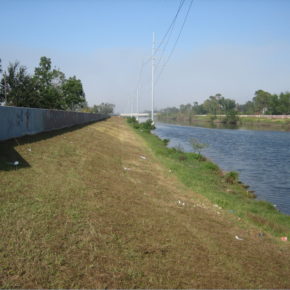
An intact portion of the 17th Street Canal (flooded after Hurricane Katrina). Concrete flood walls top the levees. CC by 2.5 Wikimedia Commons, by Infrogmation

The nation’s costliest natural disasters continue to be caused by flooding. Every year, with enormous personal and financial cost to U.S. citizens, floods damage crops, infrastructure, businesses, personal property and, most unfortunately, cost American lives.1 Americans are quick to forget such disasters, however, in part because they’re frequently popping up in other places. Remember the devastating flooding in south Louisiana in August 2016? It cost $10.0 billion. Other than Texans and Oklahomans, most Americans probably do not recall their floods way back in May 2015. It cost a mere $2.6 billion.1 And these are just a couple of examples. The single event we have not forgotten, thankfully, is the 2005 Hurricanes Katrina-Rita flooding of New Orleans and the Gulf Coast. It cost $153.0 billion, the most expensive flood disaster in the U.S. Of course, this was until Hurricane Harvey struck the Texas and Louisiana Gulf Coast. Cost are still being tallied, but unofficial estimates of flood damage cost associated with Hurricane Harvey range from $150 to $240 billion.

A sure way to reduce annual flood cost and protect the financial and personal livelihoods of Americans residing in flood prone regions is to strengthen America’s levees, an enormous system of flood control infrastructure.2 This means fortifying, heightening, and/or moving levees away from the river. These options, especially the latter, are in accord with “integrated flood management,” which has become the status quo in Europe.3, 4 In the Netherlands this approach is known as making “Room for the River.”4

Flood control in the U.S. is long entrenched in the paradigm of the “100-year” flood (i.e., 1 percent event), a strict probabilistic approach rooted in a decades old practice from the late 1960s that was advocated by insurance agencies and based on shaky assumptions regarding statistics, climate, and land use.5 A 100- year flood event may seem unlikely to occur during any given year, but it has a 26 percent chance of occurring in the life of a typical 30-year home mortgage. These are not favorable odds, and they’re even less favorable in view of documented historic (recorded) climate change, land use change, and land subsidence that has occurred since the 1950s.

Change had come to America, at least it seemed. With an inability of Congress to pass climate proof flood policy, action occurred at the executive branch. President Obama’s Executive Order 13690 (Establishing a Federal Flood Risk Management Standard and a Process for Further Soliciting and Considering Stakeholder Input(6), anchored with an extensive synthesis of floodplain science research, included many tenants of “integrated flood management” with similarities to those already practiced in Europe.3, 4 In particular, EO 13690 explicitly required up to date scientific climate change projections to be included in the design of flood control infrastructure as well as embracing a modern “flood risk” approach that takes into account human safety and the value of human activities (e.g., industry, property values, agriculture, etc…). This is broadly in agreement with the direction advocated by the nation’s highest body of science, the National Academies of Science. Specifically, EO 13690 provided three options for redesigning federal flood control levees, including i) utilizing the best “actionable” climate change science, ii) construct levees two or three feet higher than the elevation of the standard 100-year recurrence interval flood, or iii) design levees to the standard of a 500-year flood recurrence interval (in the Netherlands federal levees are designed to withstand flood events having a flood recurrence interval of 1,250 to 10,000 years). An additional key component of EO 13690 is that it recognizes the value of “working with nature” to reduce flood risks, which supports environmental conservation and restoration of valuable floodplain wetlands and associated ecosystem services. This is especially important along the Gulf Coast and the lower Mississippi River because the storage of flood waters on the floodplain increases nutrient sequestration, such as phosphorus and nitrogen, which are associated with the Gulf of Mexico Dead Zone, an enormous seasonally occurring area of hypoxic (oxygen poor) water off the coast of Louisiana and Texas detrimental to the shallow marine ecosystem. Thus, EO 13690 in essence represented a change from flood control to flood management. The intended move towards this “integrative” approach to flood management was not just substantial, it represented a paradigm change in the vision and mechanics of U.S. flood control that was also environmentally friendly. And, as levees are the embodiment of flood control infrastructure, implementation of EO 13690 is squarely in accord with President Trump’s stated intentions to improve the nation’s infrastructure.

Implementation of EO 13690 required stakeholders, such as states and levee boards, to develop a plan based on one of the three above approaches in coordination with federal agencies (e.g., FEMA, Federal Interagency Floodplain Management Task Force, Water Resources Council, etc.). Thus, local and state governmental institutions had several options that enabled them to alter the placement of levee systems in accord with their own priorities, such as nature preservation, agriculture, cultural heritage preservation, and urbanization.7 Implementation of EO 13690 would have seen the U.S. finally moving forward with adaptation of a modern “integrated” risk based approach to flood management that enhanced floodplain ecosystems as well as respecting up-to-date climate change that impacts flooding in America.

Predictably, EO 13690 was abruptly challenged by some stakeholders, including those who are arguably in most need of reduced flood risk. The Association of Louisiana Levee Boards (representing all levee boards within the state of Louisiana) was opposed to implementation of EO 13690. Louisiana contends that EO 13690 would adversely impact the Louisiana economy, and that it represented “social engineering.” Louisiana levee boards were also resistant to EO 13690 because it recognizes modern climate change science, to which there is skepticism. Louisiana was also concerned with EO 13690 because it could result in significant disruption of industry and populations residing within the wetlands and floodplains of the Mississippi delta. But in the Netherlands, the Dutch were able to efficiently implement their “Room for the River” plan within the Rhine delta, which has one of the densest populations in the world with exceptionally high economic activities and property values.

Nationally, the new standards of EO 13690 were welcomed by a larger swath of stakeholders, including the Association of State Floodplain Managers.8 And fortification of the nation’s levee system was also in accord with Congressional action following the 2005 flooding of New Orleans.9 Alarmingly, it was revealed that U.S. federal agencies have scant information regarding the overall integrity of America’s ~165,000 km system of flood control levees.2, 5

The new White House administration rescinded EO 13690 in a Presidential Executive Order on 15 August 2017, about two weeks prior to the devastating flooding by Hurricane Harvey of the Houston metropolitan and coastal southeast Texas and southwest Louisiana. The precipitation totals from Hurricane Harvey event had perhaps a 500-yr recurrence interval, and the cost of the flood disaster is on scale with the Hurricanes Katrina-Rita flooding along the Gulf Coast.

— Paul F. Hudson, PhD
Associate Professor
Leiden University
The Netherlands
p [dot] f [dot] hudson [at] luc [dot] leidenuniv [dot] nl

DOI: 10.14433/2017.0032

References cited:

  1. NOAA National Centers for Environmental Information (NCEI), 2016. U.S. Billion-Dollar Weather and Climate Disasters. https://www.ncdc.noaa.gov/billions/
  2. National Committee on Levee Safety, 2009. Recommendations for a National Levee Safety Program: A Report to Congress from the National Committee on Levee Safety.
  3. European Council (EC), 2007. Directive 2007/60/EC of the European Parliament and of the Council of 23 October 2007 on the Assessment and Management of Flood Risks.
  4. Delta Commission, 2016. National Water Plan 2016-2021. Ministry of Infrastructure and the Environment, Rijkswaterstaat, the Hague, the Netherlands.
  5. National Research Council (NRC), 2013. Levees and the National Flood Insurance Program: Improving Policies and Practices. Water Science and Technology Board, Division on Earth and Life Studies, National Academies Press, Washington D.C.
  6. Presidential Executive Order 13690. Establishing a Federal Flood Risk Management Standard and a Process for Further Soliciting and Considering Stakeholder Input https://obamawhitehouse.archives.gov/the-press-office/2015/01/30/executive-order-establishing-federal-flood-risk-management-standard-and-
  7. Federal Emergency Management Agency (FEMA), 2015. Revised Guidelines for Implementing Executive Order 11988, Floodplain Management. https://www.fema.gov/media- library/assets/documents/101761
  8. Association of State Floodplain Managers (ASFPM), 2015. Executive Order 13690 and the New Federal Flood Risk Management Standard Explained. ASFPM News & Views, 28 (1), February 2015.
  9. National Levee Safety Act, 2007. 121 Stat. 1288, Public Law 110-114-Nov. 8, 2007, 110th
    Share

Katelyn Suranovic Interns at AAG for Spring Semester

Katelyn Suranovic is currently pursuing her master’s degree in geography at George Washington University. Her focus is climate change and weather-related phenomena in response to climatic changes. Previously, Katelyn earned her bachelor of science degree from James Madison University (JMU), where she majored in geographic science with a concentration in environmental conservation, sustainability and development.
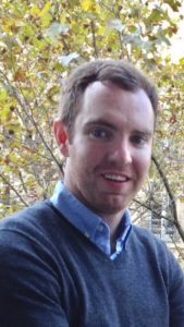
In 2015, Katelyn became a co-author for a journal article titled “Lightning Characteristics of Derecho Producing Mesoscale Convective Systems.” The article was written under the direction of Dr. Mace Bentley of JMU, along with a group of other students and was published by the international journal, Meteorology and Atmospheric Physics.

As an intern this semester, she will be working on the AP GIS&T project and will also assist with media and member outreach.

In her free time, Katelyn enjoys playing soccer, being outdoors and hanging out with her family.

    Share

Regional Divisions Announce Outstanding Graduate Student Papers from their Fall Meetings

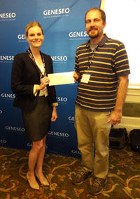
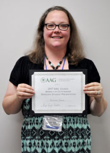
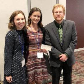
The AAG is proud to announce the Fall 2017 student winners of the AAG Council Award for Outstanding Graduate Student Paper at a Regional Meeting. The AAG Council Award for Outstanding Graduate Student Paper at a Regional Meeting is designed to encourage graduate student participation at AAG Regional Division conferences and support their attendance at AAG Annual Meetings. One graduate student in each AAG Regional Division receives this yearly award based on a paper submitted to their respective regional conference. The awardees receive $1,000 in funding for use towards their registration and travel costs to attend the AAG Annual Meeting. The board members from each region determine student award winners.

The winners from each region will be presenting their papers in two dedicated paper sessions at the upcoming 2018 AAG Annual Meeting in New Orleans. The paper sessions are tentatively scheduled for the afternoon of Tuesday, April 10, 2018.

Autumn James

WLDAAG: Autumn C. James, Ph.D. candidate, Northern Illinois University
Paper Title: Construction of Safety in Daily Living: The Role of Personal Experience and Perception

Benjamin Hemmingway

SWAAG: Benjamin Hemingway, Ph.D. candidate, Oklahoma State University
Paper Title: Vertical Sampling Scales for Atmospheric Boundary Layer Measurements from Small Unmanned Aircraft Systems (sUAS)

NESTVAL: Bogumila Backiel, M.S. (December 2017 graduate), University of Massachusetts, Amherst
Paper Title: Mapping Sandbars in the Connecticut River Watershed for Endangered Species Conservation

MAD: Joshua Wayland, PhD Candidate, Department of Geographical Sciences, University of Maryland College Park
Paper Title: Linking Natural Resources and Civil Conflict: A Spatial Panel Regression Approach

Maegen Rochner (center)

APCG: Sean Pries, PhD Candidate, Geography Graduate Group at University of California at Davis
Paper Title: The Past is the Key to the Present” Landscape of the Upper North Fork American River

Meghann Smith

SEDAAG: Maegen Rochner, PhD Candidate, University of Tennessee Knoxville
Paper Title: Climate Change in a High-Elevation Whitebark Pine Ecosystem, Beartooth Mountains, Wyoming, U.S.A.

MSDAAG: Meghann Smith, PhD Student, Montclair State University
Paper Title: Environmental and Economic Assessment of Hard Apple Cider in the Northeastern U.S.

Sam Roodbar

GPRM: Kimberly Johnson, PhD Student, Oklahoma State University
Paper Title: Perceptions and Performances of Wilder-scapes: Shaping contemporary social memories of the American West at Little House tourist sites

ELDAAG: Sam Roobar, Department of Geography, MA Student, Western Michigan University
Paper Title: “Spatial and Temporal Change in Halal Food Sales and Consumption: A case study of the city of Dearborn, Michigan”


    Share

Robert J. Mason

Robert J. Mason, a professor in the Department of Geography and Urban Studies at Temple University, died on November 15, 2017.

Rob was known for his work on environmental policymaking and land use management. He believed in international educational opportunities for students and was passionate about teaching the next generation of environmental leaders. A prolific author, Rob published Collaborative Land Use Management: The Quieter Revolution in Place-Based Planning (Rowman & Littlefield, 2008), Contested Lands: Conflict and Compromise in New Jersey’s Pine Barrens (Temple University Press, 1992) and the Atlas of United States Environmental Issues (Macmillan, 1990, with Mark Mattson).

In addition to teaching at Temple University, Rob has taught at Ohio State University, Temple University Japan in Tokyo, and Kobe College in Nishinomiya, Japan. In 2016, Rob taught at Temple Rome. He was serving a three-year term as Regional Councillor of the American Association of Geographers and had previously served as President of the Middle States Division of the AAG. He also served for many years on the Board of Directors of the Kobe College Corporation/Japan Education Exchange including as Co-President.

Rob earned his doctorate in Geography from Rutgers University in 1986, received a master’s in Geography and Environmental Studies from the University of Toronto, and held a bachelor’s in Geography and Environment Studies from the University of Buffalo.

Tribute from Camille Elliott in the Temple University Department of Geography and Urban Studies

    Share

John Whitling Hall

John Hall (1934- 2017) was born in Tulsa, OK, but grew up in Lafayette, Louisiana, and always considered it “home.”  He graduated from Lafayette High School, and later served in the Army for three years in an intelligence unit in Germany.  Upon return, he enrolled at the University of Southwestern Louisiana (U.S.L., now the U. of Louisiana-Lafayette) where he majored in geology.  John attended Southern Illinois University-Carbondale for his master’s degree.  Since his bachelors was in geology, he wrote a thesis on physical geography, titled “Lithology of Missouri, South of the Missouri River,” completed in 1963.  He returned to Lafayette, and taught at USL for about three years, and started part-time studies toward the Ph.D. at Louisiana State University, taking one course each semester.  John soon came under the influence of Prof. Fred Kniffen, and his interests changed from physical geography, to cultural and historical geography.  His dissertation was titled “Louisiana Survey Systems: Their Antecedents, Distribution, and Characteristics.”  There are five land survey types in Louisiana, 1) the French long-lot, 2) the American long-lot, 3) metes and bounds, 4) the Spanish sitio, and 5) the American rectangular system.  He researched the origin and distribution of these systems in great detail, as well as the settlement patterns that were established as a result of each.  It was a classic study, and completed in 1970.

John accepted a position at LSU-Shreveport, where he stayed for all of his career (1967-1999).  He taught both geography and anthropology, and particularly enjoyed teaching and researching American Indians.  He was instrumental in establishing the “Pioneer Heritage Center” on the campus of LSU-Shreveport, which emphasized the settlement and development of NW Louisiana.

John was an excellent teacher, and he attracted a great number of students to his classes.  He gave many talks across northwest Louisiana (to civic groups, schools, and the like), many of them supported by the Louisiana Endowment for the Humanities.  As well, John had a beautiful singing voice, was very involved in music at his church, and was a member of a barbershop quartet.  He passed away on Sept. 28, 2017.  He is survived by his wife of 60 years, Carol Ann, and two daughters, Cathryn Angeles, and Carla Minor, and granddaughter, Hannah Minor.

—Malcolm L. Comeaux

    Share

Geographers Farhana Sultana and Tim Beach Lecture at Vatican Workshops

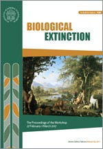
Tim Beach, Centennial Professor of Geography and Environment at UT Austin, presented an invited lecture on “Societal Collapses from the Maya to Mesopotamia and Beyond” at the Vatican in a workshop on Biological Extinction sponsored by the Pontifical Academy of Sciences and Pontifical Academy of Social Sciences. His talk included discussions of extinctions in soil ecology and used the lenses of soil and sediments to view and understand the complexity of cultural transitions from the Pleistocene to present, focusing on Maya history.  The workshop, held Feb. 27-Mar. 1, 2017, included world leaders in multiple fields from around the world. Learn more.

Farhana Sultana, associate professor of geography at the Maxwell School, presented at “The Human Right to Water” workshop, also hosted by the Pontifical Academy of Sciences, in Vatican City on Feb. 23-24, 2017. She was one of the several international researchers, humanitarian workers, government officials and corporate leaders invited to present and debate issues about water insecurity and ongoing global efforts to ensure access to clean water. Learn more.

    Share