GIS Career Mentorship with High School Juniors in Virginia

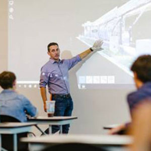
A Clark Nexsen Architecture & Engineering Firm employee instructs Grassfield High School (Virginia) studentsGeoMentor Volunteers: Clark Nexun Firm (Pravin Mathur, Kate Chaney, Jose Carvalho, Janet Webster, Gene Corbell)

Location: Chesapeak, Virginia

Grade level of participating students: 11th

Activity Theme/Focus: GIS Immersion

Number of Participants: 9

How did you connect with your collaborator? The initial partnership was introduced through an employee whose son attended the school. We have continued to partner with the school each summer.

Describe your collaboration process. There is an initial information night for the students where they can meet with representatives from different firms/companies. The students are then allowed to sign up for the company they are interested in. A colleague met with the Department Heads to see how much time they can commit to mentoring the students each summer. Then they let the teacher/school know how many students we can accept each summer.

Describe your tasks/involvement. Clark Nexsen is a multi-disciplinary firm — Architecture, Civil Engineering, GIS, Transportation, Bridges, Wireless and Interiors. Each summer, high school students enrolled in the STEM program are invited to our corporate office for a week of immersion. The STEM students meet for several hours with each department, to learn about how professionals in these fields do their day-to-day projects.

The GIS Department and the Wireless Department had the students for a two-hour span. We divided our GIS information into four sections:

  1. Basic Overview: What is GIS?, How many industries GIS supports, How GIS can be used to analyze data to solve problems, and How we use GIS at Clark Nexsen. Also, the components of GIS, a BASIC explanation of Map Projections, and images of GPS equipment. We then provide them with links to local colleges with Geospatial classes and programs with links to useful geospatial websites.
  2. Introduction Videos: This year we added videos from the ESRI Users Conference. 
  3. GIS related Apps that are fun to use: We showed how we use the what3words free app during our demonstration — mostly for fun and adventure/social activities in our off hours, but also to assist us in foreign countries where there is a language barrier. We also demonstrated ESRI StoryMaps and viewed a few public StoryMaps created by other users.
  4. Field Data Collection & Equipment Overview: A demonstration of some of our equipment we use in the field was presented — Leica Disto Laser Range finders for measuring building footprints (we let the students measure the room), the Trimble GPS units (more about this later) and the Tough Pads with Draft Site (a lite CAD program) and ArcGIS Desktop loaded. We were partnered with our Wireless Department and they demonstrated the Leica 360 Scanner and discussed the benefits of use and how the technology works.

We conveyed what makes the GPS equipment work, but also shared an example of how the equipment could be used to benefit our clients. Some examples covered were on the benefits of data produced by feature collection efforts and the sort of information one could assign to those points collected (attribution).  

Our overarching goals were to engage the students, open their awareness to GIS, and show how they are already interacting with GIS without even realizing it (navigational apps). Most of the students were focusing on Engineering studies. We showed them GIS and the science behind engineering and other market sectors. We explained how we solve complex questions through the analyzing of spatial data. Once in college, Clark Nexsen offers them to return to us for their internships during the summer months. Once graduated from college, some of our interns have returned to start their careers with us.

What did you gain from the experience? What do you think your educator collaborator and/or the students gained? Our GIS department gained a new perspective of how little the high school demographic is aware of GIS as a stand-alone technology field of study, how the Science of Where is at the forefront of so many industries, and how GIS plays a role in their daily lives.

We are hoping they gained a general understanding of GIS and how it can walk lock-step with the STEM industries they are interested in pursuing. We provided follow-up information on the colleges offering GIS programs and a sheet of helpful weblinks to Geospatial websites.

    Share

Frank A. Friedman

Frank A. Friedman, a member of AAG since 1959, died at his home in Robesonia, Pennsylvania, on May 30, 2020. He was 81.

Friedman was a graduate of Liberty High School, in his hometown of Bethlehem, and earned his Bachelor of Science in Education from Kutztown State College in 1960. He earned a Master of Education in Geography from Penn State University in 1965, and a Master of Science from Drexel University in 1980. He was a longtime geography teacher in the Conrad Weiser School District in Pennsylvania. He is survived by his sister, Marie A. Friedman.

    Share

Ronald Johnston

Ron Johnston, a human geographer who helped shape the discipline and was a winner of a Lifetime Achievement Award from AAG, died on May 29, 2020 at the age of 79. A prolific author and co-author of more than 1,000 publications, including 50 books and 800 articles, he specialized  in quantitative and political geography, but also ranged widely in urban and social issues, electoral geographies, and the history of geography.

During his career, Johnston was appointed an officer of the Order of the British Empire for services to scholarship in 2011, He also received the Murchison Award and Victoria Medal from the Royal Geographical Society, and the Prix Vautrin Lud at the International Geography Festival 1999.

Born in 1941, Johnston grew up in Swindon. He attributed his love of geography to studying maps during childhood. Educated at Commonweal School, Swindon, in 1959 he went to study Geography at the University of Manchester, and earned a PhD from Monash University in Melbourne, Australia. He returned to Great Britain in 1974, where he served as a chair and eventually Pro-Vice Chancellor at the University of Sheffield for 18 years, He subsequently moved to Essex as Vice Chancellor, then joined Bristol’s School of Geographical Sciences  in 1995.

Of Johnston’s many books, two– the Dictionary of Human Geography and Geography and Geographers – stand out for scores of undergraduate geographers: the latter (jointly authored) is in its seventh edition. Ron’s work on the British electoral system was interdisciplinary long before such research became popular.He advised all three main political parties, civil servants, House of Commons’ Select Committees and the Boundary Commission.

Johnston is survived by his wife Rita, two children, Christopher and Lucy, and by his grandchildren and great grandchildren.

    Share

Stephen Ladochy

Education: Ph.D. in Geography (University of Manitoba), M.S. in Atmospheric Sciences (Colorado State University), B.A. in Meteorology (University of California, Los Angeles)

Describe your job. What are some of the most important tasks or duties for which you are responsible?
Besides teaching classes in physical geography, meteorology and climatology, I mentor graduate students in their research and Masters’ theses.  I also write several letters of recommendation for students seeking jobs, graduate schools and research opportunities.  I continue collaborating with other scientists on climate research and occasionally answer requests from media on environmental stories.

What attracted you to this career path?
I always liked math, and found that it could be applied in meteorology.  At UCLA I interned at the National Weather Service as well as at air pollution consultants. While working at the L.A. County Air Pollution Control District, someone showed me information on “Jobs in Geography”, where you could teach weather courses at universities.  I was hired by the University of Winnipeg in the Great White North teaching weather and later climatology and environmental courses.  I enjoyed teaching, so went on to a Ph.D. in geography/climatology.

How has your education/background in geography prepared you for this position? Most of my education was in Atmospheric Sciences, so I had a lot of prep work to teach geography courses.  I found my niche and passion in meteorology and climatology and have been studying them since.

What geographic skills and information do you use most often in your work? What general skills and information do you use most often?
I like to show satellite images in my classes and the latest climatic data, such as from NASA. So using remote sensing, weather maps and oceanic conditions (being on the coast), I use statistics and recent environmental data in my classes and research.  Mostly, I’m looking at ENSO-Pacific Ocean Indices, weather maps and satellites and climate data to follow climate change.  We also have field instruments so my classes can measure surface weather data in different land uses in urban settings.

Are there any skills or information you need for your work that you did not obtain through your academic training? If so, how/where did you obtain them?
I was fortunate to have summer employment at the Jet Propulsion Laboratory, NASA. There I collaborated with oceanography scientists and student interns on several climate-related projects.  My boss there was a wonderful science communicator, so I learned a lot from him that carried into classrooms and media interviews.

Do you participate in hiring, screening, or training of new employees? If so, what qualities and/or skills do you look for?
I was just on two search committees for new hires. We looked for someone who would be a good instructor with our students, many of whom had English as a second language and were working while in school. We also looked for good mentors for these students, who could relate and encourage high achievement.  Scholarships were also important where they could lead student research

What advice would you give to someone interested in a job like yours?
You need to have a passion for your work and for helping students. That makes the hard work actually fun and something you look forward to doing.  We have special students that work hard and often reach their goals. You need to be a good mentor and inspiration to your students.  Your enthusiasm for your subjects will rub off.

What is the occupational outlook for career opportunities in your field/organization, esp. for geographers?
Our graduates have been fairly successful in finding employment in geography and related environmental fields.  Having skills in computer programming, GIS and remote sensing training or certificates, statistics and the sciences are all helpful.  Internships or summer help in companies or government agencies can often lead to more permanent employment.

    Share

David Hornbeck

On Earth Day, 2020, COVID-19 claimed the life of Dr. David Hornbeck, Professor Emeritus, Department of Geography, California State University, Northridge. David led a full and productive life, ranging from two hitches in the Air Force from 1958 to 1966, earning his B.A. and M.A. in geography at what is now called California State University, Fresno (1968 and 1969, respectively) and his Ph.D. at the University of Nebraska, Lincoln, in 1972. In 1972, he began his career in the Department of Geography at San Fernando Valley State College, now California State University, Northridge. He retired in 2009.

Dominating the majority of his work, David’s passion was historical geography, especially of California during the mission and rancho periods and during the early establishment of the American agricultural and urban landscapes on the underlying Native Californian, Spanish, and Mexican cultural landscapes. He had a particular interest in the impacts of Spanish colonial expansion on the Native Californians and their fate in the mission system, meticulously reconstructing their demographics through mission archives in California and Mexico. He worked out the details of the economics of the mission, pueblo, and presidio systems in the context of the global trade and politics of the day. He was fascinated by the privatization of lands in California by the newly independent Mexico, which eventually led to the expropriation of the mission holdings to support that purpose. Privatization required petitioners for a land grant to map their proposed properties, submitting diseños as part of the petition. These petitions and diseños became part of the process by which Mexican ranchero families defended their claims to the American Board of Land Commissioners after 1848 (79% of them successfully, though the legal expenses typically led to sale or subdivision of the adjudicated holdings). David was interested also in the development of the distinctive California agricultural system and how the California urban system still bears the marks of the preceding Spanish and Mexican settlement systems. David loved the intense archival work historical geography required and, indeed, built up quite a collection of original materials that now comprise the Hornbeck Collection at the Monterey County Historical Society.

A second compelling interest David pursued was business GIS. His earliest work in this area was in grant and contract work in business location analysis and market area analysis, first for restaurants and then for banks. By 1984, he had begun to build and license fieldwork-based GIS systems for banks’ branch analysis, market area analysis, network analysis, and merger and acquisition needs. The LandBank GIS became so popular with major banks across the country that David and his wife, Ginny, founded Area Location Systems, Inc., to develop, market, and service it and train bank staff in its use. As a result of this work, banks became among the first corporations truly to understand what it was geographers do and to seek out geographers for their own marketing and IT staffs! David and Ginny eventually sold their shares in the company by the late-1990s, Ginny moving into special education and David continuing to do consulting and workshops for the banking industry, law firms, and water agencies until he entered the Faculty Early Retirement Program in 2002.

As a university faculty member, David devoted a lot of his time and energy to his students, many of whom remembered him fondly as a vivid and caring character and remained in contact with him long after their graduations. Indeed, the root of his interest in applied economic geography and business GIS was originally his desire to help his students develop rewarding careers using their geographic education. He served as the career advisor in his department and organized sixteen annual jobs symposia for geography students. Some of his publications were explicitly devoted to geographic education and to how faculty could cultivate both applied and academic dimensions in their work to mentor their students.  Many of the “Hornbeck School of Thought” (or “Hornbeck University of Geography”) went on for Ph.D.s themselves or entered highly successful careers in banking, environmental consulting, information technology companies, education, or government. Typical of David was an insight he shared shortly before retiring. He noted that academics often deeply enjoy teaching and mentoring the “A list” students who will go on to graduate school but sometimes tend to overlook the C students in the middle of the class curve. Many of these kids are much brighter than their GPAs suggest but are either too overworked, engulfed in personal problems, or immature to do well while they are students. But they are still taking it all in and, then, he said, they “grow into their educations” a few years later. Their geographic education all comes together for them in the context of their careers, which then take off. He commented that it’s the “C” students who seem to go on into six figure salaries and highly placed jobs, not the “A” students who go on to graduate school and academic penury!

David’s tragic encounter with COVID-19 leaves behind a large cadre of students, colleagues, business associates, and friends who mourn his loss and wish to comfort his wife of forty years, Ginny; his siblings, Arlene Suart (Sutter Creek, CA) and Claro Cabading (Honolulu); his sons, David, Christopher, and Brian; his grandchildren, Ashton, Vincent, and Robin. A webpage commemorating his life has been set up where there are links to his curriculum vitae, the Hornbeck Collection, his retirement “roast” materials, and examples from David’s little known pastime, flower photography.  A full obituary will also be posted there.

Donations will be gratefully received to support the Monterey County Historical Society that physically houses his collection (https://mchsmuseum.com/salinas/). Many thanks to Mr. Patrick J. “Mike” Maloney and Ms. Miriam Infinger, Research Associate, of the Law Offices of Patrick J. Maloney (Alameda, CA); Mr. James Perry of the MCHS; and Dr. Rubén G. Mendoza, Chair of the Department of Social, Behavioral, and Global Studies, and Ms. Jennifer A. Lucico, M.A., Lecturer, Department of Social, Behavioral, and Global Studies, California State University, Monterey Bay, for their years of work getting this collection assessed and physically moved to the Museum, for creating its digital portal, and for getting it all catalogued on WorldCat.

Very sadly yours,

Chrys Rodrigue
Dave’s second graduate student and friend of 48 years

    Share

James R. McDonald

James R McDonald, Professor in the Geography Department of Eastern Michigan University from 1965 to 2000, passed away on April 20, 2020.

Jim was born in San Francisco on the 28th of January 1934 and graduated from Katonah High School, New York in 1951. Jim graduated from Antioch College in 1955 with a Bachelor’s Degree in Geography and received a Master’s Degree in Geography from the University of Illinois the following year. He then enlisted in the Army for three years and was assigned to the Counter-Intelligence Corps where he learned French in the Army Language School in Monterey before being assigned to La Rochelle, France, where he spent almost two years. Upon his return to civilian life, he returned to Illinois and completed his doctoral research on the French region of Brittany in 1964. Prior to accepting the position at EMU, Jim was an Assistant Professor at UCLA for two years.

Jim was the recipient of a National Science Foundation (NSF) Postdoctoral, an NSF Fellowship and other awards and grants including National Geographic Society Research Grants; Michigan Department of Natural Resources Grants; and Social Science Research Council Grants. Jim was a proud member of the AAG for over 50 years.

Jim specialized in the cultural, political, and economic geography of Western Europe, especially France; the geography of rural-to-urban and labor migrations; geographical aspects of environmental assessment and preservation; geography of travel and tourism; and the history of geographic ideas.  Jim authored two books, numerous professional papers and book reviews.

    Share

Ezekiel Kalipeni

The AAG community is mourning the loss of Dr. Ezekiel Kalipeni, a longtime geography professor who died in the early hours of April 11, 2020 from heart-related complications while he was in his native country, Malawi at age 66. Dr. Kalipeni globally renowned for his work around medical geography, population and environment, and international development focusing on Africa retired from an illustrious academic career in the Department of Geography & Geographic Information Science at the University of Illinois (Urbana-Champaign) in June 2019. Dr. Kalipeni was a prolific scholar of human geographer, a great teacher and mentor, a philanthropist, a world traveler, a devoted husband, and loving father.

Dr. Kalipeni earned his Bachelor of Social Science degree (with distinction) at the University of Malawi (1979), and masters (1982) and Ph.D. (1986) degrees in geography at the University of North Carolina at Chapel Hill. Although he admitted that his original career plans lay elsewhere, and that he came to geography “by chance,” he was an outstanding scholar and gifted teacher, highly respected by his colleagues and committed to his students. His distinguished academic and public intellectual career spanned nearly four decades having worked at the University of Malawi (1986-88), the University of North Carolina at Chapel Hill (1988-91), Colgate University (New York, 1991-94), and the University of Illinois at Urbana-Champaign (1994-2019). During his career, he published 16 books and over 170 peer reviewed articles, book and encyclopedia chapters. Dr. Kalipeni’s work is widely acknowledged in citations from these and other published works, at many conferences, symposia and workshops, as well as in policy circles in Africa and other developing countries.

He earned international reputation for his seminal work on spatial analysis and mapping of the HIV/AIDs epidemic in Africa and in advancing understanding of the complex underlying drivers. Dr. Kalipeni devoted many years to field research in southern Africa to examine the demographic, economic, cultural, political, economic, socio-institutional and geographic factors that shape the spatial and temporal spread of HIV and other health challenges. His work on issues of health disparities, population and natural resources management, and development in Sub-Saharan Africa with a focus on southern Africa is also widely recognized. In 2014, the American Association of Geographers (AAG) Africa Specialty Group honored Dr. Kalipeni with the Kwado-Konadu-Agyemang Distinguished Scholar in African Geography Award.

During his career, Dr. Kalipeni provided significant leadership and service to the scholarly and scientific community. He served as interim Director of the Center of African Studies 2001-2002 at the University of Illinois. and as Program Director of the National Science Foundation’s Spatial Sciences Program (2009-2011). Some scholars have remarked how helpful he was as a Program Director at NSF, going well beyond the call of duty. He is also credited as the sole editor of the African Geographical Review for several years at a critical transitional time in the journal’s development. It is now a thriving journal published by Taylor & Francis in association with the Africa Specialty Group of the AAG (one of three journals published by the AAG). This journal has become a critical outlet for geographic scholarship on Africa for geographers and scholars from related disciplines in the USA, Africa and other parts of the world. Within the AAG he chaired the West Lakes Division and the Africa Specialty Group, was on the Board for the Medical Geography Group and was an active member in the Population Specialty Group. He was also the consummate collaborator, team player and leader, and collaborated with so many colleagues with geography and related fields within and outside the USA.

Fondly known as “Dr. Zeke” among his students and close colleagues, he stood out for his selfless and untiring support and mentoring for students and upcoming scholars, particularly those of African extraction. Many of the students he has trained over the past four decades have built successful careers in academia, the public and private sector in the US, Malawi and other parts of Africa. Former students and junior scholars within the AAG Africa Specialty Group—including ones from other disciplines—attest not only to his mentorship but also active support through research collaborations and co-publishing with many. Many upcoming scholars have credited him for some of their career success. Dr Zeke never forgot his first alma mater, where he also launched his academic career.  Dr. Kalipeni cultivated and sustained strong research and mentoring relationships with the university, and after  retiring, he donated and shipped his 1,700-volume personal library to the Department of Geography and Earth Sciences, University of Malawi.

As a teacher, Dr. Kalipeni took joy in teaching large classes of undergraduate students, including Global Development & Environment, and Cities of the World, and others including population geography and Geography of Sub-Saharan Africa. He made his courses exciting and students liked his sense of humor, preparedness, and for inculcating critical thinking among students. He inspired graduate students and published with most of them, building a bridge for their future careers. He was particularly helpful to international students, helping them to navigate the US education system, and going beyond to providing temporary housing at his house if they were stranded.

Despite his prolific academic career, Dr. Kalipeni maintained some balance with family life. His wife, Fatima, and grown children Josephine, Jackie, Juliana, Jacob, Joshua, Natalia and Melissa, remember him as a loving and proud husband and father, a jovial storyteller with a ‘wicked’ sense of humor, a generous giver, and a motivator who taught them the value of hard work. Together with his family, he established the Kalipeni Foundation to support local development projects in Malawi’s southern district of Mulanje, including on education, safe water supply, environmental management and  livelihood support. His family will carry on his legacy through this foundation and in living the many lessons he taught them.

He will be missed dearly by colleagues, family, and friends but his legacy and works will live on.

Fare you well, Dr. Zeke

May his soul rest in eternal peace.

    Share

Jessica Perkins – GIS and Technical Support Program Manager, West Virginia

A Clark Nexsen Architecture & Engineering Firm employee instructs Grassfield High School (Virginia) studentsGeoMentor Volunteers: Clark Nexun Firm (Pravin Mathur, Kate Chaney, Jose Carvalho, Janet Webster, Gene Corbell)

Location: Chesapeak, Virginia

Grade level of participating students: 11th

Activity Theme/Focus: GIS Immersion

Number of Participants: 9

How did you connect with your collaborator? The initial partnership was introduced through an employee whose son attended the school. We have continued to partner with the school each summer.

Describe your collaboration process. There is an initial information night for the students where they can meet with representatives from different firms/companies. The students are then allowed to sign up for the company they are interested in. A colleague met with the Department Heads to see how much time they can commit to mentoring the students each summer. Then they let the teacher/school know how many students we can accept each summer.

Describe your tasks/involvement. Clark Nexsen is a multi-disciplinary firm — Architecture, Civil Engineering, GIS, Transportation, Bridges, Wireless and Interiors. Each summer, high school students enrolled in the STEM program are invited to our corporate office for a week of immersion. The STEM students meet for several hours with each department, to learn about how professionals in these fields do their day-to-day projects.

The GIS Department and the Wireless Department had the students for a two-hour span. We divided our GIS information into four sections:

  1. Basic Overview: What is GIS?, How many industries GIS supports, How GIS can be used to analyze data to solve problems, and How we use GIS at Clark Nexsen. Also, the components of GIS, a BASIC explanation of Map Projections, and images of GPS equipment. We then provide them with links to local colleges with Geospatial classes and programs with links to useful geospatial websites.
  2. Introduction Videos: This year we added videos from the ESRI Users Conference. 
  3. GIS related Apps that are fun to use: We showed how we use the what3words free app during our demonstration — mostly for fun and adventure/social activities in our off hours, but also to assist us in foreign countries where there is a language barrier. We also demonstrated ESRI StoryMaps and viewed a few public StoryMaps created by other users.
  4. Field Data Collection & Equipment Overview: A demonstration of some of our equipment we use in the field was presented — Leica Disto Laser Range finders for measuring building footprints (we let the students measure the room), the Trimble GPS units (more about this later) and the Tough Pads with Draft Site (a lite CAD program) and ArcGIS Desktop loaded. We were partnered with our Wireless Department and they demonstrated the Leica 360 Scanner and discussed the benefits of use and how the technology works.

We conveyed what makes the GPS equipment work, but also shared an example of how the equipment could be used to benefit our clients. Some examples covered were on the benefits of data produced by feature collection efforts and the sort of information one could assign to those points collected (attribution).  

Our overarching goals were to engage the students, open their awareness to GIS, and show how they are already interacting with GIS without even realizing it (navigational apps). Most of the students were focusing on Engineering studies. We showed them GIS and the science behind engineering and other market sectors. We explained how we solve complex questions through the analyzing of spatial data. Once in college, Clark Nexsen offers them to return to us for their internships during the summer months. Once graduated from college, some of our interns have returned to start their careers with us.

What did you gain from the experience? What do you think your educator collaborator and/or the students gained? Our GIS department gained a new perspective of how little the high school demographic is aware of GIS as a stand-alone technology field of study, how the Science of Where is at the forefront of so many industries, and how GIS plays a role in their daily lives.

We are hoping they gained a general understanding of GIS and how it can walk lock-step with the STEM industries they are interested in pursuing. We provided follow-up information on the colleges offering GIS programs and a sheet of helpful weblinks to Geospatial websites.

    Share

Patricia Syvrud

Education: M.B.A. (University of Southern California), B.S. in Business Administration (University of New Hampshire), Graduate Gemologist (G.G.) designation (Gemological Institute of America), coursework in Physical Geology, Mineralogy and Optical Mineralogy (University of Sao Paulo, Brazil)

Describe your job. What are some of the most important tasks or duties for which you are responsible?
I oversee the marketing, promotion and management of new programs within the University of Delaware’s Department of Geography: the new B.S. in GIScience and Environmental Data Analytics, the GIScience graduate certificate,  and  the new Minerals, Materials and Society (MMS) program including the MMS graduate certificate. In addition to fundraising for research, sourcing graduate internships, program promotion and managing the administration of the MMS graduate certificate program, I also oversee the development of the Jewelry Development Impact Index, a socio-economic index for the jewelry trade.

What attracted you to this career path?
Even though the entirety of my working career prior to UD has been in the jewelry industry, I have always been attracted to education and academia.  My passion lies with responsible sourcing and responsible minerals trade and addressing the issues surrounding the most vulnerable part of the extractives supply chain, artisanal and small-scale miners (ASM). Applying location-specific GIScience and understanding supply chain risk are robust tools for making a positive impact on the ASM sector.

How has your education/background in geography prepared you for this position?
Arriving in academia and specifically in geography and responsible sourcing has been a culmination of many years’ effort, education and experience. Although my education is in business, physical geology, mineralogy and gemology, geography-specific knowledge and awareness has had a huge impact on the work I’m currently involved in, including as a member of the Board of Directors of the U.S. Kimberley Process Authority (USKPA: https://www.uskpa.org/) and the Governance Committee of the Public Private Alliance for Responsible Minerals Trade (PPA: https://www.resolve.ngo/site-ppa/default.htm)

What geographic skills and information do you use most often in your work? What general skills and information do you use most often?
Given the many blockchain initiatives in the responsible minerals and jewelry trade, skill in and understanding how to harness location-specific data is particularly important in enhancing the transparency and sustainability of extractive supply chains.

Given the varied tasks involved with my position at UD, my skills in project/program management and oversight are utilized daily. As a marketer for the programs, my ease and skill as a public speaker and networker, and ability to work with others are also called upon regularly.

Are there any skills or information you need for your work that you did not obtain through your academic training? If so, how/where did you obtain them?
My most valuable skill NOT obtained through academic training is public speaking.  A certain part of this is inherent in my DNA, i.e., not having a fear of speaking in front of small and large groups, and the rest is practice and experience.

What advice would you give to someone interested in a job like yours?
Follow your passion and think outside the box. If you can’t find a job in your area of interest, don’t be afraid to volunteer your time which can lead to employment opportunities.

What is the occupational outlook for career opportunities in your field/organization, esp. for geographers?
The US Department of Labor’s Bureau of Labor Statistics predicts 15 percent growth in the need for geographic information specialists between 2018 and 2028, much faster than the average for all occupations.

    Share

Robert A. Muller

Robert A. Muller, a 2003 AAG honoree for Lifetime Achievement in climatology, died on March 12, 2020 in Baton Rouge. He was 91 years old. A graduate of Lyndhurst High School in 1945, Bob worked as a printer adjacent to the Brooklyn Bridge in Lower Manhattan for seven years, and served in the US Army in Germany during the Korean War. He graduated in geography from Rutgers University in 1958, earning an MS and PhD in physical geography and climatology at Syracuse University in 1962.

During his career, Muller served with the U.S. Forest Service and the University of California at Berkeley in a joint position, as well as and served as an associate professor at Rutgers University. He joined the Department of Geography and Anthropology faculty as a climatologist at Louisiana State University in 1969. He reestablished the position of State Climatologist and initiated the Office of State Climatology. With federal funding he founded the Southern Regional Climate Center, which he directed for six years before retirement. Muller’s research applied water-budget climatology models to floods and droughts, for the pioneering development of synoptic climatology in Louisiana. With his colleague Barry Keim, he studied the geography and history of tropical storm and hurricane strikes along the Atlantic Coast from Maine to the Yucatan.

Muller is survived by his wife, Beate “Sonni” Eckenbach-Fiedel Muller; a daughter and son-in-law, Lisa and Justin Bourgeois and two grandchildren, Ashton Leigh and Myles Patrick; a son John Henry Muller; and a brother, Jim Muller. He was preceded in death by his first wife, Jeanne Underhill Muller, and his parents, Albert and Helen Muller, and a sister, Jean Marshall.

    Share