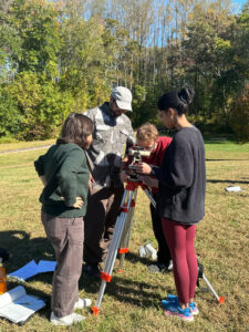
2026 AAG Communities Awards

Each year, our Communities—Regional Divisions, Specialty Groups, Affinity Groups, and Communities of Practice, lead the nomination and selection of awards that recognize outstanding members. This communities‑driven approach reflects the values, priorities, and expertise of those closest to the work. These awards support the mission of each community and honor scholars for their meaningful contributions within their specialty, affinity, or region. In doing so, they celebrate excellence, elevate peer‑recognized leadership, and advance the collective work of our community members. Below are this year’s award recipients for each community.
Regional Divisions
Association of Pacific Coast Geographers (APCG)
AAG Council Outstanding Student Paper Award, Graduate, Caitlyn Linehan, UC Santa Barbara, Who Gains, Who Loses? Equity Impacts of Park Closures and Open Streets
East Lakes Regional Division (ELDAAG)
AAG Council Outstanding Student Paper Award, Undergraduate, Margarete Brady, Grand Rapids Community College
AAG Council Outstanding Student Paper Award, Graduate, Theodora Mary Fletcher, University of Toledo
Student Poster/Presentation Award
- Anthony Randall Poynter
- Benjamin Britton
- Cyenna Ulrich-Cech
- Elizabeth Blakley-White
- Harrison Frenken
- Jennie Golaszewski
- Margarete Brady
- Tuhin Chowdhury
- Michelle Medved
- Oluwadamilola Salau
- Peter Berdo
- Ruija Hu
- Sage Lail
- Sara Conner
- Theodora Mary Fletcher
Great Plains Rocky Mountains Regional Division (GPRM)
AAG Council Outstanding Student Paper Award, Graduate, Stephen Adebisi, South Dakota State University, Do Self-Restored Peatlands Stabilize Soil Organic Carbon? An Enzyme Assay Approach to Evaluating Carbon Stability at the Marcell Experimental Forest, Minnesota, USA
Middle Atlantic Regional Division (MAD)
MAD-AAG Advancing Geography Meritorious Award (MAGMA), Maya Clark, Towson University, Urban Canopy Equity: Assessing Socioeconomic Disparities in Tree Cover and Quantifying Urban Forest Changes in Baltimore
AAG Council Outstanding Student Paper Award, Graduate
- Max Gundling, Salisbury University, The Fractured Metropolis: Gentrification, Exclusion, and Spatial Inequality in the Washington-Baltimore Corridor
- Haijun Li, University of Maryland – College Park, Agricultural expansion and intensification in Brazil: A literature synthesis of dynamics, drivers, and implications
Middle States Regional Division (MSAAG)
AAG Council Outstanding Student Paper Award, Undergraduate, Valerie Davidheiser, Kutztown University, The Influence of climate change on dew point temperatures in Pennsylvania
AAG Council Outstanding Student Paper Award, Graduate, Naznin Nahar Sultana, University of Delaware, Post-Displacement Adaptation Practices of Internally Displaced People: Reproduction of Vulnerability in Urban Informal Space
Undergraduate Student Paper Competition
- Winner – Valerie Davidheiser
- 2nd place – Padmini (Raven) Vijayakumar
Graduate Student Paper Competition
- Winner – Naznin Nahar Sultana
- 2nd place – Caitlyn Linehan
Graduate Student Poster Competition
- Winner – Kripa Shrestha
- 2nd place (tie) – Arafat Hassan & Hilda Afelu-Amenyo
New England / St. Lawrence Valley Regional Division (NESTVAL)
AAG Council Outstanding Student Paper Award, Undergraduate, Delaney Gardner, Mount Holyoke College, Coastal Resilience Planning and Policy in Florida
AAG Council Outstanding Student Paper Award, Graduate, Gianna Dejoy, University of Maine, Reconceiving rural distance: Mothers’ narratives of health resource loss and access to maternity care in Maine
Southeast Regional Division (SEDAAG)
AAG Council Outstanding Student Paper Award, Graduate, Nicko Tovar, University of North Carolina – Greensboro, Variation in Bus Transit Infrastructure Provision, Ridership, and Equity: Evidence from North Carolina
Southwest Regional Division (SWAAG)
AAG Council Outstanding Student Paper Award, Undergraduate, Carolina Cambron & Katie Dusek, Texas State University, For Peat’s Sake? An Environmental Geography Analysis of Peatland Carbon Markets in Scotland
AAG Council Outstanding Student Paper Award, Graduate, Adriana Montoya, Texas State University, Rectifying a River: A Critical Case Study of Engineering Control on the Rio Grande in El Paso, Texas
Undergraduate Student Paper Competition, Katie Dusek and Caroline Cambron (co-authors)
Graduate Student Paper Competition
- Winner – Katelyn Cooke
- 2nd place – Brock Burford
- 3rd place – Elizabeth Kubacki
Undergraduate Student Poster Competition
- Winner – Jaydon Allison
- 2nd place – Helen Wagner
Graduate Student Poster Competition
- Ashok Gahatraj
- Sahar Rezaei
World Geography Bowl Scoring Leaders
- Winner – Jaydon Allison
- 2nd place – Hardt Bergmann
- 3rd place (tie) – Brock Burford, Raynee Bacorn
West Lakes Regional Division (WLDAAG)
AAG Council Outstanding Student Paper Award, Undergraduate, Jake Plasky, Depaul University
AAG Council Outstanding Student Paper Award, Graduate, Kei Kato, University of Illinois
Undergraduate Student Paper Competition
- Winner – Joshua Elliot
- 2nd place – Grant Kerpsack
- 3rd place – Evan Frawley & Marko Nikolovski
Master’s Student Paper Competition
- Winner – Thea Brenner
- 2nd place – Isaac Eshun & Brianna Sas-Perez
- 3rd place – Derek Asiamah
PhD Student Paper Competition
- Winner – Christine Dennis & Hilary Hunt
- 2nd place – Gyudae Kim
Undergraduate Student Poster Competition
- Winner – Jared Saef
- 2nd place – Ellie Strand
- 3rd place – Rachel Loftus
Graduate Student Poster Competition
- Winner – Md Saqib Shahriar
- 2nd place – Harriet Quarshie
- 3rd place – Yiming Zhang
Groups
Africa Specialty Group
Distinguished Emerging Scholar Award in African Geography, Elmond Bandauko, University of Alberta.
Graduate Research Award, Stephanie Efua Yamoah, University of Denver
Kwadwo Konadu-Agyemang Distinguished Scholar Award in African Geography, Timothy D. Baird, Virginia Tech.
Animal Geographies Specialty Group
Graduate Student Research Competition
- Winner – Xiaoyun Neo, University of Hawaiʻi at Mānoa
- 2nd place – Sara Toroi
- Honorable Mention – Aberdeen Leary, University of Michigan
- Honorable Mention – David Kalman, University of California, Berkeley
Applied Geography Specialty Group
James R. Anderson Medal of Honor in Applied Geography, Frank Southworth
Student Annual Meeting Award
- Audrey Smith, University of Florida, Landsat to Livelihoods: Social–Ecological Costs of Large-Scale Land Acquisitions in Ethiopia
- Jason Yoo, Geospatial Mismatch between Social Vulnerability and BMP Co-benefits from Chesapeake Bay Watershed Management
- Kristina Fillman, Compounding Injustices: A Political Ecology of Wildfire Smoke, Extreme Heat, and Child Health
- Wenjing Gong, Texas A&M University, Essential Infrastructure or Unavoidable Risk? Modeling Urban Park Visitation under Dual Climate and Crime Stressors with Large-Scale Mobility Data
- Zongrong Li, Texas A&M University, Seeing Green from Indoor in 3D: How Urban Form and Vegetation Shape Window-Level Views of Nature
Asian Geography Specialty Group
Graduate Student Research Fellowship, Sufeng (Sophia) Xiao, Harvard University
AAG Group Keynote Speaker, Miles Kenney-Lazar, University of Melbourne, Sustainability Capitalism in the Age of Extractivism: Southeast Asian Trajectories
Graduate Student Paper Competition
- Dri Tattersfield, University of Minnesota
- Sufeng (Sophia) Xiao, Harvard University
Bible Geography Specialty Group
Amy Mather BGSG Student Scholar Award, Priyadharshini Sakthivel, The importance of topography and urban-rural definition in identifying Surface Urban Heat Islands in semi-arid environments: Case study of Amman, Jordan
Jonathan Lu BGSG Student Travel Enhancement Award, Brody Manquen, The University of Texas at Austin, Reclaiming the Locus Amoenus: historical narrative of post-Roman inundation in early modern Italian wetland drainages
Biogeography Specialty Group
Research Grant, Ph.D. level, Elizabeth Barnes, University of Tennessee, Environmental History and the Megafauna Extinction in Costa Rica
Student Paper Award, Doctoral Category, Wenxin Yang, UCSB, Measuring and monitoring the three-dimensional structure of terrestrial habitats to support biodiversity conservation
Travel grant for AAG meeting attendance, Cole Bristow, Virginia Tech
Black Geographies Specialty Group
Student Travel Award, Sabina Bhandari, University of Connecticut
Clyde Woods Graduate Student Paper Award, Alexis Wiley, Rutgers University – New Brunswick, Plotting Black Agrarian Geographies during the American Agrarian Transition, 1865-1970
Plenary Speaker, Danielle Purifoy, The University of North Carolina at Chapel Hill
AAG Group Keynote Speaker, Elena Serrano
Caribbean Geography Specialty Group
AAG Group Keynote Speaker, Kevon Rhiney
Cartography and Mapping Specialty Group
AAG Group Keynote Speaker, Meghan Kelly, Syracuse University, Boundaries, Placing Feminist Mapping
Master’s Thesis Research Grant
- Abby Whelan, Syracuse University, Data Visualization as a Site of Oppression: What are Maternal Health Dashboards
- Ashwin Adhip Acharya, University of Mumbai, GeoAI-Driven Physics-Guided Ensemble Modelling of Urban Flood Susceptibility under CMIP6 Climate Scenarios in the Mula–Mutha Basin, Maharashtra, India
- Sarah Haedrich, University of Oregon, Cartographies of the Renewable Energy Development: A Critical Analysis of Stakeholder Maps in British Columbia
Student-Organized Session Funding
- Fangsheng Zhou
- Gareth Baldrica-Franklin
- Lily Houtman, The Pennsylvania State University
- Yanbing Chen, Mapping Your Career Path: Mentoring Across Cartographic Trajectories
- Zhaoxu Sui
- Zongrong Li, Texas A&M University
China Geography Specialty Group
Best Student Paper Award, Shize Zhang, The everyday political economy of local governance in China: Bridging relational and territorial thinking
Student Travel Award, Vinci Ying Jia Cheung, The University of Hong Kong, Digital divide or digital dividend? The growth of a digital economy and changes in urban-rural inequality in China
AAG Group Keynote Speaker, Xueguang Zhou, Stanford University, Scale and the Logic of Governance in China
Climate Specialty Group
Paper of the Year Award, Shaina Sadai, Antarctic meltwater alters future projections of climate and sea level
AAG Group Keynote Speaker, Zeke Hausfather, Berkeley Earth, The role of aerosol declines in recent warming acceleration
Student Paper Competition
- Winner – Nishat Tasnim Sumaya, Assessing Climate Trends in Bangladesh Using the Spatial Synoptic Classification
- 2nd place – Afra Sayara Rahman, Whispers in the Wind: Oklahoma Women’s Narratives of Climate Migration Choices and Survival During the Dust Bowl
- 3rd place – Yayun Lin, Atlantic Tropical Cyclone Intensity and Aerosols: A Multiscale Analysis
Coastal and Marine Specialty Group
R.J. Russell Award, Ian Walker, University of California Santa Barbara, Coastal dune restoration as a nature-based solution to improve resilience of California’s beaches to sea level rise
The Norbert Psuty Student Paper Competition
- Winner – Holland Haverkamp, University of Maine, Tidal Infrastructures and Hydrosocial Frictions: Offshore Wind Port Development and Water Justice in Coastal Maine
- 2nd place – Yu-Chia Lin, State University of New York at Buffalo, The blame geography: ocean governance, governmentality, and fishery management on the High Seas
Community College Affinity Group
Darrel Hess Community College Geography Scholarship, Erin Dickey
Critical Islands, Archipelagos, and Oceans Specialty Group
AAG Group Keynote Speaker, Sofia Zaragocin, University of Illinois Urbana-Champaign, There Are People Too in the Galápagos! A Latin American Decolonial Feminist Perspective on Conservation in the Galápagos Islands
Critical Geographies of Education Specialty Group
Critical Geographies of Education MA Dissertation Award, Jessica Flach, Between Florida and the World: Young People and the Politics of Citizenship
Critical Geographies of Education PhD Dissertation Award, Caroline Loomis, CUNY Graduate Center, Proximity and Partition: Geographies of Childhood, Choice, and Co-Location in New York City
AAG Group Keynote Speaker, Susan Thomas, Syracuse University
Cryosphere Specialty Group
R.S. Tarr Student Travel Award
- Sepideh Jalayer, University of Colorado Boulder
- Zhengrui Huang
Cultural and Political Ecology Specialty Group
Field Study Award, Thao Nguyen, The University of British Columbia, Sustainability Initiatives to De-Risk the Natural Rubber Supply Chain in the Mekong region
Outstanding Book Award, Youjin Chung, University of California, Berkeley,
Outstanding Journal Article, Nathan Green, National University of Singapore, Maximizing Finance for Sustainable Development
Student Paper Award, Ana Lucía Araujo Raurau, The Political Economy of Belonging: Transgender Insights in Ethnographic Fieldwork in Rural Societies
AAG Group Keynote Speaker, Susanna Hecht, University of California – Los Angeles, Not all anthropocenes are the same: Political ecologies and what they can tell us about the myth of 1.5, and the adaptation complexities of a heating planet
Elsevier Geoforum Community Support Travel Award, Thuy Ho, Indiana University
Scholar-Activist Award
- Jesús Alejandro García, UC Berkeley, Escuela de Agua: Building Popular Water Knowledge, Territorialities, and Governance in the Colombian Massif
- Juan Carlos Jimenez, University of Toronto, Communal Care, Young Adult Rural Livelihoods, and Historic Trauma of War and Agrarian Exits: Towards a Political Ecology of Healing in Chalatenango, El Salvador
Cultural Geography Specialty Group
Denis E. Cosgrove (Ph.D.) Research Grant, Zachary Cudney, University of Washington
Master’s Level Research Award, Samuel Scarborough
AAG Group Keynote Speaker, Rebecca Solnit
Elsevier’s Geoforum Community Support Travel Award, Brian Boyce, University of Tennessee
Cyberinfrastructure Specialty Group
Robert Raskin Student Paper Competition
- Winner – M. Naser Lessani
- 2nd place – Pengyu Chen, University of South Carolina
- 3rd place – Haofeng Tan
Development Geographies Specialty Group
Gary Gaile Travel Award, Audrey Culver Smith, University of Florida, From Landsat to Livelihoods: Socio-Ecological Costs of Large-Scale Land Acquisitions in Ethiopia
Outstanding Paper Award, W. Nathan Green, National University of Singapore, Maximizing Finance for Sustainable Development? Microfinance, Debt-Driven Deforestation, and the Self-Regulation of Environmental Harm
AAG Group Keynote Speaker, Annie Shattuck, Indiana University Bloomington
Elsevier’s Geoforum Community Support Travel Award, Keegan A. Kessler, University of Hawai’i
Student Paper Award
- Irma Losada Olmos, Unimagined Communities Along the Maya Train: Exposing Violence Through Photography
- Jimena Natalia Perez, University of California – Berkeley, Remaking the Los Angeles River
Digital Geographies Specialty Group
(Digital) Racial Justice Award, Elspeth Iralu, The Land, the Earth, the Sky: Mapping Global Indigenous Relations
Software Tool, Platform, or Interactive Map/Visualization Award, Arunima Dasgupta, University of Connecticut, Families, Friends, and Neighborhoods (FFAN) Story Map
Outstanding Dissertation Award
- Winner – Teddy Davenport, Center for Applied Transgender Studies, Theorizing the Political Potential of Care through Digital Spaces of Trans Belonging
- Megan Wiessner, University of Virginia, Digital Timber: Remediating Resource Economies and Automating Sustainable Futures
Student Paper Award
- Dylan O’Donoghue, Rutgers University – Camden, Navigating Employment Issues and Police Encounters: Frictions across the Tech Sector’s Migrant Subcontractor Workforce
- Jillian Crandall, Plotting cryptoeconomic imaginaries and counterplotting the network state
- Zach Cudney, University of Washington, Google Gazes and Digital Seams: Visual Epistemologies between Satellite View and Street View
Disability Specialty Group
Todd Reynolds Student Paper Competition, Suzanne Nimoh, University of Texas at Austin, Unearthing the Zombie: Black, Crip, Animal
AAG Group Keynote Speaker, Kafui Attoh, City University of New York
Economic Geography Specialty Group
Research / Fieldwork Award, Induja Kumar
Travel Award, Clara Lemme Ribeiro, University of Washington
AAG Group Keynote Speaker, Kendra Kintzi, New York University
Elsevier’s Geoforum Community Support Travel Award, Dylan O’Donoghue, Rutgers University-Camden
Energy and Environment Specialty Group
Advancing Diversity and Inclusion Award, Lyric Patterson, University of Michigan
Dissertation Data & Fieldwork Award, Sebastián Solarte-Caicedo, UCLA, The Long Life of Off-Grid Energy Commons: Insights from Thirty-Five Years of Electropalmor
Powershift Award, Sarah Kelly
AAG Group Keynote Speaker, Jennifer Baka, The Pennsylvania State University, Political-Industrial Ecology for Just Energy Futures
Energy Luminary Award
- Winner – Tom Ptak, Texas State University, Repositioning energy geographies in a time of crisis: Arguments from a subdiscipline on the margins of geography (Dialogues in Human Geography)
- Honorable Mention – Chinedu C. Nsude, University of Oklahoma, Renewables but unjust? Critical restoration geography as a framework for addressing global renewable energy injustice (Energy Research & Social Science)
Best Student Paper Award
- Winner – Deniz Mine Öztürk, Clark University, Beneath the surface, injustice boils: Environmental justice struggles against geothermal energy in Turkey
- Honorable Mention – Bruce Baigrie , Syracuse University, Stacking versus Displacement in the Mexican Energy Transition
Environmental Perception and Behavioral Geography Specialty Group
Elsevier’s Geoforum Community Support Travel Award, Jiayin Zhang, University of California – Santa Barbara
AAG Group Keynote Speaker, Daniel Montello, University of California – Santa Barbara
Ethnic Geography Specialty Group
Early Career Award for Scholarship, Teaching, and Service, Weronika Kusek, Northern Michigan University, Distinguished early career contributions to ethnic geography across scholarship, teaching, and service
Distinguished Scholar Award
- Ira Sheskin, University of Miami
- Emily Skop, University of Colorado Colorado Springs
Eurasian Specialty Group
Photo Contest, Sara Maaria Toroi, Impeerii da kirikkö karjalazile keskel Piälinnua [Empire and a church for Karelians in the centre of Helsinki
European Specialty Group
AAG Group Keynote Speaker, Bernhard Kräußlich, German Geographical Society, Geography in Germany and the German Geographical Society
Feminist Geographies Specialty Group
Glenda Laws Student Paper Award, Kayla Roulhac
Rickie Sanders Junior Faculty Award, Elspeth Iralu, University of New Mexico
Susan Hanson Dissertation Proposal Award, Shubhangi
AAG Group Keynote Speaker, Beverly Mullings, University of Toronto, The Curious Resurgence of the Maternal in a World in Need of Care
Jan Monk Service Award
- Marianne Blidon, Paris 1 Panthéon Sorbonne University
- Sarah Elwood
Geographic Information Science and Systems Specialty Group
The Waldo Tobler and Transactions in GIS Distinguished Lecture in GIScience Keynote Speaker, Peter Kedron, UC Santa Barbara, New Directions in Geographic Research on Replication
AAG Group Keynote Speaker, Shawn Newsam, University of California – Merced, Over 25 years of GeoAI: From the Alexandria Digital Library Project to Now
Student Honors Paper Competition
- Winner – Qianheng Zhang, University of Wisconsin-Madison, Spatial Epistemic Collapse: Quantifying Spatial Bias in Generative GeoAI Using Street View Imagery
- 2nd place – Yifan Yang, DamageArbiter: A CLIP-Enhanced Multimodal Arbitration Framework for Hurricane Damage Assessment from Street-View Imagery
- 3rd place – Yuhao Jia, Rethinking Spatial Dependency Modeling with Urban Representations
- Finalist – Andy Qin, Leveraging Reinforcement Learning for Maternity Care Resource Reallocation
- Finalist – Junbo Wang, University of Tennessee – Knoxville, SounDiT: Geo-Contextual Soundscape-to-Landscape Generation
- Finalist – Mahbub Ul Hasan, Texas A&M University, Global Assessment of Grasslands: Three Decades of Shifting Connectivity and Increasing Fragmentation Across Regions and Scales
- Finalist – Meicheng Xiong, A graph-based deep population downscaling model on irregular spatial units
- Finalist – Qian Cao, University of Georgia, Generative AI for Planning Scenario Visualization: A Framework and Benchmark for Controllable Street-Level Image Synthesis
- Finalist – Tao Peng, Contextual Autoencoder: A Self-Supervised Learning Framework for Spatiotemporal Interpolation under Diverse Missing Data Patterns
- Finalist – Xin Jin, The Chinese University of Hong Kong, The Task Utility Gap in Human Mobility Modeling: Evidence from Environmental Exposure Assessment
Geographies of Food and Agriculture Specialty Group
Plenary Panelist Honorarium, Tisina Parker
AAG Group Keynote Speaker, Irene Vasquez,
Book Award
- Winner – Emily Reisman, The Almond Paradox: Cracking Open the Politics of What Plants Need
- 3rd place – Joshua Steckley, Carleton University, The Nightcrawlers: A story of worms, cows, and cash in the underground bait industry
Graduate Student Research Award
- Ibrahim Bahati, University of Texas at Austin, Youth Adaptive Resilience Strategies to Climate Change Shocks in Uganda’s Rural Farming Systems
- Jennie Jiang, Rutgers University, Scaling Ultra-Processed Foods: Chemicalized Capitalism and the Metabolic Pathways of U.S. Empire
Geography Education Specialty Group
Gail Hobbs Student Paper Competition
- Winner – Hunter Hansen, Exploring the Impact and Interdisciplinarity of Geographic Backgrounds among Graduate Students: A Comparative Study
- Participant – Charlotte Milner
- Participant – Chenyu Wang, Western Michigan University
- Participant – Yifan Wang, University at Buffalo – SUNY
Geomorphology Specialty Group
Allan James Msc Award, Itai Bojdak-Yates, Colorado State University
Allan James PhD Award, August Aalto, The University of Texas at Austin
Grove Karl Gilbert Award for Excellence in Geomorphological Research, Gentile Francesco Ficetola, The development of terrestrial ecosystems emerging after glacier retreat
- Gordon “Reds” Wolman Graduate Student Research Award (MSc), Itai Bojdak-Yates, Colorado State University
- Gordon “Reds” Wolman Graduate Student Research Award (PhD), Ashley Ford, Colorado State University
Melvin G. Marcus Distinguished Career Award, Sarah Praskievicz
William L. Graf Early Career Award, Zach Hilgendorf, University of Wisconsin-Eau Claire
AAG Group Keynote Speaker, Adriana Martinez, Southern Illinois University Edwardsville, Laws, landscapes, and life on the border: Shaping the Rio Grande at Eagle Pass
Graduate Student Affinity Group
AAG Group Keynote Speaker, Sandra Johnson, Western Michigan University, AAG Student-Leadership Listening Session
Travel Award
- Ali Sorrels, George Washington University
- Jiahua Chen
- Kamrun Nahar Keya
- Mst Sanjida Alam, Clark University
- Wenyu Zhang, Texas A&M University
Hazards, Risks, and Disasters Specialty Group
Gilbert F. White Dissertation Award, Garima Jain, Stanford University, Tangled up in Blue – Patterns, drivers and feedback of aquaculture land and livelihood transitions in coastal India
Gilbert White Thesis Award, Carter Beale, Collaborative relationships and nature-based solutions: Two flood management cases in Hawaiʻi
AAG Group Keynote Speaker, Adelle Thomas
Jeanne X. Kasperson Student Paper Award
- Liyue Zhang, University at Buffalo, Voluntary support and community networks during the 2022 Buffalo blizzard: An online survey of disaster Facebook group members
- Madusha Maha Gamage, The University of Alabama, Wildfire evacuation simulation toolkit (WEST): A web-based platform for modeling wildfire evacuation in the wildland-urban interface communities with transient populations
- Naznin Nahar Sultana, From risk to resilience: Community-engaged disaster management in Chittagong, Bangladesh
- Simran Koul, UC Santa Barbara, Unequal Risks: Coal Mining Hazards and Social Vulnerability in India
- Wenyu Zhang, Texas A&M University, Shops, Shelters, and Survival: A GeoAI-based Assessment of Heat Adaptation Behavior in San Antonio, Texas
Health and Medical Geography Specialty Group
Melinda S. Meade Distinguished Scholarship Award, Valorie Crooks, Simon Fraser University
Mid-Career Scholar Award, Paul Delamater
Emerging Scholar Award, Michael Desjardins, Johns Hopkins Bloomberg School of Public Health,
Health Data Visualization Award – Dynamic/Interactive, Debs Ghosh, Sabina Bhandari, Cheryl Knott, Zev Ross
Health Data Visualization Award – Static, Stephen Liwur, Florida State University
Jacques May Thesis Prize
- Chrishma Perera, Virginia Polytechnic and State University
- Hanlin Zhou, University of Connecticut
Health & Place Travel Award
- Amit Banerjee, The University of Burdwan
- Arunima Dasgupta, University of Connecticut
- Naoki Matsumoto
Peter Gould Student Paper Award
- Bryttani Wooten, University of North Carolina at Chapel Hill
- Congcong Miao, University of Connecticut
- Meixian Li, University of Illinois Urbana Champaign
- William Jones, Virginia Tech
International Medical Geography Symposium (IMGS) Student Travel Award
- Drumond Dzakuma, University at Buffalo, Access Without Arrival: Rethinking Health Equity Through the Geography of Deferred Car
- Konok Akter, PhD Student, Medical College of Wisconsin, Structural Disinvestment, Neighborhood Heat Exposure and the Mediating Effect of Tree Canopy: A National Study across U.S. Census Tracts
- Lauren Babinetz, University of North Carolina at Chapel Hill, Impact of Tropical Cyclones on Violent Injury Emergency Department Visits by Women in North Carolina
- Samiha Nuzhat, University of South Carolina, Spatiotemporal Determinants and Unintended Consequences of Inequitable Safe Drinking-Water Access in Rural Bangladesh
Human Dimensions of Global Change Specialty Group
JEDI Award, Adriana Zuniga-Teran, University of Arizona
Research Excellence Award, Diana Liverman, University of Arizona
AAG Group Keynote Speaker, Billie Lee Turner II, Arizona State University, Still Contested? Geography’s Place in the Sciences and the Academy
Student Paper Award
- Irma Losada Olmos, Unimagined Communities Along the Maya Train: Exposing Violence Through Photography
- Wenyu Wang, Uncovering Drivers of Federal Disaster Recovery Aid: A Statistical Learning Analysis of FEMA Public Assistance in Hurricane-Affected U.S. Coastal Regions
Indigenous Peoples Specialty Group
Plenary Speaker
- Jeremy Sorgen, Northeastern University
- Leaf Hillman, Karuk Tribe
Landscape Specialty Group
Student Membership Award, Sufeng (Sophia) Xiao, Curating Rurbanity: Platform-Mediated Landscape Transformation in Rural China
Photography Competition Judges, UCSB Photo Club
Landscape Photography Competition – People’s Choice Award, Somnath Nayak, University of Delhi, The Persistent Shore
AAG Group Keynote Speaker, Kat Superfisky, Enhancing Urban Ecosystems, Balancing Biodiversity, and Human Development in Los Angeles, CA
Landscape Photography Competition
- Winner – Aberdeen Leary, University of Michigan, A Forest Underwater
- Winner – Yifan Liang, Doha Daily
- Honorable Mention – Harriet Morkor Quarshie, University of Northern Iowa, Where Mangroves Become Merchandise, Volta Region, Ghana
- Honorable Mention – Lavanya Gupta, Tata Institute of Social Sciences, Confluence Border of India and Nepal
- Honorable Mention – Mitchell Snyder, McGee Creek
Latin America Specialty Group
Student Field Study Awards (MA/MS level), Mariah Smith, What enables marine cultural heritage in MPA governance
Student Field Study Awards (PhD level), Javiera Madrid-Salazar, Rutgers University – New Brunskwick, From “Empty” to Unruly Lands: Geology, Subsoil Politics, and the(Re)Making of Large-scale Mining in Chile
Best Student Paper Award, Irma Losada Olmos, Unimagined Communities Along the Maya Train: Exposing Violence Through Photography
Solidarity Award, Thayré Gómez
AAG Group Keynote Speaker, Marisol de la Cadena, University of California – Davis, Pluriversal Contact Zones
Latinx Geographies Specialty Group
Laura Pulido Research Award, Cinthya Martinez, Article: Migrant Abolition Geographies: Toxic Caging and Cuerpo-Territorio in Adelanto, California
2026 Grad Student Paper Award, Maritza Geronimo, University of California – Los Angeles, Bringing Our Land With Us: Decentralized Gardens, Indigenous Mobility, and Placemaking
2025 Paper Award, Jimena Perez, University of California – Berkeley
AAG Group Keynote Speaker, Kimberly Soriano, Washington University in St. Louis, Our Agenda On Our Own Terms
Legal Geography Specialty Group
Graduate Student Presentation Award, Samantha Saona Sarabia, Columbia University
AAG Group Keynote Speaker, Craig Segall, Environmental and climate law and policy in 2026: Proactive responses to the current moment
Media and Communication Geography Specialty Group
COMGEOG Student Paper Competition, Mei Jiang, Stand-Up, Speak Out: Open-Mic as Feminist Activism in the Sinophone Diaspora
Middle East Specialty Group
AAG Group Keynote Speaker, Hatem Bazian, University of California – Berkeley
Mountain Geography Specialty Group
Chimborazo Student Research Grant Award (PhD), Luke R. Blentlinger, University of Tennessee, Paleohydrology and landscape change across the Little Ice Age and Spanish Conquest in the Tilarán Mountains of Costa Rica
Chimborazo Student Research Grant Award, Elizabeth Barnes, University of Tennessee – Knoxville, Environmental History and the Pleistocene Megafauna Extinction at La Chonta Bog, Cordillera de Talamanca, Costa Rica
Paleoenvironmental Change Specialty Group
Paleoenvironmental Change Student Research Award, Ian Thomas von Weisenstein, University of Tennessee Knoxville, Fire History and Past Vegetation from Soil Charcoal in Tennessee’s Ridge and Valley Province
Best Presentation (PhD Category), Luke Blentlinger, University of Tennessee, A high-resolution lake sediment record of fire history over the last millennium in the Tilarán Mountains of Costa Rica
Ellen Mosley Thompson Award for Best Publication in Paleoenvironmental Change, Qiang Yao, Geographically metachronous pattern of tropical cyclone activity regimes across the North Atlantic Basin
Karl and Elisabeth Butzer Award for Lifetime Achievement in Paleoenvironmental Change, John W. (Jack) Williams, University of Wisconsin-Madison
Paleoenvironmental Change and Biogeography Specialty Groups
PEC/BSG Best Poster Presentation Award, Bronwen Hardee, Central Washington University, 7000-year anthropogenic fire history reconstruction near Progresso Lagoon in northern Belize
PEC/BSG Best Presentation Award (MS/Undergrad.), Ian von Weisenstein, University of Tennessee Knoxville, Fire History and Past Vegetation from Soil Charcoal in Tennessee’s Ridge and Valley Province
Polar Geography Specialty Group
Research Award, H Rainak Khan Real, The Ohio State University, In-situ before in-silico: Ground-truth data collection for GeoAI-driven mapping of microbial iron cycling
Polar Geography and Cryosphere Specialty Groups
AAG Group Keynote Speaker, Jarkko Saarinen, University of Oulu – Finland, Arctic Tourism Geographies
Political Geography Specialty Group
Alexander Murphy Dissertation Enhancement Award, Kai-Yang Huang, National Taiwan University
PhD Student Paper Award, Troy Brundidge, University of Oregon
Geoforum Community Support Travel Award, Irma Losada Olmos
Student Travel Award
- Aila Bandagi Kandlakunta, University of Nevada, Reno
- Benjamin Asher Kaplan Weinger
- Bryan Samir Castro-Velez, University of Maryland – Baltimore County
- Faisal Bin Islam
- Fernando Lopez Oggier, University of Hawai’i at Mānoa
- Handique, Jublee, Ohio State University
- Keegan Kessler
Protected Areas Specialty Group
Graduate Paper Award, Nancy Donald, UC – San Diego, Rewilding and the Remaking of Aysén, Chilean Patagonia: The National Huemul Corridor and the Contradictory Pursuit of Tranquilidad
AAG Group Keynote Speaker, Jeffrey Jenkins, University of California – Merced, Changing Geographies of Visitor Use of Protected Areas in California
Qualitative Research Specialty Group Award
- Ambra Bergamasco, University College Dublin – Ireland
- Hayes Hart-Thompson, University of Colorado, Boulder
- Pancho Lewis, University of Durham
Recreation, Tourism, and Sport Specialty Group
Discussant grant, Kathleen Adams, Univ of London
Early Career Researcher Award, Joshua Merced, Northern Arizona University – Merced, Joshua Z. and Scarborough, S. (2025). De‐Pale the Ale: Preserving Black Brewing Culture Through Beer Festivals, Geography Compass, https:/doi.org/10.1111/gec3.70036
John Rooney Award, Jillian Rickly, University of Nottingham
Roy Wolfe Award, Kathleen Adams, Univ. of London and Loyola University Chicago
Student Paper Award
- Xiaoyun Neo, Elephant Economics: Conditions for benefiting from Elephant Tourism Market in an upland Karen (Paganyaw) village
- Ali Mert Ipek, The University of Manchester, A ‘Green Road’ to Rural Development: State, Infrastructure, and Tourism in Turkey’s Eastern Black Sea Region
Recreation, Tourism, and Sport, and Political Geography Specialty Groups
AAG Group Keynote Speaker, Vernadette Vicuña Gonzalez, University of California, Detours as Decolonial Method and Counterarchive
Regional Development and Planning Specialty Group
Ashok K. Dutt Outstanding Graduate Student Paper Award, Yuchen Wang, Texas A&M University, Toward Equitable Access to Campus Digital Twins
Emerging Scholar Award, XIAO HUANG, Emory University
Remote Sensing Specialty Group
Early Career Scholar in Remote Sensing Award, Yuchi Ma, Stanford University
John Jensen Distinguished Lecture & AAG Group Keynote Speaker, Philip Dennison, University of Utah, Exploring drought, wildfire, greenhouse gas emissions, and economically valuable minerals through shortwave infrared remote sensing
Outstanding Contributions in Remote Sensing Award, Le Wang, The State University of New York at Buffalo
Student Honors Paper Competition Award
- Winner – Fangyi Wang, University of Illinois Urbana-Champaign, TillSight: Large-Scale Ground Reference Generation for Tillage Intensity of the U.S. Midwest Using Multi-Source Imagery and Vision-Language Foundation Models
- 2nd place – Hao Tian, Texas A&M University, Leveraging Deep Learning and Distributed Acoustic Sensing for Real-Time Traffic Monitoring
- 3rd place – Zhang Chen, University of Connecticut, Coupling Streetscape Atmosphere with Social Vulnerability and Community Resilience
Student Illustrated Paper Competition Award
- Winner – Babak Heidari, Texas State University
- 2nd place – Md Jakirul Islam Jony Prothan, Comparing Rule-Based and AI-Driven Methods for Active Fire Detection: A Case Study of the 2022 Calf Canyon–Hermits Peak Wildfires
- 3rd place – Srijana Shrestha, Analyzing Crop Phenology Responses to Climate Variability Using Multi-Source Satellite Data in the U.S. Corn Belt
Rural Geography Specialty Group
Just Rural Futures Blog Award, Global South Category, Shreya Ojha, Kansas State University, Role of Social Networks in Adapting to Climate Change: Insights from the Rural Desert Community of India.
Just Rural Futures Blog Awards, Georgia Lavigne, Early Career Category and Global North Category
Student Paper Presentation, Anika M. Rice, University of Wisconsin Madison, Landscapes of Debt: Land titling and migration loans in the Guatemalan highlands
Socialist and Critical Geography Specialty Group
AAG Annual Meeting Travel Award
- Clara Lemme Ribeiro, University of Washington
- Nirvana Heidarian
- Stefanos Milkidis
- Vishavjeet Dhanda, University of Delhi
- Will Baker, University of Arkansas
- Yimeng Yang, Northeastern University
Spatial Analysis and Modeling Specialty Group
Travel Award, Shiv Yucel, University of Oxford
AAG Group Keynote Speaker, Mei-Po Kwan, The Chinese University of Hong Kong, Neighborhood Effect Averaging Revisited: Why It Matters in Geographic, Social Science and Environmental Health Research
John Odland Award
- Winner – Victor Irekponor, University of Maryland
- 2nd place – Xinyang Zhang
- 3rd place – Chintan B. Maniyar, University of Georgia
Student Travel Award
- Chaehyeon Lee
- Min Jeong, The University of Texas at Dallas
- Qian Cao, University of Georgia
Stand Alone Geographers Affinity Group
SAGE Innovation Award, Lakeshia Wright
Transportation Geography Specialty Group
Edward L. Ullman Award, Ronald Buliung, University of Toronto Mississauga
The Fleming Lecture, Joe Weber, University of Alabama, The Streetcar Revolt and Politics of Resentment in America: Implications for Transportation Equity
Outstanding PhD Dissertation Award, Anastasia Soukhov, Reuniting Accessibility Measures with Spatial Interaction Principles
AAG Group Keynote Speaker, Joe Weber, The University of Alabama, The Streetcar Revolt and Politics of Resentment in America: Implications for Transportation Equity
Outstanding Master’s Thesis Award
- Winner – Lily Heidger
- Honorable Mention – Fabiha Rahman
Student Travel Award
- Mandela Gadri, University of Illinois Urbana Champaign
- Seung Jae Lieu
Undergraduate Student Affinity Group
Travel Grant for USAG Board
- Alex Bucher
- Sara Conner
Urban Geography Specialty Group
Alternative Modes of Scholarship Award, Jiaying Li, Tufts University, The Coastal Multiple Hazard Risk (CMHR) platform
Graduate Student Fellowship
- Winner – Kang Li, University of Utah, Seas into Cities: Global China and the socio-ecological dynamics of urbanization in Malaysia
- Honorable Mention – Yimeng Yang, Northeastern University
Graduate Student Paper Award
- Winner – Yihan Yan, The University of Manchester, Borrowing Space, Buying Certainty: Dog Caregivers’ Tactics and the Redistribution of Publicness in Urban China
- Honorable Mention – Queenie Collins, Central Connecticut State University, Immersion and Inequality: An Ethnography of Language, Privilege, and Belonging at Middlebury
PhD Dissertation Award
- Winner – Sharif Wahab, Indiana University Bloomington, Refugee Habitats: Producing And Maintaining Displaceable Rohingya Refugees in Bangladesh
- Honorable Mention – Aila Bandagi Kandlakunta, University of Nevada, Reno
- Honorable Mention – Billy Southern, University of Oregon
Student Access Award
- Jaxon Slaney
- Kelly Haggerty, Temple University
- Soo Yeon Lim, Rutgers University
- Tshui Mum Ha, The Ohio State University
- Vishavjeet Dhanda, Department of Geography, University of Delhi
Water Resources Specialty Group
Distinguished Career Award, Heejun Chang
Matthew-Dwyer Fund, Miriam Yupanqui, Nuestra Casa de East Palo Alto, Nuestra Casa Assistance with Coastal Resilience
Posthumous: Distinguished Career Award, Sarah Praskievicz
Paper Award, Kate Cullen, UC Berkeley, Navigating Power, Sustaining Access: Chile’s Community-Managed Drinking Water Systems Under Extreme Drought
AAG Group Keynote Speaker, Sasha Harris-Lovett, San Francisco Estuary Partnership, Navigating a One Water Approach to Water in the San Francisco Bay Area
Olen Paul Matthews and Kathleen A. Dwyer Fund for Water Resources Award
- Lucy Everett, King’s College London, Water Shutoffs, Extreme Heat, and the Human Right to Water in New York City
- Monique Assuncao, Queens University, Governing Water Access Through Credit: Racialized Household Impacts in São Paulo, Brazil
Presentation Award
- Harman Singh, Penn State University, Extending Protection Motivation Theory: Ownership Appraisal, Spatial Exposure, and Household Flood Preparedness in Bengaluru
- Skyy Corral, Engaging the Waters: Stormwater Infrastructure, Environmental Justice, and Community Engagement in the Southeastern United States
Research Proposal Award
- Andrea Cass, Investigating whether voluntary buyouts constitute transformative adaptation: a comparative case study of managed retreat in rural West Virginia
- Laine Sullivan, University of Colorado Boulder, Embodied Toxicity: Community Experiences of Lead Exposure in Chicago
Wine, Beer, and Spirits Specialty Group
Graduate Student Paper Award
- Winner – Brock Burford, Texas State University, Turning water to wine: An analysis of Texas wine industry water efficiency
- Honorable Mention – Kennedy Gould, San Diego State University, Influences of climate change on wine varietal choice in Southern California
 The AAG mobile app is currently available for all major smartphone brands such as Apple iPhone, Samsung, Google Pixel, and LG. To download the app for your smartphone, visit your app store and search for “AAG Meetings” or
 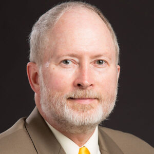 Distinguished Professor Mark D. Schwartz, of the University of Wisconsin–Milwaukee, is internationally recognized for founding the subdiscipline of phenoclimatology—the integrative study of relationships between seasonal biological activity and climate. Over four decades, his pioneering work has transformed understanding of vegetation phenology and its central role in assessing and predicting global environmental change. A prolific and influential scholar, Dr. Schwartz has authored more than one hundred peer-reviewed publications, edited three landmark editions of Phenology: An Integrative Environmental Science, and sustained continuous support from the National Science Foundation. His development of the “Spring Indices” revolutionized how scientists and agencies track the onset of the growing season, establishing indicators now used by the U.S. Global Change Research Program, the Environmental Protection Agency, and the USA National Phenology Network, which he co-founded. Through visionary research, mentorship, and leadership, Dr. Schwartz has elevated phenology from a niche topic to a core dimension of climate science. His work exemplifies geography’s power to bridge disciplines and connect data-driven inquiry with environmental understanding.
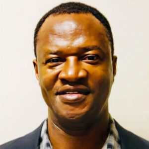 Dr. Seth Appiah-Opoku is honored with the AAG Distinguished Teaching Award for his exceptional contributions to geographic education over nearly three decades. A professor at the University of Alabama since 2002, he has demonstrated a deep commitment to student learning, curriculum innovation, and mentorship. His teaching blends interdisciplinary perspectives with experiential learning, including international field programs in Ghana.
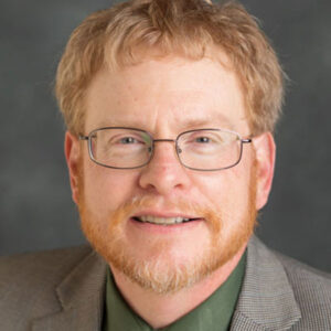 Dr. Derek H. Alderman, Chancellor’s Professor of Geography at the University of Tennessee, has received this year’s Gilbert F. White Distinguished Public Service Award. Dr. Alderman has three decades of experience advancing the field of social and cultural geography through public engagement and transformative leadership. He is a Fellow and former President (2017-18) of the AAG, having used his presidency to advocate for outreach, media engagement, and community partnerships as core professional responsibilities. He is equally dedicated to geographic education, earning the George J. Miller Award for Distinguished Service to Geographic Education (2023) and the Susan Hardwick Excellence in Mentoring Award (2024) for his extraordinary work mentoring graduate students and supporting K–12 teachers.
 Dr. Karen Barton, Professor of Geography, GIS, and Sustainability at the University of Northern Colorado, is the inaugural awardee of the Public and Engaged Scholarship Honors. Given her outstanding community engagements, Professor Barton exemplifies the qualities celebrated by this honor—collaborative knowledge production; the integration of research, teaching, and service; and long-standing relationships with community partners around the world. Her community-engaged research is rooted in and extends the values shared by geographers and humanitarian scholars, cultivating environmental sustainability with community partners in places as varied as Senegal, Nepal, Nicaragua, and Norway. Whether teaching or engaged in community-based research and practice, Karen Barton embodies the ideals of Public and Engaged Scholarship. Her collaborative, inclusive, and responsive approach to research and teaching is exemplary of how geographers can create knowledge with, not merely about, communities. For more than two decades, Dr. Barton’s research on humanitarian disasters, environmental issues, and social challenges has earned international recognition and the deep respect of those with whom she works. Through numerous grants, including twelve Fulbright awards, she ensures that research translates into tangible, lasting benefits for the communities, students, and colleagues involved. This combination of initiative and stewardship has propelled innovation in her own teaching and spurred the purposeful evolution of the Geography, GIS, and Sustainability program at the University of Northern Colorado.
 Dr. Nina Siu-Ngan Lam is the E. L. Abraham Distinguished Professor at Louisiana State University, and Wei Lun Professor at the Chinese University of Hong Kong. She has made transformative and enduring contributions to the field of geography for over four decades. As pioneering scholar in Geographic Information Science, spatial analysis, and environmental studies, Dr. Lam’s seminal research on spatial interpolation, scale, and fractal analysis established foundational principles that continue to shape contemporary GIScience and spatial modeling. Her innovative applications of these methods to topics of environmental health, disaster resilience, and sustainability have significantly advanced the understanding of human–environment systems. Notably, her Resilience Inference Measurement (RIM) framework provides a rigorous, data-driven approach for assessing community resilience to natural hazards.
 Dr. Paul Robbins has profoundly shaped geography through his transformative scholarship, exceptional academic leadership, and sustained public engagement. His pioneering work in political ecology has redefined how geographers understand human–environment relationships. His book Political Ecology: A Critical Introduction remains a foundational text in geography and beyond—spanning wildlife ecology, urban planning, and sustainability science—with more than 6,700 citations. His Lawn People—a highly original and witty exploration of the everyday political ecology of suburban landscapes—was honored with the AAG James Blaut Award and cited nearly 1,000 times.
 Dr. He Yin, Associate Professor of Geography at Kent State University, is honored with the AAG Media Achievement Award for his impactful and globally reaching research on the environmental consequences of armed conflicts and land abandonment. Dr. He Yin successfully translated sophisticated geospatial analysis into actionable insights that guide both humanitarian response and financial decision making.
 Dr. Qunying Huang is known for exceptional scholarship, exemplary dedication to training the next generation of geographers, significant contributions to the field of geography, and a strong commitment to diversity, equity, and inclusion. She leads an internationally recognized research program on geospatial big data and GeoAI at the University of Wisconsin-Madison and has established herself as a leading scholar in geocomputation and big-data sensing techniques for real-time emergency response and Earth observation. Dr. Huang is committed to high-quality teaching and mentorship, as evidenced by her recognition as a Madison Teaching and Learning Excellence Faculty Fellow at the University of Wisconsin, where she has made her courses accessible to over 700 students annually from diverse academic and cultural backgrounds. She is a sought-after advisor and has shepherded dozens of master’s and doctoral graduate students who have gone on to academia, government, and industry. She has served in various capacities for the AAG, including multiple roles within the AAG Cyberinfrastructure Specialty Group (CISG), and has organized and chaired numerous sessions at the AAG annual meeting. Her scholarly work has been dedicated to revealing and addressing social issues of underrepresented and marginalized groups, exploring access inequality, and developing evidence-based strategies for increasing equity and inclusion.
 Dr. Peter Kedron is a leading geographer whose work advances fundamental understanding of spatial processes, innovation diffusion, and the dynamics of human-environment systems. As a faculty member at the University of California Santa Barbara, he is recognized for his methodological rigor and theoretical contributions to spatial data science and economic geography. Dr. Kedron’s research integrates spatial econometrics, geographic information science, and various forms of geospatial analytics to examine how ideas, technologies, and policies evolve across space and time. His pioneering studies on replication and reproducibility in geographic research have elevated the discipline’s commitment to scientific transparency and open scholarship. An active leader in the American Association of Geographers (AAG), Dr. Kedron has strengthened the link between geographic theory and data-driven policy solutions. His scholarship exemplifies the fusion of spatial thinking, computational innovation, and interdisciplinary collaboration that defines geography’s expanding role in addressing complex societal challenges.
 Dr. Abigail H. Neely is associate professor of geography at Dartmouth College, where she is recognized for her scholarship in political ecology, health, and social justice in sub-Saharan Africa. Her award-winning book Reimagining Social Medicine from the South (Duke University Press, 2021) reframes social medicine through ethnographic and archival work in rural South Africa, examining how human and more-than-human forces shape health and inequality. She has published widely in leading journals such as Social Science & Medicine and Progress in Human Geography, with research supported by major NSF and Yale fellowships. Dr. Neely has also played a key role in disciplinary service, including editorial work for Environment and Planning E and leadership of the AAG Working Group on Research Partnerships for Targeted Mentoring Networks. At Dartmouth, she advances socially engaged scholarship as the School House Professor, leading one of Dartmouth’s six house communities, as a former Senior Fellow in the Society of Fellows and as a committed mentor to students and early career scholars.
 Dr. Godwin Arku has made significant contributions to the discipline of geography and to the AAG community through impactful scholarship, dedicated mentoring, and wide-ranging service. As professor and Western Faculty Scholar at Western University in Canada, he works in the field of urban geography, including examining the planning and management of cities, and assessing the lived experiences of urban residents, consistently foregrounding equity, institutional accountability, and the need for context-sensitive planning. Dr. Arku is deeply committed to mentorship and capacity building, having supervised many doctoral students who now hold academic and professional positions around the globe. Dr. Arku has made sustained contributions in foregrounding marginalized voices, including work on informal urban communities in Africa and racialized essential workers in Canada, and has been recognized with the Robbins-Ollivier Excellence in Equity Award. Dr. Arku served as the Chief Editor of the African Geographical Review, an official journal of the AAG published on behalf of its Africa Specialty Group. He has served the AAG in multiple other capacities, including as vice chair of the Africa Specialty Group, member of the Government Data and Employment Committee, and current member of the AAG Honors Committee.
 Dr. Marilyn A. Brown is a leading geographer and energy policy expert whose work has shaped national and global approaches to sustainable energy and climate solutions. A Regents’ Professor at the Georgia Institute of Technology’s School of Public Policy, she integrates geographic analysis with technology and policy research to advance understanding of energy transitions, innovation, and environmental equity. Previously at Oak Ridge National Laboratory, Dr. Brown led pioneering studies on renewable energy, efficiency, and the spatial dynamics of technological change. Her service on National Academies’ committees and contributions to the Intergovernmental Panel on Climate Change (IPCC) highlight her leadership in linking geography, science, and policy. Elected to the National Academy of Engineering (NAE) and the National Academies of Science, Engineering and Medicine (NASEM), and a Fellow of the American Academy of Arts and Sciences, Dr. Brown’s research continues to inform pathways toward a low-carbon, resilient, and equitable energy future.
 Dr. K. Maria D. Lane is a professor of Geography and Environmental Studies and Dean of Graduate Studies at the University of New Mexico, where she has advanced the discipline through innovative scholarship, institutional leadership, and community engagement. An internationally recognized historical geographer, she is the author of Geographies of Mars: Seeing and Knowing the Red Planet (2011) and Fluid Geographies: Water, Science, and Settler Colonialism in New Mexico (2024), both with the University of Chicago Press. These books illuminate how scientific and cartographic practices shape environmental knowledge and power. As department chair from 2014 to 2019, Dr. Lane launched the state’s first joint PhD in Geography, founded the R.H. Mallory Center for Community Geography, expanded faculty ranks, and redesigned the undergraduate curriculum. Her leadership in securing major NSF funding has strengthened graduate education, supported community-engaged research, and advanced climate change and geovisualization initiatives. She has also served as editor of both Historical Geography and the Journal of Historical Geography and continues to lead public scholarship projects such as the Indigenous Cartographies Symposium and the Native Trails geovisualization collaboration with the National Park Service.
 Dr. David López-Carr has conducted ground-breaking research on the intersecting issues of poverty, hunger, deforestation, and health in the Americas. A professor at University of California Santa Barbara, López-Carr’s pioneering work in land change science has deepened our understanding of the relationships between population dynamics and tropical deforestation, and the complicating influences of gender, local economics and remittances, and climate-driven impacts. International agencies and community organizations have benefited from his work documenting place-based ecological and socioeconomic drivers of environmental injustices faced by diverse communities across the globe. An inspiring teacher and visionary leader, Dr. López-Carr has mentored underrepresented scholars, advocated for equitable hiring, and shaped institutional practice by improving representation, recruitment, and retention.
 Dr. Jerry Mitchell, department chair and professor at the University of South Carolina, is a renowned expert in, and advocate for, geographic education. His extensive leadership, community outreach, and scholarly contributions combine a rigorous understanding of what geographic learning and teaching should aim for with creativity and entrepreneurial spirit to promote that intellectual vision. Through his two decade-long coordination of the South Carolina Geographic Alliance (SCGA), more than 40,000 teachers have received training, networking opportunities, and pedagogical support, making SCGA one of the most successful and innovative alliances in the U.S. As editor of the Journal of Geography, and president of the National Council for Geographic Education, he spearheaded efforts to strengthen and diversify geographic education scholarship; to increase involvement of early-career scholars; and to advance inclusion within the discipline. His many honors and awards, including the AAG’s Gilbert H. Grosvenor Honors in Geographic Education, are a testament to his transformative efforts to advance geographic education at all levels and to shape its future nationally and internationally.
 Dr. Joann Mossa is a highly productive fluvial geomorphologist who researches physical geography through a lens of human environment dynamics. Dr. Mossa has produced influential studies that examine coastal plain river systems as sources of water and assess the geomorphic consequences of mining, hydropower, floodplain alterations, and dredging. This work provides not only a scientific understanding of these processes but also a framework for evaluating their social and environmental tradeoffs. As an award-winning teacher and mentor at the University of Florida, her unwavering commitment to advancing discipline and mentoring the next generation of geographers is truly exemplary. She has been active in the AAG, SEDAAG, her state, university, and department, including service as president of SEDAAG and the Florida Society of Geographers. Dr. Mossa has received the AAG Geomorphology Specialty Group’s Mel Marcus Distinguished Career Award, the Richard J. Russell Award from the AAG’s Coastal and Marine Geography Specialty Group, SEDAAG’s Lifetime Achievement Award, SEDAAG Research Honors in 2022, and the inaugural Lifetime Achievement Award from the UF Geography department. The AAG is honored to recognize Dr. Joann Mossa as a Fellow.
 Dr. Michael Pretes, University of North Alabama, has balanced heavy teaching and mentoring responsibilities with impactful scholarship, extensive service to AAG and the profession, and meaningful public outreach, while still actively publishing research across a broad range of topics. He has taught more than fifty different courses covering human geography, physical geography, regional geography, and geographical methods. He has demonstrated a sustained commitment to advance justice, diversity, equity, and inclusion in the discipline, including recruiting colleagues and supporting students from varied backgrounds. Dr. Pretes has received numerous major teaching, advising, service, and scholarship honors including those from AAG, SEDAAG, APCG, NCGE, and his home university, and he served as the Distinguished Visiting Professor of Geosciences at the United States Air Force Academy in 2024-25. He has demonstrated exemplary service to the AAG, actively participating in the leadership of both SEDAAG in the region where he currently teaches, and APCG, his original home region, where he is serving as their Regional Councilor to AAG and has contributed as President, Awards Committee Chair, Archivist, and Chair of the Latina/o/e American Travel Scholarship Committee. With his incredible creativity and unwavering commitment to teaching, research, and service, the AAG proudly recognizes Dr. Michael Pretes as a Fellow.
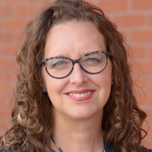 Dr. Patricia Solís is an influential geographer whose career bridges research, education, and global collaboration to advance the applied and socially engaged dimensions of geography. As research professor in the School of Geographical Sciences and Urban Planning and executive director of the Knowledge Exchange for Resilience (KER) at Arizona State University and co-founder of Youth Mappers, she has created innovative platforms connecting geographic scholarship with community resilience, open data, and youth empowerment worldwide. Dr. Solís’s work exemplifies how geospatial technologies and participatory mapping can address pressing challenges such as disaster preparedness, migration, sustainability, and social equity. Through leadership in the AAG and international initiatives, she has expanded opportunities for geographic learning and global engagement. A recognized advocate for inclusive and transformative geography, Dr. Solís has inspired a new generation of geographers to apply spatial thinking for social good—making geography a vital force for resilience, justice, and collective problem-solving in communities around the world.
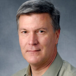 Dr. Barney Warf is a prolific scholar whose work probes and reveals the dynamic forces of change in political and economic geographies. His many books and articles have expanded the field to instill geographic insights into social and economic dimensions of modern life, including the transformative impacts of digital technologies and media, and the emergence of cosmopolitanism and post-truth geographies. A professor at the University of Kansas, Dr. Warf’s diverse contributions, including a prize-winning encyclopedia, have made geographical concepts and research findings accessible to academic and policy audiences, while increasing participation of early-career scholars who have benefited from his mentorship and editorial skills. In editorial positions at the Professional Geographer, GeoJournal, and other leading publications, and through longstanding AAG committee service, Dr. Warf has shaped the future of our discipline by expanding participation of diverse scholars, advancing a steadfast commitment to academic freedom and freedom of speech, and highlighting the responsibility that geographers bear in the public sphere.
 This award is presented in recognition of Sarah Elwood’s outstanding and sustained scholarly contributions, specifically her work on participatory, collaborative, and community-based GIS, relational poverty, and the broader dedication of her research and scholarship to social justice in the contemporary world. She is professor and chair of Geography at the University of Washington, doing research that focuses on digital technologies, urban geographies, and creative politics forged by structurally disadvantaged peoples fighting for equity, self-determination, and everyday thriving. Dr. Elwood has studied the use of geographic information systems (GIS) by neighborhood groups fighting gentrification and racial dispossession, interactive online mapping by children whose spatial knowledge and agency often go unseen, digital apps used in low-barrier employment by unsheltered people living and working in public space, and visual poverty politics advanced by unsheltered people and their allies. Works published from these lines of research have opened theoretical and methodological horizons in urban and digital geographies, relational poverty studies, critical and qualitative GIS, visual politics and mixed methods.
 Nik Heynen has earned the Presidential Achievement Award in recognition of his work on urban social justice, ecological restoration, and his collaborative work with the Geechee community on Sapelo Island in Georgia, all of which reflect the broader dedication of his research and scholarship to social justice in the contemporary world. He is a Distinguished Research Professor in the Department of Geography at the University of Georgia, a visiting scholar in Food Studies at Spelman College, and the director of education for the Athens-based nonprofit organization Shell to Shore. His research interests sit at the intersection of economic, environmental, climate, and racial justice. For just over a decade, he has been working with members of the Saltwater Geechee in the Hogg Hummock community on Sapelo Island on the restoration of traditional agricultural practices and flood mitigation made necessary as a result of descendants losing their land to development pressure and increasing sea-level rise leading to more frequent flooding. Through this work he co-directs UGA’s Cornelia Walker Bailey Program on Land, Sea and Agriculture with Maurice Bailey.
 Dr. Jonathan (Jon) Foley is the Executive Director of Project Drawdown, and independent and internationally trusted organization that provides science-based guidance to climate solutions and strategies. A world-renowned environmental scientist, sustainability expert, and public speaker, Foley focuses on understanding our changing planet and finding new solutions to sustain the climate, ecosystems, and natural resources we all depend on.

 The American Association of Geographers recognizes Professor Sarah Holloway with the Susan Hardwick Excellence in Mentoring Award for her longstanding commitment to supporting students and colleagues, and her role in fostering a positive, inclusive academic environment. Over more than 30 years at Loughborough University, she has contributed to meaningful improvements in departmental and institutional culture through her teaching, mentorship, and dedication to equitable practices.
 Dr. Rachel Goffe is a human geographer whose work sits at the intersection of social reproduction, carceral geographies, Caribbean Studies and Black Geographies. In a time when these issues are absolutely vital, Dr. Goffe is concerned with the state regulation of dispossession from life and land. While her work is situated in her native Jamaica, the work applies to us all, particularly via the global ramifications of considering racial capitalism, gentrification, placemaking, boundary writing, and how policy and the state help shape claims to the idea of home. Dr. Goffe also has a strong record of community engagement and service both in and out of the academy, including organizing writing circles for graduate students from conflict zones and supporting grassroots organizations that fight for Justice in Jamaica. As someone emphasizing the effects of today’s inequities and fighting to lessen them, Dr. Rachel Goffe should be recognized for continuing the legacy of Dr. Glenda Laws and her exemplary commitment to social justice and social policy.
 Dr. Xiao Huang is a data and environmental scientist who combines these two interests into work on disaster mitigation, human-environment interactions, disaster remote sensing, urban studies, and other areas. Rather than study data for data’s sake, he wants to put data to work studying and solving human problems. He shows that research, public service, and community engagement are not mutually exclusive endeavors. His research dossier advocates that “computational urban science needs to go beyond computational”: he considers how human mobility affects people’s lives how we can map floods in real time with social media, heat risk assessment in urban areas, and much more. His work has been featured in the popular media, showing the public how important geography is for solving social problems. Dr. Huang also has an extensive record of leadership in and service to the discipline. A true public scholar, Dr. Xiao Huang should be recognized for continuing the legacy of Dr. Glenda Laws’s exemplary commitment to social justice and social policy.
 Dr. Jayajit Chakraborty is a Professor and Mellichamp Chair in Racial Environmental Justice at the Bren School of Environmental Science and Management in the University of California, Santa Barbara, whose research has analyzed spatial and social inequalities associated with environmental hazards and disasters, as well as informed public policies that address environmental injustices. His extensive body of scholarly work, which includes many co-authored publications with graduate students, is well-cited both within and outside the academy. He has contributed to science research, writing, and advocacy, often as the only geographer, as a member of multiple US Environmental Protection Agency advisory committees. Dr. Chakraborty was recently included in the Stanford-Elsevier ranking of the world’s most cited researchers who are in the top 2% in their academic subfield (geography). He has mentored dozens of graduate and undergraduate students (including first-generation and minority students), taught undergraduate and graduate courses across various geographic subfields, served on the editorial boards of several Geography and Environmental Science journals, and chaired AAG committees.
 Dr. CindyAnn Rose-Redwood, Teaching Professor of Geography at the University of Victoria, is recognized for her exceptional dedication to teaching excellence, inclusive pedagogy, and student mentorship. Widely recognized as an inspiring instructor and innovative educational researcher, she has received prestigious awards from the Canadian Association of Geographers, the University of Victoria, and the American Association of Geographers, as well as several teaching and learning grants. Dr. Rose-Redwood’s pedagogical creativity is evident through her course design and leadership in integrating anti-racism and social justice into geography curricula, advancing the discipline’s capacity to engage urgent contemporary issues. Beyond the classroom, she has been a transformative mentor to undergraduate and graduate students, serving as a dedicated faculty advisor for student organizations and creating empowering environments for international and first-generation students. Her mentorship has nurtured the next generation of geographers, activists, and community leaders. Also significant are her scholarly contributions to understanding international student experiences. In addition to several refereed articles, her two widely recognized co-edited books reposition international students as critical social actors in shaping higher education, migration, and cultural politics.
 Dissertation: “From adaptation to entrapment: Evidence of aquaculture-induced salinity feedback in coastal India”
 Alison Mountz and Kira Williams offer a dramatic and important reworking of the disciplinary history of geography itself with Let Geography Die: Chasing Derwent’s Ghost at Harvard (MIT Press, 2025). Not only does this important book re-examine a crucial story in the discipline’s institutional trajectory within the U.S. academy, it also offers a creative and compelling model for blending together scholarly history with the reflexive practices of contemporary disciplinary critique. Combining a new reading of archival sources with new questions about queer identity and academic politics, Let Geography Die isn’t just an exhumation of a particular painful moment in geography’s past, but also an inquiry into the discipline’s present and future. It makes compelling reading for any geographers who wish to reflect on how scholarly effort and personal longing fit into the broader systems of disciplines and institutions.
 What would our streets, cities, and neighborhoods look like if urban plans took geographers and their studies seriously? With Reclaiming the Road (University of Minnesota Press), David Prytherch shows us the promise of communities planned, designed, and built for humans, rather than solely cars. Through rich case studies, extensive historical-geographical contexts, and delightful prose, the book offers an indispensable guide for re-engineering urban space through best practices, human-centered designs and policies, and abiding attention to intersectional concepts of equity and justice. In-depth interviews with transportation advocates, city planners, and community leaders across nine U.S. cities meld with interdisciplinary yet accessible theoretical discussions to ground the analysis in both lived experience and insightful scholarship. Immersed in dialogues linking practice, advocacy, and scholarship, Reclaiming the Road wields the powers of geography to ask more of urban design and to reimagine our communities as spaces of mobility and justice.
 Jennifer Mapes is the recipient of this year’s John Brinckerhoff Jackson Prize from the AAG. Mapes is an astute reader of the cultural landscape, deploying her skills in reading and interpreting the American small town and its evolution. Attentive to the social and political forces that shape places and landscapes, The New American Small Town (West Virginia University Press) challenges stereotypical perceptions and offers a new interpretation by highlighting the diversity among American towns, based in part on the lived experience of their residents. Mapes introduces a typology to show differences among small towns and discusses images ranging from the nostalgic ideal of the “real” America to stale and declining places to towns struggling to respond to rapid growth. With approachable and engaging writing, the book should be interesting to a wide range of readers, equally appealing for a graduate seminar and a general audience. The New American Small Town addresses a big theme in American geography and will encourage readers to think about these places in new ways.