The Guide: Learning the Geographic Approach circa 2026
By Dr. Michael Goodchild, Distinguished Professor Emeritus, University of California, Santa Barbara
GIS has evolved almost beyond recognition since I started offering my first course in GIS (or automated cartography as we called it then) over half a century ago in 1975. Today GIS applications can be found assisting in almost all walks of life and forms of human activity. The simple maps that we had to digitize by hand in the 1970s have expanded into the vast resources of digital geodata that are available today through a simple Web or AI-assisted search. The software for teaching GIS, which I had to write myself in the 1970s, has now become a treasure-chest of commercial and open-source tools that are capable of pretty much any kind of operation on geodata. And tools for remote sensing, GPS, surveying, BIM, digital twins, GeoAI, and other specialized topics are now fully integrated into what we increasingly think of as the geographic approach. So if I were motivated to learn GIS anew in 2026, how would I go about it? How would I structure a course, and what skills would I expect students to acquire from it?
The simple maps that we had to digitize by hand in the 1970s have expanded into the vast resources of digital geodata that are available today.”
These question drove one of the first activities of the newly funded National Center for Geographic Information and Analysis (NCGIA) in the late 1980s, when many institutions were hoping to establish GIS courses but had little idea of how to go about it. This was well before the growth of textbooks, Web resources, published applications, and all of the materials that are now available to instructors and students of GIS. Karen Kemp and I at UC Santa Barbara, together with a global community of researchers and instructors which we recruited, developed and tested what became the NCGIA Core Curriculum in GIS. Consistent with common practices in higher education at the time, it included a set of lecture notes for instructors, hard-copy illustrations, and pointers to further resources.
Jumping forward to 2026, what might a contemporary equivalent of the Core Curriculum look like? And what choices would I make if charged with teaching a course? I recently had the opportunity to review the Guide (https://www.theucsbguide.com/); to give it its full title, The UCSB Guide to the Geographic Approach: GIScience Education for the Modern Era), a resource developed by UC Santa Barbara and Esri that is not only closely in line with my own thinking and my experience over the past half century, but takes those ideas and runs with them to develop an enormously rich collection of syllabi, concepts, applications, videos, illustrations, and other course materials.
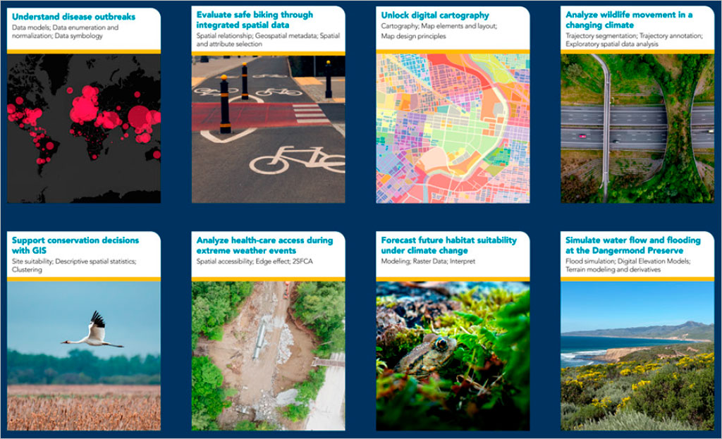
Here are some of the features of The Guide that I find especially useful and attractive as a platform for learning:
- It is multimodal, including well-written text, video, images, and interfaces with GIS, all in a StoryMap framework that encourages the practice of solving problems by telling stories, and all in the Cloud and accessible from any device.
- It is well-referenced, providing on-demand depth on fundamental issues.
- It is multidisciplinary, helping the student to explore applications of GIS in any of a large number of fields and problem domains.
- It is current, reflecting the many ways in which artificial intelligence is infiltrating much of GIS methodology, and greatly increasing the power of GIS to address complex problems.
- It is authoritative, with content that taps the best of UCSB’s and Esri’s expertise and the advice provided by many specialists worldwide.
- It is robust, well-engineered to survive the kinds of intensive use that sometimes cause classroom software to fail.
- Concern for ethics figures very strongly in the Guide. There are ethical issues in the acquisition of data for GIS, the design and execution of workflows, the interpretation of results, the training of AI, and the insertion of GIS solutions into practice. The Guide treats ethics as a constant concern, rather than sequestering it to a special section or module.
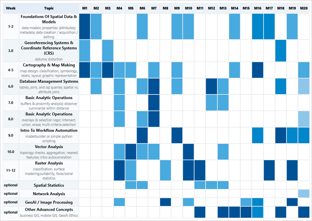
In summary, the Guide is a new and much-needed perspective on how and what to teach in the rapidly developing world of geotechnology. As such it solves a problem many of us have come to recognize: that the old ways, however successful they may have been in the past, will no longer give our students what we would like them to have as they prepare for their careers..
Featured Articles is a special section of the AAG Newsletter where AAG sponsors highlight recent programs and activities of significance to geographers and members of the AAG. To sponsor the AAG and submit an article, please contact meeting@AAG.org.