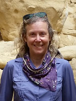
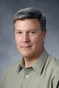
Meet the AAG Journals Editors – Barney Warf and Blake Mayberry

Barney Warf and Blake Mayberry work on The Professional Geographer, one of three academic journals published by the AAG. The Professional Geographer, published four times a year, was initially a publication of the American Society of Professional Geographers but became a journal of the American Association of Geographers in 1949 after the two organisations merged. The focus of this journal is on short articles in academic or applied geography, emphasizing empirical studies and methodologies. These features may range in content and approach from rigorously analytic to broadly philosophical or prescriptive. The journal provides a forum for new ideas and alternative viewpoints.

Barney Warf is the current Editor for The Professional Geographer and a Professor of Geography at the University of Kansas. His professional interests lie within the broad domain of human geography. Much of his research concerns information technology and telecommunications, notably geographies of the internet, including fiber optics, the digital divide, and e-government. He has also written on military spending, electoral geography, religious diversity, cosmopolitanism, and corruption. While most of his research involves secondary data, Barney’s most memorable research experiences have involved doing interviews in Latin America, particularly in Panama and Costa Rica, that added a human depth to the topics he researched. He has authored, co-authored, or co-edited eight research books, three encyclopedias, three textbooks, 50 book chapters and more than 100 refereed journal articles.
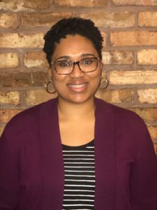
In addition to serving as editor of The Professional Geographer, he also currently serves as the editor of Geojournal, co-editor of Growth and Change, and edits a series of geography texts for Rowman and Littlefield publishers. For Barney, the best thing about being a journal editor is “reading about the diverse set of topics that authors write about. It’s truly astonishing the things people choose to research. Being an editor has exposed me to all sorts of issues and worldviews that I didn’t know existed.” For new authors, Barney encourages them to “keep an eye on important issues in the world like poverty and inequality. I worry that at times geography becomes overly ‘academic’ and too concerned with relatively obscure issues that have little bearing on the ‘real world.’”

Barney’s teaching interests include urban and economic geography, the history of geographic thought, globalization, and contemporary social theory. When asked about which area of geographic thought needs the most attention at this point in time, Barney believes “human geography today is at the confluence of several intersecting lines of theory, including poststructuralism, postcolonialism, feminism, queer theory, and the social construction of nature. I think the most interesting works are those that bring these perspectives into a creative tension with one another.”

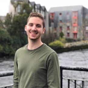
Blake Mayberry is the editorial assistant for the Professional Geographer where his role is to help screen manuscripts initially for style and then to assign appropriate peer reviewers. Blake is also currently Assistant Professor of Geography at Red Rocks Community College where he edits an on-campus student-oriented scholarly journal, teaches in the Water Quality Management Program (a four-year program), and serves on the City of Golden Planning Commission.

Blake’s path to become a geographer has been appropriately circuitous, but he could start in the beginning: as a child he slept with a globe instead of a teddy bear! At times Blake wanted to be Indiana Jones, and at other times, Leonardo DaVinci. He found that geography was the best way to satisfy the scientific, analytical side of my brain, while also indulging my more romantic, artistic side. As a career, He also found geography to be extremely rewarding. Blake has worked as an urban planner in the Omaha metropolitan area, and with environmental groups conducting ecological restoration and advocating for the protection of native ecosystems.

Blake has done research on topics ranging from urbanization and water resources in the southwestern United States, to the Indian Removal Period during the nineteenth century. However, his real passion is for grasslands. His master’s thesis at the University of Nebraska-Omaha focused on the effort to create a national park in western Iowa’s Loess Hills in the aftermath of the Farm Crisis, specifically, the role that media play in natural resource conservation policy. Expanding on that theme, his dissertation research at the University of Kansas involved an ethnographic study of environmentalists working to restore prairies on the Great Plains and how cultural identity and sense of place influence people’s actions to remake the landscape. In his spare time Blake enjoys reading maps, drawing maps, and exploring places real-life places that he find on maps.

Blake encourages prospective authors to read as much as they can before publishing: “Engage with the literature, all of it, in depth, all the time, all throughout your research… as someone who sees a lot of manuscripts come and go at the PG, the really successful ones, and the ones that end up having the most impact on the discipline, are the those that engage deeply with theory, and from multiple perspectives. Resist the temptation to get into a ‘citation silo,’ where you only engage with the literature on your subject matter from the perspective of your PhD advisor and their former students. There is nothing more I love than to see a manuscript on spatial regression that cites Tuan! I tell my students that your written work reflects your effort, and I’d say the same about being a scholar – your lit review tells us whether you did your homework or not. Doing your homework will go a long way towards preventing revise and resubmits, and outright rejections.”

    Share

New Books: May 2018

Every month the AAG compiles a list of newly-published books in geography and related areas. Some are selected for review in the AAG Review of Books.

Publishers are welcome to send new volumes to the Editor-in-Chief (Kent Mathewson, Editor-in-Chief, AAG Review of BooksDepartment of Geography and Anthropology, Louisiana State University, Baton Rouge, LA 70803).

Anyone interested in reviewing these or other titles should also contact the Editor-in-Chief.

PLEASE NOTE: Due to current public health policies which have prompted the closing of most offices, we are unable to access incoming books at this time. We are working on a solution during this transition and will continue our new books processing as soon as we can. In the meantime, please feel free to peruse previous books from our archived lists.

May 2018

Albert Bierstadt: Witness to a Changing West by Peter H. Hassrick (ed.) (University of Oklahoma Press 2018)

Anarchy as Order: The History and Future of Civic Humanity by Mohammed A. Bamyeh (Rowman and Littlefield 2010)

Bears Ears: Views from a Sacred Land by Stephen E. Strom (University of Arizona Press 2018)

A Biography of the State by Christopher Wilkes (Cambridge Scholars Publishing 2018)

Coloniality, Ontology, and the Question of the Posthuman by Mark Jackson (ed.) (Routledge 2018)

Constructing the Dynamo of Dixie: Race, Urban Planning, and Cosmopolitanism in Chattanooga, Tennessee by Courtney Elizabeth Knapp (University of North Carolina Press 2018)

Crafting a Republic for the World: Scientific, Geographic, and Historiographic Inventions of Colombia by Lina del Castillo (University of Nebraska Press 2018)

Delicious Geography: From Place to Plate by Gary Fuller and T. M. Reddekopp (Rowman and Littlefield 2017)

The Discourse of Neoliberalism: An Anatomy of a Powerful Idea by Simon Springer (Rowman and Littlefield 2019)

Environmental Geopolitics by Shannon O’Lear (Rowman and Littlefield 2018)

Fashioning the Canadian Landscape: Essays on Travel Writing, Tourism, and National Identity in the Pre-Automobile Era by J. I. Little (University of Toronto Press 2018)

Geographies of Disorientation by Marcella Schmidt di Friedberg (Routledge 2018)

Geographies of Plague Pandemics: The Spatial-Temporal Behavior of Plague to the Modern Day by Mark Welford)

The Geopolitics of Real Estate: Reconfiguring Property, Capital and Rights by Dallas Rogers (Rowman and Littlefield 2016)

Global Jewish Foodways: A History by Hasia R. Diner and Simone Cinotto (eds.) (University of Nebraska Press 2018)

Hinterland: America’s New Landscape of Class and Conflict by Phil A. Neel (Reaktion Books 2018)

Historicizing Humans: Deep Time, Evolution, and Race in Nineteenth-Century British Sciences by Efram Sera-Shriar (ed.) (University of Pittsburgh Press 2018)

Honduras in Dangerous Times: Resistance and Resilience by James J. Phillips (Lexington Books 2017)

How to Lie with Maps, Third Edition by Mark Monmonier (University of Chicago Press 2018)

The International Handbook of Political Ecology by Raymond L. Bryant (ed.) (Edward Elgar Publishing 2018)

Into the Extreme: U.S. Environmental Systems and Politics Beyond Earth by Valerie Olson (University of Minnesota Press 2018)

Kropotkin: The Politics of Community by Brian Morris (PM Press 2018)

Love, Order, and Progress: The Science, Philosophy, and Politics of Auguste Comte by Michel Bourdeau, Mary Pickering, and Warren Schmaus (eds.) (University of Pittsburgh Press 2018)

Mark Twain in Paradise: His Voyages to Bermuda by Donald Hoffmann (University of Missouri Press 2018)

New World Postcolonial: The Political Thought of Inca Garcilaso de la Vega by James W. Fuerst (University of Pittsburgh Press 2018)

Panda Nation: The Construction and Conservation of China’s Modern Icon by E. Elena Songster (Oxford University Press 2018)

Power and Progress on the Prairie: Governing People on Rosebud Reservation by Thomas Biolsi (University of Minnesota Press 2018)

Proving Ground: Expertise and Appalachian Landscapes by Edward Slavishak (Johns Hopkins University Press 2018)

Reassembling Rubbish: Worlding Electronic Waste by Josh Lepawsky (The MIT Press 2018)

A Rich and Fertile Land: A History of Food in America by Bruce Kraig (Reaktion Books 2017)

Territory Beyond Terra by Kimberley Peters, Philip Steinberg, and Elaine Stratford (eds.) (Rowman and Littlefield 2018)

Turkey: An Economic Geography by Aksel Ersoy (I.B. Tauris 2018)

US Public Memory, Rhetoric, and the National Mall by Roger C. Aden (ed.) (Rowman and Littlefield 2018)

Violence in Capitalism: Devaluing Life in an Age of Responsibility by James A. Tyner (University of Nebraska Press 2018)

Workers’ Movements and Strikes in the Twenty-First Century: A Global Perspective by Jörg Nowak, Madhumita Dutta, and Peter Birke (eds.) (Rowman and Littlefield 2018)

    Share

Otis Templer

Otis W. Templer Jr., 84, passed away on May 8, 2018 at Carillon House in Lubbock, Texas. He was born in Crystal City, Texas, and had lived in Lubbock for the past 49 years. He married Josephine Parks in Dallas. She preceded him in death. He was a member of First United Methodist Church.

He was valedictorian of his high school class and an Eagle Scout. He graduated from Texas A&M University in 1954, and then served as an artillery officer in the United States Army. In 1959, he received a J.D. degree from the University of Texas School of Law and practiced law for several years in Central Texas. He returned to graduate school at Southern Methodist University, earning a master’s degree in 1964, and later a Ph.D. from the University of California, Los Angeles in 1969.

He was the first permanent professor of Geography hired at Texas Tech and was among the founders of the Department of Geography. He came to Texas Tech as an Assistant Professor of Geography in 1968, and was promoted through the ranks to Professor in 1978, and he taught at the university for over 45 years. He served as chairman of the Department of Geography for 15 years until 1994, and as associate chair of the Department of Economics and Geography from 1994 to 2001. He retired from full-time teaching in 2001, and continued teaching part-time until 2015. Almost everyone with a Bachelor’s degree in Geography from Texas Tech has had a class with Dr. Templer. His research primarily revolved around arid lands and water law, largely in Texas.

Survivors include a brother, a son, four daughters, six grandchildren, and two great-grandchildren.

The family suggests memorial contributions be made to the Texas Tech Foundation, Inc. for the “Otis and Josephine Templer Geography Scholarship Endowment,” c/o P.O. Box 41034, Texas Tech.

    Share

Mid Atlantic Division Team Takes 2018 World Geography Bowl Title

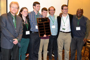
Mid Atlantic Division Team Takes 2018 World Geography Bowl Title. AAG President Derek Alderman (far left) presented the new championship award.

The Mid Atlantic Team won first place in the 2018 World Geography Bowl, an annual quiz competition for teams of college-level geography students representing the AAG’s regional divisions. The 2018 event was a milestone, marking the 25th year for hosting the event during the AAG Annual Meeting.

On April 11, while the International Reception was pumping away upstairs, the World Geography Bowl was underway on the third floor of the Sheraton Hotel in New Orleans. Ten teams representing eight of the regional divisions as well as two ad hoc spoiler teams competed in the 9 round preliminary match up. The eight divisions represented were: Mid Atlantic, East Lakes, West Lakes, Southwest, Southeast, Great Plains/Rocky Mountain, New England-St. Lawrence Valley, and Middle States Divisions. The two spoiler teams were aptly named Longitude and Latitude.

The championship round challenged the top two teams from the round-robin preliminaries: Southeast and Mid Atlantic. After a neck and neck round of toss-up questions, Mid Atlantic pulled out the victory in the team question portion of the final. AAG President Derek Alderman was on hand during the final round to serve as the guest judge and grantor of the prize atlases courtesy of National Geographic Society to the winning team.

Most of the students who participate on the regional teams are chosen during their respective regional division Geography Bowl competition held during their regional division annual meeting each fall. All students who participate receive funding from their regional division as well as the AAG in order to help offset the costs of attending the AAG Annual Meeting.

The winning Mid Atlantic Division team’s roster was:

  • Matthew Cooper, University of Maryland
  • Christine MacKrell, George Washington University
  • Brian Slobotsky, University of Maryland
  • Zachery Radziewicz, Salisbury University
  • Daniel Milbrath, Salisbury University

The first runner-up Southwest Division team’s roster was:

  • Jesse Andrews, Appalachian State University
  • William Canup, University of North Carolina, Greensboro
  • Jacob Cecil, University of Tennessee, Knoxville
  • Darby Libka, University of Mary Washington
  • Randi Robinson, Mississippi State University
  • Jared White, University of West Florida

The second runner-up Great Plains/Rocky Mountain team’s roster was:

  • Tristan Boyd, University of Colorado, Denver
  • Karl Bauer, Kansas State University
  • Sara Newman, University of Colorado, Denver
  • Peter Brandt, North Dakota State University
  • Lindy Westenhoff, University of Wyoming
  • Jonathon Preece, University of Wyoming
  • Sujan Parajuli, South Dakota State University

In addition to team prizes, the top individual scorers are also acknowledged. The Most Valuable Player of the 2018 World Geography Bowl was Jesse Andrews from Appalachian State University (SEDAAG) who was presented with an atlas courtesy of Gamma Theta Upsilon.

The remaining top five individual scorers listed in order of points received were:

  • Matthew Cooper, University of Maryland Graduate Student (MAD)
  • Kate Rigot, University of Colorado, Denver Graduate Student (Team Latitude)
  • Deondre Smiles, Ohio State University Graduate Student (East Lakes)
  • Tristan Boyd, University of Colorado, Denver Undergraduate Student (Great Plains/Rocky Mountain)

Thanks to the 2018 WGB prize donors and volunteers

Organizers of the World Geography Bowl would like to express thanks to the countless volunteer question writers, team sponsors/coaches, moderators, judges, and scorekeepers who make the competition possible, and to the many students who competed across the country. We would like to recognize the volunteers this year as: Paul McDaniel (Kennesaw State University), Wesley Reisser (US Department of State & George Washington University), Rob Edsall (Idaho State University), Dawn Drake (Missouri Western State University), Richard Deal (Edinboro University of Pennsylvania), Zia Salim (California State University at Fullerton), Ronnie Schumann (University of North Texas), Liz Lowe (GIS Technician, New Orleans City Park), Jim Baker (University of Nebraska-Omaha) Patrick May (Plymouth State University), Jase Bernhardt (Hofstra University), Mel Johnson (University of Wisconsin-Manitowoc), Olumide Olufowobi (University of Lagos), Megan Heckert (West Chester University), Tom Bell (University of Tennessee) Peggy Gripshover (Western Kentucky University), Amber Williams (West Virginia University), Lee Ann Nolan (Pennsylvania State University), Jeff Neff (Western Carolina University), Casey Allen (University of Colorado, Denver).

World Geography Bowl organizers thank its supporters, who generously donated atlases, books, gift certificates, software, plaques, and clothing – Texas State University, National Geographic Society, Pearson, Gamma Theta Upsilon, University of Georgia Press, Clark Labs, Esri, Guilford Press, Syracuse University Press, Penguin Random House, American Geosciences Institution, and Expedia – who recognize the important role the competition plays in building a sense of community and generating excitement around geographic learning. Your continued support is truly appreciated.

A special thank you goes out to the World Geography Bowl executive director, Jamison Conley (West Virginia University) for his volunteer efforts at organizing the bowl since 2015.

 2019 World Geography Bowl – Washington, D.C.

The 2019 World Geography Bowl competition will be held in Washington, D.C. in April 2019. Regional competition typically occur during the fall at respective AAG regional meetings, where regional teams for the national competition are usually formed. For more information on organizing a team or volunteering at the national event, contact the World Geography Bowl executive director, Jamison Conley at West Virginia University at Jamison [dot] Conley [at] mail [dot] wvu [dot] edu or the AAG Geography Bowl coordinator, Emily Fekete at efekete [at] aag [dot] org. To learn more about the 2019 World Geography Bowl, follow updates posted here.

In addition, a photo album of the event will be shared soon.

    Share

The Department of Geography, Environment and Spatial Sciences at Michigan State University Makes History

The MSU Department of Geography, Environment and Spatial Sciences has admitted and will fund three African American women graduate students for the 2018 academic year. This will be the first time in the history of the Department that three African American graduate students will be admitted and funded in the same year. The students admitted and funded are Cordelia Martin-Ikpe, Raven Mitchell and Kyeesha Wilcox.

Cordelia Martin-Ikpe (Photo by Dee Jordan)

Cordelia will be pursuing a Ph.D. in Geography with an emphasis on public health. She is a native of Detroit and worked at the Michigan Public Health Institute after receiving her master’s degree from Michigan State University. She will take relevant courses and conduct research on comparative maternal health outcomes for American-born and foreign-born Black women.


Raven Mitchell (Photo by Dee Jordan)

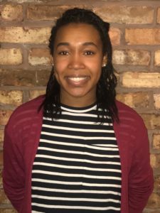
Raven will be pursuing a master’s degree with an emphasis on Physical and Environmental Geography. Raven is a native of Davison, Michigan and received her undergraduate degree from Northern Michigan University in Earth Science. She received the Outstanding Graduating Senior Award from the Department of Earth, Environmental and Geographical Sciences at Northern Michigan University. Raven was also a student in the Summer Research Opportunities Program (SROP) in 2017 at Michigan State University.


Kyeesha Wilcox (Photo by Dee Jordan)

Kyeesha will be pursuing a master’s degree with an emphasis on Urban Social Geography and the relationship between the lack of equal access to healthy food for low income populations and the high obesity rates in neighborhoods with very low socioeconomic characteristics within metropolitan areas. She received her undergraduate degree from Middle Tennessee State University. Kyeesha has already demonstrated her research skills by receiving the Undergraduate Research and Creativity Award this academic year. She was also a student in the Summer Research Opportunities Program (SROP) at Michigan State University in 2017.

How Did the Department Achieve this Historic Accomplishment?

The most important factors in the Department’s success in recruiting the underrepresented graduate students were progressive leadership and measurable commitment. Measurable commitment is demonstrated by actually funding the underrepresented students once a Department admits them. According to the most recent NSF Report on Doctorate Recipients from U.S. Universities (2016) only six African Americans received a Ph.D. in Geography in the entire United States. Among the primary reasons is the lack of funding via a graduate assistantship or fellowship support.

Already considered a progressive leader in support of diversity issues, Alan Arbogast, Chairperson of the Department, was willing to demonstrate a measurable commitment to recruit and fund the three underrepresented students mentioned above. Such willingness was communicated to the progressive Chair of the Admissions Committee and Director of the Graduate Program, Ashton Shortridge. Professor Shortridge started to engage in very active recruitment to increase the number of underrepresented graduate students. Professor Shortridge co-leads the Department’s underrepresented minority recruitment initiative with Dee Jordan, a fourth-year doctoral geography student. Dee is very experienced with diversity issues. She has served on the Diversity Panel for Graduate Student Life and Wellness, Leadership Fellows, and contributes to important conversations about navigating MSU as a student of color. Dee was selected as the 2018 recipient of the MSU Excellence in Diversity Award in the Individual Emerging Progress category.

Over the past four years, geography doctoral student Dee Jordan has been actively pursuing ways to increase underrepresented minority representation within the Department. Dee reached out to me and Professor Shortridge in 2014 and expressed concerns about the lack of African American, Hispanic, and Native American students in her cohort, among graduate students within the Department as a whole, as well as in the Department’s promotional video. Dee inquired about the Department’s recruitment strategy, which was largely passive, and she suggested more active recruitment to attract diverse student applicants. Both Professor Shortridge and I were receptive to her suggestion, and Dr. Arbogast also agreed that this approach could be beneficial for the Department.

In 2017, after researching best practices in recruiting, creating inclusive climates, cultural competency and cohort effects, the Find Your Place in the World underrepresented minority scholars in geography initiative began.

This four-pronged marketing, recruitment, retention and graduate engagement strategy is a comprehensive approach to diversifying the professoriate and increasing demographic representation for students of color in the discipline.

In addition to progressive leadership at the department level, progressive leadership at the Dean’s level was also important. Dr. Rachel Croson joined the MSU College of Social Science as Dean in August 2016. She immediately engaged in the development of a strategic plan for 2017-2022. One of the values of the plan is inclusiveness. Inclusiveness is demonstrated by a culture in which all individuals are valued, respected and engaged so that diverse voices can enrich our work (College of Social Science Strategic Plan, 2017-2022, p. 2). Among the missions of the strategic plan is diversity. The plan states, “our college is open and welcoming, deriving strength from a plurality of identities and lived experiences. We will build a more diverse and inclusive environment to fulfill our mission” (p. 5).

The Department of Geography, Environment and Spatial Sciences has taken action to assist the College in achieving this mission and insuring that the Department will continue to be a pipeline for underrepresented graduate students to not only be admitted but also funded.

— Joe T. Darden
Professor of Geography
Department of Geography, Environment and Spatial Sciences, Michigan State University, and AAG Fellow

DOI: 10.14433/2017.0035

    Share

Meet the AAG Journals Editors – Stephen Hanna

Dr. Stephen Hanna recently joined the AAG Journals’ editorial team as the Cartography Editor for the AAG suite of journals: the Annals of the Association of American Geographers, the Professional Geographer, and GeoHumanities.

Hanna is a full professor of geography and former chair of the Department of Geography at University of Mary Washington. His cartographic editorial experience is extensive, for example, Hanna has served as the cartography editor for two edited volumes on tourism, Mapping Tourism and Social Memory and Heritage Tourism Methodologies, as well as produced dozens of maps for personal publications in both academic and public outlets. As cartography editor, Hanna “enjoys engaging with a wide variety of graphics including some innovative ways of visualizing both qualitative and quantitative information.”

Hanna’s research is focused on critical cartography and heritage tourism, and his expertise is well documented in numerous cartographic projects. Some of his most recent NSF-funded team research involved investigating how slavery is (or is not) addressed in the landscapes, narratives, and performance that constitute southern plantation museums as heritage places.

In addition to ensuring that the maps and figures printed in the AAG suite of journals meet high quality cartographic standards, Hanna envisions his role as editor to include continued mentorship of students, a key component of his current work at an undergraduate focused institution.

Hanna offers the following advice for prospective publishers in geography: “As cartography editor, I’m focused on the maps people create to accompany their articles. Please don’t settle for the default map design options found in most GIS software packages. Take a little time to consider how best to encourage your readers to spend some time examining your maps. After all, you are including them to clearly communicate your findings or to support your argument.”

    Share

Free Webinar on Wildfire Management Strategies, May 16 (CEUs available)

The American Geosciences Institute’s Critical Issues Program is pleased to offer a free webinar in partnership with the American Association of Geographers, “Adapting Wildfire Management to 21st Century Conditions,” on May 16th at 1:00 PM EDT.

Critical Issues Webinar: “Adapting Wildfire Management to 21st Century Conditions”

The combination of frequent droughts, changing climate conditions, and longer fire seasons along with urban development expansion into wildland areas has resulted in more difficult conditions for managing wildfires. Over the last several decades, the size of wildfire burn areas has increased substantially and nine of the 10 years with the largest wildfire burn areas have occurred since 2000. Wildfires are causing more frequent and wider-ranging societal impacts, especially as residential communities continue to expand into wildland areas.  Since 2000, there have been twelve wildfires in the United States that have each caused damages exceeding a billion dollars; cumulatively these twelve wildfires have caused a total of $44 billion dollars in damages. As of 2010, 44 million homes in the conterminous United States were located within the wildland-urban-interface, an area where urban development either intermingles with or is in the vicinity of large areas of dense wildland vegetation. These challenging conditions present a unique opportunity to adapt existing wildfire policy and management strategies to present and future wildfire scenarios.

This Critical Issues webinar explores recent trends in wildfires and changes in contributing factors / drivers of these hazards, and features case studies of wildfire policy and management strategies in the western and southern United States.

The webinar speakers are:

  • Tania Schoennagel, Ph.D., Research Scientist, University of Colorado-Boulder, INSTAAR
  • David Godwin, Ph.D., Southern Fire Exchange / University of Florida
  • Vaughan Miller, Deputy Chief, Ventura County Fire Department

AGI would like to recognize the webinar co-sponsors: American Association of Geographers, American Institute of Professional Geologists, Geological Society of America, Southern Fire Exchange, and the Ventura Land Trust.

To register for this webinar, please visit: https://crm.americangeosciences.org/civicrm/event/register?reset=1&id=112

After registering, a confirmation email containing information about joining the webinar will be sent to you. AGI will post a recording of the webinar on the Critical Issues program’s website after the event. If you cannot make the webinar but would like to be informed about the recording, please register and AGI will notify you as soon as the recording is available.

CEUs:
All registrants who have paid for CEUs from the American Institute of Professional Geologists and attend the entire duration of the live webinar will receive 0.1 CEUs from AIPG.

If you have any questions about this webinar, please contact Leila Gonzales at lmg [at] americangeosciences [dot] org.

Additional upcoming AGI webinars:

May 11th, 1:00 PM EDT: The Current and Mid-21st Century Geoscience Workforce

    Share

Cristi Delgado

Education: M.Sc. in Geography (University of Canterbury, Christchurch, New Zealand), B.A. in Geography (University of Texas at Austin)

Describe your job. What are some of the most important tasks for which you are responsible?
I design and build an Enterprise GIS that includes innovative web solutions to increase productivity, improve efficiency and allow City departments to make better, more informed decisions, automate workflow and protect the community.  I also work to ensure that important city data, including GIS data, is available for public use: https://www.cityofberkeley.info/opendata/

What attracted you to this career path?
I live nearby in North Oakland. I want my work to be part of enriching my community, “saving puppies”, not making widgets for company x. I ride my bicycle to work and know many of the community leaders personally. I enjoy being in public service with a city known for innovation.

How has your education/background in geography prepared you for this position?
My background in physical geography and coastal geomorphology prepared me to better understand some of the drainage and hazard issues of a small city that has a coastline at its western border and rises to 2,000 feet in elevation in a relatively short distance at its eastern border.

What geographic skills and information do you use most often in your work? What general skills and information do you use most often in your work?
 The ability to see patterns and to understand the importance of place; and The First Law of Geography are most often used in my work.

Are there any skills or information you need for your work that you did not obtain through your academic training? If so, how/where did you obtain them?
I believe conveying the value of GIS and spatial analysis is a skill only gained through experience on the job. I often need to explain GIS and spatial analysis methodology in layman’s terms to a diverse crowd. It is harder than it seems, and beneficial to practice with friends and family.

Another skill I needed to hone on the job is working in a political atmosphere.  As the city’s redistricting analyst after the 2010 census, I enlisted help from our city attorney to prepare for our public presentations and hearings regarding redistricting the city’s council districts.

Do you participate in hiring, screening, or training of new employees? If so, what qualities and/or skills do you look for?
Yes; I look for someone who can express themselves well both on paper and in person. Experience in 3D and real time GIS is a plus.

What advice would you give someone interested in a job like yours?
Gain skills, experience and certifications when possible in project management, programming, web design, cartography, and spatial analysis. Become an expert in 3D and real time GIS. Distinguish yourself by having experience and skills in another field as well such as big data, planning, programming or policy analysis.

What is the occupational outlook for career opportunities in your field/organization, esp. for geographers?
The outlook is great for career opportunities in local government GIS.  All cities, towns, counties and similar agencies such as utilities, transportation agencies, airports and regional authorities need GIS analysts on staff.

    Share

Southwest Louisiana’s Creole Trail Riding Clubs

    Share

New Orleans, Unmonumentalized

Much has been said and written about the recent removal of four New Orleanian monuments to Confederate leaders and an 1874 white supremacist uprising[1] [2]. More will be said at the Annual Meeting. The wide-ranging struggle over New Orleanian monuments includes how those memorials (re)defined New Orleans’ place in American space and time around Lost Cause ideology, variously comforting, threatening, affirming and negating certain historical/geographical narratives about the city, the American South, and the United States as a whole. They rendered the Confederate cause noble, the South distinctive yet within an American nationalist imaginary of post-bellum reconciliation and “redemption,” and simultaneously championed white supremacy while obscuring and/or glorifying the violence necessary to secure and maintain it. [3]

What New Orleans’ Confederate monument boosters wanted to do to and through monumentalized public spaces is important, as are the efforts of Take ‘Em Down NOLA to redefine those spaces, this city, and the American national story through monument removal. Geographers have written about the broader questions of historical memory and memorialization in the American South[4]. In considering the meaning-making done by and against Confederate monuments in the Crescent City, we should not forget what unmonumentalized places, events, and people do to historical memory, what I call the political geography of forgetting inconvenient history in New Orleans. What historical events unheralded in public spaces do to collective memory and the political definition of place can be as important as those monumentalized. Think of those numerous small plaques, sidewalk markers, and “stumbling stones” in Paris, Berlin, and other European cities to the deported and murdered in the Holocaust; Before their installation, the fact of Nazi extermination of Jewish life was largely invisible in contemporary urban landscapes, or confined to museums and monuments instead of distributed through quotidian spaces where those absent lives were lived and ended. Think also of how few, and recent, are Parisian memorials to Algerians killed in that city during France’s dirty war against Algerian independence. The relative visibility of memorializations of German (and Vichy French) state violence against Jews and the Resistance in the 1940s and near-invisibility in public space of French state violence against Algerians and Leftists in the 1950s and ‘60s both reflects and reinforces France’s belated historical reckoning with collaboration in World War Two and ongoing historical amnesia of crimes by “good” Republican, Gaullist France twenty years later.

New Orleans’ passage through black slavery and slave resistance, the American Civil War, and Reconstruction and its counter-revolutionary rollback are the historical backdrop upon which Confederate monumentalization rested. Here, I wish to address a few historical sites within an easy walk from the AAG Annual Meeting that have remained unmemorialized, which are foundational to not just this city’s past and its reality today, but are constitutive of major aspects of America’s present reality. Check them out while you’re visiting New Orleans for the Annual Meeting. And if you do, consider what it means for our past, our present and our future these places aren’t part of the stories we tell ourselves about where we came from and how that shapes the prefigurative politics of who we are and can imagine ourselves becoming.

Historical sites mentioned here: [1] Jackson Square, where Jean St. Malo was executed in 1784; [2] The Omni Hotel, formerly the site of the St. Louis Exchange Hotel, New Orleans’ most opulent slave auction site; [3] The corner of O’Keefe and Common Streets, scene of the 1866 New Orleans Massacre; [4] Lower Canal Street, site of the 1874 Battle of Liberty Place; [5] Former site of Orleans Parish Prison, currently inside Armstrong Park. Where 11 Italians were lynched in 1891. Conference hotels: [A] The New Orleans Sheraton; [B] The New Orleans Marriott; [C] The Crowne Plaza Hotel. (Courtesy, Brian Marks)

Start in Jackson Square at the heart of the French Quarter. During the Spanish colonial period, this was the Plaza de Armas at the foot of the seat of the colonial government and Catholic cathedral. As a slave society initiated by French colonists in 1719 and expanded by the Spanish, Louisiana was home to maroon communities of African people who emancipated themselves from bondage by retreating into wetlands behind the high ground near the Mississippi River from which plantations were cut out of the forests and cane brakes of South Louisiana. One of those people history has recorded was Jean Saint Malo, who led a community of Maroons east of New Orleans in present-day Saint Bernard Parish before his capture by Spanish slave-catchers in 1784. He was executed in today’s Jackson Square on June 19, 1784. There’s no historical marker of this event, or St. Malo’s life, in the Square. The hugely important role of African people in building colonial New Orleans and making a Revolutionary Atlantic, from the Louisiana maroons, the Haitian Revolution forcing France to sell Louisiana to the United States, the Haitian refugees who came to New Orleans in the 1790s and greatly shaped the city, to the Haitian-inspired 1811 slave uprising in St. John the Baptist parish not far from the city, are largely a constitutive absence in New Orleans’ public memory.[5]From Jackson Square, head down Chartres Street (it’s pronounced ‘Charters’ by locals) two blocks to the Omni Hotel on the corner of St. Louis and Chartres. This hotel sits on the former location of the St. Louis Exchange Hotel[6], built in the 1830s and the site of the most prominent slave market in the city, a city which in the 1850s had at least 50 different businesses buying and selling enslaved people. Five different slave auctioneers, buyers, and holding pens were located on this street corner alone; another cluster was around Esplanade and Decatur on the other side of the Quarter, a third in the modern CBD just west of Canal Street along Baronne Street. In a very material way, these innocuous New Orleans intersections were the beating heart, the nerve center, the financial nexus of that enormous engine of human suffering, forced migration, and economic valorization we call the American domestic slave trade. And it was that trade that pushed black slavery, Native American land dispossession, and the pernicious circuit of slave/land/cash crop accumulation westward through the South. The domestic trade centered upon New Orleans revived, through that territorial expansion, what might have been a stagnant institution, augmenting the tremendous political and economic power of the Slave South the United States of America, and later the Confederate States of America, fought so hard to sustain, expand, and defend from any challenge. And while the Louisiana State Museum in Baton Rouge now has a permanent exhibit on the New Orleans’ role in the slave trade, and the Historic New Orleans Collection put on an important exhibition on the city in the domestic slave trade in 2015[7], consider what it says not about New Orleans’, but about America’s, blindness to its history there exists today but one humble brass plaque acknowledging any of this in those New Orleanian neighborhoods through which so many thousands of enslaved people were bought and sold, through which the destiny of 19th Century North America was cast, making first the Mexican-American War and later the American Civil War inevitable.

CHANGE. Architectural remnant of the St. Louis Exchange Hotel, home to one of New Orleans’ dozens of slave markets, built into the existent Omni Hotel. 400th block of Chartres Street, French Quarter. (Courtesy, Brian Marks)

In the St. Louis, people were auctioned under a grand dome in an auditorium ringed with decorative columns. In this city where slave markets and holding pens were ubiquitous, only two historical markers exist; in Algiers, across the river from the French Quarter, a marker attests to the landing site where thousands of enslaved people arrived from the Middle Passage. Across the street from the Omni is a marker on The Original Pierre Maspero’s Restaurant (440 Chartres) acknowledging that building was once the site of a slave auction. One architectural detail on Chartres hints at the former occupant of that block, part of the word ‘[EX]CHANGE’ preserved on an arch of the former St. Louis Exchange that was incorporated into the Omni, built on the site in 1960. It’s a poignant reminder of what this place was and how the materiality of New Orleans’ central role in the domestic slave trade survives in spite of the erasure of this memory from the city’s sidewalks and buildings.

O’Keefe Street looking towards Canal Street, overlooking the site of the 1866 New Orleans massacre. (Courtesy Brian Marks, March 2018)

Keep walking down Chartres to Canal Street and turn right. Go up Canal four blocks and cross Canal to Roosevelt Way, then one more block to the corner of O’Keefe and Common. At this location a year after the end of the Civil War, on July 30, 1866, a meeting was held in the de facto State Capitol, the New Orleans Mechanic’s Institute, to amend the 1864 Louisiana Constitution, which did not guarantee equal voting rights to all men over 21, to include universal male suffrage. While slavery had been abolished through the 13th Amendment the year prior, black voting rights and civil rights more generally were flagrantly suppressed throughout the South, including Louisiana. The state’s Republican legislators and freedmen, many Union Army veterans, wanted to put into the state Constitution what would eventually become the 15th Amendment. That late July afternoon in 1866, around 1:30pm, a pro-voting rights march of black army veterans and others, marching from the Treme neighborhood just north of the French Quarter to the Mechanic’s Institute was met at O’Keefe and Common by an armed crowd of ex-Confederates and off-duty New Orleans Police and Firemen who attacked the march and subsequently the convention delegates inside the Capitol; at least 37 people were killed and more than 100 injured on this street and in the building, long since demolished.[8]

The same street view (as previous photo) during the massacre, from the perspective of the police/civilian assailants’ skirmish line. From Harper’s Magazine, August 1866. (Courtesy Brian Marks)

The 1866 New Orleans Massacre wasn’t just a local story; outrage over the killings nationwide was one of the precipitating events in the impeachment of Andrew Johnson, the Republican sweep of Congress in 1866 and 1868, the implementation of Military Reconstruction in the South and the passage of the 14th and 15th Amendments to the United States Constitution. And yet, there’s no public memorialization of where it happened in New Orleans. Why is that? And what does it do to how Americans think about how their country came to be what it is today, or how New Orleanians imagine their city in American history, that it remains unacknowledged in public space?

Head back to Canal Street, towards the river and the conference hotels for the Annual Meeting. Right where you’ll be crossing Canal Street many times with your fellow tote-bag toting AAG’ers between the Marriott and the Sheraton, this was a battlefield in an uprising against the United States on September 14, 1874. And the rebels won that day. Here along Canal Street down to Decatur near the river front, the Battle of Liberty Place saw the White League, a white supremacist paramilitary insurgency who sought to overthrow the Reconstruction state government of Louisiana, attack, defeat, and besiege the New Orleans Metropolitan Police, the State Militia, and the city and state government. Three dozen people were shot and killed in the battle. One block down from the Marriott at the Customs House, now the Audubon Butterfly Garden and Insectarium (423 Canal Street), Louisiana’s Governor, Republican loyalists, and U.S. Army troops were besieged for three days by 5,000 White Leaguers before military reinforcements arrived.[9] Even though Reconstruction in Louisiana survived until 1877, Liberty Place and many other related episodes of anti-Reconstruction violence around Louisiana and across the region between 1873 and 1876 affected a counter-revolution in the American South, known by its participants as “Redemption.” This counter-revolution ended black voting and civil rights, removed black elected officials from office, and cancelled the limited economic and public educational reforms that were attempted during Reconstruction.[10]

Canal Street looking towards the Mississippi with the two main conference hotels in view (the Marriott on the left, the Sheraton on the right). (Courtesy Brian Marks, March 2018)

New Orleans was, again, central to these processes. The two 1870s U.S. Supreme Court cases that gutted the 14th Amendment’s civil rights protections for nearly a century implicated this city. The Slaughterhouse cases[11] (1873) – ostensibly about New Orleans’ municipal government power to regulate water pollution from dumping offal from abattoirs upriver from the city’s drinking water intakes – were hijacked into a broad constitutional judgment voiding federal power to enforce citizens’ civil rights violated by state governments. A short drive from the conference to the corner of Harmony Street and Tchoupitoulas (it’s pronounced CHOP-it-TOOL-us) takes you to as close as you can get to that former river batture dumping site, now occupied by the Port of New Orleans. And you guessed it, there’s no public memorial or signage or acknowledgment of this place’s historic role in undermining the enforcement of the 14th Amendment until the mid-1960s.

Illustration of the White League routing the New Orleans Metropolitan Police in the Battle of Liberty Place, September 14th 1874. This view from the middle of Canal Street roughly between the two main conference hotels. The view is facing east towards the Customs House, currently the Audubon Insectarium. Leslie’s Illustrated Newspaper, September 1874. (Courtesy Brian Marks)

The case U.S. v. Cruikshank (1876), tried in New Orleans district court before heading to Washington, destroyed the last vestige of federal enforcement power against constitutional civil rights violations.[12] Cruikshank was among the few indicted by federal agents for the infamous April 13, 1873 Colfax Massacre, in which more than 100 African-Americans were slaughtered at the Grant Parish courthouse by a white mob in the course of overthrowing the local, pro-Reconstruction, government.[13] (In that tiny North Louisiana town of Colfax, the official State of Louisiana historical marker emplaced in 1950 reads – today, in 2018 – the “Colfax Riot” … “marked the end of carpetbag misrule in the South.” A private memorial, dating to 1921, in that town’s graveyard to the three white rioters who died in the violence acknowledges they fell “fighting for white supremacy.” Following his initial trial in New Orleans, Cruikshank was acquitted by the U.S. Supreme Court who ruled the federal government overstepped its powers to enforce federal constitutional guarantees violated by state and local governments. This confirmed black people could be massacred with impunity and the national government would not intervene to hold them criminally responsible.

New Orleans did not fail to memorialize the Battle of Liberty Place. The problem is the city, soon after the insurrection, decided to honor and glorify the insurgents with a stone obelisk erected on Canal Street in 1891, relocated a short distance in 1993, and finally removed in 2017. This column is not about whether that monument or others in New Orleans should have been removed, but I do note that today there’s nothing in the area that tells the story of what really happened there in 1874, how it led directly to the imposition of Jim Crow segregation, impunity for anti-black violence, and disenfranchisement for 90 years, or what America would be like if history had gone another way, if equal voting rights had been enforced, if Reconstruction had not been subverted and different people with a different agenda had served in that pivotal Southern Congressional bloc in the following century. My opinion is we’d have had the legislation passed in the New Deal and Great Society about 50 years sooner, and a very different regional and racial distribution of wealth and power in this country. To not teach the historical/geographical hinge a site like the Battle of Liberty Place pivots between diverging paths in the making of America, the one taken that led us to this moment and another forsaken, is to rob us of our collective imagination to make a different future. In that sense, it’s not enough to just take down the monument.[14]

A last stop, assuming your feet don’t hurt too much already, is back up Canal Street, once more past the throngs of geographers, all the way to Rampart Street at the northern boundary of the Quarter. Turn right and follow Rampart to Armstrong Park, just past Congo Square, and go through the main, archway entrance opposite St. Ann Street. Inside the park, near where the Mahalia Jackson Theatre for the Performing Arts now stands, was the old Orleans Parish Prison. At this location the lynching of 11 Italian immigrants took place on March 14, 1891, an event that resonated widely to catalyze nativist, anti-immigrant sentiment in American public opinion.[15] The New Orleans of the 1880s and 1890s attracted thousands of Italian immigrants, many of them Sicilians, who worked on the docks, ran small shops, and did truck farming.[a] So many Sicilians crowded into the French Quarter, back then a decaying slum, that it earned the nickname ‘Little Palermo.’ When in October 1890 the New Orleans Police Chief was shot dead by unknown assailants, the Mayor and Police decided the guilty were Sicilians and rounded up 19 men for trial. Nine were actually tried and were acquitted of all charges. The next day a huge crowd, led by prominent New Orleanian legal and political figures, was agitated to action and led to the prison where they forced entry to the building and killed eleven of the 19 Italians held inside, eight managing to hide. The grand jury empaneled to investigate the murders made no indictments, even agreeing in writing with the lynch mob’s charge the jury had been bribed to acquit the Italians, so no one was held accountable.

National press coverage of the police chief’s murder, the trial, and lynching was extensive. Leading American newspapers like the Boston Globe and New York Times editorialized in favor of the lynching, while the Italian government and Italian-Americans widely decried the violence and lack of punishment for the murderers. Through these sensational press stories, Americans were acquainted for the first time with terms like “Mafia,” “stiletto,” and “vendetta” in service of the criminalization/racialization of southern Italians as undesirable persons to be discouraged or barred from the United States. So while mass immigration by southern and eastern Europeans to America would continue for another three decades, the 1891 New Orleans Italian lynchings were a critical, foundational moment normalizing hostility against these new immigrants[16], building towards the National Origins immigrant quota system that heavily restricted south and east European migration, and all but eliminated immigration from Africa or Asia, from 1924-65. We should all know about this, every child should learn it in American history class. In a New Orleans so proud of its Italian/Sicilian heritage — its St. Joseph’s altars, the Monument to the Immigrant showing an Italian family, knapsack and kerchiefs and caps and chubby baby and all, arriving from the river in Woldenberg Park with an angel harkening behind them to the Old Country, Irish and Italian parades on St. Patrick’s Day (don’t ask, it’s too complicated) – it’s inconceivable to me this event in this city is unmarked, unmemorialized, invisible in the middle of a public park. Because the events of 1891 silently shout every time a sitting Cabinet member praises America’s 1924 restrictionist immigration law[17]. And we don’t hear. And we could use those memories these days.

There’s numerous self-guided tours on the internet you can use to experientially learn more critical New Orleans history (and geography). I like the excellent collection of tours online at New Orleans Historical. And you can hire a tour guide to tell and show you more than I’ve done here; Hidden History Tours does excellent walking and bus tours of African-American New Orleans history from people who know the struggle to make this history visible because they’ve waged that struggle themselves. On the Annual Meeting agenda, consider the April 9th Black Geographies Past and Present field trip to Whitney Plantation, the daily 4/10, 4/11, 4/12 and 4/13 African Life in the French Quarter Walking Tours, the Thursday 4/12 A People’s Guide to New Orleans: Resistance in the Treme Walking Tour, or the Friday 4/13 Interpreting Slavery at River Road Plantations field trip. For those inside the meeting, consider hearing the President’s Plenary and subsequent discussion by five panelists on 4/10, the themed sessions on black geographies like Mike Crutcher’s 4/11 address on the Treme neighborhood and the 4/14 session on Clyde Woods’ Development Drowned and Reborn. See you in New Orleans.

— Brian Marks, Louisiana State University and A&M College

DOI: 10.14433/2017.0031


[a] In my family’s story, one of my great-great grandparents was a Sicilian immigrant who stowed away on a ship bound for New Orleans, then jumped into the Mississippi and swam ashore just below New Orleans to arrive clandestinely.

[1] Jennifer Speights-Binet and Rebecca Sheehan, “Confederate Monument Controversy in New Orleans,” AAG Newsletter, January 2018. https://news.aag.org/2018/01/confederate-monument-controversy-in-new-orleans/

[2] Mitch Landrieu, 2018. In the Shadow of Statues: A White Southerner Confronts History. New York: Viking.

[3] Gaines Foster, “How the South Recast Defeat as Victory with an Army of Stone Soldiers,” Zocalo Public Square, September 28, 2017. https://www.zocalopublicsquare.org/2017/09/28/south-recast-defeat-victory-army-stone-soldiers/chronicles/who-we-were/

[4] Owen Dwyer and Derek Alderman, eds. 2008. Civil Rights Memorials and the Geography of Memory. Athens: University of Georgia Press.

[5] Gwendolyn Midlo Hall, 1992. Africans in Colonial Louisiana: The Development of Afro-Creole Culture in the Eighteenth Century. Baton Rouge: Louisiana State University Press.

[6] Richard Campanella, “The St. Louis and the St. Charles: New Orleans’ Legacy of Showcase Exchange Hotels.” Preservation in Print, April 2015. https://www.richcampanella.com/assets/pdf/article_Campanella_Preservation-in-Print_2015_April_St%20Louis%20and%20St%20Charles%20Hotels.pdf

[7] John Pope, “Slavery in New Orleans is the subject of a harrowing exhibit at the Historic New Orleans Collection.” New Orleans Times-Picayune, March 27, 2015.

https://www.nola.com/arts/index.ssf/2015/03/slavery_in_new_orleans_is_the.html

Laine Kaplan-Levenson, “Sighting the Sites of the New Orleans Slave Trade.” WWNO New Orleans Public Radio, November 5, 2015.

https://wwno.org/post/sighting-sites-new-orleans-slave-trade

[8] James Hollandsworth, 2004. An Absolute Massacre: The New Orleans Race Riot of July 30, 1866. Baton Rouge: Louisiana State University Press.

[9] Lawrence Powell, 2013. “Reinventing Tradition: Liberty Place, Historical Memory, and Silk-Stocking Vigilantism in New Orleans Politics.” In Sylvia Frey and Betty Wood, eds. From Slavery to Emancipation in the Atlantic World. London: Routledge. pp. 127-49.

[10] Nicholas Lemann, 2006. Redemption: The Last Battle of the Civil War. New York: Macmillan.

[11] C-SPAN, 2017. Landmark cases: The Slaughterhouse Cases. https://landmarkcases.c-span.org/Case/3/The-Slaughterhouse-Cases

[12] Robert Goldman, 2001. Reconstruction and Black Suffrage: Losing the vote in Reese and Cruikshank. Lawrence: University Press of Kansas.

[13] LeeAnna Keith, 2008. The Colfax Massacre. New York: Oxford University Press.

[14] Scott Marler, “Removing the Confederate Monuments In New Orleans Was Only a First Step Toward Righting the Wrongs of History.” The Nation, June 14, 2017.

https://www.thenation.com/article/removing-the-confederate-monuments-in-new-orleans-was-only-a-first-step-toward-righting-the-wrongs-of-history/

[15] Alan Gauthreaux, 2010. “An Inhospitable Land: Anti-Italian Sentiment and Violence in Louisiana, 1891-1924. Louisiana History 51(1): 41-68.

[16] Christopher Woolf, “A brief history of America’s hostility to a previous generation of Mediterranean migrants – Italians.” Public Radio International, November 26, 2015.

[17] Adam Serwer, “Jeff Sessions’s Unqualified Praise for a 1924 Immigration Law.” The Nation, January 10, 2017.

    Share