Postcard from Mesoamerica


As Geography research begins in the field and ends in the field, so does my Presidential Column. I had the good fortune to be able to compose most of my first column (July 2018) during my fieldwork in Belize and Guatemala in Central America. Now I am filing my final column as your AAG President from field camp in northwestern Belize, working with an international team of colleagues, students, and volunteers to study the resilience of ancient Maya society. While “Op-Ed” stands for Opinion/Editorial, it also represents both Opportunity and Education. I thank you, my readers and fellow AAG members, for the Opportunity to freely explore challenging and timely issues and to share thoughts and opinions on current events and research over the last year. I am also grateful for the platform of the AAG Newsletter on which to perform one of my primary duties as a Professional Geographer: to Educate, to enable understanding and discussing important issues from local to global scales, and, to inspire actions to solve the planet’s most critical human and environmental problems. It is a tall order, but we should set expectations for ourselves at the very highest level to ensure a better future for people, the environment, and the planet.

Pocket transit given to Tim Beach, Sheryl’s husband, by his father. (Photo courtesy Sheryl Luzzadder-Beach)

This is my 26th field year exploring the palimpsests of millennia of urban and agricultural landscapes of parts of modern Mexico, Belize, and Guatemala. Each year we discover more about how extensive and influential ancient humans have been in the Americas. We have increased our understanding of human influences on the earth, from William Denevan exploding the Pristine Myth in the 1992 Annals Special issue (82(3):369-85), to the 2013 dawning of the journal The Anthropocene, (Anne Chin, Editor-in-Chief), to the May 2019 binding vote of the Anthropocene Working Group approving that the Anthropocene shall be “treated as a formal chrono-stratigraphic unit” and its primary marker will be “one of the stratigraphic signals around the mid-twentieth century of the Common Era” (AWG, 5/21/19). It is still a complicated matter of agreeing when that marker occurs in time globally. While the swirling smog of the 19th C. Industrial Revolution was a leading, if not charismatic, candidate, not to mention the globally detectable nuclear testing fallout signal of the mid-20th C., evidence still builds for an Early Anthropocene. Denevan’s idea (1992) that 18th century human visibility on the landscape was less substantial than that which was visible before 1492 still stands the test of time, further supported by W. F. Ruddiman et al.’s 2016 work (Rev. Geophys. 54: 93-118) on early, increased releases of CO2 and Methane to the atmosphere associated with increased burning and farming like rice paddy (wetland) agriculture in Asia. Now with advanced geospatial technology such as Lidar guiding our field exploration and validation, we are fast on the trail of finding significant extents of ancient landesque capital, including cultivated landscapes, ranging far across the Western Hemisphere, including Mesoamerica. Much else has changed in field research infrastructure since the early 1990s: Quad maps in Belize were produced for us in 1993 as Ozalid blueprints in the Government Mapping Office in Belmopan. Now there is a Land Information Center providing geospatial data. In 1994, a colleague mounted a brick-shaped GPS unit on an extension pole in the jungle, trying to reach a satellite signal at just the right hour. For communications, there was a payphone and one fax machine in the general store in the village near our field camp, a lifeline for college students with final papers due who were here in the field to collect data before the rainy season hit. Now we despair that the local internet is not working today in camp. Yet, there are some regions here in Belize and beyond still too remote to access cell service, allowing us a moment to also rejoice that there are places untouched by clouds of 4G data smog to walk through and be interrogated by.

My last official duty as AAG President will take place at the end of June, when I travel on behalf of the AAG to Beijing and Harbin, China, where I will be hosted by the Geographical Society of China to present in a session on “Scientific Organization Governance” at the China Association of Science and Technology Meeting, and will present academic talks on my team’s Ancient Water Management research, at Chinese universities. It is a privilege to be able to collaborate internationally, and to thereby conduct science and science diplomacy. Getting back to my yearlong theme of Science, Geography, and Human Rights, we must strive to fulfil the ideals of making science accessible to the benefit of all people; of guaranteeing scientists their rights to practice and to preserve science; and to protect scientists’ rights to collaborate freely and internationally.

Although my title will change to Past President on 1 July, my service to AAG as a member of the leadership team will continue for one more year: on the AAG Executive Committee, the AAG Council, and the Disciplinary Matters Committee. My writing assignment will shift from a monthly column, to composing the content and form of the Past Presidential Address for the Denver meetings and for the Annals, as per tradition. I look forward to my new role, and continuing to serve our association. I congratulate the incoming President, David Kaplan, and thank him for his service this past year as Vice President, and ask that you all lend your support to his efforts and themes. I also thank Derek Alderman for his service as Past President, and congratulate him on completing his term on the AAG Council, concluding on 30 June. I also extend a warm welcome and best wishes to Vice-President elect Amy Lobben. Speaking of service, please do not forget to nominate deserving AAG members for awards! See the AAG website for complete details.

The AAG Council and AAG Committees and Task Forces deserve much of our thanks for keeping our association vibrant and dynamic through their volunteer efforts. I am most grateful for the lasting friendships and professional relationships that have been formed with the Officers, Council, Committees, and the AAG Staff, and thank them all for their support during my presidency and beyond. My final words of praise are for the AAG Staff, the Legal team, and retiring Executive Director Dr. Douglas Richardson, for their day in and day out dedication to this non-profit organization’s mission and members. I will not be able to name all of the AAG staff in this column but please know you are a terrific team! I will note that AAG’s Rebecca Pendergast and Emily Fekete are especially thanked for their good-natured patience with my stretching the concept of “column publication deadline.”

AAG Members, I thank all 12,000 of you for making the AAG a community. I look forward to seeing you at future meetings, especially in Denver for the 2020 AAG Annual Meetings. Make a Difference with Geography. Have a great summer, wherever your Geography takes you!

— Sheryl Luzzadder-Beach
President, American Association of Geographers
Professor, Geography and the Environment and C.B. Smith Fellow in US-Mexico Relations, University of Texas at Austin
slbeach (at) austin (dot) utexas (dot) edu

DOI: 10.14433/2017.0055

    Share

Taking Steps to Create a Welcoming Discipline for ALL Geographers: A New Resource for Indigenous Students

The AAG is pleased to announce the release of a new interactive web map of colleges and universities that offer both Geography Programs and Indigenous Studies Programs. Developed in consultation with members of the AAG’s Indigenous Peoples Specialty Group (IPSG), the map serves to help Indigenous students find safe places to pursue a Geography degree. In this case safe places refer to colleges and universities that have an active Indigenous Studies program, cultural center, or other active organization that can act as a support system for Indigenous students to keep them connected to their traditional communities and provide mentorship to help them achieve their academic goals. In many cases, this also includes colleges and universities that are geographically accessible to students, meaning the school is a commutable distance from their homes or within their home state for the purposes of in-state tuition.

There is a strong record of the application of geography, and specifically GIS, to address the needs of Tribal Governments and associated communities. Tracking land ownership records for resource management and land claims,[1],[2] assisting Tribal Governments with improving medical services, transportation, and economic development, and the preservation of cultural and natural resources[3],[4] represent a few of the ways spatial techniques and GIS have assisted indigenous communities. Coupled with the expectation that the GIS industry will grow by 10% each year through 2023[5], encouraging Indigenous students to pursue Geography could not only present opportunities in a growing field but provide tools and skills to better serve the needs of their own communities.

AAG Membership Data

Since 1981, the AAG has seen a gradual increase in the number of minorities within its membership. In the early 2000s there was a dramatic increase in the number of members who identify as Asian, African American, and Hispanic, however, the number of members who identify as Native Alaskan, Native American, or Pacific Islander has not followed that trend (Graph 1).[6] This suggests that Indigenous people have not been welcomed and included in Geography to the same extent as other underrepresented groups, a concern of the AAG as the Association is dedicated to “promoting inclusion, equity, and social justice across the entire discipline.”[7]

Graph 1: AAG Minority Membership since 1981.[6]

The Interactive WebMap

To address the need for greater Native American, Native Alaskan, and Pacific Islander representation in the AAG, the AAG has developed a database and interactive webmap to help students find schools suited to their needs. The database and interactive webmap was built by cross-referencing the American Indian Higher Education Consortium’s (AIHEC) list of Tribal Colleges,[8] the Guide to Native American Studies Programs in the U.S. and Canada,[9] and the AAG’s Guide to Geography Programs in the Americas[10] to identify schools in the US and Canada that qualify as a safe place. The academic catalog for each school was reviewed to determine if they offered both Geography Programs and Indigenous Studies Programs. Those that did were then added to the database along with information about the level of degrees offered in both fields as well as any cultural centers, administrative departments, or student organizations that would also be beneficial, as well as direct links to those websites.

Some of the identified colleges and universities do not offer degrees in both fields but were still included in the database because they have another structure in place that would also fulfill that need. For example few Tribal Colleges offer degrees in geography but do offer geography courses and, as institutions run by and for their communities, support structures for students are already available. Likewise, a couple of the schools included in this database do not offer an Indigenous Studies degree, but support research centers, cultural centers, or other partnerships with community organizations that would also fulfill that need. The result is a database of 185 colleges and universities across the United States and Canada.

Once the database was completed, a corresponding webmap was made as a method of searching the database spatially and includes filters to help students narrow down potential schools. The map includes two query tools that allow the user to select schools based on the degree they are interested in pursuing. One of these filters selects  programs by the level of Geography degrees and the other sorts by the level of Indigenous Studies degrees. The application also includes a filter tool that allows the user to select schools by country (United States or Canada), State or Province, or highlight only Tribal Colleges.

For more information please contact:

Jolene Keen, Research Associate, American Association of Geographers

[1] Barcus, Holly R., and Laura J. Smith. “Facilitating Native Land Reacquisition in the Rural USA through Collaborative Research and Geographic Information Systems.” Geographical Research 54, no. 2 (12, 2015): 118-28. doi:10.1111/1745-5871.12167.

[2] Chapin, Mac, Zachary Lamb, and Bill Threlkeld. “Mapping Indigenous Lands.” Annual Review of Anthropology 34, no. 1 (10 2005): 619-38. doi:10.1146/annurev.anthro.34.081804.120429.

[3] Horn, Brady P., Gary N. Barragan, Chis Fore, and Caroline A. Bonham. “A Cost Comparison of Travel Models and Behavioural Telemedicine for Rural, Native American Populations in New Mexico.” Journal of Telemedicine and Telecare 22, no. 1 (05, 2015): 47-55. doi:10.1177/1357633×15587171.

[4] Deogawanka, Sangeeta. “How GIS Is Being Used to Help Native Americans ~ GIS Lounge.” GIS Lounge. November 10, 2014. https://www.gislounge.com/gis-used-help-native-americans/

[5] Dempsey, C. (2017, June 23). Global GIS Industry Continues to Grow ~ GIS Lounge. Retrieved from https://www.gislounge.com/global-gis-industry-continues-grow/

[6] Race and Ethnicity in Geography | AAG. (n.d.). Retrieved from https://www.aag.org/cs/disciplinarydata/raceandethnicity

[7] AAG Membership Data | AAG. (2017). Retrieved from https://www.aag.org/cs/disciplinarydata/aagmembershipdata

[8] AIHEC: Who We Serve. American Indian Higher Education Consortium.

[9] Nelson, Robert M., Guide to Native Studies Programs in the U.S. and Canada. (2011)

[10] AAG Guide to Geography Programs in the Americas 2017-2018. American Association of Geographers.

    Share

Geography, Green Resolutions, and Graduation

Complex organizations have complex interests and responsibilities, especially in the 21st century. My October 2018 Column reminded us to keep our eyes on the prize of equity for all. Together, we Geographers have worked diligently over the last several years to shine a light on equity and banish harassment and bullying from our meetings, our places of work, and our lives. We have more work to do, but we do have a heightened awareness, and a strong, renewed resolve to move forward with justice. Even though we have a strong Statement of Ethics (2009) condemning workplace harassment and discrimination, we further renewed our resolve to fight bullying and harassment with the Harassment Free AAG Initiative of 2019 (Please also remember to take the Post-Meeting Survey). And we will keep working to improve the climate for all. While keeping an eye on our social and civil well-being, the well-being of our planet also needs our attention and actions as strongly as ever. Protecting the civil rights and human rights of scientists helps to advance and protect science, to the benefit of people and the planet.

Headlines are just as alarming on the environmental justice side of the scales as they are on the social justice side. A recent email correspondent offers fair points regarding institutions and fossil fuel divestment, but implied that AAG is neglecting the environment because of our recent focus on anti-harassment initiatives. We should not be forced to make a false choice between the workplace climate, the atmosphere, and our fiduciary responsibility to members and donors as a non-profit, among others. AAG has invested in a portfolio of green funds, and it is worth thoughtful consideration of additional long-term, planet-healthy investment strategies, absolutely. We must of course maintain a complementary balance of Planet Earth’s and her Inhabitants’ well-being. Our AAG Logo and flag, after all, are green.

Recent headlines and reports include this week’s news that atmospheric carbon dioxide concentrations have hit an all-time high of 415 ppm (Washington Post, 5/14/19). That concentation is the “…highest level in human history” (WaPo 5/14/19). Other headlines include news that “humans are speeding extinction and altering the natural world at an ‘unprecedented’ pace” (NY Times 5/12/19).

In light of these daunting global trends, members of the U.S. Congress, led by Rep. Alexandria Ocasio-Cortez and Sen. Ed. Markey have proposed a non-binding resolution, the Green New Deal. The Green New Deal does not pit society against the environment, but blends the well-being of both by resolving to “reduce greenhouse emissions…to avoid the worst consequences of climate change while also…addressing “societal problems like economic inequality and racial injustice.”(New York Times, 2/21/19).

The plan encompasses five main goals to:

“invest in sustainable businesses”;

“Move to 100% clean energy by 2030”;…

“Create a Commission…to provide publicity, training, education and direct financing” for projects and reforms;

“Establish a renewable Energy Administration” modeled after Roosevelt’s “Rural Electrification Administration”; and

Create a “Full Employment Program… a direct employment initiative to guarantee jobs and a living wage for every American…” (See this link for the Full Plan Language).

Geographers’ diverse talents and insights can contribute in all of these areas.

Within the AAG’s ranks, there are also renewed Green goals. AAG passed a Resolution Requesting Action on Climate Change in 2006. In Spring 2019, a group of members have pointed out that much has changed in the last 13 year since that resolution, and it is time to strengthen our commitment to fight climate change. This monumental effort was led by Geographers Rutherford H. Platt, Ian Burton, Susan Cutter, James Kenneth Mitchell, James L. Wescoat, Claire Rubin, and Martin A. Reuss. The group sent a new Resolution on Climate Change to Council, which was passed unanimously at the April 2019 AAG Meeting. The new Resolution was rooted in the legacy of Geographer and National Academy of Sciences Member Gilbert White (1911-2006), for whom a special session was convened by the aforementioned panelists at the 2019 Annual AAG Meeting. Dr. White’s work showed compassion for people and the environment, with his pioneering work using planning policies to move people out of dangerous flood plains and save lives and property, as opposed to sole reliance on technological solutions to flooding and flood control. His floodplain management work is a great example of fulfilling the human right to benefit from science. The Green New Deal echoes this, incorporating smart business and social policy solutions to improving the environment, the economy, and people’s well-being together. The new AAG Climate Change Resolution promotes 8 goals to fight climate change, compatible with the Green New Deal, summarized at the AAG Website 2019 AAG Climate Resolution for full details. Many thanks to the authors, and to the AAG Council for supporting this.

Future Geograph-ies/-ers

It is graduation time and the goals of social and environmental justice should inspire the new generation of Geographers who are graduating this month from our institutions. We welcome them to the company of scholars and professionals, and we encourage them to carry the torch forward, to create a better social, physical, and technological world, and a brighter future. We also need to continue lending our full support as senior scholars and professional mentors for the latest generation of Geographers, in whom I have great hope, confidence, and inspiration. I end this column with my very best wishes and gratitude to my students who will always be members of our home departmental community, and to all students at this important time of transition in your lives. Congratulations to all, and to those who share in your success!

— Sheryl Luzzadder-Beach
President, American Association of Geographers
Professor, Geography and the Environment and C.B. Smith Fellow in US-Mexico Relations, University of Texas at Austin

Feel free to share your thoughts with me at: slbeach (at) austin (dot) utexas (dot) edu

DOI: 10.14433/2017.0054

    Share

Daniel McGlone

Education: Masters in Urban Spatial Analytics (University of Pennsylvania), Bachelors in Geography and Geospatial Imaging (Harrisburg University of Science and Technology)

Could you give us a description of your job and some of the primary tasks and duties for which you’re responsible?
Azavea is a geospatial software company. We’re a mixture of professional services and products. I am the Senior GIS Analyst the Data Analytics team. I’m the only person at the company with a degree in GIS, so I’m the lead on any task that involves spatial analysis. We have projects that we work on for clients that involve spatial analysis or data analysis that produce maps or reports. We also service other teams in the company, so there might be a team that’s building a geospatial software application, and they might need some data analysis or data prep.

As the Senior GIS Analyst, I am often working any of the ends on projects as well as the analysis. When we’re scoping out a proposal, I’ll work on that and outline the different tasks that we’re going to be doing, the different steps in the geospatial analysis, as well as the outline of which tools and software we’re going to use to complete the analysis. I work hand in hand with the project manager, and we deliver a scope to the client. They’ll approve it or we’ll have negotiations around it, and then we’ll begin working on the project. When a project begins, I’ll work with the project manager to assign tasks and roles. The project manager will be the primary point of contact with the client, and I’ll be working internally with the team, often doing a lot of the analysis work, and finishing off the deliverables and end products and handing them over to the client.

Who are your clients?
Azavea is a B Corporation – that stands for “Benefits”. We’re a for-profit company, but we’ve operated with the mission of a nonprofit, so we work on projects that we think benefit the world and the community we live in. Primarily our clients are nonprofits, foundations, or governments. We also pride ourselves as a civic technology firm. We work on a lot of projects that we think help connect people with decision makers, and help improve the civic sphere that we all live in.

My other job title is Cicero Data Manager. Cicero is a database of elected officials, their contact information, and legislative districts for 9 countries, all 50 states, and about 300 cities throughout the United States. I’m in charge of maintaining all of our data on elected officials. We provide Cicero as a database so our clients, which are normally nonprofits or advocacy organizations who are trying to connect their members with elected officials, can advocate for their cause. We offer our database to them to use internally.

How do you perceive the value and importance of geographic knowledge in performing your work? Could you give us a breakdown of the substantive, conceptual, and procedural geographic knowledge you’ve acquired through your training in geography and how this relates to your job? 

Being the only person with a GIS Analyst job title in my company means that I am the one that people go to when they have questions about how to complete a project with spatial analysis or geographic data.

I would say the substantive and conceptual knowledge are important usually for scoping out projects and thinking about how to complete projects. We often have clients that come to us with limited budgets, or they have a lot of data and they just don’t know what to do with it. Having a conceptual knowledge of the type of tools that you would need to run, or the type of analysis that you would need to do is really important because that helps scope out a project and figure out the solution to their problem. They might have a bunch of data about their clients, and where their clients live, but they might not know that census data exists. We can predict where other clients might be that they haven’t tapped into. Having that kind of conceptual knowledge about the relationship between people and place is really, really important.

Procedural knowledge comes in when we actually win a project. We have to figure out how we are going to go about doing it. It’s also helpful in terms of scoping out projects. We tend to respond to a lot of RFPs for work, and we apply for a lot of small business innovation research (SPIR) grants. We have a technical writer, so she responds to all of these and writes up proposals. Sometimes, she’ll come to me if there is an opportunity through a government agency, so we can figure out if we can complete that project and how exactly we would do it.

To give an example, we recently had an opportunity to do some work in Madagascar. Our client wanted to work with folks on the ground in mapping Madagascar to better connect people with elected officials to promote environmental policy. Our solution was to leverage our Cicero product to get the legislative district boundaries for Madagascar and the elected official data, and then build a mobile app that allows people in Madagascar to connect with their assembly members in the legislature. Also, we could take environmental data for Madagascar to collect land cover change, climate, and other geographic/spatial data and aggregate that into legislative districts. This would actually give people information about land cover change, deforestation, and habitat change in their district so they could inform their elected official or assembly member about what was happening. We had to find the unique solution to that problem, and it was conceptual geographic knowledge that really helped figure that out.

Substantive knowledge definitely comes into play as well. We use census data all the time in our projects. We have to figure out what is the best census data to use, and what’s the best administration level (tracts, block groups, blocks, metropolitan areas). That comes into play with a lot of our projects, including some of our software projects where we have to scope out what is the best way to display this data on a web map (MSA level, block level, tract level, state level).

What have you observed in your work in terms of impacts in your applications and uses of geography and through your organization?
At Azavea, our bottom line is that we want our projects to have a positive impact on the community. A few years ago, we worked with the Delaware Valley Association for the Education of Young Children. They are an organization that advocates for higher quality child care across the Philadelphia region. We took data on childcare institutions in the city of Philadelphia and ranked the quality of childcare at these institutions. We looked at the quality of childcare and also the risk factors or negative impacts on children in Philadelphia, and then we ranked and scored city council districts using that information. We created these targeted reports that showed the city council how they were ranked against other city council districts. It enabled the Delaware Valley Association for the Education of Young Children to advocate for increased funding for childcare. That was really powerful, as the city council ended up awarding the Delaware Valley Association for the Education of Young Children $500,000. They also got a matching grant from the William Penn Foundation. They ended up getting a million dollars to improve the quality of childcare and education for young people in Philadelphia.

That kind of model of creating, aggregating, scoring and ranking data by legislative or council district has been effective for us for a lot of different causes. Last year, I was an expert witness for a federal court case on gerrymandering here in Pennsylvania. We had an organization that was filing a lawsuit to get the congressional districts in Pennsylvania overturned as a gerrymander. They needed some mapping done to prove that some districts were gerrymandered. In terms of this court case, I was brought on and mapped out all of the congressional districts. I also used data on a partisan voting index at the voting precinct level to show that the districts were gerrymandered. The evidence and the data that was used in our case were used in the subsequent court case at the state level, which actually won and overturned the congressional districts. I can’t say that our case was successful as we were turned down in federal court in a 2-1 decision, but the subsequent state case in the state court did end up winning.

What is it about geography that inspires you and helps you pursue your life aspirations?
I have been interested in geography and maps for my entire life. I love to travel and see new places in the world, and knowing about geography and having that understanding has helped me become a better world traveler. I feel that my deep interest and understanding of geography has also helped me become a better, more engaged citizen politically. Geography gives me a better understanding of different places and different people. In terms of my professional life, I had a lot of different options. Underlying all of these options was a strong interest in geography, and I felt that GIS was the way to go.

If you could think back to that undergraduate experience you had at Harrisburg, when did you have that ‘a-ha’ moment with geography?
One of these moments occurred when I was in an undergraduate course. I have always been pretty interested in urban planning and considered it as a potential career opportunity. When I first discovered the extent to which GIS could be used in planning and transportation analysis, I became even more interested in it. I worked on a project where I mapped out a potential commuter rail line between Harrisburg and Lancaster, and I used GIS to figure out how many people lived within certain distances of different branches of railroads for potential community rail lines. It was all very conceptual, and it was all very basic, but it was then that I realized “wow, this is really powerful.”

As someone who has been interested in politics all my life, another moment was when I first realized that I can connect the dots with GIS data in terms of redistricting and drawing legislative district lines. There’s not enough discussion about how, as a GIS Analyst, I can help make redistricting and drawing of lines more accessible to everyday people. At Azavea, I had the opportunity to work on one of our projects called District Builder, which is an online, web-based tool for drawing legislative districts. It was kind of a moment when I realized “wow, GIS is so important and fundamental to how we vote,” and that was definitely an ‘a-ha’ moment for me in realizing what I wanted to do as a GIS analyst and as a geographer.

    Share

New Books: May 2019

Every month the AAG compiles a list of newly-published books in geography and related areas. Some are selected for review in the AAG Review of Books.

Publishers are welcome to send new volumes to the Editor-in-Chief (Kent Mathewson, Editor-in-Chief, AAG Review of BooksDepartment of Geography and Anthropology, Louisiana State University, Baton Rouge, LA 70803).

Anyone interested in reviewing these or other titles should also contact the Editor-in-Chief.

PLEASE NOTE: Due to current public health policies which have prompted the closing of most offices, we are unable to access incoming books at this time. We are working on a solution during this transition and will continue our new books processing as soon as we can. In the meantime, please feel free to peruse previous books from our archived lists.

May 2019

The Adventures of Alexander Von Humboldt by Andrea Wulf and Lillian Melcher (Penguin Random House 2019)

The Beachcomber’s Guide to Marine Debris by Michael Stachowitsch (Springer 2019)

Black Food Geographies: Race, Self-Reliance, and Food Access in Washington, D.C. by Ashanté M. Reese (University of North Carolina Press 2019)

Caribbean New Orleans: Empire, Race, and the Making of a Slave Society by Cécile Vidal (University of North Carolina Press 2019)

Cartography: The Ideal and Its History by Matthew H. Edney (University of Chicago Press 2019)

Chinatown Unbound: Trans-Asian Urbanism in the Age of China by Kay Anderson, Ien Ang, Andrea Del Bono, Donald McNeill, and Alexandra Wong (Rowman & Littlefield 2019)

City of a Million Dreams: A History of New Orleans at Year 300 by Jason Berry (University of North Carolina Press 2018)

Credit Where It’s Due: Rethinking Financial Citizenship by Frederick F. Wherry Kristin S. Seefeldt Anthony S. Alvarez (Russell Sage Foundation 2019)

Dealing with Peace: The Guatemalan Campesino Movement and the Post-Conflict Neoliberal State by Simon Granovsky-Larsen (University of Toronto Press 2019)

Down and Out in Saigon: Stories of the Poor in a Colonial City by Haydon Cherry (Yale University Press 2019)

Drugs on the Page: Pharmacopoeias and Healing Knowledge in the Early Modern Atlantic World by Matthew James Crawford, Joseph M. Gabriel (eds.) (University of Pittsburgh Press 2019)

Ecohumanism and the Ecological Culture: The Educational Legacy of Lewis Mumford and Ian McHarg by William J. Cohen (Temple University Press 2019)

Explorations in Place Attachment by Jeffrey S. Smith (Routledge 2017)

Giants of the Monsoon Forest: Living and Working with Elephantsby Jacob Shell (W. W. Norton & Company 2019)

Imagining Seattle: Social Values in Urban Governance by Serin D. Houston (University of Nebraska Press 2019)

The Interior Borderlands: Regional Identity in the Midwest and Great Plainsby Jon. B. Lauck (The Center for Western Studies 2019)

Marxist Class Theory for a Skeptical World by Raju J. Das (Haymarket Books 2018)

Native American Log Cabins In the Southeast by Gregory A Waselkov (University of Tennessee Press 2019)

Nature and the Iron Curtain: Environmental Policy and Social Movements in Communist and Capitalist Countries, 1945-1990 by Astrid Mignon Kirchhof, J. R. McNeill (eds.) (University of Pittsburgh Press 2019)

Oceans in Decline by Sergio Rossi (Springer 2019)

Outward and Upward Mobilities: International Students in Canada, Their Families and Structuring Institutionsby Kim Kwak (University of Toronto Press 2019)

Quest for the Unity of Knowledge by David Lowenthal (Routledge 2018)

Rice in the Time of Sugar: The Political Economy of Food in Cuba by Louis A. Pérez Jr. (University of North Carolina Press 2019)

The Spanish Caribbean and the Atlantic World in the Long Sixteenth Century by Ida Altman and David Wheat, eds. (University of Nebraska Press 2019)

Waterlogged: Examples and Procedures for Northwest Coast Archaeologists by Kathryn Bernick, ed. (Washington State University Press 2019)

    Share

Newsletter – May 2019

PRESIDENT’S COLUMN

Geography, Green Resolutions, and Graduation

By Sheryl Luzzadder-Beach

“Complex organizations have complex interests and responsibilities, especially in the 21st century… Together, we Geographers have worked diligently over the last several years to shine a light on equity and banish harassment and bullying from our meetings, our places of work, and our lives. We have more work to do, but we do have a heightened awareness, and a strong, renewed resolve to move forward with justice.”

Continue Reading.

ANNUAL MEETING

Revisit  #aagDC with Photos and Videos

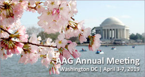
The 2019 AAG Annual Meeting hosted 8,500 students and professionals in Washington, DC. Approximately 30% of attendees came from 78 different countries to share the latest in research, policy, and applications in geography, sustainability, and GIScience. View our online gallery of photos to revisit the featured themes, special guest speakers and events, and the 120+ awards presented at the conference. Videos of several special sessions including the Opening Session and Presidential Plenary, Eric Holder’s Keynote, Atlas Awardee Carla Hayden, AAG Executive Director Doug Richardson’s Retirement Remarks, the Past President’s Address, and Recalling Gilbert White are available on the AAG YouTube Channel.

View photos of the 2019 Annual Meeting Highlights.

Watch videos of #aagDC special events.

MAD Takes Back-to-Back World Geography Bowl Titles

The 2019 World Geography Bowl was held during the AAG Annual Meeting on Thursday, April 4 at 7 PM. The 30th annual round robin quiz competition concluded with student teams from the Mid-Atlantic AAG Division and the Southeast Division of the AAG competing head to head, with team MAD pulling out the victory. MAD’s victory marks back to back championships for the division. The World Geography Bowl supports close to 60 students to help offset the costs of attending the AAG Annual Meeting.

Learn more about the World Geography Bowl.

Save the Date for AAG Denver!


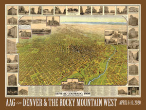
Join us for the mile high meeting. Mark your calendar for the AAG Annual Meeting in Denver on April 6-10, 2020. We invite you to organize and participate in sessions, workshops, field trips, special events, and activities. Look for the call for papers in July 2019. We look forward to seeing you in the Rocky Mountains!

Learn more about #aagDENVER.

PUBLICATIONS

NEW Annals of the American Association of Geographers Issue Alert: Articles with topics ranging from mining to climate change, health to mobility

The most recent issue of Annals of the American Association of Geographers has been published online (Volume 109, Issue 3, May 2019) focusing on current geographic research. This issue of the Annals also includes an In Memoriam to Marvin W. Mikesell. Topics in this issue include dam failurestime-space prismssmart citiescommunicable diseaseheat wavesworld city networkswalkabilityurban road networksneighborhood effects on human health, and high-speed rail. Regional areas of interest include the Global Norththe Bale Mountains, and Pittsburgh. Authors are from a variety of research institutions including: Uppsala UniversityKing’s College Londonthe Arctic Institute, and University of Maryland.

All AAG members have full online access to all issues of the Annals through the Members Only page. Each issue, the Editors choose one article to make freely available. In this issue you can read Measuring the Geometric and Semantic Similarity of Space–Time Prisms Using Temporal Signatures by Harvey J. Miller, Young Jaegal and Martin Raubal for free for the next two months.

Questions about the Annals? Contact annals [at] aag [dot] org.

NEW The Professional Geographer Issue Alert: Research featuring book reviews to beer, education to hydroelectricity

The latest issue of The Professional Geographer is now available (Vol 71, Issue 2, May 2019) with 16 new research articles in geography that emphasize applied studies. Topics include beerbehavioral effects of GPS useGeospatial literacyplace spoofingsea level riseuber and urban transportationpopulation center measurementsearly career academic mobilityachieving racial justice in geography, and the impacts of book reviews. Study areas include the American WestSalt Lake County, Utah, and Sweden. Authors are from a variety of global institutions including: Beijing Normal UniversityUniversity of AlabamaMichigan State University, and University of Oxford.

All AAG members have full online access to all issues of The Professional Geographer through the Members Only page. In every issue, the editors choose one article to make freely available. In this issue you can read Identifying American Beer Geographies: A Multiscale Core-Cluster Analysis of U.S. Breweries by Jake K. Carr, Shaun A. Fontanella, and Calvin P. Tribby for free for the next 3 months.for free for the next three months.

Questions about The PG? Contact profgeog [at] aag [dot] org.

In addition to the most recently published journal, read the latest issue of the other AAG journals online:

• Annals of the American Association of Geographers
• The Professional Geographer
• GeoHumanities
• The AAG Review of Books

NEW Spring Issue of the AAG Review of Books Published

AAG-RoB-spring-7-2-cvr-babyThe latest issue of The AAG Review of Books is now available (Volume 7, Issue 2, Spring 2019) with 11 book reviews on recent books related to geography, public policy and international affairs. The Spring 2019 issue also includes four book review discussions. The Spring 2019 Issue features a review by Stanley D. Brunn of the International Encyclopedia of Geography: People, the Earth, Environment, and Technology in which Douglas Richardson served as Editor-in-Chief.

Questions about The AAG Review of Books? Contact aagreview [at] aag [dot] org.

ASSOCIATION NEWS

AAG seeks two editors for the Annals of the American Association of Geographers

The flagship journal of the AAG, the Annals of the American Association of Geographers, has two upcoming editor vacancies to start January 2020. The open positions are in the subject areas of Human Geography and Nature & Society. Applications for the four year term will be accepted until September 6, 2019, with appointments being made in the fall of 2019.

More information about the editorial positions.

Deadline Extended to List Your Geography Program in The Guide

Guidecover1718baby-1The AAG is continuing to accept entries from geography programs for the 2019 edition of the Guide to Geography Programs in the Americas. The deadline for submitting a listing has been extended to June 1, 2019.

The 2019 edition of the Guide will be available exclusively online. The Guide lists undergraduate and graduate programs in all areas of geography and includes an interactive map that students can use to explore and discover geography programs, with easy-to-use search tools to find programs by degree type, region, and program specialization. It has long been an invaluable reference for faculty, prospective students, government agencies, and private firms in the United States, Canada, and throughout the world.

For more information and to list your program, please contact Mark Revell at guide [at] aag [dot] org.

Geography.org: A Resource for Promoting our Discipline and Recruiting Students

GeographyDotCom300-300x90Geography.org is a collaboration between the AAG and Esri to create an accessible platform and launching point for different audiences to discover the discipline of geography. Launched in the fall of 2018 as part of Geography Awareness Week, the site is useful year-round as an outreach tool for site visitors to learn more about what geography is, what geography offers, and career opportunities available in the field. Geography.org is part of the ongoing efforts of the AAG and other organizations to introduce students and the general public to a discipline that offers multiple career paths, as well as information to better understand the world.

Learn more about what the site has to offer.

AAG’s Harassment-Free AAG Survey

One of the goals of the AAG is to host an annual meeting that is inclusive and promotes a harassment-free environment for all attendees. To support this goal, we are conducting a survey about conference participants’ experiences over the past five years (since 2015). This survey is a vital and relevant assessment of the annual meeting and the results will inform policy and practice and will drive change for future annual meetings. If you have attended the AAG Annual Meeting during the past five years, we hope that you will take a few minutes of your time to help us improve as an organization.

Click here to take the survey until May 26.

MEMBER NEWS

Profiles of Professional Geographers

Do you ever wonder what it is like to be the only GIS analyst at a company? This month learn more about being the primary GIS analyst with Daniel McGlone, Senior GIS Analyst and Cicero Data Manager, at Azavea. Daniel explains his multifaceted career, one of the reasons why he wanted to work in geography, and some of the moments along his path to his current employment.

Learn more about Geography Careers.

May Member Updates

The latest news about AAG Members.

Ten students from around the nation will soon be coming to the University of South Florida for an intensive 9-week research experience on the NSF-funded Weather, Climate, and Society REU hosted by Dr. Jennifer Collins and Dr. Robin Ersing (PIs). Students participating this year: Kehinde Adekoya (Hillsborough Community College), Morgan Alexander (University of Georgia), Sydney Hampton (University of South Carolina), Malikiya Hayes (Florida A&M University), Petra Jasper (Occidental College), Conor Krystad (Willamette University), Bradley Smith (Embry-Riddle Aeronautical University), Jordan Stewart (Cornell University), Allison Foster (Auburn University), and Samantha Williams (University of South Florida). Learn more about the program.

Amy Polen, LSU Masters student in the Department of Oceanography and Coastal Sciences, was recently selected for the University Corporation of Atmospheric Research Capitol Hill Scholars Program where she will work on Environmental Policy. Watch her video submission.

RESOURCES AND OPPORTUNITIES

NSF Research Opportunity on Coastlines and People

NSF_logo2sThe NSF has recently circulated a Dear Colleagues Letter seeking those interested in establishing Research Coordination Networks for the Coastlines and People (CoPe) Project first explored in September 2018. One page summaries of projects and programs related to CoPe are being accepted until May 31, 2019 with a full proposal deadline of June 28, 2019.

Learn more.

Take Time Out This Summer for Professional Development

The AAG’s Geography Faculty Development Alliance (GFDA) will once again offer a valuable in-depth opportunity for early career professionals and department leaders in Geography to learn and engage during its annual workshops June 23-29, 2019, at George Washington University in Washington, D.C. The shorter four-day workshop for department leaders (June 26-29) will overlap with the week-long conference for early career attendees providing a full career spectrum of exercises and activities.

Register today!

Editor-in-Chief Sought for Physical Geography

The journal Physical Geography is currently seeking applicants for the position of editor-in-chief or two applicants to be joint co-editor-in-chiefs. The three year term formally starts in January 2020, with a transitional period between July and December of 2019. Applications are being accepted until May 20, 2019.

Find out more about the position.

FEATURED ARTICLES

Beyond Compactness: A New Measure to Evaluate Congressional Districts


Redrawing congressional district boundaries, an activity that happens every ten years following the decennial census, may be the most consequential application of geography in the United States. As congressional elections have become less competitive, many are raising questions about the current boundaries of congressional districts… Esri’s Policy Maps team formed the research question: How much are current congressional boundaries defined by physical features (mountains and rivers), infrastructure (highways and railroads), or other existing administrative boundaries (county and place boundaries)?

Continue reading.

GEOGRAPHERS IN THE NEWS
VENTS CALENDAR
    Share

Harassment-Free AAG: Moving Forward

“Our lives begin to end the day we become silent about things that matter.” 

Attributed to Dr. Martin Luther King Jr.

In civil society, we measure our words and deeds, and listen to others’ ideas and opinions. We set our expectations for civil discourse not necessarily based on a minimum expectation of the law, but based on our humanity, because we set high standards for ourselves and feel empathy for others.

We, too, can be thoughtful in word and deed. We, too, can have each other’s best interests at heart. Sometimes, however, we can be too stunned by words or deeds to move, frozen in shock. We can be frozen by the fear of the powerful, or the shock of the unexpected. And, we can become frustrated when the wheels of justice turn too slowly or silently. We applaud those who do speak up for justice.

I am writing to assure our community that Harassment-Free AAG does not end at the boarding gate for the flight home from the Annual Meeting. In fact, avoiding workplace discrimination and harassment all weeks of the year is the first concern in AAG’s current Statement of Professional Ethics (see section II and II.A.).

The AAG launched Harassment-Free AAG at the 2019 Annual Meeting, which members did use. I am again grateful to all the individuals, AAG Staff Members, and committee members who worked hard on the policy and on the logistics, enactment, launch, and post-meeting follow through of this new program. This program builds upon the 2017 Council Resolution creating the Standing Committee on AAG Annual Meeting Attendee Disciplinary Matters. Meanwhile, AAG members will be receiving a post-Annual Meeting survey created by the Harassment-Free AAG task force, due out in early May, to assess their experiences as a benchmark for the beginning of this program, so please watch for it and respond.

And, justice moves at a judicial pace. Several incidents did occur and were reported, and the AAG is processing them. Please do not misinterpret silence as inaction or not caring. In order for AAG sanctions to be enforceable, there must be due process. This is in fairness to those seeking justice, to complainants, witnesses, and to respondents, until all evidence is presented and considered, and decisions are rendered in the formal process. If there is no due process, it undermines AAG’s ability to enforce sanctions when warranted. So rest assured that the meeting Advocate, Ombudsperson, and AAG Staff, AAG legal counsel, and officers have been working hard behind the scenes both during and after the meeting to process and respond to reports.

That said, some incidents have been discussed in the wider social media, which of course cannot be un-seen. One recent incident is made more troubling because of the lack of response of bystanders in real time. It is certainly our collective duty to call out bullying: peer pressure is another check on misbehavior in civil society, in addition to formal proceedings. Again, we turn to Dr. King for introspection:

In the end, we will remember not the words of our enemies, but the silence of our friends.

Every one of us has a responsibility to speak out against mistreatment and misbehavior. While it is up to the justice system to investigate their severity and pervasiveness, and to determine consequences, this is also about our humanity and doing the right thing. AAG has released the following statement with the hopes that it will ease members’ concerns about the status of pending cases:

Statement by AAG regarding Harassment Free Meetings and Recent Incidents

“ The AAG is fully committed to having harassment free meetings. We have recently implemented a new wide-ranging Harassment Free AAG meetings policy (see AAG Event Conduct Policy http://annualmeeting.aag.org/conduct) that was rolled out at the Washington, DC meeting, and it has already made a positive contribution. The AAG is now compiling all the information currently available on each of the five harassment incidents which have been reported at the recent Annual Meeting. We have presented this information to our attorney, and will be undertaking formal investigations of each of the incidents as promptly as legally possible. The AAG also has a legally-reviewed policy in place on how to proceed regarding such incidents, and a special AAG Committee to handle these cases. That process is moving forward now on each of these incidents as rapidly as possible, and each will be thoroughly investigated, and enforceable sanctions will be forthcoming as warranted.”

Waiting for findings is painful, especially because we are sometimes at the mercy of University processes and timelines. So, again, I am grateful that AAG has a clear and enhanced anti-harassment policy and a process to address misbehavior by our members. I am grateful for our AAG Members’ concern and attention to this topic, and for the AAG Staff’s prompt and thorough actions to respond. AAG Council has asked the Harassment-Free Task Force to work on more specific topics that have arisen, including suggestions from our members, as we move into year 2 of this program. We will continue to review and update the new policy as unanticipated circumstances arise, and as the post-meeting survey provides input. Our work is far from done.

Thank you for allowing me into your mailboxes each month to discuss important issues that affect us all and thank you all for moving AAG into the 21st century in our expectations for courteous, thoughtful, and professional discourse, for healthy debates among ourselves, and for respect for one another.

Please share your ideas with me at: slbeach (at) austin (dot) utexas (dot) edu

— Sheryl Luzzadder-Beach, President, AAG
Professor, Geography and the Environment, The University of Texas at Austin

DOI: 10.14433/2017.0053

    Share

New Books: April 2019

Every month the AAG compiles a list of newly-published books in geography and related areas. Some are selected for review in the AAG Review of Books.

Publishers are welcome to send new volumes to the Editor-in-Chief (Kent Mathewson, Editor-in-Chief, AAG Review of BooksDepartment of Geography and Anthropology, Louisiana State University, Baton Rouge, LA 70803).

Anyone interested in reviewing these or other titles should also contact the Editor-in-Chief.

PLEASE NOTE: Due to current public health policies which have prompted the closing of most offices, we are unable to access incoming books at this time. We are working on a solution during this transition and will continue our new books processing as soon as we can. In the meantime, please feel free to peruse previous books from our archived lists.

April 2019

American Hemp: How Growing Our Newest Cash Crop Can Improve Our Health, Clean Our Environment, and Slow Climate Change by Jen Hobbs (Skyhorse Publishing 2019)

Anarchist Cuba: Countercultural Politics in the Early Twentieth Century by Kirwin Shaffer (PM Press 2019)

Anarchist Education and the Modern School: A Francisco Ferrer Reader by Mark Bray and Robert H. Haworth, eds. (PM Press 2018)

The Anarchist Imagination: Anarchism Encounters the Humanities and Social Sciences by Carl Levy and Saul Newman (Routledge 2019)

Autonomy Is in Our Hearts: Zapatista Autonomous Government through the Lens of the Tsotsil Language by Dylan Eldredge Fitzwater (PM Press 2019)

The Battle for the Mountain of the Kurds: Self-Determination and Ethnic Cleansing in the Afrin Region of Rojavaby Thomas Schmidinger (PM Press 2019)

Carbon Markets in a Climate-Changing Capitalism by Gareth Bryant (Cambridge University Press 2019)

Contested Territory: Ðien Biên Phu and the Making of Northwest Vietnam by Christian C. Lentz (Yale University Press 2019)

Dictator’s Dreamscape: How Architecture and Vision Built Machado’s Cuba and Invented Modern Havana by Joseph R. Hartman (University of Pittsburgh Press 2019)

The Economic Geographies of Organized Crime by Tim Hall (Guilford Press 2018)

Enterprising Nature: Economics, Markets, and Finance in Global Biodiversity Politics by Jessica Dempsey (Wiley-Blackwell 2016)

A Farewell to Ice: A Report from the Arctic by Peter Wadhams (Oxford University Press 2017)

Frontier Road: Power, History, and the Everyday State in the Colombian Amazon by Simón Uribe (Wiley-Blackwell 2017)

Georg Forster: Voyager, Naturalist, Revolutionary by Jürgen Goldstein (University of Chicago Press 2019)

Geostories: Another Architecture for the Environment by Rania Ghosn and El Hadi Jazairy (Actar 2018)

Global Corruption from a Geographic Perspective by Barney Warf (Springer 2019)

A History of the Czech Lands (Second Edition) by Jaroslav Pánek, Oldřich Tůma, et al., eds. (Karolinum Press 2019)

Horizon by Barry Lopez (Penguin Random House 2019)

Landscape and Power in Geographical Space as a Social-Aesthetic Construct by Olaf Kühne (Springer 2018)

Life Takes Place: Phenomenology, Lifeworlds, and Place Making by David Seamon (Routledge 2018)

The Long Honduran Night: Resistance , Terror, and the United States in the Aftermath of the Coup by Dana Frank (Haymarket Books 2018)

Maxwell Street: Writing and Thinking Place by Tim Cresswell (University of Chicago Press 2019)

The Meanings of Landscape: Essays on Place, Space, Environment and Justice by Kenneth R. Olwig (Routledge 2019)

Native American Log Cabins in the Southeast by Gregory A. Waselkov, ed. (University of Tennessee Press 2019)

The Northeast: A Fire Survey by Stephen J. Pyne (University of Arizona Press 2019)

Offshore: Exploring the Worlds of Global Outsourcing by Jamie Peck (Oxford University Press 2017)

Other Geographies: The Influences of Michael Watts by Sharad Chari, Susanne Freidberg, Vinay Gidwani, Jesse Ribot, and Wendy Wolford, eds. (Wiley 2017)

Painting Publics: Transnational Legal Graffiti Scenes as Spaces for Encounter by Caitlin Frances Bruce (Temple University Press 2019)

Plate Tectonics and Great Earthquakes: 50 Years of Earth-Shaking Events by Lynn R. Sykes (Columbia University Press 2019)

Prison Land: Mapping Carceral Power across Neoliberal America by Brett Story (University of Minnesota Press 2019)

Re-enchanting the World: Feminism and the Politics of the Commons by Silvia Federici (PM Press 2018)

Recipes for Respect: African American Meals and Meaning by Rafia Zafar (University of Georgia 2019)

The Red Atlas: How the Soviet Union Secretly Mapped the World by John Davies and Alexander J. Kent (University of Chicago Press 2017)

Reimagining Livelihoods: Life beyond Economy, Society, and Environment by Ethan Miller (University of Minnesota Press 2019)

Scarcity in the Modern World: History, Politics, Society and Sustainability, 1800-2075 by John Brewer, Neil Fromer, Fredrik Albritton Jonsson, and Frank Trentmann, eds. (Bloomsbury Academic 2019)

In the Shadows of the American Century: The Rise and Decline of US Global Power by Alfred W. McCoy (Haymarket Books 2017)

Social Imaginaries of Space: Concepts and Cases by Bernard Debarbieux (Edward Elgar Publishing 2019)

The Science of Breaking Bad by Dave Trumbore and Donna J. Nelson (The MIT Press 2019)

Into the Tempest: Essays on the New Global Capitalism by William I. Robinson (Haymarket Books 2019)

Topoi/Graphein: Mapping the Middle in Spatial Thought by Christian Abrahamsson (University of Nebraska Press 2018)

The Wizard and the Prophet: Two Remarkable Scientists and Their Dueling Visions to Shape Tomorrow’s World by Charles C. Mann (Penguin Random House 2019)

World in Crisis: Marxist Perspectives on Crash & Crisis by Guglielmo Carchedi and Michael Roberts (eds.) (Haymarket Books 2018)

    Share

Social Media at #aagDC

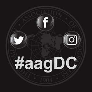
We’re getting closer to the 2019 AAG Annual Meeting! Whether you will be attending the meeting all week, for a few days, or looking to follow the action from afar, there are plenty of ways to get involved using social media. Social media is a great way for seasoned conference goers and newcomers alike to network, report on new research, engage in lively debate with those inside and outside of the discipline, and find out what’s going on during the largest geography conference in the world! Start planning your #aagDC social media strategy today with these helpful guidelines!

Twitter

One of the most frequently used social media sites for live events, Twitter is a great place to start scoping out the annual meeting. Twitter is used by geographers to discuss and share research ideas or connect with others, often leading to face to face meet-ups at the annual meeting. As the main social media channel, the AAG annual meeting has had active Twitter users since at least 2011 in Seattle. The hashtag #AAG followed by the year of the event used to be the standard AAG Annual Meeting tag. However, this year we decided to switch it up! Due to increased traffic from other events who are already using #AAG2019 (hat tip to the ASEAN Autism Games) and the fact that as geographers we are always thinking about place and space, we will now use the hashtag #aag followed by the location of the conference. This year the official conference hashtag will be #aagDC! Start using and following #aagDC; posts are already being compiled in anticipation of the meeting! If you are new to Twitter, try these tips to benefit most from the network:

  • Follow @theAAG on Twitter! The official AAG Twitter account will be active throughout the meeting with important announcements, live tweets of events, and fun photos throughout the conference hotels. Due to popularity, the AAG will continue to conduct a Twitter poll once a day for members to choose a session they would like to see live-Tweeted!
  • Use #aagDC on all your meeting related communications. Sometimes it is difficult to fit your thoughts into the (now expanded!) 280 character count, but try to include the hashtag #aagDC in each of your tweets. This will ensure that your tweets are being seen by others both at the conference and following along offsite. If you are new to hashtags, a hashtag is a way to organize a specific topic into one feed. Click on the hashtag to see the conversations happening related to that topic.
  • Whenever possible, try to include Twitter handles. If you are tweeting about a paper, panel, or poster, be sure to attribute the research to the right person by using their Twitter handle. Presenters and panelists should consider including their handles on an opening slide or in a poster corner. Conversely, if you do not want your research to be tweeted, please state that information upfront so the audience is aware of your desires.
  • Unable to attend the meeting this year? Follow the hashtag and join the conversation!

Facebook

Do you prefer Facebook over Twitter as your social media site of choice? While there will be less live coverage of specific sessions, Facebook is a great way to share photos, videos, and news about the annual meeting with your friends, family, and colleagues.

  • Make sure you like the AAG Facebook page (www.facebook.com/geographers) and set the page so that you see it first in your News Feed by clicking on the “Following” dropdown menu on the AAG Facebook page itself. This will ensure that you receive the latest meeting related announcements as soon as you open the Facebook app or website.
  • Be on the lookout for Facebook Live videos from some of the major events like the Exhibition Hall opening and the World Geography Bowl finals!
  • Check on the page each morning for reminders of the day’s schedule of events.

Instagram

The AAG’s newest social media channel, Instagram is a fun place to share your photos of activities at the annual meeting and your daily life as a geographer!

  • Follow @theAAG on Instagram for photos of the annual meeting as well as behind the scenes looks at the work that goes into planning the conference on a yearly basis!
  • Share your photos of the meeting with other attendees using the conference hashtag #aagDC and look for an Instagram collage of #aagDC photos after the meeting ends.
  • Want to be featured in our new Instagram Campaign to meet members of the AAG, #MeettheAAG? Look for AAG Staff throughout the meeting who will be taking photos and collecting information about AAG members that will be showcased during the summer.

General Communications

Because the AAG social media channels will be busy during the annual meeting, AAG staff may not be able to provide a timely reply through these mediums. The AAG Annual Meeting App is a good place to start for conference information with regards to floor plans, session times and locations, and abstracts. If you have questions or concerns and need to contact a staff member, the best option is to find a conference volunteer (wearing a neon yellow t-shirt) or to stop by the AAG Meridian or Registration area in the Atrium of the Marriott Hotel.

    Share

Bruce Mitchell

Education: B.A. in Philosophy and Religion (Eckerd College), Ph.D. in Geography and Environmental Science and Policy (University of South Florida)

Describe your job/position and some of the primary tasks and duties for which you’re responsible.
We’re a Washington, D.C. based nonprofit organization engaged in advocacy, research, and policy analysis centered on the Community Reinvestment Act of 1977. NCRC looks at investment activity within US cities, particularly mortgage and small business lending, and access to financial services. We’re very interested in the issue of equity and wealth building for low and moderate income Americans, so we focus on evaluating how banks are providing financial access for individuals in cities and rural areas. Our work is not enforcement, but we point-out where banks can do better in their performance and make recommendations to improve policy decisions and regulation.

Where do you draw your data from, and how do you use the data in your work?
We primarily use publically available datasets. For instance, to look at mortgage activity, we use data gathered as part of the Home Mortgage Disclosure Act (HMDA). Additionally, under the Community Reinvestment Act, banks are obligated to report data regarding their small business lending, so we use both of these datasets to study lending activity. Data on bank branch locations and deposits are available from the FDIC. We also use U.S. Census data quite a bit to define low to moderate income areas and determine where minority communities are located and what sort of financial access and access to capital these groups have. We’ve also done some interesting studies using historic sources, like the HOLC residential security maps, commonly referred to as “redlining maps” which identified lending risk by neighborhood using theories from Homer Hoyt and the Chicago School of urban geography. We looked at the HOLC classifications of neighborhoods done in the 1930’s to compare the demographics and economic status of the neighborhoods today. It is startling how little demographic and economic change there has been in these neighborhoods. Eighty years later and they are still mostly minority and low income. Also, we are releasing a report on gentrification and displacement and their impact on capital flow and neighborhood change.

How do you perceive the value and importance of geographic knowledge to perform the work that you just described?
A geographer brings a distinct perspective to this work. Our work at NCRC engages with the problems of urban geography, looking at neighborhood change, and how this corresponds with the spatial flow of capital within cities. We also examine capital access at different scales, from census tracts up to metro areas and states. A multi-scalar understanding of geography is critical to what we do. We use spatial statistics and spatial analysis to examine bank branch access and proximity to various communities. An economist might approach these issues in a non-spatial way and fail to see the relationship of neighborhood demographics on issues like proximity and financial access for communities. Much of our work involves mapping. Maps provides an immediate spatial awareness to people, helping them understand how lending and investment patterns differ between communities. When you combine maps with visualizations of statistical and other quantitative analysis, it is a very powerful way of providing information to advocates and policymakers.

Can you reflect and maybe give an example or two of some impacts that this work has had in the community?
What we’re engaged in is very close to critical cartography. We’re looking at inequitable access to capital, and using maps and data to encourage banks to meet their obligation to do a better job in underserved communities. This results in what are called “community benefit agreements”, involving community groups, banks, and federal agencies. The Community Reinvestment Act impacts banks when they are trying to achieve a merger and there’s a problem with their performance in low to moderate income and underserved communities. Often we are able to look at their performance and encourage increased commitments to lending and community development efforts. Some of these community benefit agreements amount to billions of dollars in commitments by banks. We’ve had a number of community benefit agreements in the past two years which have substantially increased the amount of investment in underserved communities by banks.

We also work on grants. For instance, working with the U.S. Dept. of the Treasury to assess the impact of their Bank Enterprise Award (BEA) program. Under a W.K. Kellogg Foundation grant, we’re currently looking at discrimination in small business lending. This involves rigorous testing of banks using prospective customers of different race and gender profiles to assess how customer service interactions take place. It’s a very innovative area of market research with civil rights implications. Our goal in all of these activities is to increase equity in financial access for all Americans.

How does your work connect to your aspirations, both as a private citizen and as a professional in your field? 
I enjoy both the quantitative work and the mapping work that we do. Additionally, seeing how issues in geography, that might seem theoretical, profoundly impact our communities. Redlining and the HOLC maps which arose partly out of early theories of urban geography like filtering and invasion/succession for instance. Today it is interesting to see how urban planning theories, like Richard Florida’s “creative class” are playing out through processes like neighborhood gentrification. It’s very rewarding to engage in policy issues that directly affect economic equity throughout the United States, and to be in a position that in a small way promotes greater equity for all Americans.

Based on your prior educational experiences, when did you discover geography? Can you think of a specific moment that changed your perspective about different issues, civic responsibilities, and the potential of geography to be of value in society?
The initial “hook” into geography for me was cartography. I was interested in the revolution in cartographic science that was taking place with applications like ArcGIS, enabling more people to engage in mapmaking. Beyond that, the theoretical aspects of geography matched well with my previous education in philosophy and the social sciences. Unifying the quantitative aspects of spatial analysis with my social sciences orientation has been rewarding and interesting. Outside of my job, I have done research and publications on environmental justice issues with Jayajit Chakraborty. I’ve looked at areas where there is inequitable exposure to urban heat, which I describe as an issue of thermal inequity within US cities, and also cities around the world, like in India. I use spatial statistics to determine whether there is a relationship between socially vulnerable communities and greater exposure to the urban heat island effect and climate change.

    Share