Douglas Gress

Education: Ph.D. in Geography (State University of New York at Buffalo), M.B.A. in International Business (Yonsei University, Seoul, South Korea), B.A. in International Studies (State University of New York at Buffalo), Diploma in Korean Language and Culture (The Defense Language Institute, CA)

What attracted you to a career in education?
I grew up in a home where there was a lot of emphasis on the benefits of higher education. As a way to get me interested in university, my parents had my older brother take me to an economics class at his university. I remember the professor of the lecture was engaging, organized, and incredibly knowledgeable, and I thought to myself that was something I might like to do one day. Even while serving in the army, I noticed how some of my peers were better teachers than others, and in university I constantly took note of who my best professors were and their qualities. I was an active student, so I appreciated a great class and involved guidance, and I tried to learn from them. Years later, working first on my M.B.A. thesis and then my Ph.D. dissertation, I became hooked on the research process, and took advantage of opportunities to actually teach over the course of my studies.  So in the end, a career in higher education meant being able to do research that interests me and being able to teach, too.  Bingo! Perfect job for me.  I never saw myself doing the same thing every day, day in and day out.

How has your education/background in geography prepared you for this position?
I’m an American, yet I’ve spent half of my life as an expat and my entire professional career has been overseas. Geography has greatly informed my experience. Some topics within economic geography, such as exchange rates or investment, have provided me with useful information on living overseas long term. In broader terms, geography’s approach to culture and how organizations and institutions across space are impacted has been extremely valuable.

Had I not received my Ph.D. in economic geography from SUNY Buffalo, I obviously would not have the job I do today. Formally, it was a top-notch program that provided me with a great education from some of the leading names in the field. Informally, I owe much to the professors that mentored me for their great advice and early career guidance.

What geographic skills and information do you use most often in your work? What general skills and information do you use most often in your work?
The geographic skills I use at work differ depending on whether I’m engaging with undergraduate or graduate students. In undergraduate classes, you teach about your discipline and its roots, and how to tie theory and geographic perspectives to students’ lives and the world around them today. Graduate classes allow you to delve into more advanced theory and application.

General skills that I consider important would be classroom preparation and administration. Otherwise, I’ve learned how to do things more ‘the Korean way’ over the years. Social skills are eminently important here, but it’s a high context culture, so there are a lot of unwritten norms and rules, and a lot of communication takes place ‘between the lines’.  This informs both teaching and how I perform my role in the department.

Are there any skills or information you need for your work that you did not obtain through your academic training? If so, how/where did you obtain them?
I was fortunate to have had a background in Korean language and culture prior to starting my academic career here, but not everyone is as fortunate.  If you find yourself interested in working in a particular country, I’d urge you to begin studying the language and culture as well in advance as possible. I’m not saying you can’t succeed working abroad without this background, but it certainly makes life easier and more enjoyable.

I wish I had taken graduate courses in teaching. Over the years I’ve developed what I hope is an effective teaching style, but why re-invent the wheel? Education courses provide an opportunity to teach and, more importantly, to be critiqued.  I learned via observation and while working my way up the academic food chain.  Students pick up on whether or not you have a passion for what you teach, and I hope that has helped me over the years as well.  I love what I do.

Do you participate in hiring, screening, or training of new employees? If so, what qualities and/or skills do you look for?
Yes.  I look for both hard and soft qualities in a candidate. Hard qualities include having the requisite Ph.D. and publications, and that goes for even early career hires. I also look at research agendas to see if they’re a good fit with the department. Will they be able to engage and advise our student body? Beyond that, I look for verifiable teaching experience in the target discipline and some demonstration of service. In terms of soft skills, I look for people who are personable and motivated. It sounds cliché, but we look for team players, and that is especially critical in Korea where there is a decidedly collectivist culture.

What do you find most interesting/challenging/inspiring about your work?
The great thing about economic geography is its breadth. My interests and passions have guided my research and teaching. I work at a huge university with students and scholars from all over the world, and they’re all doing interesting things.  I’m always going to special lectures or engaging with visiting students and faculty.

The biggest challenge is probably being able to maintain a work-life balance while staying on top of your diversified workload. You want to be productive, but you don’t want to get burned out.  In my case, one challenge might be that I do a lot of my work and day-to-day interactions in Korean, though I might not consider it a challenge per se.   Challenging? Sure, but it keeps the days interesting and it forces me to keep working on my Korean.

By and large, inspiration for me comes from teaching. It’s amazing when undergrads get interested in economic geography and start making connections to what we do in class and the world around them, when you see those wheels turning.  Having been at SNU for quite some time now, watching the development of grad students has also been inspirational. The increasing depth of their critical thinking ability on one hand, and then the development of their writing over time on the other.

What advice would you give to someone interested in a career in academia?
The market has changed a bit since I first started.  I would say that if you want to become a professor at an R1 university, start managing your career when you begin graduate school. Don’t just take the requisite classes, get cross-training as well.  Pick up a GIS certificate, for example, or bone up on a different sub-discipline (e.g. spatial statistics, urban geography, etc.) by taking a few extra courses. You might wonder why, but look at the ads coming out these days. Budgets are tight, so a lot of departments are looking for scholars who can wear multiple hats.

Also, be realistic and be ready to move. If you’re serious about becoming a professor at an R1 school, mission number one is to get that first tenure track job. A post-doc is all well and good, but it won’t start your tenure clock, and statistics tell us that the majority of the tenure track jobs go to those either on ABD status, or who graduated one to two years prior. If an opportunity presents itself, it may not be directly related to your research or teaching interests, it may not be at an R1 school, it may not even be in a geography department, and it might not be located where you ultimately want to settle down. Most professors I know didn’t begin and end their careers at the same university, and most have worked in more than one state or country. Working your way up often means moving around a bit.

What is the occupational outlook for career opportunities in your field/organization, esp. for geographers?
It seems that the academic job market has bounced back a bit from the trough it hit after the economic meltdown. Still, a lot of the jobs are adjunct or visiting positions, and for any given hiring season, there are more applicants than there are positions. Many jobs are also requiring increased teaching loads, but not cutting back on the publishing expectations. Your first job might not be a dream job. I think the odds are better for anyone with multiple skill sets (e.g. economic geography plus GIS or urban geography).  There’s a glut of highly qualified, well published early career scholars from around the world, so you need to set yourself apart somehow.

    Share

Jeremy Tasch

Education: Ph.D. in Geography (Clark University), M.S. in Energy Management and Policy (University of Pennsylvania), B.A. in Geography (Temple University)

What attracted you to a career in education?
Just prior to completing my undergraduate degree, I was hired by the Geography Field Division of the US Census Bureau.  This was my first full-time opportunity in cartography and data handling; but shortly after I felt that working as a consultant might be a better fit for me. I worked part-time in a city planning position and completed a graduate degree in energy management, and then was employed as an energy consultant. Working as a consultant allowed me to work throughout the US, but as it turned out I was more interested in exploring international employment opportunities, and decided to pursue a Ph.D. for the opportunity to conduct international field research. Five months after completing my international doctoral fieldwork I was employed as a country director for an international NGO. For about five years I was involved in educational reform, civil society development, and youth empowerment programs.  But it was through my work with individuals at all levels — from high school students to ministers of education — that I understood the advice I had received from a geography professor years previously. In response to a question regarding why he chose to teach rather than do something “practical,” he replied, “Education promotes change, development and emancipation.” I realized that education has the power to bring change to individuals and society, and I was convinced to return to the classroom as a professor.

How has your education/background in geography prepared you for this position?
Geography taught me that knowledge is best understood outside of the classroom.  My interests led me to conduct research in Azerbaijan, Belarus, Italy, Latvia, Kazakhstan, Kyrgyz Republic, Norway, and throughout Russia. Geography helped me develop a geographical imagination, a way to ask questions spatially and identify (potential) solutions. I honed my geographic imagination through field research in Pacific Russia, followed by a professional position in the Caucasus, from where I moved to Alaska. I not only taught in Alaska, but also helped create new programs and departments in geography, environmental studies, and international studies. Now at Towson, I have been returning to the Caucasus, Central Asia, and Pacific Russia — likely more often than the administration might prefer.

What geographic skills and information do you use most often in your work? What general skills and information do you use most often in your work?
I use a wide variety of tools to communicate geographic information, ranging from the as-expected maps, statistics, and reports to TV, the Internet, and other types of media. And to encourage other geographers who do not use GIS, I’ll mention that the last time I explicitly used GIS in a job was while a grad student working part time with the USGS.  As this list conveys, the differences between what is geographic and what is “general” can be quite small. It speaks to the need for geography to be positioned as a foundational component in the general education of everyone — a place geography actually does occupy in many countries. Competency in more than one language, though generally taken for granted by non-US based geographers, is another critical skill that is often overlooked in the US. I think back to a recent discussion on the skills expected of our geography majors in which only a minority of our faculty tried to convince the majority of the importance of language proficiency as a skill. I would have had a very different career were it not for a high school counselor who first advised me to study a second language.

Are there any skills or information you need for your work that you did not obtain through your academic training? If so, how/where did you obtain them?
As an ABD, I was one of three candidates invited for an interview, but I wasn’t hired. The employer gently explained that the other finalists demonstrated evidence of supervisory and program management experience.  Although I had made it a point to supplement my core geography classes with electives while a student, I was disappointed to realize that this was inadequate for this professional position.  It was through other positions that I learned skills such as financial management, personnel supervision, diplomacy and negotiation, program administration, public outreach and marketing.  These skills might not seem to align with geography, but I credit my background in geography for giving me the transferrable skills to manage programs, to help connect with international audiences, and to engage in different cultures.  My education in geography generally helped me to coordinate programs in a manner that strengthened relationships among diverse stakeholders, and my knowledge of cartography specifically helped me to communicate to a broad constituency using a variety of media.

Do you participate in hiring, screening, or training of new employees? If so, what qualities and/or skills do you look for?
I was involved in hiring and training while serving as the director of an international NGO.   I sought skills in foreign language proficiency, written and oral communication, experience working with international organizations, and the ability to manage one’s time and meet budget guidelines. More subjectively, I looked for collegiality and humor, understated confidence, buy-in for networked management, creativity, and flexibility.

What do you find most interesting/challenging/inspiring about your work?
Geography is a calling both inside and outside of the classroom. My work has allowed me to share ideas, communicate concepts, and encourage and participate in fascinating conversations through many roles. I will admit, with a bit of reflection and some nostalgia, that my daily professional work outside of academia seemed more dynamic: The range of issues with which I dealt and that impacted others’ lives seemed more immediate; and the tangible results of my projects were inspirations to myself and, I hope, to others.

What advice would you give to someone interested in a career in academia?
The path into academia is somewhat straightforward, though not necessarily easy. Practicing geography outside of academia is less so. My first advice (for those thinking outside academia) is to get a copy of the small, but extremely helpful book, Practicing Geography.  That book offers a wealth of websites, guidance, ideas and strategies to pursue a career in geography in diverse and surprising ways.  I would also request vacancy announcements from services such as USAJobs.gov, Idealist.org, and from specific organizations that operate in regions and specialties of interest.

What is the occupational outlook for career opportunities in your field/organization, esp. for geographers?
My answer is trite, but if a geographer is curious and analytical in applying their knowledge to real-world problem solving effectively, then career opportunities are excellent. But with a caveat — as graduates take on debt, a larger family, and material belongings it may become more difficult to accept some of the entry-level international positions that require a lighter suitcase.

    Share

Marilyn Sue O’Hara

Marilyn Sue O’Hara, also known as Marilyn Ruiz, died September 30, 2018, following a collision between her car and a semi-truck at an intersection near her home in Urbana-Champaign, Illinois. She was 58 years old. She is survived by her parents, four children, and six siblings.

Marilyn received her Ph.D. in Geography at University of Florida in 1995. Her dissertation was titled  “A Model of Error Propagation From Digital Elevation Models To Viewsheds.” Her dissertation advisor was Grant Ian Thrall. Her Bachelors and Masters degrees were from University of Illinois. Her selection of UF for her doctorate degree came about because of communications with Grant about Spatial Diffusion, Grant at  the time was resident scholar at the Homer Hoyt Institute, doing research on spatial diffusion of urban development, and he had recently co-authored a monograph titled Spatial Diffusion. She then applied for the graduate program at UF and received an offer of a UF Presidential Scholarship awarded to the University’s top entering graduate students. Marilyn never drew funds from that award because her graduate program at UF was generously and fully funded by contract grants on DEM from the US Military. Her advancements on the topic of DEM were expedient; but, her passion was Epidemiology, Spatial Diffusion of Disease.

After receiving her Ph.D. she was offered several academic appointments and accepted a position as Assistant Professor at Florida State University. After completion of her third year at FSU, she was offered positions at University of Illinois where she advanced to Clinical Professor of Pathobiology.

At University of Illinois she became a cherished teacher, advisor, and mentor. The comments on her FacebookPage from her former students in the USA, India, and Africa, stand as a testament to the high regard she was held by her students, the university, and her biological family. She was a brilliant student; a wonderful person.

I am honored to have been her Ph.D. advisor and her friend

– Grant Ian Thrall

Marilyn O’Hara’s facebook page is at https://m.facebook.com/marilyn.o.ruiz

A selected list of her publications at https://experts.illinois.edu/en/persons/marilyn-ohara-ruiz/publications/

    Share

Joe Schwartzberg

I am now in my ninety-first year and am writing this from my home in White Bear Lake, Minnesota. Presently I am in a home hospice care program in which I expect to spend whatever time remains to me. I am writing this in lieu of a much more extensive memoir in which I had hoped to present, as a major part of my legacy, a detailed account of my richly spent lifetime. But, even in this greatly abbreviated narrative my life story will, I believe, be of interest to numerous potential readers. Many of them knew/know me in respect to one or another aspect of my diverse career, but have little or no knowledge of the others. I also hope that this account will impart useful lessons to groups with whom I identify and, perhaps, induce them to work harder in support of causes – workable world government, human rights, global education (especially in geography), and others — that we jointly support.
 
To enhance its readability, this account is written in the third person to make it less open to the criticism that I, the writer, am guilty of undue self-promotion. It goes without saying that, like all other human beings, I have my share of shortcomings, but I have chosen here to focus on the positive.
 
Joseph E. Schwartzberg
Born in Brooklyn, New York on February 5, 1928, Joseph Schwartzberg was the second of four children of Philip and Frances Schwartzberg. He and his siblings were born within a span of less than six years. All six members of the family participated in the operation of their small clothing store. They lived in two rooms behind the store during the bad years of the depression and in an apartment immediately above it when times were good. Joe graduated from Erasmus Hall High School in 1945 and in 1949 from Brooklyn College (cum laude), where he majored in geology.
During World War II Joe spent parts of three summers working on farms to support the war effort: a poultry farm on a then defunct New Deal cooperative homestead project in New Jersey; a poultry and tobacco family farm in the Connecticut River Valley; and a large cattle ranch near Houston, Texas. When it became apparent that the war in the Pacific would shortly end, Joe quit his job and hitchhiked to various cities in Mexico, all the way to Acapulco on the Pacific coast. This was, arguably, the most noteworthy of his numerous hitchhiking trips – in North America, Europe and Asia — that Joe made during the course of a life marked by extensive travel.
During his years in college Joe was active in a number of student organizations. He was president of Beta Delta Mu, an interracial fraternity (quite rare in those days); and was the manager and a (not particularly good) member of the collegiate wrestling team.
Shortly after earning his B.A, Joe accepted a position as a geographer with the Map Intelligence Branch of the U.S. Army Map Service near Washington, D.C. Simultaneously he worked for his M.A. at the University of Maryland. His master’s thesis (1951), “Old Order Amish and Stauffer Mennonite Communities in Southern Maryland,” was based on field research among the communities named. This work instilled in him a love of fieldwork and an abiding interest in “plain people” and, more generally, in communities with life styles deviating from established norms. During this period, Joe frequently attended Washington’s First Unitarian Church. There, he became familiar with the then burgeoning World Federalist movement. He has maintained his allegiance to the “one world” ideal ever since.
Shortly after the outbreak of war in Korea, Joe was drafted into the U.S. Army. Although he anticipated that he would be sent to Korea immediately on conclusion of his infantry basic training, he was assigned instead to a topographic engineering battalion headquartered in the Presidio of San Francisco. After nine months in that unit he accepted a commission as a 2nd lieutenant and was transferred to Fort Belvoir, Virginia. There he trained for work in a newly created terrain intelligence unit, which was dispatched to Heidelberg, Germany in December 1952. His duties entailed extensive travel in Germany; and his leave time provided additional opportunities for international travel.
After almost three years of military service, Joe, then a 1st lieutenant, took his discharge in Germany. Thus began an extensive period of foreign travel and residence, including four months in Seville, Spain (then still under the rule of Franco) in early 1953; eight months in Paris in 1953-54, studying French language and civilization at the Sorbonne (courtesy of the G.I. Bill of Rights); a month in Israel; brief sojourns in many Islamic nations in North Africa and the Middle East; a half-year touring India and other countries of South Asia; several months in Southeast Asia; and a month in Japan.
During his stay in Paris, Joe drew up a rough draft of a World Constitution, many of whose ideas were incorporated in articles and books published later in his career. Joe’s federalist thinking was later reinforced by his experience in India, the world’s most populous federal polity. Considering that, despite its many serious problems, meager resources and incredibly diverse population, India was able to maintain a viable democracy, convinced Joe that a federalized world, with vastly greater resources, could do so as well.
Joe’s sojourn in India was marked by visits to a number of Gandhian ashrams and government-managed community development projects (some guided by the Ford Foundation); and by the formulation of numerous friendships: with government officials, holy men [sadhus], artists and writers, other travelers, etc. Several of these friendships endured for decades.
In September 1956 Joe embarked on study for a doctoral degree at the University of Wisconsin. He had by then decided to specialize in either South or Southeast Asia, and chose as his advisor the renowned geographer, Richard Hartshorne, notwithstanding the fact that Hartshorne had no Asian experience. That somehow didn’t matter. In 1958 Joe was awarded the first of two year-long fellowships from the Social Science Research Council, the first for field work in India, the second for support while writing his dissertation His field work entailed thousands of miles of travel by bicycle (accompanied by Indian interpreters) to more than 200 villages throughout India. His dissertation, Occupational Structure and Level of Economic Development in India: A Regional Analysis, completed in 1960, was later published as monograph no. 4 of the 1961 Census of India. Working with the Census Commissioner, Joe provided detailed recommendations for the schedule of questions for the 1961 census, as well as a template for decadal census atlases at both the national and state levels.
In 1960, Joe accepted a dual appointment at the University of Pennsylvania, joining the Wharton School’s Department of Geography and Industry and the Department of South Asia Regional Studies, the first such regionally specialized program in the United States. His contacts in the latter department greatly expanded his multi-disciplinary understanding, not only of South Asia, but also of regional studies in general. Several relevant papers on regionalism ensued, as did two seminal papers on the geography of the Indian caste system.
In 1962 Joe was in charge of training, at the University of Pennsylvania, of the first group of Peace Corps volunteers to be sent to Ceylon (now Sri Lanka). He accompanied the PC volunteers to Ceylon for a final month of training, following which he spent almost a year in India as a Fellow of the American Institute of Indian Studies. For most of this period he expanded his previous research.
During this year he met Monique Ribaux, a Swiss medical lab technician working for the malaria eradication program of the World Health Organization. The two were wed in Geneva in December 1963, and subsequently had two sons, Philip (b. 1964) and Paul (b. 1966). They were divorced in 1998.
In the spring of 1964, Joe learned from a colleague at Pennsylvania of a proposal to create a Historical Atlas of South Asia at the University of Minnesota, following the bequest to that institution of the magnificent Ames Library of South Asia. Excited by that challenging initiative, Joe wrote a lengthy memorandum to its two principal faculty supporters specifying what he thought such an atlas should contain. This resulted in an unanticipated invitation for him to come to Minnesota to join the Geography Department and edit the work. He accepted the offer, and moved to Minneapolis with his family that December.
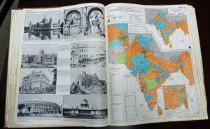
The atlas project took much longer than anticipated. It entailed procurement of numerous research grants, and required roughly 85 person-years of work from a multi-disciplinary team of specialists at Minnesota and the American Geographical Society. First published by the University of Chicago Press in 1978, the work was reissued in an updated edition by the Oxford University Press in 1992, and in a digitized edition by the University of Chicago in 2006. It won the Watumull Prize of the American Historical Association, as the best work on Indian history of the 1978-79 biennium, and an outstanding achievement award from the Association of American Geographers. In 1981 David Watumull observed: “Over the years, since 1946 when this Prize was instituted, I can … say, without a doubt, that this is the finest and most worthwhile book to be selected.” What makes the work unique is its presentation, not only of the findings of modern historians of South Asia, but also its recreations of the ways in which aspects of that region were made known by numerous actors – both South Asian and outsiders –over more than three millennia.
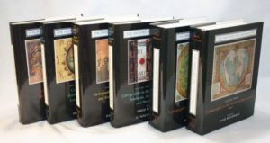
Publication of the atlas led to Joe’s being recruited into what was to become an even larger (and still on-going) project, the preparation of a multi-volume History of Cartography. Apart from offering advice in planning the work (headquartered at the University of Wisconsin), Joe was asked to write an article on the indigenous cartography of South Asia, a subject on which there was then virtually no extant literature. However, years of research in South Asia and neighboring regions – in libraries, museums and private art collections, as well as in the field – uncovered a vastly larger corpus of cartographic and cosmographic artifacts than one might have anticipated. Joe was the associate editor and principal author, by far, of two volumes of the history, one on South Asia and the Islamic World, the other on East Asia, Southeast Asia and Greater Tibet (University of Chicago Press, 1992 and 1994 respectively). In all, he contributed more than 550 pages of text and illustrations for the work. (Particularly remarkable were his 76 pages dealing with the cosmography and cartography of “Greater Tibet,” a subject on which there had been virtually no prior cartographic scholarship.)
Joe’s additional writing in his years at Minnesota (1964-2000) took numerous forms: scores of book reviews, essays in political geography, editorials on contemporary issues and events, numerous articles on the Kashmir dispute, work on folk regions in South Asia, a short monograph relating to the history of exploration, various spin-offs from his work on the history of cartography, and major contributions to several encyclopedias, including the lengthy article on the “Physical and Human Geography [of India]” for the 15th edition of the Encyclopaedia Britannica on whose advisory board he subsequently served.
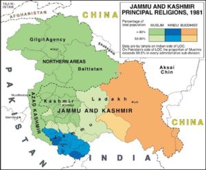
Joe’s writings on Kashmir were focused on promoting a peaceful resolution of the multi-partite disputes over that region. They were based largely on his visits – in 1993, 1994 and 1997 – to all parts of that contested, ethnically diverse state. He conducted interviews, on both sides of the Indo-Pakistani line of control, with a wide range of political actors (UN personnel, civil administrators, military officers, party leaders, dissidents [some in hiding],businessmen, journalists, victims of violence, and others). While his tours in 1993 and 1994 were largely self-financed, that of 1997 was as part of a fact-finding team sponsored by and drawn from the Kashmir Study Group (KSG). This think tank, of which Joe was a founding member, was established in 1996 by Farooq Kathwari (a wealthy Kashmir-American businessman), and was made up mainly of scholars and retired diplomats. Though the published findings and recommendations of the KSG (to which Joe was a principal – but anonymous – contributor), were widely discussed in diplomatic circles in South Asia, North America and Europe, hawkish nationalistic spoilers ultimately prevented their adoption. The KSG still exists; but it is less active than in its early years.
Along with writing, Joe taught thousands of students in a variety of courses and seminars. His most popular courses were introductory human geography (a sweeping overview of how the world is constituted) and political geography (wherein one is challenged – as in the real world – by the necessity of striking a credible balance between idealism and realpolitik). More specialized were his offerings on South and Southeast Asia and on historical cartography. Of particular relevance for his work on global governance were his seminars on “The Geography of Federalism,” “The Law of the Sea” and “A Charter for the New Millennium.” In 1979-80, Joe held a visiting Fulbright professorship at the Center for the Study of Regional Development at Jawaharlal Nehru University in New Delhi, during which he offered a course in population geography and a seminar on field methods.
Attendance at conferences provided Joe with abundant opportunities for travel, either en route to or returning from the conference venue. His participation at the 1992 Rio Summit Conference on the Environment and Development, for example, was followed by extensive travel in South America; and his atlas presentation at the Canberra meeting of the International Congress of Orientalists in 1971 was combined with visits to a number of Pacific Island nations. In all, Joe has traveled to approximately a hundred countries.
Intermittently, Joe served as a consultant to numerous governmental and scholarly agencies in the United States, Canada and India, and as a member of selection committees for various academic awards. For three years (1985-88) Joe was the elected Secretary of the US National Commission of the International Geographic Union. His previously noted work for the Indian census was instrumental in his consulting with the Mandal Commission, tasked with devising a quota system (arguably unwise) for allocating jobs and educational seats for members of so-called “other backward castes.” On October 23, 1959 Asok Mitra, the then Registrar General and Ex-Officio Census Commissioner of India, wrote to Joe as follows: “I am indeed very grateful to you for your letter of 25th September and your very well thought out recommendations for the improvement of the 1961 Census of India. I feel very grateful to you indeed, as these recommendations are by far the most detailed, practicable and important that I have ever received. All of them bear the imprint of a sense of reality.”
In recognition of his scholarly achievements the Department of Geography nominated Joe in 1995 and in 1996 for a highly competitive Regents Professorship, the highest academic honor that the University of Minnesota can bestow. However, neither nomination resulted in success.
Apart from scholarship, Joe was also heavily engaged in service activities on and off campus. On campus, he served (albeit briefly) as Chair of the Department of South Asian and Middle Eastern Studies, as an elected representative in the University Senate and in the Assembly of the College of Liberal Arts, and as a member of numerous committees. For three years (1984-87) he directed the Minnesota Studies in International Development program (MSID), providing unpaid student internships in a number of countries of the global South. He established several MSID programs in India and headed a delegation to Colombia, which led to a program with that nation’s Fundación Social, a business conglomerate guided by the Jesuit teachings of “liberation theology”. For several years following the Colombia visit, Joe was among a group of activists that tried (unsuccessfully) to establish an inner-city cooperative bank based on the Fundación model. In 2009 the University bestowed on Joe its annual “Award for Global Engagement” and the title “Distinguished International Professor Emeritus.”
In the public arena, Joe was also quite active. He served in various capacities in the Minnesota Chapter of the World Federalist Association (later Citizens for Global Solutions), including 14 years as its President. He was also active in several roles in the governance of WFA/CGS at the national level.  He chaired WFA’s Policy and Recommendations Committee for several years prior to the establishment of CGS in 2004, and for the following decade was especially active in the World Federalist Institute, a CGS-affiliated think tank. For several decades he served as a member either of the Board, or of the Advisory Council, of the Minnesota Chapter of the United Nations Association.
In 1996 Joe was one of the handful of activists who founded the Minnesota Alliance of Peacemakers, which subsequently grew into an umbrella institution with roughly eighty peace and justice organizational members. In the following year he was a co-founder of the aforementioned Kashmir Study Group. In 1999, Joe was the annual honoree of the Vincent J. Hawkinson Foundation, an entity promoting peace and justice activism in five states of the Upper Midwest of the United States.
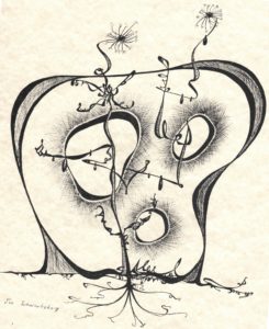
In a non-academic vein, Joe gained a touch of notoriety for his remarkable doodles, hundreds of which were created during tedious staff meetings and conferences in Minnesota and elsewhere. One of these appears to the left.
Additionally, Joe derived much pleasure from writing and illustrating whimsical stories for his children and grandchildren. Among these were Emanuel and Elvis, the story of a forgetful old man’s dependency on his pet elephant. Another favorite was There’s a Frog up Your Nose, a path-breaking four-part trilogy, the contents of which are less disgusting than the title.
Following his formal retirement from the University of Minnesota in 2000, Joe focused more heavily on issues of global governance, working largely with several organizations already named – writing scores of op-ed essays for their respective journals – and with the Academic Council on the United Nations System in whose journal, Global Governance, he published papers on UN peacekeeping and weighted voting. He expanded his advocacy of the latter idea in a monograph published in 2004 by the World Federalist Movement – Institute for Global Policy, Revitalizing the United Nations System: Reform through Weighted Voting. A related monograph, Creating a World Parliamentary Assembly: An Evolutionary Journey, was published by the Berlin-based Committee for a Democratic United Nations in 2012.
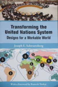
The ideas in these two monographs and in many previous articles – along with many others – were compiled in a book, Transforming the United Nations System: Designs for a Workable World (TUNS), published by the United Nations University Press in 2013. That work provides a comprehensive set of proposals for moving away from the Westphalian paradigm of unfettered state sovereignty on which the present system of global governance is predicated. Despite – or perhaps because of – its radical nature, Joe’s most recent book has been warmly endorsed by leading global thinkers, including Boutros Boutros-Ghali, Thomas Pickering, Brian Urquhart, Thomas Weiss, Johan Galtung, Alfred de Zayas, Stephen Schlesinger and many others. Joe’s editor at the United Nations University Press wrote to him shortly before publication: “I don’t think we’ve ever had a book with so much praise and backing from such a prestigious group of endorsers.” The Press then made Joe its first nominee ever for the prestigious Grawemeyer Award for Ideas Improving World Order. (He did not win, however.)
Of all that Joe has written, the most important, potentially, is the following credo, which he composed in 1976:
An Affirmation of Human Oneness
I am a member of the human family, a citizen of the world.
The achievements of men and women throughout the ages are my heritage.
My destiny is bound to that of all my fellow human beings.
What we jointly create forms our bequest to future generations.
May my life serve the good of my family.
May our use of the earth preserve it for those yet to come.
Joe hopes that this statement will be routinely recited at the outset of civic events, school ceremonies and other noteworthy occasions throughout the world, either along with the respective national anthems or independently. Toward that end Joe had the Affirmation translated into 12 major world languages for distribution at the summit Conference on the Environment and Development, which he attended in Rio de Janeiro in 1992. The total number of translations now stands at 43.
In 2001, Joe and his fellow peace and justice activist, Louise Pardee, entered into a domestic partnership and Joe moved from his cramped apartment in Minneapolis to Louise’s spacious lakeside home in suburban White Bear Lake. Since then, Louise has contributed to Joe’s work, editorially and in other ways.
In December 2014, Joe legally established The Workable World Trust, the principal purpose of which is to disseminate and promote the many global governance proposals in his most recent book. The work of the Trust has been carried out with the remarkably efficient and competent support of Ms. Nancy Dunlavy, who legally succeeded Joe as Director of the Trust in 2017. Joe then formally assumed the title of Director Emeritus. In practice, however, the two continue to cooperate on a wide variety of projects; and Joe intends to remain active as long as his health permits.
The Trust has negotiated translations of TUNS into Arabic, Chinese, French, German, Japanese, Russian and Spanish, thereby facilitating virtually worldwide discussion of its reform recommendations. Additionally, a much shorter, less academic Study and Discussion Guide has been prepared for each translation.
The Trust has supported (or is supporting) many projects in addition to those noted above, with beneficiaries in every continent. It has sponsored major conferences, such as the “Creating a Workable World” conference (University of Minnesota, 2015), the “Seminar on Security Council Reform” (UN Church Center, New York, 2016), and the “Commonwealth of Nations as a Vehicle for Sustainable Peace & Development” conference (Brisbane, Australia, 2018). It has also contributed substantial funds in support of conferences and reform advocacy by like-minded groups (e.g. The World Federalist Movement, the Berlin-based Democracy Without Borders, the Brussels-based Center for United Nations Constitutional Research), and provided travel support for youth participation at the Ventotene International Seminar in Italy and a Model UN program in Mexico City. It is also the principal financial backer of the “UN2020” initiative for a General Assembly-backed effort to institute a major reform process to mark the 75th anniversary of the UN’s founding. The Trust has also endowed a Workable World lecture series through the year 2025 in conjunction with the prestigious Nobel Peace Prize Forum, held each year at Augsburg University in Minneapolis. Further, Joe has bequeathed to Augsburg his personal global governance book collection, along with a fund for the enlargement of his bequest. Since its creation, the Trust distributed over $2 million (estimate as of March 2018) in support of numerous undertakings.
In summary, Joe has enjoyed a remarkably rich and rewarding life. He has sought to conduct himself as a World Citizen, in both word and deed. He has demonstrated his willingness to tackle big projects and his ability to bring many of them to successful conclusions, at times independently and at times as part of a team. He has been recognized for the rigor, originality, and social value of his scholarship. He has put forward detailed and practicable proposals for improving global governance through peaceful evolutionary processes. He recognizes the fallibility of human beings and the institutions that they create, and knows that utopia is not attainable. But a workable world is. Joe hopes that his work and that of the Workable Word Trust – which will outlive him – will contribute significantly toward the achievement of that goal and encourage others to join in the struggle to bring it to fruition.
   White Bear Lake, Minnesota, August 2018
    Share

Terrence W. Haverluk

Terrence W. Haverluk died September 18, 2018, in Colorado Springs, CO. He was a Professor in the Geospatial Science Program at the United States Air Force Academy. Terry was born September 12, 1958, in Gillette, Wyoming. He was an athlete throughout high school, excelling in both wrestling and baseball. He attended the University of Northern Colorado for his undergraduate degree in geography. He worked as a roughneck on the oil rigs in Weld County, CO, to pay for school. After travelling throughout Europe and Mexico, he enrolled in the Geography Department at the University of Minnesota, where he earned his MA in 1987 and PhD in 1993. Terry was a cultural geographer who published numerous influential research articles and books. He first became recognized for his work on Hispanic migration patterns in the United States and the cultural changes that resulted in receiving communities. He also published on Mexican food diffusion, regional food types, and cultural adaptations of cuisine and cooking. During the most recent years he turned to geopolitics, publishing the textbook Geopolitics From the Ground Up, journal articles, and teaching the topic in the Scholars Program at the Air Force Academy and occasionally at the University of Colorado, Colorado Springs and Pikes Peak Community College. A consummate geographer, he easily transcended subdisciplines, making connections between the physical and human world and teaching classes in both. Anybody who knew Terry can attest that he was a jovial, fun-loving, and enthusiastic person. He loved to cook and travel, and was proficient in both Spanish and French. He was also a brilliant scholar. His research contributions helped many others, and he was the best lecturer anybody could ever have the pleasure to listen to. At the Air Force Academy, he was well-known among faculty and cadets for his “Chile Pepper” lecture, and recently was known to receive standing ovations from cadets as he walked into the classroom. However, he had been in poor health for nearly a decade, suffering from various ailments, but all related to his underlying struggle with alcohol. Terry had just turned 60 the weekend before his death, and hosted a pig roast at his property. Many of his friends and family came from around the country, which gave him great joy. The geography community has lost a great mind and great spirit. He is survived by his wife Julie and daughters Elena and Claire.

    Share

Caitlin Kontgis

Education: Ph.D. in Geography (University of Wisconsin-Madison), M.S. in Environmental Health Sciences (University of California-Berkeley), B.A. in Geography (University of California-Santa Barbara)

Describe your career path following your Ph.D. up to your current position. What are the range of tasks / responsibilities for whicyou’ve been responsible in the positions you’ve held?
I submitted my dissertation in December 2015, but I had already begun at a company called Descartes Labs, a startup that analyzes petabytes of satellite imagery. We have a team of software engineers that deals with ingesting the data, correcting it, and building a Python-based platform to access it. I’m on the Applied Science team, and we’re using the data to generate models or maps of various land cover types. Some of this is client driven; for example, a client might come to us and want to know where all of the corn in the United States is and what the yields will be at the end of the year.

We have a pretty wide variety of clients. We work with the U.S. government, and we have a particularly cool project with DARPA assessing food security in the Middle East and North Africa. We have also worked with Cargill – they’re interested in agriculture, obviously, and we also have other sorts of commodities clients. We’ve also done work with non-profits and have contacts at World Resources Institute and National Geographic.

The project that I’m currently working on involves using radar data to map rice across Asia, so it’s sort of a return to what I was doing in my Ph.D. I started at Descartes while I was still finishing my dissertation. I was looking at a lot of jobs as I was finishing, but I wasn’t really finding jobs that seemed like the right fit or where I wanted to be geographically. I Googled “private sector jobs with remote sensing” and this small company came up – the company was only 10 people at the time. I interviewed and really liked New Mexico, the people, and the team, so I decided I’d give it a shot and have really enjoyed it.

The job has evolved since I began working here. When I started it was only about a dozen people, and there wasn’t much structure on the team. Now we’ve grown to about 75 people, so we’ve had to get quite a bit of structure in place. I lead our solutions efforts; on the Applied Science team, we’ll have customers come to the Sales team and pitch an idea, and I help the Sales team assess whether or not the idea is technically feasible. We now have a proposal process in place, where we’ll do a more in-depth review of the project to see how we would approach it, roughly how much time it would take, how many people it would require, and then go from there. I lead the team that is doing all of the solutions work and then work with the Sales team to make sure we’re not committing to something we can’t do.

Can you talk a little more about the analysis you perform – you mentioned that it’s not just limited to the U.S., correct?
Yes, we have the entire historical Landsat archive, as well as global MODIS data and European Space Agency Sentinel data across the globe. When the company was just getting off the ground our initial project was trying to predict corn yields in the United States earlier in the season and with higher accuracy than the USDA, which we did, and that’s how we got our first couple of customers. From there, we’ve looked at a variety of applications including forestry, construction, and different types of agriculture across the entire globe.

The backbone of the company is the computing systems that we have. The team that started the company came from Los Alamos National Labs, and they were experts in high performance computing. They picked up on remote sensing quite easily, then built a system that can process data very efficiently so we can scale analyses really, really rapidly. I think I processed all of the data for Asia and ran that model in less than six hours for the entire continent. That’s really the powerhouse of the company.

How has your education/background in geography prepared you for this position?
I think the thing that jumps out most obviously is having a good grasp of procedural geographic knowledge. We work with spatial data and massive amounts of satellite imagery on a regular basis, so having a thorough understanding of these kinds of data is critical to what we’re doing on the job. For example, we have a project monitoring food security in the Middle East and North Africa. Ideally, we would just choose a random assortment of points and label all of them across the region to train and test our models. However, that’s not feasible given constraints on how you can move across the area. For instance, there may not be road networks, or you might be trespassing onto private land. Thinking about how to best use the data given, that it might be quite linear and not indicative of the entire region that you may want to be sampling, is very important.

I think understanding that these issues exist and being able to creatively brainstorm how to overcome them is pretty critical for what we do, as a lot of clients that we work with may not necessarily understand those concepts as thoroughly. They’ll often come to you with a vector dataset of points, and not understand why you can’t use those points right off the bat. In order to communicate that information to clients in a way that makes sense and is easy for them to understand, you need to have a pretty deep understanding of the datasets and what’s possible or isn’t possible given the constraints of the imagery that’s being collected.

How does your knowledge of the region under analysis – for example, the landscape characteristics or the cultural/economic geography of the area – inform your overall approach in how you use these technologies and how you analyze the environments?
It’s a huge component of what we do. The most obvious example I can think of is just the climate of a region. When I was working in Vietnam during my Ph.D., I was relying on Landsat data, but for six months out of the year, you don’t get a single scene where you can actually see the landscape because of the monsoons. At Descartes, it’s been much easier because we have all of the radar data from the European Space Agency on their Sentinel-1 satellite. Radar data can be difficult to work with, but in regions like the monsoonal tropics, it’s the only way you’re going to get data throughout the whole year.  Having that knowledge of where you’re actually studying and understanding those climatic impacts is crucial.

Also, there are geo-political considerations. Looking at the tariffs that are now being imposed by the United States – is China going to start sourcing all of its soybeans from Brazil now? Keeping track of that and understanding how that might affect some of the models that we’re running is critical in having a deeper understanding of the dynamics that we’re trying to study and better understand. Because some of it you can’t just explain with the satellite imagery, you have to have a broader view of what’s going on globally with politics and trade.

What have you observed in your career in terms of positive impacts in the community or for your clients? How has geography enhanced the work of your organization?
In terms of the organization, I mentioned that the company was very small when I came on and most folks on the team had a background in astrophysics or computer engineering. It was amazing and pretty humbling what they were able to do without formal training in remote sensing or geography. However, being armed with some of the knowledge that I got during my Ph.D. has been important.

Understanding the terms that people are using in more detail has also been critical. For example, if we want to map urban areas, what exactly is an urban area? We think about urban areas being San Francisco or Washington, DC or New York, but globally those are quite different and varied. In Vietnam, for example, many parts of the cities are made of vegetation, so we aren’t necessarily picking up that signal in remote sensing data the same way we would looking at San Francisco. So, bringing those ideas of geography and what constitutes a certain land cover type, or this broader picture of what the data are saying has been useful for the team. I have since recruited some of my friends out of Madison so we now have more geographers on the team, which is great, as we’re able to convey geographic concepts to the broader group. I think it just arms us better to go out and talk to other experts in the field, and better communicate with our clients as well. For the organization, I think it has been very useful to have that knowledge on the team.

In terms of our community, Santa Fe is a small town and our company is a big fish in a small pond, so we’ve been able to give back in a variety of ways. We are out and involved in the community, and everybody thinks that what we are doing is mind-blowing, so it’s fun to present our work locally. We’ve done a few presentations around town and at schools, and it’s pretty neat to watch people who have no experience or exposure to satellite imagery see what sort of things can be done with it.

When you look back at your education trajectory, how did you discover geography? How did you realize that it connects with your aspirations and your goals in life, as a private citizen, but also as a professional?
I had a really, really amazing teacher for my intro to geography course at UC Santa Barbara. I didn’t know geography was something that I could major in when I went into undergrad; I took the course to fulfill a math requirement. The course was amazing. Carl Sundbeck, the lecturer for the course, showed different images of a road trip he took in the 1970s across the entire United States. He was describing the landscape and how different mountain ranges formed, or how a city such as Los Angeles grew up where it did because of the geography of the region and why that was beneficial. Drawing these connections just sort of blew me away, and suddenly the world made sense in a way I had never thought about. And it made me want to learn about geography, obviously, so then I ended up majoring in it.

I traveled for a bit between my Bachelor’s and Master’s programs, and it was amazing making those same connections that I was making during my initial intro to geography classes. It was really exciting and made me want to continue down that path. During my Master’s degree, I was doing a lot of data processing and epidemiology work, which is very statistical and very important, but it’s just not for me. I felt stuck at my desk and not really doing the work that I wanted to be doing. I went to Vietnam the summer between the two years of my Master’s program with a friend of mine from undergrad who was from there and we stayed with her family. I felt the same way as an undergrad when I was traveling. I wanted to get back to geography and do research that was in the field, which was a lot more dynamic than what I was working on for my Master’s thesis.

I then ended up going to Madison for my Ph.D. because the woman who taught my remote sensing classes at Santa Barbara had moved there. So I went to work with her and basically went with the excuse that I wanted to continue exploring, traveling, and getting to know other cultures. I proposed to do the work in Vietnam and got it funded by NASA. I was really lucky in that regard, as I got to sort of drive my own ship. And then coming to Descartes, it just sort of continued. I’m not necessarily out in the field collecting data and interviewing farmers, but it’s still every single day looking at satellite imagery and trying to better understand the world, so it’s exploration in a different form. It’s doing a lot of exploration via satellite imagery, not necessarily boots on the ground, but it’s still fulfilling that interest.

Do you remember having an “a-ha!” moment, that perhaps changed the way you think about issues and topics? Is there another example you might have?
It definitely occurred when I was at Santa Barbara. I realized that “Wow, you can earn a living doing something that you really love!” I don’t know what I envisioned I’d be doing after college when I was 18, or what I’d be doing as a career. There was some moment at Santa Barbara when it all clicked. I remember realizing there are jobs where you can continue on a path of scientific discovery and exploration, that you don’t just have to be crunching numbers and data or doing something that’s just a job. You can do something that you really feel passionately about. You know, it probably was that first geography class, and then the same lecturer taught the follow-up class the next semester. I think at that point I was pretty hooked. At that stage, I hadn’t even taken a remote sensing class and didn’t realize what career opportunities were out there. It was just sort of like: I love this; this guy can make a living doing this, so there must be room for other people. Those first couple of classes in college were pretty crucial to where I am now.

    Share

David Lowenthal

David Lowenthal died peacefully at his home in London on September 15, 2018. A giant in the fields of geography, history, and heritage studies, Lowenthal is perhaps best known for his 1985 work The Past is a Foreign Country. In 2015, the updated edition of this text, The Past is a Foreign Country – Revisited received widespread praise, including a British Academy Medal. At the San Francisco AAG Annual Meeting in 2016, Lowenthal took part in an author meets critics session on this work (pictured at right).


Born in New York City in 1923, Lowenthal received an undergraduate degree in history from Harvard University in 1944. After being deployed as a geographer during World War II, he went on to obtain an M.A. in geography under Carl Sauer at University of California, Berkeley. Sauer recommended he continue his education at University of Wisconsin, Madison, where Lowenthal completed a Ph.D. in History with a dissertation on the life of George Perkins Marsh, the subject of his first book George Perkins Marsh: versatile Vermonter (1958). Following several appointments throughout the US and Caribbean, Lowenthal became a professor of geography at University College, London in 1972 where he remained until becoming emeritus professor in 1985.


Among his works, notable ones also include The Heritage Crusade and the Spoils of History (1996) and a revised edition of his work on Marsh, George Perkins Marsh: Prophet of Conservation (2000). He was working on a final work entitled Quest for the Unity of Knowledge. Lowenthal is a medalist of the Royal Geographical, the Royal Scottish Geographical, and the American Geographical Societies; a Fellow of the British Academy; and honorary D. Litt. Memorial University of Newfoundland. In 2010 he was awarded the Forbes Lecture Prize by the International Institute for Conservation.

Remembrances have been written about him published in The GuardianThe Cambridge Heritage Research CenterThe Geographical Society of Ireland, and University College, London.

    Share

John Sauvageau

Education: M.S. in Geo-Information Science (Salem State University), B.S. in Cartography and GIS (Salem State University)

Describe your job. What are some of the most important tasks or duties for which you are responsible?
I work within the Retail Network Transformation team, which falls under the consumer business banking umbrella. We’re responsible for the strategy and planning of our branch markets, and where we want to put branches and ATMs. We leverage GIS to analyze and visualize our internal and external data spatially. We then use the ESRI platform ArcGIS Enterprise with its various tool sets including business analyst, network analyst, and spatial analyst as the tools to help us develop strategy.

We provide services to much of the northeast, including Rhode Island, Massachusetts, Connecticut, New Hampshire, Vermont, New York, Pennsylvania, Delaware, and Virginia, and also parts of the midwest like Ohio and Michigan.  We’re responsible for supporting the analysis and branch recommendations for all types of branch actions – open, close and relocations.

How has your education/background in geography prepared you for this position?
Grasping the various levels of geography and how they relate to each other is fairly important to understand. The banking industry is a little bit different than a standard retail industry, where chains can just put a store where there’s going to be high traffic. We deal with varying levels of governmental compliance. One aspect of compliance is proportionately locating branches in areas to ensure we are serving low to moderate income households, as well as middle to upper income households. We use internal and external data, including Census data,  to understand where that population is so we can target those areas.

Looking at the five themes of geography, I think we really touch two of those: location and region. Location – we have a network of branches and locations, we monitor other retail marketplaces, where they’re coming up, where they’re going away; other competitors’ locations, where customers are located. Location really is the number one thing that I think applies to what we do in this kind of planning. It’s kind of the same thing as real estate: location, location, location, everything is location.

At the regional scale we look at how everything works together and the nuances from region to region. We designate our own regions for organizational hierarchy purposes, but states, counties, etc. – they all have unique nuances, and we want to understand these so we can better interact with the population within those regions and be in the places where they are going to be. We also need to understand how they use the banks: are they primarily driven by branch visits, or using a more digital approach with online and mobile banking? How do we customize the look and feel from region to region to make our banks more attractive?

How does your geography knowledge inform your use of GIS and make it possible to get the most out of the business analyst software and work with big data?
Many of my colleagues across the industry come from more of a business intelligence background. Many have used GIS as a next step and have gone back to universities and vendors for formal training. These colleagues are amazing and have a great deal of hands-on experience and have been using these platforms for a long time. With my educational GIS & Cartography and Geo-Information Science background as a whole, I am able to bring in and apply more foundational concepts and tools to enhance our analysis. Maps can tend to be more mass produced and less of a cartographic product, but whenever I’m asked to make a map, I try to ask more questions first. Questions like: What is the purpose? What is it that you’re trying to convey? How will you be using and presenting the map? These and similar questions allow me to create a product that will be visually pleasing to the customer and their audience and allow the map to speak for itself. Different approaches and techniques will apply for varying levels of requests; it’s not always a “one size fits all” approach.

How did you discover geography was going to help you pursue your aspirations, professionally or in your personal life?
When I think of my “a-ha moment” I always refer back to a certain exercise with ArcGIS in one of my undergraduate courses, where we were working for a town searching for a site for a new fire station. We were given criteria where it had to have its own land within a certain square footage, and it couldn’t be within 7 minutes of another fire station’s service area. Taking all of that information, creating multiple layers and using a raster analysis to find out where the best possible areas were for this fire station – I had never seen that before, so I was like “wow, this is interesting!”

I was working at a bank at that time as a part time teller and thought “this would be really interesting to bring into the bank and use GIS to figure out where to put banks.” Being naïve as I was, I didn’t understand that it had already been going on. I didn’t know it existed. It wasn’t until a few years after that where I was taking some courses at the bank, learning about processes of improvement, efficiency and those sorts of concepts where I realized how interesting this was, and that I already had a good foundation for that kind of work from my education in GIS.

My branch manager at the time gave me the best advice I had ever received for this. He said: “Look in the organization, try to find somebody doing what you want to do, and just reach out to them and ask if you can talk to them and get advice on: How did you get over here, and what kind of preparation would I need to get into this kind of area within the organization?” So I did that. I identified the person I needed to talk to, reached out to them and we exchanged a few emails. Nine months later and I got an email from another person who he referred me to, and they had just created this GIS Analyst position within the bank to do exactly what I had been looking to do in branch site location. They asked me to interview for it, and a few months later I started on this path, which leads me here today. It all goes back to that one lesson in my undergraduate that kind of sparked my interest in the field, and without that I probably wouldn’t be here.

What attracted you to the banking industry? How did you initially develop that interest?
I had just returned from being deployed – I went to Afghanistan in 2010. I was looking for some part time work. My father-in-law had been working in the banking industry for a long time and thought it would be a great fit for me as a part time job.  A branch close to home was hiring, so I applied for a part time position as a teller. I began to thrive and before long I ended up becoming a supervisor. A few years later I was  promoted to a financial services representative. While I was gaining all of this financial experience, I was also going to school full time for GIS.  I had this passion for banking and this passion for GIS and I wondered, how great would it be if I could combine them?

I started in 2014 working on the real estate team and market planning, and gained a great deal of job experience in my first year. I transitioned to another financial institution performing similar tasks. I spent the last 3 years there, and now I’m taking a more senior role at a new institution. It’s been amazing, and it’s interesting because a lot of these types of decisions don’t require banking experience. It’s a unique combination of having worked in a branch and having the GIS experience that gave me insight into how the branch operates, while many of my peers don’t have the same understanding of what it’s like to work in a branch. When I’m helping to program details like how many desks we want to design in a certain branch with a certain amount of staffing, I’m able to bring a different perspective, because I’ve been in their seats before.

    Share

Patrick Shabram

EducationM.A. in Geography (San Jose State University), B.A. in Geography (University of Colorado Boulder)

What attracted you to a career in education?
I’ve spent a number of years working in private industry, yet early on began to teach part-time as an adjunct. I had spent several years teaching on the side before realizing that it is my passion. At age 42, I made the switch to full-time.

How has your education/background in geography prepared you for your teaching career?
Typically, a Master’s degree is needed to teach at a community college, along with teaching experience. Many of my colleagues have Ph.D.’s, but education is not sufficient for a position like this; without classroom experience, getting a full-time position is nearly impossible. Starting off as an adjunct or teaching as a graduate student is necessary. Personally, I brought experience from my consulting and research work in the private industry, which I believe improved my chances of securing my full-time position.

What do you do in the wine industry?
The federal government has a system in place for recognizing unique regions for viticulture, both to serve as a benefit for consumers and to protect geographic names in the industry. If a winemaker wants to use one of these geographic names on their label, 85% of the grapes used to make the wine needs to come from within the boundaries of that region (e.g., Napa Valley or Russian River Valley). To establish an area as a unique American viticultural area (AVA), a petition to the Alcohol and Tobacco Tax and Trade Bureau (TTB) is necessary. These petitions require details that identify why the area is geographically unique as a winegrowing region, as well as identify boundaries that best encompass these characteristics. I do studies that look at climate, soils, topography, viticulture and viticultural practices, and other aspects of the area to determine what makes the area unique (or determine if the area does not meet TTB requirements) and recommend boundaries. The findings are often used by growers, wineries, or grower associations to support petitions for new AVAs or to modify the boundaries of existing AVAs.

What geographic skills and information do you use most often in your work? What general skills and information do you use most often in your work?
I teach several different classes, but since I most commonly teach introductory physical geography, a well-rounded knowledge of earth sciences is essential. Technical skills in GIS, Google Earth, and other applications and online resources help in creating and running laboratories. When I interact with local organizations on building and promoting internship opportunities, an understanding of careers that are out there also helps.

Writing skills should never be overlooked. There tends to be administrative work with my job requiring the ability to present written ideas clearly and concisely.  The same goes for my work in the wine industry—that work is about 40% writing.

Are there any skills or information you need for your work that you did not obtain through your academic training? If so, how/where did you obtain them?
Networking. The importance of networking was engrained in some of my employment outside academia, where I was commonly expected to attend networking events. Someone might wonder why I need to network now, since students come to me, and I don’t really need to find new business or a new job. I’ve found a lot of excellent opportunities for collaboration, however, through my contacts at other institutions. These opportunities all have been about students. I’ve worked on grants, helped students find jobs, helped solve transfer issues, learned new teaching techniques, and found interesting subject matter all through my contacts at other colleges, non-profits, and private companies.  As an example, FRCC is in the third year of a student-focused collaborative grant with an NSF facility all as a result of networking with professionals outside my college.

Do you participate in hiring, screening, or training of new employees? If so, what qualities and/or skills do you look for?
Yes, I’ve served on several hiring committees, hired an assistant for an NSF grant, and currently help hire and manage our part-time faculty. I look for student-focused candidates; the common mistake candidates make for community college positions is focusing too much on research and not on education. Unless their research is in education, candidates need to be able to put emphasis on students and classroom experiences.

What do you find most interesting/challenging/inspiring about your work?
Seeing my students’ lives change. I’ll have students get in touch with me after having left FRCC to tell me how their time here made a difference in their lives. There’s nothing more satisfying than seeing a former student graduate from the four-year college they transferred to, and to then see the kinds of great careers they go into.

What advice would you give to someone interested in a job like yours?
Get teaching experience in any way you can. Don’t just stand in front of a room and lecture, but really think about education and your pedagogy. Strive to be a great educator.

The other advice is to be geographically flexible. If you are looking to land a job in your hometown, you may be waiting a long time.

What is the occupational outlook for career opportunities in your field, esp. for geographers?
It is competitive, but not like in other disciplines. There are usually only one or two full-time geographers at a community college, and full-time faculty tend to stay, so a position at any given college doesn’t come along very often. Someone with a degree in geography tends to have a lot of good options though, so we sometimes find we are competing for the best candidates. Chances are someone looking for a full time position won’t find a job right away, but since I’ve been here, we’ve seen a number of our adjuncts take full time positions at other institutions.

    Share

Kate Bishop

Education: Ph.D. in Geography and Anthropology (Indiana University), M.A. in Anthropology (Indiana University), B.A. in French (Bates College)

Describe your job. What are some of the most important tasks or duties for which you are responsible?
In my role as an evaluator, I am responsible for measuring, analyzing, and reporting on the results of international agricultural development projects.  I train, advise, and lead multicultural teams in mixed-method research projects such as baseline studies, qualitative assessments, midterm and final evaluations, and impact evaluations.  I also help project staff in field offices to create and implement performance management plans and develop research budgets.  I have supervised evaluations of projects in Burkina Faso, Cameroon, Ghana, Guinea-Bissau, Liberia, Mali, Niger, and South Africa that were funded by the United States Agency for International Development, the United States Department of Agriculture, and various foundations.  This work is important because it helps project funders, including U.S. taxpayers, to understand whether they have achieved programmatic goals promoting agricultural development.  Equally important, the research contributes to reconceptualizing and refining project strategies to expand outreach and improve outcomes for everyone involved.

What attracted you to this career path?
I joined the Peace Corps after I graduated from Bates College with a degree in French.  Working in Africa and teaching others about Africa has always been very important to me.  Working with NGOs was a great way to work towards social and environmental justice, learn foreign languages, and gain diplomacy skills.

How has your education/background in geography prepared you for this position?
I entered grad school after working in the field of international development for a decade.  One of my goals in studying geography was to improve my research skills, in particular methods and theories appropriate to evaluating programs in Africa.  While I gained a lot of practical knowledge as an applied researcher, it was not until I studied geography that I was able to understand and analyze important dimensions of development that are often ignored or understudied in professional research such as political economy, human-environment interactions, culture, and history.

What geographic skills and information do you use most often in your work? What general skills and information do you use most often in your work?
Geographic skills important to this work include the ability to use mixed data collection methods, to integrate qualitative and quantitative data, to analyze human-environment interactions, and to conceptualize processes through time and across space.  More generally this work requires: the ability to develop and implement culturally-appropriate research design; foreign language skills; the ability to lead and work as a team member; strong writing and presentation skills; and, resourcefulness and adaptability in a challenging fieldwork environment.

Are there any skills or information you need for your work that you did not obtain through your academic training? If so, how/where did you obtain them?
I began learning French in high school and had already spoken the language for years before entering graduate school.  I began studying Portuguese during my master’s program, and it was incredibly helpful in expanding my knowledge of Lusophone Africa.  In addition, I had a lot of experience in cross-cultural settings prior to my academic training in geography.  Building interpersonal and communication skills requires a life-long effort.

Do you participate in hiring, screening, or training of new employees? If so, what qualities and/or skills do you look for?
When I am part of the hiring process some important candidate qualities I look for include knowledge and experience in the field or position, foreign language competency, writing skills, and creativity.  For program evaluation positions in particular, I look for attention to detail, ability to conceptualize program strategy and rationale, communication skills, and generally outgoing/approachable personality.

What advice would you give someone interested in a job like yours?
My advice would be to apply to the Peace Corps or another long-term service or teaching position in a developing country in order to obtain in-depth field experience.  I would study at least one foreign language.  Become familiarized with the history, politics, arts, and geography of a country or region of interest.  Take a home-office position with an NGO in Washington, D.C. or elsewhere as a Monitoring and Evaluation Associate or Coordinator and build a career from there.  Importantly, enter this profession with a humble attitude.  You will find that your counterparts and coworkers in developing countries are often much more knowledgeable than you may expect, and that research in the field of international development is always a learning experience.

What is the occupational outlook for career opportunities in your field/organization, esp. for geographers?
Due to USAID’s emphasis on strong program evaluation across all projects, the field has been growing fairly rapidly for nearly a decade.  There appears to be plenty of opportunity for applied researchers for U.S. Government-funded programs for now, although changes in the State Department related to the policies of the current administration may lead to shifts in funding priorities.  Other opportunities exist at multilateral institutions such as the World Bank, the United Nations Development Program, and the Food and Agriculture Organization of the UN, as well as at bilateral institutions and foundations.

    Share