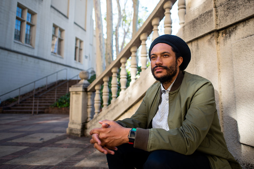
Member Profile: Jovan Scott Lewis
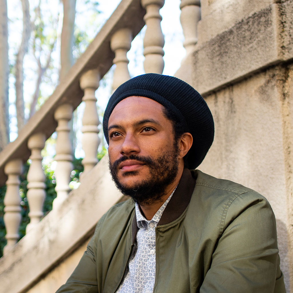
“When we think about issues of racialized poverty and racial capitalism, we’re talking about resources, fundamentally,” says Dr. Jovan Scott Lewis, chair of UC-Berkeley’s Geography Department, and a member of California’s State Reparations Task Force. Lewis’s work addresses “the driving geographic imperative to understand the earth” and the frameworks and relations human beings have created to take advantage of the earth’s resources. Lewis’s work offers spatial perspectives on the socio-political and economic contexts that led to categories of difference and discrimination during European expansion and colonization, categories that persist today and “allow us to discriminate, allow us to deprive.”
Both of Lewis’s books—Scammer’s Yard: The Crime of Black Repair in Jamaica; and Violent Utopia: Dispossession and Black Restoration in Tulsa—explore how Black people move through and endure systems of discrimination and higher risk of poverty, as well as how they define the terms for reparations for systemic harms. Examining how racialized capitalism plays a role in informing individual agency, physical and societal boundaries, and institutional actions, Lewis illuminates the experience of poverty, described by the Jamaican term “sufferation,” meaning not only the condition of poverty but the experience of living with poverty as a defining reality that shapes people’s lives. He also interrogates the concept of scarcity, an article of faith in Western economic theory. Investigations such as these have provided Lewis with a powerful lens to look at the communities he became familiar with as a part of his research.
During his time in Jamaica, while working on Scammer’s Yard, he came to understand that the scammers he studied saw themselves as facilitating a means of reparations outside of governmental apparatuses. “When I asked them, why do you scam, or how can you scam, they said, ‘well, it’s reparations.’ It’s not for me to believe them or disbelieve them.” Lewis sees his role as a researcher to “accurately represent their frameworks.” He observed that because the scammers “had access to greater amounts of capital, they were able to invest in their families and their children’s education. They were able to buy homes and buy property. All of the things that reparations policies in fact aspire to accomplish … these guys did it just by getting money. And so, it begins with thinking about what the terms of satisfaction are” for communities that have been violently dispossessed. “They gave me a very well-articulated formula for the basis for repair. They were able to determine who was guilty and why, and they were able to determine what the bases for their claims were and why, and they were able to articulate a process for actual reparations.”
When the focus of his research transitioned to the United States, although the methods to procure reparations are different, the underlying symptoms of sufferation were readily apparent. “What I realized after arriving is that there was a lot that was very familiar to me in North Tulsa” Lewis says. “So when I arrive in 2014, what do I see? I see people who are struggling financially, of course. But what I also notice is that a lot of the everyday services are being provided by nonprofits…And that was very familiar coming out of a kind of Caribbeanist perspective, where a lot of these key services in the developing world, in the Caribbean specifically, are oftentimes provided by non-governmental organizations (NGOs), ”external partners” that were not always meeting the needs of the people they were ostensibly serving.
Lewis was surprised to be appointed to the 9-member California Reparations Task Force, created in 2020, to examine ways to compensate Black Californians for generational dispossessions caused by the U.S. slavery system. Yet he also understood what led to the appointment. In his extensive teaching and research, Lewis has developed “some genuine frameworks for thinking about reparations” and specifically for connecting the largely transactional notion of reparations to the human experience of feeling satisfied with the repair. He has continued to highlight the importance of asking injured or dispossessed communities what it is they need, acknowledging that this should be a base requirement of any reparative measures implemented. The difficulty of delineating whose injury was eligible for reparations was not lost on Lewis. Understanding the complexity, and the agonizing nature of having to effectively decide who counts for the purpose of implementation of California’s reparations policies, as well as the limits of a state-sponsored policy for creating meaningful reparations, Lewis worked with the Task Force toward its March 2022 decision to award reparations only to Black Californians who are direct descendants of enslaved people.
“Reparations will always be in my work, because you can’t just leave it there [at the study of poverty or dispossession],” Lewis says. “You have to talk to people not just about the hardships that they face, but also what are the ideas, what are the principles by which they feel those hardships can be responded to.” In the classroom, he is encouraged by his students, who don’t take existing systems and frameworks for granted, but fundamentally believe that we can reimagine how our institutions interact and uplift our most vulnerable members of society. He takes the willingness to reimagine still further, offering the caveat that we must not simply upset the applecart, or destabilize it, rather we must ask the fundamental question of what an apple is, and why it is in the cart at all.
I worry that we reproduce certain kinds of categories, without really unsettling the categories themselves.
Lewis has seen how the study of geography can challenge accepted, often rigid categories, by exposing how they play out on a map or in a place. In his work, “the idea of what geography can do for thinking about reparations is so beautifully and also frustratingly obvious. We have to do a good job of communicating the power and the importance of geography to our communities and society.”
 When Nick Mellis was eight years old, he memorized the New York City subway map. He’s been a map and transit enthusiast ever since, majoring in geography as an undergrad at Clark University, and going on to pursue graduate studies in community and urban planning, also at Clark.