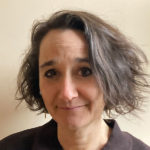
James Gordon Nelson

In May 2024, Canada lost one of its most distinguished and honored geographers, Dr. James Gordon Nelson, Distinguished Professor Emeritus of University of Waterloo in Canada.

Dr. Nelson was an internationally respected and renowned expert in conservation, protected areas, and policy, having worked all over the world, and was a leader as advocate for parks and protected areas all over Canada during a professional academic career that spanned decades. He received his B.A. from McMaster University, his M.A. from Colorado, and his Ph.D. from Johns Hopkins University. Before accepting a position with the University of Waterloo in 1975, Dr. Nelson held academic and administrative positions at the University of Calgary and the University of Western Ontario.

During his time in academia, he was a prolific scholar with hundreds of publications including dozens of peer-reviewed articles and several major authored or edited books — many with students and colleagues as co-authors. In addition, during his academic career at University of Calgary, Western University, and the University of Waterloo, Dr. Nelson advised and mentored dozens of graduate students — many of whom are today leaders in governmental agencies, NGOS, or in academia, continuing the legacy of his work. Although he retired from the University of Waterloo Department of Geography and Environmental Studies in 1998, he remained active working on book projects, with his colleagues including former graduate students. Notable publications include Protected Areas and the Regional Planning Imperative in North America: Integrating Nature, Conservation, and Sustainable Development (2003, Michigan State University Press); Places: Linking Nature and Culture for Understanding and Planning (2009, University of Calgary Press); and Amid Shifting Sands: Ancient History, Explosive Growth, Climate Change and the Uncertain Future of the United Arab (2022, Austin Macauley Publishers).

Dr. Nelson has been a member of the College of Fellows of the Royal Canadian Geographic Society, a committee member of the World Commission on Protected Areas of the International Union for Conservation of Nature and Natural Resources, a member of the National Executive Committee of the Canadian Parks and Wilderness, and Ontario’s Representative on the National Board of Governors of Heritage Canada. He has received many awards, including the first Natural Heritage Award in 1978, the Canadian Association of Geographers Award for Scholarly Distinction in Geography in 1983, the Massey Medal for the Royal Canadian Geographic Society in 1983, a Certificate of Achievement from the Grand River Conservation Authority in 1994, and the 1994 Environment Award for the Regional Municipality of Waterloo.

His loss is deeply felt by all who knew him. His legacy is one of intellectual curiosity, rigorous scholarship, and a deep commitment to the principles of ecology, geography, planning, and policy making.

    Share

Robert “Bob” Moline

The daily work rhythms Robert “Bob” Moline observed for nearly 40 years reflected a passion for landscape, weather, culture, and thinking about the human place in the environment. After teaching his 8:00 am meteorology class, Bob took his daily run through the prairie and forested landscapes of the campus arboretum. Then, it was time to print and post the daily upper air and surface weather charts, teach another class or two, followed by late afternoons spent listening to jazz at high volume while organizing his slide carousels for the next day. Bob Moline was a beloved professor and colleague and the guiding force in building both the geography and environmental studies programs at Gustavus Adolphus College in St. Peter, Minnesota. Although he passed away in January 2024, his influence continues to be felt through the thousands of people he inspired to pay careful attention to the skies, to the landscape, and to their place in the region and river basin.

Bob Moline, was born in Gary, Indiana and grew up on the Southside of Chicago where his dad was pastor of Gustavus Adolphus Lutheran Church. Bob graduated from Chicago’s Hirsch High School in 1951 and entered Augustana College in Rock Island, Illinois, where he majored in science and met his future wife, Janet Reedquist. After college he served in the Air Force from 1955-1959 as an instructor in the weather training program at Chanute Air Base in Illinois and then at Etain, France, where he taught meteorology and held the post of Chief Weather Observer. The experiences in the Air Force prompted Bob to pursue a career in teaching. When he and Janet returned to the United States, he began graduate work in geography at the University of Illinois.

As Bob was finishing his master’s degree in 1961, Gustavus Adolphus College was in the process of establishing a geography program. Bob’s alma mater, Augustana College, had established its geography program in 1949. Like Gustavus, it was affiliated with the Swedish-American Lutheran Church. A telephone call between the deans at Gustavus and Augustana identified Bob as a likely candidate, and an interview at the Conrad Hilton Hotel in Chicago led to a job offer. Soon Bob and Janet Moline were on their way to Gustavus Adolphus College in St. Peter, Minnesota, where he would spend the next 37 years teaching full-time, raising two children (Jeff Moline and Karen Wallin) and living out the remainder of their lives until Janet died in 1999.   For most of the years since that time Bob remained in St. Peter with his new wife Kay.

Sharing the basement of Old Main and later the Nobel Hall of Science with the lone geologist, Bob Moline set about building the geography department while working on his Ph.D. in geography at the University of Minnesota. Under the supervision of University of California-Berkeley-trained Ward Barrett, Bob completed his dissertation in 1969 on agricultural drainage of wetlands and shallow lakes entitled, “The Modification of the Wet Prairie in Southern Minnesota.”  This work led to two published monographs on public attitudes in water resources management. Bob’s long-term research passion was to update Jan Broek’s classic 1932 study of landscape evolution in California’s Santa Clara Valley to document the transition from prunes and cherries to microprocessors and computer software.

Bob’s teaching portfolio reflected his diverse interests: Meteorology, Water Resources, Cultural Geography, The American West, and a course whose title reflected the questions he cared most about: Environmental Attitudes and Landscape Change. Bob knew well the value of maps and the importance of field experiences. He curated the map collection at Gustavus Adolphus College, one of the largest map libraries in the country at a liberal arts college. Between 1974 and 1998 he led an annual January Term field course titled San Francisco: The City and Its Region. To bring the expansive western landscape into the classroom, Bob shot his photographs in side-by-side mode and equipped his classroom with side-by-side slide projectors operated in tandem. In recognition of his excellence in the classroom, Gustavus awarded Bob with the college’s Distinguished Teacher Award in 1987. In presenting the teaching award, a faculty colleague described Bob as evincing “enthusiasm from the heart, commitment to the land, and deep care for students.”

Bob Moline put his geographic expertise into practice by running a regional rain gauge network with local farmers and serving on the Minnesota state power plant siting committee, the River Bend regional planning organization, the Minnesota Water Resources Board, and the City of St. Peter Planning Commission. In the preamble to the city’s 1995 comprehensive plan Bob managed to quote Lewis Mumford, Michael Sorkin, and James Howard Kunstler.

Bob’s geographical fascination never wavered. He seemed to never not be a practicing geographer. His love of places and his deeply ingrained sense of the world as landscape were constants throughout his life. His family vacations, often road trips to the American West, were geographical field trips. Visitors to his house were met with walls covered in maps, each with beloved stories. Who could have much patience for faculty meetings when, out there, the landscape, even the most mundane, was waiting to be explored? Bob Moline’s legacy of service and endless geographic curiosity lives on through his many former students who have found positions in university geography departments, high school geography classrooms, city planning departments, and water resources agencies across the country. Bob is survived by his brother Norm Moline, professor emeritus of geography at Augustana College (Rock Island, Illinois), his spouse Kay, and children Jeff, Karen, and their families.

This memorial was prepared by former colleagues and family members Mark Bjelland, Robert Douglas, Jeff Moline, Norm Moline, and Anna Versluis.

    Share

Victor Gregor Limon

By Emily Frisan

Education: Master’s in Urban & Regional Planning, University of Hawai‘i at Manoa, Bachelor of Science in Geography, University of the Philippines, Diliman

Past Experiences: GIS Analyst, Ecological Determinants Lab at the University of Hawai‘i at Manoa; Cartographer, An Atlas of West Maui; Technical Staff, National Anti-Poverty Commission, Republic of the Philippines

Researching Unique Spatialities

Victor Gregor Limon got his start in data analysis, after graduating from his undergraduate degree in the Philippines. Working with the country’s National Anti-Poverty Commission, he helped inform poverty reduction policies, measures, and strategies at the national level. Throughout his master’s program at the University of Hawai’i at Manoa, Limon worked in the Ecological Determinants Lab as a GIS Analyst to evaluate the County of Honolulu’s “Housing First” program. His work evaluating data informed the organization to identify opportunities which “allowed homeless individuals to receive housing without requiring them to go through honors, like requirements or processes, and just housing them first because that’s what they need.” Now Limon’s research in the lab encompasses evaluating social and built environments, local policies, and cultural influences on the health and well-being of adolescents and adults.

His experience working with the city and county offered Limon experience in municipal government, which opened up an opportunity for him to join the Office of Climate Change, Sustainability, and Resiliency of the City and County of Honolulu as a data analyst. He now provides support to Honolulu’s energy, adaptation, hazard mitigation, and policy programs, while maintaining its Annual Sustainability Report, greenhouse gas inventory, tree plantings map, and other data resources.

Climate change’s impacts vary by place and neighborhood, says Limon. In Hawaii, especially, there are many microclimates, and spatial variations can be very marked, with wild contrasts: “It’s important to figure out that the climate impacts vary by place and the people who live in those places.”


Finding Oneself in Geography

Whether working with climate or health data, Limon’s work acknowledges how “not all places and not all groups of people are the same.” His master’s thesis examined the spatial variation of COVID-19 prevalence and infection rates, focused on the pandemic’s impact on Native Hawaiians and residents of Honolulu. Historical, long-standing inequalities have disrupted the ability to obtain reliable and targeted public health data on Native Hawaiians and Pacific Islanders, but “geography was very useful in figuring out why certain places, certain groups of people are more vulnerable than others. Geography was really the perfect tool to answer that question.”

When considering what else his future could hold, Limon doesn’t know what he would have been if he hadn’t discovered geography. “I would have been a totally different person with totally different skills, and I would have qualified for a totally different job,” he said. “Geography was instrumental in giving me the skills to figure out why there are changes. Why places are different. Why people are different and figuring out what causes those differences.”

Learn more about what a degree in geography can do for you by reading more AAG Career Profiles and discover the resources we offer for your professional development journey.

    Share

TLC GRAM Toolkit Template

    Share

AAG Welcomes Summer 2024 Interns

Two new interns have joined the AAG staff this spring. The AAG would like to welcome Nora and Shayla to the organization.

Nora ButterNora Butter (she/her) is a junior at George Washington University pursuing a dual B.A. in Environmental Studies and Geography, with minors in Geographic Information Systems (GIS) and Sustainability. Her areas of interest include environmental justice, geomorphology, biogeography, sustainable city planning as well as mapping for representation and aid. In her free time, she enjoys attending concerts, baking, and musical theater. As an Ohio native that grew up in a car-heavy town, Nora enjoys exploring Washington, D.C. via public transportation and loves riding the metro. She’s excited for this summer and the research that follows!

Shayla Flaherty is a senior at Bridgewater State University, pursuing a B.S. in Geography with a concentration in Environmental Planning and Conservation. Her areas of interest include GIS, natural resource conservation, coastal zone management, and ecosystem ecology. Outside of academics, she enjoys painting, dancing, and golfing. She is excited to be working as the AAG’s Media and Communication intern.

If you or someone you know is interested in applying for an internship at the AAG, the AAG seeks interns on a year-round basis for the spring, summer, and fall semesters. More information on internships at the AAG is also available on the Jobs & Careers section of the AAG website at https://www.aag.org/about-us/#internships.

    Share

Revolutionary Geographical Lessons from Mississippi Freedom Schools

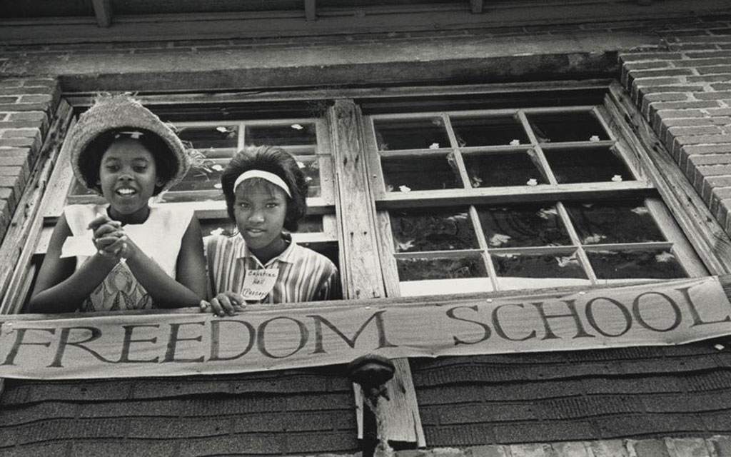
Two young African-American girls look down from window in front of the Freedom School Photo by Ken Thompson, ©The General Board of Global Ministries of The United Methodist Church, Inc. Used with permission of Global Ministries.
Freedom School Photo by Ken Thompson, ©The General Board of Global Ministries of The United Methodist Church, Inc. Used with permission of Global Ministries.

By Derek H. Alderman, University of Tennessee and Joshua Inwood, Pennsylvania State University

Derek AldermanJosh InwoodThe 60th anniversary of Freedom Summer is upon us. In the summer of 1964, several civil rights organizations, with the Student Non-Violent Coordinating Committee (SNCC) often leading the way, carried out a bold campaign uniting volunteers from across the country with oppressed, often forgotten, communities in Mississippi. This effort not only combated racial discrimination but also led to widespread changes, including expanding American democracy. The campaign’s grassroots, participatory approach empowered Black people through voter registration, community organizing, and education.

Freedom Schools were a transformative innovation of the Mississippi Freedom Project. SNCC workers and their local allies transformed churches, backyards, community centers, and other meeting places in Black communities into 41 Freedom Schools that served over 2,500 students of color. These schools provided a powerful alternative to a segregated and poorly funded state-run school system that sought to reproduce passive and demoralized Black communities—what SNCC organizer Bob Moses called the “sharecropper education.” Freedom Schools have their origin in the history of Black citizenship schools and a tradition of educational self-determination and “fugitive pedagogy” in the face of severe oppression dating back to the days of enslavement.

Freedom Schools met the basic educational needs of Black youth long denied an adequate education under racial apartheid. These schools also fostered African American creative expression, critical thinking, and appreciation for Black history and literature. These insurgent classrooms were spaces of open dialogue, encouraging students to question and challenge the ideologies and effects of racism, white supremacy, and inequalities in U.S. society. They built the self-esteem and activist skills necessary for students to participate in their own liberation. Historian Jon Hale notes that many Freedom School students worked to integrate public spaces and businesses, organize demonstrations and boycotts, and canvass communities to encourage voter registration. Although these schools operated for just six weeks in the summer of 1964, they proved influential in creating a revolutionary cadre of young Black Mississippians ready to take on the role of citizen leaders in their communities. Freedom Schools have continued to inspire educational models of social justice that are still found today.

Although scholars have often overlooked this fact, Geography was a pivotal part of the Freedom School curriculum.  Freedom Schools offered revolutionary spatial learning and inquiry, focusing on Black students and their families’ often-ignored struggles and needs. Though not explicitly stated, the curriculum developers sought to spur students to develop an ‘anti-racist regional knowledge.’ This regional knowledge was not just a collection of facts and figures but a tool for understanding and challenging the power relations undergirding the building of the Deep South as a racially unjust region. It was an embodied and visceral form of geographic learning in which SNCC empowered students to reflect on their personal experiences with Jim Crow discrimination and identify the social and geographic forces behind their oppression. Running through the Freedom School curriculum was an idea made popular many years later by Clyde Woods, who argued that racialized underdevelopment in the South did not simply happen. It resulted from a monopoly of white power, what Woods called the “plantation bloc,” arresting the development opportunities of Black people – even as these oppressed communities found ways to survive and create.

Clyde Woods…argued that racialized underdevelopment in the South did not simply happen.

In our National Science Foundation-funded research, we have examined the Freedom School curriculum closely regarding geographic education, finding that these pedagogical ideas went beyond how Geography was taught in many schools and universities at the time. While top academic geographers in 1964 debated how to make the field more scientifically precise and the merits of systematic versus regional approaches, SNCC was in Mississippi creating course content that directly connected U.S. racism and segregation to broader regional and national analysis and putting its organic geographic intellectualism in the service of racial equality. The disconnect between Geography in Freedom Schools and what was practiced by ‘professional geographers’ speaks not just to the path-breaking nature of Freedom Summer but also to the complicity of our disciplinary spaces and practices in historically ignoring and excluding Black communities.

Along with colleagues Bethany Craig and Shaundra Cunningham, our paper in the Journal of Geography in Higher Education delves into Freedom Schools as a neglected chapter in geographic education. We highlight the curricular innovations they deployed in producing geographic knowledge accountable to Black experiences, communities, and places. Freedom School curriculum called on students to critically use geographic case studies to conduct regional comparisons — both within the U.S. and internationally — to situate Mississippi and the South within broader racial struggles and human rights geographies to raise the political consciousness and expand students’ relational sense of place.

At Freedom Schools, students developed skills using data from the U.S. Census and other sources to understand racial disparities in income and housing across communities in Mississippi and concerning their own families. Freedom Schools engaged students in interrogating the material landscapes of inequality to ask probing questions about the unjust distribution of resources from place to place. The curriculum frequently used maps, not just as passive locational references. Black students were given opportunities to produce “power maps,” which charted the social and spatial connections and networks between institutions and influential people undergirding the oppressive conditions in their community. Plotted on these unconventional but important cartographies were the larger geographic scales of power driving white supremacy—from the local to the national.

The disconnect between Geography in Freedom Schools and what was practiced by ‘professional geographers’ speaks not just to the path-breaking nature of Freedom Summer but also to the complicity of our disciplinary spaces and practices in historically ignoring and excluding Black communities.

As the nation remembers Freedom Summer, we encourage colleagues to delve into the revolutionary Geography lessons at work in Freedom Schools. This curriculum offers a window into the Black Geography knowledge production that always undergirded the Civil Rights Movement. It is an essential counterpoint to popular treatments that give too little attention to the intellectual labor and sophisticated planning behind the Movement. Black geographies of education, such as those found in Freedom Schools, provide an important avenue for recovering too easily forgotten activists and activism and how educational reform remains unfinished civil rights work.

Yet, examining the Freedom School curriculum is of more than historical importance. It directly inspires a question of importance to contemporary geography educators: How can we design a curriculum that serves not just the intellectual debates and interests of the field but responds directly to the everyday experiences, needs, and well-being of students and others from historically marginalized groups? When we publish critical research on equity and social justice, do we actively consider how that scholarship could translate to and impact educational praxis? As our field struggles with addressing issues of Diversity, Equity, and Inclusion (DEI) and broadening participation as well as the relevance of Geography in an environment of education retrenchment, it is essential to note that students of color yearn for an educational experience that responds to their humanity and daily struggles.

Toward a Geography of Freedom

Freedom Schools provoke us to ask: Are we doing enough to articulate a vision of geographic education that addresses and intervenes in the struggle for freedom? Do we project within our classrooms a geographic perspective that helps historically excluded student groups make sense of and challenge their oppression and recognize their historical and contemporary contributions to building the nation and the wider world? As a discipline, are we doing what Freedom Schools did in helping our students develop the skills to identify and resist structural inequalities?

More and more geographers are committed individually and departmentally to these questions. Still, Freedom Schools provokes us to consider whether a more systemic approach is needed to rebuild Geography education and curriculum. Freedom Schools provide a moment for our field to re-evaluate and broaden what counts as geographic learning, whose lives matter in our curriculum, and what social and political work geographic pedagogy should accomplish. Several years ago, a group of educational specialists developed a set of widely distributed National Geography Standards called Geography for Life, which stops short of prominently promoting peace, social and environmental justice, and anti-discrimination. Don’t we need a new set of curricular standards borrowed from 1964 Mississippi, called Geography for Freedom?

Black geographies of education, such as those found in Freedom Schools, provide an important avenue for recovering too easily forgotten activists and activism and how educational reform remains unfinished civil rights work.

Crafting a Geography for Freedom curriculum should be a shared responsibility and involves collaborating with K-12 educators. Our K-12 colleagues have been hit especially hard by growing pressure from states, school districts, and parents to limit the very kind of discussions about racial injustice once held sixty years ago in Freedom Schools. Many university professors wrongly assume that their jobs and programs in higher education are somehow separate from and not impacted by Geography at the primary and secondary levels. The chilling, if not the absolute loss, of the right to tell and teach truths in classrooms can spread to higher education, and there are signs that it already has done so.

Reforming and rewriting the geographic curriculum taught at educational institutions is crucial. Yet, the Freedom Schools’ legacy of operating independently of and in opposition to the state should provoke us to expand the spatial politics of where teaching and learning happen. It is necessary to move beyond the traditional classroom to develop a Geography for Freedom curriculum within what Jacob Nicholson calls “alternative, non-formal educational spaces” — whether that be teach-ins, reading and writing groups, afterschool and summer programs,  teacher advocacy workshops, people’s schools or assemblies, mobile geospatial/citizen science labs, community radio shows, film screenings, or producing zines, infographics, and pamphlets.

Looking back upon Mississippi’s Freedom Schools and ‘discovering’ the role that Geography played in its educational activism should not be a feel-good moment for us in academic or professional geographic circles. Instead, it should push us to engage in a sober reckoning about what more our field can and should do to embrace the ideals and spatial imagination of Freedom Summer. We are 60 years behind, and it is time to catch up.


Perspectives is a column intended to give AAG members an opportunity to share ideas relevant to the practice of geography. If you have an idea for a Perspective, see our guidelines for more information.

    Share

Tips on Future-Proofing Your GIS Career

Illustration of a group of red and white circles containing location arrows; Credit: Al Amin Shamim, Unsplash
Credit: Al Amin Shamim, Unsplash

By Rosemary Boone, Esri Young Professionals Network (YPN)

As GIS evolves toward web-based applications, the skills required for a successful GIS career are also changing. This article provides advice on how to future-proof your GIS career by continuing your skill development and through community engagement, mentoring, networking, and attendance at conferences. You’ll receive crucial resources you can leverage to become more connected to various GIS community groups and build your own online presence and reputation.

What does it mean to be a GIS professional of the future? This is a valid question, as the world of GIS is constantly evolving. As GIS moves more toward being web-based, the skills needed to be a marketable GIS professional are changing too.

As a Senior Industry Marketing Manager at Esri, and an Advisory Board member for the Esri Young Professionals Network (YPN), I was recently inspired by an Esri YPN webinar, titled Future-Proofing Your GIS Career: Essential Skills and Training for Success, to compile five important tips for future-proofing your GIS career.

1) Stay Connected after You’ve Graduated

Preparing for your future takes a variety of forms and formats. You can build skills with online courses, apply for a certificate in a specialized area, or present at a conference. An important part of your professional development is connecting with, learning from, and sharing with your peers and community groups

Here are ways to include connections and networking in your career development:

Get Involved in GIS Communities

Connect with community groups or networks such as Esri YPN, Women+ in Geospatial, local user groups, associations like URISAAAGWomen in GIS, and USGIF.

LinkedIn is an excellent platform to stay engaged. You can follow industry experts and learn from the content they create. Start with joining the Esri YPN LinkedIn Group.

If you are a GIS user, Esri Community is one of the largest online GIS communities and is a place to read blogs, ask technical questions, connect with users of GIS technology, submit ideas, and set up RSS feeds. Many Esri products, services, and groups have their own Esri Community space and blog.

Become a Mentor

The best way to grow is to teach someone else. Mentoring, whether formally through a program or informally as a colleague, can help not only the people you mentor to learn, but you as well. Find out if you are eligible to mentor in your department, or get connected with an organization with mentoring programs, such as The URISA Mentor Network, which takes applications throughout the year for both mentors and mentees.

Ethnically Diverse Geospatial Engagement (EDGE) came out with a Beginners Guide to Mentorship with EDGE. Women+ in Geospatial has a  mentor program that also reaches an international group. AAG members also can get access to a list of mentors that you can get connected with. (Email Mark Revell to learn more).

You can also browse through the YPN Mentorship space to read up on material and resources around the overall topic of mentorship.

Attend Conferences

Conference-going is a big way to grow your skills and network through attending presentations and workshops to learn about the latest technology trends. Many times, you will be introduced to a new concept or idea while at a conference to take back to your organization that could potentially result in a successful campaign or initiative. The contacts you make at conferences can be leveraged as a resource for future collaborations, troubleshooting, mentors, and potential colleagues.

Some conferences that may interest you include AAG’s Annual Meeting and check out Esri conferences.

2) Equip Yourself to Overcome Challenges

There will be a time where you lack confidence about learning something new when you begin your career. It happens to all and the best of us! Here are ways to approach that challenge when learning something new.

First, remind yourself, “everyone has been new at something once.”

Next, ask questions. It’s best to ask questions at the beginning to show you’re engaged and you’re thinking about the problem. If you feel nervous or confused about something that you might not have the skills to accomplish, know that asking questions is not considered a weakness.

Remember, it’s okay to say, “I don’t know”. Have the mindset to say, “I don’t know but I will figure it out” because chances are the resources are out there for you. When asking quality questions, you demonstrate a sincere thoughtfulness and a willingness to go deeper.

Last, don’t underestimate the knowledge that you do have. It’s important to sometimes take a step back to acknowledge how far you have come in GIS and learning ArcGIS. Imposter Syndrome is a real thing and can be easy to get caught up in.

3) Leverage Resources to Grow Your GIS Skills

There are many resources, both formal and informal, to help keep your GIS skills sharp:

4) Validate or Demonstrate Your GIS Skills

Showcase and validate your skills through programs such as the Esri Technical Certification Program and GIS Certification Institute. Achieving a certificate in GIS can elevate your professional standing and open doors to various career opportunities.

There are costs associated with each program. Esri Technical Certifications charges a fee for the exam, which is proctored online, allowing you to take it at home or in your office. GISCI charges for the exam and a portfolio submission, as well as small annual fees and recertification every three years.

Esri also offers free Massive Open Online Courses (MOOC) on various topics such as Spatial Data Science, Cartography, Imagery, Climate, and more. Each MOOC is six-weeks long and offers a certificate upon completion.

5) Build Your Presence and Reputation in the GIS Community

Sometimes, you just have to put yourself out there. There’s just no way around it no matter how uncomfortable it feels. This takes time, intention, motivation, and tenacity. (As I sit here and write this article, I too am putting myself out there!)

Here are some ways you can begin to build a presence and reputation of your own in the GIS community.

Become a YPN Ambassador

If you are just starting out as a GIS professional, the YPN Ambassador program could be a fit for you. YPN is designed to prompt you to network online and in person, developing professional communication skills and becoming an active participant in the GIS community. Complete the steps in becoming one of three ambassador types and earn your badge and certificate.

Participate in Mapping Challenges and Competitions

Virtual challenges, hackathons, and similar events are a fun way to attract attention and demonstrate your skills in geospatial technology. Some recommendations are:

Leverage Social Media to Boost Your GIS Career

Social media is a powerful tool for building an identity that aligns with your goals and values, enabling you to communicate and connect with the outside world, learn from others, cultivate creativity, and promote your work. By leveraging social media effectively, you can boost your reputation and visibility in the GIS community and establish yourself as an active participant.

Download this ebook, published in collaboration with the URISA Vanguard Cabinet and the Esri Young Professionals Network, to discover how to use social media to supercharge your career, leading to growth opportunities, meaningful connections, and collaboration prospects.

Join a Local YPN Chapter

Esri YPN has established seven chapters across the United States, each hosting two in-person meetups a year. Meetups revolve around networking, meeting industry experts, and learning the latest trends in GIS. Some meetups take place at an Esri regional office and vary in format such as geography trivia, demos, networking activities, and more. Join a chapter near you.

Find Guest Speaking Opportunities

Consider submitting a paper session or abstract to present at a conference. I took that advice and submitted a proposal for a lightening talk at the upcoming GIS-Pro conference.  To my amazement, I later received an acceptance email and will be traveling to present! Is this nerve-wracking and a bit uncomfortable for me? Yes! But I know that I will grow professionally as a result and meet people that will make me a stronger and more well-rounded professional.


Rosemary Boone is a Senior Industry Marketing Manager for Esri, concentrating on executing marketing strategies for K-12 schools and higher education institutions. She holds a master’s degree in education technology with an emphasis on multimedia. Prior to her career in marketing, she taught elementary school and taught overseas. In her free time, she likes to listen to music, exercise, and spend time with her two Dachshunds.

Featured Articles is a special section of the AAG Newsletter where AAG sponsors highlight recent programs and activities of significance to geographers and members of the AAG. To sponsor the AAG and submit an article, please contact Oscar Larson olarson [at] aag [dot] org.

    Share

Welcoming a New President to AAG – Interview with Patricia Ehrkamp

Image of digital dots and lines forming a gavel on a desk. Credit: Conny Schneider, Unsplash
Credit: Conny Schneider, Unsplash


Photo of Rebecca LavePhoto of Patricia EhrkampFor the last president’s column of her term, President Rebecca Lave talked with incoming President Patricia Ehrkamp about her experiences within the discipline and her aspirations for her upcoming leadership at AAG. The following conversation offers insight into the new directions for the 2024-25 presidency.
RL: What brought you to geography?

PE: I’ve been a geographer since fifth grade. I grew up in Germany, and geography is taught in school and for a long time it was my favorite topic. Probably what drew me to geography then, and keeps me here, is that it’s a way of thinking about the world and understanding the world around us. And that’s fascinating.

RL: Yes, I love the way that geography so deeply connects theory with fieldwork: if you want to understand a place, you need to go there and engage in a deeply empirical way.

PE: I love the integrative nature of geography; we can study physical geography, study drought and desertification (which I did quite a bit of in Germany) alongside immigration and geopolitics, which is what I specialize in at this point. All of it in so many ways are about the relationships, and connections between environments and people, and people and environments, and different places. The fact that we, as a discipline, can even think of tackling such complex questions as climate justice, human displacement, and food security, that’s what continues to excite me about geography

RL: What do you tell students about what makes geography so relevant to the questions of the day?

PE: It’s such an amazing discipline, you know. There are so many ways that geographers can make a difference: think about making cities more livable and more just for more people. We study climate change, from both the physical science perspective and considering its impacts on people’s lives, and hopefully find solutions to alleviate these impacts. That’s what makes geography so unique and so relevant. We can analyze and map data, and then put that data to work in the interest of social justice.

RL: What prompted you to run for office in the AAG?

PE: I’ve been involved in the AAG for quite some time. I’ve served on the boards of a number of different Specialty Groups, and I’ve always enjoyed them, it’s always been a great experience. I had no idea that I was going to be nominated as vice president—as it so often happens, I think. But in thinking about it, it’s an important time to be involved, right? We’re looking at changes in higher education, challenges to academic freedom, and it’s especially important, if we have expertise and energy that we can lend, that we do so. And there are things that I want to do, also. Like thinking about how to make a more inclusive discipline: there are important efforts on the way with the JEDI Committee and Risha RaQuelle’s leadership. There is important work to support, like your work on the Public and Engaged Scholarship Task Force. So, I thought I could maybe help the broader project of working toward positive change and making a more equitable discipline of geography. That’s really what made me run.

RL: What would you say to a member considering volunteering or serving in some way with AAG?

PE: Do it! Get involved. I’ve learned so much from serving on boards of Specialty Groups, and it’s been such a joy also. You make all these connections with people from across the country, from across the world, even. One of the things I did on one of the boards was read submissions for student paper awards. You get to see this fascinating work people do, the next generation of geographers with all their brilliant ideas. So, what’s not to love? I would encourage anybody who is interested in participating to get involved. It really gives you a whole different perspective on the discipline, the organization, and it allows you to work with others and collaborate on the things that matter.

RL: I would totally agree with you on all of that. I had a somewhat different path because while I did a bit of Specially Group work, my main involvement with AAG was through the Honors Committee. Celebrating people for their work is my happy place, and it was super interesting to see the process and get to learn more about the work of the people that were nominated. Also, the committees all have people that I never would have run into otherwise because they’re in different geographic specialties. That was really cool, too.

PE: I agree, working with geographers across the breadth of the discipline is fabulous! All the committees do really important and interesting work on behalf of geographers, and it is so rewarding.

RL:  What initiatives and projects are you most excited about for your time as president?

PE: One of the big reasons why I wanted to run is my interest in strengthening approaches to mentoring. In my home department at the University of Kentucky, we’ve done a reasonably good job of creating support structures. When I was chair, I worked on creating policies, best practices. One of our most important jobs as geographers is to train the next generations and make sure that they have the best possible situation when they’re starting out in their careers. It’s not the same for everybody because some of us will end up in very small departments, in different types of institutions, or even being the only geographer at their institution. One of the things I wanted to do is think about how the AAG can best support earlier career geographers. What structures we could put in place. The Mentoring Task Force has been looking at what best practices exist, and how we can put them together. We are having conversations about topics like, how do you know when you want to be a mentor, how do you become a mentor and, if you’re becoming a mentor, are there ways that you can be trained? Are there models that work better for smaller or larger group settings so we don’t just rely on individual one-on-one mentoring?

RL: Those feel like such important questions to me. I also love the focus on moving beyond individual mentoring because I think having a broad range of mentors for a lot of different things is super helpful.

PE: Yes, you need an ecosystem, right? I’ve thoroughly enjoyed mentoring, too, and I think about getting more people involved as mentors. There’s so much learning to be done on both ends.

RL: Is there anything else that you would like to add?

PE: I so enjoyed the Honolulu meeting and the way the AAG– thanks to you and everybody at AAG and local collaborators who worked so hard–had a meeting that was so well prepared, where you felt grounded, where you had an idea of where you were going and why it matters how you show up as a geographer in a place. I think that was brilliant, and the meeting was just such a wonderful experience. I loved learning from all the plenaries on Indigenous work or scholarship, and questions of extraction and coloniality and again related to questions of justice. I am excited to carry that forward into the next meeting in Detroit, and I hope everybody else is going to be inspired to work with us on that. I think being grounded in the place, being able to bring the city and the place into the conference, bringing the conference of geographers into the city and surroundings–in meaningful ways, not just drive-by visits–I think that is so important, and we generally do that well as geographers.

And lastly, I’d like to say that I’ve been really enjoying this first year of AAG service. I’ve learned so much as vice president and I’ve very much enjoyed working with the Council and everybody on it and AAG staff, who are so committed and competent. And I know they’re working really, really hard all the time. Not just to create Annual Meeting experiences but to support us year-round, to make sure that there is a voice from the AAG to the outside world as well, which I think is increasingly important. I’ve learned a lot and I look forward to the next couple of years.


Please note: The ideas expressed in the AAG President’s column are not necessarily the views of the AAG as a whole. This column is traditionally a space in which the president may talk about their views or focus during their tenure as president of AAG, or spotlight their areas of professional work. Please feel free to email the president directly at rlave [at] indiana [at] edu to enable a constructive discussion.


    Share

Michael Libbee

Dr. Michael James Libbee, born on December 9, 1945, passed away on January 28, 2024, after a brief illness.

A graduate of West Genesee High School in Camillus, New York in 1963, Michael Libbee received his bachelor’s degree from the University of Oklahoma in 1967, and his master’s degree and Ph.D. in Geography from Syracuse University. From 1982-2020, he was Professor of Geography at Central Michigan University, spearheading the creation of four endowments and generating over $8 million in grants for the furtherance of geographic education.

Various research interests spanned environmental studies and geospatial technologies, but Dr. Libbee was specifically passionate about advancing geographic literacy and promoting the use of technology in geographical research and teaching. He published numerous articles and book chapters ranging from geographical education in North America to geographic professional development in journals such as The Professional Geographer and the Journal of Geography. In 1989 he co-founded the Michigan Geographic Alliance, with the goal of strengthening geography and environmental education in Michigan. To this day, the organization provides networking and professional development events for teachers and educational materials to classrooms across the state. His passion for education and geography was one of his trademark characteristics, and his infectious enthusiasm inspired countless students and teachers.

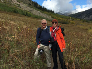
Michael Libbee and his wifeDr. Michael Libbee was the beloved husband of Kristin Sheridan, whom he married in 1971. Throughout their 53-year marriage, they shared numerous adventures together, and were often seen biking or walking their loyal canine companion, PJ. Dr. Libbee will forever be remembered for his generosity, love for his family, and dedication to his students. His legacy will continue in the lives of those he has touched.
    Share

Grant Rodriguez Almani

By Emily Frisan

Meet Grant Rodriguez Amlani, a dedicated advocate for environmental justice and a strategic recruitment coordinator who has honed his expertise in environmental issues, waste management, and the pursuit of a circular economy.

Education: M.A. in Sustainability & Development (Southern Methodist University), B.S. in geography with minors in mathematics and Spanish (University of North Texas), A.A. in general studies (University of Arkansas at Little Rock).

Professional accolades include Circularity23 Emerging Leader, a 2022 Clinton Global Initiative University Fellow, and an Envision Sustainability Professional (ENV SP).

Describe your career path up to your current position, including the range of tasks and responsibilities you oversee.  

I graduated in May 2020, which is one of the worst times to graduate, regardless of what your major was. I’d always known I wanted to go into an environmental or sustainability kind of field. Those opportunities got lost, and there were hiring freezes. I went to interviews and then everything fizzled out, which was not unique to environmental work. Everybody kind of dealt with that.

I found my current job by nature of putting myself out there and networking in Dallas. The sustainability circles are close-knit, so once you start going out there and meeting people, it lends itself well to networking and whatnot.

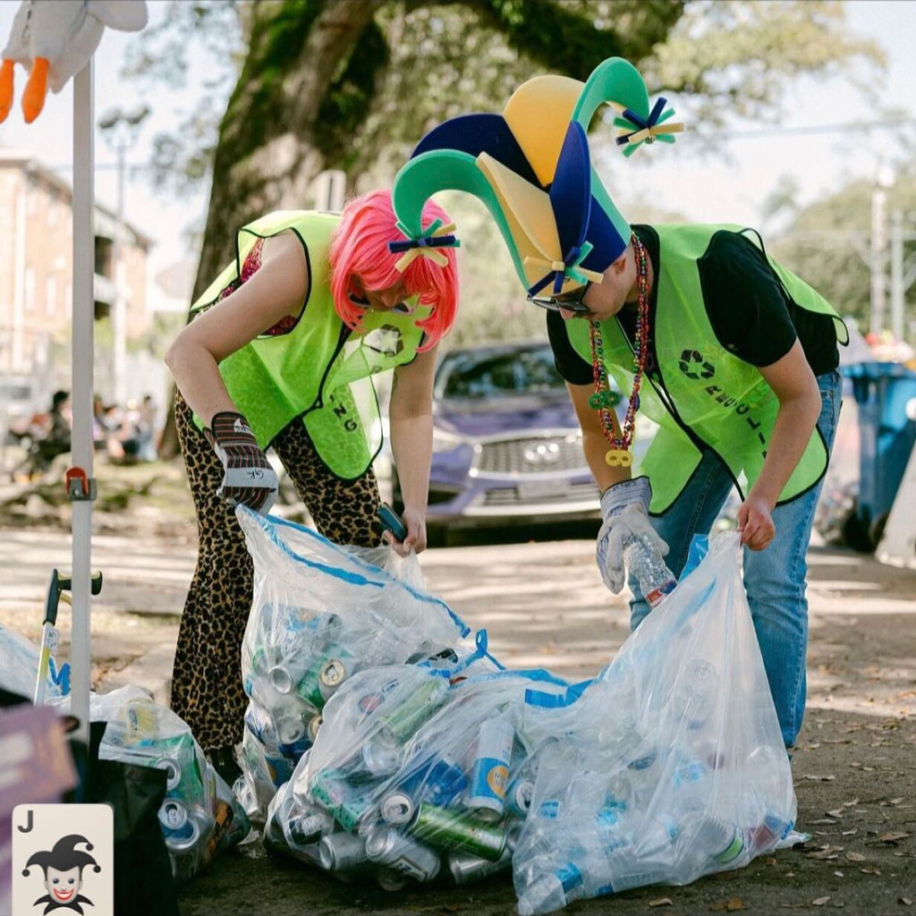
Grant Rodriguez Almani and a colleague participate in a recycling cleanup while dressed in humorous costumes. Credit: Katie Sikora
Grant Rodriguez Almani and a colleague participate in a recycling cleanup. Credit: Katie Sikora

Now, I’m the environmental justice and recruitment coordinator of the U.S. Plastics Pact. Most of my focus is on sustainability, such as waste and recycling. The way it works is we have over 130 member organizations — we call them Activators. These range from cities like the City of Austin or Seattle, to Fortune 500 companies like Walmart, or L’Oreal, or ALDI, or Target, and everybody in between. Anybody that touches plastic packaging in the chain, whether they sell it, make it, or collect it at the end of its life, as well as other nonprofits, also engage.

My role is twofold. The recruitment piece is talking to potential organizations about participating in our work, and then the environmental justice piece is figuring out where environmental justice fits into a just transition to a circular economy for plastics packaging. In the work of sustainability and the circular economy, the justice and equity pieces tend to have been kind of shoehorned in at the end or after the fact. I’m really trying to challenge people to think about that in the design process: the products, the systems, the collection, and what kind of jobs are available.

What geographic knowledge is important and most useful for you in this position?

Something interesting that I’ve seen is that in the corporate sustainability world not everybody has a strong science or geography background. It might be somebody with a business or English degree, which is fine, but it [a degree in geography] helps to have that environmental understanding of how things like climate or ecosystems work and breaking those things down for society and communities.

Separately too are the human-environment interactions. Geography helps us to talk about how people interact to the environment, how people value things. For me, it’s translating that to say, ‘How are people approaching recycling’, ‘How do they think about reuse systems.’ I’m kind of allowing that geography foundation to level up.

When you look back at your education trajectory, how did you discover geography? How did you realize that it connects with your aspirations and your goals in life, maybe as an individual but also as a professional?

I had a winding path in undergrad. I started in construction engineering, then civil engineering, and then kind of just bounced around. I also transferred schools three times. I was at the University of Arkansas and then I was at the University of Arkansas at Little Rock. It was there that, well, I was kind of like, ‘OK, I want to do environmental science.’

It took me five years to graduate and in my fourth year, I took my first geography class with Jess Porter, professor of geography at UA, Little Rock. Unfortunately, they [UA, Little Rock] didn’t have a full program, they just had the minor, so I ended up transferring back home to the Dallas-Fort Worth area, went to the University of North Texas, and finished out my geography major there.

Geography was never on my radar at all. I thought, ‘OK, it’s just maps and GIS’ and then realized, ‘oh, there’s actually a lot more to it.’ It was the perfect fit for what I needed.”


Are there any skills or information that you use for your work that you didn’t obtain through your academic training? If so, how and where did you obtain that?

I feel like there’s a lot that you learn on the job. Even though my first job wasn’t necessarily geography or sustainability focused, there are lots of skills that transfer like emailing, etiquette, and this whole world of virtual work, you know, in a COVID world, learning all of that. You just have to learn by doing.

The other essential thing was not boxing myself in. A lot of geography majors sometimes get this idea of, ‘I only took these classes, so I can only go do this job,’ when in reality, there’s so much you can do and so much you can learn. Even though you didn’t maybe learn it in a classroom, you can still put yourself out there and try to learn it now.

There’s like a lot of different pathways you can go, and the world is your oyster.”


What advice do you have for geography students and other early career professionals interested in a job like yours?

For this job, I probably wouldn’t have been aware of it. I put myself out there and networked with people, connected with them on LinkedIn, and then they happened to post about this job. So don’t be afraid to go talk to people, even if you may not know them. You should still talk to people with a genuine approach and friendliness, not just because they’re going to help you level up in your career.

Don’t be afraid to apply to jobs that don’t explicitly call out geography. If you’re scared about the experience and those types of things, I never had an internship. It’s doable without one. You can supplement that with the kind of story that you can tell about your journey and how you had your experience. Trying to go for volunteering, engaging on campus and organizations, or leading efforts in your community to gain leadership skills is also great. Just put yourself out there.

Learn more about what a degree in geography can do for you by reading more AAG Career Profiles and discover the resources we offer for your professional development journey.

    Share