The Hills of San Francisco
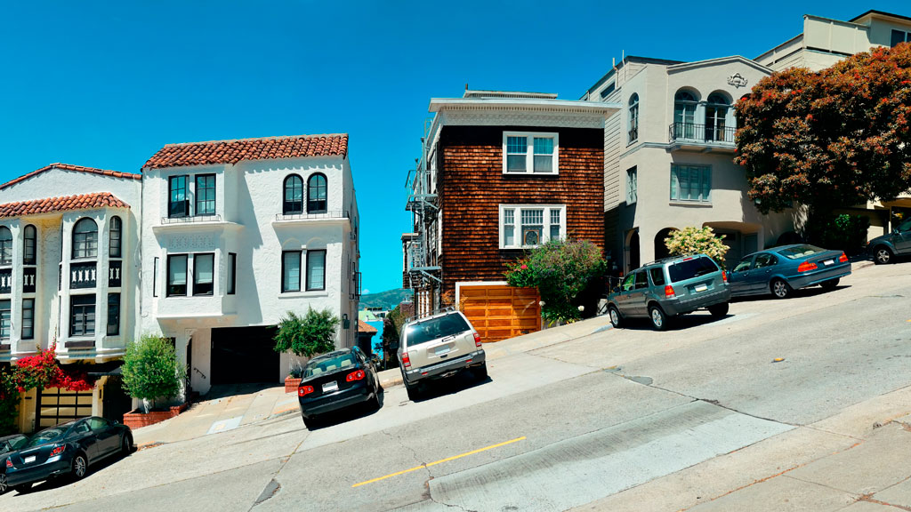
Street hill gradient showing homes built on a slope with cars parked on the deeply slanted street.
Street hill gradient in San Francisco

Unlike the rest of California, San Francisco has a unique geography that shapes its weather and settlement patterns. The city is set on the tip of a peninsula halfway up the coast of northern California, surrounded by bodies of water on three of its sides: the Pacific Ocean, the Golden Gate strait, and the San Francisco Bay. The city is laid out over hills that stretch from coast to coast, reaching heights of nearly 1,000 feet, making the climate similar to coastal areas on the Mediterranean.

The hills of San Francisco define its topography and culture. It’s hard to pinpoint the exact number in the city, but many sources consider there to be more than 50 named hills. As Pulitzer Prize-winning San Francisco Chronicle columnist Herb Caen notes in his introduction to the Hills of San Francisco, no one can quite agree on which [hills]. Although it’s debated among locals, there are seven hills that are iconic to the city: Russian Hill, Nob Hill, Telegraph Hill, Twin Peaks, Mount Davidson, Mount Sutro, and Rincon Hill.

So, when is a hill a hill? Self-proclaimed San Francisco explorer Dave Schweisguth claims, “When it’s a lone mountain. That is, if you can walk all the way around it, always looking up to its summit. It’s not so clear cut when hills run together into a ridge, which most of San Francisco’s do. Height alone is not so important: a very small hill may be perfectly obvious, while a string of higher summits may be hard to tell one from the next. It’s easier to call a hill a hill if it’s separated from its neighbors — if, on a topographic map, a contour line or two traces all the way around its summit.”

The Range of Iconography

Originally named Blue Mountain for the wildflowers that cover the hillside, the city’s tallest hill was renamed Mt. Davidson at the urging of the Sierra Club in 1911, after George Davidson, the geographer who surveyed it. It is the focal point of San Francisco’s Mt. Davidson Park, with a forest that accounts for more than 30 of the park’s acres, quietly remaining an oasis in the most densely settled city in California. Defined by a 100-foot cross at its peak, Mount Davidson stands at an elevation of 928 feet. Urban hikers share that despite how small the overall area is, the trails aren’t consistently marked, which causes explorers to get lost in the woods.

Hikers also recommend Mount Sutro, located in central San Francisco, for its role in the city’s cultural and natural history. Its century-old trails are now preserved by the University of California, San Francisco, which guides the long-term restoration of the 61 acres and protects the ecological oasis in the heart of the urban environment, along with the citizen group Sutro Stewards. The city’s elevation and abundant summer fog contribute to the mountain’s microclimates and its plant and wildlife communities.
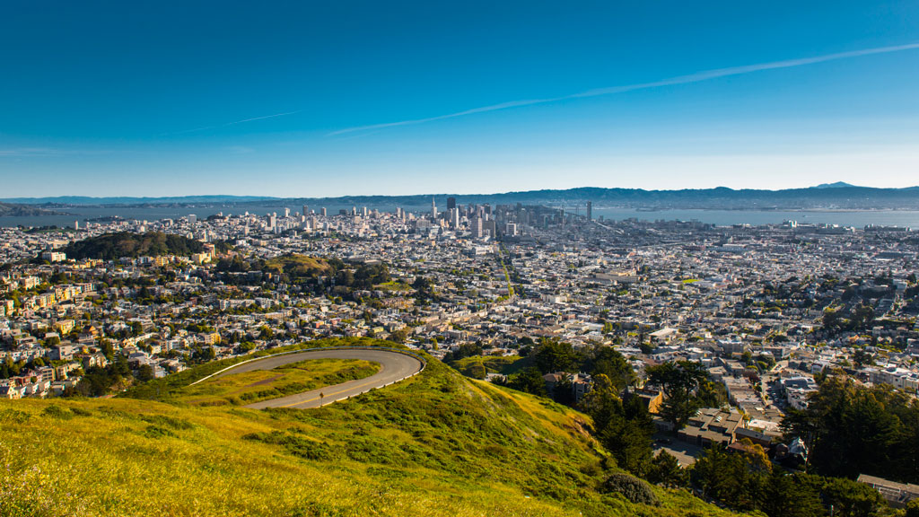
 

View of San Francisco from Twin Peaks showing the city skyline wrapping around several hills
Twin Peaks view in San Francisco. Credit: optionm, Getty Images


Originally called “Los Pechos de la Choca” (Breasts of the Maiden) by early Spanish settlers, Twin Peaks is a main landmark of San Francisco’s skyline, reaching elevations of 910 and 922 feet. Similar to Mt. Davidson and Mt. Sutro, Twin Peaks hosts a 64-acre park of coastal scrub and grassland communities that offer an idea of how San Francisco’s hills and peaks looked before development changed them forever.

Early in defining San Francisco’s history, Nob Hill, Russian Hill and Telegraph Hill continue to remain among the most popular neighborhoods to visit.
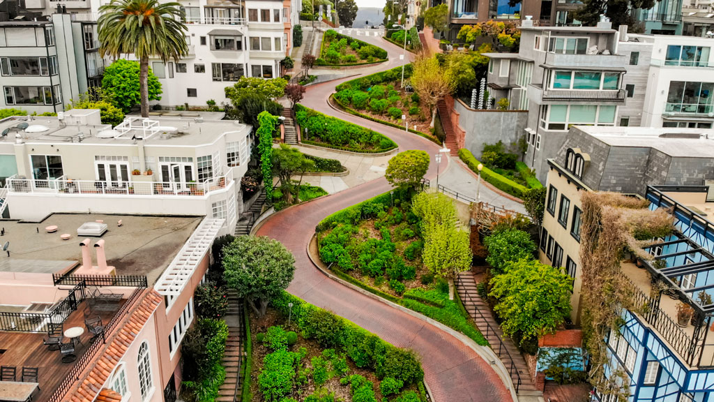
 

Aerial photo showing the curve of Lombard Street winding down the hill between homes
Lombard street in San Francisco Lockdown. Credit: Tiago Ignowski, Getty Images


Russian Hill’s name dates to 1847 when Russian sailors were buried on the hill during the gold rush in the 1800s. The burial sites are long since deeply covered, and it’s now only possible to admire a plaque at the site where the cemetery once stood. This is the same neighborhood home to the famous Lombard Street, that draws tourists from around the world due to its scenic switchbacks and postcard views. Because the slope in this area reaches 27° (51%), 8 hairpin bends were put in the 1300 feet between Hyde Street and Leavenworth Street to allow cars to drive down the street, ultimately creating one of the most winding streets in the world.

Russian Hill borders Nob Hill to the south, one of the city’s most upscale neighborhoods.  Originally called California Hill (after California Avenue, which runs right over it), Nob Hill got its name from the word “nabob” that originated from the Hindu word meaning a wealthy or powerful person. This affluent neighborhood was home to the Central Pacific Railroad tycoons known as the “Big Four,” who were among the first to build their mansions here.
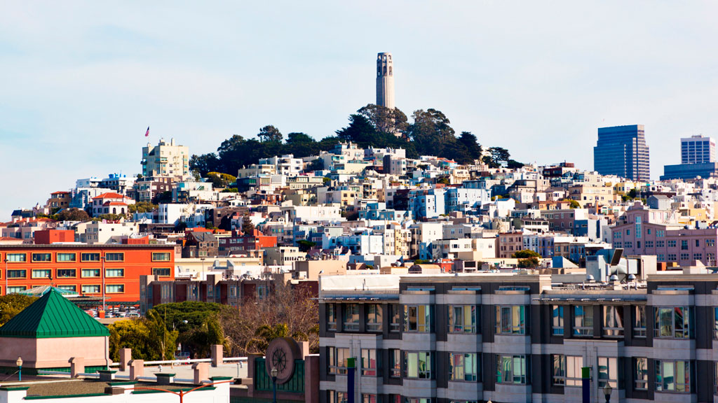
 

View of Telegraph Hill from below showing buildings and homes rising up to the tower atop the hill.
View up to Telegraph Hill’s Coit Tower. Credit: slobo, Getty Images Signature


Telegraph Hill hosts Coit Tower, an iconic piece of architecture that resembles a fire hose and affords incredible views of the city; its walls are also home to historic artwork. Originally, the Tower was a windmill-like structure created in 1849 to signal ships entering the Golden Gate. Once the trek is completed, the summit provides a breathtaking panoramic view of the city with landmarks like the Golden Gate Bridge, Alcatraz, and the Transamerica Pyramid.

Whether you’re taking a leisurely stroll or hiking the steepest routes, you can recall the words of the iconic San Francisco journalist Herb Caen, who once said, “Take anything from us — our cable cars, our bridges, even our Bay — but leave us our hills.”

You can hit the trails with a guided tour or explore the city on your own. The SF Gate compiled a list of 11 hikes within the city limits that allow visitors and residents to get to know the landscape. An interactive map created by a UC Berkeley graduate student studying urban planning maps SF’s slopes and uses simple color coding to show where the flattest pockets of land are. If you’ll be attending AAG’s 2026 Annual Meeting in San Francisco, you’ll want to bring your walking shoes!
    Share

AAG Journal Articles on Black Geographies and Racial Justice

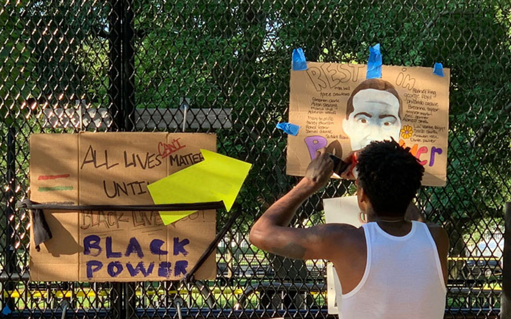
Image showing signs placed on fencing outside Lafayette Park in Washington, DC, on June 7, 2020; photo by Becky Pendergast
Credit: Becky Pendergast

The following titles reflect vital scholarship on Black Geographies in AAG’s journals in recent years. Through September 30, 2025, AAG and Taylor & Francis are providing free access to these articles, available for download at the links listed below.

For additional reading recommendations, see Black Geographies Reading List, sponsored by the AAG Black Geographies Specialty Group.

    Share

A Voice for Geographers

The following statements and actions represent AAG’s work to protect and strengthen geography and geographers, address pressing public issues, and to protect science funding and academic freedom. For a comprehensive look at AAG’s positions over the years, check out our advocacy in the Resource Hub.


Academic Freedom and Commitment to Geography’s Future


Standing Up for Science


Climate Action

    Share

Brian Berry

On January 2, 2025, Dr. Brian Berry passed away at the age of 90. Renowned for his influential work in urban and regional research, he was also a past AAG president (1978-79).

Berry was born in Sedgely, Staffordshire, United Kingdom on February 16, 1934. He graduated from University College, London, with a B.Sc. in Economics with first class honors in 1955. He was a Fulbright scholar at the University of Washington, where he completed an M.A. in 1956, and a Ph.D. in 1958, studying under noted geographer and leader of the quantitative revolution, William Garrison, in the Department of Geography.

Upon completing his Ph.D., he began his career, which spanned more than six decades. In 1958 he was named the Irving B. Harris Professor of Urban Geography, chairman of geography and director of the Center for Urban Studies at the University of Chicago. Berry’s early spatial analytic research helped spark the scientific revolution that occurred in geography and urban studies in the 1960s, making him the world’s most frequently cited geographer for more than 25 years. He refined the concept of “central place theory” and laid the foundations of analytic urban geography, spatial analysis, and of geographic information science.

In 1975, Berry was the youngest social scientist ever elected to the National Academy of Sciences. He subsequently was named a Fellow of the American Academy of Arts and Sciences and of the British Academy. From 1976 to 1981, Berry joined Harvard University where he served as the Frank Backus Williams Professor of City and Regional Planning, chair of the Ph.D. Program in Urban Planning, director of the Laboratory for Computer Graphics and Spatial Analysis, and a faculty fellow of the Institute for International Development. He was appointed University Professor of Urban Studies and Public Policy and dean of the Heinz College at Carnegie Mellon University, until he joined the University of Texas at Dallas (UTD) in 1986.

At UTD, Berry became the first director of the Bruton Center for Development Studies. In 2005, he was appointed dean of what was then the School of Social Sciences before he engineered its transformation into the School of Economic, Political and Policy Sciences (EPPS).

Among his many accolades, Berry was the 1978-79 President of the Association of American Geographers. In 1988, he was also awarded the Victoria Meda, the Royal Geographical Society’s highest honor, and the Vautrin Lud Prize — considered the “Nobel Prize for Geography” — in 2005. He also earned the Kondratieff Medal from the Russian Academy of Sciences in 2017 and the Stanley Brunn Award for Creativity in Geography from the American Association of Geographers in 2020. Most recently, in 2021, Berry earned the University Consortium for Geographic Information Science Research Award. The award recognized Berry’s early research on geographic information systems — specifically his conceptualization of the geographic matrix in 1964 — that continues to shape practice and to ensure conceptual and functional linkages between geographic information science technique and the field’s intellectual core.

Although Berry authored over 550 books and articles, he is most proud of being the advisor to more than 150 Ph.D. students and has served on an equal number of other doctoral committees. Many of his students have gone on to successful academic and professional careers in their own right.

He also has been an active family historian and genealogist, with many additional publications to his name, most recently delving into genetic genealogy. Brian retired from active academic life to become a “gentleman rancher” in 2020. Brian is survived by his wife, Janet (Shapley) Berry; son, Duncan J. Berry; and daughter, Diane Berry Yakel.

    Share

Sowing the Seeds for Food Sovereignty in Detroit

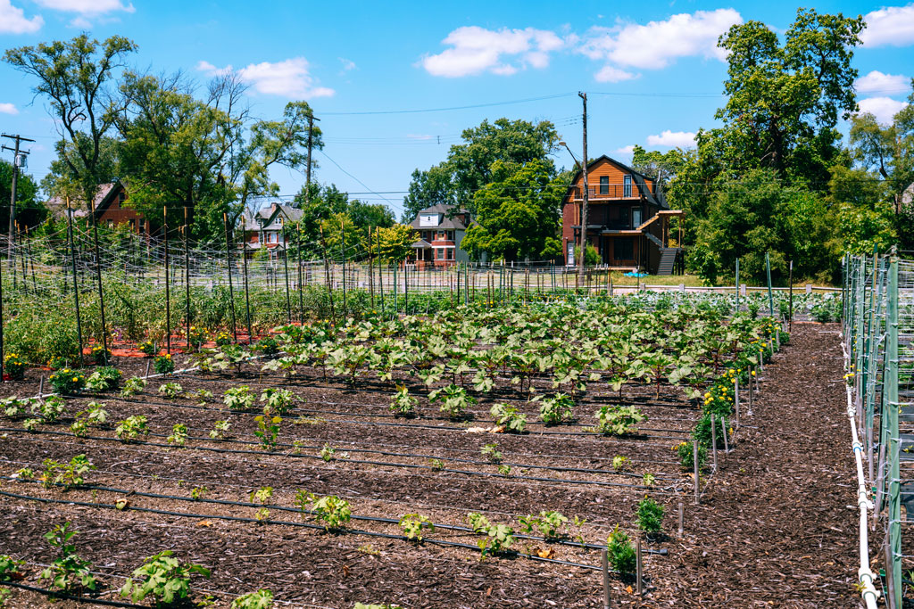
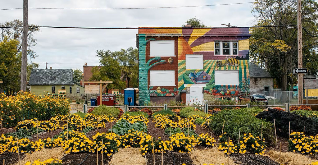
An urban farm plot of beds with crops and flowers sits in front of a building painted with an artistic mural, courtesy Michigan Urban Farming Initiative - MUFI
Photo courtesy Michigan Urban Farming Initiative (MUFI)

Urban agriculture is blossoming in Detroit, gaining recognition for its “green revolution,” through the rise of urban gardens and farms. With a total of 139 square miles or over 100,000 empty lots being vacant, this provides an opportunity to incorporate green spaces into communities throughout the city.

Urban gardening isn’t new to Detroiters. During the economic crisis of 1893, “Potato patches” helped feed hungry families and taught people how to grow their own food during times of social and economic crises. Later, in the 1970s, Mayor Coleman Young’s “Farm a Lot” program set an ambitious goal of transforming 3,000 empty lots into urban gardens. In the late 1960s the Black Panther party served breakfast to children in Black communities — highlighting the racialized gaps in funding from the United States government. The connections among community, mutual aid, and growing and providing food go far back in Detroit. Rather than working against each other, cooperatives and mutual aid programs ensure that groups can pull resources together to beat the system at its own game.

Detroit’s history of gardening, farming, and giving to neighbors shows how communities can move beyond food justice and into food sovereignty. Food justice addresses hunger at a basic level; food sovereignty takes it up a level to define, own, and dictate a food system. This in turn provides the earth with increased resilience to crises and climate impacts, in addition to promoting autonomy for communities. According to shakara tyler, co-executive director of the Detroit Black Community Food Sovereignty Network, part of creating a just society and systems means, “shifting from extractive economy and reinvesting into the regenerative economy.”

The growth of urban agriculture in Detroit is a testament to the resilience and innovation of its people. Initiatives such as the Oakland Avenue Urban Farm and Detroit Black Community Food Sovereignty Network are prime examples of how community-based organizations can catalyze change, serving as educational platforms for sustainable living. Explore gardens and organizations below to see how modern food sovereignty is inspiring Detroiters to create a deep praxis within other justice movements across local and state-wide levels.

View of plants growing in beds in an urban garden plot in Detroit, Michigan
Urban garden plot in Detroit, MI


Michigan Urban Farming Initiative

7432 Brush St, Detroit, MI 48202

Based in Detroit’s North End community, Michigan Urban Farming Initiative’s (MUFI) redevelopment of a three-acre area in Detroit’s North End, is being positioned as an “epicenter of urban agriculture.” With the goal of creating a sustainable “agrihood” with multiple projects, the campus is divided into thirds: production farming, interactive agriculture, and hardscaped spaces, such as their Community Resource Center. Since operating out of their new headquarters, MUFI has been able to grow and distribute over 50,000 pounds of produce (grown using organic methods) to over 2,000 households within 2-square miles at no cost to the recipients.

Oakland Avenue Urban Farm

9227 Goodwin St, Detroit, MI 48211

Operating out of Detroit’s North End neighborhood since 2010, the Oakland Avenue Urban Farm (OAUF) is “cultivating healthy foods, jobs, and active cultural spaces.” The “Farm” grows over 33 varieties of vegetables and fruits and operates a “Harvest on Demand” option with local farmers markets, allowing neighbors to have consistent access to produce. In addition to partnering with local chefs and nonprofits to distribute tens of thousands of hot meals across the city, OAUF provides training opportunities, manages a community land trust, and brings together youth to improve learning and leadership skills.

Keep Growing Detroit

1445 Adelaide St, Detroit, MI 48207

Keep Growing Detroit (KGD) is working to cultivate a food sovereign city where the majority of fruits and vegetables consumed by Detroiters are grown by residents within the city’s limits. Their Garden Resource Program (GRP) supports urban gardening in the city by providing high-quality resources to family, community, school, and market gardens located in Detroit, Highland Park, and Hamtramck. Participants receive seeds, transplants, personalized garden assistance from staff, and a connection to an incredible network of gardeners, farmers, and advocates for a thriving food system across the city.

Detroit Black Community Food Sovereignty Network

11000 W Mcnichols Rd Ste 103, Detroit, MI 48221

Another non-profit that aims to amplify and create sustainable and equitable food systems is the Detroit Black Community Food Sovereignty Network (DBCFSN). The 7-acre urban “D-Town Farm” grows more than 36 different fruits, vegetables, and herbs with cultural and social significance, with the intention of farming what people want to eat and in high demand. Their work to shift the understanding of food, is a way to have sovereignty and learn about the importance of these systems. In addition to providing security, DBCFSN co-founded the Detroit Black Farmer Land Fund with KGD and OAUF to support rebuilding black land wealth. Since 2020, over 239 awards have been made to residents, businesses, and organizations.

North End Agri-Arts Alley

Currently under-going construction

In March 2023, the city announced four new Arts Alley locations in North End, Detroit. Specifically, the North End Alley will be the first Agri-Arts alley as part of a federal grant to transform dilapidated alleys into artistic oases. Anchored by the Oakland Avenue Urban Farm in partnership with artists from the Oakland Avenue Artists Coalition, this green alley will complement the Oakland Avenue Farmer’s Market, North End Resource Center, Oakland Avenue Cooperative Greenhouse, and Black Bottom Garden Center. Major construction is currently underway and is expected to be completed in late Spring 2025.

Urban farms and gardens are not just places to grow food; they are hubs of community activity, education, and empowerment. While the challenge remains to make these green spaces accessible to all, efforts are being made by the city to provide urban agriculture government guidance and infrastructure. In September 2023, the city of Detroit named Tepfirah Rushdan, former co-director of Keep Growing Detroit, its first director of Urban Agriculture. Over the past decade, the movement has seen substantial growth, transitioning from a few community gardens to a network of over 2,00 gardens and farms engaging nearly 20,000 Detroiters as of 2023.


Watch the webinar recording “Building Black Food Sovereignty in Detroit,” featuring shakara tyler, as part of our Preparing for the Detroit 2025 Annual Meeting webinar series.

You can register for the 2025 Annual Meeting field visit “Feeding a City: The Geography of Urban Food Systems” hosted by the Food and Agriculture Specialty Group to further explore Detroit’s urban food system landscapes.

    Share

Co-producing Urban Space in Majority Black Detroit’s “Revival:” Co-governance Strategies to Community

Why Stay at the Conference Hotel?

Two people review and discuss financial documents

By Antoinette WinklerPrins, AAG Council Treasurer


Photo of Antoinette WinklerPrinsThis is the third in a short series of perspectives by 2024-2026 Council Treasurer Antoinette WinklerPrins, a series designed to help illuminate some of the financial challenges a professional organization such as the AAG faces.

As we plan for the next Annual Meeting in Detroit in March 2025, many of us are deciding where to lodge. There are many factors to consider in deciding where to stay, including cost, proximity to the meeting venue, and desired experience (e.g. access to a kitchen, neighborhood vs. downtown, ability to share accommodations). Different kinds of lodging offer different advantages: the conference hotel, nearby hotels, or an option such as AirBnB or VRBO.

AAG reserves discounted rooms in a nearby conference hotel at each annual meeting. How do you know whether it is the best choice for you? In this column, I explore some reasons you already know and maybe a few that you don’t.

Discounts, Convenience, and Collegiality

The AAG conference hotel is always chosen with proximity to the meeting in mind. That’s one important strength in its favor. Most years, events or receptions are even held in the conference hotel. Staying there also offers opportunities to network more intensely, with serendipitous encounters with new and old colleagues in the morning and evenings, opportunities to bring together groups to explore, have meals, or just talk shop.

While the cost of staying at a conference hotel can be higher than at a more modest facility, it is a better overall value at the discounted rate once you factor in this convenience and access to colleagues.

All for One and One for All

Staying at the conference hotel also benefits AAG as your host, and thus the broader community of participants in the meeting. It enables AAG to save on overhead and devote more resources to programming, keynote speakers, and amenities. Here’s how it works:

When AAG plans for and arranges specific annual meetings, we enter into a contract with at least one or several hotels many years in advance. The hotel sets aside conference room space for our meeting in exchange for us guaranteeing a minimum spent on lodging as well as food and beverage at the hotel.

Aside from giving us meeting space, we also lock in conference room rates. And, since the contracts are typically signed 7-8 years in advance, the savings for members can be quite high. And that is where you as members come in.

As we must commit to a specific number of nights that members book hotel rooms and consume food and beverages at the facility. If we fall short, AAG must pay the difference, which can be a substantial cost that then must be absorbed in our operating budget going forward.  At times of budget precarity, this is an expense we prefer to avoid.

Something similar is true for food and beverage obligations. As with lodging, we base this on estimated attendance. The hotel sets meeting rooms aside, and we pay for them through a minimum food and beverage spend. So, the food and drink you see at events is actually part of our “rent” for the rooms we all meet in. If we don’t spend the contractual minimum, AAG must pay the difference. So, if an event seems extravagant, remember that AAG is required to spend the funds and is seeking to maximize the benefit to participants.

We understand that every attendee will seek the best deal for lodging. However, if you are in a position to choose from among many options, we urge you to opt for the lodging that AAG has carefully chosen to suit the meeting location and capacity. Doing so will help us meet contractual obligations that help us host the most successful meeting possible, and it will help maximize opportunities to connect with our AAG worldwide community.

This is the last of my initial short series of Treasurer’s Columns. You might hear from me again in the future when there is a need to clarify financial issues around AAG’s operations.  I appreciate you taking the time to read these and think on the matters I have shared. Please send your comments and questions with the subject line “Treasurer’s Corner” to [email protected].

    Share

John S. Adams

John S. Adams, or JSA to those who knew him, was an urban economic geographer at the University of Minnesota. As a researcher, he studied the relationships between housing markets and policy, land use, and transportation in North American metropolitan areas. As a teacher, he taught classes on urban economics, transportation and land use, geography of the Twin Cities, and regional courses on North America and Russia. As a mentor, he advised dozens of graduate students, supporting them through research assistantships, an openness to whatever topic they chose to study, and continuing to be a source of guidance well after graduation. As an administrator, he was happy to take his turn as Department Chair (multiple times), President of the AAG, the first director and later the associate dean of the Humphrey School of Planning, and wherever else he was needed.

While JSA’s academic studies began in economics, he, like so many of us, took a class in geography and was hooked. After finishing his Ph.D. at the University of Minnesota, he taught at Penn State for three years before returning to Minnesota, where he taught for an astonishing 37 years. He spent time at many other institutions as a visiting scholar during that time, including UC Berkeley, Bank of America world headquarters, Moscow State University, and the U.S. Military Academy. During this time, he investigated housing policy and economics across North America, as well as developing a history of the quantitative revolution in urban geography.

Much of his research focused on the Twin Cities, including the Transportation and Regional Growth Study, funded by the Minnesota Department of Transportation, the Metropolitan Council of the Twin Cities, and the Center for Transportation Studies — a somewhat unlikely coalition to support research in the social sciences but reflective of JSA’s integrative approach to understanding the world. He was keen on producing research that was relevant to policymakers and planners in the region — many of whom he also had as students. The Center for Transportation Studies on the University of Minnesota campus established an award in 2009 in his honor for graduate students in planning and public policy, reflecting his contributions to interdisciplinary collaboration and policy-relevant research.

JSA was endlessly curious about the world. He was always asking people to share their stories with him, whether it was where they were from, where their family was from, or what they were interested in. He taught his graduate students that one of the best ways to do research was simply to ask people what they did for a living or what they thought of something, especially when it came to people like government bureaucrats whose stories often weren’t told. Field work was also essential: part of graduate student orientation at Minnesota was a field trip around the Twin Cities led by JSA and Professor Judith Martin, introducing students to their new home through a geographic lens. His willingness to strike up a conversation with anyone was especially on display during the field courses that he led across North America, Europe, and Russia for graduate and undergraduate students, along with his dedication to service no matter where he might be:

On a 1995 field study to cities of the U.S. Midwest and Southeast, it had been another long day of studying urban structure and change. Nobody knew why JSA stopped the van in the left turn lane of a busy thoroughfare during afternoon rush hour and got out of the driver’s seat, until we saw him dragging a fallen streetlight over to the curb and out of the lanes of oncoming traffic. Horns were honking, people were gawking, and we were kind of concerned that he might get electrocuted. But the image was perfect — “Citizen Adams,” in his signature plaid short-sleeve shirt and khakis, taking charge of Nashville’s “crumbling infrastructure” and “apathetic citizenry.”

Last but not least, JSA cared deeply about the institutions of higher education and of geography, arguing that higher education helps build a healthy foundation for the future of our country. He was a strong advocate for regular participation in departmental life and contributions beyond research and teaching. He argued for regular attendance at weekly departmental colloquia, in part to be well informed on the state-of-the-art of geographic research, but also to connect with students and faculty across the department as well as visiting speakers. Similarly, he advocated regular attendance at both national and regional AAG meetings, to hear about cutting edge research but also to learn about the state of the discipline in other departments and as a whole. He enjoyed introducing current and former students to each other, keeping the network of Minnesota alumni active through in-person meetings and also his family newsletter (always sent via the USPS). His sense of humor, concern for students and colleagues, and deep commitment to service are as much his legacy as his research and teaching, for geographers across Minnesota and around the world.


This memorial was prepared by Julie Cidell, Professor and Department Head of the Department of Geography & GIS at the University of Illinois at Urbana-Champaign; and Laura Smith, Associate Professor in the Department of Geography at Macalester College.

    Share

John Fraser Hart

John Fraser Hart, a towering figure in American geography whose career spanned more than seven decades of active research, teaching, and service to the profession, passed away October 14, 2024, in Madison, Wisconsin, at age 100. A meticulous and productive researcher, he authored scores of articles that appeared in the leading journals of geography. Among his books were The Look of the Land (Prentice Hall 1975), The Land that Feeds Us (Norton 1991), and The Changing Scale of American Agriculture (University of Virginia 2003).

Born and raised in southern Virginia and educated at Emory University (A.B. 1943), he returned following his wartime enlistment in the U.S. Navy and enrolled in classes at the University of Georgia in Athens. There he encountered academic geography and was soon recruited into the profession by the department head, Merle Prunty. Hart went on to Northwestern University, earning his Ph.D. in 1950, and also served on the faculty at Georgia.

The research to which he returned time and again over his long career focused on the land and how people used it. His doctoral dissertation, on hill sheep farming in southern Scotland, was a masterpiece of insight and sensitive description. As the years passed, Hart focused his research almost exclusively on the United States and he became increasingly drawn to questions of economic modernization on the farm. He was early to recognize the massive changes that were taking place both in Southern agriculture (“Land Use Change in a Piedmont County,” Annals of the AAG 70(1980) 492-527) and the Corn Belt (“Half a Century of Cropland Change,” Geographical Review 91(2002) 525-543).

He also contributed to national policy debates over the conversion of agricultural land to urban use (“Urban Encroachment on Rural Areas,” Geographical Review 66(1976) 1 – 17). Hart showed that land which went out of agricultural production was actually a surplus in terms of what was needed to maintain farm production. Urban uses were a comparatively less important reason for land conversion. His studies of land use change on the urban fringe typically involved field work and, more often than not, led to lasting acquaintances with the individuals whose farms he studied.

He served on the faculties at Indiana University (1955-1967) and the University of Minnesota (1967-2015) while making prodigious contributions to the American Association of Geographers and to the profession in general. From 1970 through 1980 he was editor of the Annals of the AAG, and regional councilor, vice president, and president of the AAG. In his AAG presidential address, “The Highest Form of the Geographer’s Art” (Annals of the AAG, 72(1982) 1-29, Hart made the case for why regional study has been so important in geography and why it should continue.

Fraser Hart remained a steadfast advocate for geography, geographers, and good scholarship throughout his career. He was a visible, approachable presence at every AAG annual meeting and at West Lakes and Southeast Division meetings until he was past his 90th year. When he retired from the University of Minnesota in 2015, he was the last member of the university’s faculty who had served in World War II.

He was predeceased by his wife, Meredith, and is survived by his children Laird (Kathie) Hart of Washington, D.C., and Anne Hart (Andy van Duym) of Madison, Wisconsin, and by his grandchildren, Dirk and Raina.

This memorial was contributed by Dr. John C. Hudson, professor emeritus of geography, Northwestern University.

    Share

History Painted in Place: Detroit Murals Map and Guide

Power to the People mural captured in an image from above on Woodward Avenue in Detroit; Source: Joe Gall, courtesy Hubert Massey and Detroit Heals Detroit
"Power to the People" mural captured in an image from above on Woodward Avenue in Detroit; Source: Joe Gall, courtesy Hubert Massey and Detroit Heals Detroit

Just weeks after Detroit was named #4 in the United States for the creation of beautiful murals, the city’s Office of Arts, Culture and Entrepreneurship (ACE) took on the task of putting the city at number one. To accomplish this, in 2022 the city launched a mural map and app to identify every mural and artist in the city, based on hundreds of curated murals and biographies of artists.

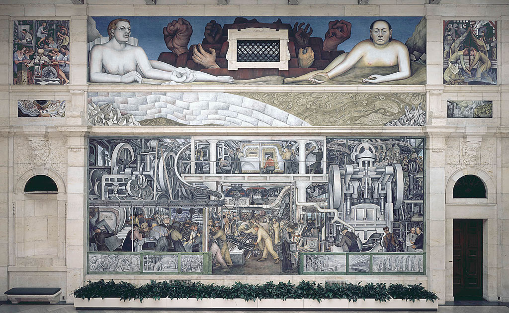
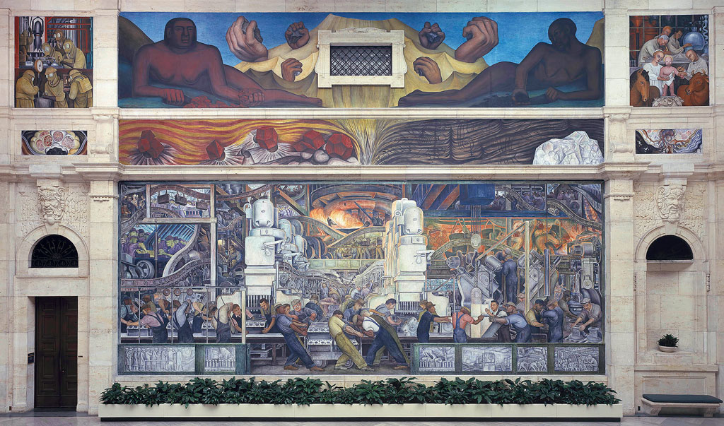
This initiative builds on a rich legacy of mural art in Detroit.  Mural art has left its mark as far back to the early 1930s, capturing almost 100 years of history in Detroit. As the city struggled through the transition of the Great Depression, the prominent Mexican painter and muralist Diego Rivera was commissioned by the Detroit Institute of Arts (DIA) to capture the energy of Detroit’s distinctive automotive, steel, and other industries. Often considered to be the most complex artworks devoted to American Industry, Rivera’s “Detroit Industry” murals depict the city’s manufacturing base and labor force on 27 panels, spanning all four walls of the DIA’s Diego Court.

Grand in scope and scale, the paintings celebrate Detroit’s auto factories and depict men of all races side by side on an assembly line. Rivera’s technique for painting frescoes, his portrayal of American life on public buildings, and the 1920s Mexican Mural Movement led to and influenced the New Deal mural programs of the 1930s and 1940s, in addition to the future generation of artists in the city.

The main two panels of his series draw inspiration from Ford’s River Rouge Plant, where Rivera toured and sketched for months before creating large-scale tributes to their workers along with a blend of critique and celebration of the forces of industry. He also blended ancient Aztec symbolism into his modernist treatment, creating allegorical figures to portray the complex relationship of human and machine.

A view of the south wall of the Diego Rivera Detroit Industry mural at the Detroit Institute of Arts


A view of the north wall of the Diego Rivera Detroit Industry mural at the Detroit Institute of Arts


The Detroit Institute of Arts’ Research Library, Archives, and Collection Information department holds the digitization of a collection of existing 8 x 10-inch (large format) nitrate photo negatives, which were taken in 1932–33 to document the making of Diego Rivera’s “Detroit Industry” murals. Their digitization preserves the history of the murals and makes the images accessible to the public. In addition, the film that Ford Motor Company’s team made of the artist at work is now accessible on the National Archives website.

Power to the People mural captured in an image from above on Woodward Avenue in Detroit; Source: Joe Gall, courtesy Hubert Massey and Detroit Heals Detroit
“Power to the People” mural captured in an image from above on Woodward Avenue in Detroit; Source: Joe Gall, courtesy Hubert Massey and Detroit Heals Detroit

Hubert Massey is a contemporary muralist whose work is inspired by 1960s- and ’70s-era activism and the art of Diego Rivera, having studied with former Rivera apprentices Stephen Dimitroff and Lucienne Bloch. In 2020, Massey worked with twenty Detroit teens to create a street mural in the Lower Woodward neighborhood, celebrating the phrase “Power to the People” and the Black Lives Matter movement spreading worldwide.

Massey works in the fresco technique and is the only known African American commissioned fresco artist in America. He has also produced work in the mediums of mosaic, terrazzo, sculpture, stained glass, and other material. You can find his work across Detroit’s Mexicantown, Greektown, the Cultural Center, the Charles H. Wright Museum of African American History, and the Detroit Athletic Club, among other places.

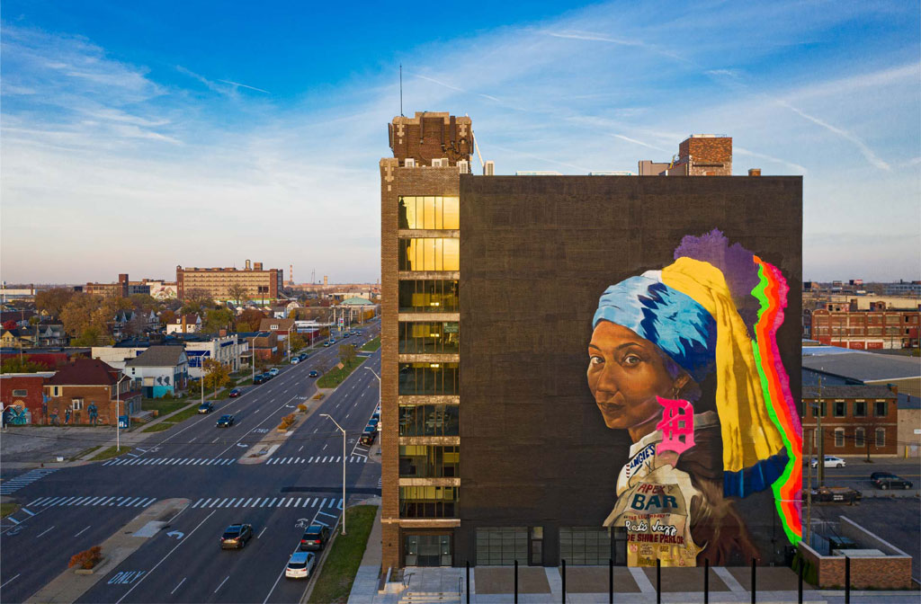
Girl with the D Earring mural; Source: Zoyes Creative
“Girl with the D Earring” mural; Source: Zoyes Creative


Sydney G. James is another Detroit artist who has contributed large-scale work to the city. A Black figurative painter and public art muralist, she pays homage to the city and emphasizes the deep connection between her art and Detroit, highlighting how murals serve as vibrant expressions of identity and community. Her work not only beautifies the urban landscape but also tells the stories of the people and the place that inspire her.

One of her most notable works is “Girl with the D Earring,” an 8,000 square-foot painting of a Black woman, on Grand Boulevard from Woodward Avenue into Milwaukee Junction. This work re-envisions Dutch artist Johannes Vermeer’s “Girl with a Pearl Earring.” “It’s one woman,” James told Hour Detroit. “But she represents Detroit in general. ‘Girl with the D Earring’ is a celebration of the city and a celebration of its people.”

“Detroit Never Left” mural; Courtesy Sheefy McFly’s website


Musician and visual artist, Sheefy McFly’s “Detroit Never Left” mural, located at Gratiot and Chene near Detroit’s Historic Eastern Market, is a nod to the idea of Detroit having a “resurgence.” The painting depicts a party full of Detroiters: a man jitting—a dance style that was born in Detroit–with a woman twerking (a dance move perfected in New Orleans in the 1990s, with origins in West African dance), a radio, and a Black man wearing a Cartier watch and a blue “D” hat, exuding an authentic Detroit. McFly told The Michigan Chronicle that “anyone from Detroit that walks by can identify with the mural.” His style blends Neo-Expressionism and Pop Art with a Detroit twist that reflects the cultural and social dynamics of Detroit, capturing the city’s spirit and history.

Public art is a form of creative place making, which further deepens connection with places where we live, work, and play.

The vibrant murals of Detroit are more than just artistic expressions; they are a testament to the city’s rich history, diverse culture, and dynamic geography. By intertwining art with public spaces, the city’s murals not only beautify the landscape but also celebrate the unique cultural tapestry that defines this iconic American city.

Explore Detroit’s murals in the city’s interactive map. Filter by year, artist, name, or location.

    Share