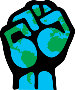
Time for a Radical Geographic Literacy in Trump America


Like many geographers, I have a world map hanging in my office. Last time I looked, I didn’t see any “shitholes” on that map. It does not come easy for me to begin my commentary with an expletive (and I apologize to those who I offend), but our current U.S. President really leaves me no choice. I am sure many of you know of the strong allegations that Mr. Donald Trump—frustrated with a bipartisan immigration proposal—argued that America needs more immigrants from places like Norway and fewer from Haiti, El Salvador and African nations, which the President reportedly called “shithole countries.”

More than mere “locker room cartography,” as one late night comic put it, the President’s harmful words project a racialized map of the world that represents Haitians, Salvadorians, and Africans not only as unwelcomed, but also as inferior. By reducing countries and an entire continent to a pejorative label, Mr. Trump denies the complexity, dignity, and richness of life in these countries and the creative resilience and resistant survivability that have always existed amid and in opposition to political oppression and poverty.

Mr. Trump’s “shithole” remark also works to erases, quite likely by design, a consideration of socio-spatial processes and difficult decisions that make migration necessary for many people, along with the very real contributions that immigrants from these denigrated nations have brought (and continue to bring) to the United States. Also obfuscated in the President’s unjust words is America’s own historical and ongoing complicity in destabilizing the governments and economies of some of these derided countries.

As a global leader and the head of a diverse nation, the President had the responsibility to create and communicate a much more informed and inclusive rendering of the world—regrettably, it appears that he chose not to do so.

There is no shortage of organizations, journalists, and individual citizens condemning Trump’s words as vulgar, racist, and unbecoming of the nation’s highest elected leader. I share in their outrage and feel strongly that the President’s remarks—and the ideology that underlies them—strike at the heart of who and what we are as geographers. His maligning of certain parts of the world runs directly contrary to our Association’s core values regarding scientific knowledge, international collaboration, support for developing regions, human rights, and anti-racism.

Before going any further, I want to be clear that this column, like all of my monthly columns, reflects my opinions and mine alone. They do not represent an official stand or position taken by the American Association of Geographers (AAG). At the same time, the AAG can and does encourage its members to speak out to express their own individual opinions about social and policy issues important to them as geographers.

The President’s recent language and policies regarding immigration are open to question on a variety of economic, diplomatic, and social justice grounds. I wish to focus here on the damage potentially done to the “geographical ethics” that we try to create within our classrooms and communities, specifically the intellectual and moral obligation to develop a sophisticated global understanding, to represent the world in just terms, to care about and develop an empathy for others—as much as that is illusive.

Regrettably, Mr. Trump’s “shithole” reference is not an isolated event, but part of a pattern of regularly degrading people and places as part of the process of governing—whether he is offering defamatory portrayals of people from Mexico, African American communities, or those living in certain Muslim nations.

I encourage members of the AAG to consider what this national ethical crisis means for our discipline—especially in terms of raising the already high stakes of geographic education—and I suggest that now is the time for articulating and promoting a “radical geographic literacy” among a public bombarded with harmful images from the White House.

The High Stakes of Geographic Education, Especially Now

When Mr. Trump uses his bully pulpit to portray an entire country as the equivalent of a toilet, he is single handedly damaging what many of us have spent our careers trying to achieve in the classroom. The full damage comes not from a single comment in a single moment, but in how that remark perpetuates a long history of nativism and white supremacy within the United States while also reinforcing centuries old negative tropes about the Global South. In this regard, we cannot dismiss the President’s words as simply political incorrectness or “Trump just being Trump”—they are part a larger historical and contemporary geography of racial injustice.

The President’s stigmatizing of Haiti, El Salvador, and African countries—and the unwillingness of some elected officials to condemn these actions—threaten not only the global outlook and values of our students, but also potentially the very safety of some of these students and other community members. I join other geographers in being gravely concerned about the wider toxic effect that the ‘shithole” controversy will have on patterns of prejudice, public treatment of targeted immigrant groups, the sense of belonging of people of color in general.

While the President has been criticized (and rightly so) by the media and teachers, the truth is that his offensive comments join a tradition among journalists and even some educators of framing African people and places largely in terms of disaster without carrying out a full and responsible historical and geographic analysis and depiction of the region. Indeed, several months before the President’s infamous “shithole” reference, a number of my colleagues who grade AP Human Geography exams contacted me. They expressed outrage this past year in finding high school student AP essays containing damaging stereotypes about Africa along with clear elements of racism, sexism, and classism. There were also concerns from my colleagues about some of the Eurocentric assumptions written into the AP exam questions and grading rubrics.

If the goal of geographic educators are, according to John Finn, to wage a “ruthless” critique of the taken for granted ways we order and fix the meaning of the world, then our job has always been a tough one and I would argue that it has gotten even tougher in the Trump era. This challenge from the White House, while clearly indicating the need for increased advocacy for geographic education, comes at a difficult time in the discipline. While not discounting significant national and international strides made in educational standards, research, and programs in geography, much of it led by the AAG, and the ever growing pedagogical importance of GIScience, the view seen by some geographers is not so rosy.

We are in a time in which some states are cutting or diluting geography within public school curriculum—a baffling decision given the international challenges and uncertainties facing us. And the National Geographic Network of State Alliances—who for thirty years was the “boots on the ground’ in the battle to train teachers and lobby for geography with state legislatures—learned in 2017 that the university-state alliance model will be de-funded by National Geographic Education for a new, and still not clearly outlined regional model of support. Coordinators of some state alliances are quite certain their offices will close—eliminating important allies in the promotion of geographic education at a most critical time.

The dramatic restructuring of the Alliance Movement, the curriculum challenges facing educators and the recent ethical challenges that I have described suggest that the stakes are especially high for a discipline-wide reinvestment in geographic education and championing what I call a “radical geographic literacy.”

Toward a Radical Geographic Literacy

I choose the word “radical” to characterize geographic literacy for two reasons. First, radical signals a profound change and I am calling for a significant discipline-wide elevation and intensification of geographic education-related outreach and advocacy. The radical approach proselytizes the educational and political necessity of having a broad comprehension and appreciation of the world’s complexity and diversity as a means of countering ongoing national efforts to deny that reality. This enhanced promotion of geographic literacy has always been important, especially given the continuing abysmal base of geographic knowledge among Americans, but particularly needed now when our President, a self-identified “stable genius,” appears unable or unwilling to articulate even the most basic understanding of the world mosaic.

To some degree, this radicalism requires geographers to keep doing what they do well, which is offer critical and accessible learning about the world and how it looks, feels, and works in actuality rather than in political rhetoric. Yet, effective teaching may not be enough. Geographers of all sub-fields should consider additional places where they can push back against unethical portrayals of the world and its people. That could be lobbying for curriculum change, designing lessons, training teachers, attending educational conferences, publishing in pedagogical journals, consulting with colleges of education, participating in community teach-ins, visiting K-12 classrooms, or collaborating, while you can, with your state geographic alliance. This radical mode of advocacy is, in my view, a responsibility of all geographers and not solely the job of those who conduct research in the theories of methods of geographic education.

Second, I use “radical” geographic literacy in a deeper way, recognizing the word’s association with revolutionary change. I believe it is time to redefine, for the public and our profession, what we fundamentally mean by and represent as geographic literacy, while also actively considering what role a revamped version of the concept can and should play in advancing a geographical ethics seemingly missing from the Oval Office.

Geographic literacy is not something that I hear many of my fellow faculty members talk about, perhaps because the public, media, and even some geographers identify it with the rote learning of the names and locations of human and physical features on the earth. There are broader and more useful conceptions of literacy. For example, Geography for Life: National Geography Standards (2nd edition) emphasizes the analytical perspectives, content knowledge, and applied skills needed to be a geographically informed person. Within the “In Brief” version of these standards, what is distributed widely to schools and teachers, geographic literacy is defined as being critical to “economic competiveness,” “quality of life,” “sustaining the environment,” and “national security.”

Absent, at least prominently, within standard definitions of geographic literacy is the relationship between geographic education and the promotion of peace, social and environmental justice, and anti-discrimination—the very matters that seem to matter the most at this historical juncture. Importantly and rigtly, Geography for Life suggests that a geographic education enables students to “engage in ethical action with regard to self, other people, other species, and Earth’s diverse cultures and natural environments,” but it stops short of identifying ethical geographical awareness and action as one of the discipline’s core or essential elements and competencies. At best, it would be subsumed under “the uses of geography.”

Strikingly, Geography for Life suggests that geography can assist in protecting the US economy and its position in defense and international relations (a point that I don’t necessarily disagree with), but it does not appear to say nearly as much about extending that concern and responsibility to a worldwide scale or the efficacy of geographic literacy in promoting international cooperation. Drawing from the writings of Barney Warf, an alternative, radical definition of geographic literacy would be more explicit in creating moments to challenge the privileging of that national order. Such a literacy would be key to “widen[ing] geographical imaginations and circles of compassion, to illustrate how students’ lives are connected to distant others, and to inject issues of empathy and caring into geographic pedagogy.”

In contrast to traditional definitions of geographic literacy, which tend to focus largely on the ability of students to process and apply geographic information, a radical version of geographic competence considers more centrally the affective and emotional aspects of developing a basic but critical knowledge of the world. Again, reading from Warf, such an approach promises to “call attention to students’ positionality, highlight their prejudices, and to make explicit the cultural filters with which they perceive those different from themselves, and thus equip them with tools to negotiate the complex terrain of social difference in meaningful and constructive ways.”

It is this very sort of reflexive engagement with values and attitudes, as part of basic geographic literacy, which is necessary for being sensitive to and standing in solidarity with the differences and legitimacies of other countries—something grossly missing from a Trump worldview.   Importantly, a radical geographic literacy does not abandon the need for foundational content and skill development, but it realizes that these geographical competencies are incomplete if not leveraged to examine, critique, and challenge inequalities—including dehumanizing portrayals of countries and regions. Importantly, this radical geographic literacy is not restricted to our colleagues in critical human geography; it can and should be part of the pedagogical DNA of our whole discipline.

Many of you already engage in and advocate for radical geographic teaching, learning, and outreach, but it is time to institutionalize these values within the promotional materials distributed to K-12 schools, universities, and public groups, the learning objectives of our introductory courses, the way we introduce ourselves to strangers, and national geography definitions and curriculum standards. Perhaps a new edition of Geography for Life is in order. Please share your ideas of how to develop and carry out a radical geographic literacy and your thoughts and experiences on the geographic ethics at work (or not) in Trump America by emailing me (dalderma [at] utk [dot] edu) or share on Twitter #PresidentAAG.

— Derek Alderman @MLKStreet
Professor Geography, University of Tennessee
President, American Association of Geographers

DOI: 10.14433/2017.0026

    Share

AAG Welcomes Two Spring Interns

The AAG is excited to have two new interns join our staff for the Spring 2018 semester. Welcome aboard Laura and Hannah!

Laura Akindo recently graduated from Frostburg State University with a Bachelor’s of Science degree in Earth Science with a Concentration in Environmental Science. She also majored in Geography. Laura is in the process of applying to Graduate Programs and hopes to begin working on her Masters of Science in the Fall in GIS and Environmental Management and Policy. In her spare time, Laura likes to read, visit new exciting outdoor parks, and watch soccer.


Hannah Ellingson is a sophomore at The George Washington University, pursuing a B.A. in geography and a minor in geographic information systems. Hannah previously interned for the City of Norfolk’s city planning department, where she used GIS to create a map of street-end water access points in Norfolk, VA, in order to support an initiative to increase public water access throughout the city. After graduation, she intends to pursue a M.A. in geography. She attributes her passion for geography to her mother, who instilled an appreciation for geography in Hannah at a young age. In her spare time, she enjoys exploring D.C.’s art museums and restaurants, traveling with her family, and playing with her black lab puppy, Hank.

    Share

Emilio Casetti

Emilio Casetti, who has died at the age of 89, three weeks short of his ninetieth birthday, made important contributions to both geography and regional science. He was honored at Ohio State with the designation Distinguished Research Scholar in 1992, and in 1994 the Association of American Geographers bestowed upon him the Honors Award, the organization’s most prestigious recognition for research excellence. He was also an unforgettable person.

He acquired his bachelor’s degree in law at the Sapienza University in Rome at the early age of 20 and earned a doctorate from the University of Rome in three years. He then practiced law in Rome and had begun work towards a doctorate in geography at the same university before leaving to do a Master’s at McGill. Afterwards, he and his wife Gabriella spent several years in a remote part of Saskatchewan teaching in a very small rural school. He did not have to be pushed to regale the listener with hair raising tales of the winters there, all told with his standard deadpan grin. Quite what had led him in the direction of geography is unclear, but by 1964 he had graduated from Northwestern deeply steeped in the quantitative methods for which the Geography Department there was, at that time, notable. His first appointment was at Toronto but in 1966 he moved to the Department at Ohio State, where he would remain until his retirement.

He would become an important influence in graduate work in the Department and a renowned advisor. What made him so effective was his ability to see the unique strengths of each of his students, help them recognize it, and then allow them to deploy that strength to its fullest advantage.  Not surprisingly, his students – and nine of his twenty-three doctoral students were, significantly for the time, women – have gone on to successful careers of their own, each in a direction that no doubt Emilio saw early on. They speak affectionately of him, and of the time he decided that they must call him ‘Emilio.’ He cared deeply for them and would defend them vigorously against pettiness.

His work was notable for its combination of simplicity, power and imagination. He himself thought that his development of what he called the expansion method was his major contribution. What this involved was taking some relationship, like Fourastié’s model of sectoral shift in a national economy, describing it with a regression model and then expanding it by setting the coefficients as functions of other pertinent variables, like, perhaps, the date at which an economy took off. This would then create a set of relationships that could stimulate further investigation. This would be a precursor to spatial regression models where the coefficients are a function of absolute or relative location.

Emilio’s expansion method led to a number of dissertations at Ohio State in the 1980s and through the 1990s. As he came to view things, however, it was not simply a method but a new paradigm for research, one that challenged scientific geography – of which he was a strong proponent – to entirely rethink the nomothetic (or law-seeking) enterprise. Instead of assuming that parameter instability was an aberration due to model misspecification or systematic biases in data and error terms, Emilio came to see the search for contextual variation in causal processes as part-and-parcel of the explanatory effort itself. For any model, the question of parameter variation opened up new questions, ones often more important than the first order explanatory questions tested in what he called the ‘initial model’.

Though he was well known for the expansion method, he was also the early inventor of what later became popularized as geographically-weighted regression (GWR). In his ‘drift-analysis-of-regression parameters’, or DARP, he constructed a grid across a set of spatially distributed observations and proceeded to run separate cell-by-cell regressions, weighting all observations according to an exponential distance-decay function from the cell’s central point. The result was a moving lattice of regression analyses that varied by the degree of information content from nearby data points, thus producing a series of ‘local’ regressions for which investigators could track and map parameter variation. Depending on the exponents determining the distance-decay of information from near or far away cases, the models could adjusted to be ‘regional’ as opposed to local. The insight led him to argue that spatially weighted regression is not a special case of regression; rather, analyses that don’t explicitly involve weighting are equivalent to assigning each case a value of 1, which is the norm for most models. Hence DARP, or geographically-weighted regression, as it became popularized, was the more general case. It is a sidebar in the history of geography that DARP preceded a now popular GWR by a decade and furthered the development of quantitative geography away from its search for universal laws to something much more sensitive to issues of context.

As a person he was a curious mix of strong views strongly held, and a sweet innocence. He was dedicated to his research but found lots of time for other things, the most notable of which were cats. Emilio was a cat lover, par excellence; not one who hoards them but who, along with his wife, took in strays in sufficiently modest numbers where they could develop an attachment to them. And he was attached. An invitation to dinner would be accepted but on his insistence, he and his wife would arrive in separate cars so that if one was involved in an accident, the cats would not go wanting. He was a very kind man and not just to cats. There are many stories of Emilio’s consideration of those students who had trouble with the quantitative methods that he taught.

There are other interesting stories about him. As a young adult growing up in postwar Italy, Emilio developed a strong aversion to traditional social institutions that he saw as oppressive and antithetical to progress.  He joined the Italian communist party, but after several years concluded that the party itself reproduced the social hierarchies that he opposed.  Many years later when he applied for a U.S. green card, he had to respond to a question about whether he had ever been a communist party member.  He was honest in his response, and attached a statement describing how and why he was no longer a communist: nepotism and cronyism.  He must be the one and only person who was given a green card after openly admitting that he had been a communist party member!

In the late 60s, he acquired, quite cheaply, one of the earlier analog computers and put it in his basement. This meant that he did not have to submit his jobs to the computing facility at the university, as was the custom at that time. The problem was, that it was huge. Being shown it was like walking down the book shelves in a library. Emilio was also an early adopter of  desktops and laptops, and once they became available, getting rid of his heap of metal – whose only real purpose was in solving partial differential equations – was a nightmare. Through it all one could see Emilio’s usual sense of humor and self-deprecation.

He liked people who he judged to be without guile and who he perceived to be honest. He will be deeply missed by those touched by his unique blend of kindness, considerateness and innocent disbelief that you might disagree with him. His life will endure through the major contributions that he made to spatial-quantitative geography and through the affectionate recollections of his students.


    Share

Enacted Tax Bill Protects Tuition Waivers

A massive tax reform package signed into law by President Trump shortly before the holidays drew attention primarily for slashing corporate rates and amending individual filing rules.  The legislation, however, was also of significance for the higher education community.

The original bill that passed the House of Representatives included language that would have counted graduate student tuition waivers as taxable income.  This proposal drew significant protests and press criticism and was ultimately removed by House and Senate negotiators.  The AAG was actively involved in opposing the provision and keeping our student members and departmental leaders informed, and we are pleased with the outcome.

Separately, the new law will apply a new excise tax of 1.4 percent on investment income for certain private colleges.  Institutions with over 500 students and holding assets of $500,000+ per student will be affected.  It is estimated that this new tax will affect approximately 35 institutions including Harvard, Yale, Princeton, and Stanford and will generate close to $2 billion in revenue over ten years.  The House had proposed taxing additional colleges and universities, but Senate negotiators argued for the more narrow language.

Finally, it will bear watching how much of an impact the new law has on financial support for public institutions in high-tax states.  The legislation caps personal deductions of state and local taxes at $10,000, which could apply pressure on certain states to lower taxes.  This, in turn, could force these states to cut budgets, including for public higher-ed institutions.

    Share

Educational GIS Activities in Africa

Over the past decade, most universities and some secondary schools across Africa have been exposed to geographic information system (GIS) technology. Teaching about and with GIS on that continent has been both challenging and rewarding.

On April 9, 2017, the panel session “Teaching GIS in Africa” was held at the Association of American Geographers (AAG) annual meeting in Boston. Esri organized this session, and speakers came from several nations and spoke of their diverse experiences as teachers and, in one case, as a student in Eastern Africa.

Although every African university and nation has its own unique characteristics, the speakers and audience members coincided on several issues. GIS education across Africa—with exceptions especially in South Africa—has been slow to evolve beyond the teaching of basic GIS theory, in large part due to a lack of sustained resources such as computer labs, Internet connections, and updated local datasets. Often these resources are donated but not maintained in the medium or long term. Software is generally available either as open source or via discounts and donations by Esri and other commercial providers.

The main limiting factor identified was the lack of instructors educated on the latest technologies and methodologies such as mobile data collection, data publishing and sharing, and advanced spatial analysis. Far too many students are still learning GIS from textbooks instead of via hands-on use. Much of the applied GIS being taught is natural resources (and satellite imagery) oriented, with less attention being paid to human geography, urban issues, and cartography. This, again, is due to the limited availability of specialists in these areas and of spatial data such as street networks and geodemographics. Many steps have been taken in the form of short-term, donor-funded projects, but often momentum is lost after project completion.

The University of North Alabama’s Jonathan Fleming, an Esri education ambassador, teaches in the geography department at the University of Dar es Salaam.

Esri is committed to making a long-term difference in GIS education in Africa and, over the past five years, has ramped up its involvement in this endeavor. Esri has sponsored a series of education user conferences (in Eastern Africa), training sessions, and other activities organized by local Esri offices. Additionally, special assistance has come from Esri’s offices in France, Portugal, and Switzerland to support universities in francophone nations, lusophone nations, and Rwanda, respectively. Esri has sponsored a growing group of education ambassadors to travel and conduct teaching and geomentoring missions across the globe. Among them are Jonathan Fleming of the University of North Alabama, who taught in Dar es Salaam in 2013, and Stace Maples from Stanford University, who visited Kenyatta University (KU) in Nairobi in spring 2017. Maples taught several classes and also mentored faculty and the university administration about how to apply and sustain GIS across the entire campus. Feedback from the universities and ambassadors was extremely positive, and so Esri will continue to support these missions in the future.

Among African universities, Kenyatta University has emerged as a star—a lighthouse exemplar—in adopting and promoting GIS. As in many GIS success stories in any field, a GIS champion was involved: Professor Simon Onywere. Onywere had been a GIS and remote-sensing expert for many years, but in 2013 he decided to take his university to the next level. He worked with Esri’s home office and Esri Eastern Africa Limited (in Nairobi) to craft a memorandum of understanding (MOU) whereby both parties would contribute to the success of GIS across the entire KU campus. Under Esri’s 100 Africa Universities program, the MOU included a donation of ArcGIS software to the university. Esri has worked with approximately 70 universities under this program thus far. With software installed in the laboratories, Onywere and Esri personnel trained instructors, students, and administrators on the power of GIS for solving spatial problems in any field of study. Enterprise GIS, including attention to servers and client apps, became available to anyone showing interest in learning on the same platform used by industrial, commercial, and government entities around the world. GIS Day and similar events were run; a GIS club was formed; and, soon, a small army of GIS users and promoters was created.

The first Esri Eastern Africa Education GIS Conference was held in Nairobi in 2013.

KU recently hosted the 2017 Esri Eastern Africa Education GIS Conference. GIS is being taught and used for research by Onywere’s environment science faculty and several others including staff of the recently added tourism and hospitality department and the newly built library. The KU story is a story of hope for GIS at African universities, demonstrating that with personal and collective initiative, anything is possible.

Working with instructors, students, and university/school administrators in Africa has been extremely rewarding and gratifying. We encourage all AAG members to consider lending a helping hand to slowly but surely raising the level of GIS education across the continent. If you’d like to apply to become an Esri Education Ambassador, send a brief CV with teaching experience and a statement of interest to edambassadors [at] esri [dot] com.

By Michael Gould, Global Education Manager, Esri

Featured Articles is a special section of the AAG Newsletter where AAG sponsors highlight recent programs and activities of significance to geographers and members of the AAG. To sponsor the AAG and submit an article, please contact Oscar Larson olarson [at] aag [dot] org.

    Share

Confederate Monument Controversy in New Orleans

Across the U.S. South and beyond, cities are debating the fate of their Confederate monuments. In New Orleans, the May 2017 removal of the Robert E. Lee monument in Lee Circle, the large round-about on St. Charles Avenue, was the culmination of over two years of public and political drama, driven primarily by Mayor Landrieu’s 2015 charge less than a week after the Charleston massacre to “look at the symbols in this city to see if they still have relevance for our future” (Times Picayune June 22, 2015). He explained that a conversation with jazz musician Wynton Marsalis, who when asked to help plan the city’s 2018 Tricentennial Celebration, challenged the mayor to consider Lee Circle through his eyes. “Who is he? What does he represent? And in that most prominent space in the city…does that space reflect who we were, who we want to be or who we are?” (Times Picayune June 24, 2015).

Landrieu proposed the removal of four monuments – statues of Robert E. Lee, P.G.T. Beauregard, Jefferson Davis, and the Battle of Liberty Place Obelisk. Dedicated between the years 1884 and 1915, these four monuments were erected as part of a national trend, particularly in the South, symbolizing the Confederacy’s Lost Cause mythology – a revisionist Civil War narrative intended to transform the South’s military defeat into a political and cultural victory, promoting white dominance and states’ rights, while deifying southern leaders (Gallagher and Nolan 2010).

Using a public nuisance law, the Mayor brought the issue to the city council that ultimately voted six to one to remove the monuments. Yet, unsurprisingly, the issue was far from resolved. While the Mayor’s office moved forward with plans for removal, pro-monument groups such as the Monumental Task Committee deployed multiple legal maneuverings to slow the process. Meanwhile, contractors bidding on the removal contract received death threats. Countless protests occurred, mostly in front of the three figurative memorials which became gathering places for supporters and opponents of removal. At times the protests were small and cordial; others were tense and required police barricades and security. Some were organized by anti-monument organizations such as Take ‘Em Down, Nola, and others by anti-removal groups like Save Our Circle, and still more were informal and grew from people walking by or patrons of local bars and restaurants coming out to engage. Not even during the city’s beloved Jazz Fest was there an escape from the controversy as a plane flew overhead with a banner reading “OUR MONUMENTS OUR HISTORY!”

Site of the Battle of Liberty Place obelisk, removed in the early morning hours of April 24th, 2017. Photograph by Jennifer Speights-Binet

After town hall meetings, hearings, lawsuits, appeals, and protesting, the uprooting of the Confederate statues in New Orleans began in the early morning hours of April 24th with no public notice of the removal. Because of serious security concerns, removal workers masked their faces as well as the company name on their vehicles and wore flak jackets. With snipers overhead in a parking garage, the workers took down the first monument, the Liberty Place obelisk behind a French Quarter shopping mall. Long a controversial monument, the Liberty Place obelisk honored those who fought against political integration of blacks into a white-controlled government (Gill 1997). The White League defeated the much smaller New Orleans’s police force, where 35 people, mostly police officers, died. Nevertheless, protestors rallied to demonstrate their disapproval of the obelisk’s removal.

Removal of Robert E. Lee monument on May 19, 2017.

About two weeks later, the statue of Confederate president Jefferson Davis at the intersection of Jefferson Davis Parkway and Canal Street was taken down in the pre-sunset hours of May 11th. Next, the P.G.T. Beauregard statue, erected at the entrance to City Park in 1915, was removed one week later, again in the morning hours, with a relatively calm crowd. At both sites, protestors for and against monument removal demonstrated, and while the scenes were heated, no physical injuries occurred.

Then on May 19th, in the light of day on a warm New Orleans afternoon, onlookers brought lawn chairs, held parasols while drinking mimosas, played Michael Jackson’s Remember the Time on a boom box; others danced as an impromptu jazz band sounded their instruments. This was the day that the most prominent of the four monuments, the Robert E. Lee northward facing bronzed statue, would be removed from its 60-foot column, where he had been standing for 133 years. This final of four Confederate statues removed seemed to resemble more of a tailgate party than a protest (Times Picayune May 19, 2017). However, contractors again wore masks and protective gear because of the highly contentious Confederate monument controversies. As a crane finally took the Lee statue down, the crowd of hundreds cheered and jeered. Here, New Orleans’s festive culture intersected with serious memory-work, highlighting that such work is always at its root local.

As Lee was descending, just a few blocks away New Orleans Mayor Mitch Landrieu was delivering the speech of a lifetime – now referred to as the Gallier Hall address after the venue where it occurred. (Read entire speech here.) Noted for its rhetorical eloquence engaging pathos, ethos, and logos, Mayor Landrieu’s speech reminded us that like monuments, words matter. Consider the following excerpt:

“America was the place where nearly 4,000 of our fellow citizens were lynched, 540 alone in Louisiana; where the courts enshrined ‘separate but equal’; where Freedom riders coming to New Orleans were beaten to a bloody pulp. So when people say to me that the monuments in question are history, well what I just described is real history as well, and it is the searing truth. And it immediately begs the questions: why there are no slave ship monuments, no prominent markers on public land to remember the lynchings or the slave blocks; nothing to remember this long chapter of our lives; the pain, the sacrifice, the same…all of it happening on the soil of New Orleans. So for those self-appointed defenders of history and the monuments, they are eerily silent on what amounts to this historical malfeasance, a lie by omission.”


Robert E. Lee Statue Currently
The empty plinth where Robert E. Lee stood for 133 years. Photograph by Rebecca Sheehan.

The four monuments are now housed in an undisclosed location with the idea that they will be relocated to a museum where proper contextualizing and interpretation may be provided. Since the beginning of the process, Mayor Landrieu has advocated this as a solution, so that the city may remember but not revere the figures and events that they embody (Times Picayune July 9, 2015). Of course, these monuments are not the only controversial memorializations in New Orleans’s cultural landscape. Take ‘Em Down Nola is advocating for the removal of other monuments such as the Andrew Jackson statue in the beloved French Quarter’s Jackson Square. Jackson, victor at the Battle of New Orleans in the War of 1812, is hailed as the Savior of New Orleans but also a major contributor to the Trail of Tears. Indeed, difficult memory-work lies ahead for the city and the U.S. South as complex histories and how to remember those histories for the present and future continue to come to the fore.

As geographers visiting the city and no doubt partaking in its festive culture, you are also encouraged to walk by the sites where these statues were emplaced for well over a century and consider what is present in their absence—as of this writing, the pedestals of these Confederate monuments remain empty. We suggest that the now empty plinths where these statues once stood are signs of promise not despair. They are part of the process of memory-work that must occur to broaden one form of spatial justice in the landscape.

Jennifer Speights-Binet
Samford University

Rebecca Sheehan
Oklahoma State University

DOI: 10.14433/2017.0022

Gallagher, Gary W and Alan T. Nolan, eds. 2010. The Myth of the Lost Cause and Civil War History. Bloomington: Indiana University Press.
Gill, James, 1997. Lords of Misrule: Mardi Gras and the Politics of Race in New Orleans. Jackson: University Press of Mississippi.

    Share

Peter Meusburger

Peter Meusburger, a professor of human geography at the University of Heidelberg, died on December 18, 2017. He was 75 years old.

Peter was born on March 14, 1942 in Lustenau, Austria and earned his doctorate in geography from the University of Innsbruck.

Meusburger’s research interests were on the geographies of education and skills, labor market research, and regional women’s research. As a scientific advisor to the Vorarlberg state government, Peter studied the emigration of highly qualified people from Vorarlberg. He also examined the state’s educational history.

Peter was appointed to the Ruprecht-Karls-University Heidelberg in 1983, serving as chair in economic and social geography at the Institute of Geography until he retired in 2007. He was named the university’s first Distinguished Senior Professor after his retirement. Meusburger held many positions at the University of Heidelberg, including Dean of the Faculty of Geosciences in 1987-1988 and 1988-1989, Vice-President in 1991-1992 and 1992-1993, and Member of the Senate from 1999 to 2006, as well as Senate spokesman and curator of the University of Heidelberg. He has been a visiting professor at various universities in Japan, China and Brazil.

Between 2001 and 2003, Peter served as president of the German Geography Society. His awards and honors include the 1968 Johann Hampel Prize of the Austrian Geographical Society, 2006 Franz von Hauer Medal of the Austrian Geographical Society, and 2010 Vorarlberg Science Award. In 2010, Peter was named Honorary Doctor of Eötvös Loránd University and Honorary Member of the Hungarian Geographical Society. That same year, Peter was awarded the 2010 AAG Presidential Achievement Award from the American Association of Geographers.

    Share

New Books: December 2017

Every month the AAG compiles a list of newly-published books in geography and related areas. Some are selected for review in the AAG Review of Books.

Publishers are welcome to send new volumes to the Editor-in-Chief (Kent Mathewson, Editor-in-Chief, AAG Review of BooksDepartment of Geography and Anthropology, Louisiana State University, Baton Rouge, LA 70803).

Anyone interested in reviewing these or other titles should also contact the Editor-in-Chief.

December 2017

2017: A Novel of Political Intrigue by E.A Stillwell (iUniverse 2017)

City of Forests, City of Farms: Sustainability Planning for New York City’s Nature by Lindsay K. Campbell (Cornell University Press 2017)

Democratic Eco-Socialism as a Real Utopia: Transitioning to an Alternative World System by Hans A. Baer (Berghahn Books 2017)

Economic Development and Environmental History in the Anthropocene: Perspectives on Asia and Africa by Gareth Austin (Bloomsbury 2017)

The Geography of the Everyday: Toward an Understanding of the Given by Rob Sullivan (University of Georgia Press 2017)

Geology of the Florida Keys by Eugene A. Shinn & Barbara H. Lidz (University Press of Florida 2018)

Historic Capital: Preservation, Race, and Real Estate in Washington, D.C. by Cameron Logan (University of Minnesota Press 2017)

Istanbul, Open City: Exhibiting Anxieties of Urban Modernity by Ipek Türeli (Routledge 2018)

Labor by Andrew Herod (Policy Press 2017)

The Long Hangover: Putin’s New Russia and the Ghosts of the Past by Shaun Walker (Oxford University Press 2018)

Literature and Cartography: Theories, Histories, Genres by Anders Engberg-Pedersen (ed.) (MIT Press 2017)

Spaces of Capital / Spaces of Resistance: Mexico and the Global Political Economy by Chris Hesketh (University of Georgia Press 2017)

Old Europe, New Suburbanization?: Governance, Land, and Infrastructure in European Suburbanization (Global Suburbanisms) by Nicholas A. Phelps (ed.) (University of Toronto Press 2017)

Growing Community Forests: Practice, Research, and Advocacy in Canada by Ryan Bullock, Gayle Broad, Lynn Palmer, and Peggy Smith (eds.) (University of Manitoba Press 2017)

The Rogue Revolutionist by Robert L. Blackburn (iUniverse 2017)

Sovereignty’s Entailments: First Nation State Formation in the Yukon by Paul Nadasdy (University of Toronto Press 2017)

Studying Arctic Fields: Cultures, Practices, and Environmental Sciences by Richard C. Powell (McGill-Queen’s University Press 2017)

Swamp: Nature and Culture by Anthony Wilson (Reaktion Books 2018)

Timespace and International Migration by Elizabeth Mavroudi, Ben Page, and Anastasia Christou (eds.) (Edward Elgar Publishing 2017)

Urban Rage: The Revolt of the Excluded by Mustafa Dikeç (Yale University Press 2018)

Why Demography Matters by Danny Dorling and Stuart Gietel-Basten (Polity Books 2018)

    Share

AAG President Highlights Civil Rights at Ohio University Colloquium

On November 3, 2017 AAG President Derek Alderman addressed the Ohio University Geography Department through its Colloquium program. His talk, entitled “Civil Rights as Geospatial Work: Role of Counter Mapping and Radical Place-making in the African American Freedom Struggle”, engaged the audience in a critical look at how geographers can play a role in discussing and practicing civil rights. He emphasized that geographers now have an opportunity to be active in a second wave of Civil Rights movements, making specific note that there is a chance to feature not only civil rights struggles, but the ways in which we talk about them. Coinciding with the Geography Awareness Week theme of the geography of civil rights movements, Alderman highlighted how geographers can interact with new grassroots movements and ways of knowing about race and place.

A key moment of Alderman’s talk called attention to the next generation of geographers. “Students will be our planners and mappers for the future–but you won’t be doing that alone, you’ll do that as part of a larger history of [geospatial and civil rights] work,” Alderman remarked. The statement captures an idea at the heart of his presentation– civil rights and geography are fundamentally linked and have a deep history which can and should be explored further. Examples of the geospatial work Alderman discussed included The Green Book, a tool which helped black travelers during the height of segregation in America, and the importance of data during sit-ins and bus boycotts. One way of looking at these important topics is to view them as part of a longer, broader civil rights movement beyond the common narratives many of us are familiar with today.

The Ohio University Geography Colloquium is a four-part, semester-long series. Chosen by the OU faculty and a graduate student representative, the colloquium speakers connect students with a variety of areas of geographic research. Many Geography departments regularly host similar events with guest speakers sharing information on topics, study areas, or research initiatives they are passionate about and ways they filter into popular culture. For students, these events can help them explore new areas of geographic thought and inspire new research ideas. For faculty in attendance, it presents an opportunity to branch out into other geographic subfields and become energized for their own research.

One way that the AAG supports colloquium programs and the sharing of geographic ideas is through the Visiting Geographical Scientist Program (VGSP). Funded by the Gamma Theta Upsilon Geography Honor Society, the program is geared towards small departments with limited resources to bring in notable geographers as guest speakers. The VGSP helps to identify potential visitors and assists with costs for travel.

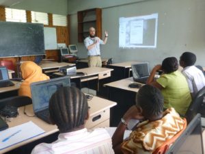
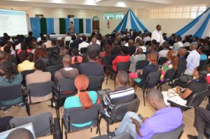
Additionally, the AAG has kicked off a brand new resource to highlight geographers interested in and available to give presentations on various aspects of geographic thought and research. The Geography Speakers Bureau is designed to facilitate connections between speakers and those hosting events such as department colloquia, or media contacts seeking a geographer perspective on a topic. The Speakers Bureau, still in development with more speakers to be added, highlights distinguished geographers and their research interests and encourages a culture of public speaking within the field. Not only does the Speakers Bureau aim to connect geographers to each other, but it also seeks to increase public engagement to help communicate all that geography has to offer the world.

For more information on the VGSP program contact Mark Revell at mrevell [at] aag [dot] org. For more information on the Geography Speakers Bureau contact David Coronado at dcoronado [at] aag [dot] org.

    Share

Commemorating the Enslaved Along Louisiana’s River Road

Members of the NSF research team visit the River Road African American Museum in Donaldsonville, Louisiana in June of 2013. (Photo by Amy Potter)

Between New Orleans and Baton Rouge, lies the remnants of antebellum sugar plantations along Louisiana’s famed River Road, named for the Mississippi River that snakes its way through southern Louisiana before spilling into the Gulf of Mexico. Many of the eighteenth-century and nineteenth-century plantation homes that still exist along this road have been preserved, and some have been transformed into museums dedicated to retelling Louisiana’s antebellum period. A few of these museums attract as many as 200,000 visitors a year (Oak Alley and Laura, A Creole Plantation, for example). Most of these plantation house museums, however, have traditionally focused their narrative presentations on the planter and his family, which necessitates that tours be spatially arranged in and around the planter’s home (The Big House).

Such narratives have traditionally marginalized, segregated, or even omitted stories of the enslaved persons whose labors made these landscapes and vast fortunes possible (Eichstedt and Small 2002). Instead of focusing on the people who toiled and effectively created these landscapes, visitors to these sites are regaled with stories of romance, wealth, scandal, and entrepreneurship, and are enchanted by elaborately costumed guides and Oak tree-lined boulevards. Narratives and artifacts tend to limit visitors’ engagement with the enslaved to the hyperlocal and the safely distant past. While their traces are to be found throughout the house and across the landscape, the onus is on visitors to seek them out.

Louisiana’s Highway 18 near Whitney Plantation in summer of 2017. Mississippi River levee on the left and sugar cane on the right. (Photo by Amy Potter)

Disturbed by the absence of the enslaved from these museums’ tour narratives, a team of geographers (Derek H. Alderman, Candace Forbes Bright, David L. Butler, Perry L. Carter, Stephen P. Hanna, E. Arnold Modlin, and Amy E. Potter) received a three-year National Science Foundation grant in 2014 to research how plantations in the South present enslavement. The grant allowed the team to continue their work on plantations in the River Road region (Alderman, Butler, and Hanna 2016), as well as expand this work into Charleston, South Carolina and the James River region of Virginia in order to gain an understanding of regional variations among plantation museum landscapes and narratives. Over a decade of research by some members of our team (Butler 2001Modlin 2011) allows us to reflect on the transformation of the River Road region alongside other plantations in the South as they struggle to engage with the legacy of slavery.

Allées Gwendolyn Midlo Hall, dedicated to the memory of enslaved persons in Louisiana. (Photo by Amy Potter)

The gross neglect of the stories of the enslaved within the region has been challenged through the development of counter narrative sites. One of these early sites in the region is the River Road African American Museum located today in Donaldsonville, Louisiana. The museum, opened in 1994, is the creation of Kathe Hambrick. Kathe, a native of Louisiana, returned from time away in California and toured plantation museums along the Mississippi River in the early nineties. She was concerned with the romanticizing of plantation life and found the narratives of the enslaved omitted from plantation museums’ presentations. Upon realizing this omission Kathe determined she wanted to do something to change that. The River Road African Museum site notes that “she vowed to her herself – We must do something to tell our story…’ Later on, one night, it just came to Hambrick that the answer was a museum.” (River Road African American Museum 2017)

More recently, the region has experienced another monumental shift in its interpretation of slavery with the 2014 opening of Whitney Plantation, financed by New Orleans attorney John Cummings. Whitney Plantation in many ways is the antithesis of the traditional plantation tourist experience. Rather than center a tour on the house and the planter family, Whitney foregrounds the voices of the enslaved. The tour is an inversion of the spatial narrative with much less emphasis on the Big House.

Children of Whitney located on a front porch of one of the original slave cabins on the property. (Photo by Amy Potter)

Our research team partnered with Whitney in the spring of 2015 as part of our larger project. Several of us have returned since its inaugural year to observe the changes taking place over the site.

In an effort to create a plantation tour that prioritizes the stories and voices of enslaved persons, Whitney utilizes resources like the Federal Writers’ Project of the Works Progress Administration Slave Narrative Collection (1936 to 1938). While the oral histories captured by the mostly white WPA interviewers are problematic (Carter, Butler, and Dwyer 2011), Whitney’s use of excerpts from these interviews with formerly enslaved persons, most of whom were children before emancipation, gives expression to those who help create this region and this country.

Visitors receive a lanyard connecting them to the story of a formerly enslaved child. (Photo by Amy Potter)

While most plantation tours begin by crediting white owners for “building” the house and grounds, Whitney turns the visitor’s attention to enslaved persons (particularly children) immediately upon entering the welcome center. Visitors receive a lanyard (to keep) featuring the words and image of a formerly enslaved child. One such example is Hannah Kelly, who was 10 years old when she was emancipated. While waiting for the 90-minute tour to start visitors can explore an exhibit on slavery, which situates the visitor within a multi-scale history that eventually connects to River Road.

The Children of Whitney, a series of sculptures created by artist Woodrow Nash in the Antioch Church. (Photo by Amy Potter)

After an introduction, visitors begin their tour of the property – a tour laid out to first honor the enslaved, then to educate visitors about the everyday lives of slaves along the River Road, and, finally to connect Whitney to both the broader historical geography of slavery and the legacies of slavery haunting us today. Guides first invite visitors to enter Antioch Church where they encounter the Children of Whitney, a series of sculptures created by artist Woodrow Nash who was inspired by 19th century photographs of enslaved children. These same children appear on the lanyards visitors wear around their necks – an intentional effort by the museum to encourage visitors to connect emotionally with the enslaved.

The tour continues to the Wall of Honor, where we learn about Anna, one of 354 enslaved persons connected to the property. Anna, we are told, was just four years old when she was bought on the dock of New Orleans in 1814 (her mother died on the journey from the Chesapeake). As she grew older she was raped by her mistress’s brother. She is the black matriarch of the eminent Haydel family of New Orleans (Sybil Morial, a descendant of Anna, is the wife of Ernest Morial, New Orleans’ first African-American mayor, and mother of Marc Morial, who also served as Mayor of New Orleans).

The Field of Angels is dedicated to the children who were enslaved in Louisiana and died before their third birthday. (Photo by Amy Potter)

Other stops along the tour include the Gwendolyn Hall Memorial and the Field of Angels, dedicated to the 2,200 children who were enslaved in Louisiana and died before their third birthday. The tour winds through the rows of slave cabins, two of which are original to the property, eventually making its way to the “Big House.” In contrast to most plantation tours, just a few minutes of the tour are spent inside the house and even here the narrative treats the house as a place of work for enslaved women and children. Visitors then return to the welcome center where they are asked to reflect on the tour and share their thoughts on a wall.

Contemplating the enslaved at Allées Gwendolyn Midlo Hall. (Photo by Raymond Glasgow)

Since the racially motivated mass shooting of worshippers at Mother Emanuel Church in Charleston, South Carolina and the violent gathering of neo-Nazis, KKK, and white supremacists in Charlottesville, Virginia, the foundations of white supremacist accounts of the antebellum South are shaken as never before. New Orleans led the way in pulling down monuments glorifying Confederate “heroes” and cities and towns throughout the country are grappling with the challenge commemorating slavery and the enslaved poses to our national mythos. Southern plantation museums like those on River Road, landscapes that traditionally reproduced a Gone with the Wind version of Southern domesticity, are in many ways at the heart of this struggle.


DOI: 10.14433/2017.0019


References
Alderman, D., Butler, D. L., and Hanna, S.P. 2016. Memory, slavery, and plantation museums: the River Road Project. Journal of Heritage Tourism 11 (3): 209-218.

Butler, D. L. 2001. Whitewashing plantations: The commodification of a slave-free Antebellum South. International Journal of Hospitality & Tourism Administration 2 (3-4): 163-175.

Carter, P. L., Butler, D. L, and Dwyer, O. (2011). Defetishizing the plantation: African Americans in the memorialized South. Historical Geography 39: 128-146.

Eichstedt, J., and Small, S. 2002. Representations of slavery: Race and ideology in southern plantation museums. Washington, DC: Smithsonian Institution Press.

Modlin, E. A. 2011. Representing slavery at plantation-house museums in the U.S. South: A dynamic spatial process. Historical Geography 39: 147-173.

River Road African American Museum. 2017. https://africanamericanmuseum.org/


    Share