Wakefield Dort

Wakefield Dort, Jr. was born on July 16, 1923, in Keene, NH, the son of Wakefield Dort, Sr. and Elizabeth (Edwards) Dort. He died peacefully in his home on Saturday, May 13, 2023 in Lawrence, KS.

He is survived by his son, Christopher Dort, his wife Missie, and two granddaughters, Brianne Dort and Erin Havrilak, her husband, Cody.

He was preceded in death by his wife, Doris Virginia Stage Dort.

Wake obtained his bachelor’s degree in geology from Harvard in 1944, went on to California Institute of Technology for a masters in 1948, and doctorate from Stanford 1955. Between his bachelors and masters, he served in the U.S. Marines as a second lieutenant in the Engineer Battalion of the First Marine Division and saw action on Peleliu (Palau Islands) in the South Pacific. His first teaching experience was as an Instructor in Mathematics in the Marine Corps schools in North Carolina.

After discharge from the Marines, he taught at Duke (1948-50) and Pennsylvania State (1952-57) universities prior to joining the faculty at University of Kansas (KU)  as an associate professor and was promoted to professor in 1970. In addition to his teaching, he supervised nine doctoral students (including two in geography and two in special studies) and 24 masters in his time on the faculty.

Arriving at KU in the fall of 1957 as an associate professor, Dort took up teaching his specialty courses of geomorphology and Quaternary geology. In addition, for three and half decades he also taught a variety of courses including Physical Geology, History of the Earth, Geology for Engineers, and Environmental Geology. He was the geomorphologist at The University of Kansas and many, if not all, the geology majors were introduced to his subjects in their time at KU.

He worked in Idaho for a quarter of a century studying alpine glaciers in the Lemhi Mountains, northwest of Idaho Falls. He also was drawn to the Antarctica where he could study the modern glaciers. After retirement he researched the geomorphology of the Great Plains and the river systems, especially in the Kansas River. He has published extensively on Pleistocene geology and geomorphology of Kansas, described some of the archeological sites in the state, and published on the Pleistocene and recent environments of the central Great Plains with the effects of climate change. He has conducted field trips for various groups in Kansas and Nebraska. In addition to his studies in Idaho, Kansas, and Nebraska, another interest has been in the geomorphology of Antarctica.

Wake was active in several organizations and is a Fellow of the AAAS and the Geological Society of America and a member of the American Geographical Society, Association of American Geographers, Society of American Archeologists, and Sigma Xi. He was a member of the Executive Committee & Education for the Institute of Tertiary-Quaternary Studied, honorary lecturer for the Mid-American University Association, Research Associate at Idaho Museum of Natural History, member of the American Geological Institute’s Visual Education Committee and Earth science Curriculum Project, and a member of the U.S. Antarctic Expeditions in 1965, 1966, and 1969.

Wake retired with emeritus status in 1993, from teaching but continued his research. One of the results being an in-depth study of the changes in the course of the Kansas River through time. The results of his investigation were published as an American Geographical Society Special Publication in 2009.

The family would like to thank Ascend Hospice and Home Instead for their care and compassion. Without these loving professionals, Wakes wish to remain in his home until death could not have happened. A special thank you for Justine who cared for Wake for over 6 years and became a trusted friend and extended family member.


Originally published by Warren-McElwain Mortuary Lawrence Chapel and reprinted with permission.

    Share

Member Profile: Eden Kinkaid

Eden Kinkaid points at their name as part of the Against Nature exhibit

It seems like everything is possible in geography

“It was one of those cosmic coincidences that I ended up in geography,” says Eden Kinkaid, who recently earned their doctorate in the field from the University of Arizona. “It is really a great intellectual home for me. I can’t imagine being anywhere else. l have all kinds of critical concerns about geography as a discipline, but as an intellectual space, the geographic imagination totally suits me. I love how interdisciplinary and sort of anti-disciplinary it is — when folks ask me what a human geographer is, I tell them that I am one-third social scientist, one-third philosopher, and one-third artist. In a certain sense, intellectually at least, it seems like everything is possible in geography.”

Kinkaid has invested deeply in exploring just how far the possibilities of geography go: as a creative geographer; co-editor of the journal You Are Here; creator of installations and sculptural inquiries; editor of @wtfisgeography, a playful, wide-ranging Twitter account “offering brief definitions of big words in geographic theory;” and as an investigator of the exclusions of the discipline and limitations of geography curriculum.” Kinkaid is also devoted to creating dialogues about the nature of geography and about how feminism and queer/trans thought can interact and strengthen one another.

“…as an intellectual space, the geographic imagination totally suits me.”

Kinkaid’s curiosity and generosity of vision came in handy during the COVID-19 pandemic, when they were one of the many graduate researchers who had to pivot their work in light of travel restrictions. “I was six years into graduate school and just about to leave for my final stint of fieldwork in north India on a Fulbright fellowship when the pandemic began. I had to literally change my project overnight.” The change led Kinkaid to study food systems, food culture and development in Tucson, where they were in school.

“Working in my own country of origin and in my first language made research much more simple,” says Kinkaid. “I had never done collaborative research, so I learned a lot. Whereas before I would never think to do qualitative research collaboratively, now collaboration is my first impulse. Doing research in my own community enabled me to use my research to actually influence some kind of change in that community. For example, our research on the pandemic’s impact on local food systems was turned into a public research report that folks working in the local food system used to advocate to the legislature for support for food assistance that would also help local farmers. They also used it for a local food system strategic planning process. So that was cool to see.”

Kinkaid’s dissertation research on the cultural politics and political economy of food-based development in Tucson has also prompted local dialogues about whiteness, social justice, and equity within Tucson’s gastrodevelopment project.

Probing the Discipline’s Boundaries and Absences

Kinkaid’s incursions into the narratives, inclusions and exclusions of geography developed concurrently with their interest in feminist and queer thought. “I never set out to study feminist theory or queer theory — it was not really on my radar. I was introduced to feminist theory by my mentors and later encountered queer theory. When I entered graduate school, I didn’t call myself queer. This identification actually emerged at the same moment I started studying geography, when I moved to central Pennsylvania and started in a program there. And the funny thing is that my identification as genderqueer emerged because of a kind of misfit within the culture of both geography and the town I was living in. The way I thought, the way I moved, the way I presented myself seemed at odds with the spaces I was in, intellectually and institutionally. Then I happened into queer theory and found a language for everything I was feeling — the way that I experienced space and my body — and a name for this growing awareness of my body as a source of dissonance in these very cisheteronormative surroundings. I became a queer geographer because I had to — I needed this kind of self-knowledge, epistemology, and theory to navigate what have often been stuffy if not toxic intellectual and institutional spaces. Along the way, I found that being queer and trans is a powerful vantage point for thinking about a lot of geographic questions.”

Kinkaid says that it is hard to draw a common thread across all of their work, “But in this moment, I am reflecting on how my intellectual and institutional work I do in geography are inseparable from the fact I am queer and trans. In a certain way, that is the common thread across lots of work that, on the surface, is not necessarily about that. For example, the way I encounter various philosophical traditions and my critiques of those traditions emerge from the fact that I don’t have the same body as many of my colleagues, that my experience of space and subjectivity is radically different than theirs, and that my experience of my body and self seems to be at odds with the world and its ‘common sense.’ I am challenging my colleagues to rethink their intellectual investments because, a lot of the time, those intellectual stances encode forms of erasure, exclusion, and domination that I experience as constraints on my body, on my world, on my life. My work on queer and trans life obviously emerges directly from the same place — from the unique vantage point afforded by being trans in spaces that are oblivious to trans existence, if not actively hostile to trans life.”

Kinkaid’s intellectual and institutional work around diversity, equity, and inclusion, comes from the same place. “The work finds me,” they say. “It is the work I have to do to render myself and the harm I and others encounter here legible.” My experience of being queer and trans in geography has opened up what feels like a kind of institutional shadow world that I have to navigate — the kinds of professional problems that confront me here (many of which I have written about) are completely bizarre and unrelatable for my peers and mentors. I have encountered a lot of cultural and institutional problems in geography that many don’t see, or refuse to see, which has raised my awareness of the kinds of so-called invisible barriers — cisheteronormativity, cultures of whiteness, ableism, class culture, etc. — that prevent minoritized people from thriving in these settings. So I have become an ethnographer of that shadow world and tried to render it legible to my colleagues — and to call out the logics that produce such inhospitable spaces, not only for queer and trans people, but also for people of color of all genders and sexualities in the discipline and other minoritized people.”

Kinkaid’s artistic work — including their recent natural history, with its nod to Enlightenment-era specimen collection and featuring Kinkaid’s months-long transformation into a satyr — comes from a rejection of the world as it is currently presented and mediated through cisheteronormative terms, and “a yearning for another space, one in which queerness and transness are not so circumscribed and subject to misrecognition and violence.” Kinkaid brings together their spatial understanding with artistic practice to quite literally create space, a space to “challenge and scramble the logics that frustrate my existence, to experiment with a new kind of grammar of existence and build a world that feels more like a home.”

Asked if they have advice for graduate students, Kinkaid counters with advice for faculty: “Learn from your students and junior colleagues. The climate of higher education has drastically changed over the last couple decades, and it is currently in freefall. We’re also in a moment of generational change, where a much more diverse group of people is moving into the discipline and struggling to find space here. So it is necessarily a moment of upheaval and change: the status quo of geography — which, to be clear, is racist, colonialist, sexist, and queerphobic — is getting unsettled. So it is crucial that the people with institutional power and various forms of privilege — senior professors, particularly the cis-het white ones — keep learning, embrace discomfort, and enter into real solidarities with graduate students and junior faculty so we can make space for minoritized people here and create more just futures for geography.”

    Share

Wayfinding: ‘Mapping Justice’ GIS Course Empowers Teens to Highlight Issues in their Communities 

Map developed by Mapping Justice student team Oluwaseun Ogundimu and Ruhe Solomon shows how fast food outlets correlate with poverty in Philadelphia. To make the map, the coordinates of fast food locations were layered over Census tracts showing race and income. See the original StoryMap.
Map developed by Mapping Justice student team Oluwaseun Ogundimu and Ruhe Solomon shows how fast food outlets correlate with poverty in Philadelphia. To make the map, the coordinates of fast food locations were layered over Census tracts showing race and income.

With a donation of $50,000 from Esri, AAG has embarked on a partnership with the new educational platform trubel&co, aiming to connect college geography departments with high school students in their area who could take part in Mapping Justice workshops. AAG and trubel&co debuted the partnership at AAG 2023 in Denver, and are growing the concept to help AAG members discover the program’s potential for attracting high school students, especially students from historically and currently marginalized groups in the field of geography, whether because of racialization, economic status, family history of access to college, or gender or sexual identity. 

With the goal of leveraging spatial analysis as an integral part of STEM learning and civic innovation, Mapping Justice began as a 2020 course at Massachusetts Institute of Technology (MIT) Online Science, Technology, and Engineering Community (MOSTEC). Founder Nick Okafor encouraged students to connect their concerns and passions with the communities and landscapes they knew—and to see those places in entirely new ways through the power of mapping. Topics included transportation inequities, climate change, discrepancies in food access, gentrification, the digital divide, voting disparities and gerrymandering, and educational inequities. Students work collaboratively, usually in pairs, on every aspect of their projects.  

“STEM is extremely collaborative,” Okafor told an interviewer for Esri in 2022, “so I want them to start building these skills early.” 

In 2022, Okafor and co-founder Alani Douglas formally incorporated trubel&co (pronounced “trouble,” as in “good trouble”) to scale the project up throughout the United States. With a team of six other practitioners, trubel&co has an ambitious vision to “champion diverse high school youth to design geospatial tools for social change, using GIS (Geographic Information Systems) to promote equity within their community.” The Mapping Justice curriculum is one effort of the rapidly growing organization, and is intended to build core technical competencies, critical thinking, spatial thinking, data fluency, self-direction, collaborative skills, and cultural awareness. 

The team at trubel&co is also branching out into service learning, notably through the month-long Resilient Civic Futures hackathon in Fall 2023, which mobilizes college students with GIS skills to work with truble&co and cosponsor Earth Hacks to “tackle environmental justice challenges in partnership with community-based organizations through the creation of geospatial tools.” 

Submit this online form to inquire about hosting a Mapping Justice workshop by trubel&co. For further questions, please contact [email protected].

DOI: 10.14433/2017.0135


StoryMap source of featured map image of fast food outlets correlating with poverty in Philadelphia.

    Share

Natasha Rivers

Geography wasn’t the only major Natasha Rivers had in mind. In fact, it wasn’t even her first choice. “I originally thought I was going to study business or become a veterinarian,” she explains. It was a course on globalization that caught her attention, however, where for the first time she really learned about the core periphery of inequality and relative inequality in America. “I was interested in the people I was learning about, not just why they move and transform places that they inhabit, but the history of these people. What’s the language with the culture? What culture do they have to get rid of in order to assimilate?”

Understanding the interconnectedness of people and places has stuck with Natasha throughout her education and into her career. “It’s like, oh, okay, we’re all connected. It’s all relative,” she says. She continues on, emphasizing to this point. “But also, what can we do?”

How to create opportunity after getting a foot in the door

Natasha’s current position is the Sustainability and Measurement Director at BECU, a not-for-profit credit union, having worked her way up after originally being hired as a Program Manager. This original position initially entailed calculating the company’s carbon footprint, but that was where the environmental sustainability responsibilities ended. She quickly realized that there were so many other opportunities associated with the role, whether through expanded staff collaborations or providing members with resources. By asking questions, assessing what was needed and what was possible, while also not being afraid to make recommendations, Natasha elevated her role and presence within the organization.

How does geography play a role in your current position?

“Geography gave me a good idea of understanding people and places, of understanding the natural environment and the built environment. I’m thinking about all of these systems and how they play together with the economy. When thinking about our members, I asked for their demographics. Can we understand more about their race, education, background so that we can really deal with those different segments of the population that might need more resources or financial education?”

Using an understanding of spatial relationships to create effective initiatives in the workplace

What’s been a constant is the importance of understanding people in places. Natasha gives the example of Seattle, a place that has experienced a lot of change and growth in recent years. As a native of the city, she’s seen how the dot com and tech booms have impacted the region. “I grew up in Seattle. But Seattle’s unaffordable for most of the people in my family. So, a lot of them live in South King County.”

This diasporic movement impacts not just Natasha’s own family but the members at BECU. With her background in geography, she’s asking important questions about forced versus chosen migration and seeking answers about why and how people congregate in certain enclaves. By doing so she can better provide short- and long-term sustainability and financial health initiatives that educate members as well as staff on the connection between environmental sustainability and a financial institution.

What was your educational path? What did you study?

Natasha’s geography journey began at the University of Washington, where she double majored in Geography and American Ethnic Studies with a focus on Gender Studies. She continued on to get her PhD in Geography from University of California Los Angeles, where she built upon her interest in demography, followed by two post-docs, one at the University of Minnesota Population Center and the other at University of Washington.

“I had goals of just being an academic, publishing papers, teaching, going to conferences,” Natasha says. “That was my actual first goal. But there wasn’t a lot of opportunity at the time. This was 2010, so our country was still in the process of recovering from the Great Recession of 2008 and jobs were limited.”

If I get a Ph.D., I have to stay in academia? Right?

“So, I have this Ph.D. and it has not worked out for me and I need to figure out what my transferable skills are. I need to tap into my network and luckily my connections at the University of Washington introduced me to someone at the Seattle School District. They had just opened a new role, a Demographer role, and that was exactly my track in undergrad, grad, and my postdoc as well.”

But moving into industry from a perceived career in academia is a difficult transition. “I had to accept that and then adjust,” says Natasha. “That was the biggest adjustment: it was realizing I’m not going to have this current path, so what else is out there for me.”

How does one transition out of academia and into industry?

The key to transitioning out of academia was investing in her own professional development. Natasha had been networking for years with others in her community, from volunteering on boards to working with nonprofits, and she learned how to market herself in a non-academic way by speaking their language. Humility also played a big role in this transition. “I think a lot of times people with PhDs might go into industry and think they should be director right away or VP because of what they’ve achieved in the academic space. But I think it’s humbling to go in as a project or program manager and work your way up.”

What is your favorite part about where you work and what you do currently?

In Natasha’s current role, her favorite aspect of the job is getting to be curious and innovative. “There was no blueprint, this role was the first of its kind,” she explains. “I’m trusted to create these initiatives and do a lot of research, see what other people are doing.”

How Natasha came to work at BECU is a valuable lesson for all of us. Her previous position as a Demographer with the Seattle School District offered no opportunity for growth, and while it served her for a while, there came a time when she felt like she needed to do something more.

“A valued member of my expanded network had an opening at BECU and she had opened the role of Sustainability and Measurement,” Natasha says. “I didn’t think a financial institution would need someone thinking about the environment or sustainability. I could totally do that! So, I went for it, and I got the job.”

How does geography and its components impact not just your professional life, but your personal life?

Geography is more than a profession for Natasha, it factors into her day-to-day life as well. “There’s always the question of why was this made, or where? Where is this coming from? There are different languages being spoken here. I wonder where they came from, or what’s their journey to the U.S. It keeps me alert. It keeps me connected. It keeps me curious.”

One example came from a recent snowstorm in the Seattle area earlier this year. “Our trash wasn’t picked up for two weeks and the trash guys went on strike. So, we got these automated calls about where you can drop your trash off, but most people didn’t know where it was, even though it might be a block or two blocks from their house. Once your trash is picked up, you don’t think about it. You don’t think about where it’s going or how it’s taken care of. You just put your bin out. But when you have to take your bin TO the trash, you see all the trash there.

“I think that is what is so fascinating to me, that there are two types of people: ones that ask questions and people who don’t. Some people just want their trash picked up. But there’s others that think about the impact on the environment or how their trash is being disposed of.”

What advice do you have for geography students and early career professionals?

“Learn a lot from people, learn what you can. Don’t have such a strict view of your life, or what your career is going to look like. Be open. Keep your heart open as well. This life does surprise you, and there’s new roles that will fit exactly what you’re looking for.

“I do think that geography is relevant today, just as it was yesterday, and will be, so don’t be discouraged. There’s so much to do, so much work to be done.”
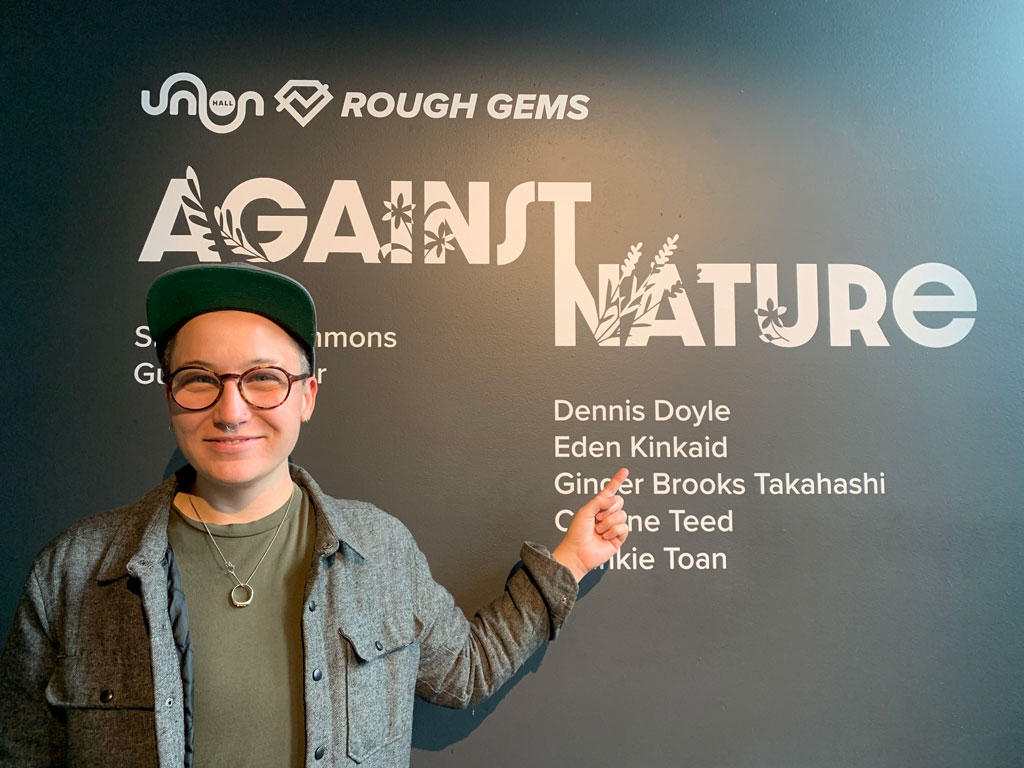
    Share

Charles Earl “Chuck” Bussing

Charles Earl “Chuck” Bussing passed away surrounded by his family at the age of 90 on April 19, 2023.

Chuck was born in Del Norte, Colorado, on October 30, 1932. He graduated high school in Fredrick Colorado in 1950, completed his B.A. in Geography from University of Northern Colorado in 1958, M.A. in Geography from University of Colorado in 1961, and his Ph.D. in Geography from the University of Nebraska in 1964. He taught at the Kansas State University (KSU) from 1964 to 1998. He did a sabbatical at the University of Auckland in New Zealand in 1970.

During his career at KSU, he had many distinguished accomplishments including mentoring a great group of Ph.D. students who went on to have illustrious careers in their own right. Some of his more notable accomplishments were being on faculty senate for four terms, chair of the faculty salary and fringe benefit subcommittee, chair of the International Studies Committee, director of International Programs, and program associate for the International Title XII Strengthening Grant from 1979-1990.

Chuck was one who loved to get together and be a part of, and a leader of groups that talked about important topics. In service of that, he was the organizer for seven conferences sponsored by the American Association of Geographers, the Tri-University Center for Latin American Studies, International Studies, and the Farming Systems Research Group.

Chuck spent his life gathering experiences, stories, information, friends — I don’t say acquaintances, because acquaintances always became friends — and especially friends who have that twinkle of playfulness and inquisitiveness. Titles didn’t matter, money didn’t matter, what really mattered was his passion for learning and collaborating/conspiring to enjoy a good story and learn more.

Chuck is survived by his loving wife Sandy, his daughter Heather (John) and her boys Alex and Holden, and his son Greg (Tracy) and his sons Austin (Caroline), Anderson, and Avery (Sarah). He was pre-deceased by his parents, Warren and Mildred Bussing and his brother Dick Bussing.


Originally published by Yorgensen-Meloan-Londeen Funeral Home and reprinted with permission.

    Share

Wayfinding: Tracing Pandemic Geographies Across Time

U.S. Department of State C2M2 base map
Credit: U.S. Department of State

Before COVID-19 locked down the world, AAG member Melinda Laituri was a world traveler. As director of the Geospatial Centroid at Colorado State University and principal investigator for participatory mapping programs for the U.S. Department of State’s Office of the Geographer, she used technology to stay connected to the world: “I have been exploring the world at my fingertips through virtual travel to exotic locations” she writes at the beginning of the book she co-edited during COVID-19. “I have visited places I never thought to explore before—Chernobyl, Mars, and Iceland’s oldest shipwreck. It isn’t quite the same but does fill a bit of the void.”

Laituri also channeled her love of place and adventure into her work with the Department’s Cities’ Covid Mitigation Mapping (C2M2) program, working with three participatory mapping hubs in Africa, Asia, and Latin America. While program coordination was virtual, the city-level projects were very much physical, or sometimes hybrid: six sites in Latin America, three in Africa, and three in Asia. Projects varied: an examination of the pandemic’s impacts on domestic violence in Peru; an assessment of second-order impacts of COVID-19 (education, economic, healthcare) in several African cities; a crowd-sourced health access app in Mongolia; and a participatory project to map the pandemic impacts on tourism-related businesses in Nepal.  

The observations gained from this work are collected in The Geographies of COVID-19: Geospatial Stories of a Global Pandemic (Springer), a set of case studied co-edited with Robert B. Richardson and Junghwan Kim. The co-authors describe the spatialized impact of COVID-19 this way: “These geographies are located in both time and space, revealing impacts that are both immediate and long-term. The story of the pandemic is dynamic, in constant flux, and flush with ephemeral observations.”  

Photo of barista preparing a beverage in Kathmandu, Nepal. Credit: Rohit Khadgi
In Nepal, Asia Hub partner Kathmandu Living Labs compiled extensive information from tourism-based businesses to map and analyze the impact of COVID-19 on their livelihoods.


One through-line of the case studies is how a large-scale event like COVID-19 reveals and exacerbates the inequities of societies around the world. Across scales, distances, and cultures, these inequities and impacts are “compounded by the government and social responses,” the team found, but also hold the key to “revealing how geography and geospatial technologies can contribute to future solutions and adaptations.”  

Throughout their book, the editors consider the act and tools of mapping, and especially the dimensions introduced by live, dynamic, and interactive mapping tools, and cautioning the reader regarding the unintended consequences of decisions about such factors as data collection and scale. “Our stories are only as good as the data we have,” and the digital divide—uneven internet access, lack of access to phones and other devices–influences which data are included. “The data are constrained by what is collected (or not), how numbers are aggregated, the level of precision of data collection instruments, and algorithms. Maps and associated models are simplifications…” 

Additionally, the book highlights the need for practitioners of many disciplines to pool their knowledge for cross-cutting solutions. Citing the work of the World Health Organization in identifying 15 international laboratories “that coordinate with national labs around the world to increase connectivity within the science community,” Laituri et al say that such efforts can go forward still more efficiently with the support of the virtual geography based on shared data and geospatial tools for place-based, data-driven decision-making. Our responsibility as geographers and geospatial students, practitioners, and scientists is to ensure grounded, ethical, and sound scientific approaches in addressing the profound problems we face,” they assert.  

The Geographies of COVID-19: Geospatial Stories of a Global Pandemic is available from Springer. 

To find out more about the U.S. Department of State’s participatory mapping programs, see the MapGive website.

DOI: 10.14433/2017.0128

    Share

William “Bill” Koelsch

William “Bill” Koelsch, 89, professor emeritus of geography, retired University historian, and a longtime activist for LBGTQ rights, died on Nov. 5, 2022.

Koelsch, who established the modern Clark Archives, was well known on campus as the author of the highly regarded “Clark University, 1887-1987: A Narrative History,” a chronicle of Clark’s first 100 years, researched and written over five years and published to coincide with the University’s centennial celebration in 1987. The volume graces bookshelves across campus and remains an invaluable repository of Clark’s early history.

In a 2012 story in Clark magazine, Koelsch recalled that he convinced then-President Mortimer Appley to grant him some time off from teaching to craft the book, which he insisted would be a robust, accurate, and honest accounting of Clark’s past.

“Non-Clark people are more interested in the University’s early years, and Clark people tend not to know about them,” he said. “I tried to get the record reasonably straight about those years. It wasn’t a public relations piece — I attempted to call the shots as I saw them.”

Photo of William Koelsch in the stacks of Goddard Library at Clark University
William Koelsch in the stacks of Goddard Library, Clark University

Koelsch scoured the academic landscape for sources. According to the story, in the 1970s, he’d crossed the country looking for original manuscripts related to early Clark, conducted interviews with former faculty and administrators, and culled from the unpublished memoirs of former presidents Howard Jefferson and Appley.

“By the time I wrote, I was in a secure position against anyone who might want to squawk about something,” he remembered. “I can defend every sentence using the backup material.”

He earned a bachelor’s degree from Bucknell University (1955), a master’s from Clark (1959), and a Ph.D. from the University of Chicago (1966), and served several years in the U.S. Army Transportation Corps. He joined Clark as an assistant professor of geography in 1967 and later became a tenured professor known for his incisiveness, erudition, and wit.

“Bill was my first adviser when I entered Clark. He was a walking encyclopedia, but not in an intimidating manner,” recalled Jeremy Tasch, Ph.D. ’06, professor in the Department of Geography and Environmental Planning at Towson University. “My classmates and I valued his long list of chronological reference lists he shared in his class on the history of geographic thought — he introduced all of us to Clarence Glacken. Because of Bill, I went into Cambridge to find ‘Traces on the Rhodian Shore’ — we weren’t using Amazon in those days. He was kind and gracious, quietly knowledgeable, and ready to give his time.”

Clark Geography Professor Rinku Roy Chowdhury told the Worcester Telegram & Gazette that when she was pursuing her doctorate at Clark, she took a course with Professor Koelsch, who created a “welcoming and fun space in a really, really intense Ph.D. program and department,” allowing the students to “establish rapport and camaraderie, not just with the professor, but with each other.”

Koelsch, who retired in 1998, moved to San Diego, where he wrote more than 20 scholarly articles and essays, including articles about G. Stanley Hall and about the influence that Jonas Clark’s strong abolitionist beliefs had on the formation of Clark University. His book “Geography and the Classical World: Unearthing Historical Geography’s Forgotten Past” was published in 2012.

He also crafted many longhand, meticulously worded letters to friends and Clark associates over the years, often alerting them to his latest work or to approaching Clark-related milestones.

Koelsch made a memorable return to Clark in 2019 to speak at the invitation of the late Professor Robert Tobin, who had organized an exhibition titled “Queering Clark.” The retired professor recounted his personal experience as a member of the “silent generation” of gay men who came out later in life, recalling that he wrote columns for Boston’s Gay Community News under the pseudonym “A. Nolder Gay.”

In 1975, Koelsch began teaching a course at Clark on the gay liberation movement. In 1982, when the HIV/AIDS crisis was dawning, he incorporated information on the disease into the syllabus of his course Health and Disease in the American Habitat and spoke about HIV/AIDS to church groups.

In his return visit, Koelsch cited reasons for optimism about the future of gay rights in the U.S., noting with satisfaction that same-sex couples can now marry and an openly gay soldier can serve in the U.S. military. “I never expected to see either of those things in my lifetime,” he marveled.

Koelsch’s papers regarding his activism are in the ONE Archives at the USC Libraries. An oral history of his Army service is online at the Library of Congress.

He is survived by his partner of over 50 years, William Dennison.


Provided by Jim Keogh, Clark University.

    Share

On the Map: Traveling by Trolley Back to the Dinosaurs

A cheerful yellow sign announces “Trolley Rides Today.” Credit: Paul Swansen, Flickr
A cheerful yellow sign announces “Trolley Rides Today.” Image by Paul Swansen, Flickr (CC BY-ND 2.0)


By Samantha Hinton

From the Fossil Trace Golf Course to the Denver Museum of Nature and Science, Denver is a modern city where the age of the dinosaurs is still present.  

One of the best ways to experience Denver’s dinosaurs is the Denver Trolley route (formerly called the Platte Valley Trolley route) to Lakewood Gulch, home to the site of the first Triceratops fossil ever found. 


Map showing the Denver Trolley route starting at Confluence Park in downtown Denver and hugging the Platte River Greenway. Credit: Denver Trolley
The Denver Trolley starts at Confluence Park in downtown Denver and hugs the Platte River Greenway. Credit: Denver Trolley


In 1887, American paleontologist, John Bell Hatcher discovered the mostly intact triceratops skull and horns and sent it to colleague, Othniel Charles Marsh. Marsh mistakenly thought the bones were from a bison, and they were not confirmed to be from a triceratops until the following year when another set of remarkably similar fossils was discovered in the area.   

The trolley trip to Lakewood Gulch combines history and paleontology with transportation geography. The current Denver Trolley system recalls the city’s once-extensive electric rail transit system. At its peak in the early 20th century, the trolley system had over 250 miles of track connecting the city and another 40 miles connected Denver to Golden and Boulder. In 1910, the system had 87,819,000 passengers.  


Map showing the Denver streetcar routes in 1917. Credit: Denver Urbanism
Denver streetcar routes in 1917. Credit: Denver Urbanism


Also in 1910, there were only 3,000 automobiles in Denver. After World War II, the American economy highly encouraged modernizing everyday life. By 1928, there were 78,000 privately owned automobiles and trolley ridership declined by 59%. By 1951, all the city’s trolley lines were abandoned and replaced by a new urban bus system.  

The Denver Trolley, a small section of that rail system, was later restored and reopened on July 4th, 1989, to revive some of the history and nostalgia along a route of some of Denver’s most popular attractions. The trolley runs Friday, Saturday, and Sunday from early spring to around Oct. 31. Tickets are $3 for adults and $2 for children. Other stops along the route include Confluence Park, REI’s flagship store, Elitch Gardens, and The Children Museum of Denver.   

Sources: Denver Trolley Colorado, Denver The Mile High City; “Dinosaurs in Denver,” Fossils Facts and Finds; “Triceratops Facts You Need to Know,” Denver Urbanism; “The History of Denver’s Streetcars and Their Routes”  

DOI: 10.14433/2017.0129

    Share

Gerry A. Hale

Gerry Hale, a long-time, much-loved professor in the Department of Geography at the University of California, Los Angeles, died on October 14, 2022.

Born in 1933 in Los Angeles, Gerry (pronounced “Gary”) was raised in the neighboring city of Glendale. He attended UCLA as both an undergraduate and graduate student. In the early 1960s, while conducting fieldwork in Sudan, Gerry served as the Head Geography Master at Unity High School for Girls in Khartoum and as a Visiting Lecturer at the University of Khartoum. Before and after his time in Sudan, he also taught at the University of Southern California. In 1966, working under the direction of Dr. Joseph Spencer, he completed his Ph.D. dissertation on agricultural terracing in Sudan’s Darfur region. Soon thereafter, he joined the UCLA Department of Geography as a tenure-track faculty member.

A political and cultural geographer, Gerry’s teaching and research focused on technology, nationalism, the state, cultural hegemony, capitalism, anti-colonialism and empire, and Marxist geography. His regional specializations were in North Africa, the Middle East, and California.

Photo of Sondra and Gerry Hale in their house in Hai el-Matar, Khartoum, Sudan, 1961.Photographer: unknown.
Sondra and Gerry Hale in their house in Hai el-Matar, Khartoum, Sudan, 1961. Photographer: unknown.

A combination of factors—ranging from witnessing pervasive racial injustice in Glendale and exposure to the early years of postcolonial life in Lebanon (where he studied as a M.A. student) and in Africa, to the horrors of the U.S. war in Vietnam—radicalized Gerry. By the late 1960s, he saw himself as Marxist—politically as well as intellectually.

Consistent with his politics—a combination of democratic socialism, feminism, and anti-racism—Gerry was involved in Antipode: A Radical Journal of Geography from its initial days. As the journal’s structure became more formalized, he served on the editorial board from 1978 to 1985.

Gerry’s politics also underlay his intense dedication to students. He was the advisor to approximately a dozen Ph.D. students who went on to academic careers, and to scores of Master’s students—in Geography as well as in the African Studies M.A. Program, for which he served as director for some years, and in the Center for Near Eastern Studies. He was also the Department of Geography’s undergraduate and graduate advisor during the 1990s. In these roles Gerry was known to be a strong supporter of women faculty and students.

Because of his politics, life at UCLA in Gerry’s earlier years as a faculty member were often difficult given the strongly conservative ethos that permeated the institution. Changing times and, more importantly, Gerry’s generous spirit, ethical character, collegiality, and dedication as a teacher of undergraduate and graduates alike eventually won over most, if not all, of his detractors. By the time of his retirement circa 1997, Gerry was a highly valued and universally appreciated citizen of the Department and the University as a whole; he was a member of some of the most prestigious bodies on campus, such as the Committee on Privilege and Tenure.

A strong sense of justice motivated much of what Gerry Hale did as a geographer. Many of those who were fortunate enough to take an undergraduate course with him, for example, learned about what happened to the predominately working class and Mexican-descended community of Chavez Ravine. Beginning in 1951, the City of Los Angeles used eminent domain to expel the area’s residents and raze their homes—in the name of public housing which never arrived. Instead, years later, the city sold the land to the Los Angeles Dodgers to build a baseball stadium.

As one former student, now a historian, recalled in relation to Gerry’s telling of the story, “When I was growing up in Echo Park (a Los Angeles neighborhood), I didn’t know this history. I don’t think most people know it today. I learned it once I got to UCLA, in a geography class with Gerry Hale. He was not even a Chicano, but a white man who engaged in a one-man boycott of Dodger Stadium, having made a personal commitment to never go to ballgames because of what had happened on the land on which Dodger Stadium sits.”

Gerry Hale is survived by his longtime partner, Sondra Hale, professor emeritus of Anthropology and Gender Studies at UCLA, and their daughters, Alexa and Adrienne, as well as by countless others whose lives he touched.


Provided by Garth Myers (Trinity College) and Joseph Nevins (Vassar College).


    Share

On the Map: Denver’s Five Points and Whittier neighborhoods

Image of Robinson Atlas of the City of Denver (Plate 12). Source: Denver Public Library, Special Collections

By Sam Hinton with Lisa Schamess

Northeast of downtown Denver, the Five Points and Whittier neighborhoods are among the city’s oldest, the first to extend beyond Denver’s original Congressional Grant. As a longstanding center for African American life in Denver, as well as a hub for the Chicano Movement, these neighborhoods are a vital location in the city.  

Five Points starts at 17th and Downing on the east edge and extends north along Downing to 38th Street. The Whittier neighborhood is less extensive, starting at 23rd and Downing Street and extending north until East Martin King, Jr. Boulevard. Established in the 1870s, Five Points was named after Denver’s diagonal downtown grid with a rectangular suburban grid, which meet at Washington Street, 27th Street, 26th Avenue, and Welton Street. Whittier Elementary School was named in honor of John Greenleaf Whittier (1807-1892), an American poet and abolitionist. 

The neighborhoods were and still are today dynamic and multi-cultural places. Many Latinx-Americans and Asian Americans work and reside in the area. While it was always historically a home to African Americans, increasing segregation in the 1920s resulted in more than 90% of Denver’s African American residents living in Five Points or Whittier during the mid-20th century.  

Throughout the 1930s, 40s, and 50s, the area was also a significant cultural and entertainment destination. The area is home to Denver’s first urban park, Colorado’s oldest Black church, and Temple Emanuel, one of the state’s oldest synagogues. Jazz also runs strongly through Five Points and Whittier’s narrative. Sometimes called the “Harlem of the West,” the area was a popular stop for jazz stars like Billie Holiday, Louis Armstrong and Miles Davis. They played clubs like the Rossonian and the Rainbow Room, and Benny Hooper’s hotel. Today, the annual Five Points Jazz Festival and Juneteenth Music Festival are renowned.  

The neighborhoods have a rich entrepreneurial history. For example, the Niederhut Carriage Company was a family-run business by brothers Henry and William Niederhut for a century, and one of the largest transportation manufacturing companies in Denver.  

In 1920, Dr. Clarence Holmes founded a dental practice at 2602 Welton Street and was the first African American to join the Denver Dental Society. A graduate of Howard University in Washington, DC, he otherwise lived his entire life in Denver. He was born to a family that valued civic responsibility: his mother Mary Holmes was the first African American woman to run for the state legislature. Dr. Holmes helped found the Colorado-Wyoming branch of the National Association for the Advancement of Colored People (NAACP). His early years as the first Black dentist in Denver were “rough,” he said in 1973, with obstacles put in his path by segregation, individual racism and intimidation, and white supremacist forces in professional societies and businesses serving dentists. Hear Dr. Holmes offer his oral history to the Denver Public Library in 1973 (Content Warning: frank use of racist terminology). 

Reverend David West Mallard owned multiple businesses including Mallard’s Grocery and Confectionery. Other notable businesses included Rice’s Tap Room and Oven, The Rhythm Records and Sporting Goods Shop, the American Woodmen’s Insurance Company, and Melvina’s Beauty Shop. 


Photo of Niederhut Carriage Company circa 1900; credit Denver Public Library Special Collections
Niederhut Carriage Company circa 1900. Credit: Denver Public Library Special Collections


Photo of David and Virginia Mallard in front of their store, circa 1948, with an unidentified man. Credit: Denver Public Library Special Collections
David and Virginia Mallard in front of their store, circa 1948, with an unidentified man. Credit: Denver Public Library Special Collections


Today, many descendants of the original Black residents no longer live in Five Points. Efforts to bring new life to the community have included a new urban rail line and the renovation of the Rossonian Hotel. These changes, however, have also accelerated gentrification, Nonetheless, the Five Points and Whittier remain an important touchpoint for Black and Latinx communities. The neighborhoods host many artists and are the center of several lively mural projects depicting their history and culture, such as La Serpienta Dorada and the Five Points Mural Gallery.  


Photo of Artist Brian Doss at the annual Jazz Festival in Five Points. Credit: Kent Kanuse, Flickr.
Artist Brian Doss at the annual Jazz Festival in Five Points. Credit: Kent Kanuse, Flickr.


Learn more: 

The neighborhood Business Improvement District hosts a self-guided, self-paced walking tour of Five Points. Five Points Plus is a museum and online exhibit that showcases the human stories and collective memory of living, working, and growing up in Five Points. Developed in partnership with the Black American West Museum and Heritage Center along with Five Points community members and supported by the Blair-Caldwell African American Research Library (Denver Public Library) and Manual Highschool. Prepare for your visit by finding out about the Black-owned and other businesses in the area. 

This article was prepared using sources from Denver.org and the Denver Public Library 

DOI: 10.14433/2017.0126

    Share