Program Profile: University of Hawaiʻi, Mānoa

University of Hawai‘i Manoa GEO department students and faculty pose for a photo in the field on Kaho'olawe (Courtesy David Beilman)
University of Hawai‘i Manoa GEO department students and faculty pose for a photo in the field on Kaho'olawe. (Courtesy David Beilman)

During the 2024 Annual Meeting, AAG staff sat down for an interview with Reece Jones, professor and chair of the Department of Geography and Environment in University of Hawaiʻi at Mānoa’s College of Social Sciences. The Department of Geography and Environment (GEO) is a vibrant academic community that focuses on global change and its local impacts on humans and the environment. Faculty and students pursue work that is inherently interdisciplinary, making various connections through other departments and units on campus. Many of GEO’s student and faculty research centers around Asia and the Pacific.

From political geographers to GIS specialists and environmental scientists, the breadth of faculty and course work offers undergraduates the chance to gain a holistic understanding of the discipline and do the necessary fieldwork or research to pursue career opportunities. GEO also offers world-class coursework and applied geographic research under two advanced degrees, a Master of Arts and a Doctor of Philosophy. Students of all levels engage in research on topics ranging from agriculture and food, climate change, and environmental conservation to geopolitics, geospatial sciences and data analytics, and tourism.  The department also offers a popular new certificate in GIS for undergraduate students in any program.

GEO partners with departments across the university to offer an accelerated, interdisciplinary online degree in Social Sciences of Oceans, with applications for resource management, city planning, community organizing, environmental consulting, and policy analysis. Similarly, a flexible Graduate Ocean Policy Certificate is available for students or working professionals through the department to broaden their understanding of the legal, political, economic, and social forces that affect ocean development activities.

Collaboration and Community

UH-Mānoa strives to create a community-minded environment: “We try to do our best to have kind of a collaborative relationship between graduate students and faculty so that they feel like they’re colleagues in a way [and] part of this kind of endeavor to do their research and carry out their projects.”

Jones offers the example of GEO professor Camilo Mora, whose graduate seminar is far from a typical semester seminar experience. Students collaboratively brainstorm a major question they want to answer at the beginning of the semester, then do the research and analysis together that results in a joint publication with Dr. Mora. “Major publications have come out of that class,” Jones states. “Camilo has done a really good job of bringing students into this research project and work together with them to produce very significant articles.”

University of Hawai‘i Manoa GEO department students and faculty participate in community work day in a lo'i. (Courtesy David Beilman)
University of Hawai‘i Manoa GEO department students and faculty participate in community work day in a lo’i. (Courtesy David Beilman)

Program faculty incorporate professional development skills directly into coursework. Incoming graduate students participate in a mentoring program to prepare for developing and maintaining crucial professional development skills in hopes of answering questions such as “How do you go to a conference? How do you present a paper at a conference? How do you publish a journal article? How does the academic job market work? How do you get a non-academic job?”


Care for the Land

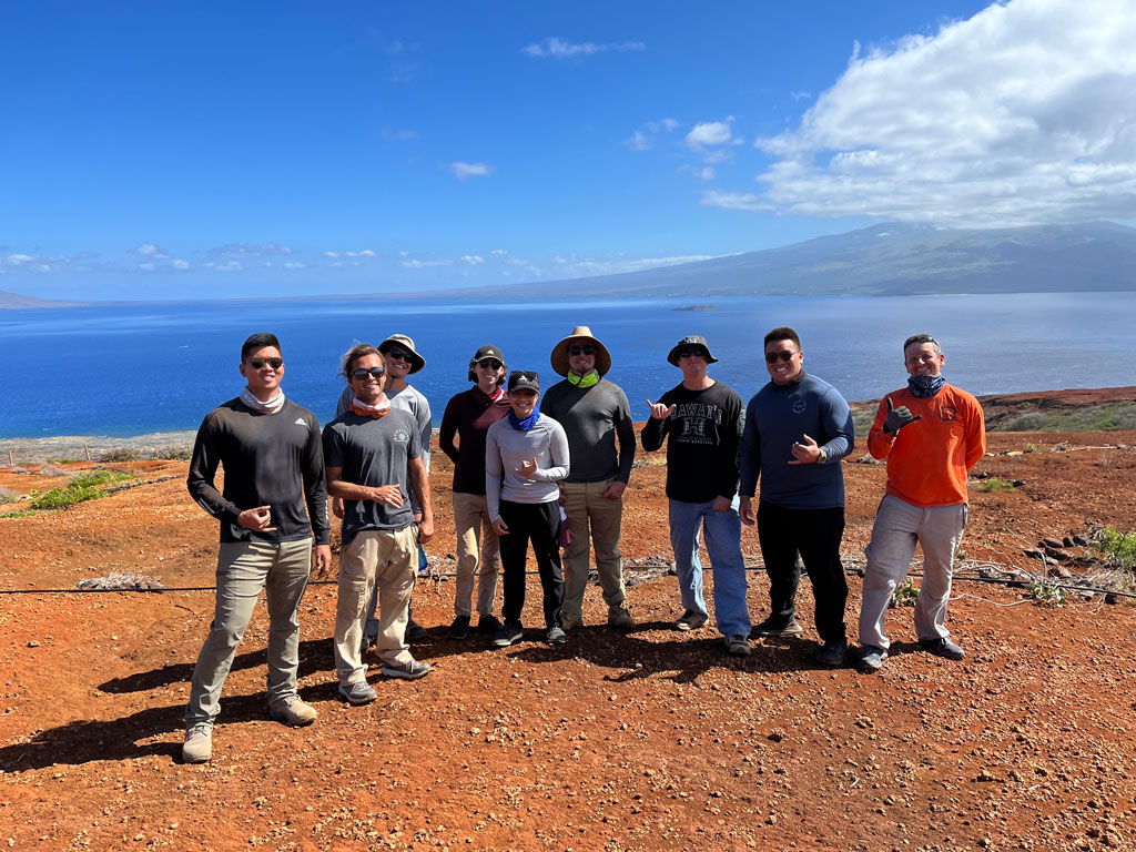
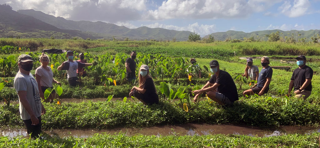
The University of Hawai‘i has a focus on being a Native Hawaiian (Kānaka Maoli) place of learning, “bringing in Native Hawaiian thought, indigenous thought and experiences into the way that we do things,” says Jones. GEO faculty work to integrate Native Hawaiian thought and knowledge into teaching, even if that’s not central to their research focus.

In Hawai‘i, Native Hawaiian concepts are important to the way that people see the world. One often integrated into education programs is “Mālama ʻĀina,” or to care for and honor the land. “For Native Hawaiians, the land is an ancestor. That way of seeing the world is to recognize the relationship between people and the environment, and not to think of them as separate, but rather as integrated and dependent upon each other,” Jones states. “And geography as a discipline, that’s exactly what it aspires to do.”

Taken together, the educational experiences made possible by GEO at UH-Mānoa have prepared graduates for careers in academia, government service, NGOs, and the private sector in Hawaiʻi and worldwide. GEO has provided alumni with the skills to shape new (and traditional) ways of caring for the earth and human societies. For example, several graduates are now faculty in the Hawai‘inuiākea School of Hawaiian Knowledge, the only college of Indigenous knowledge in a Research I institution in the United States.

University of Hawai‘i Manoa GEO department students and faculty stop to pose for a photo at at Hakalau Forest National Wildlife Refuge, near Hilo, Hawai'i. (Courtesy David Beilman)
University of Hawai‘i Manoa GEO department students and faculty stop to pose for a photo at at Hakalau Forest National Wildlife Refuge, near Hilo, Hawai’i. (Courtesy David Beilman)


    Share

Michael Libbee

Dr. Michael James Libbee, born on December 9, 1945, passed away on January 28, 2024, after a brief illness.

A graduate of West Genesee High School in Camillus, New York in 1963, Michael Libbee received his bachelor’s degree from the University of Oklahoma in 1967, and his master’s degree and Ph.D. in Geography from Syracuse University. From 1982-2020, he was Professor of Geography at Central Michigan University, spearheading the creation of four endowments and generating over $8 million in grants for the furtherance of geographic education.

Various research interests spanned environmental studies and geospatial technologies, but Dr. Libbee was specifically passionate about advancing geographic literacy and promoting the use of technology in geographical research and teaching. He published numerous articles and book chapters ranging from geographical education in North America to geographic professional development in journals such as The Professional Geographer and the Journal of Geography. In 1989 he co-founded the Michigan Geographic Alliance, with the goal of strengthening geography and environmental education in Michigan. To this day, the organization provides networking and professional development events for teachers and educational materials to classrooms across the state. His passion for education and geography was one of his trademark characteristics, and his infectious enthusiasm inspired countless students and teachers.

Michael Libbee and his wife
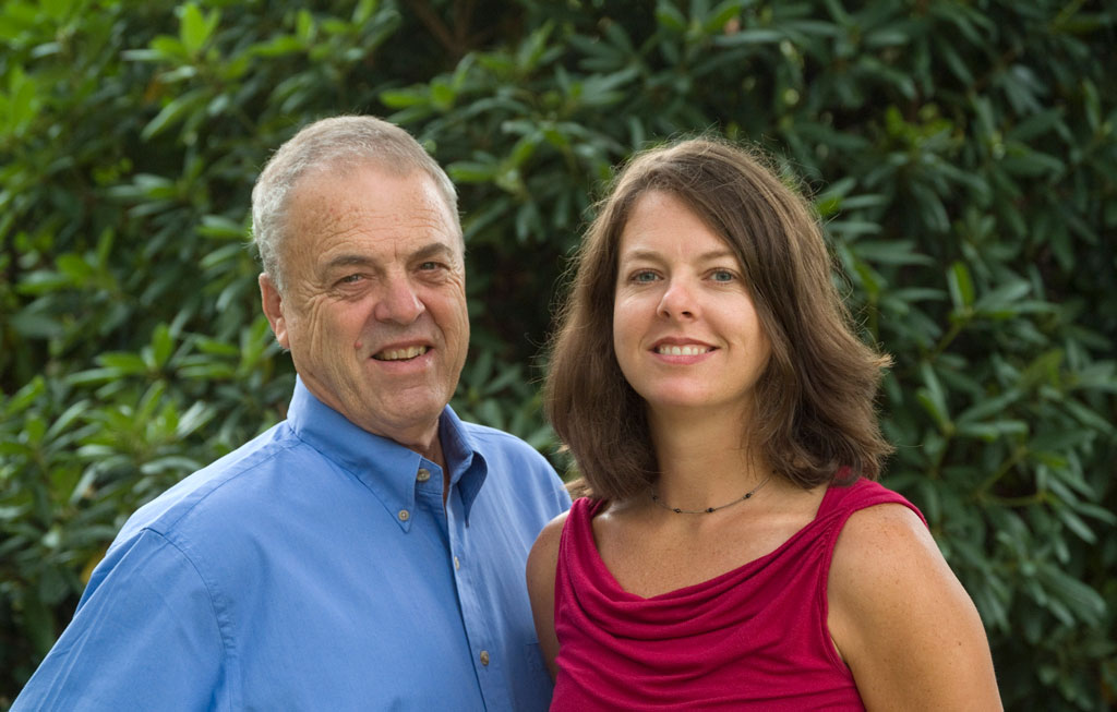
Dr. Michael Libbee was the beloved husband of Kristin Sheridan, whom he married in 1971. Throughout their 53-year marriage, they shared numerous adventures together, and were often seen biking or walking their loyal canine companion, PJ. Dr. Libbee will forever be remembered for his generosity, love for his family, and dedication to his students. His legacy will continue in the lives of those he has touched.

    Share

Grant Rodriguez Almani

By Emily Frisan

Meet Grant Rodriguez Amlani, a dedicated advocate for environmental justice and a strategic recruitment coordinator who has honed his expertise in environmental issues, waste management, and the pursuit of a circular economy.

Education: M.A. in Sustainability & Development (Southern Methodist University), B.S. in geography with minors in mathematics and Spanish (University of North Texas), A.A. in general studies (University of Arkansas at Little Rock).

Professional accolades include Circularity23 Emerging Leader, a 2022 Clinton Global Initiative University Fellow, and an Envision Sustainability Professional (ENV SP).

Describe your career path up to your current position, including the range of tasks and responsibilities you oversee.  

I graduated in May 2020, which is one of the worst times to graduate, regardless of what your major was. I’d always known I wanted to go into an environmental or sustainability kind of field. Those opportunities got lost, and there were hiring freezes. I went to interviews and then everything fizzled out, which was not unique to environmental work. Everybody kind of dealt with that.

I found my current job by nature of putting myself out there and networking in Dallas. The sustainability circles are close-knit, so once you start going out there and meeting people, it lends itself well to networking and whatnot.

Grant Rodriguez Almani and a colleague participate in a recycling cleanup while dressed in humorous costumes. Credit: Katie Sikora
Grant Rodriguez Almani and a colleague participate in a recycling cleanup. Credit: Katie Sikora

Now, I’m the environmental justice and recruitment coordinator of the U.S. Plastics Pact. Most of my focus is on sustainability, such as waste and recycling. The way it works is we have over 130 member organizations — we call them Activators. These range from cities like the City of Austin or Seattle, to Fortune 500 companies like Walmart, or L’Oreal, or ALDI, or Target, and everybody in between. Anybody that touches plastic packaging in the chain, whether they sell it, make it, or collect it at the end of its life, as well as other nonprofits, also engage.

My role is twofold. The recruitment piece is talking to potential organizations about participating in our work, and then the environmental justice piece is figuring out where environmental justice fits into a just transition to a circular economy for plastics packaging. In the work of sustainability and the circular economy, the justice and equity pieces tend to have been kind of shoehorned in at the end or after the fact. I’m really trying to challenge people to think about that in the design process: the products, the systems, the collection, and what kind of jobs are available.

What geographic knowledge is important and most useful for you in this position?

Something interesting that I’ve seen is that in the corporate sustainability world not everybody has a strong science or geography background. It might be somebody with a business or English degree, which is fine, but it [a degree in geography] helps to have that environmental understanding of how things like climate or ecosystems work and breaking those things down for society and communities.

Separately too are the human-environment interactions. Geography helps us to talk about how people interact to the environment, how people value things. For me, it’s translating that to say, ‘How are people approaching recycling’, ‘How do they think about reuse systems.’ I’m kind of allowing that geography foundation to level up.

When you look back at your education trajectory, how did you discover geography? How did you realize that it connects with your aspirations and your goals in life, maybe as an individual but also as a professional?

I had a winding path in undergrad. I started in construction engineering, then civil engineering, and then kind of just bounced around. I also transferred schools three times. I was at the University of Arkansas and then I was at the University of Arkansas at Little Rock. It was there that, well, I was kind of like, ‘OK, I want to do environmental science.’

It took me five years to graduate and in my fourth year, I took my first geography class with Jess Porter, professor of geography at UA, Little Rock. Unfortunately, they [UA, Little Rock] didn’t have a full program, they just had the minor, so I ended up transferring back home to the Dallas-Fort Worth area, went to the University of North Texas, and finished out my geography major there.

Geography was never on my radar at all. I thought, ‘OK, it’s just maps and GIS’ and then realized, ‘oh, there’s actually a lot more to it.’ It was the perfect fit for what I needed.”


Are there any skills or information that you use for your work that you didn’t obtain through your academic training? If so, how and where did you obtain that?

I feel like there’s a lot that you learn on the job. Even though my first job wasn’t necessarily geography or sustainability focused, there are lots of skills that transfer like emailing, etiquette, and this whole world of virtual work, you know, in a COVID world, learning all of that. You just have to learn by doing.

The other essential thing was not boxing myself in. A lot of geography majors sometimes get this idea of, ‘I only took these classes, so I can only go do this job,’ when in reality, there’s so much you can do and so much you can learn. Even though you didn’t maybe learn it in a classroom, you can still put yourself out there and try to learn it now.

There’s like a lot of different pathways you can go, and the world is your oyster.”


What advice do you have for geography students and other early career professionals interested in a job like yours?

For this job, I probably wouldn’t have been aware of it. I put myself out there and networked with people, connected with them on LinkedIn, and then they happened to post about this job. So don’t be afraid to go talk to people, even if you may not know them. You should still talk to people with a genuine approach and friendliness, not just because they’re going to help you level up in your career.

Don’t be afraid to apply to jobs that don’t explicitly call out geography. If you’re scared about the experience and those types of things, I never had an internship. It’s doable without one. You can supplement that with the kind of story that you can tell about your journey and how you had your experience. Trying to go for volunteering, engaging on campus and organizations, or leading efforts in your community to gain leadership skills is also great. Just put yourself out there.

Learn more about what a degree in geography can do for you by reading more AAG Career Profiles and discover the resources we offer for your professional development journey.

    Share

Richard L. Morrill

Professor Emeritus Richard L. Morrill passed away on March 28, 2024. He had been ill for several years and passed away with his wife and best friend at his bedside.

Dick was born in Los Angeles California in 1935. He received his B.A. in Geography from Dartmouth in 1955. He moved to the University of Washington in Seattle that year to pursue a master’s degree under Edward Ullman. Ullman was about to undertake fieldwork in Italy, however, so he moved to work with William Garrison, who was a pioneer in statistical methods and analysis. Dick and his cohort became known as the “Space Cadets.” During the Quantitative Revolution, Dick was part of a group of geographers who sought to transform the discipline from an idiographic regional tradition to a modern, mature spatial science.

After receiving his Ph.D. from Washington in 1959 (on the effects of the U.S interstate highway system on the use of medical services) he became an assistant professor of Geography at Northwestern University. In 1961 he became a post-doctoral researcher at the University of Lund, Sweden. That year he returned to the University of Washington in Seattle as an assistant professor. He would spend the rest of his career there, retiring in 1997. He was a founder of the Institute of Environmental Studies at UW and the first director of the Ph.D. program in Urban Design and Planning. He held appointments in Health Sciences, the Center for Demography and Ecology, and the Graduate School of Public Affairs.

Across his vast career, Dick published eight monographs, over 80 journal articles, as well as 54 chapters in books and proceedings. His books include The Geography of Poverty in the United States (1971), The Spatial Organization of Society (1972), and Political Redistricting and Geographic Theory (1981). He received eight NSF grants, a Guggenheim fellowship (1983-1984), and the University of Washington Distinguished Retiree Excellence in Community Service Award in 2014, amongst many other awards and recognition.

Dick chaired the Washington Geography Department from 1973 to 1983. He was president of the Western Regional Science Association (1992-1994). He served as AAG President in 1983. His presidential address “The Responsibility of Geography” was published in the Annals in 1984, volume 74, issue 1.

Dick’s interests were wide ranging. He was an economic geographer interested in location theory, transportation, regional planning and development. He was a socio-political geographer interested in inequality, segregation, health services, redistricting and local government reform. He was an urban geographer interested in population and migration, growth management, and regional planning. He was a methodologist interested in quantitative and spatial analysis, location and movement models. Finally, Dick was a geographer with regional expertise in the United States, the Pacific Northwest, and the Seattle metropolitan area. He taught in all these areas. He supervised 22 M.A. students and 30 Ph.D. students.

He was appointed as Special Master to the Federal District Court in Seattle to redraw Washington state legislative and congressional electoral districts in 1972. This led to work in major Supreme Court cases on political gerrymandering, and with the U.S. Justice Department on redistricting in Mississippi. Other professional service included serving on the Hanford Environmental Dose Reconstruction Project (1986-1996), drawing maps for the Seattle School District to desegregate schools (1987-1989), conducting a Branch Campus Demographic Analysis for the State of Washington (1988-1989), and drawing proposed City Council districts for a (successful) ballot initiative to shift the City of Seattle from an all at-large Council to a mostly district-based one (2012-2013). He did numerous demographic and spatial analyses including issues of Native fishing rights (the Boldt decision), and the gentrification and African-American displacement of Seattle’s Central District neighborhood.

Dick always melded his political activism with his teaching and scholarship. Besides teaching Garrison’s Geography 426 Quantitative Methods in Geography, Dick created Geography 342 Geography and Inequality (both of which are still on the books in the department!).

Dick was a member of Students for a Democratic Society, and the UW Student Peace Union. He refused to sign the anti-Communist loyalty oath at UW in the early 1960s, and was part of a court case to abolish it. He was the first single man in Washington to be allowed to adopt a child. He worked over three years with the Congress of Racial Equality (CORE) from 1960 to 1964 doing research, legal, and street action. His chapter of CORE chartered a bus to the Student Non-violent Coordinating Committee (SNCC) for the 1964 March on Washington. He worked with the American Friends Service Committee on peace issues and reform of mental institutions. He was also a member of the North Cascades Conservation council.

Amidst all this, Dick was a kind, compassionate, caring, and upbeat person. In a 1998 talk he referred to himself as a “uncurable idealist.”  He is survived by his wife Joanne, sons Lee and Andrew, and his daughter Jean and her husband Dave.

    Share

Brooke Hatcher

By Emily Frisan

Since childhood, Brooke Hatcher has been fascinated with climatology. Growing up on a horse farm in the Blue Ridge Mountains shaped her love for earth, nature, and weather. Now as a geospatial/remote sensing lead, she measures changes on Earth and brings visualizations from data to life. From her job as a senior geospatial analyst at New Light Technologies to her volunteer storytelling work with URISA as vice chair of outreach, or her recognition by Geospatial World as a Young Geospatial Professional to Watch in 2024, Hatcher credits her positive experience in the industry to the examples of powerful women in the field, including her first professional mentors at MAXAR Catherine Ipsan and Amanda Monse, who showed her that she, too, can “become a master in this field.”

Hatcher discovered her passion for geospatial information systems in an undergraduate geography course. “Being able to visualize patterns and spatial analysis, like seeing the charts over time of rain gauges, was seeing nature in a new way,” she says.


Educational journey in and beyond the classroom

Hatcher received her undergraduate degree in geography from the University of Mary Washington. Like many geographers, she stumbled upon the discipline almost by coincidence. She excelled in history during high school but hesitated to pursue a career in the subject because she was unsure about potential job prospects. She began her undergraduate degree as a biology major but soon realized a career in the lab wasn’t suitable, either.

Hatcher began her professional career creating digital nautical charts for Leidos, which opened the world to features humans can’t see with our eyes, like hydrolines and ocean depth. Following her experience at Leidos, an opportunity opened at MAXAR where Hatcher would go on to create global products for clients, such as the National Geospatial Intelligence Agency. This was the first time she began to gain experience in Landsat and Sentinel 2.

“You’re seeing the ocean in a whole new way,” Hatcher explained. “It was really beautiful to have my first job working on digital nautical charts, then working at MAXAR with land cover and creating remote sensing products with five-meter resolution.”

After gaining a few years of professional experience, Hatcher decided to pursue her master’s degree in geography. After considering her options, she got her degree online at North Carolina State.

As a geospatial engineering consultant, Hatcher continues to learn and keeps up with the latest news and information in the industry. In her professional career, she continues to read peer-reviewed papers and professional blogs and consult tutorials on platforms like YouTube and Udemy.

From Local to Global: How Geography and Opportunities Expands Horizons

Hatcher’s career is focused on developing geospatial solutions and products for disaster response with FEMA and World Bank, working on predictive damage assessments, assessing the potential impact on communities and critical infrastructure, and sharing disaster geospatial data through interagency communication efforts. As a geospatial analyst and a geographer, Hatcher’s jobs involve collaborating with other experts in many other areas, including glaciology, meteorology, paleotempestology (the study of hurricanes), and specialization in biohazards.

The resulting collaborations are mutually beneficial. Geographers “need to know that information… [and] we help work with them to make their vision come to life. We’re translating for them by creating maps,” Hatcher states.

Specifically, FEMA hired Hatcher for remote sensing and image processing, creating products to assist during disasters. Remote sensing techniques can penetrate hurricanes or wildfire smoke to extract information about structures that have been damaged.

“It was so rad,” Hatcher recalls. “It reflects geography in a beautiful way.”

In her latest role at New Light Technologies, Hatcher frequently works with user interfaces (UI) and user experience (UX) to build web applications that help clients understand the community’s profile, such as which areas are going to be most vulnerable, and who are at the most risk of disasters. She explains, “We need to really make sure that the final product is visualized to a specific community, playing into the history and culture, so that it respects the community, and they understand it enough to feel comfortable giving feedback.”

Beyond the Map: Community Impact

Beyond technical skills, important geographic skills include being able to conduct and analyze qualitative and quantitative data. “We don’t always need maps,” she states. “The reason why we need some maps is because we can’t see anything when people are dying, or buildings are being destroyed.”

Therefore, even when making predictive risk products, qualitative skills are important to understand the ability to organize various types of data, understand the importance of scales, whether there are invisible boundaries, which ones take priority, and how this affects the results of the map or product. It’s essential to have a deep understanding of community demographics and vulnerability.

“After doing this for five or six years, I am convinced more than ever, the most effective data is at the community level. We can work globally, but it just strips so much quality and quantity of data. Also, when reporting or responding to a disaster at the community level, there is passion associated with it because that’s your home.”

Being a geographer, Hatcher finds it fascinating to understand why certain geographies are so unique in the world, and how they have shaped rare communities throughout history. “It is important to preserve these unique geographic properties, even outside of my job. I am passionate about creative traveling and exploring these unique places.”

From the Pacific Northwest, Cascades, or the nation’s capital, Hatcher hopes to use her geospatial and web design skills to inspire women to take risks, explore the world, and “make geography hip.” Although her goals are constantly changing, she is dedicated to finding her purpose, and path, and is passionate about capturing the stories, art, culture, problems, and risks of the small and unique communities.

Learn more about what a degree in geography can do for you by reading more AAG Career Profiles and discover the resources we offer for your professional development journey.

    Share

Gary Manson

Dr. Gary Manson, age 86, of Haslett, Michigan, passed away peacefully on Thursday, December 14, 2023.

Gary received his undergraduate degrees from the University of Montana and his master’s degree and Ph.D. from the University of Washington in 1969. Upon graduation, Gary spent 36 years teaching and holding several academic leadership positions at Michigan State University’s Department of Geography, including chairing the Department during most of the 1980s. In the 1990s, he held various leadership roles, including director of the Landscape Architecture Program, and in 2000, was appointed associate dean for academic and student affairs at the College of Social Science.

Later in his career, his research focused on internal migration within the United States. He explored patterns, causes, and consequences of population movement within the country, publishing in journals such as The Professional Geographer, the Journal of Geography, and The Social Science Journal. Among his academic accolades, he received numerous awards for his contributions and mentorship, including MSU’s William J. Beal Outstanding Faculty Award, Teacher-Scholar Award, and Distinguished Academic Staff Award. Dr. Manson retired in 2006 as the acting dean of Social Science after a distinguished career at MSU.

Gary Manson was born on August 5, 1937, in Monona, Iowa. At the age of 19, he married his high school sweetheart, Patrosenia (Pat) Nonog, and they were happily married for 62 years until her death in 2018. They enjoyed each other’s company while traveling, fishing, cooking, entertaining friends, and loved MSU football and basketball.

    Share

Joseph L. Scarpaci

Joseph L. Scarpaci, professor emeritus at Virginia Tech, died December 30, 2023 after a brief illness. A Pittsburgh native and longtime AAG member, Scarpaci was honored in 2020 with the AAG Kauffman Award for Best Paper in Geography & Entrepreneurship.

At Virginia Tech, he taught in a remarkable range of fields, including geography, urban planning, historic preservation, landscape architecture, and Latin American studies. He was also the Executive Director of the Center for the Study of Cuban Culture + Economy.

Scarpaci earned his bachelor’s degree at Rutgers, a master’s degree from Penn State, and his Ph.D. from The University of Florida. His colleague and former student Sara Beth Keough remembered him this way in a tribute in The Geographical Review: “Joe was a prolific writer and speaker. He published numerous books and was one of those academics who had to include only ‘selected articles and presentations’ on his website because the entire list was so long.” He was a repeat recipient of Fulbright Fellowships, and his work was recognized by organizations such as the AAG, the Conference of Latin American Geography, and the Library of Congress.

Scarpaci’s research focused on the urban and social geographies of international development in Latin America, with a specialization in Cuba. Among his publications is Havana: Two Faces of the Antillean Metropolis, to which the American Library Association awarded the Choice Outstanding Book Award. Scarpaci also opened up new horizons of understanding for students through his 20-year career at Virginia Tech, taking them abroad and introducing many of them to Cuba and Latin America over the years.

Scarpaci also represented the discipline closer to home in the United States: In 2008, the Virginia Social Science Association named him their Geography-Scholar. He was also elected the vice chair of the AAG Latin American Specialty Group from 2008-2011.

He was an enthusiastic traveler and also “curated a milieu of passions and hobbies,” according to the Pittsburgh Post-Gazette, “including cycling, yoga, tennis, bird watching, ESL and Spanish instruction, [and] conservation.” Even after moving to Blacksburg, he remained faithful to his Pittsburgh roots, helping to organize high school class reunions and fundraising for the Pittsburgh-based women’s health research, in memory of his mother Josephine. He was devoted to his family, and doted on his first grandchild, Josephine “Josie” Collier.

Scarpaci is survived by his wife of 47 years, Gilda Machin-Scarpaci; children Cristina Scarpaci (Christopher Collier), Michael Scarpaci (Katie Scarpaci); granddaughters Josephine Collier and Remy Collier (who was born only a month after he passed); and siblings, Darlene Violetta (Bradley Violetta), Josette Scarpaci and Sam Scarpaci.

Sources:

Fleming, Virginia Tech News, 11 Jan. 2024; Obituary, Pittsburgh Post-Gazette, 7 Jan. 2024

Keogh, S. Geographical Review 114, 2.

    Share

Member Profile: Kenneth Martis

Ken Martis created the map to visualize the political party division of the 80th Congressional Congress.
Credit: Kenneth C. Martis, Ruth A. Rowles, cartographer, Gyula Pauer, production cartographer (full image shown below)

As a graduate student at the University of Michigan in 1972, Ken Martis stumbled on one of the greatest information vacuums in political geography — the lack of documentation for congressional districts since the founding of the United States. He decided then and there to fill the gap. His quest would result in groundbreaking research, nine books, and a lifelong calling.

“I had just chosen a dissertation topic,” Martis recalls, “which was mapping roll call votes in the United States Congress. I was focused on voting patterns on natural resources, conservation, and the environment through time, starting with the earliest congresses through the environmental issues of the 1960s.” To get started, Martis went to the university library — one of the biggest in the nation at the time — to find national-scale district maps for the last 170 years. The reference librarian took him through the card catalog. Then the Guide to Reference Books. They could find nothing. “She was as puzzled as me. She told me to give the staff a chance to look into it, and to return the next day. So I did. I was met by the librarian and the head of the reference department. They’d turned up nothing, not even for landmark eras like Abraham Lincoln’s time.”


“I realized I could be the first person in American history to map every congressional district from the First Congress forward,” he says. “It was humbling, and exciting.”

Martis is now Professor Emeritus in the Geology and Geography Department at West Virginia University. He is the author or co-author of award-winning books that have fundamentally shaped our awareness of political patterns in the United States. His first historical political atlas was The Historical Atlas of United States Congressional Districts: 1789-1983, with maps by cartographer Ruth A. Rowles. This book was the first to map every congressional district and analyze every apportionment change for every state for all of United States history. It won numerous honors, including the American Historical Association’s Waldo G. Leland Prize for the best reference book in all fields of history for the period 1981-1986. He went on to write eight additional volumes with partners, including a historical atlas of congressional political parties, a historical atlas of congressional apportionment, and the 2006 Historical Atlas of U.S. Presidential Elections 1788-2004. He has continued to document the American political landscape with co-edited works on the pivotal 2012, 2016, and 2020 elections.

Geography as Lifeline

Martis’s four grandparents and father were Slovakian immigrants from Austro-Hungary in the early 1900s. He was also the first in his family to finish high school, attend college, and attain advanced degrees. “My mother saved my grade school report cards,” he says. “They show I was a poor to average student, except in one area; geography! I loved it.”

His love of geography saved his academic career in college at the University of Toledo. After several semesters he describes as “disastrous” and himself as “barely surviving,” Martis took geography courses with engaging professors, and found his academic passion. One Toledo geography professor in particular, Dr. Donald Lewis, took Martis under his wing. “I have told him several times, he is my number one influence in becoming geographer.”

I realized I could be the first person in American history to map every congressional district from the First Congress forward.” 

The selection of geography courses and excellent professors were no accident. “The Department of Geography at the University of Toledo is a story unto itself,” says Martis. In 1958, the university appointed a new president, arctic geologist Dr. William S. Carlson. Carlson earned his B.A., M.S., and Ph.D. from the University of Michigan, where his graduate advisor was geologist William Herbert Hobbs, president of the Association of American Geographers in 1936. In 1963 President Carlson finalized the creation of a new stand-alone Department of Geography and hired full-time tenure-track faculty. Martis was among the first beneficiaries of this investment.

“Your journey in life is marked by the many choices or paths you select,” he says now. “Nevertheless, the mere existence of the path is predicated by hundreds of choices previously, mostly by people you will never know. What if William Carlson had chosen another advisor in the 1930s? Or what if he chose to remain President of the University of Delaware in 1958? What if Professor Lewis had not taken me under his wing? I believe there is no journey to geography for me if there was no Hobbs, no Carlson, no Lewis, and no establishment of Toledo geography.”


Ken Martis created the map to visualize the political party division of the 80th Congressional Congress.
The Eightieth Congress of the U.S., 1947-1949. Republicans are represented in blue, Democrats in red. Credit: Kenneth C. Martis, The Historical Atlas of Political Parties in the United States Congress: 1789-1989, p. 201. Ruth A. Rowles, cartographer, Gyula Pauer, production cartographer.


At San Diego State University, Martis discovered political geography. Mentored by Dr. Jim Blick, he was able to complete his thesis even as he lived through the uncertainty of preparing to report to the U.S. Army in the middle of the Vietnam War. After a two-year stint in the Army, he applied to the University of Michigan, under dissertation supervisor George Kish. As his career advanced, mentors and colleagues such as Stanley Brunn, Ruth Anderson Rowles, J. Clark Archer, Gerald Webster, and Fred Shelley collaborated and supported his participation in American electoral geography beyond Congress to presidential elections, gerrymandering, specific elections, and the highlights of political eras and history.

Over his nearly 50 years as a professor at West Virginia University, Martis has seen great growth, including the addition of a Ph.D. program. A critical factor in the department’s development was the incorporation of GIS into the program during the 1980s and 1990s, led by Gregory Elmes and Trevor Harris. WVU also gave faculty the academic freedom to pursue their research interests, and proximity to research resources helped, too: Morgantown is about four hours from the National Archives and Library of Congress, where Martis spent many hours over the years.

Martis’s research continues to have lasting impacts in the public arena. Using modern GIS technology and historical digital boundary databases, UCLA has worked with Martis’s maps to create highly detailed district lines  that are now the standard in congressional boundary history. Martis’s work has been used by investigative journalists and attorneys to show the history of anti-democratic gerrymandering. He has also been a consulting volunteer with the League of Woman Voters and Common Cause in their effort for fair maps, and served on the organizing committee for the AAG redistricting webinars in 2021.

“I consider myself a historical political geographer with a passion for maps,” says Martis. “I am 11 years past retirement. I am still doing geography. It looks like I always will.”

    Share

Member Profile: Neal Lineback

Neal Lineback's SUV and RV displaying Geography in the News logos
The GITN Mobile, outfitted by Lineback for geographic adventures.

As an adventuresome boy growing up in the 1940s and 50s in Forsyth County, North Carolina, Neal Lineback became a geographer before he knew what it was. Working summers for his uncle, a surveyor, since Neal was 11, he learned about topography and mapping by cutting brush and helping identify property lines, eventually training to operate the surveyor’s transit for observations.

“I was constantly exposed to maps and surveys. I loved maps and cartography and spent days plotting bicycle and car trips,” Lineback recalls. By the time he was 14, he had plotted an 80-mile backroad bicycle trip with a friend to earn Boy Scout merit badges. The trip was interrupted by Hurricane Hazel, the deadliest, costliest hurricane of the 1954 season. “We had to camp out in a dilapidated house at the foot of the Blue Ridge as the hurricane brought driving wind and rain,” says Lineback. “Our parents had no idea where we were.” Fortunately, the boys arrived at their destination unharmed the next day, and earned their badges.

At sixteen, Lineback bought a used Model A Ford for $100, intent on driving to Alaska. He changed his mind after the car broke down while he was still in North Carolina, resold it for the same amount he bought it for, and turned his attention to a more formal education. In the meantime, he worked a year in manufacturing as a millwright before he seriously began his college education.

Then as now, geography was a “discovery major.” It was not until his second year at East Carolina College that Lineback met two young and dynamic geography faculty, “Fritz” Gritzner and Louis DeVorsey and departmental chair Robert Cramer. “Thanks to them, I realized I had already been a geographer for 10 years and didn’t know it. Maps were my life and still are.”

In 1963, Lineback took his first teaching job, as a high school teacher in Henry County, Virginia. “I was told I was the first trained geographer to teach in the state. I entered the classroom with four things on my desk: a roll book, an out-of-date geography textbook from the 1950s, a 1930’s world map, and a paddle.” The Vietnam War was ever-present, and Lineback soon found the need to keep himself and the 30 students in five classes — many of them boys who might be drafted — up to date on the Southeast Asia daily news. That’s when he first had an epiphany about the work that would become a passion project of public scholarship: Geography in the News, which finally came to fruition nearly 25 years later and continued for more than 1,200 published articles. (In 2023, Lineback transferred the trademark and archives of Geography in the News to AAG, which is developing a repository of the articles and publishes highlights from the collection.)

College Teaching, Atlas of Alabama, and Field Work in Syria

Lineback went on to receive his Ph.D. from the University of Tennessee and also taught there for two years as a graduate student and adjunct instructor before taking up a post at the University of Alabama in Tuscaloosa. For 18 years, he served as editor of The Atlas of Alabama (1973, The University of Alabama Press) and several computer atlases, among the first of their kind. He served as department chair for 12 years, and also did field work as a hydrologist in Syria, studying the Figeh spring, which brings water to Damascus.

In 1986, when Lineback became chair of the Department of Geography and Planning at Appalachian State University, he was finally able to bring GITN to life. His idea for GITN’s  journalistic approach to blending geography and current events met with the enthusiasm of dean William Byrd. What clinched it was when Lineback met political and environmental geographer Harm de Blij. “I told him that I was contemplating starting work on Geography in the News that summer. He listened intently, then said, ‘Great idea! If you don’t do it, I know of someone who will.’ I immediately pitched the idea to my local newspaper, The Watauga Democrat.

The column was a hit with local readers and was increasingly requested by teachers. Within four years, Lineback had signed a contract to publish GITN online with Maps.Com in Santa Barbara, California. The Internet made it still easier to produce the column and send maps and text by email from coast to coast weekly.

I took considerable pride in involving both my undergraduate and graduate students in GITN and other work, particularly to the point of making sure their names were on my research papers and published maps.”


Using Geography to Delve Beneath the Headlines

How did Lineback address breaking issues in the news with thorough, thoughtful geographical perspectives week after week? The process went something like this: The first draft for the week would be written every Sunday evening, in time to meet his graduate or undergraduate cartographer on Monday morning for instructions for a map. Then he sent the draft to his long-time University News Bureau editor. Lineback used his lunch hour between classes to edit the article. After a few days of edits back and forth, Lineback would be ready to email the final version to California by 10 a.m. Friday. By this time he was doing 52 articles a year, never missing a week.

“I wrote them on vacation in Mexico, during Christmas week with the family, on a two-week cruise ship speaking tour around Scotland, Ireland, Portugal and Spain, and on fishing trips to Cape Hatteras. “Nobody else would be so stupid,” he laughs now. “It was almost non-stop for more than 20 years.”

The 27-year success of “Geography in the News” has given Lineback his greatest source of achievement. At its height, through school adoptions, subscriptions and media publications, the column enjoyed an estimated weekly readership far exceeding three million in the early 2000’s, winning awards from the AAG, SEDAAG, Travelocity and more, including a 2-year run on the NGS Newswatch blog.

Portrait of Neal Lineback and his daughter Mandy Lineback Gritzner, who has followed in her dad’s footsteps and become a geographer.
Neal Lineback and daughter Mandy Lineback Gritzner, who has followed in her dad’s footsteps and become a geographer.


During the last five years he teamed with his daughter, geographer Mandy Gritzner. “A Godsend,” he says. He continued to teach two or three classes per semester, preside as Department Chair, and serve on AAG and University committees, as well as writing for research projects, including a co-author of Global Change in Local Places, funded by NASA through the AAG. He debuted the World Geography Bowl to SEDAAG (1990) and two years later at AAG after witnessing it as a simple game among North Carolina college students and realized that it could be a thrilling exercise for both geography students and faculty. It was immediately a resounding success. The World Geography Bowl is now a popular event at the AAG annual meeting.

In his experiences, “Geography departments should adopt the academic model of a three-legged stool: promoting well-rounded faculty who carry out good teaching, provide good academic service to their disciplines, and accomplish/publish research in their field,” says Lineback. “In all of these tasks, they should involve their students. I took considerable pride in involving both my own undergraduate and graduate students, particularly to the point of making sure their names were on my research papers and published maps. University teaching shouldn’t go on solely in the classroom.”

    Share

Fred Shelley

AAG mourns the passing of Fred Shelley, a beloved teacher and mentor in the geography community, who passed away on October 19, 2023. He was a longtime professor at The University of Oklahoma in the Department of Geography, and chair of the department from 2004 until his retirement. 

Dr. Shelley was born on July 22, 1952, to Fred Shelley and Catherine (Murphy) Shelley. He was a 1970 graduate of Albert Einstein High School in Kensington, Maryland, and earned his bachelor’s degree in philosophy from Clark University in 1974. He went on to earn an M.A. in Geography from the University of Illinois at Urbana-Champaign in 1977, and a Ph.D. in geography from the University of Iowa in 1981. 

A political geographer, Dr. Shelley contributed significantly to the study of voting patterns, electoral politics, and voter responses to hot-button issues such as nuclear power. He also did valuable research into groundwater issues in the West. Equally significant were his contributions as a professor, inspiring students and bringing attention to the possibilities of geography for their research and careers. 

“When I was a “baby” geographer, Fred was kind and encouraging and importantly to me, just interested in what I was researching and presenting,” remembers 2023-2024 AAG Council Member and Executive Committee Member Marcia England. “He made many junior scholars feel like they mattered and were a vital part of geography and its future. He cared about geography and it was such a motivating and exciting thing to see as a graduate student (at a different university from his) that struggled with what they were doing and why at times. I will miss him greatly.” 

“Dr. Shelley was my master’s advisor and good friend afterwards,” says Ryan Weichelt, chair of the Department of Geography and Anthropology at the University of Wisconsin-Eau Claire. “By far Fred’s enduring legacy is his dedication to his students. His commitment to political geography and electoral geography was instrumental for the proliferation of the electoral studies in geography. Fred, along with other electoral geographers, set in motion the creation of numerous Atlases dedicated to U.S. Elections, that continue to this day.”

Beyond research and students, Weichelt notes, Fred Shelley was a “diehard sports fanatic” who especially loved baseball and basketball. “His love for the Oklahoma Thunder was well known. I will never forget watching the 2001 World Series with him. We watched every game together of that historic series.”

Dr. Shelley is survived by his wife Arlene M. Shelley, their son Andrew P. Shelley (wife Lindsey; daughter Hartley Rundell), stepson Edward M Stapleton (wife Melanie; daughter Jenna; son Jackson), brother Larry Shelley (wife Julie Jensen; son David Shelley), and sister Anne Shelley (partner Michael Moffitt).   


    Share