Michigan Central Station: “The Sublime Object” of Detroit

In 2019, as the renovation of Michigan Central Station (MCS) in Detroit was getting underway, geographer Lucas Pohl captured some of the mythology and mystery that arose around the station in its more than forty years of decline:
One of the first lessons I learned while visiting Detroit is that you cannot speak about the city without facing its past. While this could be said of most places, it is a particular obsession of Detroiters to point to the city’s history in order to explain its present (and future). If you base Detroit solely on ‘what you see’, you do not get the ‘whole thing’.”
—Lucas Pohl, “The sublime object of Detroit,” in Social and Cultural Geography (2021, Vol. 22, No. 8)
In 2015, Detroiters had described to Pohl the special place that the 1913 Beaux Arts-style Michigan Central Station has occupied in their minds—reflections of awe that speak from the last decade to its era of grandeur, its painful descent into ruins, and its 2024 reopening as a community and commercial hub once more:
Michigan Central Station is a special case. We have lots of skyscrapers that were empty for a long time, but the train station has a special place in the people’s hearts.”
“It’s just the One.”
“It’s a thing for everyone . . . I see it and I’m like, ‘Oh, I love Detroit.’”
New Life for the MCS
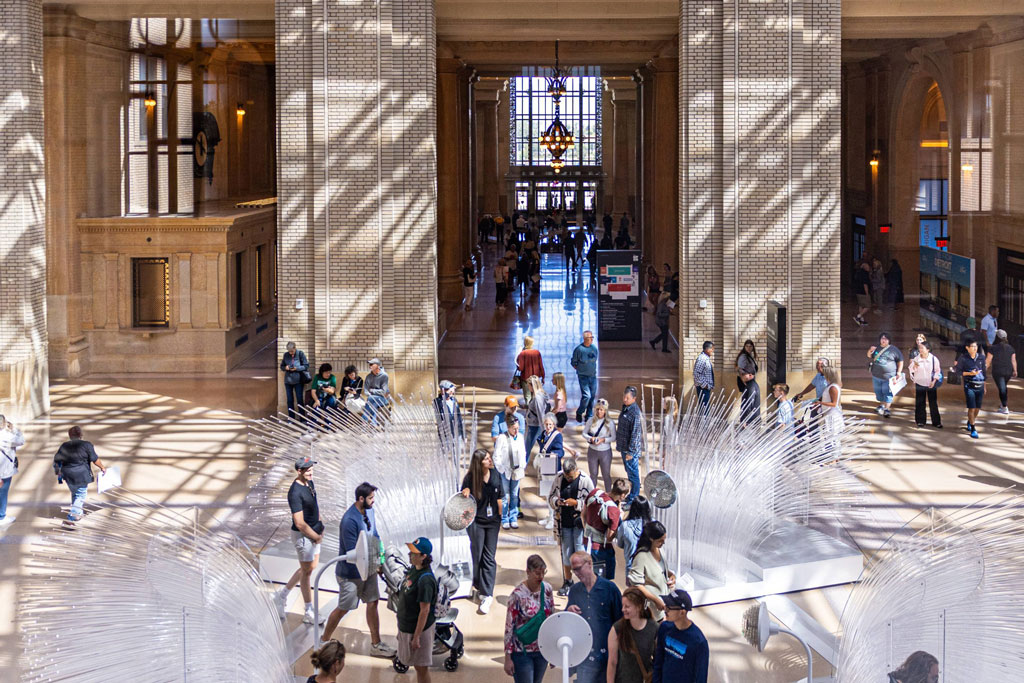
The recent renovation of the Michigan Central Station focuses on its future as a tech and mobility hub on 30 acres, with 1.2 million square feet of public and commercial space. Ford Motor Company was the lead on its renovation, with partners like Google and Newlab joining the State of Michigan and the City of Detroit. Yet this building also lives within more than 100 years of shared memories and history. Its presence in the public imagination remains a central element in its new life.
Just as there is plenty to remark on in the rebirth of the station, from the craftsmanship brought back to life to the careful planning for a mix of uses and inclusion of skills and jobs programming, Detroit historian Jamon Jordan also sheds light on the many reasons the station’s history is important to the city’s life.
On the grand reopening in June 2024, Jordan shared an op ed published in the Detroit Free Press, detailing the rich history of Michigan Central. From his childhood memories of the station in 1977, about a decade before it closed—many believed for good—Jordan traces back to the people, events, and stories that made Michigan Central a nerve center of city and Black history long before it became an emblem of decay during Detroit’s tough years at the end of the 20th century.
When the Erie Canal opened in 1825, Jordan recounts, it sparked a mass migration from the East Coast, either with Detroit as their destination, or through the city to Chicago. Starting in the 1830s, the railroad became a feature of the landscape, and the Michigan Central Railroad became a fixture by 1846.
One of the most consequential figures Jordan brings to life is Elijah McCoy, an African American engineer who began working for the Michigan Central Railroad in 1866. Born in Ontario, Canada, in 1844 to parents who escaped on the Underground Railroad, McCoy was trained in Scotland, but was “allowed only to be a lubricator and fireman on the railroad” because he was Black, says Jordan. This talented engineer was relegated to oiling the train’s moving parts and shoveling coal.
Undeterred, McCoy invented “an automatic lubricator that could oil the train’s moving parts as it was moving, eliminating the need for trains to make frequent stops,” says Jordan, thus gaining the last laugh and transforming the capacity of the railroad industry.
An era came to an end when the old 1884 Central Station was destroyed in a fire in 1913. The present building occupies a different site at 14th and Michigan. Until it closed in 1988–due to declining rail ridership nationwide and the attrition in both employers and residents in Detroit–its vast grandeur greeted thousands of travelers, including the hopeful members of the African American Great Migration. Many of them, migrating from the segregated South, had only dreamed of an arrival like this one, into a public train station without a single set of discriminating signs for “Whites” and “Coloreds.”
Jordan brings together touchstones of history through the station’s life, from international fame to personal connection: from Ossian Sweet to Joe Louis to Lucinda Ruffin—Jordan’s own grandmother.
Once, Michigan Central Station had 10 gates for trains, and its 18-story tower held 500 offices. In the station’s heyday in the 1940s, more than 4,000 passengers passed through each day. The six-year renovation preserves many of the original structures exterior and interior architectural details, and also addresses renovations at two nearby buildings, which will now house an innovation space called NewLab, and a mobility hub that incorporates greenspace, pedestrian, and bicycle connections. The result may well be a new Detroit place that is still worthy of Jacques Lacan’s somber definition of a “sublime object,” as Pohl describes it: “a remainder of loss that triggers a strong nostalgia,” yet that also can contribute to the city’s future.
Find out more about Detroit history from Black Scroll Network. Read an analysis of the fall and rise of Michigan Central in this article by Wayne State University’s Mila Puccini and Jeffrey Horner.
Register today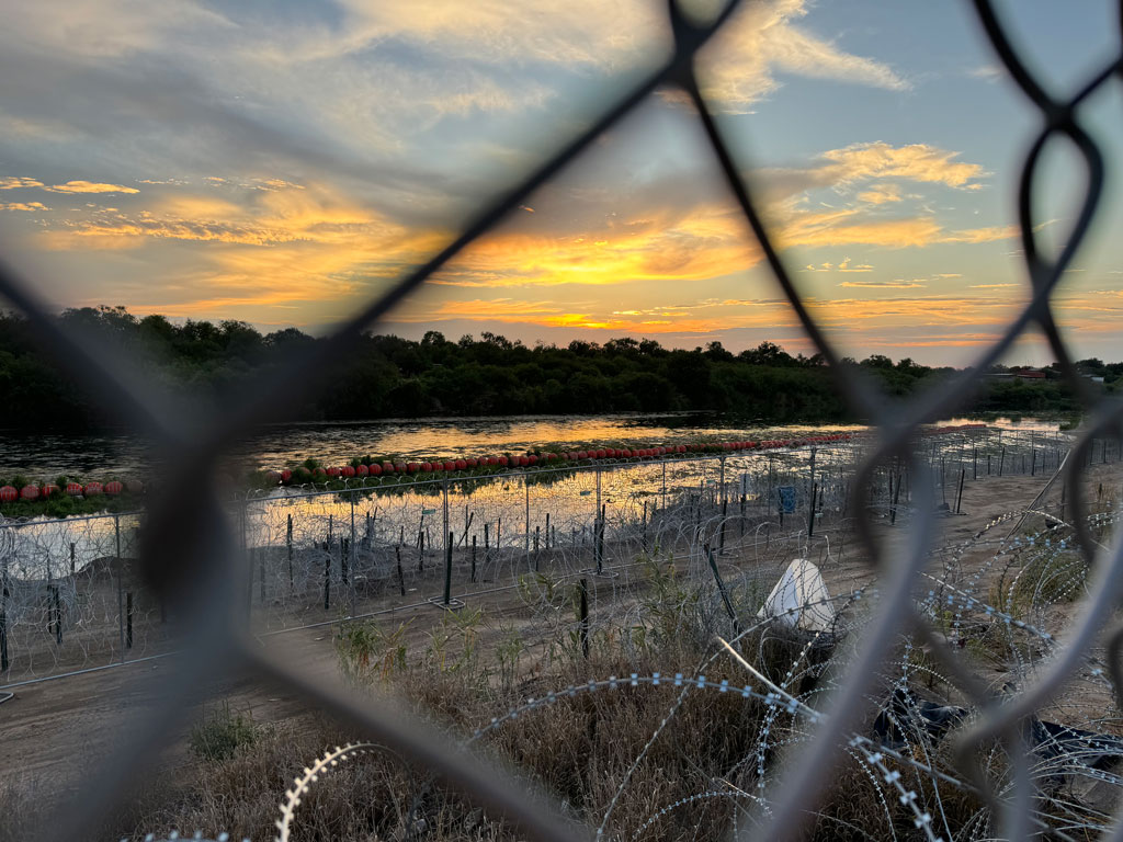
 Adriana (Didi) Martinez knows that the only thing more important than scientific understanding is the ability to share and act on that understanding with a community. As a physical geographer who studies the dynamics of rivers—a fluvial geomorphologist, to be precise—she is trained to find out what helps rivers flow and how human forces can help or harm them. In recent years, studying one of North America’s most beautiful and embattled rivers—the Rio Grande—Martinez has worked to make sure her own knowledge flows, too.
 Colleagues have praised Minghi’s energy and joyful spirit. He was “audacious and undisciplined … and a little bit playful,” in the words of Phil Steinberg, professor of political geography and arctic studies geographer at Durham University. Richard Schofield, senior lecturer in boundary studies at King’s College London, described Minghi as “a lovely man who continued to captivate my M.A. students at KCL on Geopolitics, Resources, and Territory into his 90s, delivering a usual annual clutch of lectures with relish and good humor. No one would ever call Julian a cowboy, but he did sort of die with his spurs on!”
 Geography was always there, just out of sight for Julia Dowell. Growing up in Long Beach, California, she was aware of the impacts of industrial, gas plants, and high-traffic arterial concentrated in the backyard of marginalized communities. “With my background, if I was going to do anything with my life, it had to be using environmental science and policy to right these wrongs. Studying geography and bringing in all those concepts was the best way for me to be able to do that kind of work.”
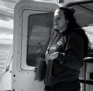 In Dowell’s previous job at environmental nonprofit, the