Terrence W. Haverluk

Terrence W. Haverluk died September 18, 2018, in Colorado Springs, CO. He was a Professor in the Geospatial Science Program at the United States Air Force Academy. Terry was born September 12, 1958, in Gillette, Wyoming. He was an athlete throughout high school, excelling in both wrestling and baseball. He attended the University of Northern Colorado for his undergraduate degree in geography. He worked as a roughneck on the oil rigs in Weld County, CO, to pay for school. After travelling throughout Europe and Mexico, he enrolled in the Geography Department at the University of Minnesota, where he earned his MA in 1987 and PhD in 1993. Terry was a cultural geographer who published numerous influential research articles and books. He first became recognized for his work on Hispanic migration patterns in the United States and the cultural changes that resulted in receiving communities. He also published on Mexican food diffusion, regional food types, and cultural adaptations of cuisine and cooking. During the most recent years he turned to geopolitics, publishing the textbook Geopolitics From the Ground Up, journal articles, and teaching the topic in the Scholars Program at the Air Force Academy and occasionally at the University of Colorado, Colorado Springs and Pikes Peak Community College. A consummate geographer, he easily transcended subdisciplines, making connections between the physical and human world and teaching classes in both. Anybody who knew Terry can attest that he was a jovial, fun-loving, and enthusiastic person. He loved to cook and travel, and was proficient in both Spanish and French. He was also a brilliant scholar. His research contributions helped many others, and he was the best lecturer anybody could ever have the pleasure to listen to. At the Air Force Academy, he was well-known among faculty and cadets for his “Chile Pepper” lecture, and recently was known to receive standing ovations from cadets as he walked into the classroom. However, he had been in poor health for nearly a decade, suffering from various ailments, but all related to his underlying struggle with alcohol. Terry had just turned 60 the weekend before his death, and hosted a pig roast at his property. Many of his friends and family came from around the country, which gave him great joy. The geography community has lost a great mind and great spirit. He is survived by his wife Julie and daughters Elena and Claire.

    Share

Caitlin Kontgis

Education: Ph.D. in Geography (University of Wisconsin-Madison), M.S. in Environmental Health Sciences (University of California-Berkeley), B.A. in Geography (University of California-Santa Barbara)

Describe your career path following your Ph.D. up to your current position. What are the range of tasks / responsibilities for whicyou’ve been responsible in the positions you’ve held?
I submitted my dissertation in December 2015, but I had already begun at a company called Descartes Labs, a startup that analyzes petabytes of satellite imagery. We have a team of software engineers that deals with ingesting the data, correcting it, and building a Python-based platform to access it. I’m on the Applied Science team, and we’re using the data to generate models or maps of various land cover types. Some of this is client driven; for example, a client might come to us and want to know where all of the corn in the United States is and what the yields will be at the end of the year.

We have a pretty wide variety of clients. We work with the U.S. government, and we have a particularly cool project with DARPA assessing food security in the Middle East and North Africa. We have also worked with Cargill – they’re interested in agriculture, obviously, and we also have other sorts of commodities clients. We’ve also done work with non-profits and have contacts at World Resources Institute and National Geographic.

The project that I’m currently working on involves using radar data to map rice across Asia, so it’s sort of a return to what I was doing in my Ph.D. I started at Descartes while I was still finishing my dissertation. I was looking at a lot of jobs as I was finishing, but I wasn’t really finding jobs that seemed like the right fit or where I wanted to be geographically. I Googled “private sector jobs with remote sensing” and this small company came up – the company was only 10 people at the time. I interviewed and really liked New Mexico, the people, and the team, so I decided I’d give it a shot and have really enjoyed it.

The job has evolved since I began working here. When I started it was only about a dozen people, and there wasn’t much structure on the team. Now we’ve grown to about 75 people, so we’ve had to get quite a bit of structure in place. I lead our solutions efforts; on the Applied Science team, we’ll have customers come to the Sales team and pitch an idea, and I help the Sales team assess whether or not the idea is technically feasible. We now have a proposal process in place, where we’ll do a more in-depth review of the project to see how we would approach it, roughly how much time it would take, how many people it would require, and then go from there. I lead the team that is doing all of the solutions work and then work with the Sales team to make sure we’re not committing to something we can’t do.

Can you talk a little more about the analysis you perform – you mentioned that it’s not just limited to the U.S., correct?
Yes, we have the entire historical Landsat archive, as well as global MODIS data and European Space Agency Sentinel data across the globe. When the company was just getting off the ground our initial project was trying to predict corn yields in the United States earlier in the season and with higher accuracy than the USDA, which we did, and that’s how we got our first couple of customers. From there, we’ve looked at a variety of applications including forestry, construction, and different types of agriculture across the entire globe.

The backbone of the company is the computing systems that we have. The team that started the company came from Los Alamos National Labs, and they were experts in high performance computing. They picked up on remote sensing quite easily, then built a system that can process data very efficiently so we can scale analyses really, really rapidly. I think I processed all of the data for Asia and ran that model in less than six hours for the entire continent. That’s really the powerhouse of the company.

How has your education/background in geography prepared you for this position?
I think the thing that jumps out most obviously is having a good grasp of procedural geographic knowledge. We work with spatial data and massive amounts of satellite imagery on a regular basis, so having a thorough understanding of these kinds of data is critical to what we’re doing on the job. For example, we have a project monitoring food security in the Middle East and North Africa. Ideally, we would just choose a random assortment of points and label all of them across the region to train and test our models. However, that’s not feasible given constraints on how you can move across the area. For instance, there may not be road networks, or you might be trespassing onto private land. Thinking about how to best use the data given, that it might be quite linear and not indicative of the entire region that you may want to be sampling, is very important.

I think understanding that these issues exist and being able to creatively brainstorm how to overcome them is pretty critical for what we do, as a lot of clients that we work with may not necessarily understand those concepts as thoroughly. They’ll often come to you with a vector dataset of points, and not understand why you can’t use those points right off the bat. In order to communicate that information to clients in a way that makes sense and is easy for them to understand, you need to have a pretty deep understanding of the datasets and what’s possible or isn’t possible given the constraints of the imagery that’s being collected.

How does your knowledge of the region under analysis – for example, the landscape characteristics or the cultural/economic geography of the area – inform your overall approach in how you use these technologies and how you analyze the environments?
It’s a huge component of what we do. The most obvious example I can think of is just the climate of a region. When I was working in Vietnam during my Ph.D., I was relying on Landsat data, but for six months out of the year, you don’t get a single scene where you can actually see the landscape because of the monsoons. At Descartes, it’s been much easier because we have all of the radar data from the European Space Agency on their Sentinel-1 satellite. Radar data can be difficult to work with, but in regions like the monsoonal tropics, it’s the only way you’re going to get data throughout the whole year.  Having that knowledge of where you’re actually studying and understanding those climatic impacts is crucial.

Also, there are geo-political considerations. Looking at the tariffs that are now being imposed by the United States – is China going to start sourcing all of its soybeans from Brazil now? Keeping track of that and understanding how that might affect some of the models that we’re running is critical in having a deeper understanding of the dynamics that we’re trying to study and better understand. Because some of it you can’t just explain with the satellite imagery, you have to have a broader view of what’s going on globally with politics and trade.

What have you observed in your career in terms of positive impacts in the community or for your clients? How has geography enhanced the work of your organization?
In terms of the organization, I mentioned that the company was very small when I came on and most folks on the team had a background in astrophysics or computer engineering. It was amazing and pretty humbling what they were able to do without formal training in remote sensing or geography. However, being armed with some of the knowledge that I got during my Ph.D. has been important.

Understanding the terms that people are using in more detail has also been critical. For example, if we want to map urban areas, what exactly is an urban area? We think about urban areas being San Francisco or Washington, DC or New York, but globally those are quite different and varied. In Vietnam, for example, many parts of the cities are made of vegetation, so we aren’t necessarily picking up that signal in remote sensing data the same way we would looking at San Francisco. So, bringing those ideas of geography and what constitutes a certain land cover type, or this broader picture of what the data are saying has been useful for the team. I have since recruited some of my friends out of Madison so we now have more geographers on the team, which is great, as we’re able to convey geographic concepts to the broader group. I think it just arms us better to go out and talk to other experts in the field, and better communicate with our clients as well. For the organization, I think it has been very useful to have that knowledge on the team.

In terms of our community, Santa Fe is a small town and our company is a big fish in a small pond, so we’ve been able to give back in a variety of ways. We are out and involved in the community, and everybody thinks that what we are doing is mind-blowing, so it’s fun to present our work locally. We’ve done a few presentations around town and at schools, and it’s pretty neat to watch people who have no experience or exposure to satellite imagery see what sort of things can be done with it.

When you look back at your education trajectory, how did you discover geography? How did you realize that it connects with your aspirations and your goals in life, as a private citizen, but also as a professional?
I had a really, really amazing teacher for my intro to geography course at UC Santa Barbara. I didn’t know geography was something that I could major in when I went into undergrad; I took the course to fulfill a math requirement. The course was amazing. Carl Sundbeck, the lecturer for the course, showed different images of a road trip he took in the 1970s across the entire United States. He was describing the landscape and how different mountain ranges formed, or how a city such as Los Angeles grew up where it did because of the geography of the region and why that was beneficial. Drawing these connections just sort of blew me away, and suddenly the world made sense in a way I had never thought about. And it made me want to learn about geography, obviously, so then I ended up majoring in it.

I traveled for a bit between my Bachelor’s and Master’s programs, and it was amazing making those same connections that I was making during my initial intro to geography classes. It was really exciting and made me want to continue down that path. During my Master’s degree, I was doing a lot of data processing and epidemiology work, which is very statistical and very important, but it’s just not for me. I felt stuck at my desk and not really doing the work that I wanted to be doing. I went to Vietnam the summer between the two years of my Master’s program with a friend of mine from undergrad who was from there and we stayed with her family. I felt the same way as an undergrad when I was traveling. I wanted to get back to geography and do research that was in the field, which was a lot more dynamic than what I was working on for my Master’s thesis.

I then ended up going to Madison for my Ph.D. because the woman who taught my remote sensing classes at Santa Barbara had moved there. So I went to work with her and basically went with the excuse that I wanted to continue exploring, traveling, and getting to know other cultures. I proposed to do the work in Vietnam and got it funded by NASA. I was really lucky in that regard, as I got to sort of drive my own ship. And then coming to Descartes, it just sort of continued. I’m not necessarily out in the field collecting data and interviewing farmers, but it’s still every single day looking at satellite imagery and trying to better understand the world, so it’s exploration in a different form. It’s doing a lot of exploration via satellite imagery, not necessarily boots on the ground, but it’s still fulfilling that interest.

Do you remember having an “a-ha!” moment, that perhaps changed the way you think about issues and topics? Is there another example you might have?
It definitely occurred when I was at Santa Barbara. I realized that “Wow, you can earn a living doing something that you really love!” I don’t know what I envisioned I’d be doing after college when I was 18, or what I’d be doing as a career. There was some moment at Santa Barbara when it all clicked. I remember realizing there are jobs where you can continue on a path of scientific discovery and exploration, that you don’t just have to be crunching numbers and data or doing something that’s just a job. You can do something that you really feel passionately about. You know, it probably was that first geography class, and then the same lecturer taught the follow-up class the next semester. I think at that point I was pretty hooked. At that stage, I hadn’t even taken a remote sensing class and didn’t realize what career opportunities were out there. It was just sort of like: I love this; this guy can make a living doing this, so there must be room for other people. Those first couple of classes in college were pretty crucial to where I am now.

    Share

David Lowenthal

David Lowenthal died peacefully at his home in London on September 15, 2018. A giant in the fields of geography, history, and heritage studies, Lowenthal is perhaps best known for his 1985 work The Past is a Foreign Country. In 2015, the updated edition of this text, The Past is a Foreign Country – Revisited received widespread praise, including a British Academy Medal. At the San Francisco AAG Annual Meeting in 2016, Lowenthal took part in an author meets critics session on this work (pictured at right).


Born in New York City in 1923, Lowenthal received an undergraduate degree in history from Harvard University in 1944. After being deployed as a geographer during World War II, he went on to obtain an M.A. in geography under Carl Sauer at University of California, Berkeley. Sauer recommended he continue his education at University of Wisconsin, Madison, where Lowenthal completed a Ph.D. in History with a dissertation on the life of George Perkins Marsh, the subject of his first book George Perkins Marsh: versatile Vermonter (1958). Following several appointments throughout the US and Caribbean, Lowenthal became a professor of geography at University College, London in 1972 where he remained until becoming emeritus professor in 1985.


Among his works, notable ones also include The Heritage Crusade and the Spoils of History (1996) and a revised edition of his work on Marsh, George Perkins Marsh: Prophet of Conservation (2000). He was working on a final work entitled Quest for the Unity of Knowledge. Lowenthal is a medalist of the Royal Geographical, the Royal Scottish Geographical, and the American Geographical Societies; a Fellow of the British Academy; and honorary D. Litt. Memorial University of Newfoundland. In 2010 he was awarded the Forbes Lecture Prize by the International Institute for Conservation.

Remembrances have been written about him published in The GuardianThe Cambridge Heritage Research CenterThe Geographical Society of Ireland, and University College, London.

    Share

John Sauvageau

Education: M.S. in Geo-Information Science (Salem State University), B.S. in Cartography and GIS (Salem State University)

Describe your job. What are some of the most important tasks or duties for which you are responsible?
I work within the Retail Network Transformation team, which falls under the consumer business banking umbrella. We’re responsible for the strategy and planning of our branch markets, and where we want to put branches and ATMs. We leverage GIS to analyze and visualize our internal and external data spatially. We then use the ESRI platform ArcGIS Enterprise with its various tool sets including business analyst, network analyst, and spatial analyst as the tools to help us develop strategy.

We provide services to much of the northeast, including Rhode Island, Massachusetts, Connecticut, New Hampshire, Vermont, New York, Pennsylvania, Delaware, and Virginia, and also parts of the midwest like Ohio and Michigan.  We’re responsible for supporting the analysis and branch recommendations for all types of branch actions – open, close and relocations.

How has your education/background in geography prepared you for this position?
Grasping the various levels of geography and how they relate to each other is fairly important to understand. The banking industry is a little bit different than a standard retail industry, where chains can just put a store where there’s going to be high traffic. We deal with varying levels of governmental compliance. One aspect of compliance is proportionately locating branches in areas to ensure we are serving low to moderate income households, as well as middle to upper income households. We use internal and external data, including Census data,  to understand where that population is so we can target those areas.

Looking at the five themes of geography, I think we really touch two of those: location and region. Location – we have a network of branches and locations, we monitor other retail marketplaces, where they’re coming up, where they’re going away; other competitors’ locations, where customers are located. Location really is the number one thing that I think applies to what we do in this kind of planning. It’s kind of the same thing as real estate: location, location, location, everything is location.

At the regional scale we look at how everything works together and the nuances from region to region. We designate our own regions for organizational hierarchy purposes, but states, counties, etc. – they all have unique nuances, and we want to understand these so we can better interact with the population within those regions and be in the places where they are going to be. We also need to understand how they use the banks: are they primarily driven by branch visits, or using a more digital approach with online and mobile banking? How do we customize the look and feel from region to region to make our banks more attractive?

How does your geography knowledge inform your use of GIS and make it possible to get the most out of the business analyst software and work with big data?
Many of my colleagues across the industry come from more of a business intelligence background. Many have used GIS as a next step and have gone back to universities and vendors for formal training. These colleagues are amazing and have a great deal of hands-on experience and have been using these platforms for a long time. With my educational GIS & Cartography and Geo-Information Science background as a whole, I am able to bring in and apply more foundational concepts and tools to enhance our analysis. Maps can tend to be more mass produced and less of a cartographic product, but whenever I’m asked to make a map, I try to ask more questions first. Questions like: What is the purpose? What is it that you’re trying to convey? How will you be using and presenting the map? These and similar questions allow me to create a product that will be visually pleasing to the customer and their audience and allow the map to speak for itself. Different approaches and techniques will apply for varying levels of requests; it’s not always a “one size fits all” approach.

How did you discover geography was going to help you pursue your aspirations, professionally or in your personal life?
When I think of my “a-ha moment” I always refer back to a certain exercise with ArcGIS in one of my undergraduate courses, where we were working for a town searching for a site for a new fire station. We were given criteria where it had to have its own land within a certain square footage, and it couldn’t be within 7 minutes of another fire station’s service area. Taking all of that information, creating multiple layers and using a raster analysis to find out where the best possible areas were for this fire station – I had never seen that before, so I was like “wow, this is interesting!”

I was working at a bank at that time as a part time teller and thought “this would be really interesting to bring into the bank and use GIS to figure out where to put banks.” Being naïve as I was, I didn’t understand that it had already been going on. I didn’t know it existed. It wasn’t until a few years after that where I was taking some courses at the bank, learning about processes of improvement, efficiency and those sorts of concepts where I realized how interesting this was, and that I already had a good foundation for that kind of work from my education in GIS.

My branch manager at the time gave me the best advice I had ever received for this. He said: “Look in the organization, try to find somebody doing what you want to do, and just reach out to them and ask if you can talk to them and get advice on: How did you get over here, and what kind of preparation would I need to get into this kind of area within the organization?” So I did that. I identified the person I needed to talk to, reached out to them and we exchanged a few emails. Nine months later and I got an email from another person who he referred me to, and they had just created this GIS Analyst position within the bank to do exactly what I had been looking to do in branch site location. They asked me to interview for it, and a few months later I started on this path, which leads me here today. It all goes back to that one lesson in my undergraduate that kind of sparked my interest in the field, and without that I probably wouldn’t be here.

What attracted you to the banking industry? How did you initially develop that interest?
I had just returned from being deployed – I went to Afghanistan in 2010. I was looking for some part time work. My father-in-law had been working in the banking industry for a long time and thought it would be a great fit for me as a part time job.  A branch close to home was hiring, so I applied for a part time position as a teller. I began to thrive and before long I ended up becoming a supervisor. A few years later I was  promoted to a financial services representative. While I was gaining all of this financial experience, I was also going to school full time for GIS.  I had this passion for banking and this passion for GIS and I wondered, how great would it be if I could combine them?

I started in 2014 working on the real estate team and market planning, and gained a great deal of job experience in my first year. I transitioned to another financial institution performing similar tasks. I spent the last 3 years there, and now I’m taking a more senior role at a new institution. It’s been amazing, and it’s interesting because a lot of these types of decisions don’t require banking experience. It’s a unique combination of having worked in a branch and having the GIS experience that gave me insight into how the branch operates, while many of my peers don’t have the same understanding of what it’s like to work in a branch. When I’m helping to program details like how many desks we want to design in a certain branch with a certain amount of staffing, I’m able to bring a different perspective, because I’ve been in their seats before.

    Share

Patrick Shabram

EducationM.A. in Geography (San Jose State University), B.A. in Geography (University of Colorado Boulder)

What attracted you to a career in education?
I’ve spent a number of years working in private industry, yet early on began to teach part-time as an adjunct. I had spent several years teaching on the side before realizing that it is my passion. At age 42, I made the switch to full-time.

How has your education/background in geography prepared you for your teaching career?
Typically, a Master’s degree is needed to teach at a community college, along with teaching experience. Many of my colleagues have Ph.D.’s, but education is not sufficient for a position like this; without classroom experience, getting a full-time position is nearly impossible. Starting off as an adjunct or teaching as a graduate student is necessary. Personally, I brought experience from my consulting and research work in the private industry, which I believe improved my chances of securing my full-time position.

What do you do in the wine industry?
The federal government has a system in place for recognizing unique regions for viticulture, both to serve as a benefit for consumers and to protect geographic names in the industry. If a winemaker wants to use one of these geographic names on their label, 85% of the grapes used to make the wine needs to come from within the boundaries of that region (e.g., Napa Valley or Russian River Valley). To establish an area as a unique American viticultural area (AVA), a petition to the Alcohol and Tobacco Tax and Trade Bureau (TTB) is necessary. These petitions require details that identify why the area is geographically unique as a winegrowing region, as well as identify boundaries that best encompass these characteristics. I do studies that look at climate, soils, topography, viticulture and viticultural practices, and other aspects of the area to determine what makes the area unique (or determine if the area does not meet TTB requirements) and recommend boundaries. The findings are often used by growers, wineries, or grower associations to support petitions for new AVAs or to modify the boundaries of existing AVAs.

What geographic skills and information do you use most often in your work? What general skills and information do you use most often in your work?
I teach several different classes, but since I most commonly teach introductory physical geography, a well-rounded knowledge of earth sciences is essential. Technical skills in GIS, Google Earth, and other applications and online resources help in creating and running laboratories. When I interact with local organizations on building and promoting internship opportunities, an understanding of careers that are out there also helps.

Writing skills should never be overlooked. There tends to be administrative work with my job requiring the ability to present written ideas clearly and concisely.  The same goes for my work in the wine industry—that work is about 40% writing.

Are there any skills or information you need for your work that you did not obtain through your academic training? If so, how/where did you obtain them?
Networking. The importance of networking was engrained in some of my employment outside academia, where I was commonly expected to attend networking events. Someone might wonder why I need to network now, since students come to me, and I don’t really need to find new business or a new job. I’ve found a lot of excellent opportunities for collaboration, however, through my contacts at other institutions. These opportunities all have been about students. I’ve worked on grants, helped students find jobs, helped solve transfer issues, learned new teaching techniques, and found interesting subject matter all through my contacts at other colleges, non-profits, and private companies.  As an example, FRCC is in the third year of a student-focused collaborative grant with an NSF facility all as a result of networking with professionals outside my college.

Do you participate in hiring, screening, or training of new employees? If so, what qualities and/or skills do you look for?
Yes, I’ve served on several hiring committees, hired an assistant for an NSF grant, and currently help hire and manage our part-time faculty. I look for student-focused candidates; the common mistake candidates make for community college positions is focusing too much on research and not on education. Unless their research is in education, candidates need to be able to put emphasis on students and classroom experiences.

What do you find most interesting/challenging/inspiring about your work?
Seeing my students’ lives change. I’ll have students get in touch with me after having left FRCC to tell me how their time here made a difference in their lives. There’s nothing more satisfying than seeing a former student graduate from the four-year college they transferred to, and to then see the kinds of great careers they go into.

What advice would you give to someone interested in a job like yours?
Get teaching experience in any way you can. Don’t just stand in front of a room and lecture, but really think about education and your pedagogy. Strive to be a great educator.

The other advice is to be geographically flexible. If you are looking to land a job in your hometown, you may be waiting a long time.

What is the occupational outlook for career opportunities in your field, esp. for geographers?
It is competitive, but not like in other disciplines. There are usually only one or two full-time geographers at a community college, and full-time faculty tend to stay, so a position at any given college doesn’t come along very often. Someone with a degree in geography tends to have a lot of good options though, so we sometimes find we are competing for the best candidates. Chances are someone looking for a full time position won’t find a job right away, but since I’ve been here, we’ve seen a number of our adjuncts take full time positions at other institutions.

    Share

Kate Bishop

Education: Ph.D. in Geography and Anthropology (Indiana University), M.A. in Anthropology (Indiana University), B.A. in French (Bates College)

Describe your job. What are some of the most important tasks or duties for which you are responsible?
In my role as an evaluator, I am responsible for measuring, analyzing, and reporting on the results of international agricultural development projects.  I train, advise, and lead multicultural teams in mixed-method research projects such as baseline studies, qualitative assessments, midterm and final evaluations, and impact evaluations.  I also help project staff in field offices to create and implement performance management plans and develop research budgets.  I have supervised evaluations of projects in Burkina Faso, Cameroon, Ghana, Guinea-Bissau, Liberia, Mali, Niger, and South Africa that were funded by the United States Agency for International Development, the United States Department of Agriculture, and various foundations.  This work is important because it helps project funders, including U.S. taxpayers, to understand whether they have achieved programmatic goals promoting agricultural development.  Equally important, the research contributes to reconceptualizing and refining project strategies to expand outreach and improve outcomes for everyone involved.

What attracted you to this career path?
I joined the Peace Corps after I graduated from Bates College with a degree in French.  Working in Africa and teaching others about Africa has always been very important to me.  Working with NGOs was a great way to work towards social and environmental justice, learn foreign languages, and gain diplomacy skills.

How has your education/background in geography prepared you for this position?
I entered grad school after working in the field of international development for a decade.  One of my goals in studying geography was to improve my research skills, in particular methods and theories appropriate to evaluating programs in Africa.  While I gained a lot of practical knowledge as an applied researcher, it was not until I studied geography that I was able to understand and analyze important dimensions of development that are often ignored or understudied in professional research such as political economy, human-environment interactions, culture, and history.

What geographic skills and information do you use most often in your work? What general skills and information do you use most often in your work?
Geographic skills important to this work include the ability to use mixed data collection methods, to integrate qualitative and quantitative data, to analyze human-environment interactions, and to conceptualize processes through time and across space.  More generally this work requires: the ability to develop and implement culturally-appropriate research design; foreign language skills; the ability to lead and work as a team member; strong writing and presentation skills; and, resourcefulness and adaptability in a challenging fieldwork environment.

Are there any skills or information you need for your work that you did not obtain through your academic training? If so, how/where did you obtain them?
I began learning French in high school and had already spoken the language for years before entering graduate school.  I began studying Portuguese during my master’s program, and it was incredibly helpful in expanding my knowledge of Lusophone Africa.  In addition, I had a lot of experience in cross-cultural settings prior to my academic training in geography.  Building interpersonal and communication skills requires a life-long effort.

Do you participate in hiring, screening, or training of new employees? If so, what qualities and/or skills do you look for?
When I am part of the hiring process some important candidate qualities I look for include knowledge and experience in the field or position, foreign language competency, writing skills, and creativity.  For program evaluation positions in particular, I look for attention to detail, ability to conceptualize program strategy and rationale, communication skills, and generally outgoing/approachable personality.

What advice would you give someone interested in a job like yours?
My advice would be to apply to the Peace Corps or another long-term service or teaching position in a developing country in order to obtain in-depth field experience.  I would study at least one foreign language.  Become familiarized with the history, politics, arts, and geography of a country or region of interest.  Take a home-office position with an NGO in Washington, D.C. or elsewhere as a Monitoring and Evaluation Associate or Coordinator and build a career from there.  Importantly, enter this profession with a humble attitude.  You will find that your counterparts and coworkers in developing countries are often much more knowledgeable than you may expect, and that research in the field of international development is always a learning experience.

What is the occupational outlook for career opportunities in your field/organization, esp. for geographers?
Due to USAID’s emphasis on strong program evaluation across all projects, the field has been growing fairly rapidly for nearly a decade.  There appears to be plenty of opportunity for applied researchers for U.S. Government-funded programs for now, although changes in the State Department related to the policies of the current administration may lead to shifts in funding priorities.  Other opportunities exist at multilateral institutions such as the World Bank, the United Nations Development Program, and the Food and Agriculture Organization of the UN, as well as at bilateral institutions and foundations.

    Share

Surveying, Mapping, and Drones with 6th & 7th Graders in Florida

Photo of Patrick Phillips
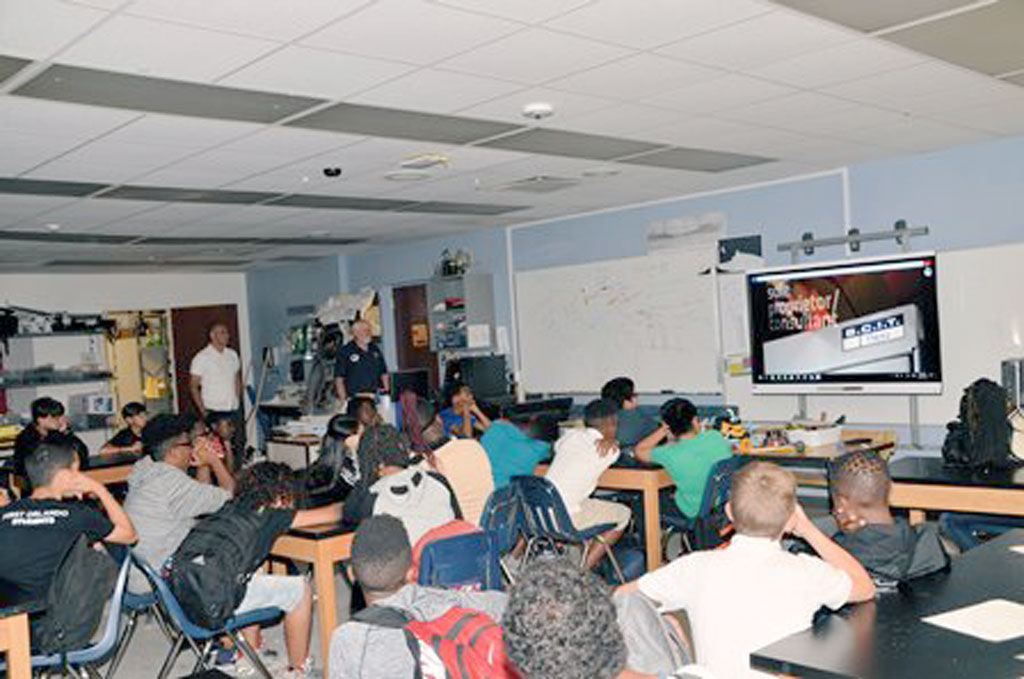
GeoMentor Volunteer:
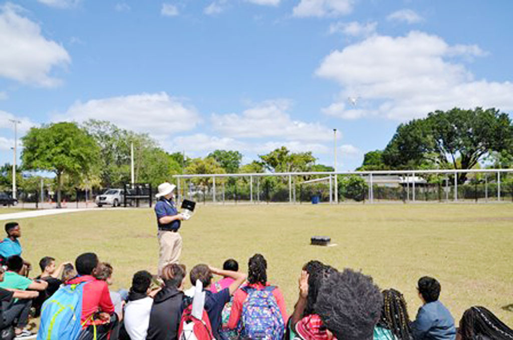
 Patrick Phillips

Location: Orlando, Florida

Grade level of participating students: 6th & 7th

Activity Theme/Focus: Surveying & Mapping

Number of Participants: 110

In conjunction with National Surveyors Week, Southeastern Surveying & Mapping Corp., Inc. (SSMC) participated in presenting Surveying & Mapping as a career to two Orlando area middle schools. James Mazurak and Patrick Phillips from the Orlando office of SSMC along with Lenora Spence, Outreach Coordinator from Florida Department of Agriculture visited the two schools.

At one school the presentations were made to about 50 students (30 6th graders, and 20 7th graders). At the second school, three or four classes of mixed grades and ages met in the school’s media center as one big group of about 60 students. James explained about Surveying & Mapping using videos, slides and personal experiences, while Patrick physically demonstrated his drone skills in the school yards. This was part of the ongoing community involvement & education that SSMC is involved with throughout the year with students ranging from Elementary School to College.

Beyond the math, science and technology involved; James explained that what draws him to the surveying profession is the time spent in the field. Most geographers, regardless of specialty, are drawn to the outdoors and all that nature has to offer. Much of surveying & mapping is following in the footsteps of those who came before us. Consequently; many practitioners are also historians and conservationists.

I have to admit, though, the technology is pretty cool and that is what drew me to the profession. I studied computer science in college but like many mappers, followed my family into the profession. So I am now applying my computer skills to surveying and mapping. The UAS portion of SSMC’s presentation primarily explained the technology behind the aerodynamic capabilities of the UAS; GPS, IMUs, accelerometers and counter rotating propellers. The students asked questions like “how high can it go?” And “can you make it flip?” Far fewer students were interested in the photogrammetry and math required to process the data.

Photo of Patrick Phillips and his colleague James Mazurak instruct a class
Patrick Phillips and his colleague James Mazurak instruct a class.


Photo of Patrick Phillips demonstrating his drone skills in the school yard.
Patrick Phillips demonstrates his drone skills in the school yard.


Patrick Phillips (right) holds a drone controller as he demonstrates a flight in the school yard, while his colleague James Mazurak (left) watches.
Patrick Phillips (right) holds a drone controller as he demonstrates a flight in the school yard, while his colleague James Mazurak watches.
    Share

Arleigh H. Laycock

Arleigh Howard Laycock, Professor Emeritus of Geography at the University of Alberta, died June 7, 2018. He was 94.

Laycock was born on May 10, 1924, in Strathmore, Alberta, the son of the late George Henry (“Harry”) and Helia (Riekki) Laycock. He was married for 60 years to Audrey Jean Tyrholm (d. 2010) and had three children: Deborah, David, and James.

From 1943 to 1945, Laycock served as a pilot in the R.C.A.F. He graduated from the University of Toronto with a BA in 1949 and received his Ph.D. from the University of Minnesota in 1957.

Arleigh held the position of Hydrologist with the Eastern Rockies Forest Conservation Board from 1952-1955, whereupon he joined the faculty of the Department of Geography at the University of Alberta, where he served as Professor until his retirement in 1989.

    Share

Robert Stoddard

The geography community at the University of Nebraska Lincoln lost a treasured colleague when Robert H. Stoddard died on May 21, 2018 at age 89.

Stoddard was born in Auburn, Nebraska, on August 29, 1928, the son of Hugh Pettit Stoddard and Nainie Lenora Robertson Stoddard. He married Sally E. Salisbury in 1955 and had three children: Martha, Andrew, and Hugh.

He started his studies at Nebraska Wesleyan where he earned a bachelors in 1950. Stoddard then earned his master’s in 1960 at the University of Nebraska. He received his doctorate at the University of Iowa in 1966 and joined the faculty at the University of Nebraska the following year. He remained there for 40 years, until his retirement in 2006. Altogether, Stoddard has taught for more than 40 years at Nebraska Wesleyan University and the University of Nebraska-Lincoln.

Stoddard was a specialist in the Geography of Asia, publishing especially on the geographic patterns of pilgrimages and sacred sites. He put his geography into practice by travelling widely with his family throughout Asia (and beyond), including extended stays in India and China. Bob had a strong sense of social justice and a keen appreciation of the many legitimate ways to live in this diverse world. Stoddard also taught high school in India (1952-57), and was Visiting Professor at Tribhuvan University in Kathmandu, Nepal (1975-76), and the University of Columbo in Sri Lanka (1986).

Dr. Rana P.B. Singh notes that “Bob was a pioneer in the geographic study of pilgrimages. He commenced his focus on the geography of religion with a Master’s thesis on the locations of churches in a Nebraska county (1960) and a Doctoral dissertation on Hindu holy sites in India (1966). He was co-editor of Sacred Places, Sacred Spaces (1997) and the GORABS chapter in Geography at the Dawn of the 21st Century (2003). His visits to many holy places in India have included the Himalayan sites of Kedanath and Gangotri.”

In addition to much productive research, many scholarly publications (notably Field Techniques and Research Methods in Geography, 1982), and unstinting university service, he also served his local community as a member of the Lincoln-Lancaster Planning Commission (1974-78). He was also a dedicated teacher and mentor, and these qualities were recognized when the National Council for Geographic Education gave him its Distinguished Teaching Award in 1992.

A collection of essays was published in 2016 in honor of Stoddard’s years of exemplary service. A copy of “Space, Region & Society: Geographical Essays in Honor of Robert H. Stoddard” is available online at https://digitalcommons.unl.edu/zeabook/48.

    Share

Joe Scarpaci

EducationPh.D. in Geography (University of Florida), M.Sc. in Geography (Penn State University), B.A. in Geography (Rutgers University). Post-doctoral Bridge Certificate in Marketing, AACSB (Association to Advance Collegiate Schools of Business)

Describe your job. What are some of the most important tasks or duties for which you are responsible?
I offer investment information for U.S. companies interested in staking a claim in Cuba’s future economy. This entails appraising them of, and simplifying, the current implications for businesses registered in the U.S. that must abide by the Trading with the Enemy Act.

I also design and lead interpretive educational/cultural tours in compliance with the current trade embargo. Since the early 1990’s, I have held licenses through my organization or from the U.S. Treasury’s Office of Foreign Assets Control (OFAC), and have since introduced over 900 American students and civic organization members to the island through these itineraries.

What attracted you to this industry?
My early research in heritage tourism and the Centro Histórico of Latin American cities led me to nine UNESCO heritage sites, including Havana and the more recent addition of Cuenca. My field work addressed city, provincial, and national governments aiming to attract new clientele to their aging historic districts – an alternative traveler than those coming to Latin America and the Caribbean for traditional tropical amenities. Place promotion and branding, I realized, become front and center in understanding how these places aimed to position themselves in the international tourism market. This inspired me to accept an offer from Virginia Tech to a post-doctoral bridge program in marketing, which required 320 hours of intensive summer study. After completing the program and receiving my certificate, I began teaching full-time and online in international business, hospitality, and marketing programs. Additionally, I’m able to consult with businesses in Hollywood and on Wall Street about working in Cuba under U.S. Treasury guidelines.

How has your education/background in geography prepared you for this position?
Geography’s interdisciplinary approach provided an excellent foundation for international marketing, which itself draws on several concepts relating to economic, cultural, and methodical foundations found in geography; however, it’s worth noting that business administration faculty often view interdisciplinary affiliations as “weak”. My “jack-of-all trades” geography training, however, was encouraged. When it comes to publications, books are not as valued as in geography, and the peer-review process is much more rigorous. All in all, my geographical fieldwork methods, foreign language training, ability to synthesize material, etc. have been assets to my work in international marketing.

What geographic skills and information do you use most often in your work? What general skills and information do you use most often in your work?
As I mentioned, the ability to synthesize both qualitative and quantitative information, as well as the ability to effectively display my work in visual and written formats and my Spanish language skills are the tools I most rely upon. Working in Cuba, I was amazed by how many “experts” on Latin America or Cuba had so little knowledge about flora, fauna, political and social history and theory, and climate patterns. I’d sat in on so many lectures where these basic factors — which would be immediately picked up by geography students — were totally absent.

Are there any skills or information you need for your work that you did not obtain through your academic training? If so, how/where did you obtain them?
I mentioned previously my post-doctoral certificate in marketing; otherwise, I’m not sure if field work counts as training, but my Spanish language skills have definitely been most helpful. The notion of “going native” is a false approach; however, I’ve found over the course of doing ethnographic work throughout the region that locals appreciate a foreigner’s ability to speak Spanish. I stress the importance of language to my students; with Spanish in particular, the use of present and imperfect subjunctives tend to be most difficult for English speakers, and I encourage my students to master that.

Having run 32 study abroad programs in Cuba, the Dominican Republic, and Chile and working with international organizations has forced me to summarize my research clearly and effectively. My center has worked with several alumni organization, museums, civic organizations, and high schools and university programs as a result. Taking account of these varying audiences, I try to “hit the right altitude” in giving lectures, assuming very little and presenting interesting and “big picture” topics on globalization, urbanization, consumer behavior, etc. rather than convey trivial information about the region.

Do you participate in hiring, screening, or training of new employees? If so, what qualities and/or skills do you look for?
In the past, I have hired part-time U.S. and Latin American-based scholars. I look for good people skills, strong bilingualism, and effective team players. Travelers in Latin America don’t want a boring and introverted docent accompanying them. Using locals, I also keep an eye out for good English skills, and the ability to keep politics in check.

What advice would you give to someone interested in a job like yours?
I appreciate the luxury of being able to be flexible with my time and with my choice of projects; however, this requires a sense of seasonality and advance planning. Another challenge tends to be good budget development skills and learning how to monetize your skills. Understanding how to conduct a marketing plan, even with geographers who don’t speak your language, is essential.

I stress the balance of having your work validated in North America while earning the respect of locals; with that, I cannot over-stress the importance of language skills. Language skills should not be treated as secondary skills, especially with the decline of Spanish and Portuguese with Fortran and COBOL (in the 1970s) and C++ (recently) being treated as “substitutes” to modern languages in contemporary higher education curricula. You should never assume that any key informants will “speak English anyhow”—personally, this is a terribly misguided assumption.

What is the occupational outlook for career opportunities in your field, esp. for geographers?
Any geographer can find their own niche, but this requires understanding the big picture. In my case, it means understanding supply chains, which in economic geography we might call the production chain or the value-added chain or the commodity chain. At each point, there is an opportunity to connect a market with a client, whether it is a B2B setting (business-to-business) or B2C (business to consumer/client) one. One of my mentors at Penn State, Pierce Lewis, who was a talented and broad-thinking scholar, wrote a Presidential Address in the 1970s following his tenure as AAG President.  In that talk, he urges students to pursue their interests without putting on ‘blinders,’ and then try some more, but to also avoid those with narrow focus who might attempt to put blinders on your vision. He encouraged geographers to work on projects not confined to one place, and that pay attention to context.

While deciding between graduate programs in the mid-1970’s, I was given advice to develop systematic skills at the master’s level, and to then focus on regional specialization at the doctoral level. I opted for a M.Sc. program at Penn State; though they had little in the way of Latin American studies, I did indeed pick this up later at the doctoral level at the University of Florida.

I remember being at Penn State while Peter Gould, the professor of my seminar on the history/philosophy of geography, opened a recent issue of the AAG’s Annals and read the caption of a photo that read something like “Campesino in field in white pants”. He didn’t have to say anything else; it was clear that this was overly descriptive. Hence, the debate on idiographic versus nomothetic approaches to geography, and the quantitate vs. qualitative debates. All geographers will have to choose those paths as their careers evolve.

Two other faculty members at Penn State — Ron Abler and Wilbur Zelinsky — told their graduate students that a good dissertation could be defended in at least two or three other departments; at the time, I found this to be hyperbole on their part, but now I see they were right. My undergraduate advisor at Rutgers (Bria Holcombe) encouraged travel and journaling, even as an undergrad. I echo the advice of these sage geographers.

    Share