Program Profile: California State University Long Beach

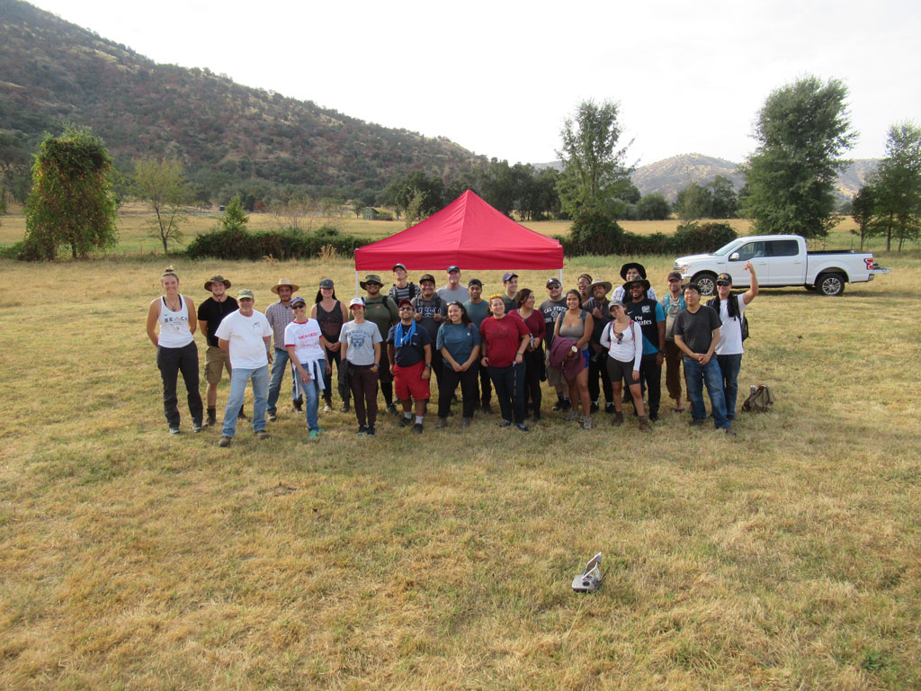
Group photo of CSULB MSGISci students
Group photo taken by a drone of MSGISci students at the River Ridge Ranch field site (with Scott Winslow, UAV and GIS Lab Manger front left and Dr. Wechsler front 2nd from left).

AAG staff recently sat down for a virtual interview with California State University Long Beach (CSULB) faculty members Dr. Suzanne Wechsler, professor and department chair; Dr. Lily House-Peters, associate professor and undergraduate advisor; and Dr. Paul Laris, professor and former department chair. When asked how their department demonstrated the value and relevancy of geography, a theme quickly emerged — actions speak louder than words.  Everything the department does is exemplary of demonstrating the importance of geography.

The department is keen on community engagement that provides research and learning opportunities for both students and faculty, adapts their program to ever-evolving geospatial technology and industry standards, and emphasizes the importance of field experience in the coursework across the program’s various concentrations. It’s obvious that CSULB’s Department of Geography is demonstrating the value and relevancy of geography daily, not only to their students, but to their university colleagues and local community members as well.

“One of the things that’s kept us going and relevant is that we’re always trying something…we’re constantly trying out and innovating,” says Laris. His response reflects the overall spirit of a department where innovation is the norm. As Wechsler puts it, being nimble and responsive is what has fostered the program’s success.

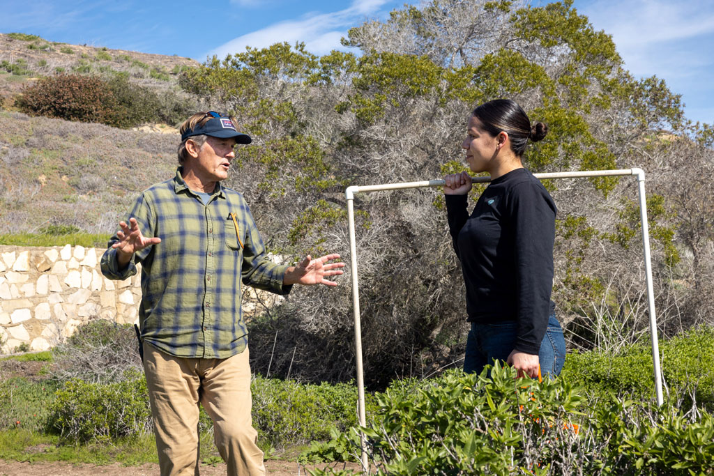
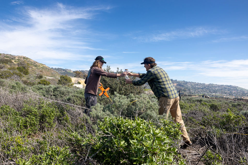
Professor and student perform field work with coastal sage scrub.
Professor Laris gives student Alexandra Trujillo a few tips on how to use a quadrat to sample coastal sage scrub vegetation at the PVP Land Conservancy.


Student and professor perform fieldwork together.
Student Cannon Hanson and Professor Laris prep a site for line transect sampling of coastal sage scrub habitat.


Creating stand-out programs to foster student success

Suzanne Wechsler has carried on this tradition in her current role as department chair where her responsibilities include directing the M.S. in Geographic Information Science (MSGISci) program. The M.S. was created 12 years ago when it was discovered that M.A. students were dropping out because they’d found work in the geospatial industry before they graduated. The problem was, that while students were obtaining excellent geotechnical skills within the M.A. program, they were taking internships that turned into the jobs they wanted, leaving them with little time or motivation, to complete their thesis. Wechsler and her colleagues realized there was a need to provide an analytical and application-based training for these students to fully prepare them for a career in the highly competitive geospatial industry, rather than the more theory-based approach of the M.A. program.

It’s about being agile and responding to the moment as best as possible, and you can’t do that without a core faculty that are dedicated and get along well…[and]…work together to…figure out how to address the moment.

—Suzanne Wechsler

The result is a vibrant graduate program which includes both a traditional Master of Arts (M.A.) and a Master of Science in Geographic Information Science (MSGISci) that received an Honorable Mention for the AAG’s Program Excellence Award in 2019, among other ranked achievements. Students can expect a small, yet strongly networked cohort environment, research and publishing opportunities with faculty that focus on local and global issues, and lectures from community leaders, activists and industry professionals to inform on current best practices and skills.  Research partnerships are built into seminars and culminating activities provide students with opportunities to gain specialized skills and competencies, and, for example, to investigate how issues such as social and environmental justice play out in community settings.

Wechsler adds that equally important to the research experiences we facilitate is the network and community we strive to develop while students are in our program, and after they graduate. With over 200 MSGISci graduates 96% of whom are working in the geospatial field, these networking opportunities are an especially important component of our program. We hope that by building a sense of community while students are here encourages them to stay connected and serve as a network and resource for future graduates.

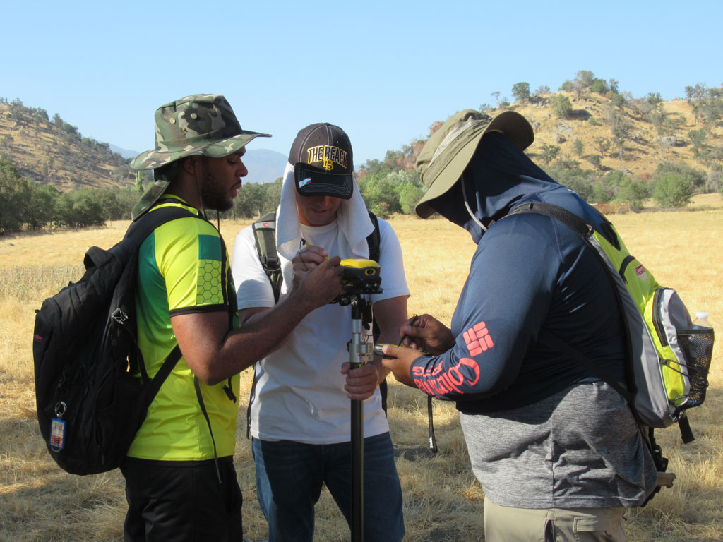
CSULB students performing GPS data collection
MSGISci students prepare GPS units for data collection at the River Ridge Ranch study site in Springville, CA.


How campus visibility maintains relevancy

The value of geography is enhanced by interdepartmental relationships within the university, according to Laris. Geography faculty often collaborate on cross-listed courses with other departments or stay on the university radar through the reception of grants including an NSF REU. Additionally, some programs such as the M.S. in Geographic Information Science generate income, attract students to the university, ultimately highlight the discipline’s relevancy.

“…we’re [the geography department] a good team player,” says Paul Laris. But it’s Suzanne Wechsler  who places the credit for this success. “That’s largely due to leadership,” she says. “Paul was instrumental in fighting for geography’s place within the college.”

Building this highly felt presence within the university is something that has taken time, but it has become a win-win for the department. At the end of the day, the department leadership’s dedication has benefitted the students, faculty, and long-lasting relevancy of geography.

Put me in, Coach!

The department’s overall success reflects its outstanding faculty. To be successful, both Laris and Wechsler emphasize the importance of creating an environment where faculty are enriched and able to succeed. Drawing on their experiences, the department chair is tasked with the difficult balancing act of distributing teaching loads at a University with a heavy teaching load (12 units per semester) combined with research and service expectations.

“I’m a sports guy,” Laris confesses with a smile. But with the confession comes an important analogy: “If your team’s going [to] do well, you’re only going to do as well as each of your players. If you put them in a position where they can do the best they can do, then maybe you’ll succeed in a place like Cal State Long Beach.”

    Share

Natasha Rivers

Geography wasn’t the only major Natasha Rivers had in mind. In fact, it wasn’t even her first choice. “I originally thought I was going to study business or become a veterinarian,” she explains. It was a course on globalization that caught her attention, however, where for the first time she really learned about the core periphery of inequality and relative inequality in America. “I was interested in the people I was learning about, not just why they move and transform places that they inhabit, but the history of these people. What’s the language with the culture? What culture do they have to get rid of in order to assimilate?”

Understanding the interconnectedness of people and places has stuck with Natasha throughout her education and into her career. “It’s like, oh, okay, we’re all connected. It’s all relative,” she says. She continues on, emphasizing to this point. “But also, what can we do?”

How to create opportunity after getting a foot in the door

Natasha’s current position is the Sustainability and Measurement Director at BECU, a not-for-profit credit union, having worked her way up after originally being hired as a Program Manager. This original position initially entailed calculating the company’s carbon footprint, but that was where the environmental sustainability responsibilities ended. She quickly realized that there were so many other opportunities associated with the role, whether through expanded staff collaborations or providing members with resources. By asking questions, assessing what was needed and what was possible, while also not being afraid to make recommendations, Natasha elevated her role and presence within the organization.

How does geography play a role in your current position?

“Geography gave me a good idea of understanding people and places, of understanding the natural environment and the built environment. I’m thinking about all of these systems and how they play together with the economy. When thinking about our members, I asked for their demographics. Can we understand more about their race, education, background so that we can really deal with those different segments of the population that might need more resources or financial education?”

Using an understanding of spatial relationships to create effective initiatives in the workplace

What’s been a constant is the importance of understanding people in places. Natasha gives the example of Seattle, a place that has experienced a lot of change and growth in recent years. As a native of the city, she’s seen how the dot com and tech booms have impacted the region. “I grew up in Seattle. But Seattle’s unaffordable for most of the people in my family. So, a lot of them live in South King County.”

This diasporic movement impacts not just Natasha’s own family but the members at BECU. With her background in geography, she’s asking important questions about forced versus chosen migration and seeking answers about why and how people congregate in certain enclaves. By doing so she can better provide short- and long-term sustainability and financial health initiatives that educate members as well as staff on the connection between environmental sustainability and a financial institution.

What was your educational path? What did you study?

Natasha’s geography journey began at the University of Washington, where she double majored in Geography and American Ethnic Studies with a focus on Gender Studies. She continued on to get her PhD in Geography from University of California Los Angeles, where she built upon her interest in demography, followed by two post-docs, one at the University of Minnesota Population Center and the other at University of Washington.

“I had goals of just being an academic, publishing papers, teaching, going to conferences,” Natasha says. “That was my actual first goal. But there wasn’t a lot of opportunity at the time. This was 2010, so our country was still in the process of recovering from the Great Recession of 2008 and jobs were limited.”

If I get a Ph.D., I have to stay in academia? Right?

“So, I have this Ph.D. and it has not worked out for me and I need to figure out what my transferable skills are. I need to tap into my network and luckily my connections at the University of Washington introduced me to someone at the Seattle School District. They had just opened a new role, a Demographer role, and that was exactly my track in undergrad, grad, and my postdoc as well.”

But moving into industry from a perceived career in academia is a difficult transition. “I had to accept that and then adjust,” says Natasha. “That was the biggest adjustment: it was realizing I’m not going to have this current path, so what else is out there for me.”

How does one transition out of academia and into industry?

The key to transitioning out of academia was investing in her own professional development. Natasha had been networking for years with others in her community, from volunteering on boards to working with nonprofits, and she learned how to market herself in a non-academic way by speaking their language. Humility also played a big role in this transition. “I think a lot of times people with PhDs might go into industry and think they should be director right away or VP because of what they’ve achieved in the academic space. But I think it’s humbling to go in as a project or program manager and work your way up.”

What is your favorite part about where you work and what you do currently?

In Natasha’s current role, her favorite aspect of the job is getting to be curious and innovative. “There was no blueprint, this role was the first of its kind,” she explains. “I’m trusted to create these initiatives and do a lot of research, see what other people are doing.”

How Natasha came to work at BECU is a valuable lesson for all of us. Her previous position as a Demographer with the Seattle School District offered no opportunity for growth, and while it served her for a while, there came a time when she felt like she needed to do something more.

“A valued member of my expanded network had an opening at BECU and she had opened the role of Sustainability and Measurement,” Natasha says. “I didn’t think a financial institution would need someone thinking about the environment or sustainability. I could totally do that! So, I went for it, and I got the job.”

How does geography and its components impact not just your professional life, but your personal life?

Geography is more than a profession for Natasha, it factors into her day-to-day life as well. “There’s always the question of why was this made, or where? Where is this coming from? There are different languages being spoken here. I wonder where they came from, or what’s their journey to the U.S. It keeps me alert. It keeps me connected. It keeps me curious.”

One example came from a recent snowstorm in the Seattle area earlier this year. “Our trash wasn’t picked up for two weeks and the trash guys went on strike. So, we got these automated calls about where you can drop your trash off, but most people didn’t know where it was, even though it might be a block or two blocks from their house. Once your trash is picked up, you don’t think about it. You don’t think about where it’s going or how it’s taken care of. You just put your bin out. But when you have to take your bin TO the trash, you see all the trash there.

“I think that is what is so fascinating to me, that there are two types of people: ones that ask questions and people who don’t. Some people just want their trash picked up. But there’s others that think about the impact on the environment or how their trash is being disposed of.”

What advice do you have for geography students and early career professionals?

“Learn a lot from people, learn what you can. Don’t have such a strict view of your life, or what your career is going to look like. Be open. Keep your heart open as well. This life does surprise you, and there’s new roles that will fit exactly what you’re looking for.

“I do think that geography is relevant today, just as it was yesterday, and will be, so don’t be discouraged. There’s so much to do, so much work to be done.”

    Share

Program Profile: Lakeland Community College’s Geography and Geospatial Technology Program

Photo of geography students receiving instruction on UAS operation during a class lab. Credit: Bobby Oliver
Geography students receive instruction on UAS operation during a class lab. Credit: Bobby Oliver

“Keeping up with technological change in the industry is key to our program,” explains Bobby Oliver, M.A., GISP professor and department chair for the Geography and Geospatial Technology program at Lakeland Community College (LCC) in Kirtland, Ohio. “We’re constantly updating and revising our curriculum to meet all of the changing needs, to ensure our students have access to the most current and advanced geospatial technologies out there.”

At LCC, keeping pace with the geospatial industry is essential to ensure the success of the hundreds of students who enroll in the Geography and Geospatial Technology program. Not only do Oliver and the LCC faculty accomplish this goal, but they do it well. In 2020, the program was recognized with the AAG Award for Associates Program Excellence. We asked Oliver what it was that made them stand out from the rest and her response was threefold: service-learning opportunities, a community engagement focus, and a highly connected professional network.

Photo of students at Lakeland Community College participating in an introductory geography class; by Bobby Oliver
Students at Lakeland Community College participate in an introductory geography class. Credit: Bobby Oliver


Community-oriented learning as a pathway to excellence

Since the program’s inception in 2011, LCC geography students have completed service-learning projects with the Greater Cleveland Food Bank, the City of Euclid’s Shore Cultural Center, and many other Cleveland-area nonprofit organizations. In response, these projects have often translated into internship opportunities for students.

We do a lot of community and college-wide engagement and make it a goal to create service-learning projects for students. We require our students to go out and be part of professional organizations within the community.

—Bobby Oliver

The involvement of LCC students within the local Cleveland community facilitates a symbiotic relationship centered around the value of a geographic education. For Oliver, this is a key component to the program. It enables students to apply their growing knowledge and skills in the real world while also building connections and bringing awareness to organizations that may not have previously understood the value of geography.

Finding success through championing the students and championing the program

Program faculty have also taken a proactive, integrative approach to teaching students about how the skills they’re learning in the classroom translate to professional careers, something geography students often aren’t aware of. Internships with local employers, job shadowing, alumni engagement, and professional meetings are well engrained elements of the program. “We have what’s called a career service checklist our students go through within each one of the courses in their program,” explains Oliver. “All of these things have helped build their job search skills for when they hit the job market.”

Developing and maintaining relationships with local professionals working in geography, GIS, and other related professions has been critical to the program’s success. Many of these professionals are on the program’s advisory board, which has strong and diverse representation from the public, private, and nonprofit sectors. This has the added benefit of ensuring that students learn on the latest software platforms used by industry professionals.

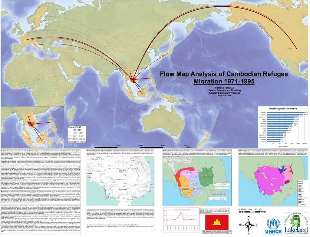
GIS poster project by Lakeland Community College Geography student Caroline Petersen on Flow Map Analysis of Cambodian Refugee Migration, 1976-1995
GIS project by Lakeland Community College Geography student Caroline Petersen on Flow Map Analysis of Cambodian Refugee Migration, 1971-1995


How increased visibility is essential to program viability

As with many geography programs, maintaining strong enrollments is the foremost challenge the program faces, and the COVID-19 pandemic has only added to the difficulty of recruiting and retaining students. However, Oliver and other program leaders have developed innovative solutions to attracting students, by exploring opportunities with other departments on campus, leveraging a dual enrollment program with area high schools, and making ongoing efforts to increase the program’s visibility on campus and in the community.

For our program to be successful, we have to make sure that people see what we’re doing, and how it impacts our community. Making sure the campus is aware that we’re here and [that] what we do is very essential—especially when it comes to [LCC’s] enrollments and long-term viability.

—Bobby Oliver


Video of LCC alumni Caroline Peterson sharing her experience in the LCC GIS program and how she uses those skills in her career.

An annual GIS Day event, Women in GIS luncheons, presentations to the Math Club and Model U.N., and collaborative projects with other departments across campus have all helped to highlight the program’s value. “We’re really trying to get the students to see how our community and region use GIS, and how geographic and geospatial skills are used in real jobs,” says Oliver. “These are the things that I feel really put us ahead, for a two-year program.”

    Share

Program Profile: Salisbury University – GIS

Photo of Michael Scott
Michael Scott

GIS has been taught at Salisbury University since at least the early nineties, says Dr. Michael Scott, a graduate of the Department of Geography and Geosciences and now a professor in the department and dean of the Henson School of Science and Technology. Continuing the success of their GIS program, in 2007, the department expanded into graduate education with their M.S. in GIS Management (MSGISM).   

Photo of Andrea Presotto
Andrea Presotto

“We realized that our students were doing very well in terms of finding employment and working in the field,” said Dr. Andrea Presotto, director of the MSGISM. “But the organizations they worked for were not particularly strategic about managing their GIS implementations.”   

The new M.S. program was conceived as a combination MBA and GIS degree, to better equip students with the skillsets necessary to become not only effective GIS practitioners, but also address this gap in data management and become leaders in public administration, grant writing, enterprise operations management, and a host of other skills beyond the technical level. This outside-the-box thinking and response to employment realities have elevated the program to one of the most respected departments on campus.  

A Regional Approach

On Maryland’s Eastern Shore, agriculture, tourism, fisheries, residential and commercial development all face challenges in response to increasing climate change. The Department of Geography and Geosciences at Salisbury University has positioned itself as a big part of the solution for the communities in the region. In 2004, department faculty formed the Eastern Shore Regional GIS Cooperative (ESRGC), which Dr. Scott directs, to help organize the region’s small towns to pool their resources for much-needed GIS project support.    

“One small town doesn’t have the ability for a GIS staff to do data collection and analysis. If you put seven or eight little towns together, suddenly there are enough resources to hire somebody to actually get that done,” explains Scott.    

[Our students] are able to get this very intensive, on-the-job experience, but the only way that works, of course, is the ESRGC has to know that the quality of the students getting GIS education coming out of the department is great, because they’re going to put them right to work.”

—Michael Scott

An outreach unit of Salisbury University and joint effort between a collection of Maryland Eastern Shore regional councils and the university, the ESRGC has grown to include 10 full-time staff, nine of whom are alumni of the department. In good years, Scott estimates that the cooperative hires anywhere from 25 to 30 interns from the department, where they acquire the invaluable real-world experiences and skills needed to move directly into professional GIS positions, even before they graduate.  

“[Our students] are able to get this very intensive, on-the-job experience,” Salisbury University’s Dr. Michael Scott explains, “but the only way that works, of course, is the ESRGC has to know that the quality of the students getting GIS education coming out of the department is great, because they’re going to put them right to work.”

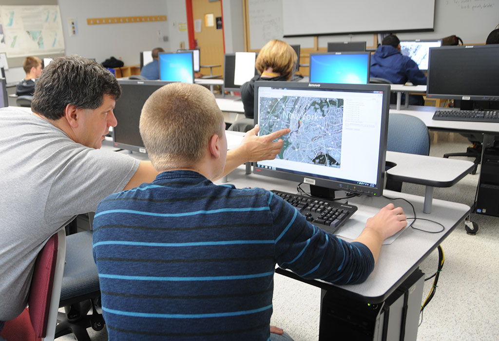
Photo of students in a Salisbury University GIS class demonstrating mapping on their computers
Photo courtesy Salisbury University

If you build it, they will come…

Students and alumni of the Department of Geography and Geosciences have earned an excellent reputation throughout the region, a credit to the dedication of the department’s faculty, and their student-centered approach. As Dr. Art Lembo, a professor in the department and Technical Director of the ESRGC explains, this starts with the physical building itself:   

“We requested the faculty offices be located in an off-hallway suite that allows our doors to be open all the time, so the students can better interact with the faculty. We made structural changes to accommodate better interaction, because it’s just in our DNA to give the students this kind of experience.”  

It trickles into [our students] bringing their friends, who can become majors as well.”

—Dr. Andrea Presotto

Dr. Dan Harris, a professor and chair of the department, notes that unlike other academic buildings on campus, which typically close at midnight, the Geography and Geosciences faculty years ago made a special request to the president of the university to allow the department lab to remain open 24 hours to provide students with the opportunity to be in the building at any time. This level of attention to detail concerning the physical learning space is representative of the student-first, innovative thinking that has set the program apart.    

“It trickles into [our students] bringing their friends, who can become majors as well,” Dr. Andrea Presotto, Geography and Geosciences professor at Salisbury University.   

Photo of Dan Harris
Dan Harris

“We have faculty who are really good at getting [undergraduate students] in for field courses, and we embed field experiences in their classes. It’s really important to show the students that it’s not just a discipline where we come in and lecture in a classroom, and you walk away and read a textbook. We actually want them to get out and see it,” says Dr. Dan Harris, department chair.

    Share

Keaton Shennan

Education: MS in Geographic Information Science (San Diego State University), BS in Architecture (University of Colorado Denver)

The following profile was compiled by Jessica Embury (San Diego State University) for the Encoding Geography initiative. To learn more, visit: https://www.ncrge.org/encoding-geography/


Please describe your job, employer, and the primary tasks that you perform in your position. 

I am currently a GIS web developer for a mid-sized engineering firm of about 600 people that has offices in Minnesota, Texas, and Colorado. My primary tasks are geospatial scripting for various locations and tracking different types of assets, like cranes and street sweepers. I also work on web mapping applications that are generally used by cities and counties to manage tax data, parcel data, or stormwater information. I work on other applications for the oil and gas industry, like helping manage location audits and tracking different types of surveys on job sites throughout Texas.   

Previously, I’ve worked on EPA projects, like a common operating picture, which was essentially an emergency response platform. It had various assets and information brought into it regarding wildfires and other things. I’ve also worked on geospatial scripting for generating time enabled smoke imagery mosaics where I took cams and files from the Forest Service’s Blue Sky platform and translated that into a time enabled hosted and managed service. 

Other projects I’ve worked on were Native American tribal nations software, like central data management systems for managing water quality, collecting surveys from research scientists, and managing environmental cleanup. 

What is your educational background? How did you initially discover geocomputation and why did you ultimately choose a career that uses geography and computer science? 

My bachelor’s degree is in architecture and that’s where I was first introduced to GIS, in a natural hazards course. It’s how I got interested in wildfires and learning about GIS and what I could do with it. I also took an architectural cartography course which covered using GIS data to visualize changes in Denver, where I went to school.  

After working in architecture for a couple years, I just didn’t enjoy it and I always loved geography so I was hoping I could use some of my experience regarding planning, knowledge of fire, and building codes and somehow apply GIS to work with wildfires. Then, I completed my masters at San Diego State University and did my thesis on geovisualization and descriptive analysis of landscape level wildfire behavior using repeat pass airborne thermal imagery.  

During that time, I developed web applications for visualizing different attributes of landscapes and wildfire behaviors, such as reduced spread. I also did a descriptive analysis and worked on a couple other projects using GIS. 

I ultimately chose a career in geocomputation because I really liked the programming side of it. I thought it was an interesting and powerful skill set for being able to work with GIS data that not a lot of people have. I felt it also helped to have programming skills when I graduated and got into the job market. 

Is GIS usage widespread in architecture education and the industry? 

No, it is primarily used by planners but not really in architecture. If you work with site plans for master planning communities then you might get a little more experience. I worked in multifamily architecture so I got some experience using GIS to edit line work for a community master plan in Colorado, but that was the extent of it. Most architects I’ve met never use GIS. They do a lot of 3D modeling and data information modeling, but that’s about it.  

When you think about geography, what specific background knowledge and conceptual ideas are important and useful to know? 

Something that I feel is really under-represented in geographic education is learning how to work with coordinate systems and geographic versus projected coordinate systems. I run into a lot of issues in my job where people aren’t familiar with those concepts and then they don’t understand why certain tools aren’t working or what data processes are happening.  

Working with different data types and understanding how a database is structured is really helpful, but that’s more specific to a development role. Also, being familiar with common tools and processes for editing vector data and evaluating the accuracy of GPS data. I think having familiarity with GIS and data standards are the most important for a geospatial developer.  

When thinking about computer science, what specific background knowledge and conceptual ideas do you think are important and useful to know? 

For a web GIS developer, understanding how websites work is important,  like what happens when you type in a URL and how data is tasked between different services. For example, if you have a GIS server instance, how do you get data from that? A broad level of knowing how a REST API works is really important and critical for using geospatial data in websites. Also, having a general understanding of relational databases and becoming comfortable with certain programming languages are big skills.  

What procedural knowledge do you think is important and useful to know, from either geography or computer science? 

From geography, or the computer science side of geography, I think it’s really important to be familiar with Esri products like ArcGIS Pro or ArcDesktop, because those are widely used, especially in cities and municipalities. Then, understanding what Esri portal and enterprise are and how to use ArcGIS Online. Even as a developer, I use those tools all the time.  

Getting a little more into the computer science part, it is important to know how to use ArcPy and the ArcGIS Python API, as well as open source software. I haven’t used QGIS recently but I think that’s a good one to learn if you don’t have access to other GIS. Then, being familiar with libraries such as GDAL and OGR for Python is really helpful. Also, knowing how to set up a PostGIS database is a specific skill that’s really helpful for the computer science part. I mainly work with Javascript, Typescript, Python, a little bit of C# (C-Sharp).  

With web development, I also use HTML and CSS. If you’re going to be a web developer, you need to know the basics of vanilla JavaScript, which is what they call using JavaScript without a framework. Understanding how to make a call to a REST endpoint and how to get data from a host or feature service is really important. Generally understanding the life cycle, like a promise in JavaScript is important, so if you get data you’re leaving that response. Then understanding the DOM, the document object model, and how that works. Essentially, how is an html page structured and then, depending on what resources you use, knowing a rest API and how that works. You could also look into a soap API which uses xml. I did run into that a little bit, especially larger scale stuff. We essentially had a big repository for data that was used by Federal Government employees and now it’s translated from xml. So that’s the specific programs stuff.  

Then, for Python, you should know some of the big geospatial libraries and know when it’s appropriate to use certain things and that just takes time. Then, if you want to get a job, it’s helpful to know a framework and have something that you’ve built, have examples of work that you’ve done, no matter how small they are, but have examples of a small portfolio and if you can explain what’s happening behind the scenes – then that’s pretty critical to getting a job in the field. 

What is an example of a social, economic, environmental or other issue that you recently investigated in a project at work? 

We work mostly with environmental issues. I’m currently working on a stormwater asset management program so it uses some hydrological modeling that’s above my head, but essentially it’s a program which can forecast when stormwater basins and ponds will need maintenance, so preserving stormwater ponds in different communities throughout Minnesota.  

Another project I worked on is the EPA common operating picture, and for that I worked on a few different widgets and a web map and one of them, for environmental data, was that smoke mosaic data. We set up a script to run every 24 hours and update daily [to] provide information on particle density for smoke over California, Nevada, and a couple other states in the southwest US. Another component of that was tracking active fire perimeters and if there were active fire parameters within 10 miles of an EPA facility, [then] that would notify people. 

What kind of geographic or computational questions did you ask and think about during your project? 

I’ll talk about the smoke data because that’s really interconnected with air quality, which can be interconnected to a lot of other social and environmental issues related to people who are disproportionately affected by that. The question is, from a technical standpoint, how do we transform these cams and the files into something that’s useful and time-enabled? Then, how do we convey that knowledge to somebody who doesn’t have a GIS background? And how can we make it useful at the scale? So the scale of this data is multiple states, the lower 48 states of the contiguous U.S..  

Knowing how to resample that imagery was important, so how do we make sure that it’s an appropriate scale and spatial resolution for the task at hand? Then, that kind of blended into programming, so this would be kind of a classic geospatial scripting – You’re transforming the data, so you first need to get the data, so you make a request to that site and get the data, unzip it, then you need to organize it. For that dataset we had times in each image file name, so you could just use Python to pull out the dates, and then you need to transform it into the correct projection. You need to reproject those rasters and then, once you do that, you can look at the different types of resampling that you can do. Then, once you have all your data finished and you finished the processing of your data, you then need to work on the final product. So you kind of have these iterative steps to clean the data, get it in a format you want, and make sure it’s displaying correctly at an appropriate spatial resolution or appropriate coordinate system. 

And then, once that’s done, you can do the final task, which is essentially creating an image service that you can just put in a web app that has time enabled on it, which is an Esri specific thing, because if you enable time on this image layer, then you can use all these different filtering tools to visualize the data. 

What types of data did you acquire to support your project? If possible, please identify up to three data sets you utilize the most. 

So we used the BlueSky daily runs from the WebSky platform from the United States Forest Service, which is a research model that they generate for different regions in the U.S.. 

https://tools.airfire.org/websky/v2/#status  

For the EPA, we used a couple different datasets. I don’t know how much I can talk about that, but we did use the classic U.S. main fire perimeter data: the NIFC current wildfire perimeters data set. Currently, we use a lot of parcel tax data, so that’s more specific to city and county level, but I would say we work with that the most. 

What type of content knowledge and skills did you use to evaluate, process, and analyze the data that you gathered for your project? 

For the remote sensing part of that project, it was about understanding the different types of interpolation, such as nearest neighbor, and resampling methods for raster data. Also, being able to identify your destination coordinate system and apply any projections that you need.  

Content knowledge and skills specifically for programming would be understanding how to use Open Source  geoproducts, so in that case it was GDAL to work with raster data. Then principles for more general types of skills like Python programming and using Jupyter notebooks or ArcGIS notebooks to schedule a task to run every 24 hours to get new data and republish the image service. 

As a developer, I get a lot of hard skills but the soft skills can be ignored a little bit. The most important thing I’ve learned is being able to explain to somebody why something is important if they don’t have a background in GIS and being able to distill the work you’re doing and provide a high level summary. That’s something we have to do all the time. An example of this would be when I built a continuous integration continuous development pipeline for a client. What this does is it builds their application tests and it deploys it to wherever they want automatically. So I had to be able to distill this really technical process of backing up and restoring databases and running certain types of integration tests to a client that doesn’t really have a strong computer science background and I’m just a GIS technician. That was for a Tribal Nations organization. So how you distill that knowledge upwards and explain what you’re doing and why it’s meaningful is the most important part of this process. 

How did you apply geography and computer science to communicate the results of your project? Do you have a recent product or publication that you can share as an example? 

I primarily use web applications. I don’t usually use maps very often, unless they’re embedded in a web application. So I do a lot of mapping applications where geovisualization is an important part of that.   

How to display data in a meaningful way is always important, even at city levels, if they have huge data sets, like a lot of utility data sets and storm water and sewer and parcel. A lot of them have tons of data, so how do you display that data in a way that doesn’t get super cluttered or confusing? 

For a recent product, we have a public facing web page. This is another product for oil and gas. There is a video on this website that does a little walkthrough: 

https://www.wsbeng.com/expertise/technology/solutions/datafi/ 

WSB Engineering and Innovate! Inc. are the two companies I’ve worked for. I wanted to work in-person. I think it is important to have that in-person mentorship as a developer. 

Reflecting on your work, how does it align with your personal values and your community or civic interests? 

I’ve been able to explore some environmental issues that generally align well with my personal values. I feel like I get to make a positive impact, and even with fields and sectors of oil and gas that I wouldn’t necessarily see myself working in, I like that I get to help with environmental compliance and making sure that field workers are safe and sticking to appropriate procedures.  

I really enjoyed the work I did for the Environmental Protection Agency. That’s probably been the highlight so far – being able to work for an agency that I admire. Being able to work with the Forest Service is great too. Most of my work is related to environmental issues, which I’m passionate about, but it would also be great to use this data for other civic or social justice projects to see how GIS data can be useful for that.  


This material is based upon work supported by the National Science Foundation under Grants No. 2031418, 2031407, and 2031380 (Collaborative Research: Encoding Geography – Scaling up an RPP to achieve inclusive geocomputational education). Any opinions, findings, and conclusions or recommendations expressed in this material are those of the author(s) and do not necessarily reflect the views of the National Science Foundation 
 

    Share

Tom Paper

Education: B.A. in Economics (Williams College), M.B.A. in General Management (Stanford University)

The following includes an interview conducted with two colleagues at Webster Pacific. Although the conversation with both Tom Paper and William Blomstedt is included below, a duplicate profile is also available for William Blomstedt, who is GIS Expert and Project Manager at Webster Pacific.

It was compiled by Jessica Embury (San Diego State University) for the Encoding Geography initiative. To learn more, visit: https://www.ncrge.org/encoding-geography/


Please describe your job, employer, and the primary tasks that you perform in your position. 

Tom Paper (TP): Our company is Webster Pacific and we provide analytical consulting services. We’ve been in business for almost 20 years and our clients are in a wide range of industries. I used to be a strategy consultant at Bain and Company a long time ago.   

We use tools like Python, ArcGIS, Tableau/PowerBI, CRM/ERP, Cloud Databases, and SQL Server to perform coding, geo-analysis, marketing analytics, web scraping/research, interviewing, and financial analysis. I can’t use any of these programs but I understand the logic of all the work that we do, much of which is geocomputational. 

William, do you want to add anything? You have a background in geoscience. 

William Blomstedt (WB): I studied geography as an undergrad and then I did a master’s course in GIS so I came to the field that way. Tom, geospatially, you only started more recently doing geospatial stuff? The work evolved to geospatial analysis. 

TP: That’s right, seven years ago, one of our clients – a private school based in Manhattan – wanted to open up schools in cities all over the world and asked us to help them analyze cities as opportunities for locating new schools. And that’s what launched us. We evolved our geospatial capabilities for this particular client to help other clients and other schools think geospatially about new locations. We just helped a preschool in Washington DC and we also helped a private school think about why a location in San Francisco had not been performing as well. 

What is your educational background and how did you initially discover geocomputation and ultimately choose a career using geography and computer science? 

TP: My background was liberal arts. I studied economics and environmental studies at Williams and so I don’t know whether the career chose me or if I chose the career. It feels a little bit like it chose me. I think for William – he chose it, he was more curious geospatially early on.  

In the last five years, pretty much since we started geospatial analytics, I got interested in antique maps and that process of discovery. I think there’s a very real thread between our work and the kind of work that people did to think about exploration. For example, I have a map of California as an island from the 17th century. I think it was George Box who said, “All models are wrong, but some are useful.” Examples of things being wrong fascinate me because we see that every day, or we know our models are wrong, but the question is whether they are helpful. 

When thinking about geography, what specific background knowledge and conceptual ideas do you think are important and useful? 

TP: I think that the ability to think in the weeds and then to think about the forest is the most important skill that we have. To be able to go back and forth between details and the big picture. I don’t have a geographic education but I think that ability is critical to what we do every day.  

WB: When I was choosing to go to school to pursue geography, someone told me that you could take a GIS course that just teaches you how to use the program and do GIS. However, they advised me to go to a course where you do a thesis where you have to solve a problem, and GIS is the tool. Instead of just learning the tool, you need to use the tool to do something with it and think about the big picture, rather than just doing geographical analysis. 

When thinking about computer science, what specific background knowledge and conceptual ideas do you think are important and useful? 

TP: I think the willingness to accept that you don’t know everything and that there are things that we still learn. Repeatedly, we learn things and how to do things that we didn’t know before, so I think the willingness to accept that you don’t know everything is critically important.  

Can you mention any procedural knowledge that you think is particularly useful from the standpoint of either geography or computer science? 

TP: We see geography and computer science, or geospatial, like they’re melded together: geography and computer science and our use of programs.  

We use Excel and Google Sheets all the time because it’s how we get into the details and also get to the big picture. Now we’ve had a lot of young people join our firm and want to use Python instead of Excel. I’m not sure I would say that I have embraced it, but I can see the power of it. No matter how programmatic they get, it is important that our team understands how to come back to the larger questions and more conceptual ways of displaying what we’re doing.  

We’re fortunate in the sense that we are driven by our client and their strategy. Every client has a different definition of what is a customer to them and their market position. The priorities are the activities that support that market position and determine who is a customer, and how to spatially define a customer in a particular space. We often think about time. We do find that mileage is not good because a mile in New York City and a mile in Los Angeles are very different due to the time it takes people to get to and from things.  

What’s an example of a social, economic, environmental or other issue that you recently investigated in a project? 

TP: Our client wanted to find a location within a metropolitan area and the customers who would go to their store. Customers are only willing to travel so far. So we wanted to locate in a place where there’s more demand than competing supply for this company. We created a map to show demand and supply in the market. The basic point was to figure out where there’s more demand than supply. Geospatially, where does that exist? We took the demand and subtracted out the supply to get our answer. If all you were doing was looking at the demand, you’d get an answer that looks very different.  

What kind of questions did you ask and think about during this project? 

WB: It’s all about location, place, and interconnection. If we need to write a code or an algorithm, we do it to either iterate faster or to make a model. For a simple supply model, we can say the supply is all in one point. In a more complex model, we will say the supply is not exactly in that point but it’s around that point (e.g. within 10 minutes) and so we have to build a model which spreads that supply out and then computationally figure out where all the supply is.  

What types of data did you acquire to support your project, and are you able to identify up to three data sets that you use frequently? 

TP: We use Census data a lot.  

WB: American Community Survey. 

TP: We use lists of schools or stores on the web. Our client will also have data about their customers and information that we will integrate into our analysis.   

But Census data is by far the biggest one. For the census data, we deal with shapefiles. Sometimes we get data by Block Group, Census Tract, county, or something else. Then, we have to turn that data into data that meshes with us.   

We use road network data sometimes. We used to build our own road networks, and now we use outside services who have data about traffic speeds. Road networks are really important to conceptualize something timewise. Sometimes we’ve thought about not just drive time but walk time or subway time. We analyzed some things in Tokyo once and we had to make a road network, if you will, that was based upon subway travel times. 

What types of content knowledge and skills did you use to evaluate, process, and analyze the data you gathered for your project? 

TP: I have a whole presentation, called the consulting toolkit, about the kinds of thinking that we have to go through to work successfully. People don’t necessarily know all the data that they’re going to need and they don’t necessarily have all the skills to solve a problem, so being able to pick things up quickly is really important.  

We’ve talked in our firm about letting the data guide you and being careful to let the data explain to you what it says. Our customers have questions and we need to be careful to not over interpret the data or over explain the data.   

We always have to look at the work that we’ve done and ask whether it makes sense. Sometimes it doesn’t make sense because we made a mistake. There are so many calculations involved in what we do, so we need to go back and see if we made a mistake. For example, William and I just got through with a particular city and there was a pocket of demand close to the core area. It didn’t make sense to us that it would exist there, so we went back and checked the calculations and discovered that there was a river creating a barrier. So, in this case, there was a geospatial reason.   

How did you apply geography and computer science to communicate the results of your project?  

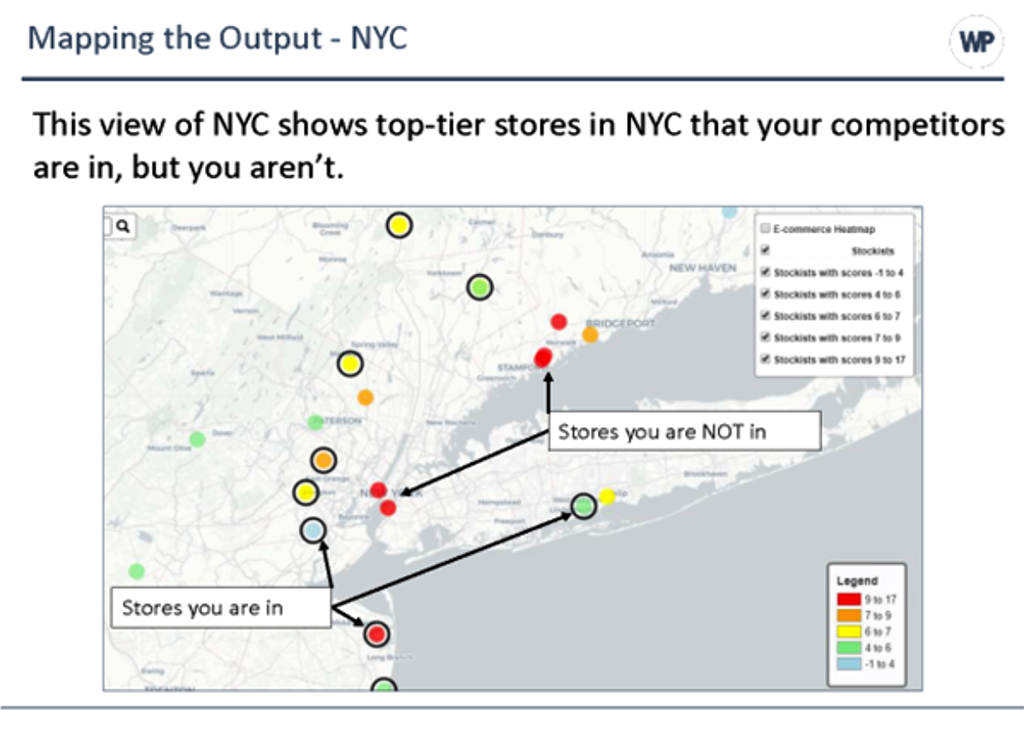
Webster Pacific map showing a retail fashion client a comparison of the stores in which they and their competitors are located.

TP: This map is for a retail fashion company. They sell their products to wholesalers who resell the product to consumers. They wanted to know which stores (wholesalers) they should sell their product to, so we found out where the competitors were located. 

That’s the coloration of the dots. Every dot is a store and the reddest dots have the most competitors located inside of them. The black circle around the dots indicate stores where our client is located. Our client was in only one store where there were a whole bunch of competitors and they were in a lot of stores with smaller numbers of competitors. So maybe the client should be in the other red dots, whereas we might not want to be in these green stores as much. 

So this is an example about displaying our results. We try to think about the ease with which somebody who knows nothing about this could understand it. How hard are we making the viewer work to understand our results and how much mental effort do they have to expend? That’s an information design problem. It’s a bit of an art and a science. The best presentations are the ones that take the least effort to understand while still projecting the appropriate amount of complexity. You have to get the answer across with the least amount of work for the viewer. 

Reflecting on your work, how does it align with personal values and community or civic interests? 

TP: We work for clients who want to serve their customers and make money, and I appreciate helping our clients and being paid for doing that work. Are we saving the world with our work? Probably not, but we are supporting ourselves, our families, and our clients. There are certain clients that I wouldn’t work for because their values don’t align with ours.  

I feel good about our work. We have a great team that appreciates the adventure, discovery, and services that we give to our clients. We have school clients and we’re proud of helping them do a better job of educating their students.  

We get paid to do this really interesting work. I tell people I don’t travel around the world physically, but I do in my brain. We get to discover things and we learn – and that is part of the great wonder and joy of this work. We get to learn all the time. There are all sorts of discoveries happening in these realms that I think equate back to when these people were making antique maps and discovering the shape of California. We’re discovering the shape of things that exist. Where is our demand? Where are our competitors? Where should we go? Where should we advertise? So there’s discovery, and that’s fun. 


This material is based upon work supported by the National Science Foundation under Grants No. 2031418, 2031407, and 2031380 (Collaborative Research: Encoding Geography – Scaling up an RPP to achieve inclusive geocomputational education). Any opinions, findings, and conclusions or recommendations expressed in this material are those of the author(s) and do not necessarily reflect the views of the National Science Foundation 
 

    Share

William Blomstedt

Education: Bachelor’s degree in Geography (Dartmouth University), MSc in Geographical Information Science (University of Edinburgh)

The following includes an interview conducted with two colleagues at Webster Pacific. Although the conversation with both William Blomstedt and Tom Paper is included below, a duplicate profile is also available for Tom Paper, who is Managing Partner at Webster Pacific.

It was compiled by Jessica Embury (San Diego State University) for the Encoding Geography initiative. To learn more, visit: https://www.ncrge.org/encoding-geography/


Please describe your job, employer, and the primary tasks that you perform in your position. 

Tom Paper (TP): Our company is Webster Pacific and we provide analytical consulting services. We’ve been in business for almost 20 years and our clients are in a wide range of industries. I used to be a strategy consultant at Bain and Company a long time ago.   

We use tools like Python, ArcGIS, Tableau/PowerBI, CRM/ERP, Cloud Databases, and SQL Server to perform coding, geo-analysis, marketing analytics, web scraping/research, interviewing, and financial analysis. I can’t use any of these programs but I understand the logic of all the work that we do, much of which is geocomputational. 

William, do you want to add anything? You have a background in geoscience. 

William Blomstedt (WB): I studied geography as an undergrad and then I did a master’s course in GIS so I came to the field that way. Tom, geospatially, you only started more recently doing geospatial stuff? The work evolved to geospatial analysis. 

TP: That’s right, seven years ago, one of our clients – a private school based in Manhattan – wanted to open up schools in cities all over the world and asked us to help them analyze cities as opportunities for locating new schools. And that’s what launched us. We evolved our geospatial capabilities for this particular client to help other clients and other schools think geospatially about new locations. We just helped a preschool in Washington DC and we also helped a private school think about why a location in San Francisco had not been performing as well. 

What is your educational background and how did you initially discover geocomputation and ultimately choose a career using geography and computer science? 

TP: My background was liberal arts. I studied economics and environmental studies at Williams and so I don’t know whether the career chose me or if I chose the career. It feels a little bit like it chose me. I think for William – he chose it, he was more curious geospatially early on.  

In the last five years, pretty much since we started geospatial analytics, I got interested in antique maps and that process of discovery. I think there’s a very real thread between our work and the kind of work that people did to think about exploration. For example, I have a map of California as an island from the 17th century. I think it was George Box who said, “All models are wrong, but some are useful.” Examples of things being wrong fascinate me because we see that every day, or we know our models are wrong, but the question is whether they are helpful. 

When thinking about geography, what specific background knowledge and conceptual ideas do you think are important and useful? 

TP: I think that the ability to think in the weeds and then to think about the forest is the most important skill that we have. To be able to go back and forth between details and the big picture. I don’t have a geographic education but I think that ability is critical to what we do every day.  

WB: When I was choosing to go to school to pursue geography, someone told me that you could take a GIS course that just teaches you how to use the program and do GIS. However, they advised me to go to a course where you do a thesis where you have to solve a problem, and GIS is the tool. Instead of just learning the tool, you need to use the tool to do something with it and think about the big picture, rather than just doing geographical analysis. 

When thinking about computer science, what specific background knowledge and conceptual ideas do you think are important and useful? 

TP: I think the willingness to accept that you don’t know everything and that there are things that we still learn. Repeatedly, we learn things and how to do things that we didn’t know before, so I think the willingness to accept that you don’t know everything is critically important.  

Can you mention any procedural knowledge that you think is particularly useful from the standpoint of either geography or computer science? 

TP: We see geography and computer science, or geospatial, like they’re melded together: geography and computer science and our use of programs.  

We use Excel and Google Sheets all the time because it’s how we get into the details and also get to the big picture. Now we’ve had a lot of young people join our firm and want to use Python instead of Excel. I’m not sure I would say that I have embraced it, but I can see the power of it. No matter how programmatic they get, it is important that our team understands how to come back to the larger questions and more conceptual ways of displaying what we’re doing.  

We’re fortunate in the sense that we are driven by our client and their strategy. Every client has a different definition of what is a customer to them and their market position. The priorities are the activities that support that market position and determine who is a customer, and how to spatially define a customer in a particular space. We often think about time. We do find that mileage is not good because a mile in New York City and a mile in Los Angeles are very different due to the time it takes people to get to and from things.  

What’s an example of a social, economic, environmental or other issue that you recently investigated in a project? 

TP: Our client wanted to find a location within a metropolitan area and the customers who would go to their store. Customers are only willing to travel so far. So we wanted to locate in a place where there’s more demand than competing supply for this company. We created a map to show demand and supply in the market. The basic point was to figure out where there’s more demand than supply. Geospatially, where does that exist? We took the demand and subtracted out the supply to get our answer. If all you were doing was looking at the demand, you’d get an answer that looks very different.  

What kind of questions did you ask and think about during this project? 

WB: It’s all about location, place, and interconnection. If we need to write a code or an algorithm, we do it to either iterate faster or to make a model. For a simple supply model, we can say the supply is all in one point. In a more complex model, we will say the supply is not exactly in that point but it’s around that point (e.g. within 10 minutes) and so we have to build a model which spreads that supply out and then computationally figure out where all the supply is.  

What types of data did you acquire to support your project, and are you able to identify up to three data sets that you use frequently? 

TP: We use Census data a lot.  

WB: American Community Survey. 

TP: We use lists of schools or stores on the web. Our client will also have data about their customers and information that we will integrate into our analysis.   

But Census data is by far the biggest one. For the census data, we deal with shapefiles. Sometimes we get data by Block Group, Census Tract, county, or something else. Then, we have to turn that data into data that meshes with us.   

We use road network data sometimes. We used to build our own road networks, and now we use outside services who have data about traffic speeds. Road networks are really important to conceptualize something timewise. Sometimes we’ve thought about not just drive time but walk time or subway time. We analyzed some things in Tokyo once and we had to make a road network, if you will, that was based upon subway travel times. 

What types of content knowledge and skills did you use to evaluate, process, and analyze the data you gathered for your project? 

TP: I have a whole presentation, called the consulting toolkit, about the kinds of thinking that we have to go through to work successfully. People don’t necessarily know all the data that they’re going to need and they don’t necessarily have all the skills to solve a problem, so being able to pick things up quickly is really important.  

We’ve talked in our firm about letting the data guide you and being careful to let the data explain to you what it says. Our customers have questions and we need to be careful to not over interpret the data or over explain the data.   

We always have to look at the work that we’ve done and ask whether it makes sense. Sometimes it doesn’t make sense because we made a mistake. There are so many calculations involved in what we do, so we need to go back and see if we made a mistake. For example, William and I just got through with a particular city and there was a pocket of demand close to the core area. It didn’t make sense to us that it would exist there, so we went back and checked the calculations and discovered that there was a river creating a barrier. So, in this case, there was a geospatial reason.   

How did you apply geography and computer science to communicate the results of your project?  

Webster Pacific map showing a retail fashion client a comparison of the stores in which they and their competitors are located.

TP: This map is for a retail fashion company. They sell their products to wholesalers who resell the product to consumers. They wanted to know which stores (wholesalers) they should sell their product to, so we found out where the competitors were located. 

That’s the coloration of the dots. Every dot is a store and the reddest dots have the most competitors located inside of them. The black circle around the dots indicate stores where our client is located. Our client was in only one store where there were a whole bunch of competitors and they were in a lot of stores with smaller numbers of competitors. So maybe the client should be in the other red dots, whereas we might not want to be in these green stores as much. 

So this is an example about displaying our results. We try to think about the ease with which somebody who knows nothing about this could understand it. How hard are we making the viewer work to understand our results and how much mental effort do they have to expend? That’s an information design problem. It’s a bit of an art and a science. The best presentations are the ones that take the least effort to understand while still projecting the appropriate amount of complexity. You have to get the answer across with the least amount of work for the viewer. 

Reflecting on your work, how does it align with personal values and community or civic interests? 

TP: We work for clients who want to serve their customers and make money, and I appreciate helping our clients and being paid for doing that work. Are we saving the world with our work? Probably not, but we are supporting ourselves, our families, and our clients. There are certain clients that I wouldn’t work for because their values don’t align with ours.  

I feel good about our work. We have a great team that appreciates the adventure, discovery, and services that we give to our clients. We have school clients and we’re proud of helping them do a better job of educating their students.  

We get paid to do this really interesting work. I tell people I don’t travel around the world physically, but I do in my brain. We get to discover things and we learn – and that is part of the great wonder and joy of this work. We get to learn all the time. There are all sorts of discoveries happening in these realms that I think equate back to when these people were making antique maps and discovering the shape of California. We’re discovering the shape of things that exist. Where is our demand? Where are our competitors? Where should we go? Where should we advertise? So there’s discovery, and that’s fun. 


This material is based upon work supported by the National Science Foundation under Grants No. 2031418, 2031407, and 2031380 (Collaborative Research: Encoding Geography – Scaling up an RPP to achieve inclusive geocomputational education). Any opinions, findings, and conclusions or recommendations expressed in this material are those of the author(s) and do not necessarily reflect the views of the National Science Foundation 
 

    Share

Chaz Olloqui

Education: Bachelor’s degree in Geography: Geographic Information Science (San Diego State University)

The following profile was compiled by Jessica Embury (San Diego State University) for the Encoding Geography initiative. To learn more, visit: https://www.ncrge.org/encoding-geography/


Please describe your job, employer, and the primary tasks you perform in your position.  

I am a GIS Specialist at the City of Oceanside Water Utilities Department. I am directly responsible for coordinating the collection of data among various departments and teams and managing the data collected. I often automate tedious tasks in order to build efficient workflows and processes for the collection of data and presentation of information.    

What is your educational background? How did you initially discover geocomputation  and why did you ultimately choose a career that uses geography and computer science?  

I chose to pursue an education in GIS because I was interested in making a positive change in our natural environment. I had aimed to leverage GIS to strengthen my environmental studies and I had come to realize that it was extremely important to have a technical skill set. It was not enough to know how to make maps and I began to learn python coding. This is when I realized the importance of data design and I expanded my toolset by learning SQL. These skills could be applied to many different fields of study, and I utilize them daily in local government.   

When thinking about geography, what specific background knowledge and conceptual ideas are important and useful to know?  

Knowing the fundamentals of Geographic and Projected coordinate systems can be useful when handling data. This is a foundational GIS concept but can be more complex than some GIS professionals would like to admit.    

When thinking about computer science, what specific background knowledge and conceptual ideas are important and useful to know?  

Data design is key. The correct data types must be considered when attempting to integrate computer science with GIS programs like Esri software.   

What procedural knowledge is important and useful to know, from either geography or computer science?   

Data cleanliness is important and having standard operating procedures for the collection of that data can make the difference between having reliable or unreliable data.  

What is an example of a social, economic, environmental, or other issue that you have recently investigated in a project at work?  

I assisted the Homeless Outreach Team in developing a survey application to better identify homeless individuals who are qualified for assistance programs. The surveys are submitted to a database and have auto-calculated fields using SQL triggers to help create more usable and robust datasets so that decision makers are more informed.   

What types of questions did you ask and think about in your project? 

I was interested in identifying hot spots of homelessness within the city and why those areas are as such. Temporal scales were considered when designing the dataset in order to have a better snapshot of the current situation. Surveys older than six months are archived using scheduled scripts. Analysis of regional interconnectedness is ongoing, and many questions are beginning to arise, both geographically and programmatically.    

What types of data did you acquire to support your project? If possible, please identify up to three datasets you utilize most.  

We utilized zoning datasets to identify responsible agencies that are required to respond to homeless activity. Districting datasets were also utilized to assign volunteers to regions of the city with more homelessness during the homeless point-in-time count.   

What types of content knowledge and skills did you use to evaluate, process, and analyze the data you gathered for your project?  

While analyzing the survey data, it was imperative that null and ‘declined’ values were accounted for to not skew the statistics. The data, or lack thereof, had to be presented succinctly.   

How did you apply geography and computer science to communicate the results of your project?  

I created an Esri Dashboard for the Homeless Outreach Team to view the live data collected in the field, which allows supervisors to observe homeless statistics and track their team’s progress.  

Reflecting on your work, how does it align with your personal values and your community or civic interests?  

I want to do everything I can to make my community better. I believe I have the power to influence change when leveraging my GIS skills and can apply my geographic and computational expertise to a multitude of different issues. 


This material is based upon work supported by the National Science Foundation under Grants No. 2031418, 2031407, and 2031380 (Collaborative Research: Encoding Geography – Scaling up an RPP to achieve inclusive geocomputational education). Any opinions, findings, and conclusions or recommendations expressed in this material are those of the author(s) and do not necessarily reflect the views of the National Science Foundation 
 

    Share

Hsiao-Chien Shih

Education: PhD in Geography (San Diego State University, UC Santa Barbara), MS in Geographic Information Science (San Diego State University), BA in Geography (National Taiwan Normal University)

The following profile was compiled by Jessica Embury (San Diego State University) for the Encoding Geography initiative. To learn more, visit: https://www.ncrge.org/encoding-geography/


Please describe your job, employer, and the primary tasks you perform in your position. 

I am a data scientist at E Source, a utility consulting firm that helps clients in a data-science-as-a-service manner. Our main task is to reduce power outage risk. My job tasks include acquiring, exploring, extracting, and transforming geospatial (and sometimes time series) data, including remotely sensed imagery, elevation, land cover, and utility assets as inputs for data science and modeling. In addition, I compile and aggregate the output risk in a geographic data format.  

What is your educational background? How did you initially discover geocomputation and why did you ultimately choose a career that uses geography and computer science? 

I am a geographer and I have doctoral, master’s, and bachelor’s degrees in Geography. My initial discovery of geocomputation came from an introductory level GIS course during my undergraduate period. I kept taking other geospatial courses, including remote sensing and spatial statistics. I found my abilities in math and reasoning made geocomputation attractive. Besides, geographic information represents real-world big datasets that can be used to solve real-world problems. Thus, I aimed to work in this field for my career. 

When thinking about geography, what specific background knowledge and conceptual ideas are important and useful to know? 

I tend to emphasize the absolute and relative geographic locations of a phenomenon, and then I shift my attention to the associated spatial distribution and temporal dynamics. The spatial-temporal process always attracts me, and I am interested in the background mechanisms of the process. For example, the spatial-temporal processes of urbanization were my dissertation topic. 

When thinking about computer science, what specific background knowledge and conceptual ideas are important and useful to know? 

Programming skills are critical for handling large amounts of data iteratively. Machine learning and its associated applications are critical to the work I perform. With the understanding of various sources of data and their caveats, I compile data to create critical inputs for machine learning. Finally, cloud computing is critical for the current job market due to the nature of largevolume geospatial data.  

What procedural knowledge is important and useful to know, from either geography or computer science? 

Knowing how to handle (read/write) geospatial data is necessary. Understanding approaches to analyze raster, vector, or point cloud data significantly contributes to the current utility consulting industry. 

What is an example of a social, economic, environmental, or other issue that you have recently investigated in a project at work? 

My colleague and I regularly work to estimate and reduce power outage risks due to environmental effects. We monitor vegetation growth based on remotely sensed data around utility assets, and then provide feedback to our clients for prioritizing vegetation management. To accomplish this task, we need to know how to compile remotely sensed, elevation, and other sources of data for monitoring the environment. Thus, knowledge of remote sensing, image processing, geometry calculation, spatial analysis, and machine learning are necessary.  

What kind of questions did you ask and think about during this project? 

For the above task, we consider the spatial scale and resolution of multiple sources of data. It is important to know how to incorporate data across multiple scales and what each scale represents in terms of the data source. We often calculate the relative location between any two objects to understand the risk of power outage. Therefore, calculating geometry is necessary. In addition, we need to know how to compile these data programmatically and we need to know some graph theory to boost the computation speed. 

What types of data did you acquire to support your project? Please identify up to three datasets you utilize most. 

Multiple sources of data are often used in our projects, and most of the data are publicly accessible. First, utility data will be used to define the geographic coverage of territories, and samples will be generated from the proximity areas of the data. We also use multiple sources of remotely sensed data, including Sentinel-2 and NAIP, as well as elevation data, such as LiDAR and the national hydrology dataset. Recently, we started using commercial satellite imagery (e.g. Planetscope data). 

What types of content knowledge and skills did you use to evaluate, process, and analyze the data you gathered for your project? 

Several skills are critical. First, knowledge of remote sensing and associated image processing approaches are necessary. Specifically, image spectrum analysis and image preprocessing are helpful. Second, machine learning knowledge is another must-have skill for data preparation and data quality confirmation, including classification and clustering. Finally, cloud computing is a nice-to-have skill because we often handle humongous amounts of data (e.g. AWS Sagemaker and S3). 

How did you apply geography and computer science to communicate the results of your project?  Do you have a recent product or publication that you could share with us as an example? 

We usually use python and QGIS for data visualization, and we use python for data compilation. Specifically, we rely on open-source python libraries (e.g.gdal) to handle geospatial data and create big data tables. Machine learning classification and regression are applied to estimate outage risks. Then, we create web-based apps to visualize the risk of power outage for our clients. 

Here is the link to our publication: https://www.esource.com/001201rt0d/data-science-company-improves-vegetation-management 

Reflecting on your work, how does it align with your personal values and your community or civic interests?  

I often think about how my learning during my undergraduate and graduate studies can contribute to a better world, especially in urban areas. The knowledge of remote sensing, GIS, and geocomputation perfectly helps me achieve the goal of moving the world toward a decarbonizing future. I am glad that I can apply my knowledge in the utility industry.  


This material is based upon work supported by the National Science Foundation under Grants No. 2031418, 2031407, and 2031380 (Collaborative Research: Encoding Geography – Scaling up an RPP to achieve inclusive geocomputational education). Any opinions, findings, and conclusions or recommendations expressed in this material are those of the author(s) and do not necessarily reflect the views of the National Science Foundation 
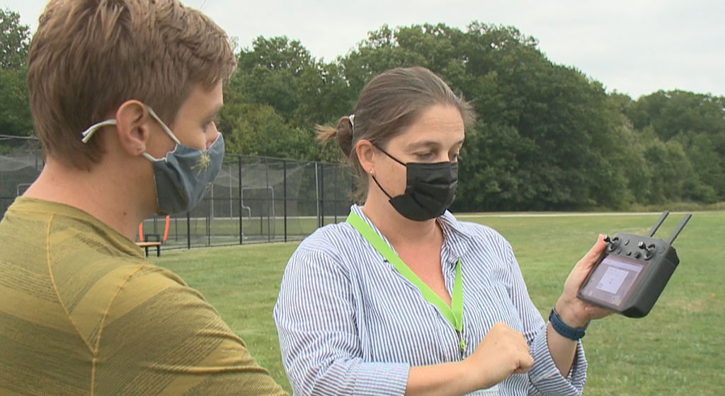
 

    Share

Carmen Leedham

Education: B.A. in Geography (San Diego State University)

The following profile was compiled by Jessica Embury (San Diego State University) for the Encoding Geography initiative. To learn more, visit: https://www.ncrge.org/encoding-geography/


Please describe your job, employer, and the primary tasks you perform in your position. 

I work for the County of San Diego, Health and Human Services Agency in the Office of Business Intelligence. The office I work for is a support department that works with other offices within the Health and Human Services Agency, such as Aging and Independent Services and Public Health Services. The primary tasks I perform revolve around GIS. I create static maps, web maps, and perform geospatial analysis to answer questions posed by leadership and my coworkers. For example, I performed geospatial analysis to convert tabular data into spatial data to answer, “How many CalFresh recipients live in each district in the County of San Diego?”  

What is your educational background? How did you initially discover geocomputation and why did you ultimately choose a career that uses geography and computer science? 

The people I met during my education have been instrumental in the trajectory of my career and have been very important to me. I first came into contact with geocomputation after completing a cultural geography course at Grossmont College with Professor Mark Goodman. He told me what a career in geography might look like and he encouraged me to enroll in an “Intro to GIS” course. At first, I did not understand anything, but the professors were so helpful and they made time for their students. I never had any computer classes in high school or middle school so learning how to work with a computer was very new to me. 

About a year later, I applied for an internship with the County of San Diego, Health and Human Services Agency in GIS. From there, I started to learn important skills, like how to work in a professional office, how to email people, and how to communicate with people in a professional setting. I started to really like it and see a life for myself working in GIS for a local government.   

At the time, I was 18 or 19 and I was going through a lot – I had unstable housing and food insecurity. I wasn’t sure how I was going to make it day-to-day or month-to-month. I saw GIS as a path to achieve the things I wanted: stable housing and a little bit of fun money. From that point forward, I started thinking about how to get a career in GIS as quickly as possible. In May 2019, I completed the GIS technician certificate of achievement at Mesa College – the requirement to get an entry level job in GIS with the County of San Diego. In September 2019, I got a full-time job with the County of San Diego in the Land Use and Environment Group. Since then, I’ve been with the County of San Diego, moving up and honing my skills in GIS.  

When thinking about geography, what specific background knowledge and conceptual ideas are important and useful to know? 

I feel like geography – both physical and cultural geography – cannot be separated from GIS or geocomputation. The foundation of geospatial analysis builds upon cultural and human relation to place and space throughout time. Likewise, GIS builds upon physical geography and knowledge of our surroundings.  

I mainly focus on cultural geography and the socioeconomic conditions of people within the Health and Human Services Agency of the County of San Diego. So, with geocomputation, we run the risk of turning people, plants, and places into numbers or into commodities and binaries. Through geography, we can return people from numbers and binaries back into real life things that have special life circumstances and value to one another.  

Conceptually, an understanding of sustainability should be gathered prior to working in geocomputation. Our actions have consequences, both positive and adverse, and this is something we should take into consideration in our day-to-day interactions. Our work always revolves around the three pillars of sustainability: people, profit, and planet.  

When thinking about computer science, what specific background knowledge and conceptual ideas do you think are important and useful to know? 

I recommend starting with the basics like: What are hard drives? What are the different types of hard drives and what do they do? What is the central processing unit of a computer? What’s a good one or a bad one? How much memory does the computer or device have?   

Then, you need to understand different types of software. Think about your needs and what software can meet the questions posed by your research. From there, you have to learn how to use the software. What file type does the software use? How are these files opened in the software? How are they saved on your computer?   

When I started GIS, I went to buy a laptop and I thought, “Okay, I need something that can handle the amount of data I’m going to be running and the strain I’m going to be putting on my computer.” I had to look at things like core memory and plan accordingly, because there are times that your computer will be overworked.  

What procedural knowledge is important to know, from either geography or computer science, in your work? 

It is important to know how to isolate your question, so things like the scientific method can be helpful. You don’t need to follow it exactly, but it can help you identify methodology to solve the question. What information do I need to solve this problem? Does this information exist in the format I need and, if not, can I create this information or do I know someone that can assist me in gathering this information? 

From there, test your methodology. Be flexible because a lot of things aren’t going to work and you need a plan B, C, D, and so on. It’s very helpful to know people within your line of work so you can ask questions and be nudged along in the direction you need.  

Can you share a specific example of how you apply geography and computer science to analyze and solve problems related to important issues?  

Since March 2020, when the novel coronavirus entered the United States, the County of San Diego tried to get ahead of it. We had public health scares in the past, like the Hepatitis A outbreak, so we had a little bit of a framework. 

My office develops and maintains a publicly available web map application for locations with publicly funded hand washing stations and public restrooms targeted for use by individuals experiencing homelessness. The County of San Diego hoped to prevent the spread of COVID-19 by placing hand washing stations and portable restrooms in locations that have known homeless encampment sites.  

What kind of geographic questions did you ask and think about during this project?  

The Office of Business Intelligence did not have to decide where the washing stations would go, but we relied on spatial data about homeless encampments to show hotspots and clusters of people experiencing homelessness.  

Someone else using this data would say, “Let’s place a hand washing station on this street where there are a lot of people experiencing homelessness,” and from there, I would receive the name of the street that this hand washing station is on and other internal information, such as how long it will be serviced or problems with the station itself. I would then convert this tabular data into spatial data. Addresses are not spatial data because there are no latitude or longitude coordinates connected to them. These coordinates are necessary to perform geocomputation, otherwise, it’s just data on your computer.  

We ended up creating a public web map application. I published the data as a hosted feature service on ArcGIS Online and I update it every so often. I had to think about possible problems with sharing this data with a large audience. We didn’t know how many people from the public would be looking at this map and a lot of pings could cause the map to be slow or stop working. I had to think of these problems ahead of time because if this map were to go down then the public would ask questions.   

In doing this project, I had to understand the software I was working with and the data formats. I had to think about whether the public would have problems viewing the map, and whether the data was understandable and digestible to the audience.  

What types of data did you acquire to support your project? Please identify up to three data sets that you utilize the most. 

I frequently perform geocoding to assign latitude and longitude to an address using an address locator. An address locator consists of different road networks of polylines within an area. For example, SANDAG publishes a dataset called “roads_all” that contains road types, road names, and address ranges. The address locator matches the tabular address data to spatial data in the road network and then converts the tabular data into spatial data. 

Since we have so many geocoding requests, we work on building the best address locator to match with the most addresses in the least amount of time and with the highest accuracy. We use “roads_all” from SANDAG as well as a road network from ESRI. We also use TIGER/Line shapefiles from the US Census Bureau because sometimes people have mailing addresses outside of the County of San Diego. I combined these road network datasets to produce a composite address locator that I worked with daily for this project. I also used the point in time homeless count from the San Diego Regional Task Force on Homelessness as well as internal data sent by my coworkers in neighboring offices. 

What types of content, knowledge, and skills did you use to evaluate the project and analyze the data gathered for your project? 

Something I wasn’t prepared for was the amount of general skills, like Excel and Word, needed to perform day-to-day tasks. Communication is another huge part of my job, so I have to understand the needs of the project, the questions answered by the project, and how to provide deliverables to the customer. The customer could be one of my coworkers in an office or it can be the public. 

With the hand washing stations and portable restrooms web map, I needed to make sure that the data was always up to date and that the data could handle being updated frequently. I needed a huge understanding of ArcGIS Online and that suite of products. Another aspect was working with firewalls. I work in a secure network that the public cannot access, so I needed to get private data to the public and ensure that it met requirements to share with the public.   

More specific skills I used are geocoding, creating an address locator, creating web maps, and creating web applications. 

How did you apply geography and computer science to communicate the results of your project? Do you have a recent product or publication that you could share with us as an example? 

https://211sandiego.org/covid19/covid-19-information/ 

The web map of hand washing stations and portable restrooms is on 211 San Diego and contains hand washing station icons and portable restroom icons. Using this map, you can enter an address to see where the nearest hand washing station or portable restroom is. You can click on an icon and get additional pop-up information.   

To create this map, I had to use Excel, bring the Excel spreadsheet into ArcGIS Pro, geocode the data set with my composite address locator, create a feature class in my geodatabase, and publish it online for the public to view. Once published on ArcGIS Online, the data is stored in the cloud and is referred to as a hosted feature service. I had to ensure the sharing capabilities were correct so other people – like students – can bring this data into their own maps. Then, I had to make sure that there were no technical problems on the backend which would make the map stop working.  

When reflecting on your work, how does it align with your personal values and your community/civic interests? 

I used to be a customer of the County of San Diego and I used to receive CalFresh. I saw how the County of San Diego helped me, I see how it helps other people who are in that situation, and I know that some good is being done. That is rewarding to me. The things that I care about are making sure that people are able to live well and thrive, rather than just survive and get by. It’s nice to know that there is a group of people working to make sure that the basic needs of our community are met, and that resources are available. 

For me, public web maps are key because we can show the public that there are resources available. People don’t always know what’s available to them and we need to share the work that we’re doing and what the County of San Diego provides. I like working for an organization that is helping people and making sure that things are working as they should be. It makes me feel good — like harm reduction is occurring.   


This material is based upon work supported by the National Science Foundation under Grants No. 2031418, 2031407, and 2031380 (Collaborative Research: Encoding Geography – Scaling up an RPP to achieve inclusive geocomputational education). Any opinions, findings, and conclusions or recommendations expressed in this material are those of the author(s) and do not necessarily reflect the views of the National Science Foundation 
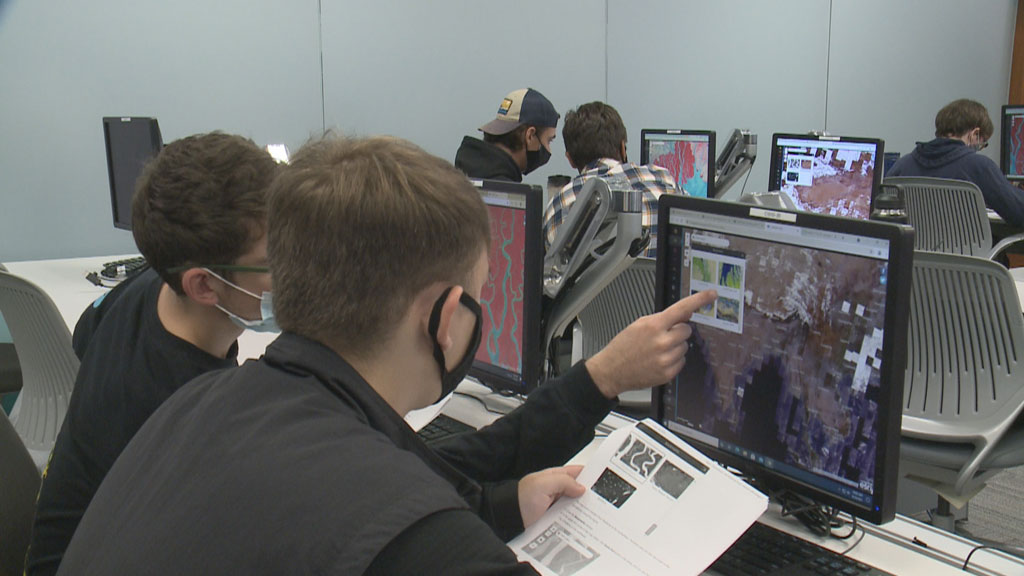
 

    Share