The Neighborhoods of Boston … and Beyond

Boston – Newbury Street Brownstones. Creative Commons License David Ohmer via Compfight.

Every day is a new day in Boston. Parks and green spaces are sprouting up all over, new hotels have recently opened, and more are soon to break ground. New restaurants are joining Boston’s distinctive dining scene and the vibrant Seaport District has added to the city’s already dynamic downtown neighborhoods. Below is an overview of the many diverse neighborhoods in and around Boston.

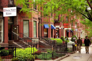
The Back Bay:  The Back Bay was planned as a fashionable residential district, and was laid out as such by the architect Arthur Gilman in 1856. Having traveled to Paris, Gilman was heavily influenced by Baron Haussmann’s plan for the new layout of that city.  The result of Gilman’s inspiration is reflected in the Back Bay thoroughfares that resemble Parisian boulevards.

In the mid-19th century, Boston’s Back Bay tidal flats were filled in to form the 450-acre neighborhood, which we now know as the Back Bay.  Prior to this time, the Back Bay was used for little more than milling operations.

As the tidal flats were slowly filled in, beginning at the edge of the Public Garden and extending westward, residential construction followed.  Because the land filling efforts proceeded slowly, construction advanced concurrently on filled-in lots as they became available.  As a result, most blocks in the Back Bay date from approximately the same era and, when viewed in sequence, illustrate the changing tastes in and stylistic evolution of American architecture over the course of the mid- to late 19th and early 20th centuries.

Commercial buildings were erected alongside these residential structures, primarily on Newbury and Boylston Streets. Commercial development began on Boylston Street around 1880 and on Newbury Street in the early 20th century. While new structures were built for some of these commercial ventures, others adapted existing row houses for their purposes.  This early example of adaptive reuse helped to maintain the Back Bay’s uniform appearance.

Today, it’s easy to understand why the Back Bay is one of America’s most desirable neighborhoods. Newbury Street, Boylston Street, and Commonwealth Avenue are lined with unique shops, trendy restaurants, and vintage homes, making the Back Bay an extremely fashionable destination for Boston residents and visitors. In fact, it’s not uncommon to spot celebrities strolling up and down these picturesque streets. This bustling neighborhood also houses the two tallest members of Boston’s skyline, the Prudential Center, and the John Hancock Tower, in addition to architectural treasures such as Trinity Church and the Boston Public Library, the first public lending library in the United States.

Beacon Hill: A 19th-century residential area north of Boston Common, Beacon Hill is named for the location of a beacon that once stood here atop the highest point in central Boston. Beacon Hill is now topped by the gleaming gold dome of the State House.  Stroll this charming half-square-mile neighborhood filled with townhomes and mansions, to discover a delightful maze of red bricked sidewalks and cobblestone streets with working gas lamps, local boutiques, popular restaurants, and quaint B&Bs.

Winding along the north slope of Beacon Hill is the Black Heritage Trail, which explores the history of Boston’s 19th century African-American community.  Highlights along the 1.6 mile trail include: The African Meeting House (1806) – the nation’s oldest existing black church built by free black Bostonians; the Abiel Smith School (1835) – the first public school for black children; and the Hayden House, an important station on the Underground Railway for escaping slaves.

Downtown Crossing: Shoppers can browse for Boston keepsakes, one-of-a-kind gifts and the latest fashions along this bustling pedestrian mall at the intersection of Summer and Washington Streets. Some of Boston’s oldest landmarks can be found here, such as the 19th-century Old South Meeting House, where a meeting of more than 5000 colonists resulted in the Boston Tea Party of 1773.

South End: The historic South End has the largest Victorian brick row house district in the nation, and has recently emerged as a vibrant urban center with fabulous art studios, experimental theaters and independent boutiques and restaurants. Explore it on foot to discover community garden plots, tiny bakeries and some of the city’s best dining.

Fenway/Kenmore Square: While this neighborhood may best be known as the home of the Red Sox and Fenway Park, it is also one of Boston’s academic and cultural hubs.  Nearly a dozen of the 70 colleges and universities located in the area can be found here giving the neighborhood an unmistakably energetic feel. Not far from Kenmore Square, you’ll find the Isabella Stewart Gardner Museum, Museum of Fine Arts and Symphony Hall.

Rickshaw
Rickshaw. Bruno Zaffoni via Compfight.

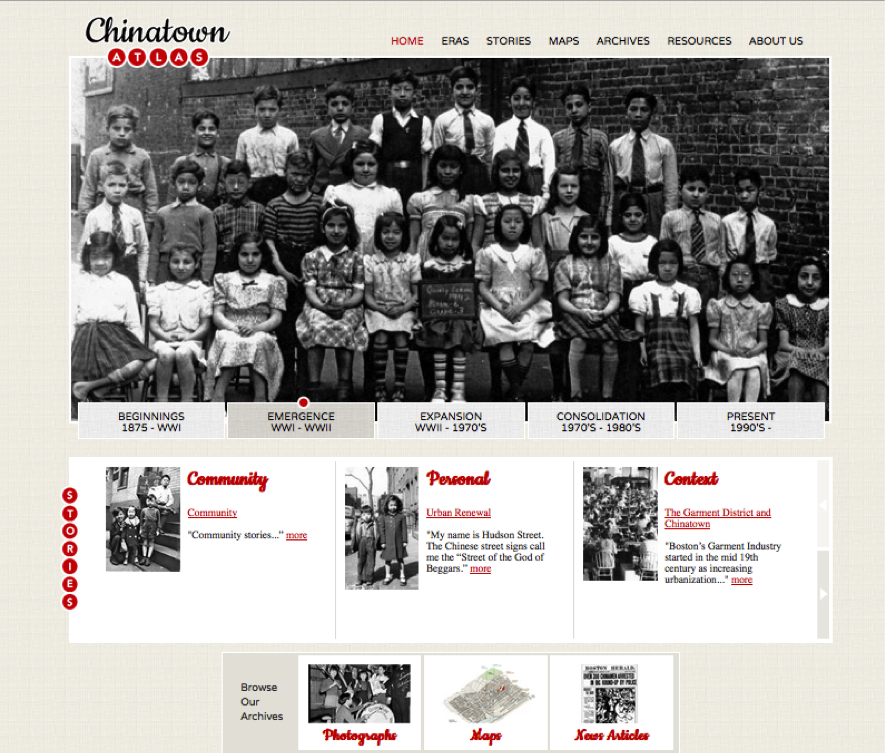
Chinatown: Boston’s Chinatown is the third largest Chinese neighborhood in the country.  Renowned for its concentration of restaurants, Chinatown’s converted historic theaters now serve up decadent dim sum feasts. Beyond the neighborhood’s elaborately decorated gate, stroll the alleys for herbal shops, barbecues and Asian markets stocked with vegetables and spices. During the Chinese New Year and August Moon Festival, the streets are filled with dancing dragons, traditional music, and martial arts demonstrations.

Theatre District: Boston’s Theater District hosts an endless array of Broadway shows. Productions at the Colonial Theatre, Opera House Boston, along with the Citi Performing Arts Center, attract theatergoers of all ages. Bordering Chinatown, the area is also home to dozens of restaurants and bars offering fare in a wide range of prices. From Chinese to Thai to upscale contemporary American cuisine, the area is the ideal place for a pre-show meal.

The North End: With dozens of eateries serving homemade pasta, fresh bread, imported olive oil, cannoli, and cappuccino, the North End is infused with the flavor of its rich Italian history. Colonial-era sites are hidden throughout the neighborhood including Paul Revere’s house, the Old North Church, and Copp’s Hill Burying Ground. The North End comes alive in the summertime with feasts, festivals, and processions.

South Boston Seaport District: Boston’s waterfront is a vibrant mix of residential condos, marinas, hotels, artists’ lofts and restaurants. The city’s Institute of Contemporary Art is an architectural masterpiece overlooking the harbor. Nearby, the newly renovated Boston Children’s Museum invites your inner child to enjoy and explore the world around you. The Boston Convention & Exhibition Center also calls the Seaport District home, as does the Seaport Hotel & World Trade Center.

Cambridge:  Just a bridge away across the Charles River, MIT and Harvard University help create the progressive flavor of Cambridge.  Often referred to as Boston’s Left Bank, it’s the spirited, slightly mischievous side of Boston and has an atmosphere and attitude all its own.  Packed with youthful vitality and international flair, it’s a city where Old World meets New Age in a mesmerizing blend of history and technology.

As a captivating, offbeat alternative to Boston’s urban center, the “squares” of Cambridge are charming neighborhoods rich in fine dining, eclectic shopping, theaters, museums and historical sites. Each square is a vibrant, colorful destination with a personality all its own, offering a unique selection of everything from restaurants, shopping, and music to technology and innovation.

As the East Coast’s leading hub for high-tech and biotech, Cambridge has a creative, entrepreneurial spirit. With over 3,000 hotel rooms, Cambridge is also a popular destination for professional meetings and conferences, offering the largest hotel inventory in New England outside of Boston.

Cambridge is the birthplace of higher education in America. Harvard College was founded in 1636, and across town, Massachusetts Institute of Technology (MIT) is known as the epicenter of cyberculture. Both universities house renowned museum collections and tours that are open to the public.

Beyond Boston: In addition to everything within the city limits, some of Massachusetts’ most scenic and historic towns are just a short distance from the city center. There are sights to see at every turn.

Hawthorne in Bronze, Salem, MA.
Hawthorne in Bronze, Salem, MA. Melinda Stuart via Compfight.

North of Boston: The charm and lure of the sea draw visitors north. The oceanside town of Winthrop is minutes from downtown Boston. Winthrop’s beaches are popular destinations for festivals and special events throughout the summer.

Five miles from the heart of Boston is a magnificent three-mile stretch of unbroken shoreline in Revere. Sea lovers stroll along the beautiful salt-water marshes and look forward to the annual Sand Sculpting Festival in July.

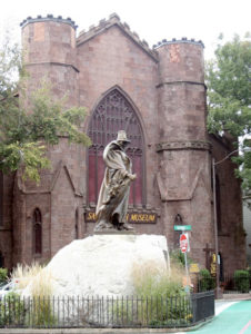
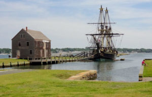
Nearby, historic Salem is one of the country’s oldest cities, with streets retaining an 18th-century charm. Sites to visit in Salem include The House of the Seven Gables, a National Historic Landmark forever immortalized by author Nathaniel Hawthorne, the Peabody Essex Museum, a museum of international art and culture housing one of the best Chinese art collections outside of China, and the Salem Witch Museum, where you can experience the Salem witch trials of 1692.

Whale-watching expeditions and harbor cruises are popular activities in the Cape Ann towns of Gloucester and Rockport. Both feature fine seafood restaurants, art galleries, and small inns.

Lowell, in the heart of the Merrimack River Valley, was home to the American Industrial Revolution and famed author Jack Kerouac. Lowell’s Heritage State Park and National Historic Park and the Lowell Folk Festival in July should not be missed.

South of Boston: With its close proximity to Boston (eight miles away), convenient access to major highways and public transportation, as well as numerous historic sites and attractions, the town of Quincy is ideally situated to host meetings, conventions, and large tour groups.

Quincy is the birthplace and summer home of presidents John Adams and John Quincy Adams. It also the shops and restaurants of picturesque Marina Bay and nearby destinations for rock climbing and harbor cruises.

An hour’s drive from Boston, Plymouth offers a resort-oriented seaside setting with 21 miles of coastline and a small-town feel. It has become a popular tourist stop and a great destination for meetings and conventions.  Visitors can enjoy championship golf courses, whale watching, sailing, and shopping. This is also the place to find attractions such as Plimoth Plantation and the Mayflower II, a full-scale reproduction of the original Pilgrim ship. From now through 2020, Plymouth will be celebrating Plymouth 400, the 400th anniversary of the 1620 Mayflower voyage, the landing of the Pilgrims and the founding of Plymouth Colony.

Just a little further south of Boston is Battleship Cove in Fall River, a maritime heritage museum featuring the world’s largest collection of historic naval ships including the Battleship U.S.S. Massachusetts.  Nearby is the New Bedford Whaling Museum, celebrating the region’s rich whaling history.

Also South of Boston are Cape Cod and the islands of Nantucket and Martha’s Vineyard. This area has become a haven for those who seek the peaceful inspiration of natural seaside beauty. Visitors can savor the local seafood delicacies and enjoy excellent beaches.  For those looking for something a little more active, fishing, golf, antiquing and shopping abound.

Though the Cape is a world apart from many other destinations in its charms and services, it lies within easy reach of Boston’s Logan International Airport, just 50 miles away. Local flights from Boston to Hyannis are available as well as excellent bus transportation and limousine service. The tip of Cape Cod, Provincetown, can be accessed from Boston on a high-speed ferry that takes only 90 minutes.

Martha’s Vineyard and Nantucket can be reached by ferry from Woods Hole and Hyannis. Air transportation is available from Boston, New York City and several Cape towns to both islands’ airports.

West of Boston: The picturesque towns of Lexington and Concord complement any visit to the Boston area. It was on Lexington Green, in the early morning hours of April 19, 1775, that Captain John Parker of the Colonial Militia announced, “Don’t fire unless fired on. But if they mean to have a war, let it begin here.” Those words and the battle that followed changed the course of history.

Sites to visit in Concord include The Old Manse, Old North Bridge, and the Concord Museum. The Concord Museum has been collecting American artifacts since before the Civil War and features treasures including the “one, if by land, and two, if by sea” lantern immortalized by Longfellow’s “Paul Revere’s Ride.”

Additional sites west of Boston include Waterworks Museum, the deCordova Sculpture Park and Museum and historic Old Sturbridge Village, which brings 19-century New England back to life. Visitors can also go skiing at Wachusett Mountain from late November through early April.

New England:  If you were to draw a two-hour circle around Boston, you’d hit all six New England States.  Visitors to Boston find that once they are here, it’s easy to get around by train or car to visit the other states that comprise this great region.

Once the showplace of opulence for New York’s high society, today’s visitors to Newport, Rhode Island, can tour its Gilded Age mansions and gardens, shop along the waterfront or enjoy the holidays with re-creations of Victorian parties and concerts. This modern and sophisticated seaside town is just one-and-a-half hours from Boston.

Mohegan Sun Casino in Connecticut is a major destination for glitz and gaming. This hot spot offers slot machines, poker, and blackjack, live entertainment, lounges, hotels, shopping and more. The casino is located two hours southwest of Boston by car, and can also be reached by bus or train.

From the quaint towns of Ogunquit and Kennebunkport to the cosmopolitan flair of Portland or Freeport with its designer outlets and LL Bean flagship store, visitors can explore timeless villages, antique or outlet stores and numerous beaches in Maine.

New Hampshire offers visitors the charm and history of Portsmouth, a rich arts-and-culture scene, and exciting mountain skiing adventures. From the capital city of Burlington on Lake Champlain to small towns and villages, Vermont offers visitors outdoor adventures and artisan experiences.


Courtesy www.bostonusa.com.

    Share

Mainstreaming Human Rights in Geography and the AAG

Nearly all geographers are concerned about human rights, and in their personal and professional lives seek meaningful ways to act on these concerns and values. The AAG and the discipline of geography intersects with human rights in numerous ways. This special theme within the 2017 AAG Annual Meeting will explore intersections of Human Rights and Geography, and will build on the AAG’s decade-long initiatives on Mainstreaming Human Rights in Geography and the AAG. An Interview with Noam Chomsky by Doug Richardson will keynote this theme at the 2017 Boston Annual Meeting.

This theme will feature 50 sessions with more than 250 presentations at the intersection of human rights and geography. Speakers from leading human rights organizations, academia, government, and international organ- izations will address human rights challenges around the world.

A sampling of featured speakers includes:

  • Noam Chomsky, Institute Professor and Professor of Linguistics Emeritus, MIT
  • Mike Posner, former Assistant Secretary of State for Human Rights
  • Terry Rockefeller, Board of Directors, Amnesty International USA
  • Colette Pichon Battle, Executive Director, US Human Rights Network
  • Stéphane Bonamy, Deputy Head, International Committee of the Red Cross
  • Lee Schwartz, Director, Office of the Geographer and Global Issues, US State Department
  • Susannah Sirkin, Director of International Policy and Partnerships, Physicians for Human Rights
  • Jessica Wyndham, Interim Director, Scientific Responsibility, Human Rights and Law Program, AAAS
  • Eric Rosenthal, Executive Director and Founder, Disability Rights International
  • Douglas Richardson, Executive Director, American Association of Geographers
  • Beth Simmons, U-Penn Law and NAS Committee on Human Rights
  • Harvard Humanitarian Initiative (four presenters from Harvard)
  • Audrey Kobayashi, Queen’s University
  • Hilary Zainab, Research Director, Standby Task Force
  • Kathryn Hanson, Smithsonian Museum Conservation Institute
  • Sheryl Beach, University of Texas at Austin
  • Balakrishnan Rajagopal, Head, International Development Group, MIT
  • Colin Kelley, Columbia Center for Climate and Security
  • Stephen Marks, Department of Global Health and Policy, Harvard University
  • Tawanda Mutasah, Senior Director for Law and Policy, Amnesty International

Sample session topics include:

Wednesday, April 5 

  • Health and human rights
  • Crime, brutality, and violence
  • Global Carceral Geographies I: Carceral Experiences
  • Global Carceral Geographies II: Carceral Societies
  • Global Carceral Geographies III: Confining the Other
  • Global Carceral Geographies IV: Carceral Intersections
  • (De)Stigmatising Sexscapes: Politics, Policy and Performance I: Porn, Pleasure & Performance

Thursday, April 6 

  • Human Rights: Humanitarian Disaster Response and Protecting Cultural Heritage
  • Right to water and safe environments
  • (De)Stigmatising Sexscapes: Politics, Policy and Performance II: 2. Rights, Wrongs and Regulations
  • Documenting Evidence for Human Rights Tribunals and Litigation Using Geographic Research and Tools
  • Mainstreaming Human Rights in Geomorphology and Water Resources
  • (De)Stigmatising Sexscapes: Politics, Policy and Performance III: 3. Governance, Policing and Design
  • Updates and Trends at AAAS and the SHRC
  • Harvard Humanitarian Initiative panel
  • (De)Stigmatising Sexscapes: Politics, Policy and Performance IV: 4. Production, Consumption and Reflection
  • Article 15: Understanding the Human Right to the Benefits of Science to Help Progress and Its Applications
  • (De)Stigmatising Sexscapes: Politics, Policy and Performance V: 5. Mobilities, Immobilities and Boundaries
  • Noam Chomsky Interview—A Continuing Conversation with Geographers

Friday, April 7 

  • Social Media and Activism: Media and Communication Geography Session IV
  • Indigenous and marginalized groups
  • Policymaking under a human rights framework
  • Human Rights and Climate Change – Featured Panel
  • Geographies of Disability 1
  • Trump on Immigration Enforcement: the First 100 Days
  • Geographies of Disability 2
  • Refugees, asylum seekers, and IDPs
  • Emerging geographies of Post-Apartheid South Africa
  • Human rights education and research practice
  • Geographies of Disability 3

Saturday, April 8 

  • Territorial Articulations and Shifting Legal Geographies: Indigenous and Native Rights in the Americas 1
  • Planning the (White) City: Neoliberal Urbanism and the Rise of the Homogenous City I
  • Human Rights and Disabilities: High-Level Perspectives From the Academy and Beyond
  • Territorial Articulations and Shifting Legal Geographies: Indigenous and Native Rights in the Americas 2
  • Planning the (White) City: Neoliberal Urbanism and the Rise of the Homogenous City II
  • Human Rights Featured Panel
  • Confronting the (White) City: A Conversation
  • Indigenous Peoples and Climate Change
  • David Harvey Featured Lecture
  • Indigenous Peoples and Climate Change II
  • Sex and Gender in Election 2016
  • Historical Geography Specialty Group Plenary: Audrey Kobayashi
  • AAG Past President Election Panel

Sunday, April 9

  • Geographies of Aging, Health and Health Care 1
  • Spaces of Informality and the Governing of Slums
  • Geographies of Aging, Health and Health Care 2
  • Gender, sexual identity, and human rights
  • Geographies of Aging, Health and Health Care 3
  • Land Rights and Colonialism
  • Racial Scars that Still Reflected on the Space
  • Urban inequalities

AAG Human Rights Initiatives

During the past decade, the AAG has undertaken many initiatives to interact geography with human rights organizations and their work. A few examples include:

Science and Human Rights Coalition (SHRC): Hosted by the AAAS, the SHRC brings together dozens of scientific associations to advance crucial human rights work around the world.

AAG Geography and Human Rights Clearinghouse: With funding from the MacArthur Foundation, the AAG developed an inventory of geographic research and scholarship relating to human rights including bibliographic, informational, and research resources.

Geospatial Technologies and Human Rights: The AAG supported this AAAS project to develop applications and information resources for the non-governmental human rights community.

For more information, please visit https://www.aag.org/cs/geohumanrights.

    Share

Second Annual ‘GeoHumanities’ GeoPoetics Poetry Reading

The first annual GeoPoetics Poetry Reading was held on March 29 at the 2016 AAG Annual Meeting in San Francisco. It was organized by the editors of the new AAG journal, GeoHumanities. Cecil Giscombe, University of California – Berkeley, is pictured here during his reading.

GeoHumanities has organized a GeoPoetics poetry reading to take place at the 2017 AAG Annual Meeting in Boston with accomplished poets from Boston and New England. These include Stephen Burt (poet, critic and professor of poetry at Harvard), January O’Neill (poet and professor at Salem State University, executive director of the Massachusetts Poetry Festival), Danielle Legros Georges (faculty member at Lesley University and Boston’s Poet Laureate), Joseph Massey (author of the recent Illocality from Wave books), and Jill McDonough (poet and professor at UMass Boston. Three times recipient of the Pushcart Prize). All of these poets approach place, and particularly the places of Boston and New England, in fresh and slant-wise ways that force us to see our world in new ways.

The first GeoHumanities GeoPoetics Poetry reading took place at the 2016 AAG Annual Meeting in San Francisco. The session featured a range of accomplished Bay Area poets including Cecil Giscombe, Douglas Powell, Mary Burger, Judy Halebsky and Lyn Hejinian. In each case the poets read work that crossed the boundaries of geography and poetry and represented some of the finest examples of “earth writing”. The session attracted a large and enthusiastic audience.

Session Information: GeoHumanities GeoPoetics Poetry Reading at the 2017 AAG Annual Meeting, Boston

    Share

James Hansen To Address Climate Change at AAG Annual Meeting

James Hansen, courtesy NASA

James Hansen, known for his climate research and his Congressional testimony on climate change that raised awareness of global warming, will deliver a featured talk on climate change, moderated by AAG President Glen MacDonald, at the AAG annual meeting in Boston on April 7, 2017.

Hansen received a B.A. in physics and mathematics, an M.S. in astronomy and a Ph.D. in physics from the University of Iowa. From 1981 to 2013, he was the head of the NASA Goddard Institute for Space Studies in New York City. Currently, he directs the Program on Climate Science, Awareness and Solutions at Columbia University’s Earth Institute.

Hansen is a member of the National Academy of Sciences, received the Heinz Award in the Environment for his global warming research, and was listed as one of Time Magazine’s 100 Most Influential People in 2006. The American Association for the Advancement of Science (AAAS) selected him for its Award for Scientific Freedom and Responsibility.

He will also be honored as the 2017 AAG Honorary Geographer during the AAG awards luncheon in Boston on April 9, 2017.

    Share

The New England Town: Not a Village

Fig.1. Town Line, Shelburne, New Hampshire.
Photo and permission by Betty Austin.

The New England town and its town meeting form of government invoke images of roadside town line signs and real democracy playing out on the floor of a wood stove heated frame town house in a small town somewhere in Boston’s hinterlands (fig.1). The New England town is a municipality that encompasses an expanse of land and usually includes compact settlements (villages /hamlets) and rural areas. These political units evolved from the seventeenth century needs of people transplanting themselves from England to the shores of Massachusetts Bay. Demands of church and civic governance resulted in a blending of religious and town government affairs in early Massachusetts. John Winthrop, first governor of the Massachusetts Bay settlements that would develop in and around the Boston locale was a principal player in both Congregationalism and establishing the underpinnings of New England town formation and administration (Rudman 1965). Towns were charged with providing local services: laying out roads and maintaining them, education, police and fire protection, overseeing the poor, passage of ordinances to protect public health and promote the general welfare of the population. These municipalities were also authorized to raise taxes to support their functions. New England colonies established policies that encouraged contiguous settlement as the frontier advanced. This provided for better safety from both external and internal dangers. Indians and foreign powers presented threats from time to time. On the domestic front church and community leaders wanted to watch over their people to ensure no citizen strayed from social norms. Hester Prynne with her scarlet letter and the banishing of Roger Williams from Massachusetts are examples of the latter (Hawthorne 1850; Barry 2012). As time passed villages within the towns became the visual icon of much of the region (Wood 1997). However, even with villages, some quite large, the town continued to be the government (Murphy 1964). If growth or political pressure resulted in city status the city line conformed to the pre-existing town line. Colonies and later states made provisions for town lines to change as development and population patterns evolved. In some situations towns reverted to unorganized townships if loss of population dictated.

Towns in New England range in geographic area from a few hundred acers in the case of some island communities and compact urban areas to a more typical size of six miles by six miles or thirty-six square miles. This larger size represents the approximate service area of a colonial church or seat of town government. Most traffic was by foot or animal. Topography and barriers to travel were often considered in laying out town lines. Towns were created from unincorporated land by colonial and later state governments. As land came under private ownership and underwent settlement, towns were incorporated upon petition of the owners and residents. In some situations plantations (planting a settlement) were formed by the colonial or state government. Plantations have fewer home rule powers then towns and are an intermediate step to becoming a town. The official name of the State of Rhode Island is Rhode Island and Providence Plantations. Our smallest state has the longest name. With population growth most plantations eventually became towns. Maine still has a few dozen of them. Many towns skipped ever being a plantation. Maine plantations have the powers of towns except they cannot enact land use ordinances without permission of the state. Most of New England is divided into towns. Larger places and some mid-sized municipalities have become cities. Cities have more complex governments than towns and this varies among states. Nearly half of Maine (most of its north and northwest) is comprised of surveyed but unincorporated townships. All have either small populations or no people.

Fig.2. Freedom of speech at a recent open town meeting in Maine.
Source: Waterville (ME) Morning Sentinel.

Towns that arose in the six New England states were governed by the open town meeting where a legislative body comprised of all voting citizens of the town gathered at annual or special meetings to transact the legal affairs of the town. Many small and mid-sized towns continue to conduct their business through open town meetings with each citizen representing himself/herself on the floor. Larger towns and cities have councils or town meetings made up of representatives elected from the general population. Selectmen, usually three or five, are elected by the voters and serve as the executive branch of the town. They are charged with carrying out the wishes of the majority of people voting at town meetings (Zimmermann, 1999; Bryan, 2004). These open meetings are at the forefront of the region’s political image. Franklin D. Roosevelt’s 1941 “Four Freedoms” speech (freedom of speech, freedom of worship, freedom from want and freedom from fear) was followed in 1943 by Norman Rockwell’s image of a citizen speaking at a classic open Vermont town meeting (Guptill 1946). That “Freedom of Speech” setting is often repeated in New England open town meetings today (Fig.2). Historically annual town meetings were held in March or April, after the hard part of winter and before planting season, a good window for farmers. As local governance became more complicated some towns moved their annual meetings to summer in order to better coordinate fiscal years with other property tax supported enterprises, such as consolidated school districts. In Maine school budgets are often voted on in June near the end of their fiscal year.

Open town meetings can be traced to the ancient Greek forum and provide an environment for citizens to vent, legislate and solve community problems. Debates involve roads, local welfare for the poor, schools, fire and police protection, etc. Each warrant article is acted upon and all citizens with voting power can participate. My six decades of attending open town meetings has resulted in a patchwork of memories encompassing thousands of discussions ,some friendly, others not. The amount of money involved may not have much to do with how heated an argument becomes. Sometimes $50 to repair the cemetery fence will generate more anger and stress than buying a $150,000 snowplow.

Fig.3. Town House, Vienna, Maine.
Photo by author

During the first decades of New England settlement town and religious meeting were often held in the same building, the meeting house. In the early stages of a town’s planting both kinds of gatherings were sometimes held in private homes or barns. With the passage of time and the growing demands of both church and town a separate structure, a town house, would be constructed to provide a place for town meetings and storage of government records. The raising of money to construct a town house represented a significant step in a town’s progress. Sometimes a wealthy citizen would donate funds for building the town house. This occurred in Vienna, Maine in 1854-55 when Joseph Whitter, a successful Boston merchant and child of Vienna, provided funds for a small Italianate style town house that continues to host town meeting (Fig.3). The structure is listed on the National Register of Historic Places (Vienna 2008). Vienna Town House is near the town’s geographic center on Town House Road and not at the village, ¾ of a mile to the southeast (fig.4).

Fig.4. Vienna, Maine ( pop.570). Town House is near geographic center of town, ¾ mile northwest of village where most community services are located.
Source: Vienna (Maine) Comprehensive Plan Committee. 2008. Town of Vienna Comprehensive Plan.
Vienna, ME: Plan Committee.

As the frontier swept west the New England town meeting was left behind. Settlers from the Mid-Atlantic and Southern regions defended strong county government and it prevailed as new land came under organizer local rule. Counties are weak in New England where most small towns and rural places are controlled by town administration. The one aspect of the New England town that did go west is the 36 square mile township that we recognize on land surveyed under the United States Northwest Ordinance of 1785.

This year’s AAG meeting in Boston is during traditional town meeting season. If you can find an open format one to attend consider making the effort. Small towns in Maine, New Hampshire and Vermont are the best bet. Its real democracy in action and it will demonstrate to all that a New England town is not a village.


Paul B. Frederic is Professor of Geography Emeritus at University of Maine-Farmington and past Director of the Maine Land Use Regulation Commission. Email: frederic [at] myfairpoint [dot] net. He is in his eleventh year as a selectman in the Town of Starks, Maine. His research is on rural issues.

DOI: 10.14433/2016.0021

References

Barry, J. 2012. Roger Williams and the Creation of the American SoulNew York: Viking Press.

Bryan F. W. 2004. Real Democracy: The New England Town Meeting. Chicago: University of Chicago Press.

Guptill A. 1946. Norman Rockwell: Illustrator. New York: Watson Guptill Publishers.

Hawthorne, N. 1850. The Scarlet Letter. Boston: Ticker and Fields.

Murphy, R. E. 1964. “Town Structure and Urban Concepts in New England” The Professional Geographer, Vol.16 (1): 1-6. DOI: 10.1111/j.0033-0124.1964.001

Rutman, D.B. 1965. Winthrop’s Boston: A Portrait of a Puritan Town, 1630-1649. Chapel Hill: University of North Carolina Press.

Vienna (Maine) Comprehensive Plan Committee. 2008. Town of Vienna Comprehensive Plan.Vienna, ME: Plan Committee.

Wood, J.S. 1997. The New England Village. Baltimore: Johns Hopkins University Press.

Zimmerman, J. F. 1999. The New England Town Meeting. Westport, CT: Praeger Press.

    Share

‘Locating Geography Education’ — Sarah Bednarz’s Past President’s Address

AAG Past President Sarah Witham Bednarz will explore the evolving role, nature, and relevance of geography education as viewed by former presidents of the AAG from 1910 to the present. AAG presidential addresses have, at times, commented directly on education issues; at other times the topic has been avoided, if not ignored. What changes have occurred over time in how geography education is perceived and valued? What persistent educational concerns has the discipline wrestled with? How has the discipline, represented by its leaders, addressed broader social, cultural, and political factors that affect the production of new geographic knowledge and the reproduction of geographers?

At the close of the plenary, Bednarz will present Roger M. Downs, professor of geography at Pennsylvania State University, with the 2017 AAG Presidential Achievement Award, for his long-term, major contributions to the discipline.

The session will take place 11:50 a.m. to 1:10 p.m. on Friday, April 7, 2017. More details will follow as they become available.

    Share

Witch Way to Salem?

Salem Witch Museum

Just a 30-minute train ride north of Boston is Salem, Massachusetts, one of America’s oldest and curious cities. Located on the North Shore of Massachusetts, Salem was one of the most significant colonial and early American seaports as well as having a rich New England history with glory and intrigue. Salem is a small, compact and walkable historic city with just over 40,000 residents and hundreds colonial-era buildings along with more than 60 restaurants, cafes and coffee shops. Over a million tourists visit annually with Halloween, October 31, being the peak where upwards of 70,000 people come to celebrate.

Much of the city’s cultural identity is defined by the Salem Witch Trials of 1692, 63 years after the founding of the city. Salem is widely known as “Witch City” with the High School’s nick name being “the Witches,” police cars have witch logos, one of the elementary schools is Witchcraft Heights Elementary School and it is hard to walk a single block without seeing witch T-shirts and other occult paraphernalia. The city even has a Harry Potter shop, and in 2015 a local witch successfully sued a local warlock! The culture of witchcraft in Salem as a symbol of Salem is a conscious product promoted by the city and its businesses to drive tourism and was mostly created in the second half of the 20th century. Salem, however, is much, much more than ghosts, goblins and witches.

The culture of witchcraft in Salem as a symbol of Salem is a conscious product promoted by the city and its businesses to drive tourism and was mostly created in the second half of the 20th century. Salem, however, is much, much more than ghosts, goblins and witches.

Prior to the arrival of European settlers, the region was home to a long-term Native American village and trading center. In 1626 a group of European fishermen from Cape Ann (just to the northeast) settled in the area led by Roger Conant. Just two years after their arrival, the Massachusetts Bay Company replaced Conant with John Endicott as the leader of the settlement and eventually governor of the larger Massachusetts Bay Colony. Because the transition was peaceful between the two leaders and their associates, the name of the settlement was changed from Naumkeag to Salem after the Hebrew word shalom meaning peace. In 1630 the Great Migration began and many puritans sailed to Massachusetts. The puritans travelled here to obtain religious freedom for themselves, but did not extend that freedom to other faiths. In 1636 the first trade ship from Salem sailed to the West Indies to trade salt cod. In 1637 when Salem had about 900 inhabitants, it held the first gathering, or muster, of a local militia on the Salem Common. All males between 16 and 60 had to possess arms and participate in the defense of the community. Because of this action, Salem has been designated as the birthplace of the US National Guard and signed into law by president Obama in 2013.

Because the transition was peaceful between the two leaders and their associates, the name of the settlement was changed from Naumkeag to Salem after the Hebrew word shalom meaning peace.

Salem Maritime National Historic Site, Salem, Mass.

Salem’s most famous puritan-era event was the witch trials of 1692. At the time people believed that witchcraft was real and evil. Nothing caused more fear in the puritans than the thought that people in their community were possessed by demons. It was a hysterical time for many. In only three months’ time 19 innocent people were hanged, and one man was pressed to death. The trials ended when Governor Phipps’ wife was accused of being a witch. A new court was established and it released those awaiting trial and pardoned those awaiting execution. After the witch trials ended, Salem continued to grow and prosper with an economy based on fishing, agriculture and trade. The shipping industry continued to grow under colonial leadership and by the 1760’s there were almost 50 large wharves in Salem handling a growing global trade.

Many people think that the first military engagement with the British occurred in Lexington and Concord, but it was here in Salem. The first armed resistance of the Revolution occurred in 1775 when Salem’s militia blocked British Colonel Leslie and his men from capturing ammunition that was stored in Salem. During the American Revolution, Salem became a center of privateering and over 800 vessels were commissioned as privateers and they destroyed some 600 British ships. Nearby Marblehead is known as the birthplace of the American Navy (though Beverly, Massachusetts, and Whitehall, in New York, also make this claim). After the Revolutionary War many ships from Salem returned to commerce and sailed around the world trading in many ports throughout the seven seas. The East Indies, West Indies and China became major destinations for Salem’s traders. By 1790, Salem was America’s seventh largest city, but the richest per capita and a world famous trading port, much more important than Boston. In some foreign harbors people thought that Salem was a country not a city. When the War of 1812 started up, Salem once again became a center of privateering, but by the end of the war, Salem’s shallow harbor, smaller economies of scale, and competition with Boston and New York led to a sharp decline. By 1850, Salem was no longer a major American port.

Nathaniel Hawthorne

Throughout its history Salem has produced many scholars and authors with Nathaniel Bowditch (1773 – 1838) and Nathanial Hawthorne (1804 – 64) being the most famous. Bowditch is credited as the founder of modern maritime navigation. He was a mathematician by trade and was largely self-taught. At age 10 he had to quit school to work in his father’s cooperage and then at age 12 he became indentured for nine years as a bookkeeper to a ship supply store. He spent years teaching himself mathematics, Latin and other subjects. At age 29 (1802) his book The American Practical Navigator was first published and is still carried on board every commissioned US Navy vessel. Nathanial Hawthorne is the great-great grandson of John Hathorne, the only witch trials judge who never repented for his actions. Hawthorne’s work drew from puritan inspiration and his themes often focused on the evil and sin of humanity. Hawthorne produced many short stories and novels; The Scarlet Letter is certainly his most famous work and the supposed namesake of The House of Seven Gables has become a tourist destination. There is also a strong tie between Hawthorne and Salem’s maritime traditions as he served as the customs collector for two years in the 1840s.

Monopoly game

For most of the 19th and 20th centuries, Salem became a second tier industrial city noted for its textiles (cotton sheeting), leather tanneries, shoe making, and diverse manufactures. Surprisingly, the Parker brothers came from Salem and the game Monopoly was produced here as well as several other board games. Salem became an integral part of Boston’s extended hinterland and part of its suburban belt. However, it has always retained its historic identity.

Today, Salem is a vibrant city on the North Shore famous for its history, tourism, higher education (Salem State University) and medical centers as well as being an up-and-coming bedroom community for Boston. Salem has preserved much of its glorious past. The sailing era of the 18th century can be seen in two historic districts, the Chestnut Street District with over 400 magnificent buildings from the era and the greatest concentrations of notable pre-1900 domestic structures in the United States. Important tourist sites include the Salem Maritime National Historic Site, consisting of 12 key builds and almost nine acres of open space along the harbor, The Peabody Essex Museum, established by ship captains and mates in 1799 which began by exhibiting “curiosities” from around the world. Today, the museum focuses on art and culture with world class exhibits drawn from around the world.

Salem is easy to reach from Boston and there is plenty to do for families and adults for a day or more with a variety of activities from visiting historic homes, going to museums, engaging with local witches, people watching from sidewalk cafes and strolling through various shops. Come and join us on our AAG-sponsored trip to Salem during the conference or travel there by yourself. From North Station in Boston there are over 30 trains during the week and fewer on the weekends.

Salem Home Page: https://salem.org/

—Stephen Young and Stephen Matchak
Salem State University


DOI: 10.14433/2016.0017

    Share

Daydreams and Nightmares in the Northern Forest: A Quarter Century of Change

The Northern Forest is a term used by forest activists, policy wonks and some geographers to describe the forested regions of upstate New York, Vermont, New Hampshire and Maine. This is a region of scattered population, glaciated hills and valleys, many lakes and rivers, and several substantial mountain ranges (Irland, 1999; 2011). In its fall displays of color, the red and yellow maples and birches are studded by dark green pines and spruce. It is virtually the last redoubt of native brook trout populations; in a few coastal Maine streams tiny surviving runs of Atlantic salmon cling to life. This region was accustomed to long-standing private ownership by paper companies, well-established timber families, and Kingdom Owners– descendants of New York wealth from the 1890’s, with their lakes and “Adirondack Camps.” The region has an aura of remoteness and wilderness character, regularly burnished by writers and artists since Thoreau’s visits in the 1840’s and the glowing paintings of Hudson River School artists. Into countless households each year, the mail order catalogs of the LL Bean Company arrive, with covers displaying appealing images of wild solitude. They become the suburbanites’ mental picture of the Northwoods. Visitors were often stunned, then, to drive into the woods and see logging trucks, recent clearcuts, and for sale signs for wildland lots. Many wanted something done about it.

Source: Northern Forest Lands Council, 1994. This region counted 26 million acres of forest in the late 80s. The acreage of forest had barely changed by 2015. In 2015, the NFL region contained 56% of all the forest land in the four states (USDA Forest Service data). Its boundaries were constructed carefully: to avoid federal lands (as in VT and NH), and to avoid as much as possible any small landholders and farmers, while including most of the largest timberland holdings of the region. Much of the private ownership here has changed hands – some more than once, since 1990.

Source: LL Bean company, reproduced by permission.

A regionwide outbreak of spruce budworm attacked spruce and fir stands from the early 70’s to the mid 80’s, leading to widely publicized spray programs and accelerated cutting in Maine where the effects were most serious. Recreationists could readily access the most remote corners of the Northwoods on gravel roads, following the end of log driving on the rivers.

This region was the culture hearth of the nation’s lumber, log driving, and paper industries; lobbyists and executives for these industries once carried big sticks in state capitals. By the late 1980’s, though, large private holdings were beginning to turn over to new owners, often non-industrial ones. Fears began to spread that the traditional model of timberland ownership would burst wide open leading to widespread shoddy subdividing and development, loss of public access, diminished timber supply, and then loss of jobs as mills could not meet their wood needs. In 1990, and again in 1994, major studies were done on these issues, funded by federal dollars.

By the early 1990s, it was thought that by judicious public policy, something resembling the traditionally stable Northern Forest landscape could be retained, fostering stable employment in rural areas and milltowns, widespread public access to private lands, and desirable wildlife habitat. In 1989, a regionwide study was launched, the Northern Forest Lands Study, to assess these issues with a guiding committee of state officials and stakeholders (USDA Forest Service and Governors’ Task Force, 1990). A followup in 2004 was a more ambitious effort to conduct detailed research and develop policy options (Northern Forest Lands Council, 1994; Northeastern State Foresters Association, 2005).

These projects conducted local public meetings to obtain input and encountered loud protests from local groups, especially in the Adirondacks, who – correctly — saw the reports as efforts to build support for more land protection. They saw this as threats to their economy and autonomy (Porter, Erickson, and Whalley, 2009). One result of this was that both reports, while depicting longterm issues and needs, had to tread gingerly by burning incense to the idols of local stakeholder input before any recommendations were made. In its 2004 Report, the Northern Forest Lands Council offered a saccharine vision of the future forest and the industries and communities depending on it. They recognized that this could not be achieved without improved public policies, for which they offered numerous suggestions. But they assumed a level of stability in markets and industry structure that was not to be.

Rarely has there been a more dynamic period in the region’s forest history than the 1990-2015 period —

Numerous small wood processing companies (Irland 2004) have been driven out of business by furniture imports from China.

From 2000 to 2015, newsprint usage nationally fell by 70%; printing and writing paper consumption by one third.   The post 2005 housing crash cut national lumber production by half, and it has since barely recovered. Today, there is no paper being manufactured along Maine’s Penobscot River, and lumber manufacturing remains as a pale shadow of what once was. Primary paper mills have virtually vanished from New York, Vermont, and New Hampshire. In parts of the region, more wood is being burned to generate electricity than to make pulp or paper. Had anyone in 1990 predicted all these events they would have been dismissed as delusional. Domestic market crashes and surges in imports upset the hopes for a stable forest economy with prospering little milltowns stretching from Tug Hill to Eastern Maine

Paper mill in Bucksport, Maine, running full steam in better days. It is now being dismantled. Its ownership history: St Regis to Champion to International Paper to Verso to scrap dealer in about 2 decades is not atypical of the northeastern industry. In early summer in the late 1930s, the Penobscot River in the foreground would be covered with pulpwood logs. Photo by author.

The 1990 study was prompted by concerns that industry would sell its land to others, who would have less reason to keep it in forest and retain public access customs. This concern proved all too well founded: for a host of reasons, forest industries sold off their holdings almost completely, and many of the mills as well (your present writer was among those who failed to predict this). At one time, with a stroll down “Paper Industry Row”, on E. 42d Street in New York, you could talk to the owners of much of the forest of the region, or at least their Wall Street bankers. No longer. Many of the longtime family holdings, such as the Adirondack “Kingdoms” held by heirs of the Robber Barons since the 1890s, went on the block as well. New owners represented a wide variety of interests, including newly rich billionaires, and investment funds managed for pension funds and institutions (Irland, Hagan, and Lutz, 2011). More than a little of this land found its way into conservation uses via NGO’s, public agencies, and conservation easements.

From some perspectives, progress has been made: counting fee ownership and conservation easements, 19% of Maine is now in conservation ownership.   Important gaps in the Adirondack Park have been filled in.   In many areas, however, the resource “took a haircut” in this process as smaller tracts and outholdings were sold off. Often the buyers were exploitive “liquidators” who stripped the timber and sold the land as “leisure lots” in sizes that would elude local land use controls (if there were any at all). Today, many who loved to hate the paper companies wistfully admit that wish we could go back to those times. Fortunately, the housing crash has cut deeply into demand for such lots, but signs of gentrification on large “view lots” are emerging once again, especially near ski areas. The old rustic “ski chalet”, often self-built, is being replaced by virtual mansions, with 2 car garages and mowed lawns. Development on view lots is eroding the sense of remoteness that once characterized much of this region, with implications for public access and wildlife habitat that are only beginning to be recognized.

Political cultures regarding public land ownership and regulation vary from state to state across this region, despite its apparent ecological and economic similarities. Substate institutions have arisen in New York (Adirondack Park Authority), New Hampshire (unincorporated portions of Coos county), and Maine (Land Use Planning Commission for 10 million acres lacking any local government). A major influence has been concentrations of wealth and population in the Boston-New York coastal strip. The Northern Forest is the recreational and second home backdrop for these regions, and most of the conservation accomplishment has been lobbied from those urban areas.   So the region has a distinct north-south political divide. Broadly speaking, advocates of the National Forests on Vermont and New Hampshire have allowed the 2 states to pass much of the cost and bureaucracy of administering dispersed forest recreation to federal taxpayers. In New York and Maine, by contrast, there is very little federal conservation land, while New York’s constitutional Forever Wild in the Adirondacks represents a huge state-managed stretch of wild land.

Both Maine and New York are not favorable to federal ownership, except where federal dollars will pick up costly coastal property (e.g. Acadia NP; Rachel Carson NWR; Fire Island National Seashore on Long Island … but these are not in the Northern Forest) One lesson has been that creating federal land units has been far easier than administering them. Drawing lines on maps cannot make the divisions among various publics go away. Since 1990, changes in fee ownership in the Northern Forest have not been substantial, amounting to only about 800,000 acres leaving private ownership over the quarter century. Most of the conservation achievement has been via conservation easements, which represent the removal of development rights from land remaining in private hands.

Source: various, compiled by author. These are proportions of total land area owned by states and by the states plus federal agencies. Accurate data on county and municipal lands are elusive. These figures refer to fee simple ownership only. Conservation easements, especially in Maine, augment these figures substantially.

The entire region has been used to urban elites picking and choosing locations for National Parks and other major conservation units, perhaps to a degree unmatched elsewhere in the country. This yielded major conservation successes: the Adirondack Park, Acadia NP, the White Mountain National Forest, and Baxter State Park. Yet it exacerbates the north-south political divides noted above.

In Maine, since about 2010 an organized program of blowback against the programs favored by Northern Forest Lands advocates has been under way. A Republican governor and legislative allies have been blocking Maine’s premier land conservation program, attempting to roll back other conservation policies, and trying to pull the teeth from Maine’s Land Use Regulation Commission (newly renamed the Land Use Planning Commission and asked to work with more county input). This revolt may be narrowly based on a few discontented small businesses in rural areas, but it has had an impact. Leaders of the blowback have not, it seems, paid any political price for their actions. Conservation and environmental groups seem slow to realize the implications.

In 2016, the entomologists are telling us that the spruce budworm is coming back – and its ultimate spread and impacts are unpredictable (Maine Forest Service, 2016). This brings a further dark cloud to the horizon for private forest owners.

The Northern Forest’s history of land use change, the underlying forces, and the effectiveness – or lack thereof—of state and federal forest policies offer many important topics for study by geographers (Wallach, 1980). The literature of the field seems sparse in attention to this unusual region; perhaps the Boston meeting will stimulate more interest.


Lloyd C. Irland is a forestry consultant in Maine, a former forestry school instructor, and public official in Maine state government. He contributed land use analysis to the 1990 Northern Forest Lands study and is author of many papers on forest resources as well as 2 books on the northeast’s forests. lcirland [at] gmail [dot] com.

Author’s Note: The title of this article does homage to Daydreams and Nightmares, a 1971 book by my colleague W. R. Burch Jr, who was one of the earliest to apply sociological insights to forest resource and natural resource problems.

DOI: 10.14433/2016.0015


References

Burch, W. R. Jr. 1971. Daydreams and Nightmares: a sociological essay on the American Environment. New York: Harper and Row.

Foster, David R. et al. 2010Wildlands & Woodlands: A Vision for the New England Landscape. Petersham: Harvard Forest. May. https://www.wildlandsandwoodlands.org/

Irland, Lloyd C. The Northeast’s Changing Forest. Harvard Forest, Petersham, MA (dist. By Harvard Univ. Press). 1999.

Irland, L. C., J. Hagan, and J. Lutz. 2011. Large timberland transactions in the Northern Forest 1980 – 2006. Yale Global Institute for Sustainable Forestry. Private Forests Working Paper No. 11. https://gisf.yale.edu/publications-presentations/gisf-research-reports

Irland. Lloyd C. 2004. Maine’s forest industry: from one era to anotherIn: R. E. Barringer (ed.) Changing Maine. Gardiner, Maine: Tilbury House, pp. 362-387.

Irland, Lloyd C. 2011.   “New England Forests: Two Centuries of a Changing Landscape

In, B. Harrison and R. Judd, eds. New England: A Landscape History. Cambridge: MIT Press. Pp. 53-70.

Maine Forest Service 2016. Spruce Budworm Internet Hub

Northern Forest Lands Council. 1994. Finding common ground: Conserving the Northern Forest. Recommendations of the Northern Forest Lands Council. Concord, NH.

Northeastern State Foresters Association.2005. Northern Forest Lands Council 10th Anniversary Forum. Concord. Northeastern State Foresters Association. www.nefainfo.org/uploads/2/7/4/5/27453461/nflcfr_final…

Porter, W. F., J. D. Erickson, and R. S. Whalley. 2009. The Great Experiment in Conservation: Voices from the Adirondack ParkSyracuse: Syracuse University Press.

USDA Forest Service and Governors’ Task Force. 1990. Northern Forest Lands Study. USDA Forest Service, Rutland, VT.

Wallach, Bret. 1980. “Logging in Maine’s Empty Quarter” Annals of the Association Geographers , vol. 70 (4):542-552. DOI: 10.1111/j.1467-8306.1980.tb01331.x


Focus on Boston is an on-going series curated by the Local Arrangements Committee to provide insight on and understanding of the geographies of Boston and New England. The 2017 AAG Annual Meeting will be held April 5-9, 2017, in Boston. 

    Share

AAG To Offer On-site Childcare During 2017 Annual Meeting

During AAG 2015 Chicago, President Mona Domosh visited CAMP AAG.

CAMP AAG was a success in San Francisco and the AAG is again making an investment to provide full-time, professionally-managed and staffed on-site childcare services for the 2017 annual meeting in Boston. CAMP AAG will offer age-appropriate activities for children ranging from 6 months to 13 years of age (separated into age-appropriate groups) including curriculum-enriched, hands-on, creative activities, arts & crafts projects, active games, and more.

Interested parents will be able to register their children either online in advance or during on-site registration in Boston. Although the AAG strongly recommends advance registration online to ensure access to your desired time slots, registration will remain open throughout the annual meeting week directly at the on-site childcare facility.

AAG’s childcare center, CAMP AAG managed by ACCENT, was a big hit with parents and kids.

The on-site childcare services will be provided by Accent on Children’s Arrangements, Inc. (ACCENT), which will design and run a children’s program called CAMP AAG. ACCENT will staff CAMP AAG with teacher professional child care providers who have completed ACCENT’s specialized training program. In addition, ACCENT’s on-site supervisors are CPR and Pediatric First Aid certified.

Here’s what a few parents said about their experiences: “Thank you for providing daycare and supporting working moms.” “Great initiative, AAG!” “Thanks for making it possible for me to attend the convention.”

Learn More and Register Now.

    Share

The Chinatown Atlas

The Chinatown Atlas website tells the story of the development of Boston’s Chinatown (in the changing context of immigration and the physical and social growth of Boston and the region). It uses a combination of text, photo, maps, and stories to track the complexity of the changes.

Boston’s Chinatown is one of the few middle-sized Chinatowns that have survived from the Chinese Exclusion Act era. Today it is the economic, social and cultural center for working-class Chinese in the metropolitan area (mostly Cantonese and Fujianese speaking immigrants). It also serves East and Southeast Asian population and tourists.

In a city known for its ethnic neighborhoods, Chinatown was always different. It was not where most Chinese lived. It was established to serve the laundrymen who lived in isolation in other neighborhoods and industrial towns. They came into Boston on Sundays to socialize in the company of their countrymen. Even as laundries gave way to restaurants and immigration laws changed, Chinatown remains until today the center of social life and provided the necessary goods and services for working class Chinese.

The Chinese were not welcome in the city and numerous efforts were made to remove them. Early efforts were street widenings, the location of the Elevated Railway, the mass arrest of suspected illegal immigrants and the growth of the garment industry. As the city grew, highway construction, the expansion of the Tufts Medical Center and urban renewal posed continuous threats to the viability of the community. More recently, the resurgence of downtown Boston has increased rents and land prices making it difficult for community businesses and low-income renters to stay in the area.

However, the community survived earlier threats through perseverance and ingenuity. Institutions such as family associations and language schools were founded to form the backbone of the community. It learned to protest and lobby against complete urban removal that had diminished or destroyed Chinatowns in cities like St. Louis or Washington, DC. At the same time, the city and the state became more committed to neighborhood concerns and public participation. As a result, the community-owned affordable housing and public facilities built with public help has enabled most low-income residents to stay.

The organization of the website. The components are the eras, essays about specific topics (e.g. garment district and community organizations) and personal stories. The eras are completed but the other sections are still in progress.

The eras as organizing principle. They are mostly defined by the changes in the immigration laws – Chinese Exclusion Act, the War Brides Act, the 1965 Immigration Act. Equally important is the context of the city and region.

Maps on specific topics to help understand both the locational and social factors involve. E.g. although Chinatown was predominantly males of working age and called a “bachelor society” the analysis of the census shows the slow but clear growth of families from 1900 to WWII even under the Exclusion Act.

Articles from the historic Boston Globe. Given very sparse records and no memoirs, the digital files proved to be valuable resources for important events and daily life.

Photos from the Chinese Historical Society and archives (Boston Public Library, Historic Boston, Boston Globe etc.)


Focus on Boston is an on-going series curated by the Local Arrangements Committee to provide insight on and understanding of the geographies of Boston and New England. The 2017 AAG Annual Meeting will be held April 5-9, 2017, in Boston. 

DOI: 10.14433/2016.0013

    Share