In the central part of peninsular Florida, in a hot and humid place with lousy cell phone reception, lies a river on its third lifetime. The headwaters of this river, the Kissimmee, located near Orlando are filled with lakes formed in karst topography due to the presence of soluble limestone deposits near the surface. The upper basin drainage is comprised of river segments that connect lakes, like beads on a chain, and flows towards Lake Kissimmee, which is 141 km² (55 mi2) in area. The lower Kissimmee drainage flows between Lakes Kissimmee and Okeechobee, which some call “The Big O”, derived from a Seminole word meaning “big water”. Lake Okeechobee is shallow, averaging only 3m (9 ft) in depth, but covers 1,900 km2 (730 mi2), making it by area the largest freshwater lake in the state of Florida and the second largest freshwater lake contained entirely within the lower 48 states. This story overviews the three lifetimes of the Lower Kissimmee River. The first is that of a river with an unusual natural hydrology of prolonged flooding; in the second lifetime, the river was channelized for flood control creating “the Big Ditch,” now transitioning to its third lifetime as one of the world’s largest river restoration projects.
Historically, the Lower Kissimmee River had an unusual hydrology with prolonged flooding, several months in duration annually, due to the low regional slopes, the flow or drainage between these two large lakes and the occurrence of backwater from Lake Okeechobee. Many rivers overtop their banks for only a few days each year, some larger rivers may flood for a few months here and there, but the Kissimmee was flooding for a few months all years and in some years half the time or more. During this first life, the river corridor was a haven for fish and wildlife with at least 39 species of fish and 38 species of water birds, which thrived off a floodplain with prolonged flooding and water-filled areas of various types and sizes, including many secondary channels, sloughs, ponds, lakes and prairies. In the 1880s, there were some early efforts to modify the river by Hamilton Disston, a Pennsylvania industrialist and developer who had purchased of 16,000 km² (6200 mi2) of Florida land in 1881, one of the largest land purchases by a single person in world history (Godfrey and Catton, 2011). The Kissimmee was part of his work, and he performed some dredging and made two artificial cutoffs, but ultimately had minimal effect on the hydrology. Following the Okeechobee hurricane of 1928, the lowermost 10 km of the Kissimmee adjoining Lake Okeechobee were channelized, but the flooding was still mostly uncontrolled and allowed for a wet floodplain that supported diverse wildlife and aquatic biota.
Figure 1
Over time, as the area became developed, cattle ranchers moved into the floodplain. Tropical cyclones came in cycles, and ranchers lost a lot of livestock during floods in the 1940s, in particular the flood of 1947. A report describing the damages featured a crying cow on the cover, prompting Congress to authorize in the following year the Central & Southern Florida Project for flood protection. The Kissimmee River portion of the project was authorized in 1954, and its planning and design then took place for several years until construction began in 1962. The project entailed creating a much straighter (166 to 90 km), deeper and larger capacity channel named C-38 across the middle of the floodplain, with the dredged material being deposited adjacent to the canal. Six water control structures (S-65 to S-65E) regulated inflow from the upper basin and divided the canal into reservoirs (Pools A-E), greatly reducing water level fluctuations (Figure 1). For the most part, the original Kissimmee River channel meanders were left intact, cutting back and forth across the new C-38 or “`Big Ditch” representing the second lifetime of the river. Water control structures and canals were built in the upper lakes region, which allowed for regulation of water flow within and between the lakes of the upper basin. The cost was $40 million, and the project was an engineering success. However, the alteration of the system’s hydrologic characteristics and the drainage of floodplain wetlands resulted in an environmental disaster with bird and wildlife populations plummeting over 90%. The lack of flow in the historic channel remnants increased floating exotic plants, organic and fine sediment accumulation, biological oxygen demand and nutrients, and decreased dissolved oxygen levels and fisheries in both the river and the lake. Stabilized water levels and reduced flow also eliminated river-floodplain interactions, spawning, and larval and juvenile refuge sites.
Although realization of this environment mistake was immediate, it took a few decades for the Kissimmee River Restoration Project to be authorized by Congress in the 1992 Water Resources Development Act. In its third life, the central portion of the Lower Kissimmee River is being restored by land acquisition, backfilling C-38 with its dredge spoil, rerouting flow back into the former historical channel, and removing two of the six structures (Figure 2). The project is being undertaken jointly by the South Florida Water Management District (SFWMD) and the US Army Corps of Engineers (USACE). Some call it the world’s largest river restoration project, with restoration defined by the National Research Council (1992) meaning the manipulation of the physical, chemical, or biological characteristics aiming to return natural/historic functions to a former or degraded aquatic resource. The channel reconfiguration of the Kissimmee River is a currently $980 million project, very large in magnitude for a river restoration project but small in comparison to the Everglades restoration, which will span 30 years and cost $13.5 billion at 2009 price levels (Secretary of the Army and the Secretary of the Interior 2011). The Kissimmee restoration is being done in phases, with the first beginning in 1999 and now the latter phase is underway with a current target completion date of 2015 (South Florida Water Management District, 2012), to be monitored for 5 years upon the end of construction to ensure restoration success. Floodplain inundation has returned, as have sand bars and several species of wading birds that disappeared. However, given upstream and downstream development and demands for water, plus the remaining human footprint, the restored river will be much improved ecologically from its channelized condition but remains a hybrid of its natural and altered form and function.
National Research Council (1992) Restoration of Aquatic Ecosystems: Science, Technology, and Public Policy. National Academies Press, Washington, DC. DOI: 10.1002/iroh.19930780304.
The Geography of Environmental Destruction in North America
The following test is recommended for all those who plan on attending the Annual Meetings of the Association of American Geographers next April, 2014, in Tampa, Florida. The test is voluntary and you are under no obligation to take it; you may stop at any time, or answer any combination of questions. Results will be kept confidential to the maximum extent of the law, and will not affect your AAG membership or ability to participate in the meetings. This test is meant as a learning guide for what you are about to experience, the tipping point from an ecological past to an artificial future. Disclosure: One all-purpose answer sufficient; fill in blank at bottom.
1) What state experienced a rate of natural areas conversion to agriculture and residential land use that exceeded the rate of tropical deforestation during the 1980s? In what state did the U.S. Army Corps of Engineers do so much environmental damage that hundreds of millions of dollars are being spent to undo what they did, and originally justified with cost-benefit analyses demonstrating that the destruction of nature would enhance the value of nature, in part by making lands accessible to hunters, who derive recreational benefits from shooting waterfowl (hint: same state)?
2) What state possesses 7800 lakes, more than any other south of the glaciated terrains of Wisconsin and Minnesota, The Land of 10,000 Lakes. What state has 425 species of birds, 3500 species of plants, and 65 species of snakes? What state possesses the largest concentration of first magnitude artesian springs in the world, as well as the world’s largest spring, with water as clear as air that aborigines and colonials thought possessed curative powers and may have inspired explorations of the North American continent by Spanish conquistadors? In what state is this unique resource being destroyed by the excessive pumping of aquifers, by nitrogen fertilization, and by changing social preferences that discount the value of natural areas in favor of controlled and artificial environments such as found in theme parks (hint: Think Disney World)?
3) In what state could settlers launch canoes in the south and paddle through interconnected swamps, marshes, and lakes, all the way to its northern border, some 350 miles distant, traversing five degrees of latitude and a wildly diverse landscape, with stands of tropical mahogany (Swietenia Magahoni) and forests of temperate hardwood emerging from extensive wetlands that accounted for ~53 percent of the state’s original territorial expanse, as granted under the 1850 Submerged and Overflowed Lands act of the Federal Government (hint: Think Everglades National Park)?
4) In what state did an Amerindian population resist Presidents Jackson’s Indian Removal Act, which deported indigenous peoples along the so-called trail of tears to lands west of the Mississippi River, an Amerindian population that engaged the US Army in three successive wars spanning nearly half a century? In what state did Amerindians kill the first governor of Puerto Rico, who’d sailed in search of riches but found his own mortality instead? What state possessed open range and an active settlement frontier that was closed only several decades into the 20th century? In what state did a murderous gunslinger and a regional development visionary merge in the mind of a single man, immortalized by the historical fiction of Peter Matthiessen for his death at the hands of vigilantes, fearful he would kill them as he’d murdered his African-American cane-cutters rather than pay them wages, in his obsession to create an agricultural economy in a land of swamps and marshes (hint: same state)?
5) What state presents a microcosm of a global society given its cultural diversity? What state presents a microcosm of a global ecocide given its exotic species invasions by both land and sea (hint: think rivers choked by Amazonian water hyacinth and Eurasian milfoil, reefs destroyed by the Indo-Pacific lionfish, wetlands desertified by Australian Melaleuca trees, etc.)?
6) In what state has the august body of the conference coordinating committee of the Association of American Geographers selected a city for their 2014 national meetings that puts conference attendees within 125 miles of several exquisite museums of the recent ecological past, including (a) a subtropical hardwood hammock with old growth cypress (Taxodium distichum) and live oak (Quercus Virginiana); (b) an artesian spring-head whose crystalline waters source a river to the Gulf of Mexico and provide habitat for the aquatically itinerant manatee; (c) a pristine barrier island whose native sabal palm trees (Sabal palmetto) are holding their own against invasive Brazil peppers and Casuarina spp.; and (d) a 24 mile stretch of undeveloped Atlantic coastline with pre-Colombian atmospherics (hint: same state)? [Note that in less than an hour (~60 miles), attendees may also witness the ecological future, namely (e) the destruction of the natural world and its replacement by artificial environments, an experience partly mitigated by (f) a smoking-hot night-life with great Cuban food in the conference town.]
Answer: ________________________________ [see g below for final hint]
a) Highlands Hammock State Park
b) Homosassa Springs Wildlife State Park
c) Caladesi Island State Park
d) Canaveral National Seashore
e) Disney World and its Splinterlands
f) Tampa, meeting location
g) THE SUNSHINE STATE
Florida is practically synonymous with water and at first blush it seems inconceivable that the Sunshine State could have water problems typical of drier western states. After all, Florida averages 54 inches of rainfall each year and despite more than a century of drainage, it still has more acres of wetlands than any state except Alaska. It also has nearly 8,000 lakes at least one acre in extent, more than 1,700 streams of all lengths and widths, and it is underlain by the Floridan aquifer, one of the most productive groundwater formations in the world. Given this, it probably comes as no surprise that peninsular Florida has more than 700 springs—the largest concentration of freshwater springs in the world. Indeed, for much of Florida’s history, people have struggled with too much water.
By the 1970s, however, rapid population growth in the Tampa Bay region and elsewhere stressed the state’s water resources. In response, the Florida legislature created five water management districts (WMDs), encompassing the entire state (figure 1). Water management district boundaries are based on surface water hydrologic divides, which is better than political boundaries, but less helpful in a state dominated by groundwater use. Florida’s water management districts are quasi state agencies, under the supervision of the Florida Department of Environmental Protection—and the state constitution demands that they manage water resources sustainably while accommodating all current and future uses (at best, a difficult balancing act).
Figure 1
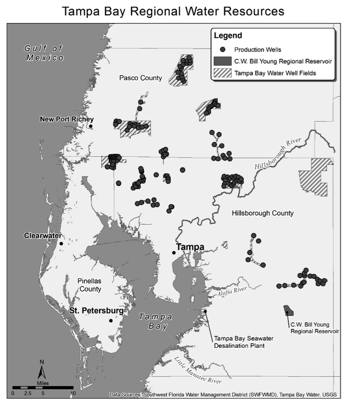
As is true for the rest of Florida, growth and development in the greater Tampa Bay region has long depended on water control. For nearly a century, the City of Tampa has tapped the Hillsborough River as a water supply. As late as the 1960s, flooding along portions of the 54-mile Hillsborough River remained the most critical water issue in Tampa. Meanwhile, continued population growth throughout the region, especially on the western side of Tampa Bay (in Pinellas County, featuring St. Petersburg and Clearwater; Figure 2), relied on access to inexpensive but high quality groundwater. Saltwater intrusion into Pinellas County well fields has been a problem since the 1920s, so Pinellas authorities ultimately bought land for well fields in rural but inland portions of neighboring Pasco and Hillsborough counties. Yet by the 1980s, many people living in these rural areas began to see the negative impacts of excessive groundwater pumping. Specifically, wetlands and lakes began drying up, much to the chagrin of property owners who built docks and boathouses that eventually extended to dry land.
While some officials blamed drought for disappearing surface water, the Southwest Florida Water Management District (often called Swiftmud) eventually demanded that Pinellas utilities reduce groundwater pumping. Swiftmud’s stance threatened the region’s growth coalition: politicians, realtors, home builders and other business leaders who believed that continued access to inexpensive groundwater remained vital to sustain continued population growth and economic development. After more than a decade of costly political and legal wrangling between Swiftmud and Pinellas County leaders (known locally as the Tampa Bay Water Wars), a settlement finally emerged in 1997. Swiftmud agreed to help a new regional water wholesaler (Tampa Bay Water) build new and expensive water infrastructure that would eventually reduce the pressure on groundwater resources while accommodating future growth and development.
Figure 2
As a result, Tampa Bay is now home to the largest desalination plant in the western hemisphere (even if water managers in California may soon claim this distinction). Plagued by serious technical problems and cost overruns, the $158 million plant finally achieved peak production of 25 million gallons per day (mgd) in late 2007. To put this in perspective, the three Tampa Bay area counties of Hillsborough, Pinellas and Pasco used 432 mgd of fresh water in 2005. Despite the advantages of flat topography (which keeps distribution costs low compared to regions with more hilly topography), drawing water from the Tampa Bay estuary (which is somewhat less salty than sea water, so it reduces treatment costs), and a location adjacent to a power plant that discharges higher temperature water used for cooling (further reducing treatment costs)—despite these advantages, the desalination plant often operates well below capacity because it produces water that costs more than other sources.
That is not all. Swiftmud also agreed to subsidize the construction of the 15 billion gallon C.W. Bill Young Regional Reservoir that would store excess surface water from local streams during the summer rainy season for use during the region’s relatively dry winter and spring. This $146 million facility developed cracks soon after opening in 2005, and, after spending several million dollars trying to make repairs and suing the original contractor, not only did Tampa Bay Water lose the lawsuit but its customers now have to pay $129 million to rebuild the reservoir. Finally, Tampa Bay Water also spent $144 million on a surface water treatment facility, which makes potable water from a variety of surface sources including the broken reservoir, the desalination plant, and local streams. Like the other projects, this treatment plant experienced problems at first, but is now functioning properly.
On top of all of this, several Tampa Bay communities continue to invest millions of dollars laying pipes and building pump stations to distribute treated wastewater from sewage treatment plants (often called reclaimed water) for use in irrigating golf courses, parks, and yards, as well as for industrial and limited agricultural use. Making use of treated wastewater is not only drought resistant, it reduces the use of drinking water for growing grass. In 1977, Tampa’s neighbor, St. Petersburg, initiated the first large urban water reuse system in the United States. Florida (along with California) leads the nation in its use of reclaimed water; data from a May 2013 Florida Department of Environmental Protection report show that the Sunshine State now reuses about 45% of treated wastewater discharged from sewage treatment plants. Similarly, Swiftmud contends that 44% of all the treated wastewater leaving sewage treatment plants in the district is now reused.
For Tampa Bay and most of the rest of Florida, authorities are already making maximum use of inexpensive groundwater, and they have begun to tap more expensive water in order to continue fanning the flames of population growth and development. Few would argue with calls to reduce water use by using water more efficiently. Yet many people are annoyed that they have to reduce their water use in order to provide water to support continued development. Worse, major water utilities investing in expensive infrastructure depend on a certain level of water sales to pay for such infrastructure; when people buy less water (conserve!), utilities often have to charge more (per unit) for what they sell. In the U.S., costs associated with public water provision are often distributed evenly among a population, with the occasional exception of instituting progressively higher rates for larger amounts of consumption/use. Certainly those who benefit the most from constant population and economic growth favor this approach. What might make more sense, however, is assigning a larger percentage of the cost of developing more expensive sources of water to those who create that need in the first place. Regardless, future water use will almost certainly be more expensive; the remaining questions are how much will it cost and who will foot the bill?
Christopher Meindl
University of South Florida – St. Petersburg
Maps by Andy Hayslip
University of South Florida – St. Petersburg
Elizabeth D. Purdum, Peter A. Kraft, Edward A. Fernald, and James R. Anderson (eds.). 1998. Water Resources Atlas of Florida. Tallahassee: Florida State University, Institute of Science and Public Affairs.
Past President’s Address Focuses on Thinking Geographically, Globally
Thinking Geographically: Globalizing Capitalism, and Beyond
In the spirit of strengthening our intellectual foundations and clarifying our contributions to shaping Earth I advocate for thinking geographically, as a way of being in the world that all can join, rather than policing the boundaries of a discipline called Geography. Thinking geographically means attending to: the geography of knowledge production; how spatio-temporalities shape and are shaped by socio-natural processes; the more-than-human world as it emerges from the interdependencies between human conception and action and biophysical processes; the variegated ontologies, epistemologies and methodologies underlying knowledge claims; and the world not only as it is but as it could be. Thinking geographically does not seek consensus around some monist body of knowledge, grounded in Lakatosian hard-core principles. It means advocating engaged pluralism: ongoing open-ended debate and mutual criticism between differently positioned knowledge producers willing to learn from one another’s local epistemologies.
What are the implications of thinking geographically about globalizing capitalism? First, it is necessary to problematize the European positionalities from which commonsense understandings of capitalism diffused. Europe did not invent capitalism, but the spatial dynamics of colonialism that elevated Europe to the global core also made it globalizing capitalism’s center of calculation. Globally influential theories of capitalism thus were European in origin, grounded in European Enlightenment thinkers’ encounters with the forms that emerged in eighteenth and nineteenth century northwestern Europe. British capitalism, in particular, became the basis for defining capitalism, and the whetting stone on which theories of capitalism were sharpened. Across Europe, other socio-spatial positionalities generated very different conceptions of capitalism, from the free trade proponents of English political economy, to the trenchant critiques of that socialist German immigrant Karl Marx, or the nationalist vision of Friedrich List. Thinkers positioned beyond the European realm, such as Latin American dependency theorists or the Africans Samir Amin and Frantz Fanon, have also shaped global debate—albeit about the consequences rather than the definition of capitalism. Notwithstanding such interventions, the local epistemology that is global commonsense, and the model of capitalism underwriting it, remains rooted in eighteenth century English political economy with its influential proponents.
Second, thinking geographically about this economic model raises serious questions about its internal coherence. Capitalism cannot be described in terms of an idealized equilibrium outcome where markets clear, but exhibits out-of-equilibrium dynamical complexity characterized by path-dependence, instability, unpredictability, conflict and uneven geographical development. In a spatially differentiated economy, the ‘free’ markets propounded by neoliberal visions of capitalism cannot be self-regulating and harmonious; their creation and maintenance require continual spatio-temporal interventions by extra-market forces. Indeed, capitalism cannot be understood, or successfully practiced, simply as an economic process; its economic aspects are co-implicated with political, cultural, social and biophysical processes, in ways that repeatedly exceed the ‘laws of economics’. This undermines the vision of globalizing capitalism as a rising tide capable of lifting all boats, bringing prosperity to all hard-working and responsible individuals and well-governed territories.
Third, thinking geographically questions the capacity of globalizing capitalism to deliver on its own promise. The mainstream vision of capitalism inclines to a place-based imaginary: Success or failure is generally attributed to characteristics (e.g., culture, climate, governance, coherence) of the entities being assessed—whether individuals, cities, regions or nations. Yet such place-based explanations are insufficient and misleading. Socio-economic performance is equally shaped by the asymmetric connectivities between places, and the inter-scalar dynamics, that co-evolve with uneven geographical development. Further, market-based principles are inadequate for redressing political, cultural or biophysical conflict or dysfunction.
It follows that globalizing capitalism (as we know it) cannot be considered the best practice culmination of some ubiquitously applicable developmental trajectory, mandatory for the success of every territorial economy. Far from being the go-to solution to impoverishment, globalizing capitalism’s uneven geographical development is itself productive of social and geographical inequality—realizing possibilities for those occupying privileged socio-spatial positionalities while undermining them for the majority. It is thus necessary to acknowledge space for alternative, more-than-capitalist experiments and trajectories, enriched by peripheral experiences of and encounters with globalizing capitalism. These alternatives cannot simply be read off from well-trodden European-style debates about capitalism vs. socialism; thinking geographically induces skepticism about the adequacy of any ubiquitous ‘best practice’ alternative. There is a plurality of distinctly situated existing and potential alternatives, whose impact on the livelihood possibilities of both those pursuing them and those living otherwise (and elsewhere) should be critically assessed. This will require reciprocal critical engagement between alternatives, and the political and moral grounds motivating them.
The Past President’s Address will take place at 6:30 p.m. on Thursday, April 10, 2014, at the AAG Annual Meeting in Tampa, Florida. Eric Sheppard will present the 2013 Presidential Achievement Award to Doreen Massey. See www.aag.org/annualmeeting for details and to register.
Share
Annual Meeting
Winkler’s Presidential Plenary to Kick Off Climate Change Theme
Climate change is a major environmental challenge facing humankind today. Geographies of Climate Change, a featured theme for the upcoming AAG Annual Meeting in Tampa, highlights the complex spatial dimensions of climate change including the observed and anticipated geographical differentiation in potential impacts and vulnerability. The theme will address such topics as the scientific complexity and uncertainty of climate change, its political and policy contextualization, the challenges of formulating adaptation and mitigation strategies, and the importance of effective communication strategies. The Presidential Plenary that opens the Annual Meeting will focus on this theme, and will feature four leading experts in the area of climate change research.
Mike Hulme is professor of climate and culture in the Department of Geography at King’s College London. His work explores the idea of climate change using historical, cultural and scientific analyses, seeking to illuminate the numerous ways in which climate change is deployed in public and political discourse. His latest book – Can Science Fix Climate Change?A Case Against Climate Engineering (Polity) – is due out in April. He is also the author of Exploring Climate Change Through Science and In Society (Routledge), Making Climate Change Work For Us (Cambridge) and Why We Disagree About Climate Change (Cambridge). This latter book was chosen by The Economist magazine as one of its science and technology books of the year. From 2000 to 2007 he was the Founding Director of the Tyndall Centre for Climate Change Research, based at the University of East Anglia, and since 2007 has been the founding Editor-in-Chief of the review journal Wiley Interdisciplinary Reviews (WIREs) Climate Change.
Linda Mearns is a Senior Scientist at the National Center for Atmospheric Research (NCAR), and serves as NCAR’s Director of the Weather and Climate Impacts Assessment Science Program and Head of the Regional Integrated Sciences Collective within the Institute for Mathematics Applied to Geosciences. She has performed research and published mainly in the areas of climate change scenario formation, quantifying uncertainties, and climate change impacts on agro-ecosystems, and has worked extensively with regional climate models. She was an author for the Intergovernmental Panel on Climate Change (IPCC) 1995, 2001, 2007, and 2013 assessments. She leads the multi-agency supported North American Regional Climate Change Assessment Program (NARCCAP), which is providing multiple high-resolution climate change scenarios for the North American impacts community.
Susanne (Susi) Moser is Director and Principal Researcher of Susanne Moser Research & Consulting, a Social Science Research Fellow at Stanford University’s Woods Institute for the Environment, and a Research Associate of the Institute for Marine Sciences at the University of California-Santa Cruz. As a nationally and internationally recognized expert in climate change adaptation, communication for social change, and science-policy interactions, she works with researchers, governmental and non-governmental organizations in the US, Europe and Australia. She contributed to the Fourth and Fifth Assessment Reports of the Intergovernmental Panel on Climate Change (IPCC) and was a Review Editor for the IPCC Special Report on extreme events, disaster risk management and adaptation. She also is a member of the federal advisory committee on the Third US National Climate Assessment and serves as one of the Convening Lead Authors on its coastal chapter. She is a fellow of the Aldo Leopold Leadership, Kavli Frontiers of Science, Donella Meadows Leadership, Google Science Communication, and Walton Sustainability Solutions Programs.
Marshall Shepherd is the 2013 President of the American Meteorological Society. He is the UGA Athletic Association Professor of Geography at the University of Georgia and director of the University’s Atmospheric Sciences Program. Prior to joining the University of Georgia faculty, Shepherd was a research meteorologist in the Earth-Sun Division at NASA-Goddard Space Flight Center and deputy project scientist for the Global Precipitation Measurement mission. In 2004, he received the PECASE Award, one the nation’s highest scientific awards, for pioneering research on urban-hydroclimate relationships. Dr. Shepherd currently serves on the National Oceanic and Atmospheric Administration Science Advisory Board, the Earth Science Subcommittee of the NASA Advisory Council, the NASA Goddard Space Flight Center Visiting Expert Committee and numerous other high level committees. He co-authored a recent National Academy of Sciences report on urban meteorology and is working on the Wiley textbook, The Urban Climate System. He is also the Climatology Editor for the AAG Encyclopedia of Geography.
Florida, The Sunshine State, is a slogan designed to attract tourists. The nickname was officially adopted by the state legislature in 1970, although it had already appeared on license plates since the 1950s. Florida brings to mind sunny skies, sandy beaches, and warm waters. It is the place for fun in the sun, whether you are looking for boating, fishing, swimming, or simply sunbathing. Florida is home to some of the country’s most entertaining and enjoyable theme parks: Walt Disney World, Sea World, Universal, and Busch Gardens. And the state hosts many events that visitors come to watch such as Super Bowls (15 to date), college football bowl games (six games are scheduled for the 2013-14 postseason), spring training baseball, shuttle launches and other space-related missions, and the Daytona 500. Add in a few cruise ports, some tourists from Central and South America who visit for a day or two of shopping along Florida’s Gold Coast, and a competitive convention business. The result is a tourism industry that is arguably the most salient and successful among the 50 states, and the most important sector of Florida’s economy.
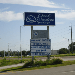
Florida first started receiving visitors with the arrival of Ponce de Leon’s convoy of explorers in 1513, an event the state is currently commemorating with its Viva Florida 500 celebration. Significant numbers of tourists began to arrive during the latter half of the 19th century. However, Florida’s tourism history is most commonly defined by the opening of Walt Disney World on October 1, 1971. All other events are categorized as pre or post Disney. In the decades prior to the opening of Walt Disney World, Florida attracted automobile visitors with a number of roadside attractions that promoted the State’s natural environment and wildlife. The map below illustrates the location of many of these attractions, as well as the major US highways that visitors used to travel throughout the state. Places like Cypress Gardens, Silver Springs, and Weeki Wachee Springs (see photo) promoted the lush tropical vegetation and aquatic formations that could be found in Florida. Attractions such as Marineland and Parrot Jungle exhibited the fish, mammals, reptiles and birds that inhabited the state. In a sense, these places were the precursors to contemporary ecotourism.
The post Disney era is characterized by large theme parks and large numbers of visitors who converge on the state by highway and by air. In a recent interview on NPR (2013), Oscar Collins, a glass bottom boat captain at Silver Springs characterized the park’s heyday during the 1960s by stating “we were doing 4-and 5000 people in the middle of the week, and on weekends, 6- and 7000.” In 2010, Walt Disney World’s Magic Kingdom welcomed nearly 17 million visitors, an average of over 46,000 persons per day. Walt Disney World’s other three theme parks (EPCOT, Hollywood Studios, and Animal Kingdom) welcomed approximately 10 million additional visitors each. Universal’s two Orlando theme parks received approximately 6 million guests each, and Busch Gardens in Tampa welcomed more than 4 million visitors (Inside the Magic 2011).
Numbers like these should allow Florida to pursue some lofty tourism goals. Specifically, the state wishes to become the No. 1 travel destination in the world. This is the vision of Visit Florida, a not-for-profit corporation created by the state legislature in 1996, which serves as the state’s official tourism marketing agency (www.visitflorida.com). 2012 was a record year for tourism in Florida. The state welcomed over 91 million visitors who spent over $71 billion, generating 23 percent of the state’s sales tax revenue (Visit Florida 2013). There were also over 20 million in-state visits and staycations. This continues a trend of steady growth in the number of tourists from year to year over the past 10 years. Only the financial crisis of 2008-2009 created a temporary drop in the number of visitors to Florida since 2002. And Visit Florida is taking steps to build on the current success. Beginning in the summer of 2013, video teams trained by Google Maps experts began to use Google’s Street View Trekker technology to capture images of the state’s 825 miles of beaches. Florida’s Governor Rick Scott said “this technology from Google will allow anyone in the world to see how vast and beautiful Florida’s beaches are, which will create more opportunities for tourism.” The organization is also using social media, expert bloggers with journalism backgrounds, as well as traditional TV, radio, cinema, and print advertising to promote the state for tourism.
And while Visit Florida promotes tourism outside the state, the Partnership for Florida’s Tourism (www.floridastourismcounts.org), a grassroots coalition designed to increase public funding of tourism marketing, promotes the industry inside the state. Their lobbying focuses on the importance of visitors in creating jobs for Floridians. Their research shows that over 1 million Floridians are employed in the tourism industry, and that one new job is created by every 85 additional visitors. Comprised of associations representing restaurants and lodging, attractions, RV and campgrounds, and destination marketing organizations, the Partnership for Florida’s Tourism argues that Florida must combat the increased funding for tourism promotion spent by other states and destinations.
However, there is plenty of combat within the state as well. Over the past several years, investors in South Florida have lobbied the legislature to allow billion dollar resort casinos to be developed in Dade and Broward Counties. These efforts have been met by strong opposition from the Walt Disney Company and the Florida Chamber of Commerce which support the family-friendly image of Central Florida’s theme parks. They are also concerned that these resort casinos would create the hotel and meeting room space necessary for South Florida to significantly impinge on Central Florida’s convention business.
There are many other examples of serious competition for visitors within the state. The website for Florida Suncoast Tourism Promotions (www.floridatourism.com) contains a regional travel guide that states “South Florida has seen the best days go by as Orlando and other parts of the state beckon tourists . . . Although Fort Lauderdale is no longer a spring break haven, and Miami has seen its share of urban troubles, the beaches, the people, the Everglades, and the experience of it all is not to be missed.”
In addition, some of Florida’s traditional vernacular regions have Balkanized as adjacent areas compete for tourism income and tax revenue. Two of the most recent examples would be the emergence of the Historic Coast in St. Augustine and St. Johns County, formerly part of the First Coast, and the Cultural Coast south of Tampa Bay focusing on Sarasota, formerly part of the Sun Coast. Moreover, the Visit Florida website presents literally hundreds of vacation options, each one hoping to outshine the other and attract potential visitors.
Obstacles to success in the tourism industry are not restricted to competition among Florida localities. Events beyond the control of the tourism industry may impede Florida’s desire to be the world’s number one travel destination. Devastating hurricanes are always a possibility during the summer and fall months. Human caused disasters such as the Deep Water Horizon oil spill in 2010 threatened the pristine character of Florida’s beaches. And Florida’s controversial stand- your-ground law, the focus of intense media attention during the spring and summer of 2013, has many groups calling for a boycott of Florida tourism until the law is overturned.
Despite these obstacles, the state recorded a record number of tourists for the first quarter of 2013. Florida has come a long way since the nature based tourism of the early 20th century, and the state is banking on tourism to remain a major job and revenue creator in the state’s 21st century economy. ♦
Ray Oldakowski
Department of Geography and the Environment
Jacksonville University, Jacksonville, FL
The Association of American Geographers (AAG) is pleased to announce that Julian Bond, a renowned civil rights pioneer and political leader, has been named the third recipient of the AAG Atlas Award. Professor Bond will receive the award at the AAG’s next Annual Meeting in Tampa, Florida on Friday evening, April 11, 2014, where he will deliver a presentation on “Race Around the World,” focusing on how civil rights figures and organizations have shaped and changed American foreign policy. More than 8,000 geographers and others from around the world, including the media, are expected to attend the AAG meeting.
Julian Bond
Bond
Bond is the son of former college and university president Horace Mann Bond, and he has built his own record as a celebrated educator, having held appointments at several leading institutions, including American, Harvard, and the University of Virginia. He has been awarded more than 20 honorary degrees throughout his career.Julian Bond has played a central role throughout the U.S. Civil Rights Movement, as a leading figure in the Student Nonviolent Coordinating Committee and as co-founder and first president of the Southern Poverty Law Center. Bond was repeatedly elected to the Georgia General Assembly for 20 years, including six terms as a state senator. More recently, he has served as Chairman of the NAACP for 12 years, from 1998 to 2010.
Julian Bond embodies the ideals and goals of the AAG Atlas Award, which is designed to recognize and celebrate outstanding accomplishments that advance world understanding in exceptional ways. The image of Atlas bearing the weight of the world on his shoulders is a powerful metaphor for this award program, as the AAG’s awardees are those who have taken the weight of the world on their shoulders and moved it forward, whether in science, politics, scholarship, the arts, or in war and peace. In addition to a substantial cash prize, an Atlas statuette will be presented to Professor Bond as a compelling keepsake and an inspiring symbol for the award program itself. Author and scientist Jane Goodall and human rights leader Mary Robinson are the previous recipients of the AAG Atlas Award.
We invite you to join Professor Julian Bond and the AAG in Tampa to celebrate his extraordinary accomplishments and to discuss with him and others from around the world the future of civil rights and social justice. To register for the meeting, please visit www.aag.org/annualmeeting.
About the Association of American Geographers
The AAG is a scholarly and professional association representing leading researchers, educators, and practitioners in geography. Founded in 1904, its 10,000 members share interests in the theory, methods, and practice of geography, and its role in helping to create a better world. Visit www.aag.org for more information.
Share
Annual Meeting
While you are in Tampa, you may notice signage for U.S. Highway 41.
For a walking tour of Calle Ocho in Little Havana visit: https://travel.nationalgeographic.com/travel/city-guides/miami-walking-tour-3/. Map Credit: Hilton Cordoba.
While you are in Tampa, you may notice signage for U.S. Highway 41. Built in the 1920s, it was the only overland route across the southern tip of Florida. U.S. In a larger spatial context, U.S. 41 is a north-south axis that spans the middle of North America and extends from Michigan’s Upper Peninsula to Miami. The southernmost section (Tampa to Miami) is known as the Tamiami Trail. The last few miles of the road are locally known as Calle Ocho (Southwest 8th Street), which forms the main artery and an important boundary within the vibrant multi-ethnic community of Little Havana. The Cuban imprint in ‘Little Havana’ is a cultural layer that simultaneously underlies the current demographic structure of the neighborhood and provides glimpses into the neighborhood’s cultural and historical change.
Before Little Havana
Little Havana has been a common destination for a number of groups that include: Miccosukees, Bahamians Jews, Greeks, Cuban refugees, and immigrants from almost every Latin American country (Shell-Weiss, 2009). Originally, Little Havana consisted of two neighborhoods: Riverside and Shenandoah. Calle Ocho was known as Orange Glades Road that marked a division within the area that is noticeable even today. Riverside, the neighborhood north of Calle Ocho, acquired its name due to its close proximity to the Miami River and was home to some of Miami’s earliest schools, churches, and businesses. Shenandoah (the neighborhood south of Calle Ocho) remained in farmland until the 1920’s when it was developed as a single-family residential area. By contrast, the Riverside the area north of Calle Ocho saw the construction of primarily multi-family housing to meet the needs of number of Jewish people who moved from the Northeast. With them came a landscape comprising a number of synagogues, Sunday schools, Jewish senior homes, as well as numbers of influential leaders who arrived in Miami from the Southeast (George, 2006).
The Tower Theater with its Art Deco style has been a landmark of the neighborhood since it first opened its doors in 1926. Located along Calle Ocho and 15th avenue, the road was a two way street at the time hence the sign of the theater was built at an angle so that it was easy for the drivers to glance quickly at the listing of shows. In the 1960’s with the growth of the Cuban population, the theater was the first one to offer titles in Spanish in Miami-Dade County. Picture Credit: Hilton Cordoba
The making of an enclave
The first wave of Cubans arrived between 1959 and 1962 and became known in the Cuban Community as the ‘golden exiles’ because of the human capital that they brought with them. Many of them were well educated and had business experience. They settled in Riverside and Shenandoah and established businesses and social organizations. In a second wave that occurred from1965 to1973, 3,000 to 4,000 Cubans per month were airlifted to the U.S. Diplomatic preference and easier paths to resettlement were given to those Cubans who had relatives already established in the U.S. During this period Riverside and Shenandoah collectively became known as Little Havana. In this new layer of settlement, many of the apartment buildings that once were occupied by Jews and Anglo Americans were now homes of the newly arrived Cubans. In this cultural an ethnic shift, many of the synagogues were converted into Catholic churches, and the elementary schools’ curricula now featured classes in Spanish (Alberts, 2005). The last major wave of Cuban migration was in 1980 when a boatlift was organized at the port of Mariel; those who embarked on this voyage are sometimes referred as ‘Marielitos’ because of their port of exit. The Cuban population of Little Havana reached its peak with the Census of 1980 when it stood at 95,522. In relative terms that number accounted for approximately 70 percent of the total population and 85 percent of the Hispanics in Little Havana (Cordoba & Carrillo, 2010).
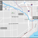
A shot of the Miami River from Jose Marti Park with the I-95 overpass in the background. In the late 1800’s the Miccosukee people navigated the river from the Everglades to come to trade and exchange items with the white settlers. By 1980, the I-95 overpass was the temporary home where the U.S. government created makeshift camps for Cuban refugees that arrived during the Mariel boatlift. In 2008, Jose Marti Park with the Miami River in the background were the setting for a scene in the comedy-drama film Marley & Me. Picture Credit: Hilton Cordoba
From ethnic enclave to multi-ethnic community
Between 1980 and 2000, Little Havana’s Cuban population decreased by 30 percent, and by the 2000 U.S. census, they accounted for 56 percent of Hispanics in Little Havana; estimates of the 2009 American Community Survey showed a slight increase to 58 percent share among Hispanics. Central and South Americans on the other hand, have continued to increase their numbers in Little Havana where now they represent thirty and twelve percent of the Hispanic population, respectively. Nicaraguans and Hondurans account for the two biggest groups from the Central American community while Colombians and Peruvians from the South American community. The fastest growth in the last decade came from the Uruguayans and Argentineans (595 and 318 percent, respectively) as many left for the United States with the collapse of the Argentinean economy in 2001. Little Havana has changed as the different groups that have come through the area have made it their home. Nicaraguans have especially acquired an affinity for Little Havana as you can find their fritangas (cafeteria style restaurants serving Nicaraguan food and specialty drinks) at almost every major intersection, a street name after Nicaraguan poet Ruben Dario, the offices of the Nicaraguan consulate, the mausoleum of former Nicaraguan president Anastasio Somoza Debayle, and St. John Bosco Catholic Church and its Nicaraguan parishioners.
Fritangas are found throughout the streetscape of Little Havana. These restaurants are not just about the ethnic dishes but also a place to gather news about the homeland or the local community, buy phone cards to call relatives, a place to find souvenirs and delicacies imported from Nicaragua, and even a place of worship on the evening of every December 7th when Nicaraguans celebrate ‘la griteria’ (a chanting to the Immaculate Concepcion of the Virgin Mary, a tradition that dates back to colonial times). Picture Credit: Hilton Cordoba
The centrality of Little Havana is often most overlooked but helps explain why this area has been sought out by so many immigrants and helps us understand why it continues to be the residential area of choice of many Hispanic seniors. Businesses along Southwest 8th Street, West Flagler Street and other major roads not only prevent residents from having to go outside the neighborhood for goods and services, but also make it easy to live in the area without dependence on the automobile. This centrality also creates locational advantages in access jobs: Little Havana is in the vicinity of higher income areas, which are the workplace for many immigrants who live in the neighborhood. Areas such as Brickell, Coconut Grove, Key Biscayne, and Miami Beach, are luxury condominium communities, with extravagant homes, and hotels that provide work for many immigrants who find positions as maids, gardeners, and construction workers. These workers capitalize on a huge cultural benefit of not having to learn a new language; many can live in Little Havana without ever learning English. The combination of these unique characteristics creates a safe haven for immigrants and the perfect gateway for those in search of a new life in America.
There is more to Little Havana than the name suggests, so when you come across U.S. route 41 in Tampa, think about the lively multi-ethnic neighborhood at the southern end of the road. You can venture out along the Tamiami Trail and cross the Everglades as the famous Trail Blazers did in early 1920’s. You will have a chance to stop by the Miccosukee village, catch an airboat ride, or hop on a bike to explore the Everglades on a 15 mile loop at Shark Valley. If you prefer not to drive, you may take the 92 Silverstar and enjoy a train ride through the verdant back country of Florida; whatever you decide to do, just bring a camera along to capture the unique streetscape and a hearty appetite for the endless variety of Latin food that await you in Little Havana.
By April, you are likely to be thinking that it’s been a long cold lonely winter. If you’ve booked your ticket to ride to our 2014 AAG annual meeting in Tampa, then a good day sunshine may very well be on the horizon. Florida’s peninsular shape, concave and convex coastal segments and location between the Gulf of Mexico and the North Atlantic Ocean all play an essential part in the development of the state’s weather (Stowers and Tabb 1987). Spanning latitudes 25-30° N, most of the state experiences humid subtropical conditions according to the climate classification developed by Köppen. When the rain comes, they run and hide their heads from an average of 46.3 inches in Tampa (Hillsborough County) and 50.8 inches in St. Petersburg (Pinellas County) each year (NWS Data). For two months of the year, the average high temperature in Tampa is above 90°F with relative humidity above 50 percent, yet Sunshine State weather in April tends to feel fine with an average high at just 81° F.
However, tangerine trees and marmalade skies can give way to damaging winds and heavy rains, leaving many with a need to fix the holes where the rain gets in. Florida is not a stranger to thunderstorms. In fact, lightning occurs so frequently within Florida that the state is considered the lightning capital of the United States with over fifty strikes per square mile per year (Mogil and Seaman 2008). Cloud-to-ground lightning often streams helter skelter across the landscape as the state’s highest flash densities occur in West-Central Florida around Tampa Bay. This is due to the collision of sea breeze boundaries in this area of the state, especially during June-August. Spectacular offshore lightning displays at night can be triggered by land breezes. So come to Florida and join the local hockey fans who enjoy a fantastic “Lightning” display.
Tornadoes have occurred in every state. However, some may be surprised to learn that Florida was ranked third in average annual tornadoes per state 1991-2010 according to data from the National Climatic Data Center (NCDC). Florida had an average of 66 tornadoes reported annually during that period, including 105 in 2004 alone. April 2014 marks 49 years since an F4 tornado moved across Pinellas and Hillsborough Counties and continued across the peninsula causing upwards of 3300 injuries with 11 deaths. It is the only F4 tornado occurring in Florida since 1950 according to data from the Storm Prediction Center. Fortunately, no other April tornadoes have caused the wind to be high within Hillsborough County where our meeting will be held. Water spouts are also a common occurrence along Florida’s coastline. A 15-year study by Golden (1977) found that the Florida Keys experienced the greatest frequency of water spouts from Texas to Maine. But when you talk about destruction, Tampa Bay had the highest number of damaging cases.
Figure 1. Tracks of tropical cyclones making landfall over Florida 1851-2011.
The severe weather phenomenon most often associated with Florida is the hurricane. While Tampa has not experienced a landfall in many years, the state of Florida has not been so fortunate. Florida experiences twice as many landfalling hurricanes as the next prevalent state, Texas. After using a GIS to plot the tracks of all tropical cyclone during 1851-2011 (Figure 1), it can be seen that 269 have crossed the boundary of Florida, yielding an average of 1.67 landfalls per year and many a wild and windy night. Fortunately for AAG attendees, no Florida landfalls have occurred during April. Unlike some other national events held in Tampa e.g. the 2012 RNC, the AAG invites its members to Tampa before hurricane season starts!
When considering the impacts of these various weather phenomena, one must also consider the number of people who have come together to live in the Tampa Bay area. Population growth from 1950 – 2010 was 390% for Hillsborough County and 475% for Pinellas County. Neighboring Polk and Pasco Counties experienced growth of 385% and 2165%, respectively under their blue suburban skies. The implications of this growth are staggering in terms of the number of people left to make ends meet and millions of dollars involved if disastrous weather should strike the Tampa Bay area. Given the shallow bathymetry of the bay, the infrastructure built along and near its shores, and the high population density in the area, the costs of Hurricanes Andrew, Katrina, or Sandy could easily be surpassed if a similar storm hit Tampa.
Yet before the arrival of hot weather and hurricanes, April is a great month to be outdoors and follow the sun in Tampa. According to the NCDC, the average high and low temperatures for the week of the AAG conference approximate 80° and 61° F, making for a fab forecast. Unfortunately for those who like to watch endless rain pouring into a paper cup, April is the second driest month receiving only 2.03 inches of rainfall on average. If you do wear a raincoat, you may be standing solo in the sun as April is tied with May as the sunniest month of the year, with 75% of possible sunshine occurring. Sun, sun, sun, here it comes! With sunshine at its highest, temperatures at their most pleasant, and severe weather occurrences at their lowest, the weather is sure to please please you during the 2014 AAG annual meeting in Tampa. We hope you will enjoy the show.
Stowers, D.M., and N.D. Tabb 1987, An investigation of the variances from the traditional summer precipitation in the west-central Florida region. Florida Scientist, 50, 177-183.
Part 1: Congo Square, Atlantic Exchange, and the Emergence of Jazz
New Orleans is a meeting ground. Situated at the confluence of the Mississippi River and the Gulf of Mexico, the city connects North America’s most expansive riverine network with the vast Atlantic basin. Its strategic location has long attracted diverse peoples and ideas, whose collaborations have forged extraordinary cultural, economic, and ecological innovations. Prominent among those novel expressions, music remains central to New Orleans’ sense of place. This essay, offered in two parts, surveys the cultural and historical geographies of music in New Orleans. It outlines a rough chronology of the innovative musical cultures that coalesced and continue to proliferate in New Orleans, emphasizing both the singularity of the city’s cultural production, as well as its fundamental connections with the French, Hispanic, and Black Atlantics.[1] This geographical treatment will, I hope, prime attendees of the 2018 AAG Annual Meeting to indulge in New Orleans’ rich musical (and other performative) cultures on display at countless clubs, bars, restaurants, parties, parades, and street corners, as well as the French Quarter Music Festival. Overlapping with the AAG conference and free of charge (!), the lively outdoor fête showcases some of the region’s most celebrated acts and styles. In this first of two parts, I treat the city from its founding in the early-eighteenth century through the emergence of jazz in the early-twentieth century, providing historical-geographical context for the distinct and diverse musical cultures emanating from New Orleans.
New Orleans and its musical cultures are perhaps best understood through the city’s complex connections to the African diaspora, its experiences within the French and Spanish Colonial Empires, and its relations to fluvial networks and ports throughout the mainland Americas and the Caribbean. After founding the city in 1718, France ceded New Orleans to Spain in 1762. The city spent four formative decades under Spanish control, undergoing significant demographic, urban, and economic growth. Napoleonic France briefly regained control of the city in 1803 before selling it to the United States just three weeks later in the Louisiana Purchase. As the colony changed hands over the eighteenth and nineteenth centuries, a steady flow of enslaved Africans continually replenished profound African influence in New Orleans and its environs. Those fundamental influences continue to manifest in the city’s rich cultural and economic development, especially by way of its music.[2]
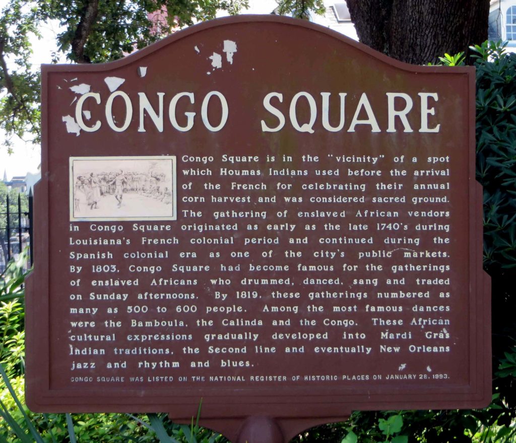
The historical-geographical hearth of musical culture in New Orleans (and, it could be said, of the US as a whole) is Congo Square—the first and only sanctioned gathering place for enslaved people in the antebellum United States—beginning as early as the 1740s (Figure 1). Located just outside of the original city walls, near the grounds of the Tremé Planation, Congo Square originated as a Sunday market where enslaved Afro-descendants and indigenous people gathered to trade in goods they themselves had grown, gathered, and hunted. The weekly gatherings soon became an extraordinary venue for cultural exchange where hundreds of people mingled, cooked, drummed, worshipped, danced, and sang. Spirituality was fundamental in those musical and rhythmic expressions, as drumming remains essential in the syncretic religions that developed among Afro-descendants in the New World, among them Vodun in Haiti, Santeria in Cuba, and Voodoo and Hoodoo in New Orleans.[3]
Beginning in the French period, Congo Square and its weekly assemblies survived and evolved through Spanish control and later the city’s integration into the United States. By the early nineteenth century, visitors documented crowds numbering more than 500 practicing distinct forms of African drumming, singing, and dancing. The humble outdoor market became a historic nexus crucial for the preservation of African cultural forms, as well as the eventual creation of novel hybrids mixing, as just one example, Senegambian-style banjos with drumming from the Kongo. Congo Square thus remains an important site of African-American cultural and economic resistance where enslaved people of African descent, despite the horrific brutalities of slavery, laid the rhythmic foundations for what eventually became blues, ragtime, jazz, country, rhythm and blues, rock and roll, hip hop, and countless other American musical genres. As prominent New Orleans jazz musician, educator, and advocate Wynton Marsalis proclaimed, “The bloodlines of all important modern American music can be traced to Congo Square.”[4]
A plaque commemorating Congo Square in Louis Armstrong Park where the French Quarter and Tremé neighborhoods meet at Rampart and Orleans Streets (Photo credit: K.D. Burns, 2012).
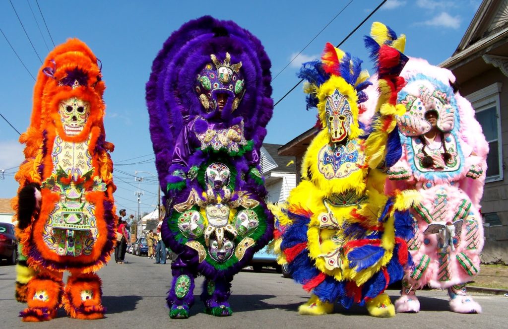
While many New Orleans traditions trace their beginnings to Congo Square, the various groups collectively known as Mardi Gras Indians maintain a particularly firm link to the traditions forged there. Melding West African, Indigenous American, and European Catholic traditions, the Mardi Gras Indians celebrate the pre-Lenten Carnival (and a few other dates) by creating, costuming, and parading in lavish handmade regalia adorned with thousands of sequins, beads, and feathers (see Figure 2). Keepers of extravagant musical and material traditions traceable to Yoruba and Haitian Afro-creole antecedents, the Indians remain influential community leaders in many neighborhoods of New Orleans. (See Part II of this essay for more on the Indians’ musical influence).[5]
New Orleans Mardi Gras Indians “masking” in the Lower Ninth Ward. Image courtesy of House of Dance and Feathers, a local museum (consider visiting and supporting them).
New Orleans’ distinct musical traditions began to coalesce during the Spanish period (1763-1803) when colonial trade and administrative networks linked the city with Vera Cruz, Tampico, and especially Havana, then the seat of the Spanish American colonies. Military-style marching bands provided the basic instrumentation and arrangements for the region’s music, as well as public spectacles. When Spanish Governor Miro received a delegation of Choctaw and Chickasaw Indian chiefs in 1787, he wooed them with a ballroom dance and an extravagant military parade.[6]
The following decade, refugees fleeing the Haitian (Saint Domingan) Revolution—roughly equal thirds White creole, enslaved, and free people of color—began streaming into New Orleans. Bringing with them African-inspired spiritual and musical traditions forged in the French Atlantic, the refugees doubled the city’s size by 1810. To keep up with the abrupt population growth, New Orleans quickly expanded its footprint north of the original city into former lands of the Tremé plantation, creating the faubourg (neighborhood) of the same name, where many Haitians and other émigrés eventually settled.[7]
Born in New Orleans, antebellum piano prodigy Louis Moreau Gottschalk grew up studying music with his grandmother Bruslé and her enslaved nurse Sally, both natives of Saint Domingue, before travelling widely in the Caribbean and Latin America. His piano composition “Bamboula, Danse des Nègres” (1848) drew on African-inspired folk traditions from the Antilles, and melded seamlessly with the rhythms of Congo Square. Written in Martinique in 1859, his “Ojos Criollos, Danse Cubaine” (Creole Eyes, Cuban Dance) blended Afro-Cuban rhythms with European melodies to foreshadow ragtime by three decades. By the mid-19th century, many widely popular musical styles—from minstrel show tunes, ragtime, and cakewalks to Cuban habanera, rumba, and son clave—all shared syncopated two-hand piano riffs made popular by Gottschalk. Those rhythms served as a foundation for later styles, including jazz, and live on not only in New Orleans’ second line parades and Mardi Gras Indian gatherings, but also the comparsa and conga processions of Cuban Carnival.[8]
Essential to the city’s musical traditions, brass bands were already integral to public life in New Orleans by the early nineteenth century. In 1838 the daily Picayune proclaimed a “mania in this city for horn and trumpet playing” derived from military bands and processions. Following the Civil War, that instrumentation combined with African-inspired funeral celebrations to lay the groundwork for New Orleans jazz funerals and second lines. Adding to the mix were post-abolition waves of African-American workers who migrated to the city in search of economic opportunities, bringing along their canon of work songs, spirituals, and blues from the Mississippi Delta. There the sacred call-and-response musical aesthetic of the Plantation South encountered the widely popular dance craze known as ragtime, and together began filtering through New Orleans’ traditional brass instrumentation and syncopated African rhythms.[9]
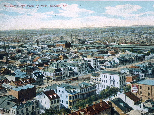
By century’s end, changes in the city’s legal frameworks would unwittingly galvanize the music scene in New Orleans, and provide the final ingredients for the musical gumbo that would coalesce as jazz. After the landmark Supreme Court decision Plessy v. Ferguson codified racial segregation into a strict binary, mixed race creole musicians found themselves officially classified as Blacks. An unforeseen consequence of that terrible ruling was the integration of the city’s brass bands, unifying creole musicians and their classical training with the more freewheeling styles of the city’s Black blues musicians. The following year, in 1897, the New Orleans city council created the city’s red light district where prostitution, drugs, and gambling were regulated and confined. The rough-and-tumble Storyville district provided steady gigs for brass bands and piano players at the end of the nineteenth century. Located in the Faubourg Tremé just two blocks from the site of Congo Square, the district became ground zero for a revolution in American music (Figure 3).[10]
Postcard showing view of Storyville; New Orleans: C. B. Mason, [1904–8]; The Historic New Orleans Collection, 1979.362.16
Emanating from New Orleans around the turn of the twentieth century, the novel improvisational styles that would collectively become known as jazz emerged from essential connections with the Mississippi Delta, Latin America, and the Caribbean. First visiting the city as part of the New Orleans World’s Fair of 1884–85, several Mexican bands and musicians became legendary for their lasting effects on the city’s musical cultures, including the introduction of the saxophone, bass plucking, and original compositions. Members of the Onward Brass Band, then among New Orleans’ most prominent marching bands, traveled to Cuba during the Spanish-American War. Among them were trombonist Willie Cornish and alto horn player John Baptiste Delisle, musicians that also played with Charles “Buddy” Bolden, a (the?) forerunning jazz musician. By the turn of the 20th century, jazz pioneers Bolden, Joe “King” Oliver, and Jack “Papa” Laine were collaborating with musicians with strong ties to Cuba, such as Manuel Pérez and Manuel Mello.[11]
The second generation of New Orleans jazz musicians could still discern the Afro-Latin influences fundamental to the jazz sound. Citing what he called “little tinges of Spanish,” New Orleans pianist Ferdinand “Jelly Roll” Morton, himself a descendant of creole Haitian émigrés, credited habanera rhythms as essential elements in New Orleans jazz. Another member of the second generation, the great Louis Armstrong, got his start in Storyville where he played in bands led by Kid Ory and King Oliver. Their repertoire included “New Orleans Stomp,” a popular dance tune steeped in complex Afro-Caribbean rhythms and time signatures.[12]
Jazz thus emerged in New Orleans as a delicious gumbo of ragtime, Delta blues, and the diasporic rhythms of the Afro-Caribbean. Despite continuous growth and innovation, most New Orleans music still derives from fluid blends of syncopated rhythms celebrated in Congo square and countless Afro-Caribbean communities with Eurasian instrumentation and melodic forms. The genius of New Orleans’ music springs not from the spontaneous epiphanies of a few talented individuals, but instead crystallizes from the city’s fluid connections to other places. At the confluence of the French, Spanish, and Black Atlantic Worlds, New Orleans has long provided an inclusive venue for the integration of diverse cultural forms.
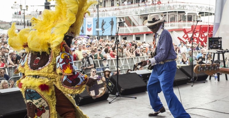
New Orleans will forever be associated with jazz, yet the soundtrack of the contemporary city is more complex. While people of all ages continue to enjoy an ever-expanding array of expressions falling under the jazz umbrella (e.g. Dixieland, trad jazz, Latin jazz, avant-garde jazz, jazz-funk, and various fusion sounds), New Orleans remains devoted to a grand diversity of musical genres and styles, such as brass bands, R&B, soul, funk, rock and roll, heavy metal, hip hop, bounce, and even zydeco—an upbeat Afro-French creole dance music from west of the Atchafalaya. In part two of this essay (coming early 2018) I discuss several of those musical traditions as they emerged in New Orleans since the twentieth century, with special emphasis on the artists and styles on display at the 2018 French Quarter Music Festival (Figure 4) that overlaps with the AAG annual meeting.
New Orleans blues guitarist Little Freddie King jams with Big Chief Juan Pardo of The Golden Comanche Mardi Gras Indians at the French Quarter Festival near Woldenberg Riverfront Park, 2015. Photo credit: Zack Smith, courtesy of French Quarter Festival.
Further reading and listening: To begin your preparations for New Orleans, be sure to live stream WWOZ, New Orleans community radio and self-proclaimed “Guardians of the Groove.” For more on New Orleans music, see the works referenced in the notes below and the following resources: recordings posted online by the Smithsonian Folkways Magazine, a YouTube playlist of recordings of Mardi Gras Indians compiled by the Alan Lomax archive; and a YouTube playlist of New Orleans music compiled by the author. Finally, I cannot recommend enough A Closer Walk, an interactive website, map, and series of guided tours of the geographies of New Orleans music, sponsored by WWOZ and others.
[4] References in note 3. Benjamin Henry Latrobe, Impressions Respecting New Orleans: Diary and Sketches, 1818-1820, ed. Samuel Wilson Jr. (New York: Columbia University Press, 1951). Quote on the jacket for Evans, Congo Square.
[6] Charles Gayarré, History of Louisiana, Vol. 3 (New York: Redfield, 1885). William Schafer, Brass Bands and New Orleans Jazz (Baton Rouge: Louisiana State University Press, 1977).
[7] Sublette, The World that Made New Orleans. Crutcher, Tremé.
[8] S. Frederick Starr, Bamboula! The Life and Times of Louis Moreau Gottschalk (New York: Oxford University Press, 1995). Jack Stewart, “Cuban Influences on New Orleans Music,” Jazz Archivist 13 (1999): 14–23. Turner, Jazz Religion. Sublette, The World that Made New Orleans.
[10] Al Rose, Storyville, New Orleans: Being an Authentic, Illustrated Account of the Notorious Red-Light District (Tuscaloosa: University of Alabama Press, 1974). Charles Hersch, Subversive Sounds: Race and the Birth of Jazz in New Orleans (Chicago: University of Chicago Press, 2007). City leaders demolished Storyville in 1940 to make way for the New Deal era Iberville Housing Projects, which are currently being redeveloped as mixed-income apartments.
[11] Jack Stewart, “Cuban Influences on New Orleans Music.” Jack Stewart, “The Mexican Band Legend: Myth, Reality, and Musical Impact; A Preliminary Investigation,” Jazz Archivist 6, no. 2 (1991): 1–14. Jack Stewart, “The Mexican Band Legend–Part II,” Jazz Archivist 9, no. 1 (1994): 1–17. John McCusker, “The Onward Brass Band in the Spanish American War,” Jazz Archivist 13 (1998-1999): 24-35. Schafer, Brass bands.
[12] Ferdinand “Jelly Roll” Morton, Jelly Roll Morton: The Complete Library of Congress Recordings by Alan Lomax, Music CD (Cambridge, MA: Rounder Records, 2005): Disc 6, Tracks 8 and 9. Stewart, “Cuban Influences.” Louis Armstrong, Satchmo: My Life in New Orleans (New York: Da Capo Press, 1986).
AAG Members get exclusive access to publications, prominent journals, unique advocacy, grant, scholarship and professional opportunities with access to industry focus communities, and event discounts, including our annual meeting.
Some content may only be accessible if you belong to specific Specialty or Affinity Groups. You can still update your membership below. You will need to go through the Join flow, but you do not need to repurchase your membership unless it is expired or about to expire.
To provide the best experiences, we use technologies like cookies to store and/or access device information. Consenting to these technologies will allow us to process data such as browsing behavior or unique IDs on this site. Not consenting or withdrawing consent, may adversely affect certain features and functions.
Functional
Always active
The technical storage or access is strictly necessary for the legitimate purpose of enabling the use of a specific service explicitly requested by the subscriber or user, or for the sole purpose of carrying out the transmission of a communication over an electronic communications network.
Preferences
The technical storage or access is necessary for the legitimate purpose of storing preferences that are not requested by the subscriber or user.
Statistics
The technical storage or access that is used exclusively for statistical purposes.The technical storage or access that is used exclusively for anonymous statistical purposes. Without a subpoena, voluntary compliance on the part of your Internet Service Provider, or additional records from a third party, information stored or retrieved for this purpose alone cannot usually be used to identify you.
Marketing
The technical storage or access is required to create user profiles to send advertising, or to track the user on a website or across several websites for similar marketing purposes.
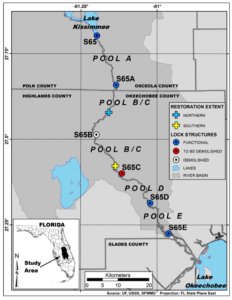
 Figure 2
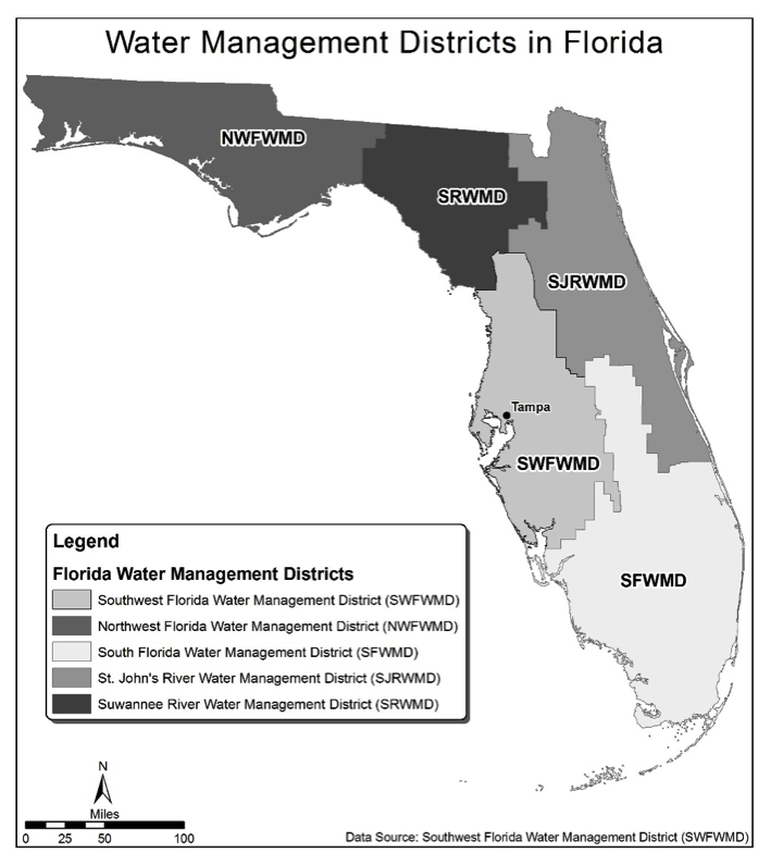


 The Tower Theater with its Art Deco style has been a landmark of the neighborhood since it first opened its doors in 1926. Located along Calle Ocho and 15th avenue, the road was a two way street at the time hence the sign of the theater was built at an angle so that it was easy for the drivers to glance quickly at the listing of shows. In the 1960’s with the growth of the Cuban population, the theater was the first one to offer titles in Spanish in Miami-Dade County. Picture Credit: Hilton Cordoba
 A shot of the Miami River from Jose Marti Park with the I-95 overpass in the background. In the late 1800’s the Miccosukee people navigated the river from the Everglades to come to trade and exchange items with the white settlers. By 1980, the I-95 overpass was the temporary home where the U.S. government created makeshift camps for Cuban refugees that arrived during the Mariel boatlift. In 2008, Jose Marti Park with the Miami River in the background were the setting for a scene in the comedy-drama film Marley & Me. Picture Credit: Hilton Cordoba
 Fritangas are found throughout the streetscape of Little Havana. These restaurants are not just about the ethnic dishes but also a place to gather news about the homeland or the local community, buy phone cards to call relatives, a place to find souvenirs and delicacies imported from Nicaragua, and even a place of worship on the evening of every December 7th when Nicaraguans celebrate ‘la griteria’ (a chanting to the Immaculate Concepcion of the Virgin Mary, a tradition that dates back to colonial times). Picture Credit: Hilton Cordoba