Program Profile: Lakeland Community College’s Geography and Geospatial Technology Program

Photo of geography students receiving instruction on UAS operation during a class lab. Credit: Bobby Oliver
Geography students receive instruction on UAS operation during a class lab. Credit: Bobby Oliver

“Keeping up with technological change in the industry is key to our program,” explains Bobby Oliver, M.A., GISP professor and department chair for the Geography and Geospatial Technology program at Lakeland Community College (LCC) in Kirtland, Ohio. “We’re constantly updating and revising our curriculum to meet all of the changing needs, to ensure our students have access to the most current and advanced geospatial technologies out there.”

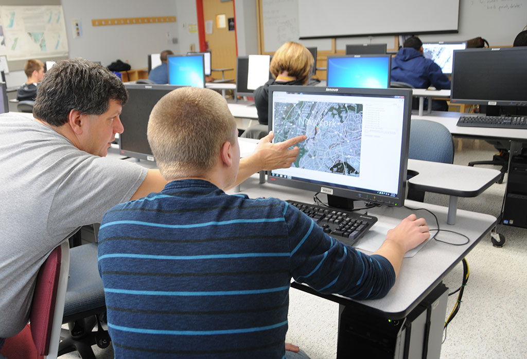
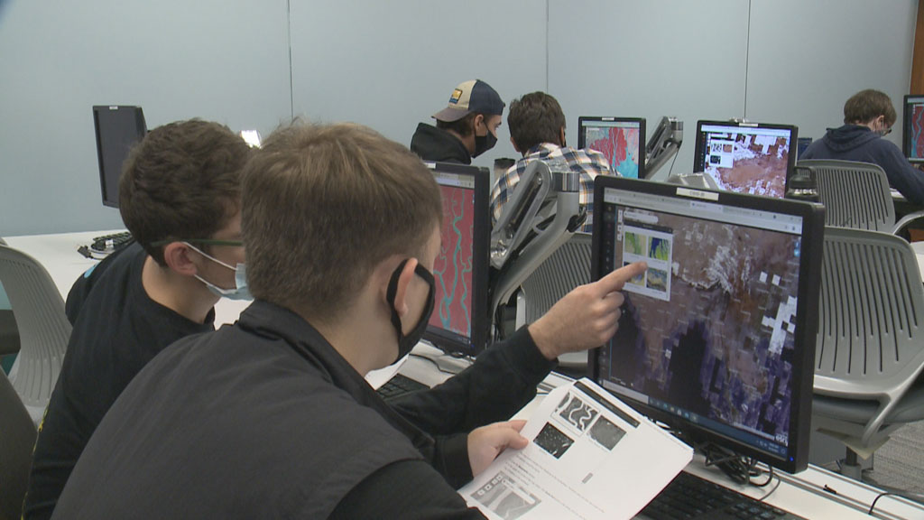
At LCC, keeping pace with the geospatial industry is essential to ensure the success of the hundreds of students who enroll in the Geography and Geospatial Technology program. Not only do Oliver and the LCC faculty accomplish this goal, but they do it well. In 2020, the program was recognized with the AAG Award for Associates Program Excellence. We asked Oliver what it was that made them stand out from the rest and her response was threefold: service-learning opportunities, a community engagement focus, and a highly connected professional network.

Photo of students at Lakeland Community College participating in an introductory geography class; by Bobby Oliver
Students at Lakeland Community College participate in an introductory geography class. Credit: Bobby Oliver


Community-oriented learning as a pathway to excellence

Since the program’s inception in 2011, LCC geography students have completed service-learning projects with the Greater Cleveland Food Bank, the City of Euclid’s Shore Cultural Center, and many other Cleveland-area nonprofit organizations. In response, these projects have often translated into internship opportunities for students.

We do a lot of community and college-wide engagement and make it a goal to create service-learning projects for students. We require our students to go out and be part of professional organizations within the community.

—Bobby Oliver

The involvement of LCC students within the local Cleveland community facilitates a symbiotic relationship centered around the value of a geographic education. For Oliver, this is a key component to the program. It enables students to apply their growing knowledge and skills in the real world while also building connections and bringing awareness to organizations that may not have previously understood the value of geography.

Finding success through championing the students and championing the program

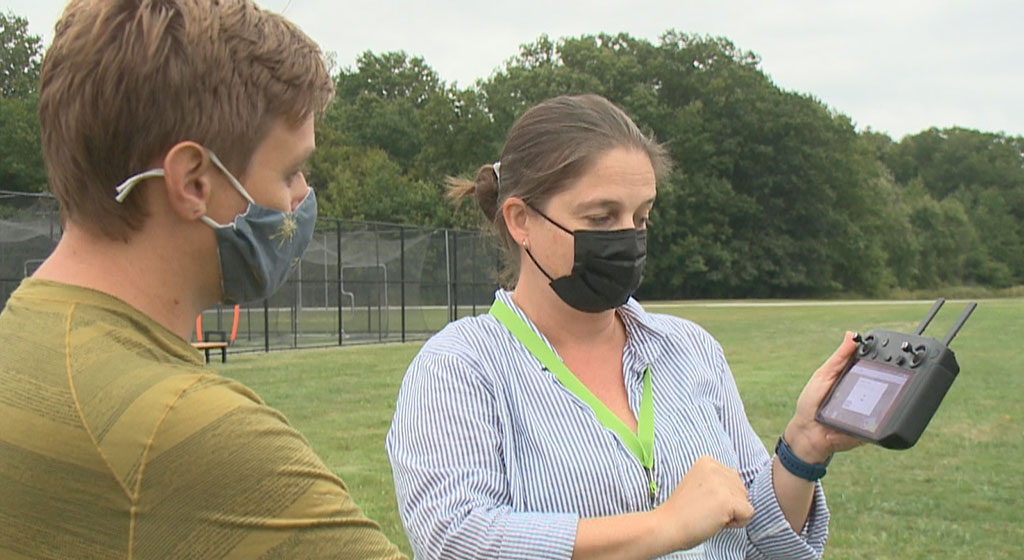
Program faculty have also taken a proactive, integrative approach to teaching students about how the skills they’re learning in the classroom translate to professional careers, something geography students often aren’t aware of. Internships with local employers, job shadowing, alumni engagement, and professional meetings are well engrained elements of the program. “We have what’s called a career service checklist our students go through within each one of the courses in their program,” explains Oliver. “All of these things have helped build their job search skills for when they hit the job market.”

Developing and maintaining relationships with local professionals working in geography, GIS, and other related professions has been critical to the program’s success. Many of these professionals are on the program’s advisory board, which has strong and diverse representation from the public, private, and nonprofit sectors. This has the added benefit of ensuring that students learn on the latest software platforms used by industry professionals.

GIS poster project by Lakeland Community College Geography student Caroline Petersen on Flow Map Analysis of Cambodian Refugee Migration, 1976-1995
GIS project by Lakeland Community College Geography student Caroline Petersen on Flow Map Analysis of Cambodian Refugee Migration, 1971-1995


How increased visibility is essential to program viability

As with many geography programs, maintaining strong enrollments is the foremost challenge the program faces, and the COVID-19 pandemic has only added to the difficulty of recruiting and retaining students. However, Oliver and other program leaders have developed innovative solutions to attracting students, by exploring opportunities with other departments on campus, leveraging a dual enrollment program with area high schools, and making ongoing efforts to increase the program’s visibility on campus and in the community.

For our program to be successful, we have to make sure that people see what we’re doing, and how it impacts our community. Making sure the campus is aware that we’re here and [that] what we do is very essential—especially when it comes to [LCC’s] enrollments and long-term viability.

—Bobby Oliver


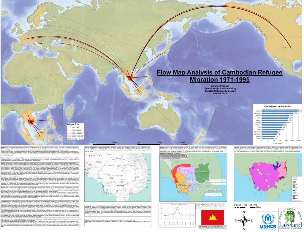
Video of LCC alumni Caroline Peterson sharing her experience in the LCC GIS program and how she uses those skills in her career.

An annual GIS Day event, Women in GIS luncheons, presentations to the Math Club and Model U.N., and collaborative projects with other departments across campus have all helped to highlight the program’s value. “We’re really trying to get the students to see how our community and region use GIS, and how geographic and geospatial skills are used in real jobs,” says Oliver. “These are the things that I feel really put us ahead, for a two-year program.”

    Share

Program Profile: Salisbury University – GIS

Photo of Michael Scott
Michael Scott

GIS has been taught at Salisbury University since at least the early nineties, says Dr. Michael Scott, a graduate of the Department of Geography and Geosciences and now a professor in the department and dean of the Henson School of Science and Technology. Continuing the success of their GIS program, in 2007, the department expanded into graduate education with their M.S. in GIS Management (MSGISM).   

Photo of Andrea Presotto
Andrea Presotto

“We realized that our students were doing very well in terms of finding employment and working in the field,” said Dr. Andrea Presotto, director of the MSGISM. “But the organizations they worked for were not particularly strategic about managing their GIS implementations.”   

The new M.S. program was conceived as a combination MBA and GIS degree, to better equip students with the skillsets necessary to become not only effective GIS practitioners, but also address this gap in data management and become leaders in public administration, grant writing, enterprise operations management, and a host of other skills beyond the technical level. This outside-the-box thinking and response to employment realities have elevated the program to one of the most respected departments on campus.  

A Regional Approach

On Maryland’s Eastern Shore, agriculture, tourism, fisheries, residential and commercial development all face challenges in response to increasing climate change. The Department of Geography and Geosciences at Salisbury University has positioned itself as a big part of the solution for the communities in the region. In 2004, department faculty formed the Eastern Shore Regional GIS Cooperative (ESRGC), which Dr. Scott directs, to help organize the region’s small towns to pool their resources for much-needed GIS project support.    

“One small town doesn’t have the ability for a GIS staff to do data collection and analysis. If you put seven or eight little towns together, suddenly there are enough resources to hire somebody to actually get that done,” explains Scott.    

[Our students] are able to get this very intensive, on-the-job experience, but the only way that works, of course, is the ESRGC has to know that the quality of the students getting GIS education coming out of the department is great, because they’re going to put them right to work.”

—Michael Scott

An outreach unit of Salisbury University and joint effort between a collection of Maryland Eastern Shore regional councils and the university, the ESRGC has grown to include 10 full-time staff, nine of whom are alumni of the department. In good years, Scott estimates that the cooperative hires anywhere from 25 to 30 interns from the department, where they acquire the invaluable real-world experiences and skills needed to move directly into professional GIS positions, even before they graduate.  

“[Our students] are able to get this very intensive, on-the-job experience,” Salisbury University’s Dr. Michael Scott explains, “but the only way that works, of course, is the ESRGC has to know that the quality of the students getting GIS education coming out of the department is great, because they’re going to put them right to work.”

Photo of students in a Salisbury University GIS class demonstrating mapping on their computers
Photo courtesy Salisbury University

If you build it, they will come…

Students and alumni of the Department of Geography and Geosciences have earned an excellent reputation throughout the region, a credit to the dedication of the department’s faculty, and their student-centered approach. As Dr. Art Lembo, a professor in the department and Technical Director of the ESRGC explains, this starts with the physical building itself:   

“We requested the faculty offices be located in an off-hallway suite that allows our doors to be open all the time, so the students can better interact with the faculty. We made structural changes to accommodate better interaction, because it’s just in our DNA to give the students this kind of experience.”  

It trickles into [our students] bringing their friends, who can become majors as well.”

—Dr. Andrea Presotto

Dr. Dan Harris, a professor and chair of the department, notes that unlike other academic buildings on campus, which typically close at midnight, the Geography and Geosciences faculty years ago made a special request to the president of the university to allow the department lab to remain open 24 hours to provide students with the opportunity to be in the building at any time. This level of attention to detail concerning the physical learning space is representative of the student-first, innovative thinking that has set the program apart.    

“It trickles into [our students] bringing their friends, who can become majors as well,” Dr. Andrea Presotto, Geography and Geosciences professor at Salisbury University.   

Photo of Dan Harris
Dan Harris

“We have faculty who are really good at getting [undergraduate students] in for field courses, and we embed field experiences in their classes. It’s really important to show the students that it’s not just a discipline where we come in and lecture in a classroom, and you walk away and read a textbook. We actually want them to get out and see it,” says Dr. Dan Harris, department chair.

    Share