Winds of Change

 Geography in the News is an educational series offered by the American Association of Geographers for teachers and students in all subjects. We include vocabulary, discussion, and assignment ideas at the end of each article.
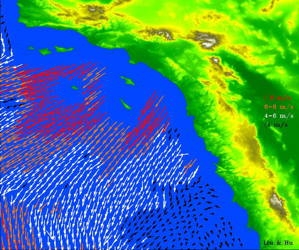
Powerful Santa Ana winds often make the headlines in Southern California. They have brought traffic to a standstill on freeways, with wind gusts up to 80 mph (129 kph). They create dust storms and deplete the soil. Sometimes the winds are strong enough to topple trucks and blow down trees. Worst of all, they can power wildfires.
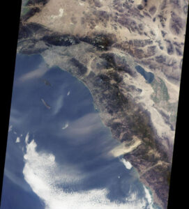
Also called “devil winds,” the Santa Ana winds blow down from the Santa Ana mountains, the Colorado Plateau and the Basin and Range in Utah, Arizona, and Nevada. The winds blow across westward across the coast and into the Pacific Ocean. They happen in the deadly dry season of autumn wildfires in Southern California. In October 2023, Santa Ana winds whipped up a small grassland blaze into the devastating Highland Fire. The fire grew from 14 acres to more than 2,400 acres before it was contained a week later.
Santa Anas are katabatic winds. Also called “gravity winds,” they blow out of high-pressure cells in the mountains. They can be any temperature. The bora winds of Italy and Slovenia are cold, while the Santa Ana winds and their cousins in France, mistrals, are usually hot. In Japan, the katabatic wind is called the oroshi. In Switzerland, it is the foehn.

The high-pressure air mass at the heart of a katabatic wind begins over mountains or high plateaus. As dense air rushes outward from the center of the high-pressure area, its weight causes it to hug the ground. Wind velocity increases as gravity draws it toward the lowlands. When the Santa Ana wind descends in elevation, it also heats up through adiabatic warming, as it compresses, with no exchange of heat from the surrounding air. The typical rate of warming is 5.5 degrees Fahrenheit per 1,000 feet (1 C./100 m.) of descent. The Santa Ana winds can be as hot as 100 F by the time they reach sea level.
Katabatic winds are very, very dry, with humidity of less than 10 percent. In California, this adds to their dangers. Their gusts dry out vegetation and disturb loose soil. While many native California plants are adapted to these conditions, non-native grasses and undergrowth are not. This has contributed to fire hazard, along with some forest management practices that were, ironically, meant to stop fires.
An Ill Wind
“There was a desert wind blowing that night. It was one of those hot dry Santa Anas that come down through the mountain passes and curl your hair and make your nerves jump and your skin itch.”
—Raymond Chandler
The Santa Ana winds are a dramatic player in literature and lore. Their dry, usually hot temperament contributes to an image of Los Angeles as mysterious and sultry, with a hint of menace. Culture critic Mary McNamara compares the winds to living on the surface of Mars. She says, “The Santa Anas are exhausting, and no one does well when they are exhausted.” Writer Joan Didion said, “It is hard for people who have not lived in Los Angeles to realize how radically the Santa Ana figures in the local imagination.” These howling dry winds do seem to define autumn in southern California, buffeting houses and cars and carrying dust and debris. To be fair, they also usher in some of the area’s best surfing waves, and can extend summertime weather at the beach.
Will Climate Change Affect the Winds?
A 2019 study observed that the frequency of Santa Ana winds has decreased in the last twenty years, due to climate shifts. In the early and late parts of the Santa Ana’s season, there are fewer winds than in the 20th century. During the peak from November to January, there hasn’t been much change.

Since that first study, the authors have discovered a cold version of the Santa Ana winds that forms differently and has less threat for wildfires. Either type, hot or cold, is associated with temperature extremes in the region. Southern California’s hottest and coldest days have been when these winds happen. Yet the cold type has become much less frequent since the 1940s. “In that case,” says the study’s lead author Alexander Gershunov. “We’re not seeing any positive news in terms of future wildfire seasons.” Gershunov and his co-researchers hope that their work can contribute to early-warning systems for the hot winds to come.
And that is Geography in the News, updated November 1, 2024.
Material in this article comes from “How an Ill Wind Blows” (1996), an original article for Geography in the News by Neal Lineback, Appalachian State University.
AAG’s Geography in the News is inspired by the series of the same name founded by Neal Lineback, professor and the chair of Appalachian State University’s Department of Geography and Planning. For nearly 30 years from 1986 to 2013, GITN delivered timely explainer articles to educators and students, relevant to topics in the news. Many of these were published on Maps.com’s educational platforms and in National Geographic’s blogs. AAG is pleased to carry on the series.
Sources Consulted for this Article
- American Museum of Natural History, Katabatic Winds.
- Chandler, R. Red Wind, out of print, 1938.
- Didion, J., The Santa Anas, also known as Los Angeles Notebook, 1969.
- Gershunov, A. et al, Hot and cold flavors of California’s Santa Ana Winds: Their causes, trends, and links with wildfires (open access), Springer 2021.
- Guzman-Morales, J. and A. Gershunov, Climate change suppresses Santa Ana winds of Southern California and sharpens their seasonality (free), Geophysical Research Letters, 2019.
- MacNamara, M. Forget traffic and earthquakes: The Santa Anas are the worst part of life in L.A., Los Angeles Times, 2012.
- Masters, N. The devil wind: A brief history of the Santa Anas, PBS SoCal, 2012.
- NASA Earth Observatory, QuickSCAT.
- National Geographic Education, Wind.
- National Weather Service, Mountain and Valley Winds.
- Voosen, P. California’s fire-fanning Santa Ana winds may not get any better with climate change, Science 2021.
Vocabulary and Terms
- Adiabatic warming
- Bora
- Elevation
- Froehn
- Humidity
- Intensify
- Katabatic winds
- Lowlands
- Mistral
- Plateau
- Velocity
Questions for Discussion and Further Study
- What geographic feature are the Santa Ana winds znamed for? What type of wind are they?
For further study outside of this article: How much can you discover about katabatic winds? - How does NASA’s QuickSCAT radar scatterometer get information about wind and ocean currents?
For further study outside of this article: What kind of tools and techniques do geographers, meteorologists, oceanographers, and other earth and space scientists use to measure and track winds? - Apart from the Santa Ana winds, what are some of the other conditions and environmental elements that can aggravate wildfires?
For further study outside of this article: What techniques, new and old, are used to control wildfires?


