Wayfinding: Tracing Pandemic Geographies Across Time
Before COVID-19 locked down the world, AAG member Melinda Laituri was a world traveler. As director of the Geospatial Centroid at Colorado State University and principal investigator for participatory mapping programs for the U.S. Department of State’s Office of the Geographer, she used technology to stay connected to the world: “I have been exploring the world at my fingertips through virtual travel to exotic locations” she writes at the beginning of the book she co-edited during COVID-19. “I have visited places I never thought to explore before—Chernobyl, Mars, and Iceland’s oldest shipwreck. It isn’t quite the same but does fill a bit of the void.”
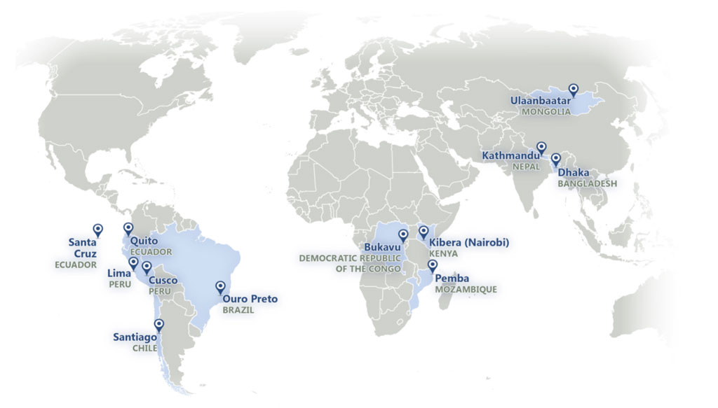
Laituri also channeled her love of place and adventure into her work with the Department’s Cities’ Covid Mitigation Mapping (C2M2) program, working with three participatory mapping hubs in Africa, Asia, and Latin America. While program coordination was virtual, the city-level projects were very much physical, or sometimes hybrid: six sites in Latin America, three in Africa, and three in Asia. Projects varied: an examination of the pandemic’s impacts on domestic violence in Peru; an assessment of second-order impacts of COVID-19 (education, economic, healthcare) in several African cities; a crowd-sourced health access app in Mongolia; and a participatory project to map the pandemic impacts on tourism-related businesses in Nepal.
The observations gained from this work are collected in The Geographies of COVID-19: Geospatial Stories of a Global Pandemic (Springer), a set of case studied co-edited with Robert B. Richardson and Junghwan Kim. The co-authors describe the spatialized impact of COVID-19 this way: “These geographies are located in both time and space, revealing impacts that are both immediate and long-term. The story of the pandemic is dynamic, in constant flux, and flush with ephemeral observations.”

One through-line of the case studies is how a large-scale event like COVID-19 reveals and exacerbates the inequities of societies around the world. Across scales, distances, and cultures, these inequities and impacts are “compounded by the government and social responses,” the team found, but also hold the key to “revealing how geography and geospatial technologies can contribute to future solutions and adaptations.”
Throughout their book, the editors consider the act and tools of mapping, and especially the dimensions introduced by live, dynamic, and interactive mapping tools, and cautioning the reader regarding the unintended consequences of decisions about such factors as data collection and scale. “Our stories are only as good as the data we have,” and the digital divide—uneven internet access, lack of access to phones and other devices–influences which data are included. “The data are constrained by what is collected (or not), how numbers are aggregated, the level of precision of data collection instruments, and algorithms. Maps and associated models are simplifications…”
Additionally, the book highlights the need for practitioners of many disciplines to pool their knowledge for cross-cutting solutions. Citing the work of the World Health Organization in identifying 15 international laboratories “that coordinate with national labs around the world to increase connectivity within the science community,” Laituri et al say that such efforts can go forward still more efficiently with the support of the virtual geography based on shared data and geospatial tools for place-based, data-driven decision-making. Our responsibility as geographers and geospatial students, practitioners, and scientists is to ensure grounded, ethical, and sound scientific approaches in addressing the profound problems we face,” they assert.
The Geographies of COVID-19: Geospatial Stories of a Global Pandemic is available from Springer.
To find out more about the U.S. Department of State’s participatory mapping programs, see the MapGive website.
DOI: 10.14433/2017.0128