The Resilient Streams in the Urban Landscape of Washington, D.C.
 The process of urbanization often leads to the alteration of local streams. Such alterations range from complete disappearance of streams by making them flow underground, converting them into canals, loss of their aquatic habitat, and changes in their morphology (Kang and Marston 2006; Kang 2007) . In Washington, D.C. many streams and springs have disappeared during the last 200 years of urban development and federal growth (Williams 1977) . The two rivers bordering the city, the Potomac and Anacostia rivers, and the National Mall within the city, look very different as compared to their respective landscape characteristics in the 1700s due to changing sediment and runoff volumes. In Figure 1 you can see that the current stream density within the city and the surrounding areas reveals a significant difference (Figure 1). However, some times the local conditions of streams are resilient enough to counter the effects of the urban runoff (Kang 2007; Kang and Marston 2006).
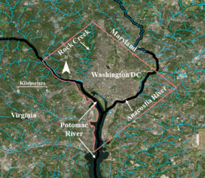
While many local streams have disappeared, the resilient Rock Creek continues to drain the western portion of the national city into the Potomac River. The prominent names among the streams that disappeared include Smith Spring, Frankling Park Springs, Gibson’s Spring, Caffrey’s Spring, City Spring, and Tiber Spring (Williams 1977) . While some of them are underground, others were converted into canals or significantly reduced in their coverage for the development of the city. However, Rock Creek has successfully survived through the impervious development of the city.
Despite ambitious urban growth, the federal government protected the Rock Creek Park so that Rock Creek could meander through its flood plain. It is also a vibrant ecosystem supporting aquatic life as well as wildlife in its flood plain. One of the cherished experiences of many Washingtonians is to witness a rich variety of wild life as they conclude their late evening commute from work through the Rock Creek Parkway that partially runs through the flood plains of Rock Creek.
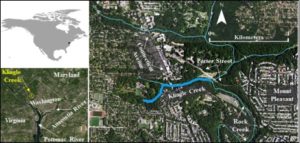
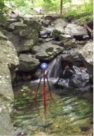
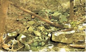
The successful survival of Rock Creek during the last century of urban growth is also because of its equally resilient tributaries that kept it alive and strong. Tributaries such as Klingle Creek (Figure 2), offer a microcosm to understand the resilient structure and ecology of this national creek. Klingle Creek is a small urban branch of Rock Creek and flows through the neighborhoods of Woodley Park, Cleveland Park, and Mount Pleasant in the city of Washington. It is unique to Rock Creek because of its geomorphic survival during the changing land cover politics around it. Surrounded by highly urbanized landscape, Klingle Creek presents a healthy ecosystem with a variety of fluvial processes. The stream has adjusted to the surrounding highly impervious landscape in a synergistic fashion. Starting as a narrow channel at the headwater, its capacity gradually increases in the downstream direction to accommodate the urban run-off. Various sections in the upstream portion of Klingle Creek experience bank erosion allowing for a sediment supply for the lower portion. The lower portion of the creek includes large rocks creating beautiful waterfalls (Figure 3) while reducing the velocity of the urban flow. It also provides sediment traps for various types of aquatic habitat (Figure 4). Many portions of the creek present lush moss covered rocks and woody debris offering a soothing experience to nature lovers.
|
|
 |
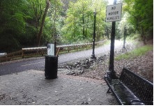
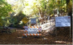
Despite a highly urban landscape comprising its watershed, Klingle Creek is lined by a riparian corridor with a thick tree canopy. While the occasional tree fall offers woody debris to regulate the eco-geomorphology of the stream, a thick tree canopy helps promote the interception of rainwater. Therefore, it has played an important role in the survival of Rock Creek against the urban sprawl in the heart of our capital. For a long time, Klingle road (which ran parallel to Klingle Creek) was used by locals as a quick access between Cortland Place and Porter Street. However, the frequent flooding and maintenance costs of the road made the city think about alternatives to the road which led to the calls for saving Klingle Valley. While various groups of the community gathered support to remove the road, other groups gathered in favor of keeping the road. The battle grew until the dispute reached the City Council and in 1991, the road was barricaded (Figure 5).
 |
|
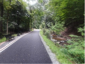
After more than two decades of dispute, in 2015 the barricaded portion of Klingle Road was replaced by a multi-use trail (Figure 6). The trail offers a variety of recreational opportunities for users of all age groups. One side of the new trail is bordered by Klingle Creek and the other side includes the historical woodland garden of the Tregaron Conservancy. While benches along the trail offer a view of the creek (Figure 7), the trail also connects the recreational communities of two neighborhoods in the city.
|
|
|
|
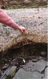
The process of replacing the road with a trail included restoring various sections of Klingle Creek through alterations of the stream banks and creating a sequence of steps and pools along the stream. It also included efforts to modify the banks by planting native vegetation and covering various portions of the bank with protective matting (Figure 8).. |
The replacement of the road with a trail along Klingle Creek is an example of geodesign. There are numerous cases of urban areas across the globe where communities and city officials worked together in geodesigning their cities with a sustainable futuristic approach (Beatley 2016). The high line project in New York City and the urban parks in the city of Singapore are just two more examples where cities introduced green zones within the highly urbanized landscapes to connect their communities with nature using softer sustainable architectural designs. Economics is often one of the major driving forces behind such conservation and restoration initiatives so that the long term future demands are met with minimal cost. The ecological challenges and experiences of residents in Klingle Valley during the next decade will determine the effects of the restored creek on the larger Rock Creek, the role and functions of the new trail, and the appropriateness of restoration design and expenditures in the Klingle Valley restoration project. Klingle Valley, an urban creek along with its sister tributaries of Rock Creek offer us a soothing experience and a quick get away from the urban stress. With Washington moving forward as a sustainable city, Klingle Creek complements that ambition as a resilient hydrology of Anthropocene.
Ranbir Kang is an associate professor at Western Illinois University. With a long term research interest in the Washington metropolitan area, he specializes in urban hydrology, human impact on fluvial systems, and high resolution river surveys.
DOI: 10.14433/2017.0044
References:
Beatley, Tim. 2016. Geodesigning nature into cities. ArcNews Winter 2016:20-21.
Kang, R. S. 2007. Effects of urbanization on channel morphology of three streams in the central redbed plains of Oklahoma, Graduate College of Oklahoma State University, Oklahoma State University, Stillwater, OK.
Kang, R. S., and R. A. Marston. 2006. Geomorphic effects of rural-to-urban land use conversion on three streams in the Central Redbed Plains of Oklahoma. Geomorphology 79:488-506.
Williams, Garnett. P. 1977. Washington D.C.’s Vanishing Springs and Waterways. Arlington, VA 22202: U. S. Geological Survey.
