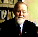
Roger Tomlinson
1933 - 2014

Roger Tomlinson, often referred to as the “Father of GIS” was born in Cambridge, England in 1933, and received degrees in geography from Nottingham University in England and McGill University in Montreal, and a PhD from University College in London. After a stint in the Royal Air Force, he adopted Canadian citizenship and joined Canada’s government as a GIS developer in the early 1960s. In that position, he conducted a geographic analysis of Canada’s vast landbase, a major national need at the time.An outgrowth of that project in which he played the leading role was the development of the Canada Geographic Information System, widely regarded as the first serious GIS.
In his approach to Geographic Information Systems, Tomlinson has consistently stressed the idea that GIS begins with and is based on geography. He emphasized that the strength of the term GIS comes from its fundamentals: “The word “geography” is not going to go away. It has been in use for hundreds (some would say thousands) of years…It is clear to me that the overall process is that of earth description; in short, it is geography. It has been demonstrated beyond any refutation that geography matters in human decision making.”
His career focused on the development of major international GIS programs, ranging widely in geographic scope and content, but with a special emphasis on environmental protection, natural resources management, national parks, and forests. Throughout his impressive career in geography and GIS, Tomlinson served as a consultant to many governmental and international organizations, including the World Bank; several branches of the United Nations, including UNESCO, the FAO, UNIDO, and UNEP; the U.S. Departments of Commerce and Agriculture, the U.S. Geological Survey, the U.S. Forest Service, the U.S. Bureau of the Census; several U.S. state governments; and the national governments of Canada, the United Kingdom, France, Australia, and Sweden.
Roger also places enormous importance on geographic education, calling it a vital goal, and has long supported geography education at all levels of our schools and universities. He says that it was a high school geography teacher that first captured his imagination in the geography of the world around him, and led to his lifelong interest and pioneering career in the field.
Jack Dangermond, founder and president of Esri, sees Tomlinson as one of the great contributors to the origin and development of GIS. Regarding Tomlinson’s career, Jack commented:
“Roger has brought great distinction to our field by defining the basic and essential vision that GIS is both an extension of geographic science and a practical way to apply geographic knowledge to a whole world of applications. His work over the last three decades has also defined our field as a kind of profession with formal methodology for designing and implementing systems. Finally, Roger always makes me realize that GIS must first and foremost be focused on providing information that really matters (maps, reports, etc.) and that improves our sciences, processes, and decision making.”
Geographers and friends from around the world gathered to honor GIS pioneer Roger Tomlinson when he received the first Robert T. Aangeenbrug Distinguished Career Award on April 7, 2005, at the Association of American Geographers Annual Meeting in Denver. That inaugural award was formally bestowed at the AAG Banquet by the Association’s Geographic Information Science and Systems Specialty Group. The Distinguished Career Award is named after the late Dr. Robert Aangeenbrug, also an early leader in GIS and a contemporary of Roger Tomlinson.