Every year the AAG provides funding to enable a member of the AAG to take their domestic partner on a research trip, regardless of them having any formal training in geography. One recipient was chosen this year from among eight applicants and receives $1,200.
Shouraseni Roy, Associate Professor in the Department of Geography and Regional Studies at the University of Miami, is conducting a research project entitled “Linking Gender Inequalities/Inequities with Impacts of Climate Change in the Global South.” The study explores how the detrimental impacts of climate change in the Global South affect women more than men.
The first stage of Shouraseni’s research is an analysis of secondary data. Using several variables from the 2015 Human Development Report and the World Bank’s Global Gender Gap Report, she will identify the spatial clustering of low levels of female education. She will then set this alongside data from the climate vulnerability index to reveal the different relationships that exist in different points in space.
The second stage of her research is to examine how regional scale spatial patterns relate to local level processes. In the Indian cities of New Delhi and Mumbai, she will meet with various NGOs working in women’s empowerment and environment. She hopes that her findings will expand the debate on the gendering impacts of climate change and help in effective gender mainstreaming in policy formulation.
The funding will enable Shouraseni’s partner, Oliver Martin, a Marketing Technical Adviser for Federal Express, to join her during her fieldwork in India.
The joy of working alongside one’s partner was something very dear to Anne Underwood, wife of geographer, Gilbert White. After their youngest child went off to boarding school, Anne joined with Gilbert in field studies of domestic water use in East Africa. This was the first in a series of studies on water supply and health that she completed independently or in collaboration with others.
In 1989, Gilbert and Anne donated a sum of money to the American Association of Geographers to establish the Anne U. White Fund specifically to support accompanied field research. Gilbert White and other donors subsequently added substantially to the original gift.
Every year the AAG provides small grants to support research and fieldwork that address questions of major importance to the discipline. Three recipients were chosen this year from among 15 applicants and will each receive $500.
Laura-Anne Minkoff-Zern is Assistant Professor of Food Studies in the Department of Public Health, Food Studies and Nutrition at Syracuse University, as well as an Affiliated Faculty in the departments of Geography, and Women’s and Gender Studies. She has received support for a project entitled “The New American Farmer: Immigration, Race, and the Struggle for Sustainability.” This research explores the transition of immigrant Latinos from farmworkers to farm owners, looking at racial discrimination, agrarian identity, and inclusivity in food and farming in America. She is comparing four sites across the United States, each of which has a significant and unique group of Latino farmers who have struggled against multiple levels of inequality to start their own farm businesses. The funds from the grant will be used for travel to her final fieldwork location of Yakima, Washington in spring 2016 to conduct interviews.
Margaret Sugg is an Assistant Professor in the Department of Geography and Planning at Appalachian State University. She has received support for a project entitled “A multiscale approach to assessing heat-health vulnerability.” With a large number of hospitalizations and deaths each year related to heat exposure, this research seeks to identify individual to regional patterns of heat-health vulnerabilities and the thermal environments that control these patterns. The funds from the grant will be used to purchase 12 Maximum Integrated thermocron ibutton Devices which measure the ambient temperatures experienced by wearers both indoors and outdoors. Students from Appalachian State University will test the devices before they are given to heat-vulnerable populations such has outdoor laborers and high school athletes.
Sophie Webber is a Postdoctoral Research Fellow in the Department of Geography at University of California, Los Angeles. She has received support for a project entitled “Climate Service: Commercializing science for urban adaptation and infrastructure planning.” This research explores the relations between states, markets, and science in the context of climate change, particularly the commercialization of climate science through ‘climate services.’ She will be looking at major global climate service governance organizations such as the World Bank and the Climate Services Center, conducting key informant interviews, analyses of policies and documentation, and participant observation at conferences and meetings. The funds from the grant will be used for travel to Washington DC and New York City to study these organizations that produce climate services.
The AAG Research Grants are competitively awarded to scholars to provide direct expenses for research or fieldwork, excluding master’s or doctoral dissertation research.
The AAG’s three annual book awards recognize outstanding works written by geographers and published by during the previous year.
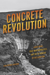
The Meridian Book Award for Outstanding Scholarly Work in Geography goes to a volume that makes an unusually important contribution to advancing the science and art of geography. This year’s winner is Concrete Revolution:Large Dams, Cold War Geopolitics, and US Bureau of Reclamation by Christopher Sneddon. It was published in 2015 by the University of Chicago Press.
The story of the Bureau of Reclamation and the damming of America’s rivers has been told before, but never from the fresh and provocative perspective found in Concrete Revolution. As told by Sneddon, this is a story that transcends the United States and led to the redesign of drainage systems across the developing world, as American dam building became an instrument of Cold War rivalry for the affection of peoples in the emerging economies of the non-aligned world. It is also a story that takes us to the philosophical heart of modernity and its radical reimagining of human relations with the natural world. All of this Sneddon does in a style that is accessible and engaging, but also serious and masterly.
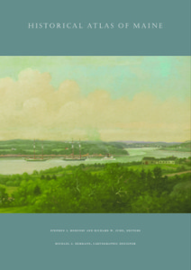
The Globe Book Award for Public Understanding of Geography is for a book that conveys most powerfully the nature and importance of geography to the non-academic world. This year’s winner is the Historical Atlas of Maine, edited by Stephen J. Hornsby and Richard W. Judd, with the Cartographic Design by Michael J. Hermann. It was published by the University of Maine Press in 2015.
This is one of the most significant atlases to appear in the United States in recent decades. It covers the period from the end of the last ice age to AD 2000, telling the history of Native peoples, European exploration and settlement, the American Revolution, Maine statehood, industrial development, and the rise of tourism and environmental awareness. Almost every plate in the atlas is based on new research. The creation of the atlas, which took 18 years from conception to publication, was envisioned as an outreach project from the University of Maine to the state’s residents, visitors, and the general public. The result is not only a unique interpretation of Maine, but also a splendid visual record of the state’s history.
The John Brinckerhoff Jackson Prize is awarded to a serious but popular book about the human geography of the contemporary United States that conveys the insights of professional geography in language that is interesting and attractive to a lay audience.
This year’s winner is Hispanic and Latino New Orleans: Immigration and Identity since the Eighteenth Century by Andrew Sluyter, Case Watkins, James P. Chaney, and Annie M. Gibson. It was published in 2015 by Louisiana State University Press.
The four authors of this book seamlessly combined their expertise and varied perspectives to produce a well-written account of a little-known aspect of New Orleans’ cultural and historical geography. Thanks to their careful study of census records, archival research, interviews, and other sources, we now know that Hispanic and Latino individuals and communities have been part of the city throughout its history. Previous assumptions about the basic similarities of Latino and Hispanic immigrants become much more nuanced in this study, as the authors explain the diversity of Spanish-speaking immigrants from Mexico, Latin America, South America, and the Caribbean – people who made distinct impressions on their respective neighborhoods and contributions to the city’s rich culture. These immigrants’ experiences also varied significantly depending on many factors, not least when they came. The book also contributes to the emerging literature on Hispanics in the South and the cultural diversity of Hispanic and Latino immigration from the period of early European contact up to the present.
The AAG congratulates each of the winners and would like to thank the three book award committees who considered this year’s nominations.
The AAG Book Awards will be conferred during the AAG Awards Luncheon on April 2, 2016, at the Hotel Nikko in San Francisco.
AAG Invites Members to Join Mentoring Network for Women in Geography
A Special Kickoff Event is Planned for the AAG Annual Meeting
The AAG Committee on the Status of Women in Geography will hold a special session at the AAG Annual Meeting to help launch the Mentoring Network for Women in Geography.
The CSWG also invites faculty, staff, and professionals to serve as mentors in the newly established mentoring group. A previous call for participants yielded an unprecedented number of requests for mentors. Participation is not limited to those with senior positions, tenure, or who identify as female. Anyone who feels they can provide guidance on the early stages of academic careers is highly encouraged to participate.
Mentors are asked to commit to regular mentoring sessions (via call or Skype) with their mentee for one year, commencing with the 2016 Annual Meeting and concluding at the 2017 Annual Meeting. It is recommended that mentoring sessions occur once every six weeks but ultimately the mentor and their mentee should decide upon an appropriate interval.
The CSWG would like for mentors to meet their mentees in person at the 2016 Annual Meeting at a session scheduled for Thursday, March 31. The session will begin at 7:10 p.m. in Franciscan A on the Ballroom Level at the Hilton Hotel.
If you are willing to serve as a mentor to a woman geographer, please e-mail Lisa Davis (CSWG Chair), lisa [dot] davis [at] ua [dot] edu, as soon as possible.
Carry the AAG 2016 Annual Meeting Program in Your Pocket
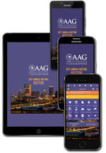
Get the most from your AAG 2016 San Francisco experience with the mobile app. Enjoy an interactive experience on your Apple, Android, BlackBerry and other mobile devices during AAG 2016 in San Francisco. If you’re a laptop user or have a Windows phone, there’s also a Web version for your devices.
Plan your experience throughout the meeting:
search sessions by day, group or type or just browse the abstracts and participants listings
create your own calendar of events by adding your favorite sessions to your schedule
receive updated changes to sessions and events from organizers
browse exhibitor listings
take notes during sessions and send as emails and also rate the sessions
view the list of local restaurants to experience during your visit
locate various sessions by tapping on areas of each floor plan within the maps icon
The app will help you balance your schedule of preferred sessions, events and meetings with friends and colleagues, while keeping you informed with daily Geograms and social media updates. Networking features offer colleagues tools to share schedules and exchange contact information. The AAG mobile app also integrates with social media networks on Twitter, Facebook, and LinkedIn. And, it will help you collect and share important notes and information from sessions and exhibitors.
IMPORTANT NOTES: If you plan to use the app on two of your mobile devices, it’s important to set up the multi-device sync within the app on both devices. (See tip sheet for more details.)
Also, if you find the app is slow to launch, you may bypass the update by simply tapping the back arrow on Android or the cancel button on iOS devices to immediately get to the dashboard. Update times during app launch vary by device, connection strength and also depend on when you last did a full update. Remember, this is a large meeting with 6,600 abstracts, 1,700 sessions and 8,500 attendees! Make sure you try to update at least once a day to capture any changes, such as session updates, newly added attendees, etc. If your refresh button turns red, it’s time to update.
Share
Member News
AAG Member and First Female Pakistani Geomorphologist Khalida Khan Honored as ISDR Researcher of the Year
Dr. Khalida M. Khan has been honored as ISDR Researcher of the Year at the U.S. National Postdoctoral Association (NPA) by the Inter-regional Directors’ Board of the SAARC-ASEAN Post-doc Academia.
Khan is an Associate Professor in Geology and Mountain Research at the University of Punjab. She also founded the Centre for Integrated Mountain Research (CIMR) at the Univeristy of Punjab in 1987 and has served as the Centre’s director since its inception. Dr. Khan is a former UNESCO chair holder whose research interests include geomorphology, sustainable development education, watershed conservation and management, socio-cultural and economic studies, women/gender and mountain studies, impact assessment of mountainous areas analytical studies, eco-tourism, hazard investigations, and strategic rural areas studies.
AAG Announces Inaugural Award for Program Excellence
The AAG is pleased to announce that the Department of Geography at DePaul University will receive the inaugural AAG Award for Program Excellence, which was established to recognize geography programs at U.S. colleges and universities. This award honors non-PhD granting geography programs that have significantly enhanced the prominence and reputation of geography as a discipline, and demonstrated the characteristics of a strong and engaged academic unit.
The Department of Geography at DePaul University, housed in the College of Liberal Arts and Social Sciences, offers a BA in Geography. DePaul’s dynamic and innovative department has seven tenure-track faculty members along with two to three adjunct faculty members. Formed in 1948 as a single-person academic unit, the Department was threatened with closure in the late-1990s. In response, the Department set out an ambitious plan to rejuvenate and transform its institutional position and departmental health over the past 15 years.
The Selection Committee noted the success that the Department of Geography at DePaul has had in: 1) diversifying its faculty membership and student body; 2) developing a curriculum that advances urban social justice, community service, and geotechnology; 3) promoting Geography both on and off campus in Chicago; 4) taking a leadership role in the West Lakes division of the AAG; 5) engaging in local, national and international scholarly debates and research; 6) attracting talented students who later pursue graduate study in geography or geography-related careers; and 7) creatively using social media to maintain and advance alumni relations and public outreach.
The DePaul program’s application was marked by effusive letters of praise and support from current students, alumni, the Dean’s office, and colleagues outside the university. The Geography Department at DePaul is led by Dr. Euan Hague, who serves as Chair.
The Selection Committee also chose to grant an honorable mention to the Geography Program within the Department of Geography-Geology at Illinois State University. Housed in the College of Arts & Sciences, the program offers BA and BS degrees in Geography with four possible thematic concentrations and a Geography Teacher Education Major. Illinois State University had the first stand-alone Geography department in Illinois, dating back to 1902, and was among the very first in the country. Now residing in a blended department with Geology and Hydrogeology, the Geography Program embraces shared governance built upon consensus-building, participative leadership, accountability, open communication, and a commitment to diversity.
With eight tenure tenure-line faculty members who balance scholarship, teaching, and outreach activities, Illinois State Geography’s curriculum is deeply rooted in liberal arts tradition while also demonstrating innovations in field-based education, internationalization of learning, and individualized undergraduate research. Every major student is required to engage in off-campus experiential learning and career preparation and the program’s geospatial initiative, called GEOMAP, is a frequent source of collaborations for faculty and students. The Illinois Geographic Alliance has been headquartered on campus since 1987. The Geography-Geology Department at Illinois State is led by Dr. Dagmar Budikova, who serves as Chair.
The AAG Award for Program Excellencewill be presented in alternate years to bachelor’s programs and master’s programs with the inaugural 2016 award going to a department that offers no higher than an undergraduate degree.
Liza Giebel Joins AAG Staff as IT Support Specialist
The American Association of Geographers is pleased to announce that Liza G. Giebel has joined the staff as an IT Support Specialist at its headquarters in Washington, D.C.
Prior to coming to work for AAG, Liza worked for the Amalgamated Transit International Union for seven years where she was responsible for solving a myriad of IT issues and managing the internal network and databases.
Her background includes studies at the Borough of Manhattan Community College and adventures growing up in Brooklyn, N.Y. She is also a volunteer at the National Multiple Sclerosis Society in D.C.
When she’s not working with AAG staff to make sure technology is running smoothly, she enjoys working in her hop and vegetable garden, salsa dancing and taking in the museums and sites of the nation’s capital.
New NSF REU Experience for Undergraduates: Community GIS and Citizen Science in Belize
This summer at the University of Central Florida, we are pleased to host the first year of our National Science Foundation Research Experiences for Undergraduates (REU) Site “Preparing the Next Generation of Scholars through Community GIS and Citizen Science.” Our program offers fully funded summer research experiences for at least 8 undergraduate students in Belize for 5 weeks and Orlando for two weeks. The program is open to all U.S. students and runs June 20-August 5, 2016. We are interdisciplinary in nature emphasizing community geography, community GIS, and citizen science through mixed methods, including sketch mapping, mobile mapping applications, focus groups, in-depth interviews, GIS, and spatial analysis. Please distribute to interested students and your networks.
Research opportunities: Students will work in one of two research directions with community partners and mentors from University of Central Florida, University of Belize, Georgia State University, and The Smithsonian National Museum of Natural History’s Caribbean Coral Reef Ecosystems Program:
Research Direction 1: Mapping disparities in flooding & disaster management
Research Direction 2: Mapping marine debris & mitigating impacts on coastal communities
Compensation: Each REU student will receive a competitive funding package, including a $3500 research stipend, $1400 meal allowance, free shared housing in Belize and Orlando, up to $750 in travel support to/from the REU Site, up to $750 for post-REU conference travel, and 2 research methods books.
Application process: The priority application deadline is Friday, March 25th @ 5 PM EST. Complete program information and application instructions can be found at https://www.citizensciencegis.org/ucf-reu-site/.
Student reflections from the field: “Challenging, emotional, fun, collaborative, thought-provoking, interesting, real-life, and eye-opening.” These are some of the words used by students to describe our previous research programs. We expect similar experiences in our new REU! Check out a series of short videos from our students at:https://www.citizensciencegis.org/ucf-reu-site/student-reflections/.
Questions can be directed to:
Dr. Timothy Hawthorne: Principal Investigator, Assistant Professor of Geographic Information Systems at University of Central Florida
When geographers touch down in San Francisco this spring, they will encounter a socio-natural world produced in part through technical efforts to understand and manage it. As a primary means by which such efforts were pursued in the Bay Area during the postwar years, the San Francisco Bay-Delta Hydraulic Model – located a few miles north of the city in the town of Sausalito – offers a unique window into the formation of the metropolitan region. Built by the Army Corps of Engineers to simulate bay-estuary conditions and test the feasibility of development plans, the physical model now operates as an educational center and public showcase for the accomplishments of the Corps. Spread out over an acre in a former military shipbuilding warehouse and composed of hundreds of 12’ by 12’ concrete slabs, the model also constitutes a richly layered if seemingly anachronistic world onto itself. Passing through the Bay Model Visitor Center means confronting a vast terrain of miniature canals and levees, dikes and bridges, rivers and bays, and technical instruments and appurtenances that collectively target the bay and its watershed. Above the ebb and flow of the model’s mechanized tide, the whir of electric devices punctures the damp stillness of the air. Below it, rust steadily creeps throughout a labyrinth of channels. A landscape to traverse as much as a view to behold, the Bay Model promises to lend unique perspective on the world beyond the walls that house it.
Model Diagram. From McLeod and McLeod, 1983.
At the turn of the millennium, rendered obsolete by advances in computer modeling, the Bay Model ceased operating in any official research capacity. Over its four-decade working life, however, the model generated important new understandings about the San Francisco Bay and Sacramento-San Joaquin Delta as “a complex estuarine system” (USACE 1993). To meet the needs of comprehensive planning, the Corps undertook an extensive survey of the Bay Area and constructed the replica landscape between 1956 and 1957 at a horizontal scale of 1:1,000 and a vertical one of 1:100. Originally encompassing a swath of the Pacific and the entire bay-estuary to the confluence of the Sacramento and San Joaquin rivers, the tool was designed to reproduce an average tidal cycle at a timescale of 14.9 minutes. But before it could be used to either simulate circulation patterns or forecast the effects of various reclamation and barrier proposals – such as the infamous Reber Plan to dam the bay (Wollenberg 2015) – the model had to be verified to known prototype conditions through a series of infrastructural interventions and measurements in the field. With the construction of the delta addition in the late 1960s, the model was mobilized to study the impact of dredging, channel realignment, and fresh-water diversion – still a source of conflict in California – on salinity intrusion and water quality. While running simulations initially required a team of seventy technicians to perform an intricate choreography of measurement and calculation, ongoing processes of instrumentation and the establishment of computerized control and data acquisition systems later allowed for greater operational flexibility. Today the model’s test-bed embodies the sedimentation of over forty years of technical practice.
Tide Generator at the Bay Model. From USACE, 1963.
As an engineering and planning tool, the Bay Model produced a number of effects that continue to animate political life the Bay Area. Most notably, it constituted the bay-delta system as an object of sustained inquiry and fixed the region as an appropriate scale of environmental management and administration. As early as 1967, Eugene Huggins and Edward Schultz of the San Francisco Army Engineer District pointed to the model as a primary means by which such realignments were achieved. On the one hand, they argued that simulations run on the model produced “the finest and most comprehensive library of data on the action and environment of the Bay now in existence” and provided “the foundation for almost all regional planning, by practically all agencies, in the Bay Area.” By offering a framework with which to probe the impact of individual projects on the bay-estuary and delta as a whole, the model, in their view, girded a broader scientific and popular shift in conceptions of the San Francisco Bay as an interconnected ecological system. Tellingly, data about the bay-delta system generated on the physical model, programmed into computers, continues to inform contemporary modeling exercises. On the other hand, in highlighting the intertwined fate of different Bay Area communities at the scale of nature, Huggins and Schultz suggested that the information produced on the model proved to be a “major stimulant…for the formation of regional authorities.” Indeed, the Bay Conservation and Development Commission, the Association of Bay Area Governments, and the Bay Area Council, among other regional organizations that guide development and promote policy in the Bay Area today, all drew upon studies conducted at the Bay Model and the expertise of the Corps more generally to support their institutional formation and governance agendas.
The Mississippi River Basin Model. Photo: John Elrick.
While the San Francisco Bay Model was but one of several large-scale hydraulic models built by the Corps of Engineers, it is the only one actively maintained. The outlines of Maryland’s Chesapeake Bay Model, opened in 1970s before rapidly falling into disuse and decay, might be gleaned from satellite images today. Likewise, the ruins of the massive Mississippi River Basin Model, itself a feat of engineering that targeted the Mississippi River and its major tributaries, can still be found in Clinton, Mississippi. Approved in 1943 and constructed with technical assistance from the Waterways Experiment Station and POW labor, the Basin Model – the ‘ur-model’ of the Corps’ mid-century hydraulic engineering program – embodied an important shift in approaches to water management. The Flood Control Act of 1936 charged the Corps with developing a more comprehensive solution to inundation than earlier piecemeal efforts to control individual rivers. “To understand the Mississippi River Basin as a dynamic system of interconnected waterways,” Kristi Dykema Cheramie suggests in an insightful essay, “the Corps needed new, more sophisticated tools” (2011). After successfully predicting the extent and impact of flooding in 1952, the test-bed was vindicated as a forecasting tool and mobilized to simulate flows throughout the watershed as a system. “The model,” Cheramie argues, “allowed the Mississippi River Basin to become, for the purposes of study, an object, a manageable site.” Like the San Francisco Bay Model, it promoted “a new scale of thinking” and demonstrated “the power of visualizations to shape policy through design.” With the development of “computational scripting and planning analysis technologies” in the 1970s, however, the Basin Model was “gradually upstaged by a mainframe computer in Sacramento.” In the 1990s, the Corps abandoned the model altogether, leaving it to be reclaimed by a pine forest.
The Bay Model from on high. Photo: John Elrick.
A combination of factors helps account for the preservation of the San Francisco Bay Model as well as its relative longevity as a research tool. First, unlike the Mississippi River Basin Model, the Bay Model’s test-bed was built upon a network of adjustable jacks in anticipation of seismic disturbances, allowing it to be continually re-calibrated to the shifting topography of the bay. The capacity to tune the model to fit changing conditions, combined with the fact that it remained sheltered within a controlled environment able to accommodate innovations, fostered the formation of a community of engineers willing to advocate for its continued relevance into the 1990s (Sinclaire 2011). Second, and perhaps most importantly, under the stewardship of William Angeloni, the model secured “Operation and Maintenance” funding in 1980. Rather than continuing to seek out financial support from project to project, federal apportionment gave the Bay Model stability as a site. Finally, while this funding provided for both the establishment of the Visitor Center and the facility’s eventual transformation into a tourist attraction, the model – from its inception – was understood to serve a pedagogical function. Built on location due to widespread enthusiasm for the project, it opened to ceremonious fanfare as a demonstration site where the public could learn about “the needs of a balanced ecology” and “hard data” might temper contentious debates over development and water policy (Huggins and Schultz 1967; Weisberg 2013). The model soon became – and still is – a regular stop on the school field-trip circuit. Yet, as Javier Arbona points out, both the aesthetic qualities of the model and the layout of its facility underwent subtle but important changes after 2000. Though framed today as an educational complex highlighting the region’s ecology and the importance of water conservation, the Visitor Center – with the model as its crown jewel – might just as well be understood as “a monument to the Army Corps” itself (Arbona and Woebken 2015).
The Angel of History at Richardson Bay. Photo: John Elrick.
Despite the new layers of paint, the framing devices, and the addition of an observation deck designed to render the structure legible, visiting the model today can still leave one feeling overwhelmed. Indeed, it’s not uncommon to spot marauding bands of children and their adult counterparts hurry past exhibits on natural history and WWII-era shipbuilding only to lose themselves within the abstract landscape of concrete bays and sculpted channels. While the model’s size, shape, and distorted scale combine to produce a sense of disorientation, its character as a relic or technological artifact of some bygone era bolsters this impression. It’s almost as though the model – a mere stone’s throw from the global epicenter of ‘disruptive innovation’ – got swept up in the storm of progress and dumped on shores of Richardson Bay in Sausalito. There’s something fitting, poignant even, about the un-timeliness of the model. After all, upon stepping out of the warehouse, one of the first things to confront visitors is a heaping mountain of wreckage. The Corps continues to run its “floating debris hazard collection” operations out of the Sausalito Base Yard, and it regularly deploys patrols to search for driftwood, sunken vessels, and rotting piers that might hinder navigation. Around ninety tons of detritus is pulled from the bay each month and loaded onto a dock in front of the Bay Model. There it sits, waiting to be trucked offsite for disposal. For the San Francisco District of the Army Corps of Engineers, progress literally entails the piling up of debris.
John Elrick is a PhD candidate at UC Berkeley. The Bay Model is located at 2100 Bridgeway, Sausalito, CA 94965. Additional information about the Bay Model Visitor Center can be found on its website.
US Army Corps of Engineers, San Francisco District, Comprehensive Survey of the San Francisco Bay and Tributaries, California. Appendix ‘H,’ Hydraulic Model Studies to the Interim Report on San Francisco Bay Barriers, Volume I of III (Figure 8). US Government Printing Office, March 1963.
US Army Corps of Engineers, San Francisco District, San Francisco Bay-Delta Tidal Hydraulic Model User’s Manual. US Government Printing Office, 1993.
AAG Members get exclusive access to publications, prominent journals, unique advocacy, grant, scholarship and professional opportunities with access to industry focus communities, and event discounts, including our annual meeting.
Some content may only be accessible if you belong to specific Specialty or Affinity Groups. You can still update your membership below. You will need to go through the Join flow, but you do not need to repurchase your membership unless it is expired or about to expire.
To provide the best experiences, we use technologies like cookies to store and/or access device information. Consenting to these technologies will allow us to process data such as browsing behavior or unique IDs on this site. Not consenting or withdrawing consent, may adversely affect certain features and functions.
Functional
Always active
The technical storage or access is strictly necessary for the legitimate purpose of enabling the use of a specific service explicitly requested by the subscriber or user, or for the sole purpose of carrying out the transmission of a communication over an electronic communications network.
Preferences
The technical storage or access is necessary for the legitimate purpose of storing preferences that are not requested by the subscriber or user.
Statistics
The technical storage or access that is used exclusively for statistical purposes.The technical storage or access that is used exclusively for anonymous statistical purposes. Without a subpoena, voluntary compliance on the part of your Internet Service Provider, or additional records from a third party, information stored or retrieved for this purpose alone cannot usually be used to identify you.
Marketing
The technical storage or access is required to create user profiles to send advertising, or to track the user on a website or across several websites for similar marketing purposes.