Educational GIS Activities in Africa
Over the past decade, most universities and some secondary schools across Africa have been exposed to geographic information system (GIS) technology. Teaching about and with GIS on that continent has been both challenging and rewarding.
On April 9, 2017, the panel session “Teaching GIS in Africa” was held at the Association of American Geographers (AAG) annual meeting in Boston. Esri organized this session, and speakers came from several nations and spoke of their diverse experiences as teachers and, in one case, as a student in Eastern Africa.
Although every African university and nation has its own unique characteristics, the speakers and audience members coincided on several issues. GIS education across Africa—with exceptions especially in South Africa—has been slow to evolve beyond the teaching of basic GIS theory, in large part due to a lack of sustained resources such as computer labs, Internet connections, and updated local datasets. Often these resources are donated but not maintained in the medium or long term. Software is generally available either as open source or via discounts and donations by Esri and other commercial providers.
The main limiting factor identified was the lack of instructors educated on the latest technologies and methodologies such as mobile data collection, data publishing and sharing, and advanced spatial analysis. Far too many students are still learning GIS from textbooks instead of via hands-on use. Much of the applied GIS being taught is natural resources (and satellite imagery) oriented, with less attention being paid to human geography, urban issues, and cartography. This, again, is due to the limited availability of specialists in these areas and of spatial data such as street networks and geodemographics. Many steps have been taken in the form of short-term, donor-funded projects, but often momentum is lost after project completion.

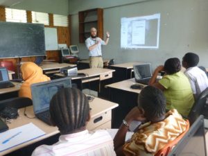
Esri is committed to making a long-term difference in GIS education in Africa and, over the past five years, has ramped up its involvement in this endeavor. Esri has sponsored a series of education user conferences (in Eastern Africa), training sessions, and other activities organized by local Esri offices. Additionally, special assistance has come from Esri’s offices in France, Portugal, and Switzerland to support universities in francophone nations, lusophone nations, and Rwanda, respectively. Esri has sponsored a growing group of education ambassadors to travel and conduct teaching and geomentoring missions across the globe. Among them are Jonathan Fleming of the University of North Alabama, who taught in Dar es Salaam in 2013, and Stace Maples from Stanford University, who visited Kenyatta University (KU) in Nairobi in spring 2017. Maples taught several classes and also mentored faculty and the university administration about how to apply and sustain GIS across the entire campus. Feedback from the universities and ambassadors was extremely positive, and so Esri will continue to support these missions in the future.
Among African universities, Kenyatta University has emerged as a star—a lighthouse exemplar—in adopting and promoting GIS. As in many GIS success stories in any field, a GIS champion was involved: Professor Simon Onywere. Onywere had been a GIS and remote-sensing expert for many years, but in 2013 he decided to take his university to the next level. He worked with Esri’s home office and Esri Eastern Africa Limited (in Nairobi) to craft a memorandum of understanding (MOU) whereby both parties would contribute to the success of GIS across the entire KU campus. Under Esri’s 100 Africa Universities program, the MOU included a donation of ArcGIS software to the university. Esri has worked with approximately 70 universities under this program thus far. With software installed in the laboratories, Onywere and Esri personnel trained instructors, students, and administrators on the power of GIS for solving spatial problems in any field of study. Enterprise GIS, including attention to servers and client apps, became available to anyone showing interest in learning on the same platform used by industrial, commercial, and government entities around the world. GIS Day and similar events were run; a GIS club was formed; and, soon, a small army of GIS users and promoters was created.

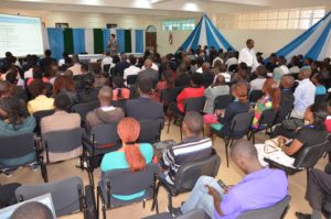
KU recently hosted the 2017 Esri Eastern Africa Education GIS Conference. GIS is being taught and used for research by Onywere’s environment science faculty and several others including staff of the recently added tourism and hospitality department and the newly built library. The KU story is a story of hope for GIS at African universities, demonstrating that with personal and collective initiative, anything is possible.
Working with instructors, students, and university/school administrators in Africa has been extremely rewarding and gratifying. We encourage all AAG members to consider lending a helping hand to slowly but surely raising the level of GIS education across the continent. If you’d like to apply to become an Esri Education Ambassador, send a brief CV with teaching experience and a statement of interest to edambassadors [at] esri [dot] com.
By Michael Gould, Global Education Manager, Esri
Featured Articles is a special section of the AAG Newsletter where AAG sponsors highlight recent programs and activities of significance to geographers and members of the AAG. To sponsor the AAG and submit an article, please contact Oscar Larson olarson [at] aag [dot] org.


