The Future Is Here: Sophia Garcia and the Intersections of GIS, Redistricting, and Social Justice
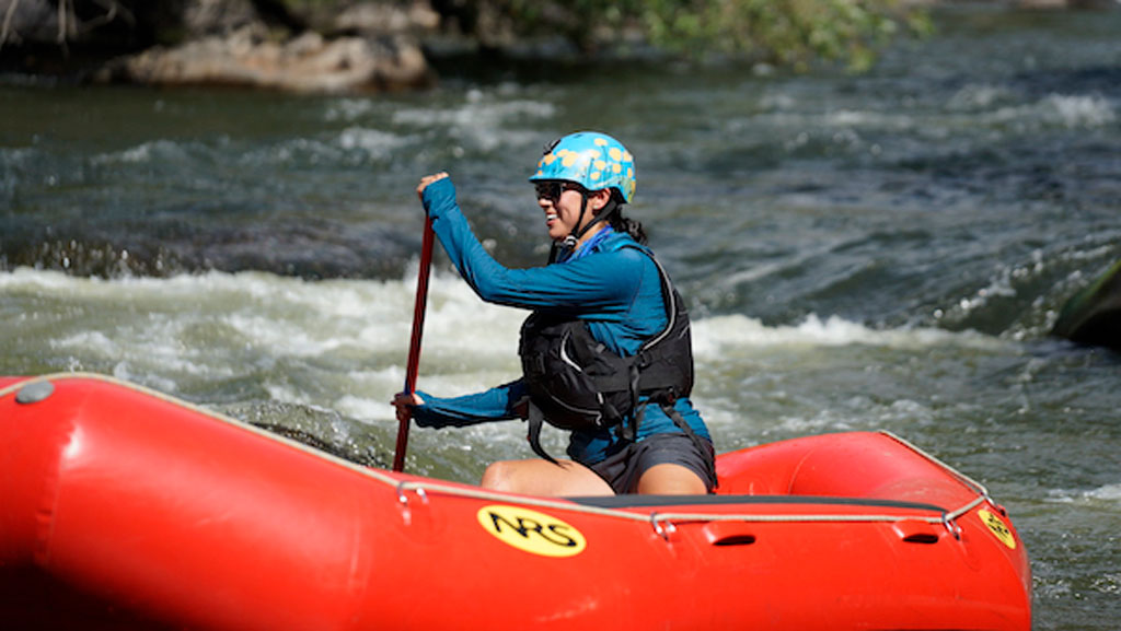
Photo of Sophia Garcia padding a raft in river rapids

We’re celebrating the accomplishments of geographers during Geography Awareness Week (November 14-20) and beyond. Find out more about this year’s theme, “The Future Is Here: Geographers Pursue the Path Forward” at our GeoWeek StoryMap, and follow the celebration at #GeoWeek or #GeoWeek2021.

Photo of Sophia GarciaSophia Garcia, the GIS and Outreach Director for Redistricting Partners in Sacramento, CA, understands how maps can start necessary conversations. In her current role, she sees redistricting efforts and community involvement as the “perfect intersection of talking about community, uplifting the community and letting them know what’s happening.” In her work she focuses on the imperative that we bring light to the redistricting process, engage communities, and empower them to get involved.

Garcia graduated with a bachelor’s degree in Environmental Studies from Wellesley College in 2015, and now works for Redistricting Partners from her base in Bakersfield, California. Garcia came to her current role from her previous work as a GIS Analyst for the Dolores Huerta Foundation, where she saw firsthand how she could uplift the work of her colleagues and community organizers through mapping. GIS software has great potential to start a dialogue and Garcia knows this:

Data is more than just numbers; there’s a story behind what’s happening.

Although she grew up with a father who worked in the GIS field (she attended her first ESRI User Conference when she was 10 years old, and mainly remembers the refreshments), Garcia did not see the full potential of GIS until college. Along with her classmates, she was tasked with figuring out how people living in a certain census block could do something sustainable surrounding food and grocery shopping. After knocking on doors and having conversations with people in the neighborhood, she found that not everyone had access to the nearest grocery store because of factors such as affordability, distance, and access to transportation.

Photo of Sophia Garcia padding a raft in river rapids
In addition to her work with GIS and redistricting, Sophia is a skilled rafter and rafting guide.


Because of the geographic nature surrounding the factors of access to food and sustainability, Garcia had an “aha moment” and realized the stories of everyone she had talked to could be conveyed using a map. She started to work with GIS on the project, and eventually went on to intern with the GIS departments in Kern County to learn more about the different ways that the departments utilized GIS.

At Redistricting Partners, Garcia has been very successful in using mapping technologies and outreach to emphasize the real-world implications of redistricting, and advocate for a more fair process. She was part of the group that sparked the passage of the California Assembly Bill No. 849, which mandates rules to increase transparency in the redistricting process in cities and counties across California. This bill, which Garcia hopes to see similarly implemented in other parts of the country, requires localities to have specific redistricting websites and mandates redistricting to be talked about during long public meetings, among other components.

When asked how younger geographers can explore new, interdisciplinary possibilities in geography, Garcia urges them to find a project they are passionate about and make use of mapping technology which is often available from ESRI to college and K-12 students. She recognizes that you can categorize pretty much any data geographically, and urges young geographers to “find whatever you’re passionate about, or mad about, or excited about, and learn to map it, make it as a poster, share it with someone, and you can have a discussion about it.”
    Share

Jessica Perkins – GIS and Technical Support Program Manager, West Virginia

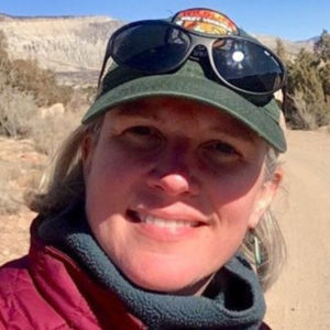
Photo of Jessica PerkinsPosition: GIS and Technical Support Program Manager, West Virginia Division of Natural Resources, Wildlife Resources Section: Supporting Game Management, Fish Management, Environmental Coordination, Wildlife Diversity and Natural Heritage with geographic information systems, data, and planning needs.

What was your favorite class in K-12? Environmental Science and Math (geometry, algebra, trig…)

How did you first learn about and/or use GIS? In 1996 I was a park ranger student trainee alternating undergrad and working at a US Army Corps of Engineers lake project in Southern Virginia. We were using Trimble GPS units to map things like eagle nests, timber harvest areas, and permits. At the beginning we had a crude GIS in Microstation but as I was working there we transitioned into using ArcView. I went back to school and took classes in GIS because something really clicked and made sense working in this environment.

Name one thing you love about GIS and/or geography: Traveling and learning about all the amazing places on Earth and our connection to the natural world.

Why did you want to volunteer as a GeoMentor? About 15 years ago I worked with a group of students at Roanoke Valley Governor’s School for Science and Technology on a stream delineation and mapping project. This was my first GeoMentor experience before there was a GeoMentor program. It has been a fulfilling part of my career to give back and prepare students for a future in this field.

If someone asked you why they should learn about GIS and/or geography, how would you respond in one sentence? You should learn about GIS and geography because it makes the world more understandable: there is a geography of everything in the universe really and the position and relative position to other things often explains why it is there.

Websites:

    Share

Frank Romo – Public Safety Data Manager & Geospatial Consultant, Michigan

Photo of Jessica PerkinsPosition: GIS and Technical Support Program Manager, West Virginia Division of Natural Resources, Wildlife Resources Section: Supporting Game Management, Fish Management, Environmental Coordination, Wildlife Diversity and Natural Heritage with geographic information systems, data, and planning needs.

What was your favorite class in K-12? Environmental Science and Math (geometry, algebra, trig…)

How did you first learn about and/or use GIS? In 1996 I was a park ranger student trainee alternating undergrad and working at a US Army Corps of Engineers lake project in Southern Virginia. We were using Trimble GPS units to map things like eagle nests, timber harvest areas, and permits. At the beginning we had a crude GIS in Microstation but as I was working there we transitioned into using ArcView. I went back to school and took classes in GIS because something really clicked and made sense working in this environment.

Name one thing you love about GIS and/or geography: Traveling and learning about all the amazing places on Earth and our connection to the natural world.

Why did you want to volunteer as a GeoMentor? About 15 years ago I worked with a group of students at Roanoke Valley Governor’s School for Science and Technology on a stream delineation and mapping project. This was my first GeoMentor experience before there was a GeoMentor program. It has been a fulfilling part of my career to give back and prepare students for a future in this field.

If someone asked you why they should learn about GIS and/or geography, how would you respond in one sentence? You should learn about GIS and geography because it makes the world more understandable: there is a geography of everything in the universe really and the position and relative position to other things often explains why it is there.

Websites:

    Share

Erin Silva – Project Manager, Maryland

Photo of Jessica PerkinsPosition: GIS and Technical Support Program Manager, West Virginia Division of Natural Resources, Wildlife Resources Section: Supporting Game Management, Fish Management, Environmental Coordination, Wildlife Diversity and Natural Heritage with geographic information systems, data, and planning needs.

What was your favorite class in K-12? Environmental Science and Math (geometry, algebra, trig…)

How did you first learn about and/or use GIS? In 1996 I was a park ranger student trainee alternating undergrad and working at a US Army Corps of Engineers lake project in Southern Virginia. We were using Trimble GPS units to map things like eagle nests, timber harvest areas, and permits. At the beginning we had a crude GIS in Microstation but as I was working there we transitioned into using ArcView. I went back to school and took classes in GIS because something really clicked and made sense working in this environment.

Name one thing you love about GIS and/or geography: Traveling and learning about all the amazing places on Earth and our connection to the natural world.

Why did you want to volunteer as a GeoMentor? About 15 years ago I worked with a group of students at Roanoke Valley Governor’s School for Science and Technology on a stream delineation and mapping project. This was my first GeoMentor experience before there was a GeoMentor program. It has been a fulfilling part of my career to give back and prepare students for a future in this field.

If someone asked you why they should learn about GIS and/or geography, how would you respond in one sentence? You should learn about GIS and geography because it makes the world more understandable: there is a geography of everything in the universe really and the position and relative position to other things often explains why it is there.

Websites:

    Share

Daniel Yelito – Transportation Services Manager, Pennsylvania

Photo of Jessica PerkinsPosition: GIS and Technical Support Program Manager, West Virginia Division of Natural Resources, Wildlife Resources Section: Supporting Game Management, Fish Management, Environmental Coordination, Wildlife Diversity and Natural Heritage with geographic information systems, data, and planning needs.

What was your favorite class in K-12? Environmental Science and Math (geometry, algebra, trig…)

How did you first learn about and/or use GIS? In 1996 I was a park ranger student trainee alternating undergrad and working at a US Army Corps of Engineers lake project in Southern Virginia. We were using Trimble GPS units to map things like eagle nests, timber harvest areas, and permits. At the beginning we had a crude GIS in Microstation but as I was working there we transitioned into using ArcView. I went back to school and took classes in GIS because something really clicked and made sense working in this environment.

Name one thing you love about GIS and/or geography: Traveling and learning about all the amazing places on Earth and our connection to the natural world.

Why did you want to volunteer as a GeoMentor? About 15 years ago I worked with a group of students at Roanoke Valley Governor’s School for Science and Technology on a stream delineation and mapping project. This was my first GeoMentor experience before there was a GeoMentor program. It has been a fulfilling part of my career to give back and prepare students for a future in this field.

If someone asked you why they should learn about GIS and/or geography, how would you respond in one sentence? You should learn about GIS and geography because it makes the world more understandable: there is a geography of everything in the universe really and the position and relative position to other things often explains why it is there.

Websites:

    Share