Advocate for Geography in Austerity

This is Part 1 of a two-part column on what geography departments can do (and should not do) to advocate for their work in budget talks, which are all the more crucial during the COVID-19 pandemic. These points are largely derived from answers I received from geographers in upper administrative positions at universities.

At the end of October, the Chronicle of Higher Education covered the looming budget woes for colleges and universities across the country, with many states expecting 10% budget cuts. Public higher education likely will be disproportionally affected by state budget cuts as they face “two crises: the impact of Covid-19 on their operations and a downturn in state funding brought on by the current recession.” In addition, as reported in a June article in Nature, the response to the Coronavirus pandemic will also force universities to address growing challenges in higher education, such as mounting tuition costs, public perception of relevancy, and a demographically driven decrease in numbers of graduating high school seniors.  Yet, as we know, tuition increases are a direct result of more than a decade’s worth of states balancing their budgets on the backs of public colleges and universities that were once the lifeblood of the U.S.’s affordable higher education.  Further, in an article just released in Inside Higher Ed, the coronavirus pandemic has caused more than one-third of prospective college students to reconsider higher education (see Doubts About Going to College).

In short, the COVID-19 crisis has aggravated problems we have known about for some time. As a 2019 Gallup poll showed, there was already a marked decrease in public confidence in higher education in the U.S. going into this pandemic as a result of soaring tuition and barriers to access.  If 2020 has taught us nothing else, it is that geography is a crucial discipline for grasping and addressing the dire issues our earth faces. Yet in a year that has demonstrated our value, some of our geography departments continue to struggle for relevancy on university campuses.

What’s a Geography Department To Do (or Not Do)?

While geography departments do not control university budgets, we can think and act strategically to remain relevant to students, the public, and university and college administration. In this light, I have received a growing number of requests from department chairs as well as individual members asking for AAG assistance in demonstrating geography departments’ relevancy to key stakeholders. Those requests have varied, but range from advocating for lost positions to requesting brochures/videos to show to administration to demonstrate geography’s relevancy. I reflected on my experience as department chair and I was fairly certain that deans, provosts, and presidents wouldn’t be swayed by (or even take the time to view) brochures or videos from AAG.  I also knew that the time to act is before positions are cut, not after.

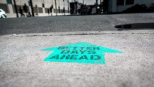
I therefore drafted an email and sent it to several geographers in administrative positions around the U.S.  My request was fairly simple… “please list your ‘Top 3 Dos’ and ‘Top 3 Not Dos’ in order to develop highly effective, impactful, and well-functioning geography departments (from the perspective of deans and provosts).”  The responses were remarkably consistent.

I’ll go in reverse order and start with the “Top 3 Don’ts,” mostly because these are relatively straightforward and require little additional discussion—the “Do’s” will have a column of their own next month.  Some of these Don’ts harken back to Ron Abler’s Five Steps to Oblivion.

1.  Don’t Prolong and Disseminate Department Conflict and In-fighting. Unless you’re a one-person department, you can’t escape departmental politics, one of the primary dynamics in academic departments. In a broader sense, conflict is an unavoidable and sometimes-necessary aspect of academic life. Yet persistent, unresolved in-fighting is not healthy for departments and, if tolerated, will hurt your department’s chances of success in budget battles. As one of the respondents to my request said: “No provost or president wants to become embroiled in personnel problems in a department.  I had the very negative experience of being an external “visitor” at a major university to look at the issues in a particular department (not geography).  The department members had done almost everything they could have done to bring negative attention to themselves and place themselves on the cutting block.”

While we have our moments, I’m fortunate to work in a functional and collegial department.  But I’ve experienced and heard tales about departments that are not as fortunate…slamming doors, stomping out of meetings, pouting, insulting…  Is this behavior rooted in academics’ quest for intellectual discussion, our passion for our sub-disciplines, or because we care so much for our students?

No.

Clearly, some conflicts can be helpful.  For example, conflicts around marginalization because of disability, race, or gender are necessary for departments to grow.  The  destructive conflicts, however—the ones that divide departments—always seem to be personal.  Petty turf wars, feelings of being slighted, resentment about small merit pay differences, irritation at office assignments, frustration over teaching assistant selection, and on and on.  We all know the many examples.  Airing these grievances may offer temporary relief and validation, but can in the long term crowd out the space for collaboration where the exploration of healthy, generative differences can be daylighted and lead to stronger visions for a department that addresses different views about direction, vision, power, and the future of the discipline.  Worse yet, airing these grievances outside the department creates a large billboard to the world stating “This department is dysfunctional.”

In short, work out difficulties and leave the personal battles at the door when visiting your dean or provost with requests on behalf of the department.  As intelligent, hyper-educated academics, we should know better than to pee in our own pool.

2. Don’t be unrealistic in demands for central resource investments. In my experience, this issue often arises when departments discuss graduate student support and new or replacement faculty lines. I’m always surprised when I hear something along the lines of… “central administration has to know how important it is for us to replace our position in fill-in-the-blank sub-discipline.”

No, they don’t have to know that.  In fact, they may not even care about disciplines; their focus is on the overall health of the home institution.  It’s our job to collect, analyze, and summarize the data and demonstrate the relevance of our needs to the entire university, not just to Geography.  Usually, but not always, university budgets are rather immobile.  And inadequate.  It’s strategic and realistic to realize that a finite and inadequate budget is applied to all units across campus.  Departments should continue to be visionary and ambitious, but recognize the broader realities and adjust arguments accordingly.  Every other department on campus is also asking for resources.  And, many colleges and universities have precarious structures which are not designed to withstand the level of disruption that the collective COVID response has thrown at them.

3. Don’t whine. 

The them-versus-us paradigm between faculty and administrators plays out across campuses throughout the world.  Faculty complain about the familiar issues: poor student preparation, equity in teaching loads, poor facilities, lack of equipment, competition for inadequate resources, underfunded initiatives…  This paradigm has become its own social construct in which faculty often see administrators as obstructionists.

Yet, often the reality is that both faculty and administrators care deeply about the students and institution.  The disconnect comes because administrators are the policy and budgetary gatekeepers, with the unappealing task of trying to stretch inadequate resources across an entire campus.  They are often (but not always) aware of the shortfalls that result.  Departments and faculty, then, often feel that they’re at the bottom of the hill, shoveling the proverbial dung.

While it’s important to advocate for the needs of our departments to higher administration, perpetuating institutional cynicism is not strategic.  One of the best lessons I learned from all of my years serving on review panels throughout the National Science Foundation is the importance of positively stating negative critiques:  “this proposal would be improved if the PI did…”.  I shamelessly borrowed this approach from NSF during my time as department chair, making the argument to the administration that specific productivity and metrics would be enhanced with identified allocation improvements.

Don’t bring a problem to your administrators.  Bring a solution.

.  .  .

In hindsight, I realize that the lists of Dos and Don’ts I received rather mirror each other.  But, I parsed them out and summarize the Don’ts above.  Next month, I’ll share the Dos.  As a preview, the three Dos, which have been expanded into four Dos, include: strategic alignment, communication, partnership, and productivity.

—Amy Lobben
AAG President and Professor at University of Oregon
lobben [at] uoregon [dot] edu

DOI: 10.14433/2017.0082


Please note: The ideas expressed in the AAG President’s column are not necessarily the views of the AAG as a whole. This column is traditionally a space in which the president may talk about their views or focus during their tenure as president of AAG, or spotlight their areas of professional work. Please feel free to email the president directly at lobben [at] uoregon [dot] edu to enable a constructive discussion.

Featured Image: “Better Days Ahead” painted in a bright blue arrow directly on a street. Photographer Ian Taylor, Unsplash

    Share

The Advancement of Location Analytics in Business Schools

by Joseph Kerski
Education Manager, Esri, and Instructor, University of Denver

A quiet geographic revolution is occurring on many university and college campuses around the world. Faculty and students in schools and colleges of business are increasingly turning to GIS tools and data in instruction and research. Given that business has always been about “location, location, location,” it makes sense that educators seeking to prepare their students for the workplace are doing so. Yet location analytics, as it is most often called in business schools, took some years to gain a firm foothold. Why is this the case, what are the implications, and how can the geography community assist with these exciting developments?

Business schools adopt geospatial tools and datasets for the same reasons that faculty in disciplines such as geography, health, and data science do so: instructors want students to learn skills in critical thinking, spatial thinking, and problem-solving; to find tools that can help them link theory and practice; to guide students to be effective decision-makers and leaders when they graduate into the workplace; and to see patterns, relationships, and trends in the data they analyze for their own research. Location analytics is most commonly taught in supply chain management, risk assessment, marketing, consumer behavior, and management courses. This article highlights five shining examples of exciting developments happening right now, ranging from individual courses to complete programs in business analytics.

In this location analytics activity are enriched tessellations using ArcGIS Business Analyst Web App showing the number of adults carrying medical insurance.

Several developments have been key to ushering in the adoption of location analytics:

  • As GIS tools migrated to a cloud-based, software-as-a-service (SaaS) environment—manifested in such tools as ArcGIS Insights, ArcGIS Online, and Business Analyst Web App—they became much more straightforward for instructors to incorporate into their courses. The tools have become easier to use and no software needs to be installed.
  • Data on business locations, suppliers, demographic characteristics, and consumer preferences has become available for multiple countries and often at very detailed geographic units (in some instances, down to the neighborhood scale).
  • There is recognition that GIS can help users analyze patterns, relationships, and trends as well as assist businesses to meet the needs of their customers and reach their sustainability and societal goals. Businesses exist to add value. Location is vital to all aspects of business and adds value to it. The world of business is in a state of continual change. Location analytics enables businesses not only to manage current operations but also to plan for and enable change.
  • There is a growing trend toward enabling students to be proficient in today’s “big data” world. This is partly why some universities are creating data science programs, which often are coupled with business programs.
  • Seeking to place graduates in meaningful careers, colleges and universities view location analytics skills as enhancing a graduate’s value to a current or future employer.
  • Business schools, by their very nature, are competitive. They see that adding location analytics courses and programs helps their university stand out and attract students.

For more about these and other developments, see the article Introducing Business School Students to Location Analytics.

Why should the geography community care about these developments? Consider the thousands of students graduating each year with bachelor’s and master’s degrees in business from hundreds of universities around the world. Think of these graduates’ influence in society. Imagine a world where decisions in the business world are routinely made by people who have applied geographic thinking to solve problems—people who began their geospatial journey while they were students. Within academia, business students and faculty keen on the application of location-based data and tools can be strong allies for your own geography department and initiatives.

Despite the adoption of the use of GIS in business programs, much work needs to be done. Many faculty members in business are still not aware of the value that applied geography brings to their programs, nor do they know how to use GIS. They may think that GIS is just for the geography department and is not applicable to their own work. Using any professional-level tool such as GIS presents a double challenge: faculty must at least be comfortable enough with the tools to use them in their courses, and they must understand how to effectively teach with them. Location analytics is part of a system—a geographic information system—that contains many interlocking components. Deciding which of the components to use in teaching, and in what manner to do, so takes effort.

This is a key time to work with your business schools. The disruptions to business and society caused by COVID-19 can be understood and mitigated through using geographic thinking and applying geospatial tools. The spread of disease, the actions taken to limit the spread, the disruptions in supply chains, the choices of how and when to reopen public spaces and university campuses, and a score of other relevant and current issues are rooted in geography. Businesses and business schools are more receptive than ever to tools that will help them deal with the disruptions, and geographers can help their business school colleagues learn to use these tools effectively.

With your grounding in geographic theory and practice, you—the geography community—could be of enormous help to business students and faculty. To assist you in this effort, see the Location Analytics in Business Education landing page, which includes location analytics tools to use in courses; ways to learn how to use these tools; and learning pathways, spatial data, curricular materials, case studies, and success stories. Key messages and a workshop syllabus are included and might be useful as you work with these colleagues. Such collaborative efforts could also provide you with resources and perspectives that you could incorporate into your own courses.

    Share

Joanna Thompson-Anselm

Education: Honours B.A. in Geography and Urban Studies (York University), Bachelor of Education (York University)

Describe your job. What are some of the most important tasks or duties for which you are responsible?
My job as subject head is to ensure quality geography programming for all students in our building and to mentor staff to develop their own professional geography knowledge to stay current with pedagogical demands and content.  I work with staff and students to determine what current geographic issues are of interest and important to them and then help develop a program that is responsive to those interests.  It is really important that we are continually reviewing geotechnology’s part in helping us inquire more deeply about geographic issues, but also transferrable and other geography-specific skills that are needed for students to be employable in the 21st century.  To create a robust program that serves the whole student, this requires ongoing professional development both in teaching and learning strategies as well as current trends in geography.

What attracted you to this career path?
I have always known that I wanted to be a teacher, but I didn’t know that I wanted to be a geography teacher until I met my high school geography teacher, Mr. Meikle.  The way that he engaged us in anecdotes, case studies and simulations that made me realize that my passion was really about understanding why people and things are different in different parts of the world.  I am inspired daily to work with staff to come up with engaging ways to have students learn important skills, but at the same time have fun and be excited to ask more questions about the world they live in.  As value in our subject area has been dwindling in my community over the past few years, I’m more impassioned than ever to work on creating relevant and meaningful geography tasks for the students I work with.  Students and parents need to understand that geography brings together all other disciplines and includes very employable skills in a globalized world.   As Michael Palin, past president of the Royal Geographical Society, has remarked: “Geography explains the past, illuminates the present, and prepares us for the future.  What could be more important than that?”

With regards to working as a course writer for Queen’s University, this is the newest chapter of my life. I’ve chosen to explore this in order to help people find their own passion to develop quality geography programming in our schools.  I believe that in order for geography to be more recognized as a valuable subject area, it should be taught by teachers who are inspired to look at it in new and different ways. My goal is to develop a culture of creative and critical educators who will engage their students in meaningful work that will make an impact on their communities.  I want to encourage teachers to try something new that will allow their students to explore and be challenged by geography content and skills.

How has your education/background in geography prepared you for this position?
My degrees in geography and education have given me the credentials to teach geography in Ontario, but most of my education has been on the job and through professional development offered through the York Region District School Board or OAGEE (Ontario Association of Geographic and Environmental Educators) and through the networks I have created for myself.  In our discipline, content is changing daily and approaches to teaching are changing equally rapidly in response to technological development, student engagement and workforce demands.  Continually trying to find ways to showcase that geography teachers are relevant is an ongoing educational and marketing experience!  I have recently presented on gamification in the classroom to a group of educators at the IDEAS Conference at the University of Calgary, but the learning of gamification came from professional reading and collaborating with colleagues.  The learning and education of a geography teacher never ends!

What geographic skills and information do you use most often in your work? What general skills and information do you use most often?
These days I find myself using a lot of spatial analysis skills to come up with my tasks and hooks for students and to help them dig more deeply into their own geographic inquiries.  For example, the ability to use spatial skills to interpret a thematic map or analyze an aerial photo to see if a location contains the features I am looking for to develop a task to engage my students is critical.  The geography teachers in our department often look at spatial data to ask or answer questions about content we are working on, and sometimes we look at it together and are excited by the information we have found that we can now share with students!  We often use our geographic thinking concepts of interrelationships, spatial significance, pattern and trend and geographic perspective to help students see the complexity of geographic problems and how they are interconnected with other subjects like science, business and urban planning.

One important general skill I use on a daily basis is communication, which I use in a variety of contexts from discussing programming needs with our administrators, to teaching students about the applications of geotechnology, to speaking with parents about student progress and needs.  Data management and critical thinking skills are also essential when organizing groups of students, plotting curriculum standards into themes for student learning and scaffolding that learning for best success.  Lastly, I routinely use the skill of time management – forgotten by many of us!  With all the responsibilities that come along with my job, it’s important that I make agendas, checklists and review my goals for work, home and recreation to keep a balanced life.

Are there any skills or information you need for your work that you did not obtain through your academic training? If so, how/where did you obtain them?
My geography/urban studies degree mainly focused around human geography, urban dynamics and some physical geography foundations.  Cartography was not a mandatory course, so I left university without much learning about GIS.  Now I feel that it is my duty to be informed about various geotechnologies, specifically public domain ones, so that I can build a more relevant and accessible program that develops employable skills in my students.  Google Tourbuilder, Timelapse, Earth, and Maps have all been useful platforms for which I’ve had to learn the capabilities to be able to instruct my students directly or pair them with a problem solving task.

Do you participate in hiring, screening, or training of new employees? If so, what qualities and/or skills do you look for?
In the public education system, subject heads are not allowed to be involved in the hiring process.  However, once teachers have been hired and assigned to our department, it is then my job to mentor them and offer professional development opportunities.  I really value teachers who have a sense of excitement about geography and a drive to be creative in their activity planning, assessments and lesson delivery.  It is always exciting to work with someone who is equally invested and interested in taking risks in the classroom with their program delivery.  They don’t even have to be geography teachers, just people who are willing to learn, refine, collaborate and take risks to improve student learning experiences in geography.  I also value working with teachers who have strengths that complement my own.  For example, it is a huge asset to have someone who is more proficient than I am in geotechnology and Google Apps so that I can learn from them in building my own competencies.

What advice would you give to someone interested in a job like yours?
I would highly suggest seeking mentorship from an in-service geography teacher who knows how to network, find resources, is well connected with outside organizations and loves their job.  These are the qualities of a person who will be able to give you sound advice and encourage you to become the teacher you want to be.  I would also suggest taking pedagogical risks in the classroom and exercising your creativity.  Work ethic and creativity are also things that can really set people apart.

What is the occupational outlook for career opportunities in your field/organization, esp. for geographers?
It is difficult to say what the career opportunities look like for geographers in terms of being a geography teacher or instructional leader, as so much of it has to do with the particular school board.  In the Toronto District School Board they have subscribed to the model of “super heads” in which an instructional leader is responsible for supporting curricula from multiple subject areas.  In my school board, geography subject heads are still distinctive, but there is growing concern about how long we can stay that way without being amalgamated into a “social studies” subject head that would include other departments.

As for being a geography teacher, I believe that the future is bright.  The headlines everyday speak to global issues such as those associated with climate change, genocide, globalization, and geopolitics.  People are beginning to recognize the importance of geographers in helping to bring together all of the pieces from different disciplines in order to help solve these complex problems.  I hope I can play an important role in that!

    Share

Melanie Vanderhoof

Education: Ph.D. in Geography (Clark University), M.A. in Geography (San Francisco State University), B.S. in Biology and Society (Cornell University)

Describe your job. What are some of the most important tasks or duties for which you are responsible?
I lead research that uses diverse sources of satellite imagery to help us understand how ecosystems respond to stressors, such as a drought, flood, or fire. I am responsible for proposing research ideas, leading data acquisition and analysis, publishing results in peer-reviewed journals, and collaborating with others.

What attracted you to this career path?
I started my career in the private consulting industry as a biologist. Although I loved the field work, I quickly got bored with my position. What is so attractive about my current career path is that I can take every project as an opportunity to learn something new and push myself outside of my comfort zone, either technically or within the fields of ecology and hydrology. I also really enjoy the flexibility to pursue research that I find interesting and that I hope is relevant and useful to other scientists, land managers, and society at large.

How has your education/background in geography prepared you for this position?
To me, geography is a way of thinking. Instead of thinking about a topic in isolation, geography embraces complexity, looking for patterns across space and time, making connections across disciplines, and seeking to understand the global context in which a phenomenon occurs. This perspective drives my approach to research. I tend to include as many different types and sources of data in a single analysis as I can. I think of it as throwing all the data in a pot and stirring it until I start to understand how each dataset informs the others and fits together into a single story.

More directly, my most useful courses were technical courses that explored remote sensing and ecology as well as courses that pushed me to think critically about research and knowledge.

What geographic skills and information do you use most often in your work? What general skills and information do you use most often?
I use my geographic skills in remote sensing and GIS the most often in my work. Other general skills and information that I rely heavily on include writing, statistics, programming, ecology and hydrology.

Are there any skills or information you need for your work that you did not obtain through your academic training? If so, how/where did you obtain them?
The field of remote sensing continues to evolve rapidly as “big data” approaches have become the new normal. My skills in programming were inadequate from my academic training, entirely due to my own initial aversion to programming. My programming skills in JavaScript, Python, and R have improved over time mostly from self-teaching as well as learning from colleagues and collaborators more skilled in programming than myself.

Do you participate in hiring, screening, or training of new employees? If so, what qualities and/or skills do you look for?
Yes, I participate in hiring, screening and training new employees. In research we are always trying something new, which means that there tends to be less structure and more trial and error in any given project. I look for people who show a demonstrated interest in science and the natural world, are resilient, responsible, and enjoy problem solving and being creative.

What advice would you give to someone interested in a job like yours?
Go for it! I feel incredibly fortunate to have the opportunity to be both a geographer and a scientist! To someone who was interested in a job like mine, I would advise them to find an area of research that you can get excited about, get involved in research projects with different scientists, talk to as many people as you can who have jobs that you might want, and publish!

What is the occupational outlook for career opportunities in your field/organization, esp. for geographers?
I think geography is an exciting place to be right now. Most of my friends and colleagues in the field have successfully obtained jobs either in academia or with the federal government. And skills in GIS, remote sensing, data analysis, and machine learning are currently widely marketable.

    Share

Resilience in GIS Education

COVID-19 Cases across the United States.

Bang. The spring semester was cut short, everyone was sent home, and the fall semester is still morphing. The COVID-19 pandemic has caused a reset in the way we think about teaching and learning. Distance learning is not new, of course, but forced distance learning on a global scale—that’s a different story. This causes disruption and tension in all disciplines but is more acutely felt in disciplines that are dependent on hardware laboratories, as in the case of GIS. Can we–educators and learners—adapt? Are we resilient? And will we be resilient when the next unannounced disruption occurs?

During August 2020, the University Consortium on Geographic Information Science (UCGIS) began a series of online panel sessions entitled Resilience in GIScience Education. During the preliminaries, the group quickly agreed on a very wide view of resilience, defining it as the overall ability to cope with and adapt to disruption. Because the first round of panels was focused on pedagogy, I made what I feel is another important clarification. The title of the session series (as well as “UCGIS”) deliberately refers to geographic information science (GIScience), not GIS per se, although many people will conflate them. But it seems useful to clarify whether any one of us is really talking about educating geographic information scientists (which is normally done at the graduate school level), or whether we’re talking about educating undergrads about the hows and whys of GIS. One learner may be planning to go on to a research career; another may want to graduate ASAP and go to work for a GIS company or government agency. One curriculum would normally focus on theory and methods (David Mark, 2003), the other on practice and problem solving. Student profiles and expectations are important to consider here.

There were some other fundamental questions as well. Is COVID-19 different from other disruptions? (I remember when the University of Iowa was flooded in 2008; and certainly, in Latin America, university classes are disrupted for months on end due to strikes.) Is the COVID-19 disruption somehow unique for GIScience? To what extent is resilience affected by social, institutional, legal, and societal norms?

These sessions moved from the pedagogic implications of COVID-19 and other disruptions to some of the more technology-related implications, and then to implementation of resilient GIScience education. The latter topics are where Esri’s education outreach team has much experience, having worked directly or indirectly with almost 11,000 university users over the past two decades. In the end, the topics are intertwined—pedagogy necessarily changes, as do the classroom environment and the manner in which courses are conducted.

In terms of equity, did all registered university students before COVID-19 have access to GIS? Historically, the GIS lab was the great leveler—every GIS student had access to the same computers and the same software—but only on Tuesdays and Thursdays from 9:30 a.m. to 11:00 p.m.  And only those learners who knew—or were allowed—to register for a GIS course could access the GIS. More recently, universities began installing GIS software in common spaces, such as libraries and study rooms, which is a big step toward resilience. Suddenly GIS was available at any time. Desktop software is now easier for students to acquire—via direct downloads or access codes from instructors—for installation on student-owned computers.

This reminds me that part of human resilience is insistence—speaking up and asking for a possible “yes” rather than assuming a “no.” The squeaky wheel gets the grease—or, in this case, the software.

In 1992, Michael Phoenix created Esri’s unwritten pledge that needy people in the education world would gain access to the software they need. Esri now offers free access to pandemic-affected (at-home) students who are not already covered by university software licenses.

But is that an equitable solution? Should we expect that every student owns a laptop with the requirements for modern desktop software? This is not totally realistic even in the wealthiest areas of developed countries. Saving many a GIS instructor, accessing GIS online is a trend that is at least five years old but has exploded in popularity during the COVID-19 crisis. The end user connects on almost any hardware via an internet browser, and the server in the cloud does most of the work. ArcGIS Online now has a sufficiently robust set of spatial analysis tools, so many introductory GIS courses can be taught on that platform today. Some instructors miss some of their favorite desktop tools, but the resilient instructors work with the available tools and move forward, and students whet their appetites for GIS.

But there are still underserved populations. Does resilience include a university or a government agency that covers the cost of hardware and internet connectivity for each needy student? Again, is GIS different in that respect to, say, graphic design or engineering fields? In any case, the GIS industry and the AAG are doing what they can to help people continue under difficult circumstances. See the COVID-19 pandemic-related Esri education resources and updates from the AAG COVID-19 Rapid Response Task Force for more information.

We welcome the active collaboration of resilient educators and students so that we can all keep moving forward in helping solve geographical problems.

Michael Gould is the Esri Global Education Manager


References:

UCGIS 2020 Global GIScience Conversations https://www.globalgiscienceeducation.org/conversations

Mark, D. M., “Geographic Information Science: Defining the Field,” in Foundations of Geographic Information Science, edited by M. Duckham, M. F. Goodchild, and M. F. Worboys (New York: Taylor and Francis, 2003), 1–18. doi:10.1201/9780203009543.ch1.

    Share

Geographers Recognized for National Research on COVID-19

Projects address mobility patterns, access to health care and food systems, racial and disability disparities during the pandemic

WASHINGTON, DC…Geographers have been recognized in 16 research and educational fellowships from The Geospatial Software Institute (GSI) Conceptualization Project. The fellowships support 14 projects that tackle COVID-19’s challenges for public health, social networks and contact tracing, housing stability, and disparities due to age, race, and disabilities, using geospatial software and advanced capabilities in cyberinfrastructure and data science. A full list of the fellows, with biographies and project information, is at https://gsi.cigi.illinois.edu/geospatial-fellows-members/.

“The COVID-19 crisis has shown how critical it is to have cutting-edge geospatial software and cyberinfrastructure to tackle the pandemic’s many challenges,” said Shaowen Wang, a geographer who is the principal investigator of the NSF project and founding director of the CyberGIS Center at University of Illinois Urbana-Champaign. “We are extremely grateful for NSF’s support to fund this talented group of researchers, whose work is so diverse yet complementary.”

The American Association of Geographers (AAG) is a partner in the GSI Conceptualization Project, which is supported by the National Science Foundation (NSF). Other partners include the Consortium of Universities for the Advancement of Hydrologic Science, Inc. (CUAHSI), the National Opinion Research Center (NORC) at the University of Chicago, Open Geospatial Consortium (OGC), and University Consortium for Geographic Information Science (UCGIS). Technical and cyberinfrastructure support are provided by the CyberGIS Center for Advanced Digital and Spatial Studies (CyberGIS Center)  at the University of Illinois at Urbana-Champaign.

“Geospatial technologies connect us and make us more geospatially aware, and in doing so, diminish everyday inconveniences,” said Coline Dony, senior geography researcher at AAG. “The AAG is committed to working with groups like GSI to ensure that the complex, interrelated, social, environmental, and scientific challenges of geospatial technologies are addressed. I think these challenges are what the GSI and Geospatial Fellows are well-positioned to accomplish.”

The Fellows come from varied professional, cultural, and institutional backgrounds, representing many disciplinary areas, including public health, food justice, hazard prediction and response, housing and neighborhood change, and community-based mapping. The fellowship projects represent frontiers of emerging geospatial data science, including for example deep learning, geovisualization, advanced approaches to gathering and analyzing geospatial data, and GeoAI.

Pioneered by multi-million research funded by NSF, cyberGIS (i.e., cyber geographic information science and systems based on advanced computing and cyberinfrastructure) has emerged as a new generation of GIS, comprising a seamless integration of advanced cyberinfrastructure, GIS, and spatial analysis and modeling capabilities while leading to widespread research advances and broad societal impacts. Built on the progress made by cyberGIS-related communities, the GSI conceptualization project is charged with developing a strategic plan for a long-term hub of excellence in geospatial software infrastructure, one that can better address emergent issues of food systems, ecology, emergency management, environmental research and stewardship, national security, public health, and more.

The Geospatial Fellows program will enable diverse researchers and educators to harness geospatial software and data at scale, in reproducible and transparent ways; and will contribute to the nation’s workforce capability and capacity to utilize geospatial big data and software for knowledge discovery.

With a particular focus on COVID-19, the combined research findings of the Fellows will offer insight on how to make geospatial research computationally reproducible and transparent, while also developing novel methods, including analysis, simulation, and modeling, to study the spread and impacts of the virus. The Fellows’ research will substantially add to public understanding of the societal impacts of COVID-19 on different communities, assessing the social and spatial disparities of COVID-19 among vulnerable populations.

For more information about the GSI conceptualization project, see their website: https://gsi.cigi.illinois.edu/.

For a list of Geospatial Fellows and their projects, visit https://gsi.cigi.illinois.edu/geospatial-fellows-members/

For more than 100 years The American Association of Geographers (AAG) has contributed to the advancement of geography. Our members from nearly 100 countries share interests in the theory, methods, and practice of geography, which they cultivate through the AAG’s Annual Meeting, scholarly journals (Annals of the American Association of GeographersThe Professional Geographer, the AAG Review of Books and GeoHumanities), and the online AAG Newsletter. The AAG is a 501(c)3 nonprofit organization founded in 1904.

FOR INTERVIEWS OR INFORMATION, CONTACT Lisa Schamess, phone 202.234.1450, ext 1164 or lschamess [at] aag [dot] org

    Share

AAG Welcomes Fall 2020 Interns

Two new interns have joined the AAG staff this fall! The AAG would like to welcome Jenna and Mei to the organization. We are also grateful to have one of our summer interns, Sekour, continue working with us this semester.

Jenna Pulice is a senior at Penn State University pursuing a Bachelor of Science in geography, with a minor in climatology, and certificates in GIS and human/societal geographies. She is beginning the process of applying to graduate programs in geography and/or climate science and is also considering spending time abroad on a work visa to continue exploring new places. She is passionate about climate change, and enjoys traveling, scuba diving, and doing anything outdoors, especially when she can photograph it.

Mei Harrison is a junior at The George Washington University, pursuing a B.A. in Geography and International Affairs with a concentration in international development. Mei has previously interned for the Peace Corps as a communications intern and has collaborated as a technical research assistant with a professor writing a children’s U.S. geography book. After graduation, she intends to work with NGOs that focus on development in Africa before continuing to graduate or law school. In her spare time, Mei enjoys skiing, writing, trying out new restaurants, and going on walks around D.C.

Sekour Mason recently graduated from the University of Maryland, College Park with a Bachelor’s of Science degree in Geographical Sciences: GIS and Computer Cartography. He hopes to secure a full-time career in the near future and return to UMD later to obtain his Master’s degree. Sekour was born in Washington, DC and currently resides in Laurel, Maryland. In his spare time, Sekour likes to watch sports, play video games, and be in the company of his friends.

If you or someone you know is interested in applying for an internship at the AAG, the AAG seeks interns on a year-round basis for the spring, summer, and fall semesters. More information on internships at the AAG is also available on the Jobs & Careers section of the AAG website at: https://www.aag.org/internships.

    Share

Tyrel (Tink) Moore

It is with great sadness that we announce the passing of Dr. Tyrel (Tink) Moore, Professor Emeritus in Geography and Earth Sciences, on September 14, 2020. A scholar of the South, Tink arrived at University of North Carolina Charlotte in 1982. It is estimated that he taught more than 20,000 undergraduates as well as a significant portion of the Charlotte region’s urban planners.

Above all, Tink was a devoted educator who loved the classroom, but who also used his calm demeanor to shepherd many nervous Assistant Professors, Lecturers, Graduate Students, and Part-time Instructors through their first few years of teaching (and even helped some of them move!). Tink never failed to have time for those who needed his help, advice or perspective. Tink’s talent for teaching and mentoring was widely recognized: he received the UNC Board of Governors Award for Excellence in Teaching in 2004 and the Bank of America Award for Teaching Excellence in 2003. Tink was also a great evangelist for geography and served as the President of the Southeastern Division of the American Association of Geographers in 2001 and received the organization’s Lifetime Achievement Award in 2009. It’s been said by many that Tink’s greatest strength was being good to people and his belief in intellectual and professional humility. Tink will be greatly missed.

There will be a celebration of his life when we can gather together safely. People can donate in his honor to benefit students to the “Dr. Tink Moore Memorial Fund” by notating a donation to the UNC Charlotte “Department of Geography & Earth Science Fund” at giving.uncc.edu.

– Faculty at UNC Charlotte Department of Geography and Earth Sciences

    Share

Welcome to Clancy Wilmott, and thank you to John Kelmelis: AAG representatives on the Board of Directors of the GIS Certification Institute

The GIS Certification Institute or GISCI was established in 2002 by member organizations: Association of American Geographers (AAG), Geospatial Information and Technology Association (GITA), National States Geographic Information Council (NSGIC), University Consortium of Geographic Information Science (UCGIS), Urban and Regional Information Systems Association (URISA), to provide the GIS community with a complete certification program, leading to Certified GIS Professionals.

John Kelmelis has completed five years as AAG representative of GISCI’s board of directors and is succeeded by Clancy Wilmott, who assumes a two-year term on the board, and will join Mike S. Scott (Salisbury University) who is currently on the board.

Clancy Wilmott is at the University of California at Berkeley where she serves as an Assistant Professor in Critical Cartography, Geovisualisation and Design in the Berkeley Centre for New Media and the Department of Geography. Wilmott received her PhD in Human Geography from the University of Manchester and also holds undergraduate degrees in Communications (Media Arts and Production) and International Studies (Italian), as well as a postgraduate degree in Cultural Studies from the University of Technology, Sydney.

Wilmott researches critical cartography, new media and spatial practices. She published papers in the Annals of the Association of American Geographers, Big Data and Society, the Leonardo Electronic Almanac and the Journal of Television and New Media, amongst others. She is also the author of Mobile Mapping: Space, Cartography, and the Digital published in 2020 by Amsterdam University Press. This book argues for a theory of mobile mapping, a situated and spatial approach towards researching how everyday digital mobile media practices are bound up in global systems of knowledge and power.

We are impressed by her experience applying GIS to a variety of projects and by her experience teaching GIS to students from different disciplinary communities. As a member of the board, she will bring an important and needed perspective, and an understanding of the newer challenges in the profession and of the importance of training and awareness GIS Professionals require today.

We would like to express their heartfelt thanks to John Kelmelis for his service and dedication in the last 5 years. He has contributed tremendously the advancement of the GISP credential through providing guidance on important policy issue surrounding the implementation and subsequent revisions to the GISCI Geospatial Core Technical Knowledge Exam that has become a foundation of the GISP certification. John also served on the Executive Director search committee that began its work following Bill Hodge’s announcement of his upcoming retirement.

“The members of the GISCI Board of Directors will miss John’s insights, perspective, and sense of humor and we sincerely appreciate his dedication to our profession and to GISCI,” said Martin Roche, President of GISCI.

The GISCI board meets monthly to ensure the certification process is adapted to new circumstances and effectively administered. Indeed, since the establishment of the institute in 2002, we see continuous innovation to the capabilities of GIS and are still experiencing growth in the field of GIScience. Additionally, a growing number of communities and disciplines – beyond Geography, are gaining interest in the capabilities of GIS.

Learn more about the GISCI at https://www.gisci.org/.

    Share

AAG Council Earmarks $900,000 to Support Geographers

COVID19taskforcepbnr

As the COVID-19 pandemic grew in severity, the AAG Council recognized that the work of geographers is more crucial than ever, yet the teaching and practice of geography is at risk. While the impacts to public health affect every geographer around the world, the economic impacts also threaten the institutions and businesses that support our discipline as a whole.

COVID19RapidResponseTaskForceprojectfactsheetbabyIn response, the AAG Council formed the COVID-19 Rapid Response Task Force. This group consisted of more than 60 AAG member volunteers on five subcommittees, each focused on a facet of AAG membership (i.e., students, departments, regions, members, and virtual connections) charged with developing proposals that answer this question: What can the AAG do to address the systemic crisis facing geographers and geography?

Proposals were evaluated by a Blue Ribbon Panel, composed of former AAG presidents, AAG fellows, students, and others covering a wide-ranging set of expertise and perspectives, which then recommended the most feasible and impactful projects to the AAG Council. Of the original 34 proposals, nine were chosen to receive nearly $1 million in funding. Some projects launched immediately, while more complex plans will take longer to roll out. All will strengthen and benefit geography and provide means of support to AAG members most affected by the pandemic.

Highlights include: supporting vulnerable members with dues assistance, expanding jobs and career resources, funding new mentoring and internship opportunities, providing aid for computer equipment needed for virtual learning, and reinforcing regional and national annual meetings. Other relief will include various degrees of support for the AAG’s regional divisions, specialty and affinity groups, and academic departments. At this critical time, the AAG will continue to raise awareness of the relevance of geography to both decision-makers and to the public.

Diversity and inclusion is a key focus when implementing these proposals. For example, the AAG will donate funds to faculty at Historically Black Colleges and Universities and Tribal Colleges and Universities to provide their geography students with laptops, internet service, and software through its Bridging the Digital Divide project.

More details on projects will be announced as they become available.

If you would like to help support the membership renewal fund and our other COVID-19 rapid response initiatives, please consider making a donation.

    Share